For those of you planning on attending this Sunday’s event at Mendon Ponds, be sure to check out the Hiking Gear display at the Evergreen Shelter from 11:00 to 4:00. This building is located at the junction of Hopkins Point Road and Canfield Rd. In conjunction with the ADK gear collection, Don is setting up a display of traction devices and will be promoting our own Springwater Trails Inc.
Author Archives: Melissa
Sunday Hike at Mendon Ponds Park January 18
Link
Note starting time:3:00 PM
If you love Winter, don’t miss this week’s hike. Springwater Trails will be exploring a portion of Mendon Ponds Park in conjunction with the annual Mendon Ponds Winterfest. Activities at the park begin at 11:00 AM and continue throughout the day until 4:00. The weather promises to be a toasty 40 degrees, perfect for enjoying the outdoors. For a listing of events go to www.mendonpondswinterfest.org. You are sure to find something exciting.
Our hike will begin later than usual, to allow folks to sample the myriad of events, and also to avoid some potential parking congestion. Hikers should convene at the HopkinsPoint Lodge (43.028941, -77.569951) at about 2:45, to depart on our hike promptly at 3:00. If there are no parking spots you can park at the Pond View Shelter or on the access road. Our after hike social will be a the Hopkins Point Lodge so if you are bringing a dish to share you can leave it there. (Please label it as belonging to Springwater Trails or else it might be mistaken as belonging to the ravenous Rochester Orienteering Club).
Naturalist Hike
Leaving the lodge, Naturalists will climb a short hill to access the West Esker Trail, Orange blazes. This loop is 1.5 miles. The hike can be extended by .67 miles continuing along the shore of Deep Pond on the green Devil’s Bathtub Trail to the Algonkian Shelter with a return to the Hopkins Point Lodge. At this time of year there is minimal flora and fauna to observe, but knowing our group they will find some interesting items. The trail is mostly level. Mark has offered to lead this group.
Tourist and Climbers Hike
This group will begin climbing up to the West Esker Trail then branching off on the Devil’s Bathtub (Green) trail to the Grasslands Trail (Blue). There are a couple of short climbs, with a total of 3.5 miles. There are some nice views of the “bathtub” on the return trip. The loop will return us to the Hopkins Point Lodge. Melissa will lead this group.
Trail Conditions
As of Monday afternoon, there was enough snow for the use of snow shoes. Traction devices are advisable.
Note: As of Monday afternoon Hopkins Point Rd is not plowed from Rt 65 to the lodge access.
To Hopkins Point Lodge from points south: NY 65 north to Canfield Rd. turn right. Turn right on Hopkins Point Rd follow to lodge on right. Details from Springwater available here.
From North: NY 65 south. Left on Canfield Rd.. Right on Hopkins Point Rd, Follow to lodge on right.
Map of Mendon Ponds Park available at http://www2.monroecounty.gov/files/parks/Maps/MendonPark.pdf
After Hike Social
We will meet at the Hopkins Point Lodge at about 5:00 following the hikes. Please bring a dish to share or make a contribution. Please label all items left at the lodge prior to the hike, There should be a fire going as well as electric if you need to plug in a crock pot.
Hope to see you all there!
Steege Hill Hike Recap
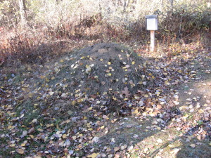 The mound ants and timber rattle snakes were nestled in against the brisk autumn winds, so twelve hikers, plus three dogs, had the woods to themselves. Three vehicles transported the Springwater Trails hikers to the Steege Hill Nature Preserve, just east of Corning. Thanks to everyone for heeding the advice to car pool.
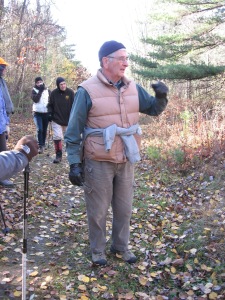 The steward of the preserve, Bob Corneau, was there to greet us all and offer his services as guide. As we strolled the woods, he painted a portrait of how devastated the forest had been 40 years ago and how the land had been rescued from illegal logging practices, via a wealthy donor and the Finger Lakes Land Trust. Bob has been a volunteer steward on this preserve, mowing, clearing the trails, and monitoring the wildlife for 14 years. He shared fascinating stories and revealed secrets of the forest that the casual hiker would never notice. We were so very fortunate to be his students for our two hour tour on Steege Hill.
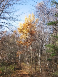 Our journey began with a steep climb from the parking area up to the top of the hill to access the trails. We set out in one group on the easiest loop to allow us all to learn about the history of the preserve from our host. The trail is one of the logging roads that wind through the hillside. Eroded tracks of bulldozers and numerous tree stumps evidence the destruction of the past. Several varieties of hardwoods were identified, as well a few fungi, thanks to Gene and Georgia. A small pond was a highlight, especially for Newton. Bob told us of a tornado that had cut across the area recently. We observed a huge chestnut oak, uprooted by the storm.
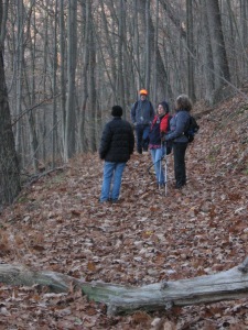 Eventually our Climbers set out to experience some of the more challenging terrain, hiking down the hillside, overlooking the Chemung River, then trudging back up to meet the Naturalist group. It was all down hill from there, a noticeable chill in the air as the sun dipped below the trees.
Good food and excellent service awaited us at Tags Restaurant. Everyone was starving, so this was a welcome conclusion to our afternoon excursion. The buzz at dinner was that folks were anxious to return to Steege Hill. I encourage anyone to visit this preserve on their own. The trails are well marked. The hospitality is outstanding.
Steege Hill, Big Flats, Sunday November 2 – 2:00EST
Have you ever seen an Allegheny Ant Mound? Join us for this Sunday’s hike and you will observe several. Experience one of the Finger Lake Land Trust’s finest nature preserves, 794 acres of recovering forest. In the 1970’s this tract was severely damaged by extensive logging, so much so that the town closed it to the timber companies, a legislative first. As we explore the deep ravines and enjoy the wide variety of hardwoods and hemlocks, we will be providing a service for the Land Trust. The donor of this land has stipulated that each year, during hunting season, it must be patrolled to inform any hunters that they must stay outside the boundaries of the preserve. Not to worry. In the numerous times I have patrolled here, I have yet to encounter a hunter.
Description of Hike
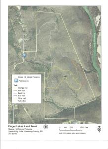 Steege Hill contains 7 miles of trails with varying terrain. Most are abandoned logging roads. All groups will begin their journey at the small parking area on the east side of Steege Hill Road ascending approximately 1/2 miles to the top of the preserve. A map of the trails is included with this description and also can be accessed at the FLLT website.
 Naturalist Hikers will bear right onto the yellow trail and make a counter clockwise loop, returning to their starting point. It is a fairly level loop of approximately 2 miles with a few minor uphill sections. This group can spend time at a small pond and admire the several species of trees. The forest is quite open.
Tourist Hikers will bear left on the yellow trail then drop down to the left on the blue loop. The terrain is rocky in places with some ups and downs. Depending on time, this group may continue on the Blue loop and rejoin the Yellow trail, completing the loop in a clockwise direction. If a longer walk is wanted, they may bear left on the Red trail and follow it to connect with the Yellow loop. This hike will be about 3.5 miles.
Climbers will circumnavigate the trail system. Starting out on the White trail, climbers will drop down the hillside and back up for a 2 mile loop. The trail could be quite muddy so boots and/or gaiters are recommended. Climbers will then traverse the Blue and Red trails back to the Yellow loop. Plenty of climbing involved with some steep spots.
Getting There Parking is VERY LIMITED. Roadside parking is not advisable. Please carpool from the Springwater Town Hall, leaving at 12:30. Drive time is about 1 hour 15 minutes.
 Directions: Take 390 South to I 86 East. Take Exit # 48. Turn Right on NY 352. Go 1.5 miles. Turn right on S. Corning Rd. (Chemung CR 10). Go .7 miles. Just after bridge turn left on Steege Hill Rd. Go 1 mile. Slow down. Parking is on left. Preserve sign is difficult to spot.
Social There is a great little joint called Tags, recommended by local folks. to get there, retrace your steps back to Rte 352. Turn right and travel about .6 mile. Restaurant is on the right. Menu is full of salads, burgers, wraps and apps. See it at tagsrestaurant.com

