PLEASE NOTE THIS HIKE IS A CHANGE FROM THE HIKE SCHEDULE LISTED IN THE S/T SPRING HIKING BROCHURE!
⇒ Conditions Update: (Sat, 4/26 @ 12:25PM) Temperatures immediately adjacent Lake Ontario (the big lake) which has a huge heat deficit in relation to land masses this time of year, can be substantially cooler than inland Monroe County and say Springwater, Dansville, Honeoye, etc, and can be highly dependent on any changing breezes or winds. So despite how it seems when preparing to start the drive to the hike, as insurance an extra jacket & a hat may prove to be well thought out for your comfort. (See trail conditions below.)
HIKE:
Who: Springwater Trails hikers and members of the general public
What: Sunday Springwater Trails – Durand-Eastman Park Arboretum hike, an interpretive led tour/hike as led by volunteer Monroe County Cornell Cooperative Extension Master Gardeners (and possibly a second separate S/T hike following). And an optional after-hike social, Grillin’ at the Three Lakes Pavilion.
 Why:
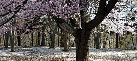
Why: To appreciate the blossoming flowering tree collection in the Arboretum, and other unique trees there as well. Because its Sunday and S/T hikers always hike on Sundays for fun/adventure/exercise/communing with Nature/camaraderie/fresh air/relaxation/sharing/learning/sometimes Grillin’, and more…
When: Sunday, April 27, 2014 2:00PM You will find the Springwater Trails hiking group and members of the general public at this Interpretive led tour/hike of the Arboretum.
Where: 43.231915, -77.555795 Both hike meet & start point is the Kiosk on Zoo Rd at the public parking lot on west side of Zoo Rd immediately adjacent the Durand-Eastman Park “Labor Center” fenced in parking lot & building. (Situate in City of Rochester/Town of Irondequoit, Monroe County. Immediately south of the shores of Lake Ontario.) (hint: for
www.maps.google.com approximate location is 100 Zoo Rd., Rochester (Irondequoit), NY. All roads you will drive to get to the hike are paved, the parking lot is gravel.
How: Hiking by our own muscle power, and encouragement of fellow hikers.
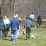
Accompaniment of hikers by well behaved and cleaned-up after furry companions (dogs) is welcome at this hike.
After-hike social: will be a picnic in the park, pot luck style, please bring a dish-to-pass. We are Grillin’.
Carpool (self-organized) is provided for in this Hike Plan, for carpooling from the Springwater & Hemlock region.
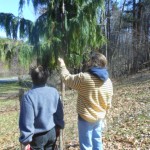
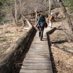
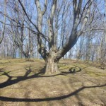
The main hike focus is a Nature Interpretive led hike througn parts of the Arboretum, chiefly flowering tree sections, with small amounts of history imparted. (This hike is in one concentrated yet spanning area of the Arboretum, there are numerous sections of the Arboretum in other areas of Durand-Eastman park as well.) Hike impetus is appreciating the Arboretum in general and Spring blossoms in particular, perhaps approximately 1 -2 miles or so in length (but may be extended) with one or more substantial downhill path and similar uphill. Those hills are uneven terrain paths thru woods, and a substantial part of the hike is on level ground near roads. Point being, family members who are not considered “hikers” may wish to join in for the appreciation aspect as the “hike” itself can be a relatively short one. Other longer trails exist in this section of the park & Arboretum for somewhat longer hikes. Routes will be provided for various interests immediately prior to the hike start.
A bit of a primer on the Durand Eastman Park Arboretum is able to be read and pictorials at http://www.rochestergardening.com/spotlight/a/sl990421x.html
What not to miss in the park, while driving to the hike: As you proceed from I-590 on Durand Blvd, immediately upon crossing Culver Road there will be the first of two flowering tree collections on the left before starting down a pronounced hill as you drive. You may or may not notice the signing of “Durand-Eastman Park & Arboretum” and the “City of Rochester” on the right, which would be a distraction from viewing trees in bloom on the left. So concentrate on looking to the left (and if you are the vehicle driver, concentrating on the road is a excellent idea). There will be blooms for the April 27th hike on the trail as well as along the roadway in the park as you approach the hike locale. April 6th & 13th found no blooming, and likely April 20th also none.
Most S/T hikers are aware of the “Crap Shoot” as to specifically what is in bloom & when (weather dependent), and of the later than avg cold temperatures this Spring that resulted in postponements of earlier days in April for this hike because there were no blooms. There will be Blooms on April 27th!!!
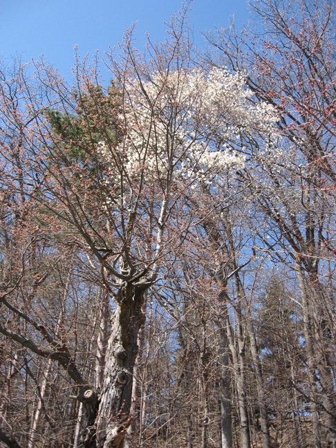
The trails: Two trails sections, one down a mildly steep path in a wooded area and another up a mildly steep path in a wooded area, and perhaps some others as well have elevation rise or fall. The trails are not so steep as to require switchbacks, and the hills are relatively small with most being 100′ or so gain or loss in elevation of less. These trails are not considered to be “handicapped accessible” by ADA definition. Some other sections of the hike which are flat and near roadways are accessible. Some areas of the hike on a relatively flat low-lying area may be squishy &/or muddy, and some trails on an incline if muddy may be slippery still from recent rains.
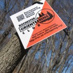
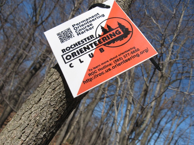
Of note to those interested. Durand-Eastman Park is home to a permanently established “orienteering course” (as is Mendon Ponds Park, Webster Park and Letchworth State Park). There are some orienteering controls (permanent installed posts/markers) near the area we will be hiking. This hike does not provide for orienteering as planned. Should you choose to avail yourself of such possibilities while hiking, you may want to check on the Rochester Orienteering Club website http://roc.us.orienteering.org/permanent.shtml. You would need a map, and perhaps GPS or compass.
Some Extras for an add-on hike:
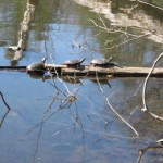
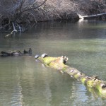
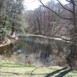
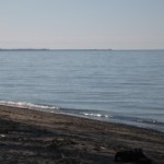
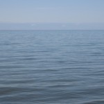
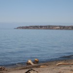
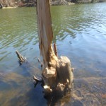
Nooks & Crannies, & Overlooks & park benches. Yep, there are plenty of these among open spaces and forested areas in the park. Several small lakes and ponds, and the sand beach of the Great Lake Ontario too.
With a waxing high sun angle, and daylight well past 8:00PM, and so much to see and having traveled the distance, … a possibility exists that, after the first hike, or after the after-hike social there will be a second organized hike for those who did not get enough miles or scenic open areas interspersed with forested hillsides and small lakes and ponds. And if hikers wish they can venture on their own, as the area is difficult to become lost in for hikers with any intuition, or a map, or a bit of a primer on “lay of the land”
There is an 8:07PM sunset on April 27th which means daylight well after 8:00PM, and with a midday sun angle of 60.8 degrees above the horizon (similar to mid-August) the sun can provide substantial warmth. One sun warming difference (April to August) is deciduous trees are devoid on leaves in April, so if you are in a scantly forested area of deciduous trees atop a hill more sun reaches you in April than in August (and better views may be afforded). Such is the described case of the locale of the after-hike social. An extra jacket for possible protection from wind and warmth preservation, is insurance.
AFTER-HIKE SOCIAL:
Following the hike S/T hikers will meet for an optional after-hike social. We are a grillin’. Zweigle’s hots & turkey hots, & buns, will be provided, as will the grill and condiments. With high temp predicted to be upper 40s on Sunday, likely cold things will do OK, and hot things can be consumed at room temp or heated up. So plan accordingly, and bring a dish to pass and beverage of choice, or make a donation (suggested $5) to the social fund to help keep supplies on hand for our socials.
The Condiment Queen (no names, J) among us may choose to bring her favorite condiments. hint: Some of Dena’s legendary macaroni salad, would go well, if Dena is out there listening, as would Char’s Pineapple upside-down cake. If anyone wants to bring antelope sausage or some other exotic meat for grill’ and sharin’ feel free to do so. If Santa brought you a solar cooker for Christmas, bring it and maybe we can see well how it works.
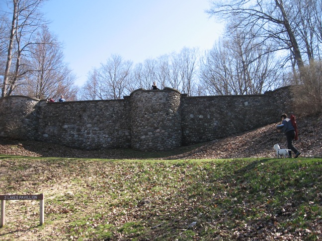
50+ stairs to the bluff top of “Three Lakes Pavilion” where the after-hike social will afford a sweeping view of Lake Ontario and view of Durand Lake & Eastman Lake, the Peace Garden, and perhaps Canada if you bring your high power binoculars or telescope. For hikers who prefer to avoid stairs, accommodatingly there are two grassy former roadways that also lead to the top, and the locale is extremely close to car parking. There is a fire circle and some wood can be found, so if you are thinking marshmallows or s’mores bring the fixin’s, & if desired we can sit (or stand) around a campfire and enjoy the view. (There is a “Plan B” after-hike social separate location in case of rain, more on that info at the hike if needed.)
While this is our first S/T outdoor social of the Spring Season, it is not the first of the year. The after-hike social following the hike of Johnson Hill Rd trails on January 19th, 2014 holds that distinction, when gloves were worn as we ate adjacent the southeast area of Hemlock Lake. https://springwatertrails.org/2014/01/page/2/ The order of the day on April 27th, will be “Look Ma, No Gloves”.
CARPOOLING INFO:
The hike is 51 driving miles (less than 40 miles as the crow flies) north of Springwater. A self-directed car pool (first location) will form at the Springwater Town Hall at 12:20 and leave promptly at 12:35. The carpool will stop at Hemlock Lake Park parking lot on Rix Hill Rd. (as a second sequential location ~13 minutes drive from the first), where I am assured some S/T hikers will be waiting, thus allowing for carpool reformation and should leave promptly at 12:55PM. Google Maps estimates one hour from Springwater if you follow 15A north to I-390 at Jefferson Rd. You may save three minutes by turning left at Lima (Rt 5&20) to pick up I-390. Once on I-390 follow the Driving Directions below.
DRIVING DIRECTIONS:
Directions: (43.231915 , -77.555795)
From the South: Take I-390 North to I-590 N at Exit 15. Follow I-590 N around Rochester and north toward Sea Breeze. On I-590 after the intersection with Rt 104 (where you may also see nomenclature of I-590 as Sea Breeze Dr) there are four 15MPH traffic circles (aka roundabouts/turnabouts). (15MPH, means you have to SLOW DOWN before entering the circles!) Continue on Rt 590 around the first three traffic circles and then go ¾ of the way around the fourth traffic circle and exit onto Durand Blvd. Continue on that street for one mile and turn left onto Zoo Rd (Zoo Rd is one way). The meeting location is at the Kiosk 0.2miles up Zoo Rd on the right (Kiosk is at the second parking area [the first parking area is on the left]). Note: According to Google Maps, Durand Blvd becomes Sweet Fern Rd and then Pine Valley Rd before becoming Lake Shore Blvd at Zoo Rd but you probably will not notice the street name changes. There is a permanent Durand Eastman Arboretum sign and a temporary Sunday Park Hike sign at Zoo Rd. Please watch for bicycles when turning left onto Zoo Rd from Lakeshore Blvd.
From Charlotte and Greece: Take Lake Ontario State Parkway east to Charlotte. At the end of the Parkway, continue straight onto Pattonwood Dr. At the end of Pattonwood, turn right onto St Paul Blvd and then the first left onto Lake Shore Blvd. After 2.4 miles, turn right onto Zoo Rd (Zoo Rd is one way). The meeting location is at the Kiosk 0.2miles up Zoo Rd on the right (Kiosk is at the second parking area [the first parking area is on the left]).
From Canandaigua, Victor and Fairport: Take I-490 W. At Exit 21, follow the 590 N signs. Continue with the directions From the South.
Optional equipment:
- Reading Glasses, for reading info on the Kiosk, history & maps.
- Binoculars (or telescope), especially for the after-hike social, for views possibly to Canada.
- MICROspikes or Trail Crampons for a few squishy &/or slippery muddy areas on inclines.
- Folding chair for the after-hike social.
- An extra jacket (and a hat) for after the hike as insurance against possible wind and as warmth preservation.
- Likewise an extra pair of shoes & socks, as insurance in case you get wet feet.
- Camera.
ANCILLARY:
An unfortunate need of precautionary: When on this hike at the Arboretum in Durand Eastman Park, hikers should use caution of where they step and especially so along road edge corridors, as this area is a very popular dog walking location. While dog owners are supposed to clean up after their dogs often times owners are devoid of their responsibility and the result is numerous places that unknowing hikers can step in a pile of dog crap. Not much to the liking to have that nasty excrement clinging to hiking shoe treads and up on sides of shoes. So, Hikers Be Aware, & dog owners please clean up after your pets.
Two hike previews in the two weeks preceding this hike found trail conditions generally good. Very few mildly muddy areas which are apropos for “Winter traction aids” such as Kahtoola MICROspikes, Hillsound Trail Crampons & YakTrax XTR Extreme. No snow, but Winter traction aids also do well for use in shoulder hiking season conditions (mud), and the models mentioned fit easily in a pocket. (Bring a plastic bag to protect belongings from muddy spikes/crampons). Perhaps by 4/27 all will be dry (but doubtful), and many trampling hikers can cause deteriorating conditions to create more mud.
Historic photos and maps can be viewed at: a) Durand-Eastman Park golf course clubhouse foyer (Jack’s Place restaurant), b) on the Kiosk at parking lot of Zoo Rd Labor Center, and c) on the Kiosk on Log Cabin Rd near Pat Lake. For the mostly “over 40 crowd”, bring reading glasses to read some maps and history. Some of what you will find: info about 1907 land donated for Durand-Eastman Park to City of Rochester, and photos of park “opening day” in 1909. A large map prepared on unknown date of the park layout including the zoo & animal locations, photos of the refectory and Three Lakes Pavilion, Arboretum preparation & plantings, etc.
As long as S/T hikers are in the area, feel free to query “local hikers” on area history etc. There is history of Native Americans & much more recent as well, and much no longer that exists in manmade structures of many varieties that are from a bygone era. The RR, trolley, Bathhouse, refectory refreshment stand, lakefront Resorts, ferries to Coburg & Toronto in Canada, Dr. Durand’s summer residence, the White Lady’s house, etc. Annually late May/early June, Lakeshore Blvd is the site of the Greater Rochester Soap Box Derby since the 1930’s.
The Sea Breeze area adjacent eastern Durand-Eastman Park is a unique community of residential, business, & amusement mix. Some features:
♠ The breakwall pier and walkway on the Irondequoit side of The Irondequoit Bay Outlet which empties into Lake Ontario. Abbott’s Frozen Custard co-occupies the same restaurant building as Bill Gray’s Restaurant. Two other staple burger places on the same block (nearly the furthest reaches of Culver Rd) are Vic&Irv’s, and Don’s Original (which is known for decades of quality ground round burgers and more). Sea Breeze Amusement & Water Park is very closeby and in view from this “Restaurant Row” area.
♥ History and architecture appreciators will find some unique features in the area, one of which is a hexagon cobblestone small structure in a “pocket” or “vest” corner park at Culver Rd & Pinehill Dr, (not the original location of the hexagon). The “Swing Bridge” that seasonally connects road traffic of Culver Rd Irondequoit to Lake Rd Webster will be “out” effective ~ 8AM April 1st , until Nov 1st when it is annually reinstalled. (This bridge is not to be confused with the real deal railroad swing bridge over the Genesee River for the nicknamed “Hojack” line RR, which was dismantled and removed in 2012 and was situate 2-3 miles from Seabreeze.) Irondequoit Bay Marine Park & Boat launch, and a narrow public lakefront access park area also are in Seabreeze area. Call it kitesurfing, kiteboarding, or parasurfing, …on the right day & time you may find these enthusiasts on Lake Ontario at Sea Breeze, yes even in April!
♦ Simply New York Marketplace & Gifts, which sells only goods and products made in NYS, is at 4364 Culver Rd, opposite Parkside Diner & Parkside Whispering Pines Miniature Golf, all of which are one block north of the Culver Rd intersection with Durand Blvd & Sweet Fern Rd.
♣ Nearby communities of Summerville on the east side of the Genesee River and Charlotte on the west side of the river also have much history and unique character, and each has a long pier extending into Lake Ontario used as popular walks by many local folks.
A copied hyperlink & article text from an on-line article in the Genesee Valley Penny Saver about Arboretum tours every Sunday in April. http://www.gvpennysaver.com/event/arboretum-tour-durand-eastman-park/all/
The Monroe County Cooperative Extension, in conjunction with Monroe County Parks, will lead public tours of the historic Arboretum in April. The routes will traverse moderate hills and wooded trails, so please dress accordingly. There is no charge. Donations accepted. Meet at the kiosk on Zoo Rd. next to the park offices lot.
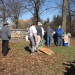
Being that Saturday 4/26 is the 5th annual scheduled “pick up the parks” event, we may find the park in a “picked-up” fashion. But since Saturday volunteers likely have limited capability as to how much ground they can cover, perhaps S/T may take impetus on our next-day hike of 4/27 to “pick-up” the route that we hike. Probably a couple/few plastic grocery bags would suffice for such a pick-up. Saturday event info at http://www2.monroecounty.gov/parks/pickuptheparks And for those unaware Saturday May 3rd, 2014 is the third annual “I Love My Park Day”, a celebration of parks and work project day in NYS parks, and some local parks. http://www.ptny.org/ilovemypark/
If you have an opinion about the roundabouts aka turnabouts aka traffic circles on I-590/Sea Breeze Dr, after traveling them, feel free to offer you opinion on such as fodder for hiking discussion.

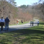
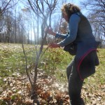
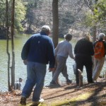
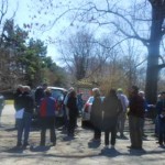
 It was a beautiful day Sunday – just right for an early spring tour of Durand Eastman park.
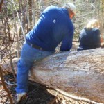
 Climbers (9 of ’em) set out on their own. Climbers, at a Tourist pace, toured through contiguous parts of the arboretum adjacent multiple lakes, climbed up & down numerous hills, navigated downed trees, and followed several trails. As they wandered, they found one control point for the orienteering course set up at Durand Eastman.
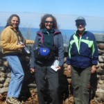
 About a dozen hikers availed themselves of the after-hike social where a sweeping view of Lake Ontario high above Lakeshore Blvd at Three Lakes Pavilion afforded plenty of open space and facility. Grillin’ at the Pavili’n on a portable Propane Grill with fare of more than a dozen of both hot & cold potluck dishes-to-pass all set up along the stone wall of the pavilion worked well with nearly no winds. And for those of us not already schooled in the art of keeping a “hot dish” hot when bringing it to a social, …a couple of thick towels wrapping the dish or pan works fantastic for heat retention. Thanks to all for the fantastic cookin’, bakin’, salad makin’, and Grillin’ !!
 If you did not make our first potluck picnic after-hike social of the Spring Season here’s what you missed: Zweigle’s Sausage, Hots, Chilidogs, Kosher dill pickles, lasagna, baked beans, veggie tray & dips & chips, many types of salads, two cakes (one being Char’s legendary Pineapple upside-down cake), and fresh cut watermelon. Toss in some non-alcoholic libations, some brews, wine glasses and vino & a view, … and it worked quite well. Truly a fantastic variety of food was served, sound good? Take notice, Sunday May 4th at the S/T Sonyea State Forest hike hikers not only have an opportunity to hike a new locale for S/T but also to enjoy the second Potluck Picnic of the Spring Season.
 Specifically in our Arboretum hike discussions whilst among the conifers at varying points was how our S/T Evergreen aficionado and owner of All Western Evergreen Nursery would have appreciated the arboretum and contributed to the group if she had been able to attend this hike.