
Sand Pit Road
Bath NY
 This Sunday we start a series of hikes along the main Finger Lakes Trail between the Bristol Hills Branch and the Letchworth Branch. Previous hikes have followed each of the two branches to the east and to the west of Springwater. This series will connect the two branches along the Main Trail to the south of Springwater.
A word of warning. The trail between the two branches is 78 miles long. With one 4 mile hike each month, we would need 20 hikes to cover every mile, so I expect we will be more selective, planning to explore most of the trail (but not every mile) over the next year.
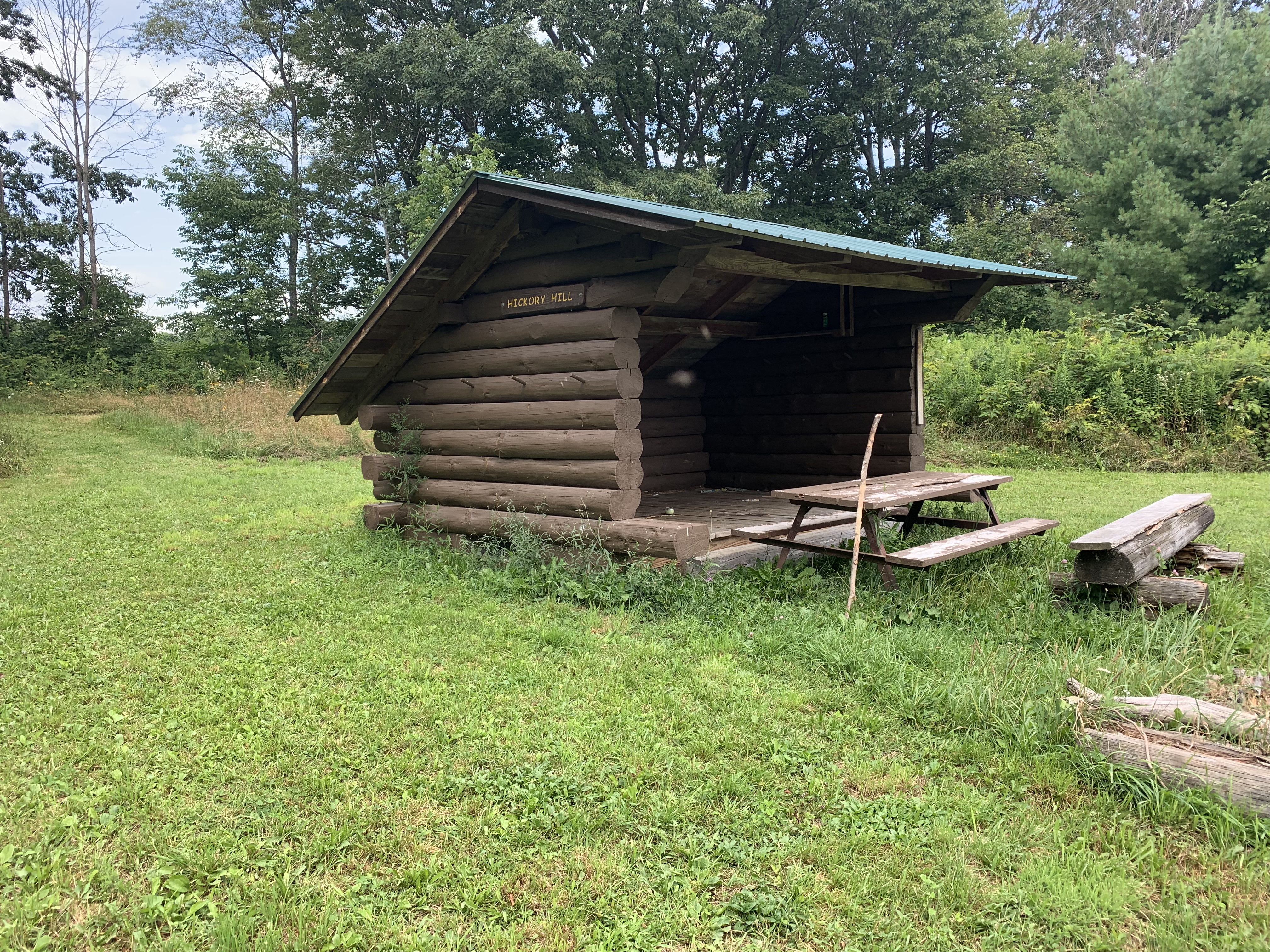
For this hike, we are offering three routes. The Climbers will start at Access 1 on Sand Pit Rd outside of Bath. They will follow the white blazes for 1.8 miles climbing some 400 feet to the Hickory Hill Lean To, where we will stop for a mid hike social – see below. Following the social, the Climbers will continue north, over Kershener Hill (1820′) to Access 2 where they will use the Tourists cars to return to the start point.(Total 3.1 miles, 550 feet up, 300 feet down)
The Tourists will carpool to Access 2 on Robbins Rd (maybe it is Barrett Rd) and will hike the reverse hike. The trail starts on a farmer’s road which heads up to a large field. Just before the field, the trail goes off to the left. If you get to the field you will see there are no more white blazes, so go back and find the branch. It is a 300′ climb to the top of Kershener Hill. At the LeanTo (1,3 miles from the start) we will stop for a social, meeting the Climbers and exchanging keys. (Total 3.1 miles, 300 feet up, 550 feet down)
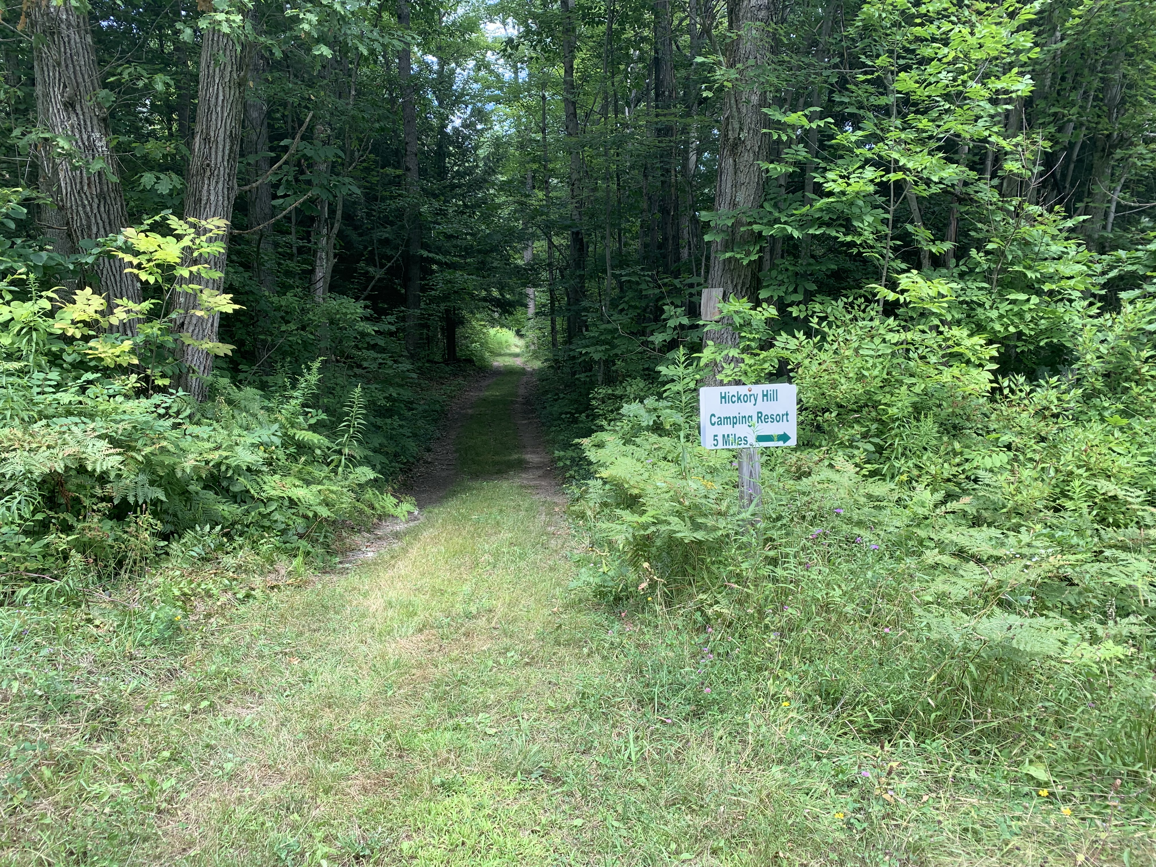
It’s very easy to see the start of the side trail down to Hickory Hill Campground.
The Naturalists will start with the Tourists. Following the social, they will continue for 0.2 miles and then will turn right onto a blue blazed trail to follow a pipeline down 0.7 miles to Hickory Hill Campground where they will find a car to return to the start point. (Total 2.2 miles).
Social. On this hike, we will take advantage of a Leanto and hold our social on the trail. Please bring a sandwich and extra water for yourself. You may also want to carry in some vegetables, chips, fruit or cookies to share – don’t go overboard – you do need to carry your snack in.
Directions:
From Springwater: Take NY-15 south through Wayland to I-390. Turn left to enter I-390 south. In 16 miles, merge onto I-86 East. Take the next exit (Exit 37) for NY-53 Kanona/Prattsburg. Turn right (S) on 53 for 0.6 miles. Turn left onto NY-415 for 1.4 miles. Turn left onto Spaulding Dr, the left onto Harrisburg Hollow Rd. In 0.4 miles turn right onto Sandpit Rd. There is plenty of roadside parking.
 From Naples: There are two routes, either through Cohocton to I-390 or follow NY-53 south: Head south on Main St in Naples. Just past the Wayside Market, stay straight onto NY-53 for 22.3 miles. After passing under I-86, turn left onto NY-415 for 1.4 miles. Turn left onto Spaulding Dr, the left onto Harrisburg Hollow Rd. In 0.4 miles turn right onto Sandpit Rd. There is plenty of roadside parking.
From Corning: Take I-86 west to Exit 38 NY-54 Bath/Hammondsport. Turn right onto NY-54 N, then left onto NY-415N for 1 mile. Turn right onto Spaulding Dr, the right onto Harrisburg Hollow Rd. In 0.4 miles turn right onto Sandpit Rd. There is plenty of roadside parking.
Car Pool from Access 1 to Access 2:Head southeast on Sandpit Rd. At the tee turn right onto Snyder Hill Rd. Continue onto Maple Heights and on down to the stop light at Washington St. At the next light, turn left onto Liberty St. Stay left onto Haverling St toward CR 13. In 2 miles, leave a Naturalist car near the Hickory Hill Campground. Continue north on Mitchellsville Rd for 1.3 miles. Turn left onto Robbins Rd (basically the first left turn). The road makes a right hand turn at the Bath/Wheeler town line.Make a U turn and park on the side of the road. at the start of the trail. The trail is a continuation of Robbins Rd that you came up on.
Well, it is noon and sunny. Its hard to cancel a hike for rain when it is sunny out, so Katherine, John and I are going to meet at Sandpit Rd at 4:00. If it is thunderstorms with lightning, we won’t hike but maybe we can get a beer instead. Bring rain gear – that will ensure it doesn’t rain!
Thunderstorms are predicted for this afternoon. Be sure to bring rain gear – ponchos or raincoat and rain hat. Also, please check this post before you come- we will cancel if it looks like lightning.