This Sunday, January 26, 2014, at 2 PM, we will be hiking a section of the Finger Lakes Trail, east of Swain. The hikes will begin and end in Swain.
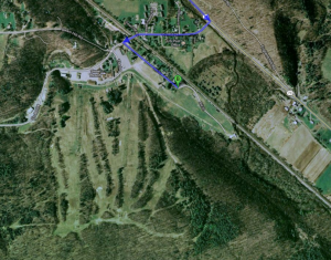
To get to the parking area, from Dansville, go south on Clara Barton St., which becomes route 36. Turn right on 70, past Canaseraga, and left on 24 into Swain. Make a left on Mill St, opposite the Sierra Inn, and, at the end, you will come to a parking area, across from the tubing hill. Be sure to go all the way to the end of Mill St. There is a tall wall at the lot and, unless you come early, you will be welcomed by our friendly sign. Since parking may be limited, Gene will be at the parking lot, by the municipal building, in Dansville, at 1:10, for those who would like to carpool. The lot is on the west side of Clara Barton St., just south of Main. Plan to leave promptly at 1:15.
 All hikers will cross a field and climb a short hill to the main, white blazed, trail, which then goes along a level railroad bed for about half a mile to the junction with the orange trail..
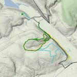
The naturalists will stay on the main trail (red line on the attached map) to the junction with the yellow trail (shortly past the blue trail) loop and take the yellow trail back. (if conditions prohibit the yellow trail, the naturalists will return on the main trail). Total distance is about 3 miles. Because the trail is level, if there’s enough snow, it’s good for snowshoes or XC skis.
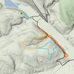
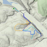
Tourists will enter the orange trail, on the right side of the trail and follow it up the gorge. At the top, this group will turn left on the 2nd blue trail connection, hike it back to the main trail, and return by the main trail. The total hike is about 4 miles (dark blue on the left map).  Climbers will also enter the orange blazed loop, on the right, then take the first right to hike the orange trail counter-clockwise back to the main trail. This loop is 2.3 miles, making the total hike (green line on the right) also about 4 miles. Although the climbers hike may actually be a little shorter than the tourists, the orange loop has a steep climb up near the beginning. With this information, you can decide which one you would prefer. If there’s snow, snowshoes can be used on the loop trails but, they are a bit steep and narrow for XC skis. Maps will be available for leaders and sweeps. When ending the hike, watch the blazes so you don’t miss the right turn off the railroad bed, to get back to your cars.
After the hike, the social will be at the Sierra Inn, in Swain. They will have a table for us in the back, around 4:30. There is a well stocked bar and a big menu with many choices including wild game and conventional dinners, burgers, pizza, and many bar items. Prices are reasonable and they often have specials. After the social, some of you might like to stay and enjoy the ski resort’s great downhill ski trails.
Directions to the start of the hike are available here. From the hike parking lot, the Sierra Inn is back on Mill St to CR 24 in Swain.


Pingback: Planning Winter 2017 Hikes – Looking for hike planner | Springwater Trails