
 Now that we’ve seen the southeast corner of Hemlock Lake from the beachfront, on Sunday January 10 we will explore the opposite corner of Hemlock on the Bur Oak Trail and the Walnut Trail, both on State land within the Canadice Hemlock State Forest. One section is a snowmobile trail, and the other follows in the woods parallel to the shoreline. For those who enjoy stony beach walking, there will be an opportunity for that too.
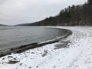
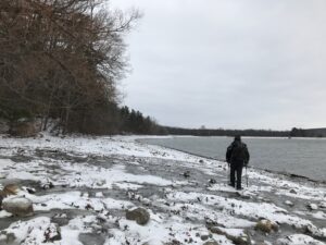 Meet at 1:45 at the northwest corner of Hemlock Lake at the Rix Hill Road trailhead parking area just west of the Hemlock Outlet and Hemlock Lake State Park. There are small parking areas on both sides of the road, and a kiosk on the south side. All hikers will first follow the Bur Oak Trail north along the Hemlock Outlet to a grassland loop off Blank Road, and return for a total of about 2.5 miles – this is a snowmobile trail. We will then cross the road and follow the Walnut Trail south through the woods for about .75 miles and back; this requires some agility in stream crossing. The final leg will be a walk down the Hemlock shoreline and back, fording small streams as we pass them. Bring good waterproof winter footwear and poles. Those wanting a shorter hike will have ample opportunity to bail out as we pass the starting point twice.
No social due to Covid guidelines.
Directions: from Springwater: Head north on NY-15A. At the end of Hemlock Lake, turn left on Rix Hill Road. Pass the park entrance on your left and go over the Hemlock Outlet bridge. The parking areas will be on both sides of the road, or park on the shoulder.
Directions: from Canandaigua, Honeoye and points east: From Honeoye, continue west on Main Street (Route 21A) to Route 15A in Hemlock. Make a left, go a half mile, and take a right on Rix Hill Road. Pass the park entrance on your left and go over the Hemlock Outlet bridge. The parking areas will be on both sides of the road, or park on the shoulder.
Directions from north and west: Take Route 390 south to Exit 9 (Lakeville-Livonia). Go south on Route 15 into Livonia, the southeast on 20 A. Make a right after 3.9 miles on County Road 56 (Federal Road), then a left on Adams Road after .6 miles. Take the second right on Blank Road. In a mile, fork left at Rix Hill Road and go down the hill to lake level. The parking lots will be at the foot of the hill, just before you come to the lake.