
1901 S Genesee St
Montour Falls, NY 14865
USA
Click image for more detail.
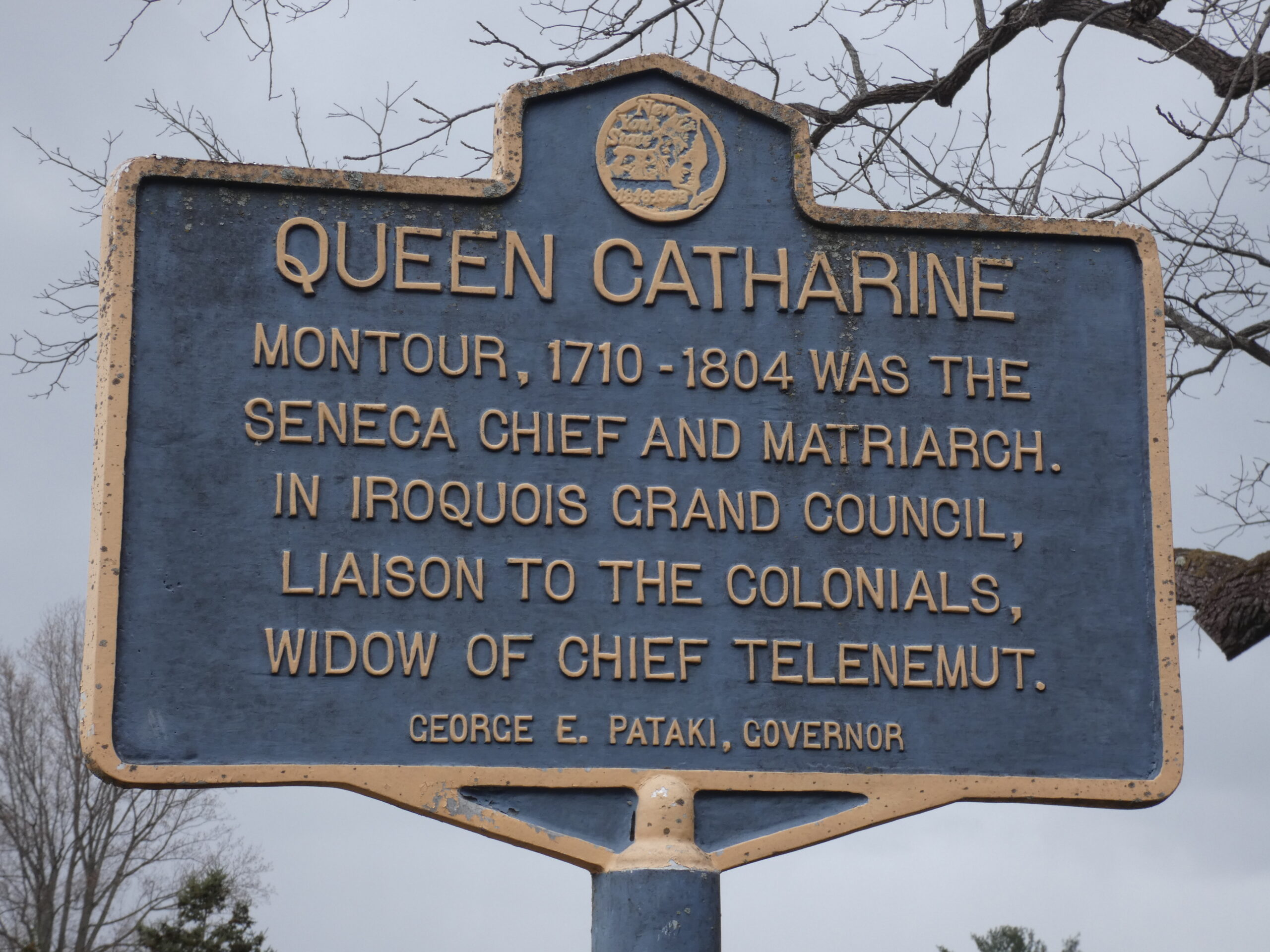
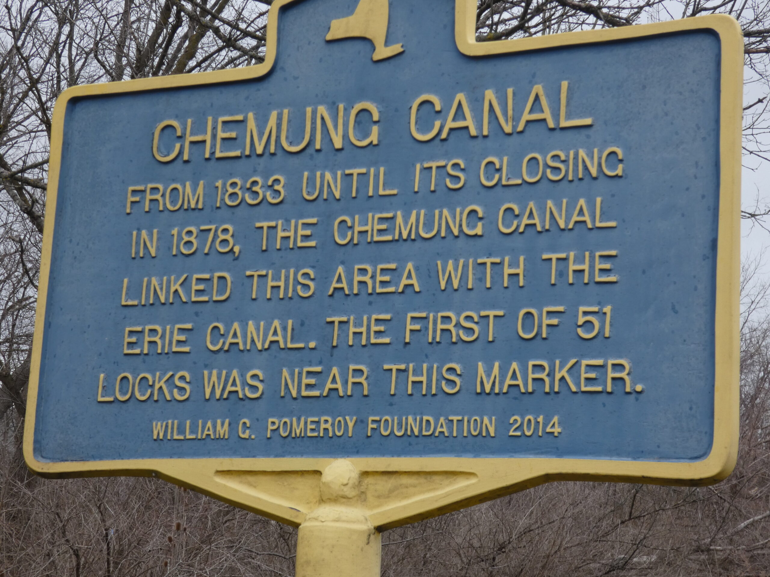
Catharine Valley Trail is a state park and recreation trail which is located in Schuyler and Chemung Counties. It runs for 12 miles between Watkins Glen State Park and Mark Twain State Park and uses the abandoned Chemung/Northern Central Railroad and the old Chemung Canal. The trail is named for Queen Catharine Montour, a prominent Seneca leader of Native American and French ancestry who lived in a village called She-O-Qua-Gah near present day Montour Falls. The village was one of the many destroyed by Sullivan’s Army in 1779. Catharine Creek, Seneca Lake’s inlet, is a popular Rainbow Trout fishing stream and runs parallel to the trail.
Meeting Place
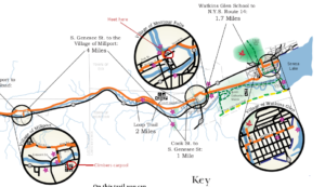
We will all meet at the S Genesee Street parking area south of the Village of Montour Falls to explore part of the trail. Bikers will go south for an out and back of about 8-10 miles (hybrid or mountain bikes recommended); climbers will carpool to Millport and walk north the 4 miles back to the S Genesee Street parking area; the tourists/naturalists will walk south from the parking area to complete a 2 mile loop along the old canal.
Social
The social will be at an area restaurant in Watkins Glen. Location TBD.
Directions
From Watkins Glen (or Rochester and Exit 42 on the Thruway and Geneva): Take NY 14 south from the thruway, through Geneva and Watkins Glen. South of Watkins Glen, stay on NY 14 until it curves to the left. In the middle of the curve, turn right onto S. Genesee St. The parking lot is on the left in 1.7 miles.
From Horseheads and I-86 Exit 52B: Turn left onto NY-14. In 10.8 miles, turn left onto S Genesee St. The parking area will be on the right, just past the bridge over Catherine Creek.
 From Springwater: take NY Route 15 south to Route 390. Take I-390/ south to I-86 east and get off at EXIT 40 – Savona. Turn left onto NY-226 and follow it 13.22 miles to where you will turn right onto County Road 23. Go 8.03 miles then take a slight right onto County Road 28. Go 1.16 miles and take a slight left onto NY-409. Go 0.54 miles and at the stop light in the Village of Watkins Glen turn right onto NY-14.
 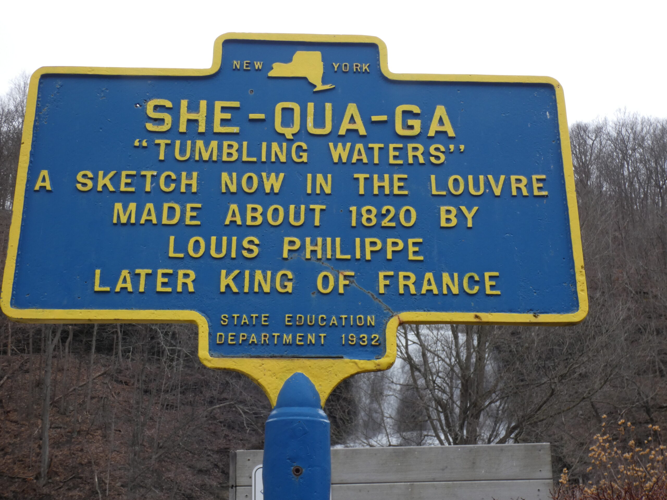 Continue on NY-14 for 4.40 miles then turn right onto S Genesee Street. In a short distance go over the bridge for Catherine Creek and the parking area will be on the right. According to MapQuest this route is 61.8 miles and the estimated driving time is 1 hour 12 minutes.
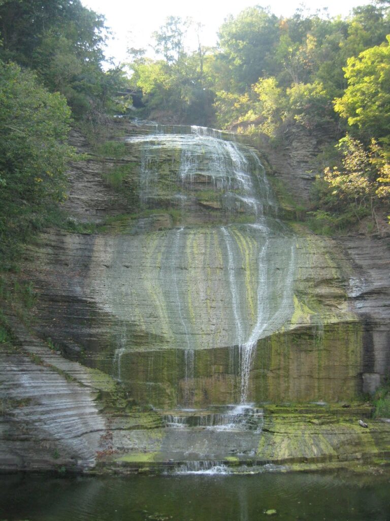
People may want to arrive early and budget extra time to stop at Shequaga Falls Park in Montour Falls, do some shopping at Famous Brands in Watkins Glen, or go birding along the Queen Catharine Marsh Trail.
More Information