Calendar

Hikes led by Springwater Trails are generally held on Sunday afternoons and appear in this calendar in green.

Sun Mon Tue Wed Thu Fri Sat
1
2
3
Lock 32 Canal Park Hike or Bike 2:00 pm
Lock 32 Canal Park Hike or Bike
Dec 3 @ 2:00 pm – 4:00 pm
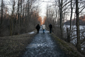
Lock 32 Canal Park Hike or Bike
Continuing with our hunting-free hike series, please join us on December 3 for a walk, or a bike ride if conditions permit, on the Erie Canal Trail starting at Lock 32 Canal State Park, at 2759 Clover Street in Pittsford … Continue reading
4
5
6
7
8
9
10
Sandy Bottom Nature Trail 2:00 pm
Sandy Bottom Nature Trail @ Sandy bottom Hike
Dec 10 @ 2:00 pm – 4:00 pm
This Sundays hike will be at Sandy Bottom Nature Trail starting at the entrance off Main Street in the Village of Honeoye. All hikers will Meet at 1:45 PM. There is parking across the street from the trail entrance. Sandy … Continue reading
11
12
13
14
15
16
17
Schribner Valley Hike, Springwater 2:00 pm
Schribner Valley Hike, Springwater
Dec 17 @ 2:00 pm – 4:00 pm
Join us for the final hike of the year for Springwater Trails. This hike will be on private property on Schribner Rd in Springwater. NOTE: Bow and Muzzel loading seasons are open on the day of the hike, but at … Continue reading
18
19
20
21
22
23
25
26
27
28
29
30
Dec
10
Sun
2023
Sandy Bottom Nature Trail @ Sandy bottom Hike
Dec 10 @ 2:00 pm – 4:00 pm

This Sundays hike will be at Sandy Bottom Nature Trail starting at the entrance off Main Street in the Village of Honeoye. All hikers will Meet at 1:45 PM.

There is parking across the street from the trail entrance. Sandy Bottom Trail is about 3 miles total . The climbers may wish to retrace their hike to make this a 2 hour hike.

Naturalists and tourists can walk at their own pace.

After Hike Social: After the hike those who wish can go to the “Bird  House ” for dinner. this is located in the brown building across the street from the sandy Bottom Main Street entrance where the hike started.

Directions:
From Springwater: Head north to Route 20A in Hemlock. Turn east on Route 20A.  , Drive about 5 miles to Honeoye Main Street. Sandy bottom Trail is on the right (blue sign). Parking is  available across the street.

From Naples:  Go north on County Road 36, Continue on County Road 36 to Honeoye. Turn right onto State route 20A(Main Street Honeoye). Sandy Bottom Trail  is on the right (blue sign). Parking is across the the road.

From the east (Bristol, Canandaigua, etc): Take Rte 64 south to Rte 20A, make right onto 20A, Continue on 20A to Honeoye. Sand Bottom Nature Trail is on your left off Main Street.(blue sign) . parking across the street.

From the west (Hemlock, Livonia, etc): Take Rte 15A to Route 20A, make left onto 20A, Continue on 20A.. Drive about 5 miles to Honeoye Main Street. Sandy bottom Trail is on the right (blue sign). Parking is  available across the street.

Dec
17
Sun
2023
Schribner Valley Hike, Springwater
Dec 17 @ 2:00 pm – 4:00 pm

Join us for the final hike of the year for Springwater Trails. This hike will be on private property on Schribner Rd in Springwater.

NOTE: Bow and Muzzel loading seasons are open on the day of the hike, but at the time of the hike, no hunters will be on most of the private land hosting our hike.

We will have two or three hikes available, depending on demand.  All hikes will start at the Hopkins’ home, located on the south west side of Schribner Rd just before (if you are coming from Tabors Corner) the intersection with Giles Rd.

All hikers will leave from the front of the house and will follow the trail by the woodshed, and along the creek, by the A-Frame to the blueberries.

At this point, the climbers and tourists will turn left down to the stream and then up to the hardwood forest. The climbers will take several switchbacks to get to the potato fields. Continuing up the hill, we will enjoy the views of the fields and follow the edge of the forest around to an entrance to the forest on the west side. From there we will head north to cross Giles Rd where we will stop briefly  to investigate a cemetery from the 1880s. The trail continues north along a small creek which eventually flows into the Chesapeake Bay. From there, we will make our way back to the house for some more socializing.

Meanwhile, the tourists take a more direct route to the west side exit to the potato field. A quick U-turn will take us to the north trail, past the cemetery, around the valley and back to the house.

When the Naturalists depart from the climbers, they will continue north west along pine forests planted in the 30s and 50s and through some older natural white pines. We will pass the multicolored barn to follow a loop through the woods. Unless a one-horse sleigh picks us up, we will continue back south and cross the “bumpy” field to the house.

Following the hikes, all hikers are invited to join us for a seasonal social at the house. We will have a ham to share. Please bring a side dish or appetizer or dessert and your favorite beverage. Or make a small donation to the social fund.

Preview: Rather than a hike on New Years Eve, Springwater Trails is again leading a hike on New Years Day as part of the state-wide First Day Hikes program. Please join us at 2:00 at the north end of Canadice Lake. You will meet many hikers new to Springwater Trails.  Or if you are more adventurous, there are 8 hikes on the Greenway, and one near Alfred at Phillips Creek State Forest. Check out the map.  Its a great way to start the new year.

Directions: 

These directions are being provided because Schribner and Giles are seasonal roads at the north west ends.  If you use your GPS, please be sure that you are coming up Schribner Rd from Tabors Corners Rd. Enter Tabors Corners and Schribner Rd, Wayland NY.  Just to make sure you have good directions for the winter, check that the directions do not include Strutt St or Quanz Rd or Giles Rd. And whatever the weather is like, do not turn onto Schribner Rd from Strutt St (you will regret it!).

When you get onto Schribner Rd,  continue for 1 mile. The driveway is on the left one mile up Schribner Rd and about 10 feet before the intersection with Giles Rd. There is room for a few cars in the driveway, or turn around at the intersection and park on the the road. You may also park on the second driveway on the far side of the intersection, although, if you pull up the driveway, others may park behind you!

From Springwater: Head north on Rt 15A from the light in Springwater.  Take the first right on Wheaton Hill Rd (Co Rd 16).  Turn right on Wetmore Rd at the stop sign at the top of the hill.  At the end of Wetmore, bear right on Tabors Corners Rd.  After 3.5 miles turn right on Schribner Rd.  Follow the directions above in green.

From Wayland: From Rt 15, head east on Rt 21 toward North Cohocton for 3 miles. Turn left on Tabors Corners Rd (Steuben Co Rd 37).  After 2 miles, turn left on Schribner Rd (the second left). Follow the directions above in green.

From Honeoye: From Rt 20A, head south on Ontario Co Rd 37.  At Canadice, continue straight ahead on Canadice Hill Rd as Co Rd 37 turns right. When Ross Rd bears to the right, take the right.  This avoids the potholes in the dirt road straight ahead. In 2.7 miles, turn left on Tibbles Rd (the first left road on Ross Rd. In 1.1 miles turn right onto Wetmore Rd. Stay on Wetmore up over the hill to the end (2.2 miles). Bear right on Tabors Corners Rd.  Turn right at 3.5 miles onto Scribner Rd.  Follow the directions above in green.

From the East Lake Rd in Honeoye or From Naples: Rather than traveling north to reach 20A or Co Rd 37, hikers from east of Honeoye Lake may go south to Ontario Co Rd 36 and follow Co Rd 36 to Naples. Turn right on Rt 21 south.  Turn right to stay on Rt 21 for 4.5 miles to N Cohocton.  Turn right to stay on Rt 21 towards Wayland.  After 3.8 miles turn right on Tabors Corners Rd (Steuben Co Rd 37).  After 2 miles, turn left on Schribner Rd (the second left). Follow the directions above in green.

Dec
24
Sun
2023
No hike – Christmas Eve
Dec 24 – Dec 25 all-day
Dec
31
Sun
2023
No Hike – New Year’s Eve
Dec 31 @ 2:00 pm – 4:00 pm
Jan
1
Mon
2024
First Day Hike – Canadice Lake Trail @ Canadice Lake North West Parking
Jan 1 @ 2:00 pm – 4:00 pm

The Hike:

Start the New Year the way you mean to go on – come for an inspiring hike along Canadice Lake! This is an easy, 1.8-mile each way hike along the shore of the lake; the trail is level and well-maintained and the lake views are lovely. For most hikers it will be a walk along the lake for an hour or so, and then back the same way; more enthusiastic hikers can veer off on Rob’s Trail that leads over the ridge and down to Hemlock Lake – this is a moderate to hard trail with several steep uphill and downhill sections. We’ll take a roll call the day of the hike if anyone wants to walk Rob’s Trail. We’ll arrange for transport back for those who only want to walk one way. Dress appropriately for the weather, carry water and some energy food, and carry a walking pole if it helps. Leashed pets are welcome.

This is not a “routine” Sunday hike – it’s special because the hike is promoted by the NYS DEC, and is part of a larger program of First Day Hikes to encourage people to get out and experience the magnificent Sate of New York that they live in. The DECState Parks, and the Canal Corporation invite New Yorkers to kick off 2023 by participating in one of the many hikes being held at state parks, historic sites, wildlife areas, trails, and public lands across the Empire State. All hikers will leave with a memento of the hike and will be eligible to win an Empire Pass the allows entry to most state parks across the state.

Please note that the First Day hike this year is at 2:00pm Monday, giving everyone a little more time to get over the night before.

The Meet-Up Location

All First Day hikers should meet at the parking area off Purcell Hill Road, Town of Canadice, Ontario County. Google Maps (leaves this website) Click here for directions.

The Social

There won’t be an organized social on this hike.

Jan
7
Sun
2024
Cumming Nature Center
Jan 7 @ 2:00 pm – 4:00 pm
**Each hiker is asked to pay the $5 entrance fee for this hike.  Members of Rochester Museum and Science Center, toddlers and  active military/veterans have free admission.
Meet at 1:45 for a 2 PM hike start at Cumming Nature Center, 6472 Gulick Road, Naples. The RMSC-owned Cumming Center is a 900 acre preserve with 15 miles of hiking and ski trails hosting year round environmental education programs.  If there is snow before Sunday they will offer snow shoe and cross country ski rentals.
Climbers will follow along the interior trails to the Wilderness Trail and if time allows connect to the DEC trail to the Honeoye Inlet Overlook.
Naturalists and Tourists will explore the interior trails, passing beaver habitat, learning Native practices and possibly spot a gnome or 2.
Social will be held at The Redwood Restaurant, 6 Cohocton St, Naples
Directions:

From Rochester and points North: Take 390 South to Routes 5 & 20,   Proceed to Rt15A in Lima. Head South on Rt15A to Route 20A in Hemlock,   Head East on 20A to East Lake Road in Honeoye. Proceed South on East Lake Road a short distance to County Road 33, (there are signs pointing the way from the junction of East Lake Road and County Road 33). Turn East on County Road 33, then Southeast on Pinewood Hill Road, which becomes becomes Gulick Road.  After 5.6 miles the CNC entrance will be on the right.

From Springwater: Go North on Rt 15A to Route 20A in Hemlock,   Head East on Rt 20A to East Lake Road in Honeoye. Proceed South on East Lake Road to County Road 33 (Signs point the way from the junction of East Lake Road and County Road 33). Turn East on County Road 33, then Southeast on Pinewood Hill Road.  This becomes Gulick Road.  After 5.6 miles the CNC entrance will be on the Right, about 1.5 miles past the Wesley Hill parking lot.  OR, go to Naples and follow the directions below. They are both about 23 mile routes.

From Wayland, Naples, and points South: Follow NY 21 East from Wayland, thru N.Cohocton to Naples (11.4miles). Turn Left onto Clark Street (County Hwy36), heading North (Next to Middletown Tavern). Take first Right onto  Gulick Road. Follow Gulick Road for 6.6 miles.   CNC will be on the Left.

Directions to Social:  Go south on Gulick Road toward Naples. At the end of Gulick, make a left onto County Road 36. At Main Street, Naples, turn right. At the intersection where Route 21 forks right and Route 53 forks left, go right. The Redwood will be on your left just past the intersection.

Jan
14
Sun
2024
Fishers Park Hike – CANCELLED DUE TO WEATHER
Jan 14 @ 2:00 pm – 4:00 pm

IN LIGHT OF HIGH WIND WARNINGS, FISHERS PARK HIKE FOR JANUARY 12 IS CANCELLED,

We will reschedule this hike for March 17. Please join us next week at Ganondagan.  

Join us on Sunday January 14th for a hike around Fisher Park . Located in the hamlet of Fishers, this 93 acre park is a diversity of passive and active recreation opportunities. Visitors can see a multitude of wildlife from deer, squirrels, and other woodland creatures to waterfowl and trout that spawn in the spring. Trails meander through the park across wooded ridges, through wetland areas, and along the banks of Irondequoit Creek.

Everyone will meet at the parking area at 7938 Main St, Fishers(Victor),  at 1:45 for a 2PM start.


The Hike:

Naturalists will explore mostly the outer perimeter on the White and Red trails. Included will be nice wide trails, a vista at a high point with a beautiful view looking out over the western side of the park, a stroll along Irondequoit Creek, and trail maps every so often showing your present location. Hikers will then loop back to the parking lot.

The hike length is about 1.5miles with an option to add (we will vote on it) some small inner trails to extend hiking time.

Climbers/Tourists will also head out on the White trail but will cover more of the Yellow trails with rolling hills, ending on the Red trail along Irondequoit Creek and then loop back to the parking lot.

Hike length is about 3 miles.


The Social:

The social afterwards is at the Cottage Hotel in Mendon, at the 4 corners in Mendon at 1390 Pittsford Mendon Road.


Directions:

Directions from Springwater and Honeoye:  take County Road 37 north from Route 20A about 7 miles north to Route 5 and 20 in West Bloomfield.   Route 65 begins there.  About a half mile north Route 65 makes a sharp left turn.  Do not go left, go staight onto County Road 35, otherwise known as West Bloomfield Road.  Go about 6 miles up to Route 251 and turn right.  You will come to the traffic light at the 4 corners of Mendon.  Go straight ahead  to Mile Square Road.  There is no road sign at Mile Square Road so look for some bright lime green home made signs on either side of the road in about 1/2mile.  Turn left onto Mile Square Road.  Main Street Fishers will be the third road on your right.  After you pass Old Dutch Road on the right look for a green house at 7937 Main Street.  The sign for the entrance to the Park is right after that house on the right.

Directions from Canandaigua and Farmington:  Take Route 332 north to Route 96. Go north on Route 96 through the village of Victor  all the way to a large intersection with a Valvoline, a Burger King, a car wash and a Chili’s Restaurant at the corners.  Rowley Street goes to the right but turn left onto County Road 42.  Go through the little hamlet of Fishers past the old Firehouse on the left and past Wangum Road on the left where the first entrance for Fishers Park is.  You want the second entrance to the park farther down the road on the left.

Directions from Rochester:  Take Route 495 East all the way to the Victor exit.  It will take you right onto  Route 96 South.  At the first large intersection with Chili’s Restaurant on the right hand corner, turn right.  Drive through the little hamlet of Fishers and after the old fire house on the left you will see a sign for the first entrance to Fishers Park on Wangum Road.  Do not turn there.  Go a little farther until you see the second entrance to the park on your left.


Directions to the Cottage Hotel:

Turn left (west) out of the parking lot of Fishers Park and go all the way to the end of Main Street. Turn left onto Mile Square Road.   Turn right onto Route 251.   Drive to the 4 corners of Mendon to the light.   The Cottage Hotel is on the right.


Jan
21
Sun
2024
Ganondagan Historic American Indian Site
Jan 21 @ 2:00 pm – 4:00 pm

Loop Hike

This Sunday, Springwater Trails will return to the trails of Ganondagan State Historic Site at 7000 County Rd. 41, Victor, NY. This is a favorite location for hiking with trails contributed by the Friends of Ganondagan and by .Victor Hiking Trails.

Here’s a bit of the history of Ganondagan:

Ganondagan also known as Boughton Hill, is a Native American historic site in Ontario County.  It is the location of the largest Seneca village of the 17th century. At one time the community consisted of 150 bark longhouses and an estimated population of 4,500. his site is at the center of the story of the Peacemaker, who unified the five major peoples and created the Haudenosaunee confederacy, which survives to this day.

On June 13th 1687, 832 colonial regulars, 900 Canadian militia, and some 400 Indian allies arrived at Ganondagan to eliminate the Seneca competitors in the international fur trade.  The Canadian led troops  were attacked by 450 – 800 Senecas, but after a short engagement the Senecas fled to Cayuga and later resettled in Canandaigua.

We will decide the details of the hike when everyone arrives. Options include the Seneca and Dryer trails, The Earth is our Mother Trail and the Trail of Peace. These trails include both wooded and open grass areas, plus flat and hilly terrain.


The Meeting Place

A Ganondagan parking lot at (42.961511736583894, -77.41544238309267)


The Social

The social will be at Cheap Charlies: 8 Elm St., Bloomfield, NY


Directions 

Can be easily found using GPS

From Springwater and South – Take Route 15A north Just past the green dollar store in Hemlock make a right onto 20A.  Make a left onto County Rd. 37 just before the Valley Inn on the corner.  Take County Rd. 37.  Continuing straight it will become Rt. 65, then W. Bloomfield Rd. (CR-35).  You will turn right onto Boughton Hill Rd. (CR-53 which becomes 41) Make a left into the parking lot.

From Rochester, take I-490 to the Victor exit, then Route 96 to Victor. At the third traffic light in the center of Victor, turn right onto Maple Avenue (State Route 444). At the top of the hill (stop sign/red light), turn right onto County Road 41 (Boughton Hill Road). The Seneca Art & Culture Center is down the hill on your right. The entrance to visitor parking is the third driveway on the right.

Directions to Cheap Charlies

5 minute trip – Make a  left out of the parking lot onto Boughton Hill Rd.  At the blinking light, make a right onto State Route 444. Continue straight, Cheap Charlies will be on the left as you approach Bloomfield.

Jan
28
Sun
2024
Updated Hike switched to Canadice Lake @ Canadice North Parking Lot
Jan 28 @ 2:00 pm – 4:00 pm

Since our thaw has generally eliminated our snow, Rick checked out the conditions at Harriet Hollister Spencer Park today and found the “groomed” trails were now simply ice.  For safety reasons, he has switched our hike to Canadice Lake.

All hikers will meet at the North end of Canadice Lake at the parking area off Purcell Hill Road, Town of Canadice, Ontario County. Google Maps (leaves this website) Click here for directions. Plan to arrive early in case you need to park on Purcell Hill Rd and walk into the parking lot.

Hikers who wish to do a through hike along the lake side trail to the South end should meet at the South entrance by 1:40 to leave cars.  You then can carpool to the North end, leaving at 1:45.

All hikers will head south from the parking lot at 2:00 and will continue for one hour. If cars are available at the south end, hikers may continue south.  Otherwise, turn around and return to the cars at the north end.  NOTE: Do not continue south after 3:10 unless you have confirmed a ride back to your car with a specific driver; a complete loop around the lake will end in the dark.

The Social

Following the hike, please join us at the Tee&Gee restaurant at  6028 Big Tree Rd, Livonia. This is a switch from the Birdhouse because that restaurant it closed for a week.

Feb
4
Sun
2024
Stid Hill from Dugway Road @ Dugway Rd
Feb 4 @ 2:00 pm – 4:00 pm

Please join us on Sunday Feb. 4 for an old favorite hiking spot, from a new perspective. A couple of years ago the DEC purchased additional land for their Stid Hill Multiple Use Area, including new frontage on Dugway Road with space for a generous new parking area. They also have created several new trails linking the new access point with their older trail network. We will explore these new trails and some of the older ones too.

All hikers will meet at the Dugway Road trailhead, about 1/3 mile west of Johnson Hill Road, Naturalists and Tourists will follow the old dirt road up to the hill to the intersection with the Yellow Trail Link, then follow the Yellow Loop to the Blue Trail intersection and return the same way. The Climbers will start off on one of the new DEC trails from the parking area, then join the old road to the Yellow Trail Link and on to the Blue Trail. We will then loop around through the familiar hilltop trail sequence, past the old truck and back to the start on another new DEC trail. Total distance will be about 2 miles for the slower group, and about 3-4 miles for the Climbers. We will be starting higher up the hill, so the elevation gain will be much less than the traditional hike into Stid Hill from Route 64. The trails are well marked and generally well drained, and the forecast is promising for hiking, but poles and good winter footwear is advised anyway.

Social: We will gather after the hike at Lock, Stock and Barrel, 5436 Route 64, Canandaigua, about 3/4 miles north of Bristol Mountain.

DirectionsFrom Springwater, go north to Hemlock, then east to Honeoye and beyond on Route 20A. At the Wizard of Clay domes, take a right on County Road 32, then another right on Route 64 in Bristol Center. In 1.25 miles, make a left on Dugway Road. In 1.75 miles, look for a parking area on your right, at the top of the hill.

From Naples:  Go north on Route 21 and then Route 64. About 6.4 miles north of the 21-64 intersection, turn right on Dugway Road. In 1.75 miles, look for a parking area on your right, at the top of the hill.

From Rochester or Victor: Take Victor Exit off 490 to Route 96 (Main Street Victor. Take Route 444 south toward Bloomfield, When you come to Route 5&20, go left, then right on Route 64. In about 6.75 miles, go left on Dugway Road. In 1.75 miles, look for a parking area on your right, at the top of the hill.

From Canandaigua or points east:  Head south on Route 21 through Cheshire. About 4 miles past Cheshire, make a right on Dugway Road. In about 1.4 miles, look for a parking area on your left, at the top of the hill.

To the Social: From the trailhead, go left (west) on Dugway Road. At Route 64, go south. Lock Stock and Barrell will be on your right in about 2.4 miles, at #5436.


One thought on “Calendar

  1. Looking for brochure.or mailing list so I can receive it in the mail.
    Nothing opens up for mailing list.
    There’s all kinds of very bizarre ads and post for viagra and other drugs above on calender page.
    Please let me know if there’s a brochure available

Leave a Reply