Calendar

Hikes led by Springwater Trails are generally held on Sunday afternoons and appear in this calendar in green.

Sun Mon Tue Wed Thu Fri Sat
1
2
3
4
Canadice Lake Paddle and Hike 4:00 pm
Canadice Lake Paddle and Hike @ Canoe Launch
Aug 4 @ 4:00 pm – 6:00 pm
Canadice Lake Paddle and Hike @ Canoe Launch
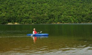
Please Note:  PURCELL HILL ROAD CLOSURE.  Due to construction of a new culvert from Canadice Lake under Purcell Hill Road, Purcell Hill Road is closed from the North Parking Lot trail entrance to Canadice Lake Road.  The north parking lot … Continue reading
5
6
7
8
9
10
11
Hemlock Lake Paddle 4:00 pm
Hemlock Lake Paddle @ Hemlock South Boat Launch
Aug 11 @ 4:00 pm – 6:00 pm
Hemlock Lake Paddle @ Hemlock South Boat Launch
Sunday should be another perfect day to be out on the water of Hemlock Lake?  Temperatures in the high seventies and a steady light wind. This week we will meet at the South Boat Launch on Hemlock Lake just miles … Continue reading
12
13
14
15
16
17
18
Hickory Hill – Map 12 – FLT Series #1 4:00 pm
Hickory Hill – Map 12 – FLT Series #1 @ Access 1
Aug 18 @ 4:00 pm – 6:00 pm
Hickory Hill - Map 12 - FLT Series #1 @ Access 1
This Sunday we start a series of hikes along the main Finger Lakes Trail between the Bristol Hills Branch and the Letchworth Branch. Previous hikes have followed each of the two branches to the east and to the west of … Continue reading
19
20
21
22
23
24
25
Railroad Bed Trail, Avon 4:00 pm
Railroad Bed Trail, Avon @ South Avon Rd Trailhead
Aug 25 @ 4:00 pm – 6:00 pm
(42.866140, -77.790775) Join us Sunday for a new venue – an easy stroll with length options from 1.6 to 4 miles on the level and shady Railroad Bed Trail between Avon and Geneseo. The original railroad was built in the … Continue reading
26
27
28
29
30
31
Aug
25
Sun
2019
Railroad Bed Trail, Avon @ South Avon Rd Trailhead
Aug 25 @ 4:00 pm – 6:00 pm

(42.866140, -77.790775)

Join us Sunday for a new venue – an easy stroll with length options from 1.6 to 4 miles on the level and shady Railroad Bed Trail between Avon and Geneseo. The original railroad was built in the 1840’s from Rochester to Nunda as an alternate form of transportation to nearby canals. In 1856 the railroad was purchased by the Genesee Valley Railroad and in 1859 the first train arrived in Geneseo. As gasoline powered vehicles became popular the railroad became unpopular and the last train passed over the line in 1940. Stripped of rails and ties, the land was then sold to adjacent landowners as a trail for recreational use. In 1993, Edward and Jacquelin Harris donated their section of the trail to the Genesee Valley Conservancy to ensure the property would remain a trail for community use.

The GVC Railroad Bed is open daily from sun-up to sun-down for equestrian uses, hiking, running, biking, dog-walking, bird watching, and geocaching. The trail is mostly hard-packed dirt but you may encounter some mud and tall grasses. Please stay on the trail as all other trails you will see running east/west are privately owned. Keep dogs leashed or under voice control and clean up after them.  Don’t forget the usual accessories: bug spray, water, etc. 

The Trail: has three access points. Please park on the side of the road and do not block the trail.

  • Fowlerville Road (Rt 22) – Trailhead sign is approximately 100 ft west of the intersection with Route 39
  • Hogmire Road – Trailhead signs are north and south of the road, approx .5 mile west of the intersection with Route 39
  • South Avon Road* – Trailhead signs are north and south of the road, 1 mile west of the intersection with Route 39

*NOTE: The publicly available portion of the trail ends at a wide grass strip approximately .85 miles south of the South Avon Road crossing. This demarcates an underground pipeline that cuts east/west across the Railroad Bed Trail.

Please do not trespass south of this landmark.


EVERYONE WILL MEET AT 3:45 AT THE SOUTH AVON RD TRAILHEAD, where some of us will then carpool approx 3 miles to the Fowlerville Rd trailhead.

  • CLIMBERS will start out going south and hike as far as the underground pipeline (.85 miles), then backtrack to starting point and continue to the Fowlerville Rd trailhead (2.25 miles) for a total of almost 4 miles.
  • TOURISTS will start from the Fowlerville Rd trailhead and hike to the starting point (2.25 miles) or continue past the South Avon Rd crossing to the southern end at the underground pipeline and back to South Avon Rd for a total of almost 4 miles.
  • NATURALISTS can hike south and back (1.7 miles) or north to Hogmire Rd and back (1.6 miles) or as far as comfortable either direction.

Trail brochure and map:    https://www.geneseevalleyconservancy.org/images/uploads/Railroad%20Bed%20Brochure.pdf

 DIRECTIONS:        

FROM AVON: From Route 20, take Rt. 39 south (Wadsworth Ave) appox 3.6 miles. Turn right onto South Avon Rd and drive approx 1 mile to trailhead.

FROM SPRINGWATER: From intersection of Rts 15A and 15, go west up Rt 15 to Livonia, the left onto Rt 20A to Lakeville. Bear to the right onto Rochester Rd and go approx 1.4 miles and turn left onto Triphammer Rd (Rt 52) until it ends (approx 3 miles). Turn right onto Rt 39 for .6 miles, and then left onto South Avon Rd. Trailhead is about 1 mile ahead.

FROM GENESEO: From intersection of Main, Court, North Streets and Rt 39 (Avon-Geneseo Rd), take Rt 39 north approx 5 miles and turn left onto South Avon Rd. Trailhead is about 1 mile ahead.

SOCIAL: 3 LEGGED PIG BBQ        https://www.3leggedpig.com/menu

3415 Rochester Rd, Lakeville NY 14480 Open Sun 11-8:00 (585) 346-0001

DIRECTIONS TO SOCIAL: From starting point, 1 mile back to Rt 39, then turn right for .6 miles. Turn left onto Triphammer Rd for approx 3 miles. Then turn right onto Rt 256 followed by a quick left at the fork onto Rochester Rd for about 1.4 miles into Lakeville. 3 Legged Pig is on the left just before stoplight.

Sep
1
Sun
2019
Conklin Gully
Sep 1 @ 2:00 pm – 4:00 pm

This Sunday, we will meet at the end of Dewolf Rd. Naples, to organize carpooling into HiTor WMA.

GPS 42.617350, -77.321399

The weather is looking cooler and should be a nice day to see Conklin Gully. Wildflowers are still blooming along the way. 

THE CLIMBERS~ Carpool to Parish Hill Rd entrance of HiTor. This is the Blue trail. Continue on the trail to Conklin Gully then bear left uphill to the 4 way intersection and pick up the orange trail, a left turn ending on Brink Hill Rd.The majority of this portion will be a significant climb. Be prepared with hiking poles, water and sturdy boots. After exiting the trail on Brink, turn left, back to Dewolf Rd.

THE TOURISTS~ If we have enough Tourists, you will begin at the Brink Hill Rd entrance to the FLT, a short walk from Dewolf. Dress accordingly for some mud and uneven ground. Poles are a good idea. Follow the Orange trail and at the intersection of the trail and maintenance road, turn right onto the Blue trail and continue mostly downhill bearing right to follow the blue trail to the gully. Continue all the way on the blue trail, over the bridge and out to the Parish Hill parking area.  There will be a car to return you to Dewolf Rd. Simply drive up Parish Hill Rd 1.1 miles, take the curve to the right (DO NOT stay straight, this becomes Lower Rd). At the next intersection, turn left on Shay then right on Brink Rd. Brink runs into Dewolf.

Depending on turnout, we may combine Tourist into Naturalist route.

THE NATURALISTS~ Carpool to Parish Hill Rd entrance of HiTor Blue trail. You will hike to Conklin Gully, enjoy the gully view and creek, then return the same route to the vehicles.

DIRECTIONS~ From Naples, take Main St which becomes Rt 53 South, up the hill. Watch for the Italy Valley sign pointing left. Take Italy Valley Rd  2 miles, turn left at the curve onto Bassett Rd. Proceed 1.6 miles, turn left onto Brink Hill Rd. Continue to the intersection of Dewolf Rd.. Turn right onto the dirt road to the top.

After hike social will be on Dewolf Rd. Please bring a dish to pass or make a $5 donation. Meat provided. Please bring your own drinks.


Sep
8
Sun
2019
Taughannock Falls
Sep 8 @ 3:30 pm – 6:00 pm

The Hike

On Sunday 8th September 2019 we will hike in the Taughannock Falls State Park. 

The Climbers and the Tourists will hike the North and South Rim Trails starting with the North Rim Trail at the Taughannock Falls Visitor Center, crossing the river above the High Falls, and returning on the South Rim Trail to its end near the park entrance. If there’s some energy left they will hike the stream bed to the base of the High Falls. The Naturalists will start at the car park at the park entrance, and walk the stream be to the High Falls.

There is a lovely view of the High Falls from the North Rim Trail, and lots of views of the gorge along the South Rim Trail. There’s a terrific view of the rapids above the High Falls where the North Rim Trail turns over to the South Rim Trail.

This is a VERY easy hike. The trail is mostly broad and lightly surfaced, and there are occasional benches along the route for hikers like us to take in the view. Wherever the path gets steep, such as where the South Rim Trail drops down to the park entrance, there are stone steps. This is a very scenic walk, and is best done slowly with lots of stops to take pictures.

There is a small charge for entrance to the park.

Meeting Up

We’ll meet at the Taughannock Falls Visitor Center (pictured left, GPS coordinates 42.5391, -76.6073). The Climbers and Tourists will have shuttled most of their cars to the park entrance parking lot, and will give their remaining car keys to naturalists to take down the hill; the Climbers and Tourists will start their hike at the Visitor Center. The Naturalists will take all of the cars down to the parking lot at the park entrance and hike from the parking lot.

The meeting time is set to be 3:30pm at the Visitor Center. There is a little leeway here that allows for people getting lost, being late, and for organizing the car shuttle and the picnic location.


The Social

The social will be a picnic. We can decide at the beginning of the hike where to have it – at the small waterfall near the park entrance or by the lake shore. There are picnic tables in both places, but it is a Sunday and there will be other people around looking for tables too. There will be a small gas barbecue for heating up things. Please bring a dish to pass and whatever you like to drink.

Getting There

There will be a car pool organized, aiming to leave from the Naples public parking lot on Mill Street at 1:30pm. For those of you who want to drive themselves, here are the directions.

From Springwater, Honoeye and Naples: this route begins Naples. From Springwater and Honoeye, take your favorite route to Naples and pick up the direction on Rt. 21N. Google estimates the trip to be 1 h 44 min (83.9 mi) from Springwater.


Follow Rt. 21N (S Main Street) in Naples until you reach the junction with Rt. 245

Turn right onto NY-245 N
Drive 13.9 mi
 
Turn left onto N Main St in Rushville
Drive 0.3 mi
 
Turn right onto NY-245 N/NY-247 N
Drive 1.1 mi
 
Continue straight onto NY-245 N
Drive 10.1 mi
 
Slight left onto NY-14A N/NY-245 N
Drive 3.1 mi
 
Turn right onto Hwy 20 E
Drive 4.2 mi
 
Turn right onto NY-96A S
Drive 17.3 mi
 
Continue onto NY-96 S
Drive 3.0 mi
 
Turn left onto Center Rd
Drive 1.4 mi
 
Turn right onto NY-89 S
Drive 11.8 mi
 
Drive to Taughannock Park Rd
Drive 0.7 mi
 
Turn right onto Taughannock Park Rd
Drive 262 ft
 
Turn right at the 1st cross street to stay on Taughannock Park Rd
Destination will be on the left
 
Sep
15
Sun
2019
FLT Series: Map 11, Access 2 to 5 @ Access 3
Sep 15 @ 2:00 pm – 4:00 pm

In August, we hiked a section of the Finger Lakes Trail north west of Bath that primarily stayed in the woods. This Sunday we will go a bit west of Bath to a section that is more evenly split between fields and woods, which should keep all our hikers alert to follow the blazes.

The weather promises to be good, so following the hike, we will have a dish to pass social at the end of the Climbers’ hike. This is a change from the original posting.

We will meet at the middle of the 3.8 mile section on Snell Hill Road (Access 3). The Naturalists and Climbers will carpool to Access 2 on Harris Hill Rd and follow the trail east, around a swamp and up to the top of a level ridge. The first road is CR 69 which we cross onto a uphill road through the woods. This section ends with a walk along the edge of the yard onto Snell Hill Rd and the Naturalists cars.  The climbers will continue east. This next section is a little tricky. The trail starts with a short section along a field and enters the woods. There are a couple of sticks blocking the way between trees, but it is easy to get around and continue the trail though easy woods. The trail turns left to scoot down a hedgerow, but it is best to find a way out to the field on the left and stay along the edge of the hedgerow down to Gay Gulf Rd. It is a pretty road walk as Gay Gulf Rd cuts along a steep bank with interesting rock formations. In about 0.2 miles, the trail turns right up a steep road and continues to Robinson Rd. Across the road, follow the edge of the corn field on the right, and then enter a large woods. Take care, there has recent logging and the trail is rutted. The hike ends along a hay field to the Tourists cars on Sinclair Rd.

Meanwhile, the Tourists will carpool to Access 5 on Sinclair Rd. They will hike north west along the hay field, then into a recently logged forest to Robinson Rd. Continue across Robinson Rd, following the blazes to Gay Gulf Rd. Turn left and notice the rock wall on the left side of the road. You should pass cows on the left, before coming to a left turn into a driveway (watch for blazes painted on the guardrail entering the driveway. Pass between two farm buildings and turn left to the hedgerow.  Follow the edge of the field, Once the hedgerow on the left become more of a forest, you should be able to find a route into the woods to find the blazed trail. Continue down to Snell Hill Rd and the cars. At this point, check the time. The trail jogs left on Snell Hill and then continues west.  The Tourists should continue a far as desired, then turn around and return to Snell Hill Rd and the cars.

Directions: From Springwater, Wayland, Dansville etc: Take I-390 South toward Bath and Corning. Take Exit 1 (Avoca), and turn right on Michigan Hollow Rd. Turn left onto NY-415 for 0.8 miles. Turn right onto CR-70A just before the road goes under I-86. In 3 miles, turn left onto Bouten Rd. You will cross a creek and then stay to the left to keep on Bouten. The road name may change, but continue for 1.3 miles. Turn right onto Snell Hill Rd. The trail crosses the road in about 1.3 miles. Park along the road.

From Naples and Cohocton: From Naples, take NY-21 South to N. Cohocton. Continue straight for 5 miles to Cohocton. At the stop sign, continue straight onto NY-415 for 9.6 miles. Turn right onto CR-70A just before the road goes under I-86. In 3 miles, turn left onto Bouten Rd. You will cross a creek and then stay to the left to keep on Bouten. The road name may change, but continue for 1.3 miles. Turn right onto Snell Hill Rd. The trail crosses the road in about 1.3 miles.

Directions to hike starts

From Snell Hill Rd to Harris Hill Rd: Continue south on Snell Hill Rd, which becomes McChesney Rd. Turn right onto Turnpike Rd for 0.4 miles, then right onto Harris Hill Rd. In 0.7 miles, cross McCaddam Rd. The trail will be on the right in about 0.2 miles. Park on the shoulder.

From Snell Hill Rd to Sinclair Rd: Continue south on Snell Hill Rd, which becomes McChesney Rd. Turn left onto Turnpike Rd for 1.8 miles, then left onto Sinclair Rd. The trail is on the left in about half a mile.

Directions to the Social on Sinclair Rd

From Harris Hill: Return south on Harris Hill Rd to the stop sign at Turnpike Rd. Turn left on Turnpike Rd and continue for 2.2 miles. Turn left onto Sinclair Rd at a curve in Turnpike.The trail is on the left in about half a mile.

From Snell Hill: Continue south on Snell Hill Rd, which becomes McChesney Rd. Turn left onto Turnpike Rd for 1.8 miles, then left onto Sinclair Rd. The trail is on the left in about half a mile.


Sep
22
Sun
2019
Mushroom Hike @ All Western Evergreen Nursery & Christmas Tree Farm
Sep 22 @ 2:00 pm – 4:00 pm

Katherine has invited us back to her farm in the beautiful town of Springwater to explore for wild mushrooms.  This is a great opportunity to pick some interesting mushrooms and learn about them from people who have studied them. You will learn which are safe to eat and whether any are good to eat.

Note: it is safe to pick mushrooms, but wait until you know what is what before you eat them.

Char will lead the Climbers. After checking in at the farm parking lot to sign the waiver and to receive the instructions on how to collect a specimen, the Climbers will carpool to Amanda’s Garden where Ellen Folts will host the group for an hour at her place. Then the Climbers will car pool to the All Western Evergreen South field Road entrance off Story Road and hike down through the wholesale trees A through E (back and forth through Fraser fir, Concolor fir, Korean and Turkish fir and notice the view, then back to Story Road to go through the Northwest Forest to the Cathedral pines, the south forest, across the choose and cut lots of Fraser fir, Korean fir and Concolor fir, to the North field road, scouring the hedgerow for mushrooms. Then we will hike up the farm road to Story road, staying on the farm land around the stone pile and back to the carpooled cars, drive back to the house.

Tourists will be led by Katherine or Carol: After checking in at the farm parking lot to sign the waiver and to receive the instructions on how to collect a specimen, the Tourists will hike to the south up through the woods and fields to Swartz Road and back through the Norway Spruce up by the pond and up through the Cathedral pines, across to the fields through O lots (correction strip trees), across the fields to the North field road down along the hedge row, through Scot Hill Triangle, down north field road along the hedgerow and just below the UVW fence, then through the woods back to the house where downstairs the mushrooms will be identified by Dr. Randy Weidner from RAMA and then we will have dish-to-pass social upstairs.

Naturalists: After checking in at the farm parking lot to sign the waiver and to receive the instructions on how to collect a specimen, the Naturalists, led by Gene & Georgia, will hike around the back yard behind the house including the Alaska Yellow Cedar, the nursery and up through the forest up behind all the houses along Liberty Pole Road, back up the hike path to the XY Douglas-fir and Concolor, through the fence around UVW across to the man gate at X center lot and then up the outside of the UVW fence to the Cathedral pines along the south field road and back to the house via the pond J Lot and forest back to the house where downstairs the mushrooms will be identified by Dr. Randy Weidner from RAMA and then we will have dish-to-pass social upstairs.

After the hikes, we will gather in the garage to see all of the collected mushrooms. Mushrooms will be identified by Dr. Randy Weidner from Rochester Area Micological Association (RAMA) from about 4:30 to 5:00. Hikers should plan their time to return to the house before that time.

Following the mushroom identification, join us for a dish-to-pass social upstairs.Please bring a dish to share (or make a small donation to the social fund) and your own beverage of choice. Water and tea will be available. Paper plates and plastic utensils will be provided unless you wish to bring your own place setting (and help save a tree). There will be space in the range oven and in the refriderator/freezers for your dishes if needed – please come in the garage and call upstairs if no one is there.

CR 60
Directions to 6840 Liberty Pole Rd, Dansville, NY (in beautiful Springwater, NY):

Note: It has been reported that some GPS systems use the center of the farm as the target location and send you to the wrong side of the farm. Before you leave check that the last road is Liberty Pole Rd and not Swartz Rd. Google Maps seems to know the location of the house. Or, use the directions below. There is a tree farm sign clearly visible at 6840 Liberty Pole Road and the house is visible from the road.

From Springwater: Go west from the Springwater light on Rt 15 North.  Just past the top of the hill, turn left on Co Rd  38 (Liberty Pole Rd).  The farm is on the left 1.1 miles from Rt 15 at 6840 Liberty Pole Rd.

From Geneseo: Go south on NY 63. About 6.4 miles after passing Rt 408, turn left on County Road 1 at Groveland.  This road becomes CR 1A at Scottsburg (rt 256) and then Liberty Pole Rd (CR 38).  It is 7.1 miles from Groveland to the All Western Evergreen Tree Farm.

From Honeoye: Take 20A west to Hemlock and 15A south to Springwater.  Then follow the Springwater directions.

From Rochester: Take I390 south to Exit 9 (NY 15 / Lakeville).  Turn left onto NY 15 and follow Rt 15 through Lakeville and Livonia (16.5 miles).  Just past Webster’s Crossing stay straight on CR 60 when Rt 15 bears left.  Take the first right off CR 60 onto Liberty Pole Rd (CR 38). The farm is on the left at 6840 Liberty Pole Rd.


Sep
29
Sun
2019
Stid Hill from Dugway Road @ Bristol
Sep 29 @ 2:00 pm – 4:00 pm

The primary purposes of Stid Hill Wildlife Management Area (WMA) are for wildlife management, wildlife habitat management, and wildlife-dependent recreation. This WMA is a 847-acre tract of land situated in the townships of Bristol and South Bristol in Ontario County. It is bounded by Route 64 on the west and Dugway Road on the north. Ganargua Creek, better known as Mud Creek, flows along Route 64. At one time, Stid Hill was productive sheep and cattle grazing land. Today, grazing has been eliminated. The mixture of steep hills, ravines, gullies, gorges, woods, and open areas create scenic vistas and also provide varied wildlife habitats.

The hike on Sunday Sept 29th will begin at the Dugway Road trail head @ 2:00; please arrive by 1:45. There is only a small parking area here, so please pull off and park on the shoulder near the trail head. The trailhead is easy to miss – it’s just a widening of the road after a sharp turn. The trail head is on the south side of the road and marked with a discreet DEC sign a little too far from the road.There are two loop trails from here as well as a trail that continues over the hill to the blue and yellow trails, which go down to the Rt 64 trailhead. Today we will be hiking both of the loop trails (1 to 2.5 miles), and the Climbers will venture beyond the loop trails and farther into the WMA (3-4 miles). Please bring good footwear and poles as needed.

From the trail head, the initial quarter mile is a good path, although it may be a bit wet and slippery if there has been recent rain. You will come to a prominent “Stop” sign and a gate. This is a little misleading; there are public trails to the left and right if these barriers. Both of these trails make up the short loop trail. Above this loop there is a much longer loop trail.

Climbers: Will cover a little more trail at a faster pace…they will continue up the incline (not a real serious one, as this area typically offers otherwise) then make a right into the denser woods. Arriving at several large shaggy hickory trees that have many yellow paint marks on them (probably used a bucket of paint here) we will turn left, continuing on the portion of the yellow trail that heads south, through a grove of thorn trees. We will then hike through a serene pine forest, and turn right onto a short trail that passes by an old pickup truck. Heading downhill, we will turn right onto the return loop through the pine & shaggy hickory forest.

Tourists: From the Stop sign, turn onto the trail to the left going up the ravine. There will be DEC signs on your right. At the first cross ravine, turn right and take the trail up the bank onto the top part of the short loop trail. Watch for the trail that goes uphill on the left, and turn here. Farther along, there will be some DEC Foot Trail markers. Continue until you come to an intersection where there are some larger trees with a lot of pink paint. Turn right on the pink trail, which is well marked and will lead you through the woods back to the intersection of the loop trails. From here, follow the wide pink marked trail down the hill and back to the Stop sign.

Naturalists: From the Stop sign, follow the trail to the right past a length of crash barrier, then uphill on a broad trail into the Stid Hill WMA. This trail is well marked with pink paint. Very shortly, you will come to a pink marked trail that turns left into the woods. This will take you to the intersection of both loop trails. Here you will take an immediate sharp left turn that crosses the top of the short loop trail. This trail does not have pink markers, but there are DEC Foot Trail signs (although they tend to be on the opposite sides of trees traveling this direction). This part of the trail can be a bit wet and muddy in spots. Continue to the end and turn left onto the ravine trail that will lead back down to the Stop sign.

After Hike Social:          Brew and Brats at Arbor Hill      6461 BB State Route 64 , Naples, NY   14512      (585) 531-4113

https://brewandbrats.com/     Approximately 6 miles from the Dugway trailhead via Rt 21 South

 Directions:

From the north: Starting at Route 5 & 20 in Bloomfield, drive south down Route 20A/64 for 5.3 miles to the intersection with Cty Rd 32 at Bristol Center. Continue for 1.4 miles and turn left on Dugway Road. If you come to a Stid Hill MUA parking area, you’ve come too far south – turn around and try again. Trailhead is on the right exactly 2.0 miles from Rt 64.

From the south: From the intersection of Rt 21 and 64 in Bristol Springs, drive north on Rt 64 for 6.5 miles. You will pass by two separate Stid Hill parking area signs on your right. Take the first right turn onto Dugway Road. It is 2 miles to the trailhead.

From Springwater, Head north to 20A, turning right just before Hemlock. Stay on 20A through Honeoye, and continue until it ends at Rt 64. Turn right and drive south on Rt 64 for 3 miles. Turn left onto Dugway Rd and go 2.0 miles to the trailhead.

Dugway Road is a good dirt road.  Please park carefully on the shoulder. There isn’t much parking space to be had.

Oct
5
Sat
2019
Wesley Hill Preserve – 30th Anniversary Saturday Hike with FLLT @ Richmond
Oct 5 @ 10:00 am – 11:30 am
Wesley Hill Preserve - 30th Anniversary Saturday Hike with FLLT @ Richmond

See hike description at https://www.fllt.org/events/30-for-30-anniversary-hike-at-the-wesley-hill-nature-preserve    Event includes a dish-to-pass

get-together with grill at the end of the hike.

Oct
13
Sun
2019
Rochester Folk Art Guild – Hike and Fall Open House/Apple Festival @ East Hill Farm
Oct 13 @ 2:00 pm – 4:00 pm

Sunday October 13 we will visit East Hill Farm, home of the Rochester Folk Art Guild, for a hike across a 350-acre hilltop farm and woodlot and a tour of the craft workshops. The Guild is a community of craftspeople, some resident and some visiting, and the weekend of October 12-13 is their annual fall Apple Festival and Open House, a celebration of the season with a home-cooked Farm lunch, local food vendors, fresh pressed cider, and tours/demonstrations at the pottery, wood, weaving and graphic arts studios. The Gallery/gift shop is also open for business. Admission is free, and the event runs until 5 PM.  For event details see:  Link here

To make sure you won’t miss out on the Guild’s acclaimed spread, please come by 1 PM for lunch before the hike. Others, please arrive by 1:45 to prepare for hiking at 2 PM. Hikes of 1.5 and 3.5 miles will allow for time to tour the  workshops and Gallery afterwards. The Guild lunch menu includes homemade soups and salads, homemade bread and desserts, cider and coffee, for $12 total, or a-la-carte.

Please park on the road shoulder at 1445 Upper Hill Road, Middlesex (directions below). We will convene at the side of the East Hill Gallery, the first building on the left as you come in the driveway. Trails are gently sloped and well cleared, but may be muddy, and grass is ankle-deep in many areas, so wear good hiking shoes or rubber boots.

Climbers will head south through the Guild’s farm and neighboring properties, past a pond and sauna, through a spruce grove, and loop through woods and mowed fields to the “Golden Valley”, named for its spectacular fall color and views to the east. We will return through the woods and pass an eclectic array of residential buildings, workplaces and gathering places, designed and built by community members over their 50 years of occupancy at the East Hill Farm. Workshops will be open for Climbers to tour after the hike if they wish.  Naturalists will make a shorter loop of about 1.5 miles, ending with a tour of the Guild buildings and the workshops.

Social:  We will reconvene after 4 PM in the Dining Hall for a dessert-to-pass post-hike social. Some Guild food and desserts may still be available for purchase. Cider and coffee will be plentiful, or bring your own beverage.

Directionsfrom Springwater/Naples: Take Route 15 south to Wayland and Route 21 east/north to Naples. Turn right on Route 245 opposite Bob’s and Ruth’s Restaurant, at the north end of the village. Follow Route 245 north to Middlesex, about 8.75 miles.  Turn right on Route 364 and go up the hill, one mile. Turn right on Upper Hill Road and go 1.5 miles.  East Hill Farm will be on your left, at #1445.  Park on the road shoulder and walk in the driveway to the Gallery/Dining Hall building, the white house on your left.

From Rochester and points north: Head to Routes 5 and 20 via Bloomfield or Canandaigua. At the east edge of the City of Canandaigua (first light after Wegmans/Post Office), turn south on Route NYS Route 364 (a.k.a. East Lake Road).  Follow Route 364 south 12.5 miles to Middlesex, where 364 turns to the east and you will make a left onto Route 245 and then an immediate right to continue on 364.  Go up the hill, one mile. Turn right on Upper Hill Road and go 1.5 miles.  East Hill Farm will be on your left, at #1445.  Park on the road shoulder and walk in the driveway to the Gallery/Dining Hall building, the white house on your left.

Oct
20
Sun
2019
Finger Lakes Trail Series @ Map 10 FLT
Oct 20 @ 2:00 pm – 4:00 pm

This month’s Finger Lakes Trail hike continues west toward Hornell in the Town of Howard. The trail is both pretty and pretty remote, and the day is predicted to be sunny with temperatures in the 60s. So a simple social is planned following the hike at the endpoint on Burleson Rd (a good dirt road). Bring lunch for yourself and if you wish, a desert to pass. Since cars will be left at the start of the hike, please plan to carry your lunch on the hike. And remember to bring water for hiking and the social.

This hike is on Map 10 between Access 9 and Access 7. All hikers will start from Hughes Road and hike west. This first section is on land owned by an archery hunter, who asks that we wear blaze orange during hunting season. The first section is mostly in the woods with intermittent views to the west. The trail is covered with leaves at this time of year, so watch the white blazes carefully. Depending on the size of the group, we will separate into two groups according to hiking speed. In 1.7 miles, the trail crosses Burleson Rd (a 200′ road walk to the left). From Burleson Rd, the climbers will follow a farm lane until we come to a pig farm. Follow the blazes to a bridge across the creek and then out to Stephens Gulch Rd. Please make sure the group leaves all gates as they found them.

The trail continues straight across the road, primarily on the seasonal Spencer Hill Rd to the top where wind turbines and views abound. However, watching our time, the Climbers will return back to Burleson Rd.

We will have cars waiting at Burleson Rd. We will find a nice spot along the road to enjoy the views and for a light picnic – bring a sandwich, extra liquid and if you wish, a desert to share.

Directions:

If you are willing to arrive 20 minutes early, please meet at the Burleson Rd trailhead (see below). We will carpool to the startOtherwise, here are directions to the start of the hike.  We will start hiking at 2:00PM.

The following directions use I390 and I86 to get to Howard, NY. You can save about 5 minutes by taking Rt 21 south from Wayland, if you don’t get lost. Please note, there was construction on 415 south of Cohocton yesterday, requiring an easy detour.

From Springwater and Wayland: Head south on NY 15, through Wayland. Turn left to get onto I-390 south. Take the I-86 west exit toward Jamestown and take exit 35 for Howard, NY. Turn left from the exit, onto CR 70. Continue straight across CR70A onto Mill Rd. Bear left to stay on Mill Rd (don’t go straight onto Hopkins Rd) Continue straight at a small hamlet onto Craig Rd, then immediately turn right onto Hughes Rd. Hughes Rd will cross Turnpike Rd in 1.5 miles. Continue to the trail head on the right in 0.4 miles after Turnpike Rd.

From Naples: Head south on NY 21 to N. Cohocton. Continue straight on NY 371 to Cohocton. Turn right on NY-415 (Maple Ave). In 0.6 miles, turn left on Cohocton Loon Lake Rd and then left to get onto I-390 south. Take the I-86 west exit toward Jamestown and take exit 35 for Howard, NY. Turn left from the exit, onto CR 70. Continue straight across CR70A onto Mill Rd. Bear left to stay on Mill Rd (don’t go straight onto Hopkins Rd) Continue straight at a small hamlet onto Craig Rd, then immediately turn right onto Hughes Rd. Hughes Rd will cross Turnpike Rd in 1.5 miles. Continue to the trail head on the right in 0.4 miles after Turnpike Rd.

From Dansville: Take I390 toward Wayland. Continue on the Springwater directions above.

Directions to the end of the hike at Burleson Rd

From Springwater: Head south on NY 15, through Wayland. Turn left to get onto I-390 south. Take the I-86 west exit toward Jamestown and take exit 35 for Howard, NY. Turn left from the exit, onto CR 70. Turn right onto CR 70A.. In 0.4 miles, stay left (70A curves to the right) onto Graves Hill Rd (or maybe it is called Pfitzenmaier Rd or Starr Hill Rd) and then left on CR 27 (Stephens Gulch Rd). At the end (2.1 miles) turn right on Turnpike Rd, then a quick left onto Burleson Rd. The trail crosses the road in 1.5 miles. Park on the shoulder.

Directions from Burleson Rd to the start of the hike: Head north on Burleson back to Turnpike Rd. Turn right on Turnpike Rd. Continue straight for 0.8 miles, then turn right onto Hughes Rd. The trailhead is on the right in 0.4 miles.

Oct
27
Sun
2019
Cleveland Hill on the Bristol Hills Branch of the FLT @ Northern Access
Oct 27 @ 2:00 pm – 4:00 pm

This Sunday we return to Cleveland Hill at the back of Camp Cutler. This hike will provide a good climb and the resulting views of Naples Valley.

NOTE: Dogs are not allowed on this hike, except with the Naturalists.

Click on picture for a high resolution panorama view.

The Climbers and Tourists will hike together. They will start at Cutler Rd and will enjoy a woods walk up Cleveland Hill through the Camp Warren Cutler boy scout camp and back down to West Hollow Rd (CR 33). This is a 3.1 mile hike. Meanwhile, the Naturalists will avoid the hill completely, and instead walk across CR 33 and hike a mile into the Beaver Pond before returning to the cars.

NOTE: The BHB trail is closed past the Beaver Pond for the fall hiking season.

All hikers will meet at the  Camp Cutler parking area on West Hollow Rd (CR 33), to leave most cars at the end of the hike.  The parking lot (42.6862, -77.417 or N42 41.1732 W77 25.0211) is on the west side of CR 33 about 1.8 miles north of Clement Rd, or 2.3 miles south of CR 34. From the parking lot, the Climbers and Tourists will carpool to the Clement Rd parking area (0.2 miles west of CR 33). The Naturalists will leave their cars in the parking lot, walk across the road and turn right for 200 feet to and follow the BHB trail to the east.

As you will see when you arrive at this hike, Cleveland Hill is quite high and steep. The climb is 400 vertical feet at each end. Fortunately, the trail has nice long switchbacks, so the slope is reasonable, but continues for nearly a mile. Plan on a steady climb with stops to catch your breath.

The Climbers and Tourists will carpool to Clement Rd (Turn right onto W Hollow Rd. Take the first right (1.8mi) on Clement Rd for 0.3mi. Park in the lot on the right). We will turn right coming out of the parking lot and walk on the road for a tenth of a mile. There is logging taking place near the trail and the initial road that we will walk on is rutted and muddy, but with some care you can avoid getting your boots very muddy. Turning right off the road and following the orange blazes, hikers will first pass a boy scout shelter, and then will turn right at the intersection with the white and blue trails. At several points on this hike, different boy scout trails will connect to the BHB trail, but we will stay on the orange trail for the entire route.The trail follows the east side of the hill, with at least one photo opportunity overlooking the West Hollow. After a mile along the top of the hill, a steep hike down will end at the original parking lot on CR 33.

The Naturalists will exit the parking lot and turn right to follow the road for 200 feet, where they will turn left to leave the road and cross the open field. They will follow a relatively flat trail for about an hour to the beaver pond.  If time permits, there is a branch trail around the pond that can be explored. After the pond, the Naturalists will retrace their steps to the car.

As always, check the weather and dress appropriately. You will appreciate layers that can come off during the initial climb, and worn again at the top.

Following the hikes, please join us at the Neopolitan Pizza in Naples for food and socializing.

Directions:

From Springwater, (Wayland and Dansville): Take NY 15 South from Springwater to the light in Wayland. Turn left on NY 21 for 11.7 miles through N Cohocton (left turn) and into Naples (left turn at NY 53). Follow Main St for a half mile and turn left onto Vine St (the fourth left). Take an immediate right onto Race St following the sign “To CR 33”. Take the next left onto Cross Rd and then bear to the left onto West Hollow Rd. The parking lot is 4.7 miles ahead on the left.

From Honeoye: Head east on US 20A and turn right onto E. Lake Rd. In 0.6mi turn left onto Egype Valley Rd (CR 33). In 6.9 miles, turn right onto West Hollow Rd (stay on CR 33). The parking area is on the right in 2.3 miles.

From West Lake Rd south of Honeoye Lake: Follow West Lake Rd (CR 36) south, past Hunt Hollow ski area and past French Hill Rd. Turn left onto Gulick Rd. In 2.9 mi, turn right on Clement Rd. In a half mile, you will see the entrance to the BHB trail on the left, followed in a tenth mile, the parking lot also on the left. But keep going to the tee and turn left onto West Hollow Rd. The parking lot is on the left in 1.8 miles.

From Canandaigua: Take NY-21 south to the intersection with NY-64. Turn right onto NY 64 North for 2.3 miles. Turn left onto CR 34, then left onto CR 33 (West Hollow Rd). The parking area is on the right in 2.3 miles.

Directions to social at the Neopolitan:

From end of the hike on CR 33: Turn right (south) on CR 33. (be sure to stop at Clement Rd to pick Climber’s cars). In Naples, bear left onto Elizabeth St. Take the first right on Lyon St. The Restaurant is on the right at the intersection with Main St. Turn right onto Main St to park.

One thought on “Calendar

  1. Looking for brochure.or mailing list so I can receive it in the mail.
    Nothing opens up for mailing list.
    There’s all kinds of very bizarre ads and post for viagra and other drugs above on calender page.
    Please let me know if there’s a brochure available

Leave a Reply