
Hikes led by Springwater Trails are generally held on Sunday afternoons and appear in this calendar in green.
| Sun | Mon | Tue | Wed | Thu | Fri | Sat |
|---|---|---|---|---|---|---|
| Genesee County Park & Forest, E. Bethany 4:00 pm Genesee County Park & Forest, E. Bethany @ Genesee County Park Jul 11 @ 4:00 pm – 6:00 pm 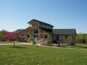 History: Genesee County Park is the oldest county forest in New York State. It has 431 acres of forested rolling hills, five ponds, and a 4-acre wetland, located in Black Creek Watershed. The park has 10 miles of trails for … Continue reading | ||||||
| Canceled – Clark Gully. Possible substitutes 4:00 pm Canceled – Clark Gully. Possible substitutes Jul 18 @ 4:00 pm – 6:00 pm I have received emails about possible substitute hikes for the Clark Gully hike that has been cancelled. According to Wunderground, there is a 20% chance of rain at both locations below, so make your own choice. From Don: Here is … Continue reading CANCELLED – Clark’s Gully Hike – CANCELLED 4:00 pm CANCELLED – Clark’s Gully Hike – CANCELLED @ Sunnyside Parking area Jul 18 @ 4:00 pm – 6:00 pm 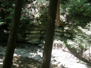 NOTICE: The expected mud on the steep trails has forced us to cancel our hike on Clark Gully. On Sunday we will return to Clark Gully on the south east side of Canandaigua Lake. This gully is a part of … Continue reading | ||||||
| Paddle/Hike at Finger Lakes Museum, Branchport 4:00 pm Paddle/Hike at Finger Lakes Museum, Branchport @ Finger Lakes Museum Jul 25 @ 4:00 pm – 6:00 pm 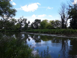 Please join us for kayaking on Sugar Creek and Keuka Lake or a hike through the marsh preserve to the lake. Our starting point will be the Finger Lakes Museum site, accessible from Guyanoga Road or from Route 54, both … Continue reading |
Subscribe
| Sun | Mon | Tue | Wed | Thu | Fri | Sat |
|---|---|---|---|---|---|---|
|
Genesee County Park & Forest, E. Bethany
4:00 pm
Genesee County Park & Forest, E. Bethany
@ Genesee County Park
Jul 11 @ 4:00 pm – 6:00 pm
History: Genesee County Park is the oldest county forest in New York State. It has 431 acres of forested rolling hills, five ponds, and a 4-acre wetland, located in Black Creek Watershed. The park has 10 miles of trails for … Continue reading
|
||||||
|
Canceled – Clark Gully. Possible substitutes
4:00 pm
Canceled – Clark Gully. Possible substitutes
Jul 18 @ 4:00 pm – 6:00 pm
I have received emails about possible substitute hikes for the Clark Gully hike that has been cancelled. According to Wunderground, there is a 20% chance of rain at both locations below, so make your own choice. From Don: Here is … Continue reading
CANCELLED – Clark’s Gully Hike – CANCELLED
4:00 pm
CANCELLED – Clark’s Gully Hike – CANCELLED
@ Sunnyside Parking area
Jul 18 @ 4:00 pm – 6:00 pm
NOTICE: The expected mud on the steep trails has forced us to cancel our hike on Clark Gully. On Sunday we will return to Clark Gully on the south east side of Canandaigua Lake. This gully is a part of … Continue reading
|
||||||
|
Paddle/Hike at Finger Lakes Museum, Branchport
4:00 pm
Paddle/Hike at Finger Lakes Museum, Branchport
@ Finger Lakes Museum
Jul 25 @ 4:00 pm – 6:00 pm
Please join us for kayaking on Sugar Creek and Keuka Lake or a hike through the marsh preserve to the lake. Our starting point will be the Finger Lakes Museum site, accessible from Guyanoga Road or from Route 54, both … Continue reading
|
Subscribe
One thought on “Calendar”
Leave a Reply
You must be logged in to post a comment.
Looking for brochure.or mailing list so I can receive it in the mail.
Nothing opens up for mailing list.
There’s all kinds of very bizarre ads and post for viagra and other drugs above on calender page.
Please let me know if there’s a brochure available