
3432 Jones Bridge Road
Mount Morris, NY 14510
USA
Canceled: At 2:20, the forecast has gotten more definite for thunderstorms. So we have canceled the hike for today. Please join us next Sunday.
Notice: As of 1:30 Sunday, wunderground predicts 80% chance of thunderstorms in Geneseo. Although we aren’t cancelling the hike until we see the weather at 4:00, please know that we will cancel if there is lightning at 4:00 and we will abort if the lightning starts during the hike. Pati has also scoped out a couple of shelters for the social if it raining at the end of the hike. Hope to see you at four
A year ago last March our group enjoyed this hike despite the cold and muddy conditions. The weather predictions for this Sunday look sunny and warm. With the rain this week expect some mud, but for the most part a pleasant hike and great company. We will meet at 4:00 at the Preserve Kiosk on Jones Bridge Rd and Rt63.
History of the area
Indian Fort Nature Preserve (42.766,-77.8295) is managed and maintained by Genesee Valley Conservancy. It is known as “Indian Fort” because of the two palisades that once stood on the site. Two mounds are still visible where the wooden posts created a fenced enclosure between the two main gullies. These palisades date back to 1400 – 1500 A.D. The former Iroquois palisades prompted the area to be listed on the National Register of Historic Places in 1974. Because of the diverse botanical, cultural and geological features, the preserve has been designated a Research Reserve by the conservancy.
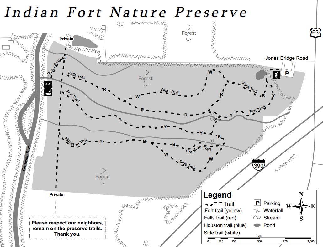
Upper falls
The property consists of sixty acres with gullies, creeks, a small field, a pond, and access to the Genesee River. Trails are well marked and go from the parking area on the northeast side of the preserve through the preserve to the Genesee River. Two waterfalls can be seen from the trails.
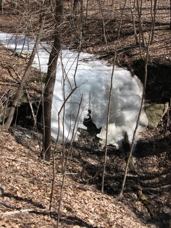
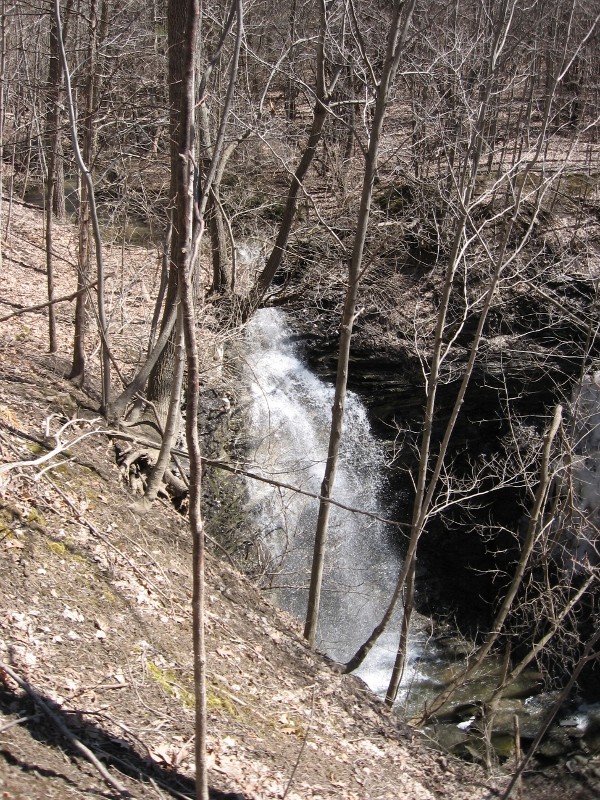
Snowfalls
Our Hikes
Climbers will not find the main trails a challenge, but they can travel up the gullies to the waterfalls and climb the steep sides of the gullies. Tourists can follow the climbers and scale the gully walls before they get too steep. naturalists will find easy hiking on trails that have slight hills and a lot of flat land.
The Social
The hike will be followed by a tailgate social in the parking lot. Bring a dish to pass and your own beverage or make a contribution to the social fund. Bring a chair is you choose to rest your bones.
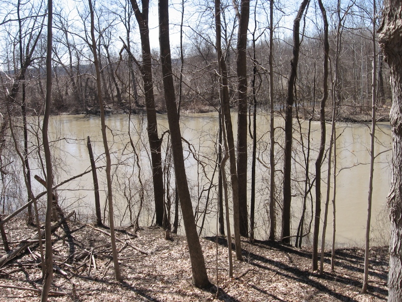
The Genesee River
Dogs are allowed on a leash or ‘controlled’ by verbal commands. Please note that some parts of the trails are in close proximity to busy route 63.
Directions
The preserve is located at 3432 Jones Bridge Road. There is no sign identifying this branch of Jones Bridge Road. Please note: Jones Bridge Road has three sections separated by the Genesee River and by I-390. The preserve is on the small section west of I-390 and east of the Genesee River.
From Springwater: There are many options from Springwater including taking I 390N from Wayland to Mt Morris (see below). The route with the fewest turns takes Rt 15 N out of Springwater for 1.5 miles. Turn left onto Liberty Pole Rd (CR 38) and follow that road for 8.1 miles (it will change names and CR numbers two times) to NY-63. Turn right and follow NY 63 for 8.3 miles (there is a right turn staying on NY 63 [Mt Morris-Geneseo Rd] after 6.4mi). The Preserve is on the left and the kiosk can be seen from the road.
From Mt. Morris exit of Rt 390: North on Rt. 408, which becomes Rt. 63. Stay on Rt. 63 for 2 miles. The Preserve is on the left and the kiosk can be seen from the road.
From Geneseo: Head south on Rt. 39/Rt. 20A. At the traffic light where Routes 20A and 39 turn to the right, continue south on Rt. 63 for 1.2 mile. The preserve is on the right and the kiosk can be seen from the road.
From Rochester: Head south on I 390 S to Exit 8. Turn right onto US 20A for 4.9 miles. Turn right onto Mt Morris Rd (20A and 39S). At the traffic light where Routes 20A and 39 turn to the right, continue south on Rt. 63 for 1.2 mile. The preserve is on the right and the kiosk can be seen from the road.
From Honeoye: Follow Rt 20A west to Geneseo. Turn right onto Mt Morris Rd (20A and 39S). At the traffic light where Routes 20A and 39 turn to the right, continue south on Rt. 63 for 1.2 mile. The preserve is on the right.