
Hopkins Rd Hornell
NY 14843
 It’s already the third Sunday of December and time to return to our Finger Lakes Trail series. Last month we hiked through Kanakadea Park and a loop of the FLT just north of I-86. This month we join the trail just west of that loop as the trail enters a series of state forests. This hike will cover about half of the trail through Bully Hill State Forest.
In 2012, Springwater Trails held a hike in Bully Hill State Forest.
All hikers will start at the intersection of Hopkins Rd in Almond, NY and hike over a hill to Bully Hill Rd. Based on time, hikers will continue across Bully Hill Rd and hike up a creek, turning around so as to arrive back at the waiting cars on Bully Hill Rd. Hikers will exit for Hopkins Rd and turn left on Bishopville Rd, then right onto a blue access trail. The blue trail merges onto the main white blazed trail. Continue straight onto the main trail. The trail passes through a gate (leave the gate how you find it) and enters the state forest. The hike is now fairly level until we cross Karr Rd. After Karr Rd, it is all downhill to Bully Hill Rd. (2.2 miles) Hikers with time and inclination for a longer hike should turn right on Bully Hill to cross the bridge over the creek and then left onto the trail. Continue along the trail, keeping an eye on the clock – turn around to return to the car on Bully Hill Rd.
Following the hike, you are invited to join us for a social at a Dansville establishment to be selected by the hikers. The following restaurants are available after 5 on Sunday: Battle Street Brewery (until 6), Jack’s Place Gaslight Grill, Sunrise Restaurant, Tony’s Pizza, The Leaning Tower.
A carpool to this hike will be available from the parking area behind the Firehall in Wayland. The carpool will leave promptly at 1:15.
Directions to Carpool at Wayland Parking (42.568606, -77.590562):
Plan to be at the parking area at 12:50. We will leave at 1:00 for Hornell and will drop off one car at Bully Hill Rd..
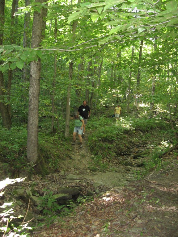
Pam and Marty, along the creek near Bully Hill Rd.
From Springwater: Head south on NY-15 to the light in Wayland. Turn right on Rt 63 (W Naples St). In about 150ft, turn right between the Fire House and the Sugar Creek building to get to the parking lot in the center of the block.
From Naples and N Cohocton: Head west on NY-21S toward Wayland. Go through the light at NY-15. In about 150ft, turn left between the Fire House and the Sugar Creek building to get to the parking lot in the center of the block.
Directions to Hike
From Springwater and Wayland: Head south on NY-15. In Wayland, continue south on NY-21 and stay on 21 for 18.8 miles. Turn right on NY-36 N. In half a mile use the right lane onto I-86 West. Take the first exit (Exit 33) for NY-21, Almond. Turn right on Karr Valley Rd, then left on Bishopville Rd. In one mile, turn right onto Hopkins Rd (This is the second entrance to Hopkins Rd from Bishopville Rd). You can park on the shoulder of Hopkins Rd. The trail head is across Bishopville Rd and about 50 ft to the left from Hopkins Rd.
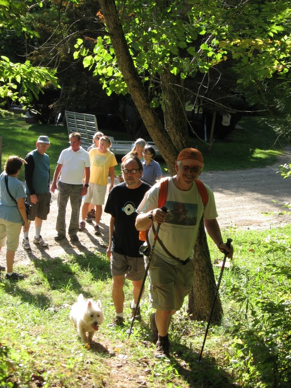
Leaving Bully Hill Rd toward Hopkins Rd. Our hike will end at this point.
From Dansville: Head south on NY-36 past Stony Brook. In Arkport, turn left on West Ave. In 0.3 miles, turn left onto Bishopville Rd (CR 67). In 2.9 miles, turn left to stay on Bishopville Rd. In another 3.2 miles, turn left onto Hopkins Rd.
From Naples and N Cohocton: Head south on NY-21S. In N Cohocton continue straight onto NY-371. At the stop sign in Cohocton, turn right onto Maple Ave. In a half mile, turn left onto Cohocton Loon Lake. Continue straight past the entrance to I-390 where the road becomes CR-121. In 4 miles, turn left onto NY-21. Turn right on NY-36 N. In half a mile use the right lane onto I-86 West. Take the first exit (Exit 33) for NY-21, Almond. Turn right on Karr Valley Rd, then left on Bishopville Rd. In one mile, turn right onto Hopkins Rd (This is the second entrance to Hopkins Rd from Bishopville Rd). You can park on the shoulder of Hopkins Rd. The trail head is across Bishopville Rd and about 50 ft to the left from Hopkins Rd.
From other points along I-86: From I-86, take Exit 33 for NY-21, Almond. Turn right on Karr Valley Rd, then left on Bishopville Rd. In one mile, turn right onto Hopkins Rd (This is the second entrance to Hopkins Rd from Bishopville Rd). You can park on the shoulder of Hopkins Rd. The trail head is across Bishopville Rd and about 50 ft to the left from Hopkins Rd.
Well, the weather fooled me. As I planned today’s hike, I thought all of the snow would be gone after rain on Saturday. It turned out to be snow instead.
I haven’t been to Bully Hill SF today, but Wunderground.com says Hornell only got a half inch of snow yesterday, so I am expecting that we will be hiking through wet snow conditions but not as much as here in the hills of Springwater.
I am going to bring my snowshoes in case there is more snow at the hike.
Generally, a hiking trail like the FLT is not built for skiing, and you should expect some steep, narrow downhills, especially going down from Karr Rd to Bully Hill Rd. However, Karr Rd is the snowmobile route through Sully Hill SF and Bully Hill Rd above the point where we will end our hike is seasonal (unplowed). So, if you are adventurous, you have two alternatives:
1. Meet the car pool at Bully Hill Rd when they drop off a car at the endpoint of the hike at the FLT trail crossing. If you are doing this, please arrive by 1:40 so you can sign in with us. From there you can ski up Bully Hill Rd, turn left at Farr Rd (called Stearns Rd on the Bully Hill SF map) and turn right on an old abandoned Stearns Rd to return to Bully Hill.
2. Meet at Hopkins Rd, by 2:00. From there, follow the FLT up to Farr Rd. Turn left on Farr Rd and then turn left on either Stearns Rd or go all the way to a left turn on Bully Hill Rd. Follow the road down to the end point for the hike.
NOTE: The north south road marked with dashed lines in the map at the top of this post, is what I have referred to as Sterns Rd.
I look forward to seeing a big crowd for what should be a nice winter hike!
From Jamieson: Also open on Sunday is Big Sky Restaurant, turn by the Kwik Fill past Tops & at the end of that street is Big Sky, don’t let the outside fool you, it is quite nice, and often has game day specials, and the food is outstanding. Scoville’s Grill at the golf course should also be open.