Wayland, NY 14572
USA
NOTICE: Daylight Savings Time starts on Sunday.
This week’s hike was originally scheduled for the Bristol Hills Branch through Hi Tor. This section is 5.6 miles according to the FLT map, which is a bit longer than a standard climbers hike (4 to 4.5 miles), did not seem out of line with other hikes in this series. However, the snow makes a difference. On Wednesday, Linda and I did a pre-hike which took over 5 hours – way too long, even if we started an hour early. So, quick change of plans.
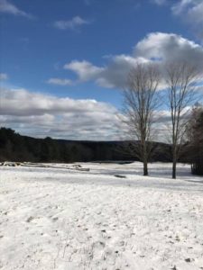
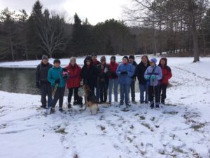
Sunday’s hike will be at 8664 Schribner Rd. There will be three hikes of 1, 2 or 3 miles long. Today (Thursday), the snow is 8 to 10 inches deep with a crust on the top. Snow shoes or cross country skis are highly recommended, although boots will be acceptable once a couple of snowshoes lead the way. Each hike will be adjustable by the hike leader to accommodate conditions. So plan on a two hour winter hike through fields and woods.
The Climbers and Skiers will head across the valley and then go south along the side of the valley. This hike will climb one short but steep climb up from the creek. On the way back, skiers may want to take off their skis since the snow is crusty and heavy and the trail is narrow. We will go down and back up the valley on either side of the old farmer’s fields. The fields are now filled with pines and other trees planted in the 1950’s.
 The Tourists will also cross the valley, but will turn right for a slightly shorter hike. This hike will follow the edge of the hardwood forest that was harvested three years ago. Hikers on the Cleveland Hill section of the BHB last month, may want to compare logging to encourage regeneration of Oak trees on Cleveland Hill, to logging to allow the small Maple trees to thrive.
The Naturalists will stay on the road side of the valley. The hike will only climb about 50 feet across a large field. At the top, be sure to turn around for the best view on the property. On the way back, we will take a quick peak inside the Red Pine woods planted in the 1930’s. You will see a few trees marked for telephone poles, but not worth the effort needed to remove them.
After the hike, please join us for a social at our house. Bring a dish to pass and your own beverage, or contribute $5 to the social fund.
Directions are available here. If you use a GPS, enter “Schribner and Tabors Corners Rd, Wayland NY” and the come up Schribner Rd for 1 mile. Park along the road just past the driveway, or park in the driveway if there is room.


good morning! I would like to join you on your schribner vally hike.
All hikers are welcome to join us on any hike. Simply follow the directions in the hike description on the home page of the website, and show up a few minutes before the start time. Before you come to a hike, we suggest that you:
1. Check the hike description for the time and date of the hike. Sometimes, old hike descriptions appear on our web page.
2. Check the weather and dress accordingly. Dress in layers so you can adjust when the wind changes, or when you are working harder.
3. Look at a map to find the start point. Compare the directions in the hike description to your GPS directions. Sometimes your GPS will take you on seasonal roads that are best avoided.