
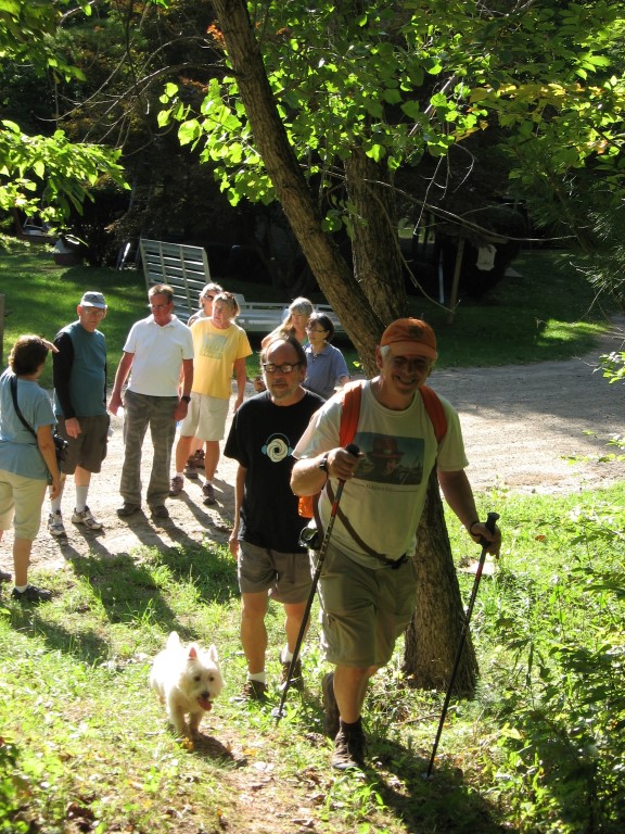
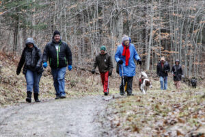
Hikes led by Springwater Trails are generally held on Sunday afternoons and appear in this calendar in green.
| Sun | Mon | Tue | Wed | Thu | Fri | Sat |
|---|---|---|---|---|---|---|
| Lehigh Valley Trail Hike or Bike in Rush, NY 2:00 pm Lehigh Valley Trail Hike or Bike in Rush, NY @ Stevens-Connor Lehigh Valley Lodge Apr 6 @ 2:00 pm – 4:00 pm Come join us for a leisurely hike or bike along the Lehigh Valley Trail on Sunday April 6th! With its flat even surface, the trail is a hidden gem for walking, hiking, jogging, biking. It is a vital link in … Continue reading | ||||||
| Ontario County Park at Gannett Hill Hike-Naples 2:00 pm Ontario County Park at Gannett Hill Hike-Naples @ Lookout Parking area Apr 13 @ 2:00 pm – 4:00 pm  This is one of our group’s favorite hikes! Ontario County Park at Gannett Hill is one of the highest points in Ontario County and located in the scenic Bristol Hills. At an elevation of 2,256 feet above sea level, you’ll … Continue reading | ||||||
| No Hike-Easter Break 2:00 pm No Hike-Easter Break Apr 20 @ 2:00 pm – 4:00 pm No hike has been scheduled for this date due to the Easter Holiday. Enjoy the break, spend time with loved ones and eat chocolate bunnies. This will give you something to burn off next week  | ||||||
| Hike Rob’s Trail – Hemlock Lake side 2:00 pm Hike Rob’s Trail – Hemlock Lake side Apr 27 @ 2:00 pm – 4:00 pm Join us on Sunday April 27th to hike the west side of Rob’s Trail, the DEC/Nature Conservancy property in the northeast corner of Hemlock Lake! Options are to hike out and back to the south along the trail … Continue reading |
This hike is CANCELLED!!!!! The freezing rain across the region is too dangerous for both driving and walking!
Description
- This 800 acre preserve is a sanctuary for hikers during hunting season. It was acquired by the Finger Lakes Land Trust in 2001 with generous help from an anonymous donor. A stipulation of this gift was that the preserve would be patrolled during hunting seasons to protect against trespassers. Our hikers will contribute to this effort.
The hilltop preserve looks down upon the Chemung River between Corning and Elmira. At one time this area was nearly ruined by heavy logging, but the town of Big Flats stepped in to halt the destruction. The original forest has made an impressive recovery through natural regeneration of many tree species. On some of the steep slopes, original hardwoods and conifers remain.
Some forest residents are worth noting, although in December they are not likely to be visible. Timber rattlesnakes are long time residents here. Allegheny mound ants have also carved a niche. Black bears have been sighted in recent years. For additional information and history go to http://fllt.org/preserves/steege-hill-preserve
 Special Note: Although no hunters have been spotted here in all these years, please make yourself visible by wearing blaze orange. Conditions in December are unpredictable. It is advisable to bring hiking poles and traction devices for your boots.
The 6 miles of trails are largely old logging roads, well marked and maintained. All hikers will gather at the new and improved parking area on Steege Hill Rd, which has been recently repaved. It is still a small area so carpooling is encouraged. Meet at Springwater Town Hall on Rt. 15 at 12:45 to share a ride for the 1 hour drive to Big Flats.
Hiking Groups There is a moderate half mile climb from the parking area to the various trailheads.
Naturalists will enjoy meandering for about 2 miles along the yellow trail with its gentle slopes and a scenic pond. A hike leader will be needed for this group. Trail map will be provided.
Tourists will traverse the blue and orange loops for about 3.5 miles, enjoying a variety of terrain and some nice views. Uphills are moderate. A volunteer hike leader is needed for this group.
Climbers will tackle the red, white, and blue trails for a distance of about 4.5 miles with some up and downhill challenges.Directions Take 390 South to I86E.
Follow I 86 E to exit 48.
Take 353 E for 1.5 miles
Turn right on South Corning road and go .7 miles.
Cross Chemung River and turn left on Steege Hill Rd.
After 1 mile look for preserve sign on left.
After Hike Social will be at Tags Restaurant, 3037 Rt. 352 in Big Flats. We have enjoyed dinner here several times. See menu at http://www.tagsrestaurant.com
This event has been postponed to March 8, 2020 so that people have the opportunity to attend the annual Naples Ecumenical Christmas Concert.
We have decided not to hike the hills and dales this Sunday. Instead, by popular demand, we shall gather at St. Januarius church on Main Street in Naples, and enjoy the stunning annual Christmas concert. For those with concerns about the separation of religion and hiking, this is a secular event. While there may be plenty of traditional christian Christmas music, there will not be any proselytizing.
St. Januarius is 180 North Main Street in Naples, NY. It is on the northern side of the village, a 100 yards or so south of Roots restaurant and on the opposite side of the street.
There’s no meeting places as such. We’ll just show up at the church and find seats. It would be wise to come early – this is a popular concert.
The concert starts at 2:00pm.
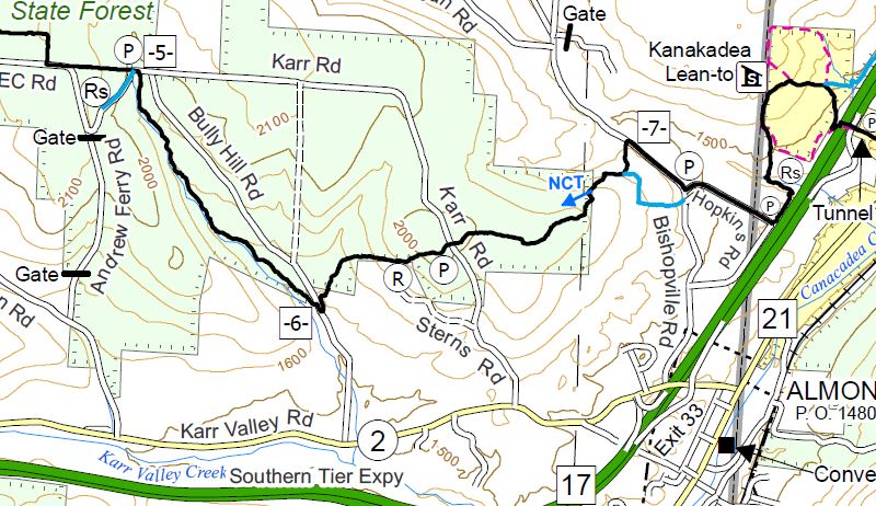 It’s already the third Sunday of December and time to return to our Finger Lakes Trail series. Last month we hiked through Kanakadea Park and a loop of the FLT just north of I-86. This month we join the trail just west of that loop as the trail enters a series of state forests. This hike will cover about half of the trail through Bully Hill State Forest.
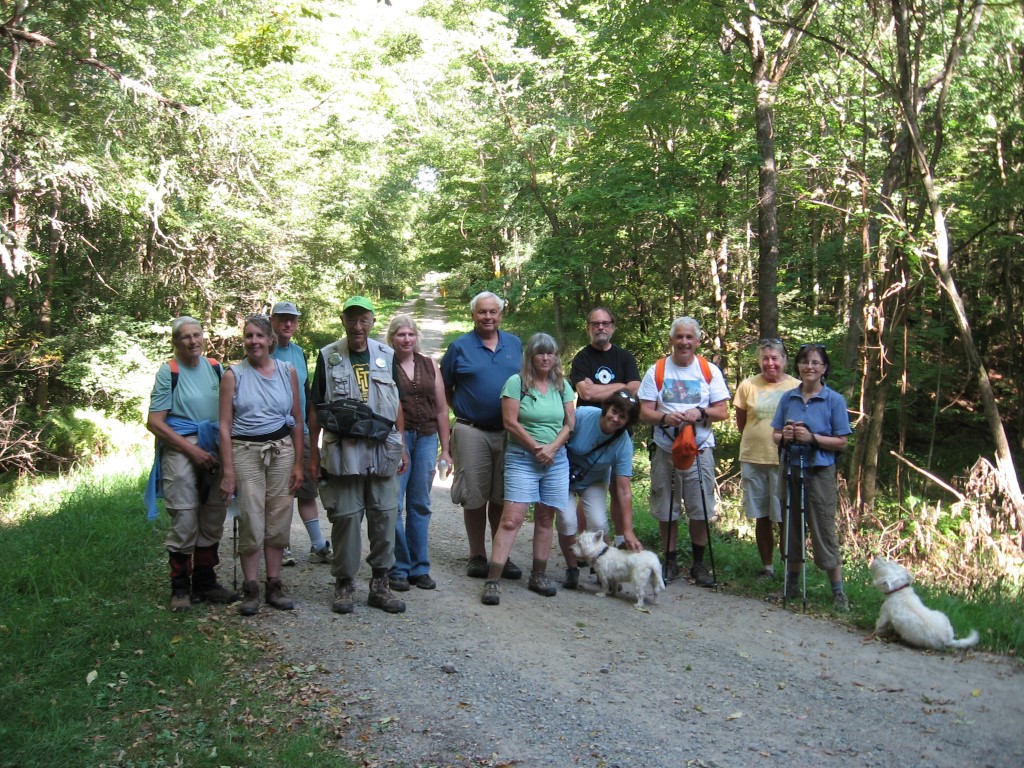
In 2012, Springwater Trails held a hike in Bully Hill State Forest.
All hikers will start at the intersection of Hopkins Rd in Almond, NY and hike over a hill to Bully Hill Rd. Based on time, hikers will continue across Bully Hill Rd and hike up a creek, turning around so as to arrive back at the waiting cars on Bully Hill Rd. Hikers will exit for Hopkins Rd and turn left on Bishopville Rd, then right onto a blue access trail. The blue trail merges onto the main white blazed trail. Continue straight onto the main trail. The trail passes through a gate (leave the gate how you find it) and enters the state forest. The hike is now fairly level until we cross Karr Rd. After Karr Rd, it is all downhill to Bully Hill Rd. (2.2 miles) Hikers with time and inclination for a longer hike should turn right on Bully Hill to cross the bridge over the creek and then left onto the trail. Continue along the trail, keeping an eye on the clock – turn around to return to the car on Bully Hill Rd.
Following the hike, you are invited to join us for a social at a Dansville establishment to be selected by the hikers. The following restaurants are available after 5 on Sunday: Battle Street Brewery (until 6), Jack’s Place Gaslight Grill, Sunrise Restaurant, Tony’s Pizza, The Leaning Tower.
A carpool to this hike will be available from the parking area behind the Firehall in Wayland. The carpool will leave promptly at 1:15.
Directions to Carpool at Wayland Parking (42.568606, -77.590562):
Plan to be at the parking area at 12:50. We will leave at 1:00 for Hornell and will drop off one car at Bully Hill Rd..
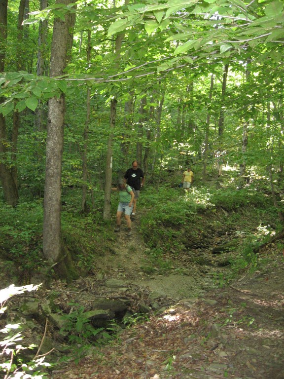
Pam and Marty, along the creek near Bully Hill Rd.
From Springwater: Head south on NY-15 to the light in Wayland. Turn right on Rt 63 (W Naples St). In about 150ft, turn right between the Fire House and the Sugar Creek building to get to the parking lot in the center of the block.
From Naples and N Cohocton: Head west on NY-21S toward Wayland. Go through the light at NY-15. In about 150ft, turn left between the Fire House and the Sugar Creek building to get to the parking lot in the center of the block.
Directions to Hike
From Springwater and Wayland: Head south on NY-15. In Wayland, continue south on NY-21 and stay on 21 for 18.8 miles. Turn right on NY-36 N. In half a mile use the right lane onto I-86 West. Take the first exit (Exit 33) for NY-21, Almond. Turn right on Karr Valley Rd, then left on Bishopville Rd. In one mile, turn right onto Hopkins Rd (This is the second entrance to Hopkins Rd from Bishopville Rd). You can park on the shoulder of Hopkins Rd. The trail head is across Bishopville Rd and about 50 ft to the left from Hopkins Rd.
Leaving Bully Hill Rd toward Hopkins Rd. Our hike will end at this point.
From Dansville: Head south on NY-36 past Stony Brook. In Arkport, turn left on West Ave. In 0.3 miles, turn left onto Bishopville Rd (CR 67). In 2.9 miles, turn left to stay on Bishopville Rd. In another 3.2 miles, turn left onto Hopkins Rd.
From Naples and N Cohocton: Head south on NY-21S. In N Cohocton continue straight onto NY-371. At the stop sign in Cohocton, turn right onto Maple Ave. In a half mile, turn left onto Cohocton Loon Lake. Continue straight past the entrance to I-390 where the road becomes CR-121. In 4 miles, turn left onto NY-21. Turn right on NY-36 N. In half a mile use the right lane onto I-86 West. Take the first exit (Exit 33) for NY-21, Almond. Turn right on Karr Valley Rd, then left on Bishopville Rd. In one mile, turn right onto Hopkins Rd (This is the second entrance to Hopkins Rd from Bishopville Rd). You can park on the shoulder of Hopkins Rd. The trail head is across Bishopville Rd and about 50 ft to the left from Hopkins Rd.
From other points along I-86: From I-86, take Exit 33 for NY-21, Almond. Turn right on Karr Valley Rd, then left on Bishopville Rd. In one mile, turn right onto Hopkins Rd (This is the second entrance to Hopkins Rd from Bishopville Rd). You can park on the shoulder of Hopkins Rd. The trail head is across Bishopville Rd and about 50 ft to the left from Hopkins Rd.
This Sunday’s outing will be on the section of the Genesee Valley Greenway that is between Cuylerville and Piffard in the towns of Leicester and York in Livingston County. This section has farmland, large ponds, woodlands, pastures, old oak trees, and in several places runs alongside the Genesee River. All groups will meet at the Greenway Parking and Kiosk Area on the north side of Rt 20A in Cuylerville. Be prepared to cross-country ski, snowshoe, or hike depending on conditions. Dress in layers and pack water and a snack.
Information on the Genesee Valley Greenway can be found on the NYS Parks, Recreation and Historic Preservation website at: http://nysparks.com/parks/189/details.aspx .
Hiking Groups
We will divide into several groups depending on people’s interests and abilities. All groups will head north for about one hour and then return back to the parking area by the same route. Distances may range from several miles up to 8 miles for those that go to Piffard and back. Naturalists may want to bring binoculars and spend time looking for winter birds, animal tracks and other interesting things along the trail.
Social
An after hike social will be at the National Hotel, 2927 Cuylerville Road, Leicester, NY 14481. The hotel has a tavern and a restaurant with a nice dinner menu. It is within walking distance of the Greenway Parking area.
Directions to Meeting Place
From Springwater: Take NY-15N west from the flashing light for 1.5 miles. Turn left on Liberty Pole Rd (CR 38). This road changes names and numbers (CR 1A and then CR 1) but continue for 8 miles. Turn right onto NY-63N for 9.4 miles. Take a sharp left turn onto US-20A W (NY 39 also). The parking area is on the right in 2.4 miles just before US-20A turns a sharp left in Cuylerville.
This Sunday we will explore the trails on the west side of Cleveland Hill, starting fro m the Gulick Road entrance to Camp Cutler, about 4 miles south of the Wesley Hill Nature Preserve parking lot. Also known as the J. Warren Cutler Scout Reservation, Camp Cutler is a 1,200 acre year-round property dedicated to Boy Scout camping, and the home of the Cub Scout Adventure program of the Seneca Waterways Council. The camp is named for J. Warren Cutler, a Rochester businessman and an avid supporter of scouting. It has been in operation since 1966. It has an extensive network of hiking and mountain bike trails, some of which overlap with the Bristol Hills Branch of the Finger Lakes Trail which links Clement Road and West Hollow Road. The Camp Cutler Trails up the west side have a gentler ascent to the top of Cleveland Hill than those we have seen coming from the north or the south.
Trail condition update: Trail condition varies a good deal – some areas are snow-covered and/or icy, some are wet and muddy, and some are open woods. Waterproof footwear is a must, traction devices are a good idea, and poles are recommended if you are used to hiking with them. Also rain gear if the forecast calls for showers between 2 and 4.
We will convene at 1:45 and start our hikes at 2 PM at the Gulick Road parking lot. All hikers will start out as a group along the Red, Purple and Blue Trails, following Whispering Creek in the northern section of the camp. Naturalists will turn back at whatever point they choose. After about 2 miles, the Tourists will head back to the starting point on the Green Trail, an easy downhill past several lean-tos and cabins, for a total of about 3 miles. Climbers will continue on the Blue Trail to the top of Cleveland Hill, joining the Bristol Hill Branch for the overlooks to the east and southeast before turning back on the White and Red Trails to the starting point. Total estimated distance for the Climbers is 4.7 miles. See link here for a trail map: /…019/11/Camp-Cutler-Trails-annotated.pdf
Social – Following the hike, please join us for holiday cheer at the The Neapolitan Brick Oven Pizzeria at 120 N. Main Street, Naples.
Directions to Gulick Road Trail Head:
DIRECTIONS:
From Springwater/Dansville/Wayland: Take Rt 21N into Naples, turn left on Clark St. (at Middletown Tavern) and drive 1.2 miles to the Gulick Road intersection on your right. Follow Guliick Road north for 4.2 miles to the camp entry on your right. The parking lot is near the entrance, on your left.
From Honeoye and Route 20A: Take East Lake Road south from Route 20A for 1/2 mile. Make a left on County Road 34 and then a right on Pinewood Hill Road. In one mile Pinewood Hill Road becomes Gulick Road as you bear right. Follow Gulick Road south for 7.3 miles, past Wesley Hill and Cummings Nature Center. The Camp Cutler entrance will be on your left.
From Route 64 north or south: Follow Route 64 to the intersection with County Road 34, about 2 miles north of Bristol Springs and about 1.2 miles south of Bristol Mountain. Turn west on County Road 33 for 1.6 miles, and then south on County Road 34 (a.k.a. West Hollow Road) for 4 miles. Make a right on Clement Road, and then a right on Gulick Road. The camp entrance will be about 1 mile ahead on your right. The parking lot is near the entrance, on your left.
Directions to The Neapolitan:
From Camp Cutler, go left (south) on Gulick Road to the end (4.2 miles) and then left on County Road 36 (a.k.a. Hunt Hollow Road) into Naples. Turn left on Main Street The Neapolitan is at 120 N. Main Street, just past the center of town.
The Hike:
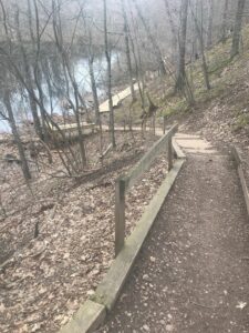
A First Day hike along Canadice Lake.
Start the New Year the way you mean to go on – come for an inspiring hike along Canadice Lake! This is an easy, 1.8-mile hike along the shore of the lake; the trail is level and well-maintained and the lake views are lovely. For most hikers it will be a walk along the lake for an hour or so, and then back the same way; more enthusiastic hikers can veer off on Rob’s Trail that leads over the ridge and down to Hemlock Lake – this is a moderate to hard trail with several steep uphill and downhill sections. We’ll take a roll call the day of the hike if anyone wants to walk Rob’s Trail. We’ll arrange for transport back for those who only want to walk one way. Dress appropriately for the weather, carry water and some energy food, and carry a walking pole if it helps. Leashed pets are allowed.
A First Day hike along Canadice Lake.
This is not a “routine” Sunday hike – for a start, it’s happening on a Wednesday! The hike is promoted by the NYS DEC, and is part of a larger program of First Day Hikes to encourage people to get out and experience the magnificent Sate of New York that they live in. As an extra enticement, there will be a raffle at the start of the hike; DEC is giving away a free Empire Pass to one lucky hiker who has the winning raffle ticket. We’ll be giving every hiker who shows up before the 10:00am start time a raffle ticket; naturally, DEC employees and any organizers of the hike will not be offered tickets – that would be way too suspicious!
The Meet-Up Location
All First Day hikers should meet at the parking area off Purcell Hill Road, Town of Canadice, Ontario County. Google Maps (leaves this website)
The Social
There won’t be an organized social on this hike.
 We will meet at the parking area at 2:00PM. All the snow has melted, so it might be muddy – be prepared! At this point, the prospect of snow shoeing or skiing is hopeless. It will be old-fashioned walking.
Hikers may want to bring traction devices. All of the trails will be available and we will adjust the hike based on conditions.
We will break into groups based on the interests of the participants.Bring water and snacks and dress appropriately for the weather with layers that are easy to add or subtract. Having your own map is always a good idea – here is a link to a winter trail map.
We will select a location for the after hike social at the time of the hike.
 Directions:
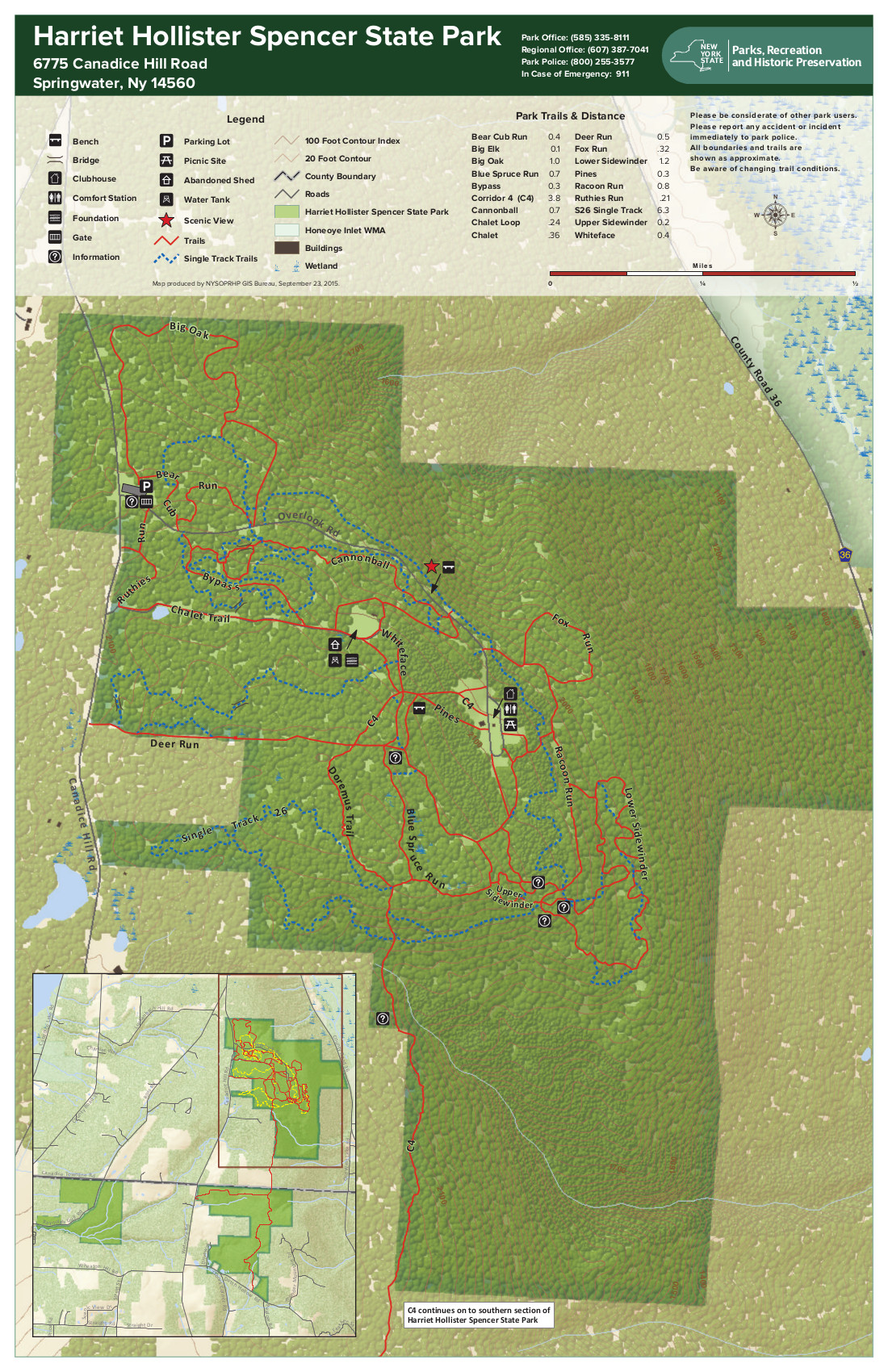
NOTE: We do not recommend approaching HHS from the south on Canadice Hill Rd. It is muddy and full of ruts.
FROM HONEOYE: From 20A turn south onto County Route 37 and go about 4 miles to the County Route 37/Canadice Hill Road split. Continue south on Canadice Hill Road about 3 miles. Harriett Hollister Spencer Park will be on your left.
FROM SPRINGWATER: Take Route 15A north out of Springwater for one mile and turn right on Wheaton Hill Road. Take the 1st left onto Canadice Rd. Turn right to stay on Canadice Rd. At the county line continue onto Co Rd 37 for 2.0 miles. Turn right onto Luckenbach Hill Rd. At the top, turn left onto Ross Rd. At the stop sign, take a sharp right onto Canadice Hill Rd. Harriett Hollister Spencer Park will be on your left.
FROM NAPLES: Please check your route before you leave. Google Maps will send you up Garlinghouse, which is a seasonal road and impassible in the winter. From Main St in Naples, turn north west on Clark St and continue onto CR 36 (Hunt Hollow Rd) for 11.9 miles. Turn left onto Jersey Hill Rd (Note Cratsley Rd is also seasonal). At the top, turn left onto CR 37. Continue straight through Canadice onto Canadice Hill Rd, and stay straight on Canadice Hill Rd when it turns to a dirt road. The Park will be on your left.
CANCELED. Both the Winterfest and the Springwater Hike scheduled for Sunday, January 12, 2020 have been CANCELED due to high winds and wet conditions. We will try to reschedule.
Our mid-January hike will be at Mendon Ponds Park, coinciding with Monroe County’s annual Winterfest. The park will be teeming with cold-weather fun activities between 11 and 3, including refreshments and programs on nature and winter sports for kids and adults. This time around we will hike the Devil’s Bathtub and West Esker parts of the park, as well as the popular Birdsong Trail near the Nature Center (good for chickadee-feeding).
We will meet at 1:45 at the Devil’s Bathtub parking area, a short drive inside the Pond Road entrance off Route 65/Clover Street, on the other side of the road from the Nature Center. If the upper Devil’s Bathtub lot is blocked off, park at the base of the hill and walk up. We will all begin by hiking down the stairs (with railings) and into the Tub, and then head north along a valley with a series of smaller kettle ponds and wetlands. The Tourists and Naturalists will peel off across the ridge and over to a trail along Deep Pond, passing the cars again after .6 miles, and heading south past the Bathtub and on to the Grasslands Trail, crossing Pond Road to loop around the Birdsong Trail and return, for a total of 2.6 miles. Climbers will venture farther up the Bathtub Valley and return on the ridge part of the West Esker Trail loop, continuing to the Grasslands and Birdsong Trail for a total of 3.8 miles.
Trail conditions are likely to be muddy due to rain in the prior few days, so poles and traction devices are recommended. Bring rain gear if the forecast is for rain between 2 and 4 Sunday.
Come earlier if you’d like to take advantage of the refreshments at the East and West Lodges, or the free coffee and hot chocolate and Wild Wings birds of prey at the Nature Center. Other free winter activities – dog sleds, orienteering, geocaching, winter equipment demonstrations, fossils and minerals, etc – are scheduled throughout the park; see https://www2.monroecounty.gov/parks-winterfest And here’s a park map link: map here
Social: Afterwards please join us for the social at the American Hotel at the center of Lima (7304 East Main St.. Lima), renowned for their huge selection of homemade soups as well as sandwiches, beverages and other hearty fare. You can see the full menu at https://americanhoteloflima.com/menu/
Directions: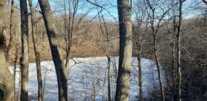
From Springwater: Head north on 15A for 21.6 miles through Hemlock and Lima. Take a right at the exit to Honeoye Falls. Stay on W Main St into the village where you will pass the Brewery Pub and Grill on the right at the intersection with NY 65 (1.9 mi). Continue straight onto NY 65 for 4.4 mi. (At 2 miles, you will go around a traffic circle. Stay on NY 65.) Turn right onto Pond Rd at the park entrance. The Devil’s Bathtub parking area is in .25 miles, on the left.
From Honeoye, take US 20A west and head north on CR 37 for 8.2 miles to W Bloomfield. Continue straight on NY 65 for about 3 miles, and make a right on Quaker Meeting House Road just before you come into Honeoye Falls. When Quaker Meeting House Road ends at Route 251 (Rush-Mendon Road), go left and then right on Route 65/Clover Street. The Pond Road entrance to the park is about 2 miles to the north, on the right. The Devil’s Bathtub parking area is in .25 miles, on the left.
From Rochester: Exit I 590 at Monroe Ave toward Pittsford. Turn right (south) onto NY 65 (Clover St). In about 6.7 you will come to the Canfield Road entrance to the park – this is not the one you want. Continue another 1.5 miles, then turn left onto Pond Rd, the second entrance into the park. The Devil’s Bathtub parking area is in .25 miles, on the left.
Directions to the Social: From the Devil’s Bathtub lot, go right back to Route 65/Clover Street. Make a left and go 4.4 miles to the village center of Honeoye Falls. Make a right on Main Street and continue about a mile out of town to the intersection with 15A. Make a left on 15A and proceed 2.3 miles to Lima. The American Hotel is at the intersection of Route 15A and Routes 5 & So (Main Street Lima). You can’t miss it.
This Sunday Hike is a replacement for the Finger Lakes Trail series we have been doing this fall. The combination of the distance to the FLT and the winter weather has reduced the interest in this series. We may continue later in the spring after seasonal roads reopen. But meanwhile, we are going to make an effort to visit sections of the Genesee Valley Greenway that Springwater Trails hasn’t seen. If there is snow, I am hoping this trail will be more appropriate than the FLT for easy cross country skiing.
In December, Wendy led a hike headed north from Cuylerville to Piffard. So this week we will continue north, starting in Piffard. If the snow listens to the weather man, we should have fresh snow Saturday and light snow Sunday afternoon. Check outside and bring your snowshoes, skis or winter boots.
All participants will start at the parking area in Piffard, and will head north toward York Landing Rd about 3 miles away. Skiers will turn around at York Landing and return to the starting point. Hikers and snowshoers will probably prefer to limit the distance to about 3 to 4 miles and therefore will end at York Landing where cars will be staged. (See below). Naturalists can watch the time and turn around to return to the cars if it is determined that conditions will not permit them to reach York Landing.
If you are willing to help stage cars, please arrive at the Piffard parking lot at 1:30 so we can shuttle cars to York Landing. Please send an email to info@springwatertrails.org so that I know who to expect.
Following the hike, we will head to the Yard of Ale to warm up with a pint and dinner.
Directions:
From Geneseo: Head north on Main St, then turn left on Court St, then at the bottom of the hill turn right on NY-63. In 2.3 miles, the road crosses the Greenway and parking is on the left next to the Yard of Ale. To get to York Landing Rd, continue west on NY-63 for 0.4 miles. Turn right on River Rd. Turn right on York Landing Rd in 2.7 miles. The parking is at the end of the road in 0.1 mile.
From Springwater: Take NY 15 north. After the curve at the top of the hill, turn left onto Liberty Pole Rd (CR 38). The road changes its name and number a couple of times, but keep going to the end. Turn right onto NY-63. Stay on NY-63 for 13.3 miles to Piffard. Parking is on the left next to the Yard of Ale.
From Wayland: Head south on NY 15/21 to I-390. Turn right onto I-390. Take exit 7 and turn right onto NY-408. Continue straight onto NY-63. Stay on NY 63 for 7 miles to Piffard. Parking is on the left next to the Yard of Ale.
From Honeoye: Head west on NY 20A. Turn right onto Big Tree Rd and continue for 6.9 miles into Livonia. Turn left on 20A and continue for 8.7 miles into Geneseo. Continue straight on Mary Jemison Dr by the college, then turn right onto NY 63. In 3 miles, parking is on the left next to the Yard of Ale.
Looking for brochure.or mailing list so I can receive it in the mail.
Nothing opens up for mailing list.
There’s all kinds of very bizarre ads and post for viagra and other drugs above on calender page.
Please let me know if there’s a brochure available