
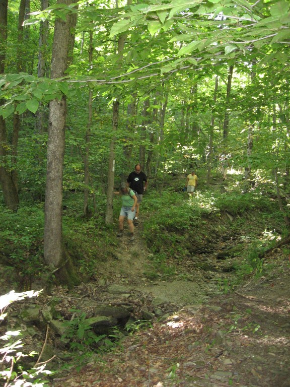
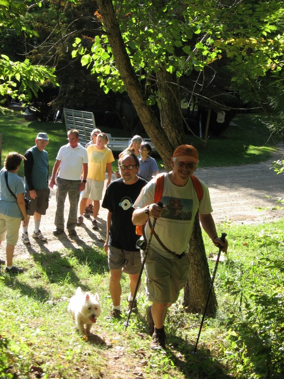
Hikes led by Springwater Trails are generally held on Sunday afternoons and appear in this calendar in green.
| Sun | Mon | Tue | Wed | Thu | Fri | Sat |
|---|---|---|---|---|---|---|
| Lehigh Valley Trail Hike or Bike in Rush, NY 2:00 pm Lehigh Valley Trail Hike or Bike in Rush, NY @ Stevens-Connor Lehigh Valley Lodge Apr 6 @ 2:00 pm – 4:00 pm Come join us for a leisurely hike or bike along the Lehigh Valley Trail on Sunday April 6th! With its flat even surface, the trail is a hidden gem for walking, hiking, jogging, biking. It is a vital link in … Continue reading | ||||||
| Ontario County Park at Gannett Hill Hike-Naples 2:00 pm Ontario County Park at Gannett Hill Hike-Naples Apr 13 @ 2:00 pm – 4:00 pm  Save the date! This is one of our group favorite hikes. Ontario County Park at Gannett Hill is one of the highest points in Ontario County and located in the scenic Bristol Hills. At an elevation of 2,256 feet above … Continue reading | ||||||
| No Hike-Easter Break 2:00 pm No Hike-Easter Break Apr 20 @ 2:00 pm – 4:00 pm No hike has been scheduled for this date due to the Easter Holiday. Enjoy the break, spend time with loved ones and eat chocolate bunnies. This will give you something to burn off next week  | ||||||
| Mystery Hike-Details Coming Soon 2:00 pm Mystery Hike-Details Coming Soon Apr 27 @ 2:00 pm – 4:00 pm Mystery Hike coming your way….details under construction. Please check back. |
SPRINGWATER TRAILS HIKE FOR 2:00pm (try to arrive at 1:45PM), Nov.3rd , 2019
LOCATION: Stoneybrook State Park
HIKE DISCRIPTION: Hikers will split into three groups but essentially walk the same trail. Each group will walk at thier own pace. Climbers and Tourists will start from the snowmobile trail off RT 36 at the lower park entrance and climb along the eastern trail working thier way up to the upper park and then crossing over StoneyBrook Creek to the west side of the park and continue down to the lower park parking lot.
The Naturalists will car pool to the upper park and walk toward StoneyBrook Creek and cross over to the east trail and work their way down the snowmobile trial that the climbers and tourists climbed up. Once at the bottom, they will walk to the lower parking lot.
Most of the trail is up and down hill at the beginning and end of the hike but, levels off in the upper park. Trails are most likely going to be wet and slippery so poles and traction devices or good treaded hiking boots are recommended.
RECOMMENDATIONS: Dress accordingly, multiple thin layers(synthetic under layer, fleece 2nd layer. light shell 3rd layer; avoid heavy parka’s.
After hike social: Will be the Sunrise Restaurant on the North end of downtown Dansville.
DIRECTIONS : From Downtown Dansville take RT.36 South for about 4 miles. Turn left into Stony Brook State Park. Drive to the main parking lot where we will divide into our three groups.
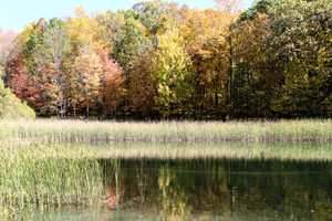
The hike on Sunday November 10 2019 will be at the Wesley Hill Nature Preserve, a Finger Lakes Land Trust property. The Wesley Hill tract covers 390 acres and includes stands of northern hardwoods, red and white pines, a woodland pond, and the northern edge of Briggs Gully, as well as the Wenrich Cabin, set in an old forest overlooking the gully, deep in the woods. A network of trails through the preserve offers excellent hiking routes of various lengths and levels of difficulty.
 The preserve was founded in 1999 by the generous donation of 90 acres by the children of three artists – John Wenrich, James Havens and Colburn Dugan – to the Finger Lakes Land Trust. Since that time, the Land Trust has expanded Wesley Hill to over 390 acres through the purchase or donation of four additional parcels.
We will meet at 1:45 and start our hikes at 2 PM at the Gulick Road parking lot. This access point is on the west side of Gulick Road, 8.2 miles north of the junction with County Road 36 in Naples and 4.6 mile south of the junction with County Road 33 in Richmond.
This hike is being walked in hunting season, and many of the western trails are closed to hikers. Please respect all closure signs – there may be hunters out there and they won’t be expecting hikers in the woods. WEAR BRIGHT COLORS! Hunters can wander off course too; it’s important not to look like a deer!
The Hike:
All hikers will start together on the red trail until we reach Anna’s pond (which is pictured above). Then….
NATURALISTS will walk around the pond as far as the trail allows, and then walk back to the start point. This is about 1 mile total.
TOURISTS will walk back to the junction with the green trail where they will turn right. They will follow the green trail about 0.2 miles to a junction of the returning red trail. They will turn left on the trail and walk 0.8 miles to the start point. The whole walk is about 1.6 miles.
CLIMBERS will take the red trail counter-clockwise around the tract. At the Wenrich cabin we will take a short extra walk to the overlook, and then back on the red trail to the start point. This hike as about 2.8 miles. If the weather is fine and we feel like walking a little extra we can turn right on the orange trail not long after we pass Anna’s Pond. This will take us on a loop through the northern parts of the tract until it ends at the yellow trail. Here we MUST turn left and follow the yellow trail back to the red trail to continue the hike. We will rejoin the red trail about 0.6 miles from where we left it. A right turn on the yellow trail would take us into hunting territory. If we take the orange trail then the total hike is about 3.8 miles.
The Social:
Following the hike, the optional social will be at the Neapolitan Pizzeria at 120 N. Main Street in Naples.
Directions to Gulick Road Trail Head:
From Honeoye take route 20A east through Honeoye to East Lake Road (CR-33). Turn right onto East Lake Road. Take first left, staying on CR33, then the first right onto Pinewood Hill which becomes Gulick Road. Travel 4.6 miles. The parking area is on the right.
From Springwater Head north on Rt 15A toward Hemlock. Just before Hemlock turn right on Rt 20A. Follow Rt 20A to Honeoye and the follow directions above.
From Naples From the southern end of Naples at the Middletown Tavern, head north on County Rd 36 (also called Hunt Hollow Road and Clark Street). Follow County Rd 36 for 1.2 miles to the first right turn on Gulick Road. Follow Gulick Rd for 8.2 miles. The parking area is on the left.
Directions to Neapolitan Pizzeria:
From the Gulick Road parking lot turn right and follow Gulick Road downhill until it ends at County Road 36. Turn left on County Road 36 (still going downhill) until this road ends at Naples Main Street (also called NY 21). Turn left. The Neapolitan Pizzeria is about half a mile away on the left hand side of the road, next to Artizan’s gift shop. It a fine Victorian house set back a little from the road.

FLT through Kanakadea Park. The FLT (shown in Black) is marked with White blazes on trees, signs or posts.
This Sunday we will follow the Finger Lakes Trail through the Kanakadea County Park west of Hornell. Last month we hiked south of Howard NY from Hughes Rd to Burleson Rd. The next section of the FLT starting at Spencer Hill Rd and ending on Lain Rd was led by Bill and Pam three years ago, and featured a social at the Cider Creek Cidery. In 2015, Linda led us on the section from Lower Glen Ave to North Hornell. For this FLT Series, we are going to skip to the west of Hornell and enjoy a recent route change for the FLT that takes advantage of park trails through Kanakadea Park. I will leave the previous two sections to leaders who would like to repeat a past hike.
A carpool to this hike will be available from the parking area behind the Firehall in Wayland. The carpool will leave promptly at 1:15. Following our hike, we will return to Wayland for a Social at the “Belt in the Eye” Diner.
All hikers will meet at the Parking lot in Kanakadea Park. The Climbers and Tourists will carpool a mile farther down Webbs Crossing Rd to a FLT trail-head parking lot.. We will assign leaders of the Climbers, Tourists and Naturalists at the hike depending on the requested groups.
NOTE: The portion of this hike south of the interstate is fairly flat and would be easy walking in dry conditions. With snow on the soft ground, walking will be slower and more difficult. Traction devices are encouraged, as are walking sticks. The section north of the interstate is a series of steep ups and downs. Special care to avoid slipping will be needed. In addition, the tunnel under the interstate is long and dark. A flashlight or headlamp is recommended for the Tourists and Climbers. As usual, dress in layers and carry water.

Naturalists will leave directly from the Park lot.
The Naturalists will start from the Park lot and head toward the lake to find white blazes for the FLT. Note that the road goes down to the water, while the trail stays along the edge of the high ground. Follow white blazes through wood and then up and across a field to the park’s Nature Trail. Once on the Nature Trail bear right to stay on the FLT. Once the trail comes out onto a field, hikers may decide to turn around and re-enter the Nature Trail. Following another section of the Nature Trail will return you to the parking area. Based on time, the Naturalists may follow the park road a short distance out of the parking lot, then turn left to continue on the FLT through the campgrounds. Naturalists are encouraged to leave the trail and explore near the lake.

The Tourists will cross Webbs Crossing Rd and follow the FLT within Kanakadea.
The Tourists will carpool to the FLT parking lot on Webbs Crossing. They will start with the Climbers heading out the back of the parking area uphill toward I-86. This will allow the Tourists to see the long tunnel under the highway before turning around and returning to the parking lot and starting to hike toward the Kanakedea Park. Carefully cross Webbs Crossing Rd and follow the white blazes on a mowed path parallel to the road. There is one section that isn’t blazed, but the trail goes to the left and is easy to follow to a gate to the park. (You can first go to the right and walk down to the lake – then return to the intersection and continue). Continue on the park road (there are occasional blazes on posts and the backs of signs). Turn right at the main park road and continue to the cars. As time permits, the Tourists can continue on the Naturalists route to the Nature Trail. [NOTE: If the tourists would prefer more climbing, but a shorter hike than the Climbers, they can follow the Climbers through the tunnel and around the loop, ending their hike at the FLT parking lot. If they do this, be sure to have keys to the cars so you can return to the park after the hike.
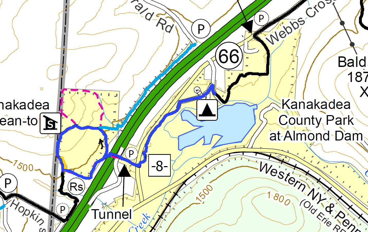
The Climbers will pass through the Tunnel and loop around back the the Tunnel, before following the Tourists through the park.
The Climbers will carpool with the Tourists to the FLT parking lot on Webbs Crossing. They will start uphill through the tunnel to the Senaca County Park on the other side of the highway. At the end of the fences, Climbers will turn right and follow the White blazed FLT. We will pass a Blue spur trail and later the Kanakadea Lean-to each on the right. About 0.3 miles after the Lean-To, we will see large yellow blazes and will leave the FLT when the yellow blazes go off to the left. After returning through the tunnel, we will follow the Tourist route to the Park and the waiting cars.
Directions to Carpool at Wayland Parking (42.568606, -77.590562):
Plan to be at the parking area at 1:00. We will leave at 1:15 for Hornell.
From Springwater: Head south on NY-15 to the light in Wayland. Turn right on Rt 63 (W Naples St). In about 150ft, turn right between the Fire House and the Sugar Creek building to get to the parking lot in the center of the block.
From Dansville: Head east on Rt 63 toward Wayland. Just before the second light in Wayland (at NY-15) turn left between the Fire House and the Sugar Creek building to get to the parking lot in the center of the block.
From Naples and N Cohocton: Head west on NY-21S toward Wayland. Go through the light at NY-15. In about 150ft, turn left between the Fire House and the Sugar Creek building to get to the parking lot in the center of the block.
Directions to Hike
From Springwater: Head south on NY-15. In Wayland, continue south on NY-21 and stay on 21 for 16.6 miles. Just before Hornell, turn right on CR 66 (Webbs Crossing Rd). (If you miss CR 66, turn right on Airport Rd, or NY-36 N and then take the first left onto CR-66). Continue for 2.5 miles. Turn left into Kanakadea Park. At the fork, stay to the left to the parking lot.
From Dansville: Head south on NY-36 past Stony Brook. In 14.5 miles, pass under I-86 and take the first right onto CR-36. In 2.2 miles, turn left into Kanakadea Park. At the fork, stay to the left to the parking lot.
From Naples and N Cohocton: Head south on NY-21S. In N Cohocton continue straight onto NY-371. At the stop sign in Cohocton, turn right onto Maple Ave. In a half mile, turn left onto Cohocton Loon Lake. Continue straight past the entrance to I-390 where the road becomes CR-121. In 4 miles, turn left onto NY-21. Just before Hornell, turn right on CR 66 (Webbs Crossing Rd). (If you miss CR 66, turn right on Airport Rd, or NY-36 N and then take the first left onto CR-66). Continue for 2.5 miles. Turn left into Kanakadea Park. At the fork, stay to the left to the parking lot.
Directions to Social
Head back toward Hornell on CR-66. Turn left onto NY-21N for 18 miles. In Wayland at the light, turn left on W Naples St, then right onto N Main St. The restaurant is on the right. You can park on Main St, or in the parking area where the carpool started. From the carpool parking, walk out the west entrance to Main St and turn left for the diner.
Mount Hope Cemetery in Rochester was dedicated in 1838 as the first municipal cemetery in the US. It was opened in response to the Cholera outbreak of 1831 to 1834. The location of the cemetery was selected for its challenging landscape, and was intended as a park-like cemetery to enhance the quality of life of the city residents. This hike will explore the hills, valley and heavily wooded areas of the cemetery in addition to visiting some of the well known graves including the graves of Susan B Anthony, Frederick Douglass, William Warfield and if we are fortunate, Harriet Hollister Spencer. You can read stories from Mt Hope Cemetery from the City Newspaper, and Wikipedia.
We have planned three separate hikes, which will be selected based on our turnout. All hikes will start at the North Gate entrance parking area in front of the 1862 chapel. You may download maps of the hikes here.
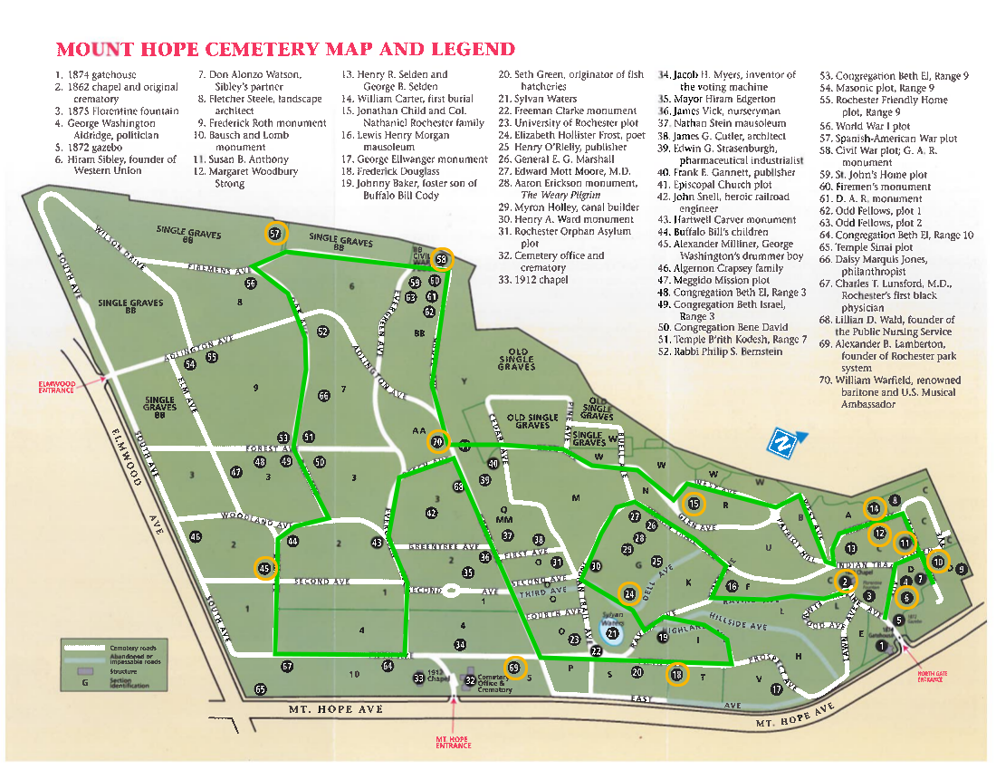 The Tourist hike will start by visiting the North end of the cemetery and Susan B Anthony’s grave-site. We will head up Linden Ave to Anthony’s grave near the corner with Maple Ave. The tourists will travel around the cemetery in a counterclockwise direction. In addition to the Anthony grave (11.), we will try to visit the following:
11. Susan B Anthony
6. Hiram Sibley
10. Bausch and Lomb monument (also look for mausoleums on Grove Ave).
12. Margaret Woodbury Strong
14 Earliest burial
15. Col Nathaniel Rochester
70. William Warfield
57&58. Civil War and Spanish American War plots
45. George Washington’s drummer boy – Alexander Milliner
69. Alexander Lamberton
18 Frederick Douglass
24. Elizabeth Hollister Frost
The Climbers will head up the hill on Lawn Ave to the right of the entrance toward Frederick Douglass’ grave. We will travel around the cemetery in a clockwise direction, Expect more hill climbing on this hike, as we explore the geologic feature of the cemetery. In addition, we will check out the following historic sites:
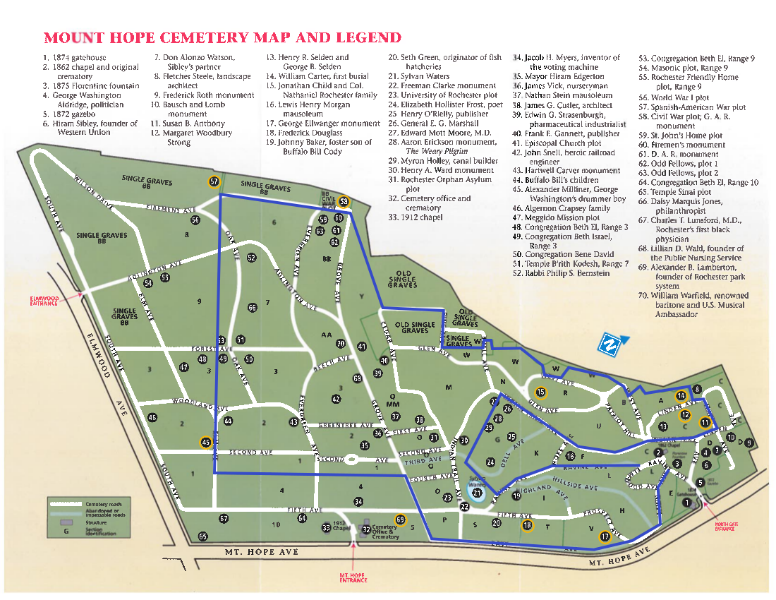 17. George Ellwanger monument
18. Frederick Douglass
69. Alexander Lamberton
45. Alexander Milliner, George Washington’s drummer boy
57 & 58: Spanish American and Civil War plots
70. William Warfield
24. Elizabeth Hollister Frost, and maybe Harriet Hollister Spencer
15. Col Rochester
14. First Burial
12. Margaret Woodbury Strong
11. Susan B Anthony
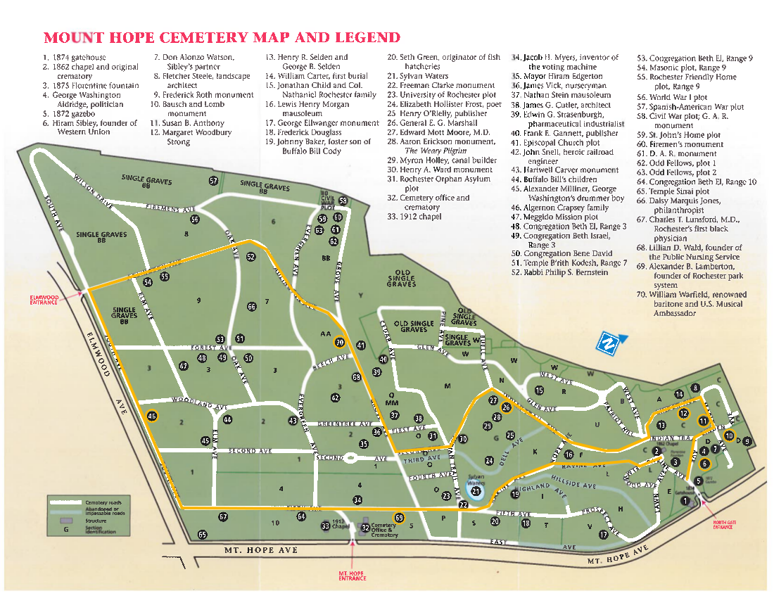 The Naturalists will head to the south end of the cemetery where they can explore as much as desired. But be sure to watch the time and head back along Indian Trail Ave to the north end and the Susan B Anthony site. The route plan will go past several interesting sites:
69. Alexander Lamberton
46. Algernon Crapsey
70. William Warfield
26. General E. G. Marshall
12. Margaret Woodbury Strong
11. Susan B Anthony
6. Hiram Sibley
10. Bausch and Lomb monument
Following our hike, join us for a social at the The Distillery – Sports Bar & Grill, 1142 Mt. Hope Ave, a half mile south of the cemetery entrance.
Directions
Mt Hope Cemetery is 47 minutes north of Springwater, so car pooling is recommended. Leave a comment on here on the website to plan carpooling. Good places to meet would be the Springwater Town Hall, Hemlock Lake Park at the north end of the lake, or Sandy Hook in Honeoye.
From Springwater: Head north on NY 15A for 19 miles to Lima. Turn left on US-20 for 4.2 miles. Turn right onto I-390 N. At the split with 590, stay left on I-390 and then stay right to exit 16B for NY 15A/E Henrietta Rd. Continue straight past South Ave and turn right onto Mt Hope Ave. Go up and over the hill for 1.8 miles to the second entrance to the Cemetery. There is parking inside the entrance.
From Naples: Take CR-36 (West Lake Rd) to Honeoye. Turn left on US-20A. In 5 miles turn right onto NY-15A and follow the Springwater directions.
This hike is CANCELLED!!!!! The freezing rain across the region is too dangerous for both driving and walking!
Description
- This 800 acre preserve is a sanctuary for hikers during hunting season. It was acquired by the Finger Lakes Land Trust in 2001 with generous help from an anonymous donor. A stipulation of this gift was that the preserve would be patrolled during hunting seasons to protect against trespassers. Our hikers will contribute to this effort.
The hilltop preserve looks down upon the Chemung River between Corning and Elmira. At one time this area was nearly ruined by heavy logging, but the town of Big Flats stepped in to halt the destruction. The original forest has made an impressive recovery through natural regeneration of many tree species. On some of the steep slopes, original hardwoods and conifers remain.
Some forest residents are worth noting, although in December they are not likely to be visible. Timber rattlesnakes are long time residents here. Allegheny mound ants have also carved a niche. Black bears have been sighted in recent years. For additional information and history go to http://fllt.org/preserves/steege-hill-preserve
 Special Note: Although no hunters have been spotted here in all these years, please make yourself visible by wearing blaze orange. Conditions in December are unpredictable. It is advisable to bring hiking poles and traction devices for your boots.
The 6 miles of trails are largely old logging roads, well marked and maintained. All hikers will gather at the new and improved parking area on Steege Hill Rd, which has been recently repaved. It is still a small area so carpooling is encouraged. Meet at Springwater Town Hall on Rt. 15 at 12:45 to share a ride for the 1 hour drive to Big Flats.
Hiking Groups There is a moderate half mile climb from the parking area to the various trailheads.
Naturalists will enjoy meandering for about 2 miles along the yellow trail with its gentle slopes and a scenic pond. A hike leader will be needed for this group. Trail map will be provided.
Tourists will traverse the blue and orange loops for about 3.5 miles, enjoying a variety of terrain and some nice views. Uphills are moderate. A volunteer hike leader is needed for this group.
Climbers will tackle the red, white, and blue trails for a distance of about 4.5 miles with some up and downhill challenges.Directions Take 390 South to I86E.
Follow I 86 E to exit 48.
Take 353 E for 1.5 miles
Turn right on South Corning road and go .7 miles.
Cross Chemung River and turn left on Steege Hill Rd.
After 1 mile look for preserve sign on left.
After Hike Social will be at Tags Restaurant, 3037 Rt. 352 in Big Flats. We have enjoyed dinner here several times. See menu at http://www.tagsrestaurant.com
This event has been postponed to March 8, 2020 so that people have the opportunity to attend the annual Naples Ecumenical Christmas Concert.
We have decided not to hike the hills and dales this Sunday. Instead, by popular demand, we shall gather at St. Januarius church on Main Street in Naples, and enjoy the stunning annual Christmas concert. For those with concerns about the separation of religion and hiking, this is a secular event. While there may be plenty of traditional christian Christmas music, there will not be any proselytizing.
St. Januarius is 180 North Main Street in Naples, NY. It is on the northern side of the village, a 100 yards or so south of Roots restaurant and on the opposite side of the street.
There’s no meeting places as such. We’ll just show up at the church and find seats. It would be wise to come early – this is a popular concert.
The concert starts at 2:00pm.
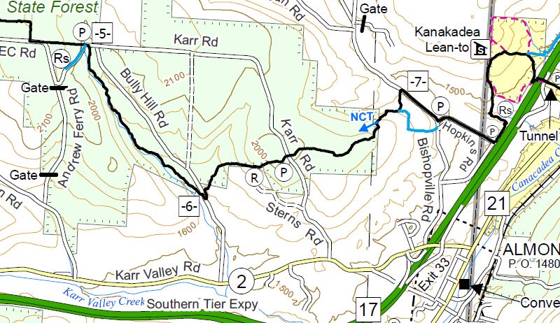 It’s already the third Sunday of December and time to return to our Finger Lakes Trail series. Last month we hiked through Kanakadea Park and a loop of the FLT just north of I-86. This month we join the trail just west of that loop as the trail enters a series of state forests. This hike will cover about half of the trail through Bully Hill State Forest.
In 2012, Springwater Trails held a hike in Bully Hill State Forest.
All hikers will start at the intersection of Hopkins Rd in Almond, NY and hike over a hill to Bully Hill Rd. Based on time, hikers will continue across Bully Hill Rd and hike up a creek, turning around so as to arrive back at the waiting cars on Bully Hill Rd. Hikers will exit for Hopkins Rd and turn left on Bishopville Rd, then right onto a blue access trail. The blue trail merges onto the main white blazed trail. Continue straight onto the main trail. The trail passes through a gate (leave the gate how you find it) and enters the state forest. The hike is now fairly level until we cross Karr Rd. After Karr Rd, it is all downhill to Bully Hill Rd. (2.2 miles) Hikers with time and inclination for a longer hike should turn right on Bully Hill to cross the bridge over the creek and then left onto the trail. Continue along the trail, keeping an eye on the clock – turn around to return to the car on Bully Hill Rd.
Following the hike, you are invited to join us for a social at a Dansville establishment to be selected by the hikers. The following restaurants are available after 5 on Sunday: Battle Street Brewery (until 6), Jack’s Place Gaslight Grill, Sunrise Restaurant, Tony’s Pizza, The Leaning Tower.
A carpool to this hike will be available from the parking area behind the Firehall in Wayland. The carpool will leave promptly at 1:15.
Directions to Carpool at Wayland Parking (42.568606, -77.590562):
Plan to be at the parking area at 12:50. We will leave at 1:00 for Hornell and will drop off one car at Bully Hill Rd..
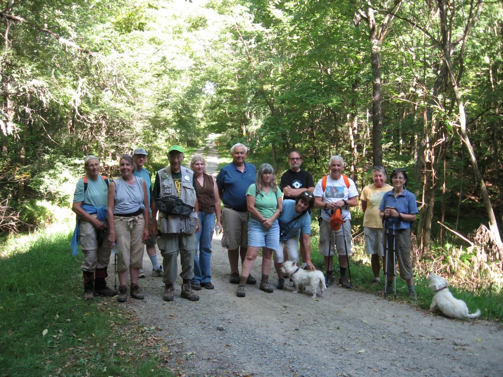
Pam and Marty, along the creek near Bully Hill Rd.
From Springwater: Head south on NY-15 to the light in Wayland. Turn right on Rt 63 (W Naples St). In about 150ft, turn right between the Fire House and the Sugar Creek building to get to the parking lot in the center of the block.
From Naples and N Cohocton: Head west on NY-21S toward Wayland. Go through the light at NY-15. In about 150ft, turn left between the Fire House and the Sugar Creek building to get to the parking lot in the center of the block.
Directions to Hike
From Springwater and Wayland: Head south on NY-15. In Wayland, continue south on NY-21 and stay on 21 for 18.8 miles. Turn right on NY-36 N. In half a mile use the right lane onto I-86 West. Take the first exit (Exit 33) for NY-21, Almond. Turn right on Karr Valley Rd, then left on Bishopville Rd. In one mile, turn right onto Hopkins Rd (This is the second entrance to Hopkins Rd from Bishopville Rd). You can park on the shoulder of Hopkins Rd. The trail head is across Bishopville Rd and about 50 ft to the left from Hopkins Rd.
Leaving Bully Hill Rd toward Hopkins Rd. Our hike will end at this point.
From Dansville: Head south on NY-36 past Stony Brook. In Arkport, turn left on West Ave. In 0.3 miles, turn left onto Bishopville Rd (CR 67). In 2.9 miles, turn left to stay on Bishopville Rd. In another 3.2 miles, turn left onto Hopkins Rd.
From Naples and N Cohocton: Head south on NY-21S. In N Cohocton continue straight onto NY-371. At the stop sign in Cohocton, turn right onto Maple Ave. In a half mile, turn left onto Cohocton Loon Lake. Continue straight past the entrance to I-390 where the road becomes CR-121. In 4 miles, turn left onto NY-21. Turn right on NY-36 N. In half a mile use the right lane onto I-86 West. Take the first exit (Exit 33) for NY-21, Almond. Turn right on Karr Valley Rd, then left on Bishopville Rd. In one mile, turn right onto Hopkins Rd (This is the second entrance to Hopkins Rd from Bishopville Rd). You can park on the shoulder of Hopkins Rd. The trail head is across Bishopville Rd and about 50 ft to the left from Hopkins Rd.
From other points along I-86: From I-86, take Exit 33 for NY-21, Almond. Turn right on Karr Valley Rd, then left on Bishopville Rd. In one mile, turn right onto Hopkins Rd (This is the second entrance to Hopkins Rd from Bishopville Rd). You can park on the shoulder of Hopkins Rd. The trail head is across Bishopville Rd and about 50 ft to the left from Hopkins Rd.
Looking for brochure.or mailing list so I can receive it in the mail.
Nothing opens up for mailing list.
There’s all kinds of very bizarre ads and post for viagra and other drugs above on calender page.
Please let me know if there’s a brochure available