
Hikes led by Springwater Trails are generally held on Sunday afternoons and appear in this calendar in green.
| Sun | Mon | Tue | Wed | Thu | Fri | Sat |
|---|---|---|---|---|---|---|
| Lehigh Valley Trail Hike or Bike in Rush, NY 2:00 pm Lehigh Valley Trail Hike or Bike in Rush, NY @ Stevens-Connor Lehigh Valley Lodge Apr 6 @ 2:00 pm – 4:00 pm Come join us for a leisurely hike or bike along the Lehigh Valley Trail on Sunday April 6th! With its flat even surface, the trail is a hidden gem for walking, hiking, jogging, biking. It is a vital link in … Continue reading | ||||||
| Ontario County Park at Gannett Hill Hike-Naples 2:00 pm Ontario County Park at Gannett Hill Hike-Naples @ Lookout Parking area Apr 13 @ 2:00 pm – 4:00 pm  This is one of our group’s favorite hikes! Ontario County Park at Gannett Hill is one of the highest points in Ontario County and located in the scenic Bristol Hills. At an elevation of 2,256 feet above sea level, you’ll … Continue reading | ||||||
| No Hike-Easter Break 2:00 pm No Hike-Easter Break Apr 20 @ 2:00 pm – 4:00 pm No hike has been scheduled for this date due to the Easter Holiday. Enjoy the break, spend time with loved ones and eat chocolate bunnies. This will give you something to burn off next week  | ||||||
| Hike Rob’s Trail – Hemlock Lake side 2:00 pm Hike Rob’s Trail – Hemlock Lake side Apr 27 @ 2:00 pm – 4:00 pm Join us on Sunday April 27th to hike the west side of Rob’s Trail, the DEC/Nature Conservancy property in the northeast corner of Hemlock Lake! Options are to hike out and back to the south along the trail from the … Continue reading |
The Steuben County Fairgrounds in Bath, NY will be transformed into a celebration of all things outdoors on Friday, July 26. The Finger Lakes Trail Conference along with the Steuben County Conference & Visitors Bureau and Friends of the Chemung River is excited to present the first Finger Lakes Trail Days over two jam packed days.
Kicking off the festivities Friday night is a concert featuring the Grammy Award winning bluegrass band, Steep Canyon Rangers. The duet of Rob Ickes and Trey Hensley will show off their guitar and vocal prowess warming up for the Steep Canyon Rangers.
Doors open at 6:00 pm and food and drink will be available.
Tickets can be purchased for either Friday evening’s concert or for Saturday; a two-day pass is also available. For more information on tickets, activities, on-site camping opportunities and the music schedule visit www.fingerlakestraildays.com or contact info@fingerlakestraildays.com
The Steuben County Fairgrounds in Bath, NY will be transformed into a celebration of all things outdoors on Friday, July 26. The Finger Lakes Trail Conference along with the Steuben County Conference & Visitors Bureau and Friends of the Chemung River is excited to present the first Finger Lakes Trail Days over two jam packed days.
Whether you are an outdoor enthusiast who already spends weekends hiking, biking, kayaking or fishing/hunting or someone who has always thought about trying something new, Saturday is filled with outdoor recreation activities of all kinds.
Additionally, enjoy local food, drinks, and a remarkable musical line-up. From 8:30 – 3pm there will be hikes of varying lengths and difficulty levels (click here for more information).
Also, check out the guided tours of places of interest in the area.
Beginning at 11 am at the Fairgrounds, attend one of the many interesting presentations, ranging from Geocaching to Yoga, Birdwatching to Medicinal plants and more.
Local food trucks and beer garden will be available all throughout the day.
Attendees can also experience a zip line, climb a rock wall, learn to kayak or mountain bike and navigate a ropes course.
There is a stellar lineup of outdoor exhibitors available to answer questions and provide information about their organization. Hiking groups from around the state will be available.
And meet the experts to find out more about birding, conserving land, our local rivers or monarchs.
Throughout the day you will hear a music line-up featuring Sawyer Fredericks (the 2015 winner of The Voice), Cicada Rhythm, Joshua Davis, Aaron Lipp & the Slack Tones, and Joseph Alton Miller.
There are plenty of activities for the entire family!
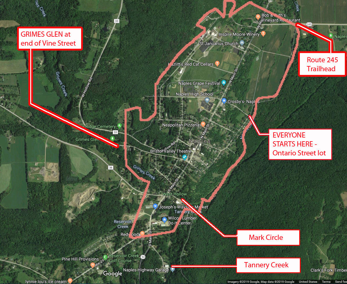
42.617844, -77.396354 (Ontario St. Parking Lot)
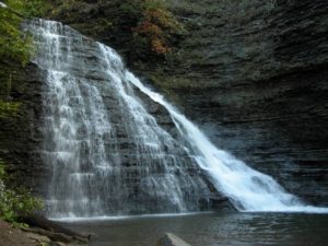
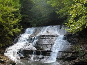
This Sunday we will hike trails on the outskirts of the Village of Naples. The first is the Naples Creek Trail, which follows the eastern edge of Naples Creek within the Hi Tor Wildlife Management Area. The second is Grimes Glen Park, a spectacular glen on the west side of the village. And for the more adventurous, the Tannery Creek Falls which features a number of waterfalls and cascades. These trails offer splendid creek-side scenery.
Tannery Creek Falls: Not as well known, or as large as its more famous companion Grimes Glen, it is another glen that is well worth the visit. Unlike Grimes Glen, there are no signs for this glen, so it gets much less traffic. Walking up the creek you will pass a couple of 10′ high falls before reaching a bigger 15′ falls. Above this is a much higher two tiered falls, around 50′ high. The trail requires some scrambling, steep ascents, and creek crossings. It is recommended that your footwear has good traction because the shale in the creek bed is very slippery. The rock walls along the creek are steep, varied, and beautiful.
1) We will need at least 4 or 5 drivers to meet at 3:35 to drop off some ‘transport’ vehicles at the Mark Circle parking lot: 42.608848 -77.403133 (Mark Circle)
Drivers will then carpool 1 mile to meet the rest of the arrivals at Ontario Street(see below). If you can be part of the transport team, please leave a comment below.
2) All hikers will then meet @ 3:45 at the parking area at the bottom of Ontario Street for check-in, maps, hiking instructions, and directions to the social.
3) We will begin the hike by crossing the bridge over Naples Creek, where we will then split up.
Naturalists will hike north along the level and picturesque Naples Creek to Rt 245, then return to starting point for a total of approximately 1.5 miles. Following this, the naturalists may wish to drive south .4 miles on Main St; turning right onto Vine Street. Grimes Glen is at the end of this street. There is a nice trail of about ½ mile to the waterfalls.
Climbers and Tourists will head south along Naples Creek for .8 miles to Mark Circle. This trail is mostly level except for a moderate climb and descent in the southern half. If there has been recent rain, there will be muddy patches.
Climbers will then carpool approx. ¾ of a mile by going back up to Main St., turning left, and continuing along S. Main Street past Joseph’s Farm stand and the Hardware store on your left. Stay on Rt 53 past the Rt 21 intersection for about 175 yards and turn left onto Tannery Creek Rd. Parking for the Tannery Creek Falls is on the right, across from the highway dept building (look for the green sign).
The trail to the creek is accessed by walking between the two buildings. Go down the bank to the creek. Cross it and continue upstream on the left side. It is necessary to cross over to the right side before climbing to the high, two-tiered falls. There are ropes provided for the steepest ascents.
Tourists will then carpool approx. ¾ of a mile from Mark Circle to Grimes Glen. To get there, from Main Street turn right and take the first left onto Weld Street. Go to the end and turn left onto Vine St., which will take you into Grimes Glen. It is a short ½ mile hike up to the falls and back.
Following the hike, please join us for an optional social at John & Susan’s (directions available at the start of the hike). Please bring a dish to pass (or make a $5 donation to the social fund), a beverage of your choice, and any musical instruments you might want to play around a campfire. Hotdogs, marshmallows, and ice-cream will be provided!
DIRECTIONS to Ontario St. parking lot https://goo.gl/maps/TbNWrqUSkZsr2E4Z
Drive up to Main St and turn right. In .67 miles, turn right onto Ontario Street. Drive down to the bottom and park on the left.
- From Springwater/Dansville/Wayland: Take Rt 21N into Naples, turning to the left at the intersection with Rt 53. Turn right in about .9 miles down Main Street onto Ontario St (across from the High School) and drive down to the parking area.
- From Honeoye: Take Rt #36 South into Naples, turn left on Main St an drive .7 miles and turn right onto Ontario St. Go down to the bottom parking lot on the left.
- From Canandaigua: Take Rt 21 South to Naples. From the intersection with Rt 245, drive approximately .5 miles along Main St. and turn left onto Ontario St. Go down to the parking area on the left at the bottom.
See 1) above for directions to Mark Circle – this is for transport vehicles only
Please Note: PURCELL HILL ROAD CLOSURE. Due to construction of a new culvert from Canadice Lake under Purcell Hill Road, Purcell Hill Road is closed from the North Parking Lot trail entrance to Canadice Lake Road. The north parking lot is open but may only be accessed from Rt. 15A side of Purcell Hill Road.
The sun will be out and Canadice Lake will be gorgeous. This week will be a choice of a paddle or a walk around Canadice Lake. Read below for driving directions to both events.
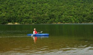
Kayakers: Please meet at 3:45 to unload boats and be in the water by 4:00. We will paddle across the lake, selecting a route based on wind and interest of the group.
Hikers: Meet at the canoe launch to select leaders and drivers to the South hiking path.
Naturalists: will walk the road around the lake observing the marsh land on the south side of the lake and the activity of the beavers on the southwestern corner of the lake.
Climbers: will hike along the lake to join Rob’s trail hiking up a portion of the trail then turn around and return to the trail head.
Social: The social will be held by the lake at the canoe launch. A table and paper products will be provided. You may wish to bring a chair to sit on at the social. There is one bench available at the site.
If you do not own a kayak, you can test the waters by renting one from Canadice Lake Outfitters at a very reasonable rate.
Rates are $20 for 2 hours; $40 for 4 hours Click here for better information. Reservations must be made in advance. Call: ( 585) 669-9512
Directions to the Hike:
Please Note: PURCELL HILL ROAD CLOSURE. Due to construction of a new culvert from Canadice Lake under Purcell Hill Road, Purcell Hill Road is closed from the North Parking Lot trail entrance to Canadice Lake Road. The North parking lot is open but may only be accessed from Rt. 15A side of Purcell Hill Road.
From Springwater: Johnson Hill access: Go North on 15A for 2.7 miles. Bear right on Old Bald Hill Rd S and then an immediate right on Johnson Hill Rd. Take the first left onto Canadice Lake Rd. The Trail-head is 1.1 miles north of Johnson Hill Rd.
From Honeoye: Take Co Rd 37 South from 20A, Turn right after 3.7mi to stay on Co Rd 37. Stay straight onto Burch Hill Rd. At the lake, turn left onto Canadice Lake Rd. The Trail-head is 2.8 miles south of Burch Hill Rd.
From Hemlock and Rochester: (This route avoids the construction) Take NY Rt 15A south from Rochester through Lima and Hemlock. Just past Hemlock, Turn left on Rt 20A. In 1.4 miles, turn right onto Canadice Lake Rd. The Canoe Launch is 6.3 miles south on the right side of the road near the south end of the lake. Note, you will pass the motor boat launch near the north end of the lake. The canoe launch is another 1.5 miles south.
Sunday should be another perfect day to be out on the water of Hemlock Lake? Temperatures in the high seventies and a steady light wind. This week we will meet at the South Boat Launch on Hemlock Lake just miles north of the light in Springwater, and kayak north on the lake. We will cross the lake and explore the western shore. After an hour of paddling we will recross the lake and follow the eastern shoreline, possibly seeing the hikers. The eagles may even turn out to soar above us. We will kayak into the inlet until we hit a “tree block”, turn around and come back. If time we may head north for a bit on the shore of Hemlock Lake.
![]()
Attention: It is highly recommended that you bring sun glasses, suntan lotion, bug spray and water. It is going to be sunny and there is no shade on the lake!
If kayaking isn’t for you, hikers will enjoy a lovely walk along the lake, heading north from the boat launch. with several opportunities to get down to the lake and enjoy the view of the water and the opposite tree filled shore. The walk goes along the city’s access road, for about a mile each direction. You will notice many new culverts that have been installed, plus several “fords” where the water is intended to flow directly across the road. The climbers will have the option to continue on along the old road after the end of the maintained road. This involves climbing over fallen trees and possibly one narrow portion before the trail is reduced to about 6 inches wide on the edge of the bank. Total hike about 3.5 miles.
Social: Pot luck social after the hike near the parking lot. Please bring a dish to pass and your own beverage.
Kayak: Hemlock Boat Launch: South end, please arrive around 3:40 to get kayaks in the water
Hike: Hemlock trail from south end boat launch.
From Springwater: Follow 15A North from Springwater for 2.3 miles. Turn left into the parking area, then an immediate right to head down the access road. In about half a mile, the launch is on the left, and the parking area is on the right.
From Hemlock or Honeoye: Follow 15A South for 8.4 miles from the 15A / 20A intersection south of Hemlock. Turn right into the parking area, then an immediate right to head down the access road. In about half a mile, the launch is on the left, and the parking area is on the right.
 This Sunday we start a series of hikes along the main Finger Lakes Trail between the Bristol Hills Branch and the Letchworth Branch. Previous hikes have followed each of the two branches to the east and to the west of Springwater. This series will connect the two branches along the Main Trail to the south of Springwater.
A word of warning. The trail between the two branches is 78 miles long. With one 4 mile hike each month, we would need 20 hikes to cover every mile, so I expect we will be more selective, planning to explore most of the trail (but not every mile) over the next year.
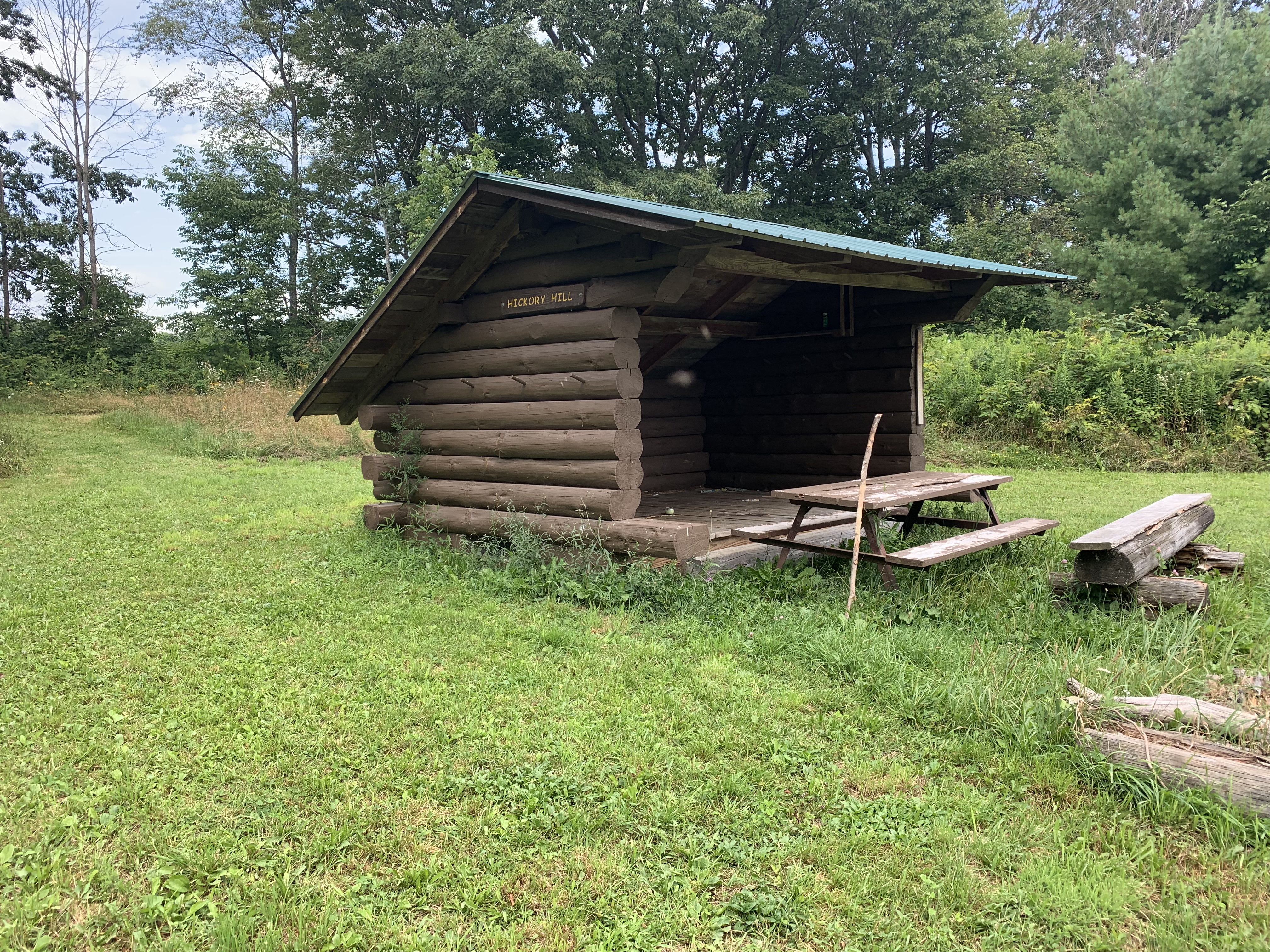
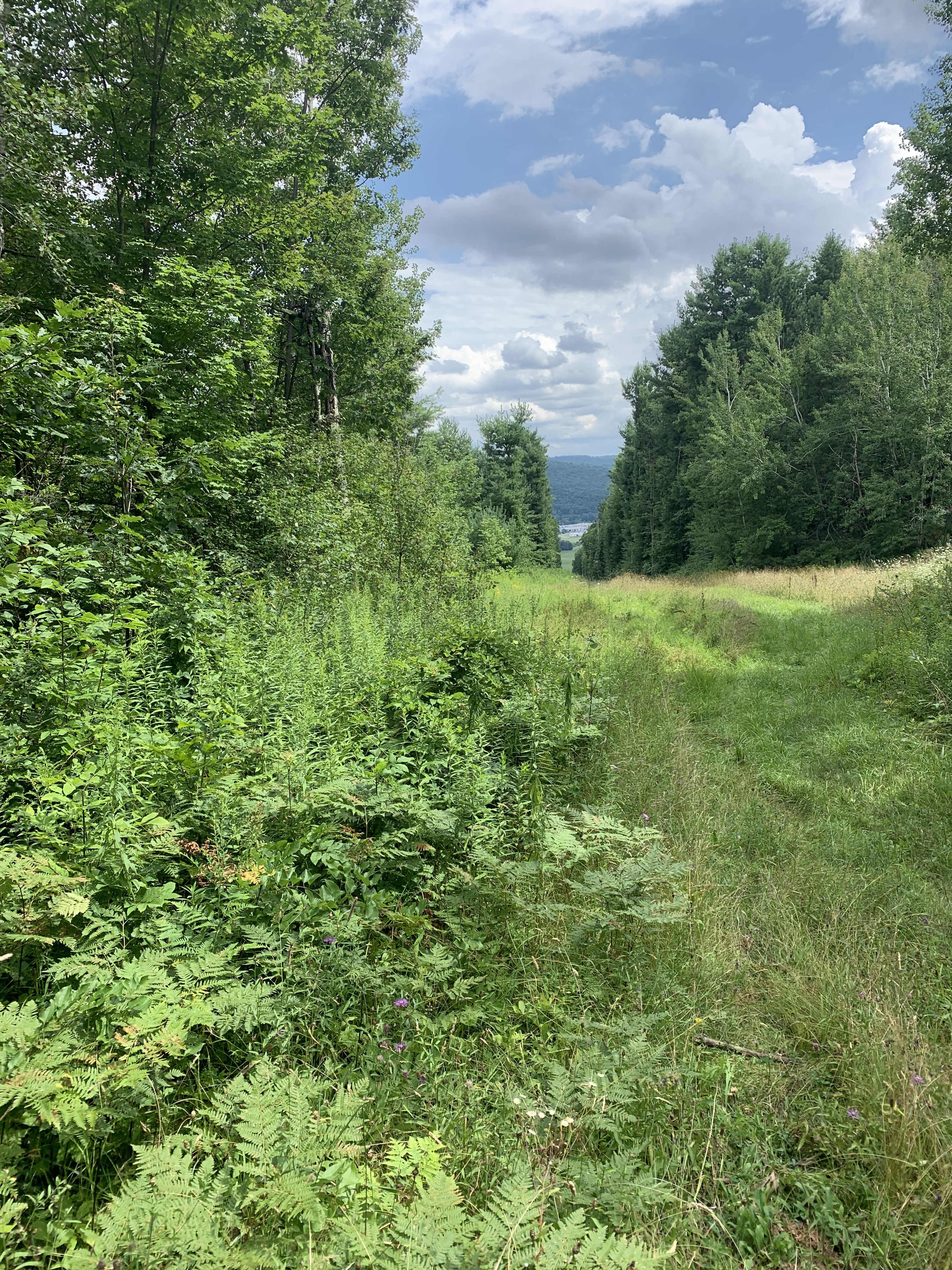
For this hike, we are offering three routes. The Climbers will start at Access 1 on Sand Pit Rd outside of Bath. They will follow the white blazes for 1.8 miles climbing some 400 feet to the Hickory Hill Lean To, where we will stop for a mid hike social – see below. Following the social, the Climbers will continue north, over Kershener Hill (1820′) to Access 2 where they will use the Tourists cars to return to the start point.(Total 3.1 miles, 550 feet up, 300 feet down)
The Tourists will carpool to Access 2 on Robbins Rd (maybe it is Barrett Rd) and will hike the reverse hike. The trail starts on a farmer’s road which heads up to a large field. Just before the field, the trail goes off to the left. If you get to the field you will see there are no more white blazes, so go back and find the branch. It is a 300′ climb to the top of Kershener Hill. At the LeanTo (1,3 miles from the start) we will stop for a social, meeting the Climbers and exchanging keys. (Total 3.1 miles, 300 feet up, 550 feet down)
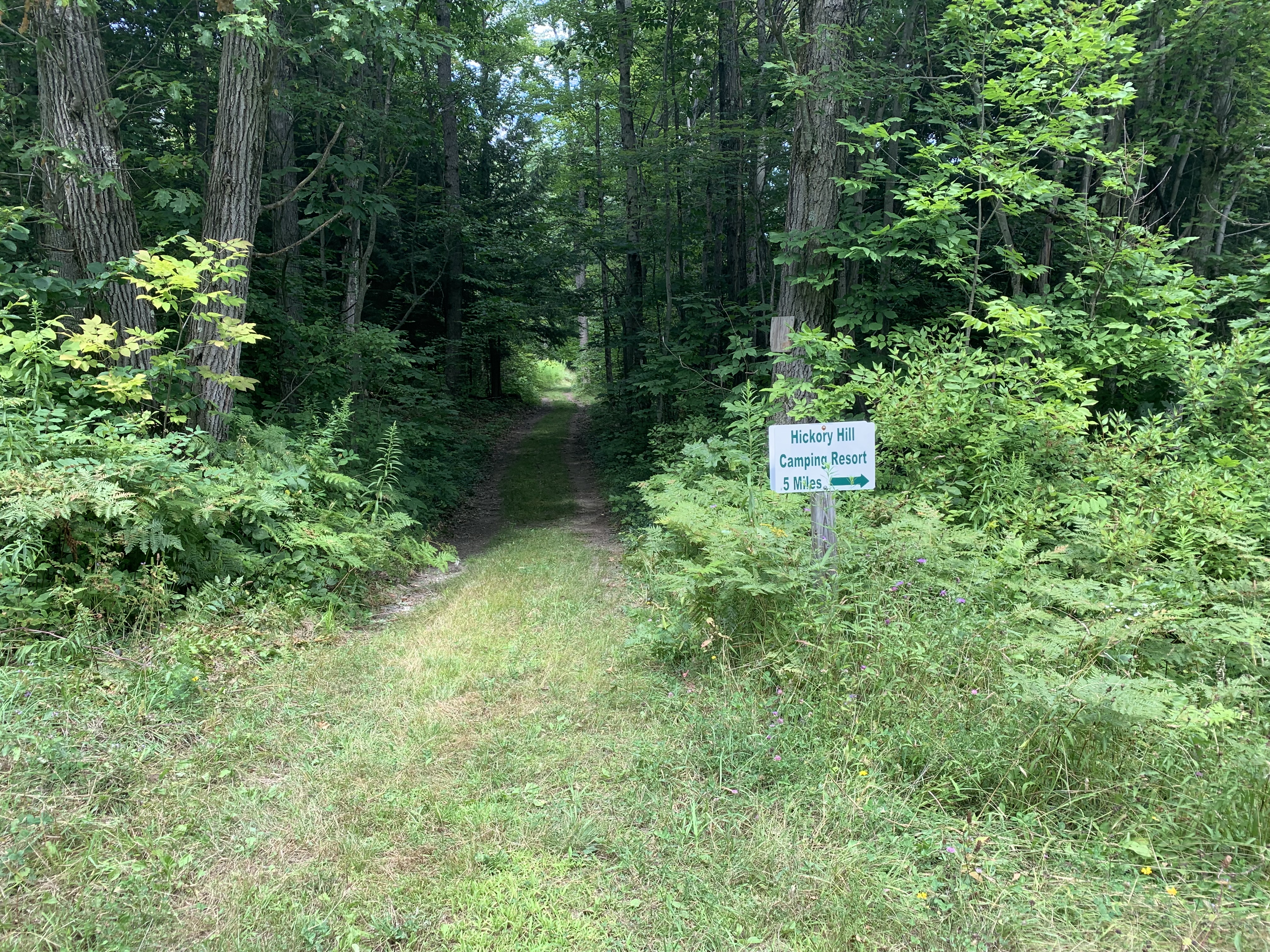
It’s very easy to see the start of the side trail down to Hickory Hill Campground.
The Naturalists will start with the Tourists. Following the social, they will continue for 0.2 miles and then will turn right onto a blue blazed trail to follow a pipeline down 0.7 miles to Hickory Hill Campground where they will find a car to return to the start point. (Total 2.2 miles).
Social. On this hike, we will take advantage of a Leanto and hold our social on the trail. Please bring a sandwich and extra water for yourself. You may also want to carry in some vegetables, chips, fruit or cookies to share – don’t go overboard – you do need to carry your snack in.
Directions:
From Springwater: Take NY-15 south through Wayland to I-390. Turn left to enter I-390 south. In 16 miles, merge onto I-86 East. Take the next exit (Exit 37) for NY-53 Kanona/Prattsburg. Turn right (S) on 53 for 0.6 miles. Turn left onto NY-415 for 1.4 miles. Turn left onto Spaulding Dr, the left onto Harrisburg Hollow Rd. In 0.4 miles turn right onto Sandpit Rd. There is plenty of roadside parking.
 From Naples: There are two routes, either through Cohocton to I-390 or follow NY-53 south: Head south on Main St in Naples. Just past the Wayside Market, stay straight onto NY-53 for 22.3 miles. After passing under I-86, turn left onto NY-415 for 1.4 miles. Turn left onto Spaulding Dr, the left onto Harrisburg Hollow Rd. In 0.4 miles turn right onto Sandpit Rd. There is plenty of roadside parking.
From Corning: Take I-86 west to Exit 38 NY-54 Bath/Hammondsport. Turn right onto NY-54 N, then left onto NY-415N for 1 mile. Turn right onto Spaulding Dr, the right onto Harrisburg Hollow Rd. In 0.4 miles turn right onto Sandpit Rd. There is plenty of roadside parking.
Car Pool from Access 1 to Access 2:Head southeast on Sandpit Rd. At the tee turn right onto Snyder Hill Rd. Continue onto Maple Heights and on down to the stop light at Washington St. At the next light, turn left onto Liberty St. Stay left onto Haverling St toward CR 13. In 2 miles, leave a Naturalist car near the Hickory Hill Campground. Continue north on Mitchellsville Rd for 1.3 miles. Turn left onto Robbins Rd (basically the first left turn). The road makes a right hand turn at the Bath/Wheeler town line.Make a U turn and park on the side of the road. at the start of the trail. The trail is a continuation of Robbins Rd that you came up on.
(42.866140, -77.790775)
Join us Sunday for a new venue – an easy stroll with length options from 1.6 to 4 miles on the level and shady Railroad Bed Trail between Avon and Geneseo. The original railroad was built in the 1840’s from Rochester to Nunda as an alternate form of transportation to nearby canals. In 1856 the railroad was purchased by the Genesee Valley Railroad and in 1859 the first train arrived in Geneseo. As gasoline powered vehicles became popular the railroad became unpopular and the last train passed over the line in 1940. Stripped of rails and ties, the land was then sold to adjacent landowners as a trail for recreational use. In 1993, Edward and Jacquelin Harris donated their section of the trail to the Genesee Valley Conservancy to ensure the property would remain a trail for community use.
The GVC Railroad Bed is open daily from sun-up to sun-down for equestrian uses, hiking, running, biking, dog-walking, bird watching, and geocaching. The trail is mostly hard-packed dirt but you may encounter some mud and tall grasses. Please stay on the trail as all other trails you will see running east/west are privately owned. Keep dogs leashed or under voice control and clean up after them. Don’t forget the usual accessories: bug spray, water, etc.
The Trail: has three access points. Please park on the side of the road and do not block the trail.
- Fowlerville Road (Rt 22) – Trailhead sign is approximately 100 ft west of the intersection with Route 39
- Hogmire Road – Trailhead signs are north and south of the road, approx .5 mile west of the intersection with Route 39
- South Avon Road* – Trailhead signs are north and south of the road, 1 mile west of the intersection with Route 39
*NOTE: The publicly available portion of the trail ends at a wide grass strip approximately .85 miles south of the South Avon Road crossing. This demarcates an underground pipeline that cuts east/west across the Railroad Bed Trail.
Please do not trespass south of this landmark.
EVERYONE WILL MEET AT 3:45 AT THE SOUTH AVON RD TRAILHEAD, where some of us will then carpool approx 3 miles to the Fowlerville Rd trailhead.
- CLIMBERS will start out going south and hike as far as the underground pipeline (.85 miles), then backtrack to starting point and continue to the Fowlerville Rd trailhead (2.25 miles) for a total of almost 4 miles.
- TOURISTS will start from the Fowlerville Rd trailhead and hike to the starting point (2.25 miles) or continue past the South Avon Rd crossing to the southern end at the underground pipeline and back to South Avon Rd for a total of almost 4 miles.
- NATURALISTS can hike south and back (1.7 miles) or north to Hogmire Rd and back (1.6 miles) or as far as comfortable either direction.
Trail brochure and map: https://www.geneseevalleyconservancy.org/images/uploads/Railroad%20Bed%20Brochure.pdf
DIRECTIONS:
FROM AVON: From Route 20, take Rt. 39 south (Wadsworth Ave) appox 3.6 miles. Turn right onto South Avon Rd and drive approx 1 mile to trailhead.
FROM SPRINGWATER: From intersection of Rts 15A and 15, go west up Rt 15 to Livonia, the left onto Rt 20A to Lakeville. Bear to the right onto Rochester Rd and go approx 1.4 miles and turn left onto Triphammer Rd (Rt 52) until it ends (approx 3 miles). Turn right onto Rt 39 for .6 miles, and then left onto South Avon Rd. Trailhead is about 1 mile ahead.
FROM GENESEO: From intersection of Main, Court, North Streets and Rt 39 (Avon-Geneseo Rd), take Rt 39 north approx 5 miles and turn left onto South Avon Rd. Trailhead is about 1 mile ahead.
SOCIAL: 3 LEGGED PIG BBQ https://www.3leggedpig.com/menu
3415 Rochester Rd, Lakeville NY 14480 Open Sun 11-8:00 (585) 346-0001
DIRECTIONS TO SOCIAL: From starting point, 1 mile back to Rt 39, then turn right for .6 miles. Turn left onto Triphammer Rd for approx 3 miles. Then turn right onto Rt 256 followed by a quick left at the fork onto Rochester Rd for about 1.4 miles into Lakeville. 3 Legged Pig is on the left just before stoplight.
This Sunday, we will meet at the end of Dewolf Rd. Naples, to organize carpooling into HiTor WMA.
GPS 42.617350, -77.321399
The weather is looking cooler and should be a nice day to see Conklin Gully. Wildflowers are still blooming along the way. 
THE CLIMBERS~ Carpool to Parish Hill Rd entrance of HiTor. This is the Blue trail. Continue on the trail to Conklin Gully then bear left uphill to the 4 way intersection and pick up the orange trail, a left turn ending on Brink Hill Rd.The majority of this portion will be a significant climb. Be prepared with hiking poles, water and sturdy boots. After exiting the trail on Brink, turn left, back to Dewolf Rd.
THE TOURISTS~ If we have enough Tourists, you will begin at the Brink Hill Rd entrance to the FLT, a short walk from Dewolf. Dress accordingly for some mud and uneven ground. Poles are a good idea. Follow the Orange trail and at the intersection of the trail and maintenance road, turn right onto the Blue trail and continue mostly downhill bearing right to follow the blue trail to the gully. Continue all the way on the blue trail, over the bridge and out to the Parish Hill parking area. There will be a car to return you to Dewolf Rd. Simply drive up Parish Hill Rd 1.1 miles, take the curve to the right (DO NOT stay straight, this becomes Lower Rd). At the next intersection, turn left on Shay then right on Brink Rd. Brink runs into Dewolf.
Depending on turnout, we may combine Tourist into Naturalist route.
THE NATURALISTS~ Carpool to Parish Hill Rd entrance of HiTor Blue trail. You will hike to Conklin Gully, enjoy the gully view and creek, then return the same route to the vehicles.
DIRECTIONS~ From Naples, take Main St which becomes Rt 53 South, up the hill. Watch for the Italy Valley sign pointing left. Take Italy Valley Rd 2 miles, turn left at the curve onto Bassett Rd. Proceed 1.6 miles, turn left onto Brink Hill Rd. Continue to the intersection of Dewolf Rd.. Turn right onto the dirt road to the top.
After hike social will be on Dewolf Rd. Please bring a dish to pass or make a $5 donation. Meat provided. Please bring your own drinks.
The Hike
On Sunday 8th September 2019 we will hike in the Taughannock Falls State Park.
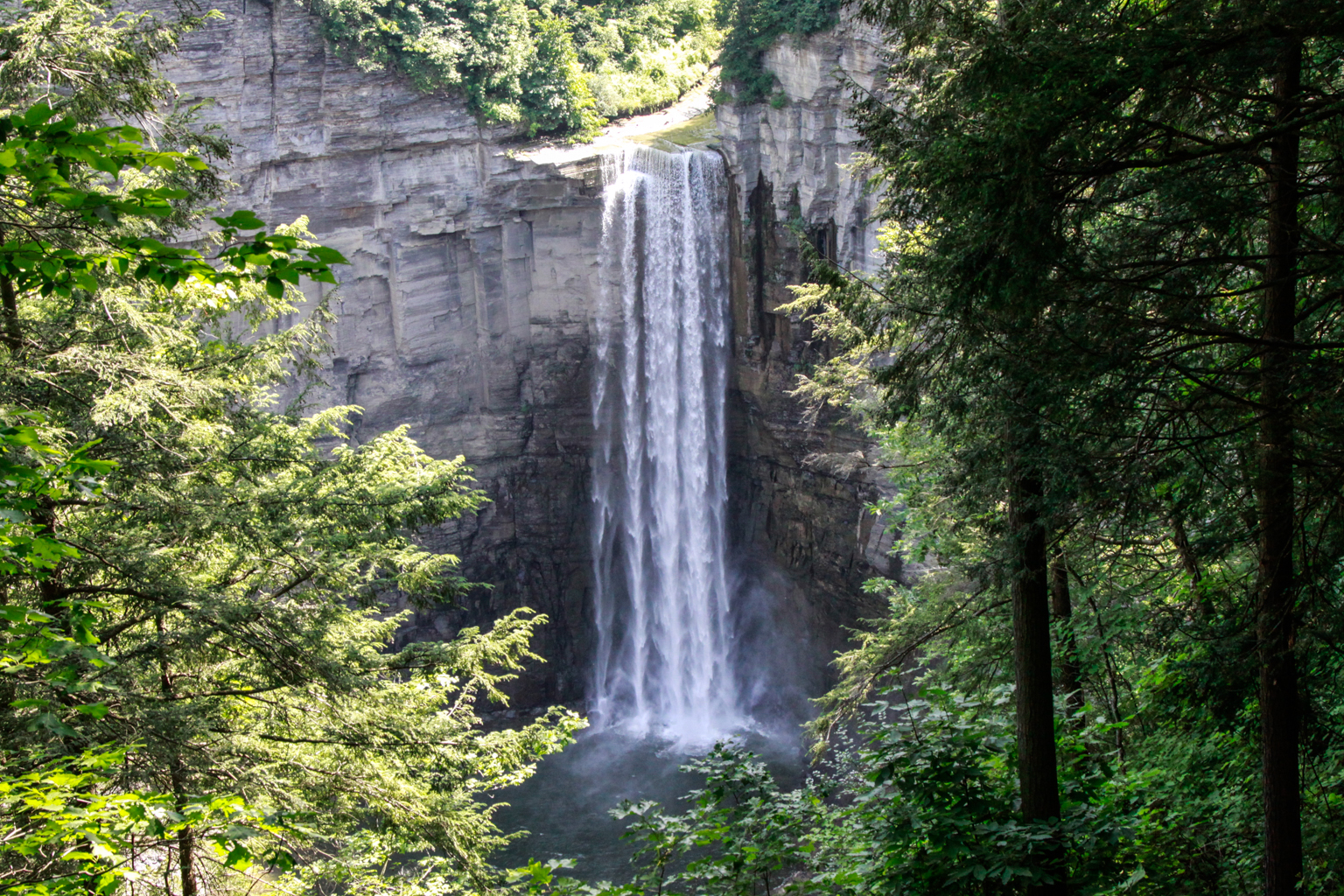
The Climbers and the Tourists will hike the North and South Rim Trails starting with the North Rim Trail at the Taughannock Falls Visitor Center, crossing the river above the High Falls, and returning on the South Rim Trail to its end near the park entrance. If there’s some energy left they will hike the stream bed to the base of the High Falls. The Naturalists will start at the car park at the park entrance, and walk the stream be to the High Falls.
There is a lovely view of the High Falls from the North Rim Trail, and lots of views of the gorge along the South Rim Trail. There’s a terrific view of the rapids above the High Falls where the North Rim Trail turns over to the South Rim Trail.
This is a VERY easy hike. The trail is mostly broad and lightly surfaced, and there are occasional benches along the route for hikers like us to take in the view. Wherever the path gets steep, such as where the South Rim Trail drops down to the park entrance, there are stone steps. This is a very scenic walk, and is best done slowly with lots of stops to take pictures.
There is a small charge for entrance to the park.
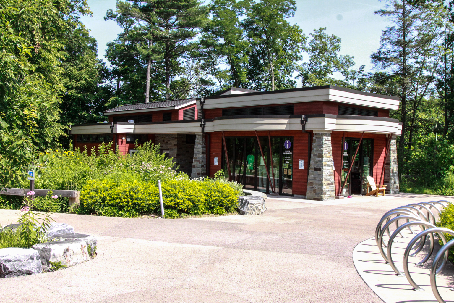
We’ll meet at the Taughannock Falls Visitor Center (pictured left, GPS coordinates 42.5391, -76.6073). The Climbers and Tourists will have shuttled most of their cars to the park entrance parking lot, and will give their remaining car keys to naturalists to take down the hill; the Climbers and Tourists will start their hike at the Visitor Center. The Naturalists will take all of the cars down to the parking lot at the park entrance and hike from the parking lot.
The meeting time is set to be 3:30pm at the Visitor Center. There is a little leeway here that allows for people getting lost, being late, and for organizing the car shuttle and the picnic location.
The social will be a picnic. We can decide at the beginning of the hike where to have it – at the small waterfall near the park entrance or by the lake shore. There are picnic tables in both places, but it is a Sunday and there will be other people around looking for tables too. There will be a small gas barbecue for heating up things. Please bring a dish to pass and whatever you like to drink.
There will be a car pool organized, aiming to leave from the Naples public parking lot on Mill Street at 1:30pm. For those of you who want to drive themselves, here are the directions.
From Springwater, Honoeye and Naples: this route begins Naples. From Springwater and Honoeye, take your favorite route to Naples and pick up the direction on Rt. 21N. Google estimates the trip to be 1 h 44 min (83.9 mi) from Springwater.
Follow Rt. 21N (S Main Street) in Naples until you reach the junction with Rt. 245
In August, we hiked a section of the Finger Lakes Trail north west of Bath that primarily stayed in the woods. This Sunday we will go a bit west of Bath to a section that is more evenly split between fields and woods, which should keep all our hikers alert to follow the blazes.
The weather promises to be good, so following the hike, we will have a dish to pass social at the end of the Climbers’ hike. This is a change from the original posting.
We will meet at the middle of the 3.8 mile section on Snell Hill Road (Access 3). The Naturalists and Climbers will carpool to Access 2 on Harris Hill Rd and follow the trail east, around a swamp and up to the top of a level ridge. The first road is CR 69 which we cross onto a uphill road through the woods. This section ends with a walk along the edge of the yard onto Snell Hill Rd and the Naturalists cars. The climbers will continue east. This next section is a little tricky. The trail starts with a short section along a field and enters the woods. There are a couple of sticks blocking the way between trees, but it is easy to get around and continue the trail though easy woods. The trail turns left to scoot down a hedgerow, but it is best to find a way out to the field on the left and stay along the edge of the hedgerow down to Gay Gulf Rd. It is a pretty road walk as Gay Gulf Rd cuts along a steep bank with interesting rock formations. In about 0.2 miles, the trail turns right up a steep road and continues to Robinson Rd. Across the road, follow the edge of the corn field on the right, and then enter a large woods. Take care, there has recent logging and the trail is rutted. The hike ends along a hay field to the Tourists cars on Sinclair Rd.
Meanwhile, the Tourists will carpool to Access 5 on Sinclair Rd. They will hike north west along the hay field, then into a recently logged forest to Robinson Rd. Continue across Robinson Rd, following the blazes to Gay Gulf Rd. Turn left and notice the rock wall on the left side of the road. You should pass cows on the left, before coming to a left turn into a driveway (watch for blazes painted on the guardrail entering the driveway. Pass between two farm buildings and turn left to the hedgerow. Follow the edge of the field, Once the hedgerow on the left become more of a forest, you should be able to find a route into the woods to find the blazed trail. Continue down to Snell Hill Rd and the cars. At this point, check the time. The trail jogs left on Snell Hill and then continues west. The Tourists should continue a far as desired, then turn around and return to Snell Hill Rd and the cars.
Directions: From Springwater, Wayland, Dansville etc: Take I-390 South toward Bath and Corning. Take Exit 1 (Avoca), and turn right on Michigan Hollow Rd. Turn left onto NY-415 for 0.8 miles. Turn right onto CR-70A just before the road goes under I-86. In 3 miles, turn left onto Bouten Rd. You will cross a creek and then stay to the left to keep on Bouten. The road name may change, but continue for 1.3 miles. Turn right onto Snell Hill Rd. The trail crosses the road in about 1.3 miles. Park along the road.
From Naples and Cohocton: From Naples, take NY-21 South to N. Cohocton. Continue straight for 5 miles to Cohocton. At the stop sign, continue straight onto NY-415 for 9.6 miles. Turn right onto CR-70A just before the road goes under I-86. In 3 miles, turn left onto Bouten Rd. You will cross a creek and then stay to the left to keep on Bouten. The road name may change, but continue for 1.3 miles. Turn right onto Snell Hill Rd. The trail crosses the road in about 1.3 miles.
Directions to hike starts
From Snell Hill Rd to Harris Hill Rd: Continue south on Snell Hill Rd, which becomes McChesney Rd. Turn right onto Turnpike Rd for 0.4 miles, then right onto Harris Hill Rd. In 0.7 miles, cross McCaddam Rd. The trail will be on the right in about 0.2 miles. Park on the shoulder.
From Snell Hill Rd to Sinclair Rd: Continue south on Snell Hill Rd, which becomes McChesney Rd. Turn left onto Turnpike Rd for 1.8 miles, then left onto Sinclair Rd. The trail is on the left in about half a mile.
Directions to the Social on Sinclair Rd
From Harris Hill: Return south on Harris Hill Rd to the stop sign at Turnpike Rd. Turn left on Turnpike Rd and continue for 2.2 miles. Turn left onto Sinclair Rd at a curve in Turnpike.The trail is on the left in about half a mile.
From Snell Hill: Continue south on Snell Hill Rd, which becomes McChesney Rd. Turn left onto Turnpike Rd for 1.8 miles, then left onto Sinclair Rd. The trail is on the left in about half a mile.
Looking for brochure.or mailing list so I can receive it in the mail.
Nothing opens up for mailing list.
There’s all kinds of very bizarre ads and post for viagra and other drugs above on calender page.
Please let me know if there’s a brochure available