
Hikes led by Springwater Trails are generally held on Sunday afternoons and appear in this calendar in green.
Cost: $10 per family
Registration: call 315- 536-5123 or click here
Back by popular demand, Yates County Cornell Cooperative Extension, the Master Forest Owner Volunteers, and the NYS Dept. of Environmental Conservation will host a workshop on understanding landowner liability issues. This workshop will explore the responsibility and liability of landowners for the actions of a trespasser, hunter, invitee, and other types of people who may access your property. This workshop will provide information about the laws of New York and give guidance on how to proceed with enforcement through local authorities.
This workshop presents an opportunity to have all your questions answered by qualified experts.
Featured Presenters Include:
David Colligan, attorney at law at Colligan Law, LLP will cover the following topics:
- Current landowner liability case law;
- Posting your property;
- Providing permission to people to hike, hunt, or ride ATV’s on your land;
- Liability toward trespassers versus people who are allowed to be there;
- Right-of-ways; and
- Ponds, swimming, and attractive nuisances.
Josh Crain, Environmental Conservation Officer,
Ed Nemitz, Yates County Sheriff’s Department, and
Dave Mashewske, Yates County District Attorney’s Office will cover the following topics:
- What to do when you suspect a trespass;
- How to report a trespass;
- How to approach a potential situation on your property; and
- Personal experiences and lessons learned.
Workshop fee: $10.00 per person/family includes presentations, refreshments, and expert answers to your questions. Pre-registration is required by clicking here or calling 315-536-5123.
Please call with questions and registration: Yates County Cornell Cooperative Extension 315-536-5123

There are seven separate scheduled hikes in recognition of North Country National Scenic Trail (NCNST) Day for 2015 (Saturday, September 26th, 2015). The locales are spread throughout NYS and in North Dakota, Michigan and Pennsylvania if you are traveling.
There are three hikes accessible from Springwater this year
- Hike #1 FLTC Map M1, Allegany State Park at 8:30am – Hike from New York to Pennsylvania!
- Hike #6 Three Preserve Hike – Enfield, NY in Tompkins County at 10:00am – Lead by Roger Hopkins from the Cayuga Trails Club
- Hike #7 FLT Map M4, Boyce Hill State Forest, Franklinville, NY at 10am – Get directions here.
Some unique hike opportunities exist if you wish to get in some hiking beyond a weekly S/T hike.
Details can be found on the North Country website and on the Finger Lakes Trail Conference website.
Please check and confirm start times and locations. The time listing in this Springwater Trails listing is used as a foothold approximation only! So, be sure to check the posting on the FLTC website for more exacting details, and further hike options.
Every fall, Trail Maintenance and Trail Quality hold two meetings for trail maintainers and any other interested parties. One of the meetings, intended for hikers or workers on the main trail between Portageville (M 7) through Watkins Glen (M 14), the Letchowrth, Bristol Hills, or Crystal Hills Branches and the Queen Catharine
Marsh and and Montour Falls Historic Loops, will be held at the Bath Fire Hall.
Each meeting will be informed by your specific questions and the problems you have encountered, but both will include about any trail management policies which you need to be familiar with. This years meeting will feature Marty Howden, Western Regional Coordinator for the FLTC and Coordinator of the Chainsaw Training. Marty and Lynda Rummel, FLTC VP for Trail Quality, will talk about the status of the NPS & USFS chainsaw and cross-cut saw certifications and the increased emphasis on working safely in the field.
Who should attend? All hikers who enjoy the Finger Lakes Trail system including Springwater Trails members who wish to help maintain the Bristol Hills Branch.
For more information, please see the full meeting announcement.
10 AM sharp. Bring your lunch, your questions, and your ideas. Coffee, apple juice and some breakfast goodies provided.
Directions:
From Springwater: Take Rt 15 South for 6.9 miles. Turn left to merge onto I-390 South for 20.2 miles. Take exit 38 from I-86 (Rt 17) for Bath. Turn left onto W Washington St. Turn right at the 2nd cross street on W Morris St. The firehouse is on the left about a half mile down Morris St (past Pulteney Park). Parking is available behind the fire house.
Hike Leader – Cate Concannon, catrina616@gmail.com
Hike Description – Map B3, Access 18 to Map 12, Access 2.
This hike will start with a steep uphill at Access 18 off Mitchellsville Road on the Bristol Hills Trail. We will follow the BHT through the forest, past Lake David and through gullies for a total of 3.6 miles, then cross over to the mail FLT with a short road walk on Harrisburg Hollow Road. We should have some nice views of the area and finish the hike on 2.1 miles of the main FLT trail. A hike encompassing two maps and two different trails – how fun! Perhaps someone will know if this is the first time this has been done on the Named Hike series.
Car Pooling: Springwater Trails will organize a car pool from the parking area behind the Wayland Fire House. Be at the parking are at 9:15 – we will leave promptly at 9:25!
Meeting time – 10 am, with a departure time of 10:10. We’ll need to place cars for the car shuttle.
Meeting place – We will meet at the Hickory Hill Campground (click for map and directions) . From there we will drop cars at our end point and proceed to our starting point, Access 18 on Route 13. From exit 38 off I-86 (Route 17), follow signs to Route 54. After following Rt 54 through town including a 90 degree left turn, Route 13/Mitchellsville Road will branch off to the left. Prominent signs for the campground, which will be on your left off Rt 13 just north of Bath.
Notes – Please dress for the weather, but as a general rule of thumb, dress in layers and bring extra clothes. Waterproof jacket & pants will most likely come in handy, plus hat and gloves. Pack a lunch that can be eaten quickly on the trail, plus lots of water.Be prepared for steep ascents and descents! E-mail hike leader with your interest in joining the hike – carpooling is encouraged and she will help to organize.
Updates: Check for updates at the FLT website.
Katherine J. T. Humphrey will present a discussion on what is new or current in home food preservation – like increased interest in fermentation, using less energy, using what is available locally and seasonally, deciding on what method of preservation would be best for a single person or for a household of many people, where to begin if a novice or an experienced home preserver, and the place to go for research based answers to questions, especially when it comes to safety and quality considerations.
Katherine was a full time Cornell Cooperative Extension Educator 1969-1991, and a CCE Livingston County Home Economics Program Leader. She has been a CCE Home Food Preservation Instructor since 1989.
 The Finger Lakes Trail across upstate NY was started in 1962, and for nearly 25 of those years, Howard Beye was THE major volunteer for the organization that tends it. He was a deeply involved trail chair, keeping track of map updates, organizing and training those who adopt portions of our over 900-mile trail system, tracking volunteer hours for every one of them during an annual “census,” arranging Challenge Cost Share projects, and organizing every one of our three to four special work-week projects, the annual “Alley Cats,” and handling the majority of correspondence with the state agencies who host many miles of our trail.
2017 HOWARD BEYE WINTER HIKE
We will hike to Huckleberry Bog on the Bristol Hills Trail and follow the Bog Nature Trail Loop. This is an upland bog located on a plateau west of Keuka Lake in Urbana State Forest, Steuben County. Two routes will be offered, one approaching from the north and one from the south. Both hikes are loop hikes and both ~4.5 miles.
a) Northern Approach. The trail climbs steadily through a hemlock and oak woods to the top of the plateau, going by the Evangeline Shelter and entering Urbana State Forest before reaching the Bog Nature Trail Loop.
b) Southern Approach. The hike starts at a higher elevation and directly enters Urbana State Forest. It will be a somewhat slower hike. Hikers will follow the Bog Nature Trail Loop and along the way stop at the observation deck to see how the bog looks in mid-winter.
A Bog Nature Trail Guide can be downloaded from the FLTC website.
The Huckleberry Bog Nature Trail is Hike #6 in the FLT Passport book for the Central Portion. Bring your book and a pencil if you would like to take a rubbing.
Bring water and a lunch that can be eaten on the trail. Snowshoes may be needed if the snow is deep.
Meeting time9:30am. Car pools will leave for the hike at 9:45am. LocationMeet at Heron Hill Winery, 9301 County Route 76, Hammondsport, NY 14840 in the upper parking lot. The parking at the trailhead is very limited, so we will leave the majority of the cars at Heron Hill. The Heron Hill winery will be open from 10-5. There will not be restrooms at the winery available for us to use prior to the hike. Directions to Meeting LocationFrom Springwater: Head south of NY-15 through Wayland. Turn left onto I-390 S. In 15.9 miles, merge onto I-86 E. Take Exit 38 Bath. Turn left onto Washington St (NY 54). In 1.2 miles turn left onto Liberty St to stay on NY 54. Follow NY 54 for 6.7 miles into Hammondsport. From the Village of Hammondsport turn left on Main St/NY-54A. At the T, turn right onto Pulteney St to stay on NY-54A and go .33 miles. Turn slight left onto Pulteney St/ CR 76 and go 2.99 miles. Follow signs and turn left onto the Hill Winery driveway. Park in the upper parking lot. Enjoy the view of Keuka Lake. |
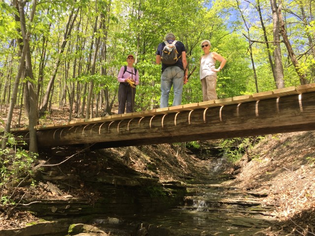 The NCS Honor Society has offered to do some maintenance and construction work on the BHB in Naples as part of their community service commitment. They will be working on the landscaping around the new bridge on Gideon Hanggi’s land. If you can spare a couple of hours on a Sunday afternoon in October to help Donna, our FLT volunteer coordinator, to support these teenagers, please meet at Bob and Ruth’s parking lot on Rt 21 in Naples at 12:30. We will work from 1 to 3. Please RSVP if you plan to come.
Springwater Trails has agreed to maintain the Bristol Hills Branch of the Finger Lakes Trail between Clement Rd and NY 245 in Naples. The FLT is sponsoring a workshop on trail mainentance on Oct 14th in Bath.
This is an opportunity for all hikers interested in helping to maintain hiking trail with Springwater Trails to learn more about the tasks required to maintain a great trail and to get to know other people who are also working on the trail.
Please look at this season’s Trail Tenders News for more details and RSVP if you are interested in attending. We can arrange a car pool if we know you want to come.
Directions from Springwater: Take NY 15 south through Wayland. Turn left onto I390 S, which joins I86 E in 16 miles. Take Exit 38 and turn left onto NY 54 N. Go under the expressway and turn right at the first intersection E. Morris St. The Fire Hall is on the right in 1.1 miles.
The fourth hike in our Bristol Hills Branch series will be called the up and down hike.The longest climb on this section will be 300 feet in elevation over half a mile, but there are two of those plus a third climb of about 150 feet. So this hike is a challenge to select a sections that are less steep, so you will find that the hikes are a little shorter than usual, allowing some time for catching our breath.
All hikers will meet at Access Pt 15 on CR 77. This is the same spot that we meet last month.
The Naturalists and Tourists will carpool to Williams Rd to the north. This hike starts with a short step descent from the road, followed by a half mile of uphill. A downhill section through woods and down shared driveway will cross CR 74 and follow Presler Rd into the Bud Valley Campground. This is the targeted end of the Naturalist hike and cars will be pre-staged here. Based on the interest of the hikers, and the time, the Naturalists can explore the campground or continue on with the trail as it climbs to an abandoned road and another high point. The Tourists should check their watches at this high point and turn around to return to the campground.
Meanwhile, the Climbers will leave CR 77 and head north on the BHB. The trail immediately starts a climb to about 1600′ and to open views to the north. After crossing a creek, the trail turns west to follow an abandoned road between fields and descends to the campground. Continue to follow the campground driveway north to CR 74. After crossing the road, we continue north along an old shared road. Follow the blazes and don’t miss the sharp left off the road. This hike ends at Williams Rd at the Naturalists cars. Hikers intent on completing all of the BHB trail should turn right and follow the road to the next driveway where the trail enters the woods to the left. We will continue the trail at this point after hunting season.
Following the hikes we will need to find all of the cars and then return to Naples for a social.
Directions:
From Springwater (and Wayland, N Cohocton and Naples): Take Rt 15 South to Wayland. At the stop light, turn left and follow Rt 21 through North Cohocton (take a left at the stop sign) to the south end of Naples. At the stop sign, turn right onto NY 53S for 12.1 miles. Turn left onto Waldo Rd. Continue straight onto CR 77 (Shuart Rd). In 2.3 miles, parking is on the right hand shoulder just past the “Pulteney” sign.
From Bath: Take Exit 37 from I86 (NY 17) for NY 53. Head north on NY 53 for 8.8 miles. Turn right onto Bean Station Rd and take the first left (in 0.4 miles) on Muck Rd. At the end of Muck Rd, turn right on Shuart Rd. Parking is on the right in 1.6 miles.
Directions to Williams Rd: Head west on CR 77. Stay on Cr 77 (turns to right) at Waldo Rd, and continue past Flynn Rd. The next right is Trant Rd which continues straight onto Williams Rd. The trail head is 0.3 miles up on Williams Rd.
Looking for brochure.or mailing list so I can receive it in the mail.
Nothing opens up for mailing list.
There’s all kinds of very bizarre ads and post for viagra and other drugs above on calender page.
Please let me know if there’s a brochure available