
Hikes led by Springwater Trails are generally held on Sunday afternoons and appear in this calendar in green.
| Sun | Mon | Tue | Wed | Thu | Fri | Sat |
|---|---|---|---|---|---|---|
| Charlotte-Genesee Lighthouse Tour (Optional) AND Hike or Bike Genesee Riverway Trail 1:00 pm Charlotte-Genesee Lighthouse Tour (Optional) AND Hike or Bike Genesee Riverway Trail May 4 @ 1:00 pm – 4:00 pm Tour of Charlotte Genesee Lighthouse (Optional) AND Hike or Bike Genesee Riverway Trail A special treat has been added for this hike date! We have been invited to tour the Charlotte Genesee Lighthouse BEFORE our regular scheduled hike time. For those … Continue reading | ||||||
| Hike at Oatka Creek Park, Wheatland 2:00 pm Hike at Oatka Creek Park, Wheatland @ Virginia Bluebells! May 11 @ 2:00 pm – 4:00 pm  On Mother’s Day we have often hiked in search of the beautiful Mertensia, a.k.a Virginia Bluebells, a stream-bank perennial which blooms in early to mid-May. This Sunday, May 11, we will visit a truly outstanding Mertensia patch, spread out along … Continue reading | ||||||
| Sonyea State Forest-Keshequa Creek Hike 2:00 pm Sonyea State Forest-Keshequa Creek Hike @ Sonyea State Forest Hike May 18 @ 2:00 pm – 4:00 pm 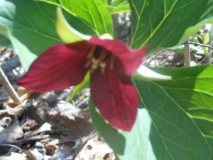 This Sunday, we’re returning to Sonyea State Forest in Livingston County, to hike along the Keshequa Creek and hopefully enjoy early spring flowers including trillium (as pictured in this post.) We will meet at 1:45pm at the gate that marks … Continue reading | ||||||
| Washington Grove/Cobbs Hill Park Hike, Rochester 2:00 pm Washington Grove/Cobbs Hill Park Hike, Rochester May 25 @ 2:00 pm – 4:00 pm More details to follow soon! Please check back. |
Tour of Charlotte Genesee Lighthouse (Optional) AND Hike or Bike Genesee Riverway Trail
A special treat has been added for this hike date! We have been invited to tour the Charlotte Genesee Lighthouse BEFORE our regular scheduled hike time. For those interested in the tour, you will need to RSVP Kelly Rell (kellrell@verizon.net) NO LATER than FRIDAY 5/2/25 by 10AM.
We will meet at Charlotte Genesee Lighthouse 4492 Lake Avenue Rochester, NY 14612 (in the parking lot of the Holy Cross Roman Catholic Church). Plan on an hour for the lighthouse and home tour. Please arrive by 12:45pm for a 1:00pm start time. *Note there is an admission fee of $5.00 for adults aged 18 and over.
Hike:
We will meet at Charlotte Genesee Lighthouse 4492 Lake Avenue Rochester, NY 14612 (in the parking lot of the Holy Cross Roman Catholic Church) at 1:45pm for our hike or bike to Turning Point Park.
Cyclists: will follow the Genesee Riverway Trail down to Turning Point Park and beyond doing a 1-hour loop and return.
Climbers: After climbing the lighthouse steps they will follow the Genesee Riverway Trail the 2.2 miles to Turning Point Park and return. If time allows they can add a walk towards Lake Ontario Park.
Naturalists/Tourists: Will follow the Genesee Riverway Trail for a 1-hour loop and return.
Parking: Parking for the Lighthouse shares the lot with Holy Cross Roman Catholic Church at 4492 Lake Avenue, Rochester, NY 14612. Please use the address of the church for your GPS.
Social: Will be held at the Hose 22 Firehouse Grill, 56 Stutson Street, Rochester, NY 14612
Directions to Social: Turn left onto Lake Avenue out of the Church parking lot. Go 2 blocks and turn into parking lot for Hose 22 Firehouse. You can enter off of Lake Avenue or by turning left onto Stutson St. You can also leave your car at the church lot and walk down to the social!
On Mother’s Day we have often hiked in search of the beautiful Mertensia, a.k.a Virginia Bluebells, a stream-bank perennial which blooms in early to mid-May. This Sunday, May 11, we will visit a truly outstanding Mertensia patch, spread out along a good stretch on both sides of Oatka Creek in Monroe County’s Oatka Creek Park. Oatka Creek Park is on the west side of the Genesee River, about 2 miles southwest of Scottsville and easily accessible from Exit 11 (Rush) on Route 390. We will hike the Mertensia Loop along the creek, followed by a longer hike through woods and grasslands around the perimeter of the park. The social afterwards will be a dish-to-pass at the park.
The 461-acre Oatka Creek Park offers mostly undeveloped woodlands and stream frontage for public recreation including fine fishing opportunities. Highlights include mature woods, isolated meadows, beautiful view of Oatka Creek, and the visible remains of the gypsum mines, which operated in the hamlet of Garbutt until the 1930’s. See https://www.townofwheatland.org/single-post/gypsum-mining-in-garbutt for the history of the park site; we will pass mysterious earthworks generated for the mine operations.
Meet at 1:45 for a 2 PM hiking start at the inner parking area – drive straight ahead past the parking lot on your left as you first enter the park from Union Street. We will all head north to the creek, cross the bridge and hike the Mertensia Loop, with the Naturalists returning as we came for a roughly 2-mile hike. The Climbers will proceed further upstream and make a larger loop around the park perimeter for a total hike of about 4 miles. The trails are well maintained but be prepared for some muddy areas; weatherproof boots and poles are advised, along with tick protection. The Park is fairly level, with some moderate rolling hills along the Climber route.
Social – Bring your favorite goodies to share for our first of the year dish-to-pass social adjacent to the parking area. Please bring your own lawn chair, and a folding table if you have one. As an option, you may contribute $5 to the social fund in lieu of food, but bring your own beverage.
Directions: From Interstate 390, take Exit 11 (Rush) and go west on Route 251. After crossing the Genesee River, go straight ahead on Quaker Road when Route 251 turns north toward Scottsville. In about 2.25 miles Quaker Road will end in a T at Union Street, with the park entrance straight ahead. Drive through to the inner parking lot.
Alternative from Springwater: Take Route 15 north to Route 251 intersection. Go west, cross river, keep going straight ahead on Quaker Road to park entrance.
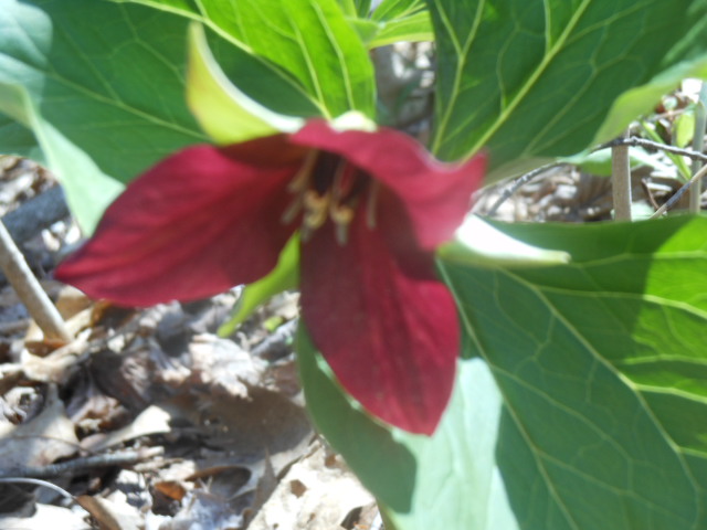
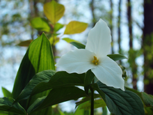 This Sunday, we’re returning to Sonyea State Forest in Livingston County, to hike along the Keshequa Creek and hopefully enjoy early spring flowers including trillium (as pictured in this post.)
We will meet at 1:45pm at the gate that marks the head of the Keshequa Creek Falls Trail about 2.7 miles from the beginning of Union Corners Rd. Hike will begin promptly at 2:00pm. Dress appropriately for the weather and bring poles if you wish. See directions below.
All hikers will walk around the gate to a well-groomed trail the heads down a steep hill to the creek. Be careful walking down, and on the way back you will want to take your time climbing this hill. But the hill is not long and most of the rest of the trail is along the old Genesee Valley Canal and railroad bed.
Our hike will take us to the western side of the forest, where we will encounter the gorge along Keshequa Creek. Within the gorge, we will see remains of the Genesee Canal and a major branch of the Pennsylvania Railroad, as well as rapids and falls along the creek.
![]() Social: After the hike, we will enjoy a May weather picnic in the woods. Bring a dish to pass or make a donation. We will select a clear area so, bring folding chairs, and a table, if you have one. There are no washroom facilities, not even portable ones, but lots of trees. If the day should turn out to be a rainy one, we will return to the Sunrise, in Dansville.
Social: After the hike, we will enjoy a May weather picnic in the woods. Bring a dish to pass or make a donation. We will select a clear area so, bring folding chairs, and a table, if you have one. There are no washroom facilities, not even portable ones, but lots of trees. If the day should turn out to be a rainy one, we will return to the Sunrise, in Dansville.
Directions: Please note: Directions on Google Maps from Springwater takes you on NY 36 North to Craig Rd up through the Groveland Correctional Facility. This road is closed to cars, although walkers and bikers are allowed to use it as part of the Genesee Valley Greenway trail.. This is not a good way to get to our hike. Please follow the directions below.
From exit 6 on 390, turn south on NY 36. Then, take the first right onto CR 72, aka Presbyterian Rd. Follow it for 3.7 miles, bearing right at the intersection with CR 11, to Union Corners Rd. Turn right here and keep going for 2.7 miles,, till you see the gate. Union Corners Rd is unpaved, with potholes, making for slow going so, consider this in planning your travel time. Turn around at the gate and park on either side of the road.
From Springwater: Take NY 15 west from the flashing light. At the top of the hill (1.5 mi), turn left onto Liberty Pole Rd.(CR 38). Continue for 8.1 miles as the road number changes from CR 38 to CR 1A to CR 1. Turn left onto NY 63 S. In just 0.3 miles take the first right onto N 258. In 1.9 miles, continue straight across NY 36 and onto CR 72 (Presbyterian Rd). Follow the directions above to the state forest.
From Naples. Follow NY 21 S to Wayland. At the first light, turn left to stay on NY 21. In 1.8 miles south of Wayland, turn right on I-390 N. In 16 miles, take Exit 6. Turn right onto NY 36. Follow the directions above.
From Rochester: take 390 south to the Sonyea exit.Turn left onto Route 36 and drive a short distance then turn right on to county road 72. Drive a few miles and turn right onto Union Corners Road. Drive a couple of miles where you will enter the Sonyea State Forest. Drive about half a mile in until you reach the parking area. There is some logging going on so the road is a little bumpy but passable.
From Dansville: and points east, take Route 36 north toward Sonyea. Turn left onto CR 72. From there follow the directions above.
More details to follow soon! Please check back.
This hike is a guaranteed crowd pleaser! Please check back for more details.
Please check back for more details. Note, hike time change for summer hours.
A very special hike has been planned for this Father’s Day! More details to follow. Please check back.
The Springwater Trails group is most fortunate to have been invited back to the private property of one of our members!
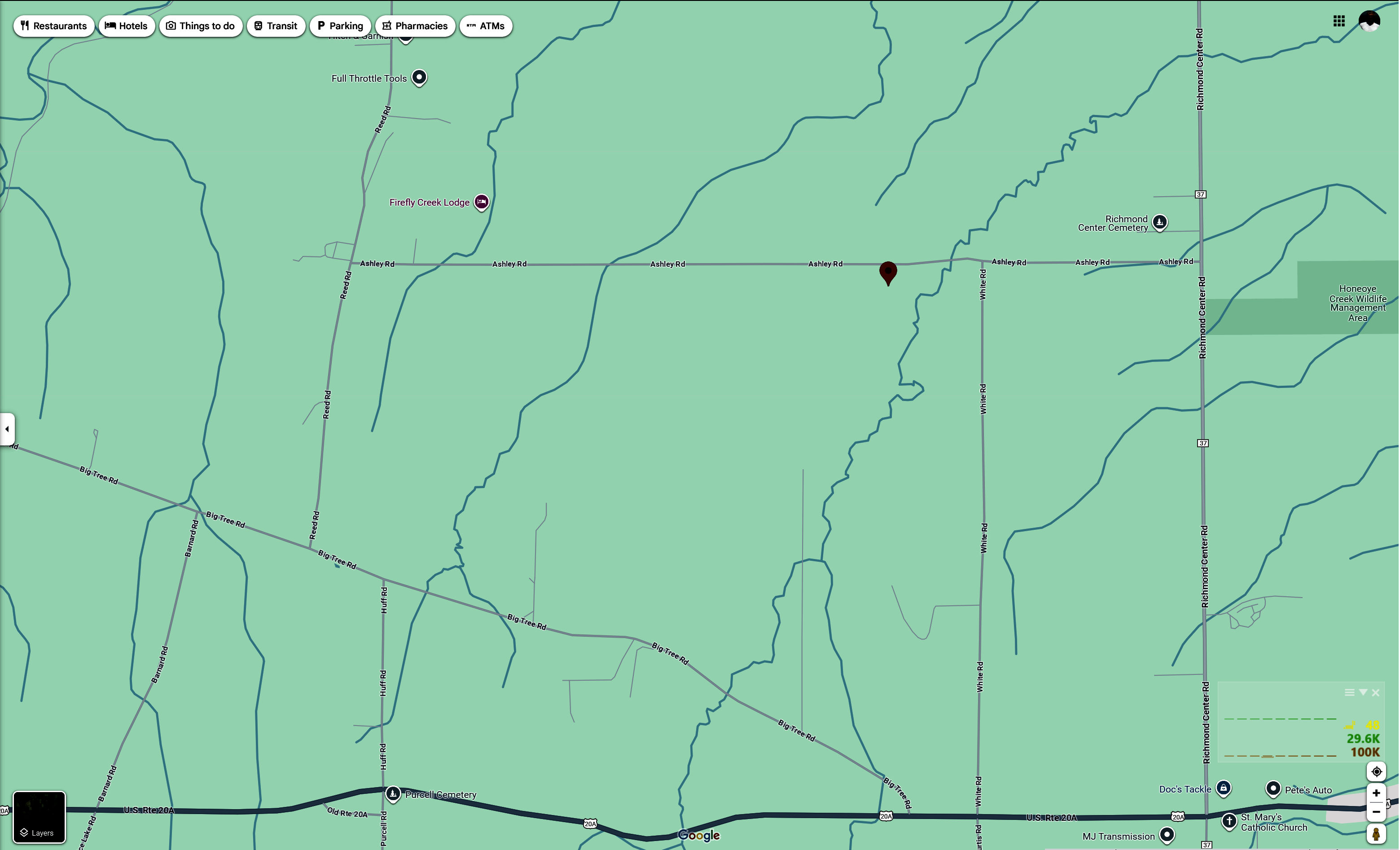
Hike: The meeting point will be 9181 Ashley Rd, Livonia, NY. Hike will begin at 4:00pm. Please plan to arrive by 3:45pm to ensure timely departure of the groups. Hikers will start out flat, going through a wooded area and then we will climb a hill for a beautiful view before heading back. The trail through the woods can be muddy at times. Dress appropriately for the weather conditions.
Bike Details: to be posted closer to hike date. Please check back.
Directions: Ashley road runs between County Road 37 and Reed Road. Ashley road is also the only road off of county road 37 between 20A (Valley Inn is in the corner) and Richmond Mills Road. If heading south from Rochester it will be a right, if heading north from the Valley Inn it will be a left. We will be the first house past White Road in the left.
Social: After the hike, plan to relax, cool down and join the group onsite at the Wagner homestead. Please bring a dish to pass or small monetary donation.
Please join us on Sunday, June 29th to hike the newly renovated Hickory Ridge Trail (formerly known as the West Hill Preserve), off Seman Road in Naples. Hickory Ridge is alive with migrating birds in the spring. Over 150 bird species have been identified at the preserve. The list includes 10 species of hawks and falcons, 12 species of sparrows and 20 species of warblers. Listen for the signature drumming of ruffed grouse and the “who cooks for you” call of the barred owl.
Meet at 3:45pm for a 4:00pm start at 6795 Seman Road, Naples. All groups will start on the same route, with the Climbers completing the full counterclockwise loop of about 4 miles and the Tourists and Naturalists tackling the easier east side of the loop and returning as they came, for a total of 2-3 miles. The trails are all wooded, well-groomed and wide, with gentle elevation gains. Dress appropriately for the weather.
Our Social-location will be communicated at a later date.
Directions:
From Springwater: Go south to Wayland and east on Route 21, through Naples. At .4 miles past Bob and Ruth’s and Route 245, take the first left onto County Road 12. IN 1.8 miles, take the left fork onto Rhine Street. At the first intersection (3/4 mile) go left on Seman Road. The Hickory Ridge parking area will be on your left in about a half mile.
From Honeoye: Go south on East Lake Road, then turn left onto County Road 33 (Egypt Valley Road). Continue on 33 all the way to the intersection with County Road 34; keep straight on County Road 33, whose name now changes to West Hollow Road. Continue for 4.3 miles, passing Clement Road on your right. Turn left on Seman Road. Go 1.3 miles to Hickory Ridge Trailhead on your right.
From Rochester/Victor/Canandaigua: Follow 5 and 20 to Route 64, Then south on Route 64 through the Bristol Valley about 13 miles to Bristol Springs.Just past Gannett Hill Road, go right on County Road 12. Go 2.8 miles, pass the Scenic Overlook, and take a right on Oakley Road. At the intersection in 3/4 mile, go straight onto Seman Road. In a half mile, the trailhead will be on your left.
Welcome to the 12th Annual Mushroom Foray where Springwater Trails and the Rochester Area Mycological Association come together for a very special event! Several hiking groups are planned, all starting and ending at the parking area at the farm. The groups will explore much of the farm, with many opportunities to find mycological specimens.
Please plan to arrive early (1:45 PM) to sign in and to sign the RAMA liability forms.
Maps of the farm, paper bags and paper plates for collecting and displaying mushrooms will be provided. Those who want to learn how to collect mushrooms will be instructed by Gene and Georgia, and any other Rochester Area Mycological Association members who will be our guests.
The Climbers will follow the driveway up to the fields, turning to the left at the top. We will circle the pond on the southern portion of the farm and the spruce forest along the edge of the Christmas tree plantations. Heading west through the Cathedral Pines will take us to wet spots in the woods. We will return along the edge of several more Christmas tree plantations (Douglas-fir, Nordmann fir, Grand fir, Concolor fir, Canaan fir, Alaska yellow cedar, Norway Spruce, Meyer Spruce).
The Tourists will follow the driveway up through the woods, stopping occasionally to explore for mushrooms. When reaching saleable size Christmas trees (Lot Z), head to the right around or through the Christmas tree plantation. At the corner where the small Southwestern White Pine tree row ends and the tall Concolor fir are, follow the trail into the woods and back to the field and head west along the north field road to a hidden corner of the field with some spectacular 35 foot green and blue Concolor fir Christmas trees live, the size seen during Christmas season in a large mall. If there is still time, follow the north field road next to the hedge row up to Story Road. We will return through the tillable fields, visiting smaller collections of trees and back down through the woods.
The Naturalists will start exploring under and behind the Western red cedars (thuja plicata or giant arborvitae) by the parking area and south to the Alaska yellow cedar, large Concolor fir and spruce, then back up through the woods to the right of the trail up to the main fields. These are likely full of mushrooms, but you will find some swampy areas, so don’t get lost behind people’s homes along Liberty Pole.
All hikers should check their watches and return to the parking area by 4:00 PM to have their collections identified.
Mushroom Identification/Social
After the hike, several RAMA members will help identify the mushrooms collected. After the mushrooms are identified please join us for a dish-to-pass social hosted by Katherine. Please bring your own beverage, plus a dish to share or a $5 contribution to the social fund.
We will begin all the hikes at 6840 Liberty Pole Road where there is ample parking at the Christmas tree loading area between the tall Western red cedar and Morton Building and Nursery beds. Follow the parking signs. When we return from our foray, the mushrooms will be displayed for identification on paper plates on the tables outdoors. Please dress for the weather, rain gear as needed.
From Springwater: Go west from the Springwater light on NY-15 North. Just past the top of the hill and after rounding the tight curve, turn left on CR 38 (Liberty Pole Road). The farm is on the left (the high side) 1.1 miles from NY-15 at 6840 Liberty Pole Road after you cross Carney Hollow Rd. There is a sign for the All Western Evergreen Nursery & Christmas Tree Farm. Follow the orange cones to the parking area and park facing the house.
From Geneseo: Go south on NY-63. About 6.4 miles after passing NY-408, turn left on CR-1 (Groveland Scottsburg Rd) at Groveland Station. This road becomes CR 1A (Springwater Scottsburg Rd) at Scottsburg (Route 256) and then Liberty Pole Road after you cross Stagecoach Road (CR 71), and finally CR-38 (still Liberty Pole Rd) after crossing Reeds Corners Rd (CR-29). It is 7.1 miles from Groveland Station to All Western Evergreen Farm. The farm is on the right (the high side). Follow the orange cones to the parking area and park facing the house.
From Honeoye: Take 20A west to Hemlock and 15A south to Springwater. Then follow the Springwater directions above.
From Rochester: Take I-390S from Rochester. Use Exit 9 for NY-15 Lakeville. Turn left onto NY-15. Stay on NY-15 for 16.5 miles, through Lakeville, Livonia, Conesus and Webster Crossing. When NY-15 curves to the left at the south end of Webster Crossing, continue straight onto CR-60 (Carney Hollow Rd) and take the first right onto Liberty Pole Rd. The farm is on the left (the high side) at 6840 Liberty Pole Rd. Follow the orange cones to the parking area and park facing the house.
If using GPS, use the map directions on the www.allwesterntrees.com website and make sure you are on Liberty Pole Road and not being directed to the center of the farm from Swartz Road or Story Road. Follow the orange cones to the parking area and park facing the house.
Looking for brochure.or mailing list so I can receive it in the mail.
Nothing opens up for mailing list.
There’s all kinds of very bizarre ads and post for viagra and other drugs above on calender page.
Please let me know if there’s a brochure available