
Hikes led by Springwater Trails are generally held on Sunday afternoons and appear in this calendar in green.
| Sun | Mon | Tue | Wed | Thu | Fri | Sat |
|---|---|---|---|---|---|---|
| Lehigh Valley Trail Hike or Bike in Rush, NY 2:00 pm Lehigh Valley Trail Hike or Bike in Rush, NY @ Stevens-Connor Lehigh Valley Lodge Apr 6 @ 2:00 pm – 4:00 pm Come join us for a leisurely hike or bike along the Lehigh Valley Trail on Sunday April 6th! With its flat even surface, the trail is a hidden gem for walking, hiking, jogging, biking. It is a vital link in … Continue reading | ||||||
| Ontario County Park at Gannett Hill Hike-Naples 2:00 pm Ontario County Park at Gannett Hill Hike-Naples @ Lookout Parking area Apr 13 @ 2:00 pm – 4:00 pm  This is one of our group’s favorite hikes! Ontario County Park at Gannett Hill is one of the highest points in Ontario County and located in the scenic Bristol Hills. At an elevation of 2,256 feet above sea level, you’ll … Continue reading | ||||||
| No Hike-Easter Break 2:00 pm No Hike-Easter Break Apr 20 @ 2:00 pm – 4:00 pm No hike has been scheduled for this date due to the Easter Holiday. Enjoy the break, spend time with loved ones and eat chocolate bunnies. This will give you something to burn off next week  | ||||||
| Hike Rob’s Trail – Hemlock Lake side 2:00 pm Hike Rob’s Trail – Hemlock Lake side Apr 27 @ 2:00 pm – 4:00 pm Join us on Sunday April 27th to hike the west side of Rob’s Trail, the DEC/Nature Conservancy property in the northeast corner of Hemlock Lake! Options are to hike out and back to the south along the trail … Continue reading |
NOTE SPECIAL HIKE STARTING TIME
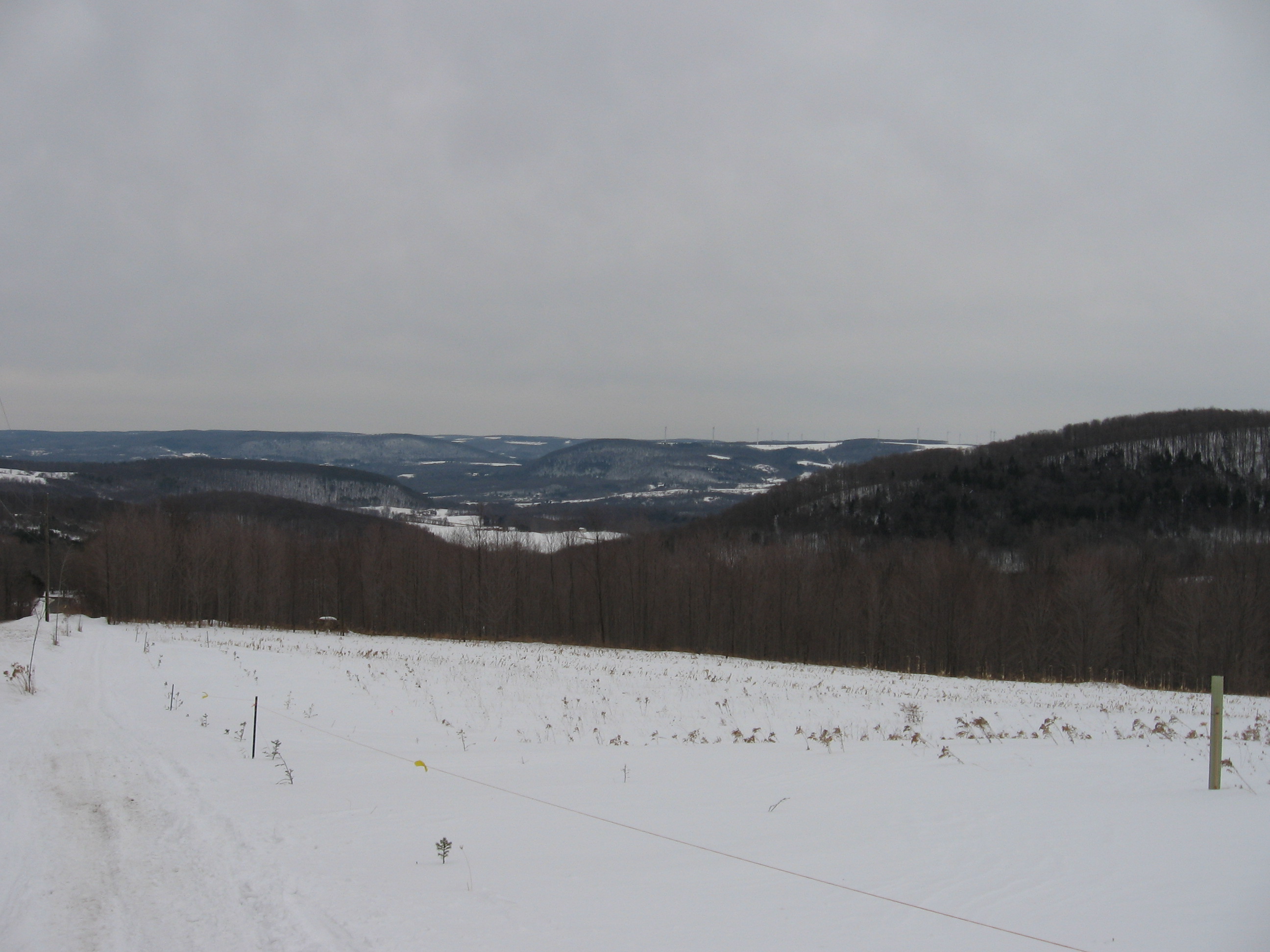 It has been an interesting Maple season this year, with temperatures having wide swings all winter. Come learn about the experience of the Wohlschlegel Maple Farm just over the Coates Rd from Springwater. Springwater Trails will take advantage of Maple Weekend for a lunch of pancakes with this year’s maple syrup, followed by a revisit to a hike along the Snowmobile Trail and through the Wohlschlegel’s Sugar Bush. The pancake lunch will be today’s social.
We will meet at Wohlschlegel’s Maple Farm, near the east end of Coates Rd., west of Naples. For $7.00, you can get all the pancakes you can eat, 2 sausages and beverage. Their pancake kitchen opens at 8 AM but closes at 1 PM so, you will need to get there by 12:30 to enjoy your meal. If there’s time after your meal, you can enjoy tours of their farm as well as samples of some of their maple products. For more information on Wohlschlegel’s Naples Maple Farm you can check out their website at: http://www.fingerlakesbulkmaplesyrup.com/
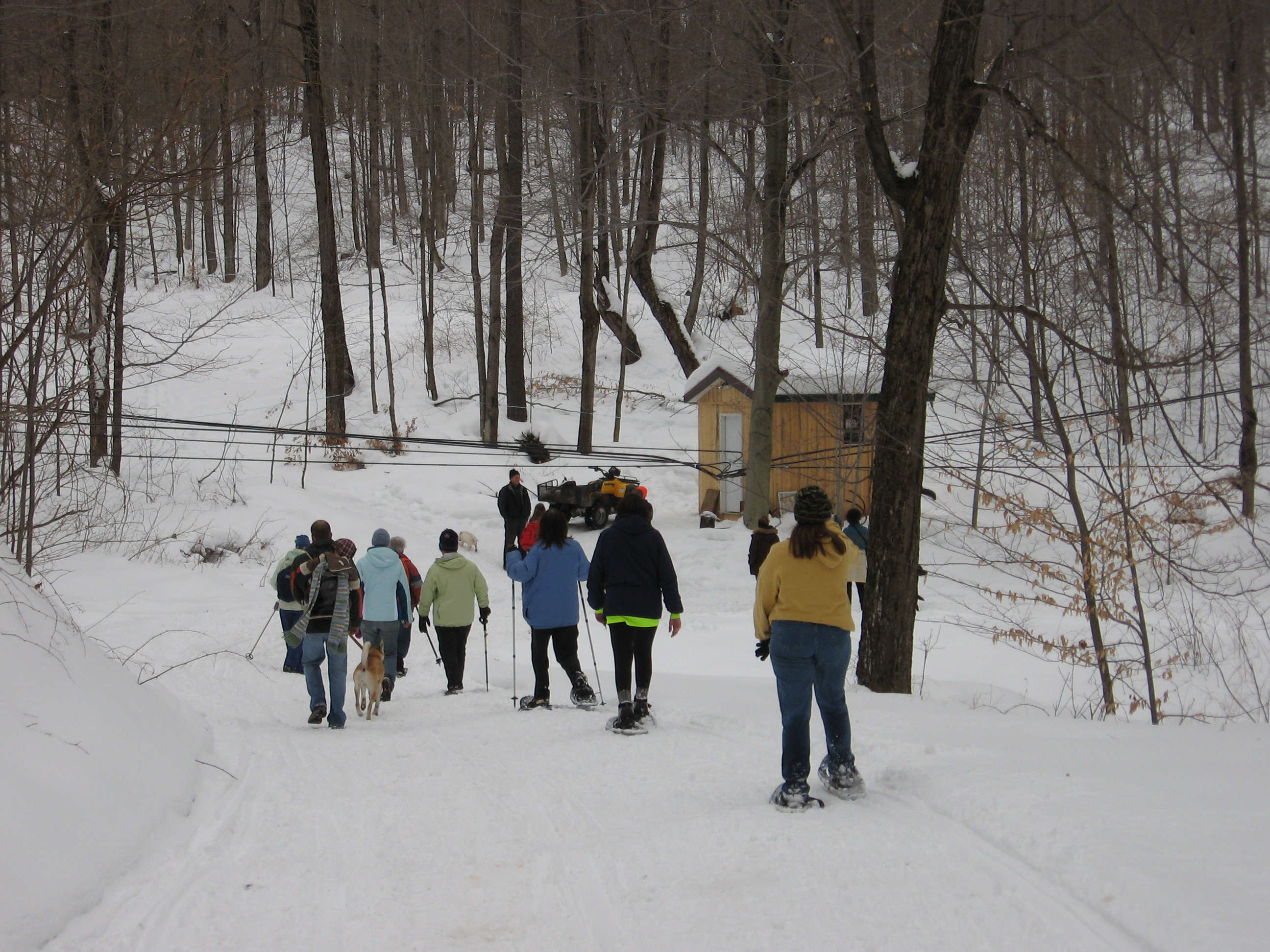 Because you have to get there by 12:30 for your pancake lunch, we’re going to start our hike today at 1:30. We will have our usual 3 hiking groups, starting on the snowmobile trail on their farm. The climbers will follow the Snowmobile trail south toward Richards Rd and then will return through the sugar-bushto the Sugar House. Naturalists and Tourists will walk through the sugar-bush, take a quick peek into the pump house followed by a hike up through the eastern half of the sugar-bush.
Directions to Wohlschlegel’s Maple Farm, 8064 Coates Rd. Naples.
Although Wohlschlegel’s is just over the road from Springwater, you can’t get there directly from Springwater because of seasonal roads. Check your GPS and note that Warner Rd/Garlinghouse Rd, Liddiard Rd, Coates Rd and Richards Rd are all closed until April 1 as they cross over from Springwater to Naples. (And you likely won’t want to drive them even when they are open). You must enter Coates Rd from Garlinghouse Rd on the Naples side of the hill.
From Wayland and the hamlets of Springwater and Webster Crossing. Go south on NY-15 to Wayland. Turn east on NY 21(N) for 5.6 miles. Left on to CR 38 (Rowe Rd). At the tee (3 miles), go left onto Garlinghouse Rd. Take the second left on Coates Rd (watch for Maple signs). Farm is on the left, about 1/2 mile. Look for the bright purple roof. Don’t attempt to enter Coates Rd. from Pardee Hollow, as it is not be plowed and is a rough seasonal road at the top of the hill.
From Tabors Corners and East Springwater: Head south on Tabors Corners Rd. Turn left on Pardee Hollow Rd. At the tee, turn right to stay on Pardee Hollow Rd. Continue past Coates Rd and Richards Rd, ignoring any directions from your GPS. At the tee, turn left on Atlanta-Garlinghouse Rd. At the next tee, go left onto Garlinghouse Rd. Take the second left on Coates Rd (watch for Maple signs). Farm is on the left, about 1/2 mile. Look for the bright purple roof. Don’t attempt to enter Coates Rd. from Pardee Hollow, as it is not be plowed and is a rough seasonal road at the top of the hill.
From Naples and Canandaigua. Head south on NY-21. On the southern side of Naples, turn right at the Middletown Tavern on Clark St (CR 36) which becomes Hunt Hollow Rd. In 2 miles, turn left on French Hill Rd. At the tee, turn right to stay on French Hill Rd, which becomes Garlinghouse Rd at the next intersection. In 1.4 miles, turn left onto Coates Rd. Farm is on the left, about 1/2 mile. Look for the bright purple roof.
From Hemlock and Honeoye. From US-20A, turn south on CR-36 (West Lake Rd) for 13.9 miles. Turn right onto French Hill Rd. At the tee, turn right to stay on French Hill Rd, which becomes Garlinghouse Rd at the next intersection. In 1.4 miles, turn left onto Coates Rd. Farm is on the left, about 1/2 mile. Look for the bright purple roof. NOTE: do not take CR 37 south from Honeoye into Springwater. This would put you on the wrong side of the hill and you will need to go through Springwater into Steuben County to get to the Sugar House.
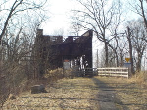
On April 7 we will hike or bike the western end of the Lehigh Valley Trail Linear Park, following the rail trail across the Genesee River on the original rail truss bridge to the Greenway intersection. Hikers have the option of a 5-mile hike or a 2.5 mile hike to the river and back. Part of the Monroe County Parks System, the rail trail is wide, flat, fairly dry and nicely paved with stone dust along most of its length, and has some interesting railroad era structures and interpretive markers at the river crossing end. We might see some early signs of spring too. See trail flier at map.
Everyone will meet at 1:45 at the Honeoye Creek Fishing Access parking area on Fishell Road west of Route 15 in Rush, just past the 390 overpass. Tourists and Climbers will hike to the west 2.5 miles to the Greenway crossing on the west side of the Genesee, and back for a total of 5 miles. Naturalists will drive to an alternative parking lot closer to the river, continuing west on Fishell Road to the East River Road intersection, making a left, and parking in the trailside parking lot on the west side of East River Road, walking from there to the end and back for a total of about 2.5 miles. If weather is conducive, Cyclists will begin at the Fishell Road parking area and ride to the Greenway and back, then continuing east along Honeoye Creek as far as Rochester Junction in Mendon before returning to the cars, for a total of about 15 miles. Expect a few damp sections of trail.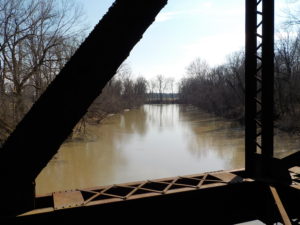
Social – Please join us for the social gathering at the Brewery Pub at 8 W. Main Street in the center of Honeoye Falls, overlooking the falls.
Directions:
From Springwater, Honeoye and points south: Follow Route 15A north through Hemlock and Lima. In Honeoye Falls, after the turn-off to West Main Street, make a left on Honeoye Falls-Five Points Road. Go through the Five Points intersection and past the Oak Openings on your left. At Route 15 (W. Henrietta Road) make a right. Go 1 mile and make a left on Fishell Road. The parking area will be on your left, just past the first 390 overpass.
Alternative Interstate Route: Take I-390 north to Exit 11 (Route 251 Rush). Go east on 251 for a short distance, then south on NY Route 15 for about 2 miles. Make a right on Fishell Road. The parking area will be on your left, just past the first 390 overpass.
From Rochester and points north: Take 390 South to Exit 11, Go east on 251 for a short distance, then south on NY Route 15 for about 2 miles. Make a right on Fishell Road. The parking area will be on your left, just past the first 390 overpass.
Directions to Social: Return east on Fishell Road to Route 15. Go south 2 miles to Honeoye Falls-Five Points Road and make a left. Go about 4 miles into the center of Honeoye Falls. At the light, the Brewery Pub will be straight ahead on your right, just before the bridge.
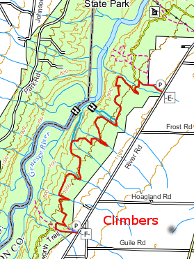
 This week’s hike continues our Letchworth Branch series. For those of you who have been following this series, you may be looking forward to lots of creek crossings and the associated scrambles up and down the creek banks. But this week will be a bit calmer, with much of the hike follows the old Genesee Valley Canal, and the seasonal portion of River Rd.
The hike will start at the Parade Grounds. All hikers should park at the Parade Grounds, just off the East Park Rd. The branch trail is a short walk down hill on the road from the parking area.
Weather note: Rain is expected Sunday morning, so trails will be wet, and poles and traction footwear are recommended, especially for Climbers. Naturalist and Tourist routes are fairly flat, but Climber route includes some hills and small stream crossings.
The Climbers and Tourists will turn right onto the FLT Branch trail (See the green line on the map [click the map to enlarge]) At this point the Genesee Valley Greenway and the FLT Branch are the same trail and are marked with yellow blazes. The trail follows the old canal for 1.8 miles to River Rd. Turn left onto River Rd (the Greenway continues straight across the road heading toward Nunda). River Rd is seasonal on this section – it is officially open for traffic but likely we won’t meet many cars. Stay on River Rd for a mile – you may note two park trails (8A and 9) leaving the road to the left. Look for yellow blazes where the Letchworth Branch enters into the woods on the left. At this point, the tourists should continue straight on River Rd to our staged cars at Dygert Rd. The tourist hike is about 3.5 miles.
Meanwhile, the Climbers will turn left to stay on the branch trail from River Rd. In a bit less than a mile, turn right onto the blue access trail to hike out to Dygert Rd (you can’t miss the turn, because the main trail heads up a step hill with only a narrow path (that we climbed last month). The Climber hike is about 4.2 miles.
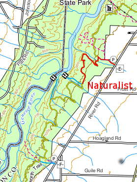
Back at the East Park Rd intersection with the Branch Trail, the Naturalists will turn left on the branch trail and walk to the middle falls. There is a sign at the start of this trail announcing that it is closed in a half mile. The Naturalists will follow this trail to the Middle Falls. In half a mile when you come to a fence, turn around and return to the road. At this point there are three options:
- Continue straight along the branch trail for another half mile. Turn around at 3:30 and return to the cars.
- Turn left and walk down the road a half mile, to a point opposite the lower falls, then turn around and return to the road and climb back up to the cars.
- Turn right and return to the parade grounds. A brief walk around the parade grounds will complete the hike.
Following the hike, everyone is invited to join us for a pot luck picnic at the Parade Grounds shelter. Bring a dish to pass and your own beverage (or make a small donation to the social fund). Perhaps someone who just doesn’t have the time to make a dish to pass will stop at a grocery and bring hotdogs and buns. John will bring a grill.
Directions:
Since this hike is a one-way hike for Climbers and Tourists, we need to stage some cars at Dygert Rd. If you would like to participate in this effort, please meet at Dygert Rd at 1:30PM. If you can’t make it to Dygert before 1:40, please go directly to the Parade Grounds.
To the Parade Grounds from Springwater, Wayland and Dansville: In Dansville, take Ossian St (NY-36N) west from Main St. Continue straight onto NY-436W. Follow NY 436 for 18.3 miles through Nunda. About 4.3 miles past the light in Nunda, turn right into the Letchworth entrance – there are two roads at this intersection, take the sharp right through the gate. Parking is about half a mile down on the left.
To the Parade Grounds from Mt Morris, Geneseo and I390: Take exit 7 from I390 and head south-west on NY-408. In Mt Morris, 408 jogs one street to the left at Main St. Continue on NY-408 south from Mt Morris for 9.2 miles. Turn right onto Wildey Rd, then (in 1 mile) turn left onto Short Tract Rd. At the end, turn right onto NY-436. In 2.1 miles turn right into the Letchworth entrance – there are two roads at this intersection, take the sharp right through the gate. Parking is about half a mile down on the left.
To the Dygert from Springwater, Wayland and Dansville: Follow these directions if you can leave your car at Dygert Rd before 1:40. In Dansville, take Ossian St (NY-36N) west from Main St. Continue straight onto NY-436W. Follow NY 436 for 15.2 miles through Nunda. About 1.5 miles past the light in Nunda, turn right onto Oakland Rd. Continue straight at the stop sign at Short Tract Rd and take the next left onto Dygert Rd. Park on the south side of the road at the tee with River Rd.
Springwater Trails is taking this week off. Please join us next Sunday for our annual Earth Day spring cleaning on Rt 15 through Springwater.
Click on the map to see a larger version. This map shows the paths we will work on, and the possible extension.
Springwater Trails is taking part in the Livingston County “Operation Community Cleanup” in honor of Earth Day 2018.
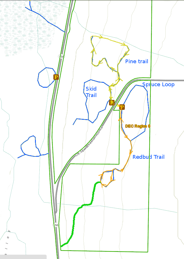
Join us at the State Forest trails on Wheaton Hill at 2:00 on Sunday. Springwater Trails has an agreement with the Department of Environmental Conservation to maintain four trails at this location. After a windy winter, we will break into groups to remove branches from the trails and litter from the woods.
We will form a one group on Spruce Loop, another on the Pine and Skid Trails and a third walking through the woods north of the trailhead checking for trash from the road.
All members of the greater Springwater Community are welcome to join this effort.
What do I need to bring?
The trails are mostly dry, but you should expect some mud as you cross the many drainage flows that tend to collect on the low spots. Bring hand held clippers to remove the multiflora roses that have sprung up on the trail. Look for thick gloves that will protect you from the thorns. Also there are lots of small branches on the trails, which only need light gloves. Finally, trash bags if you want to help pick up road litter in the woods. And, of course, bring your water bottle.
Social
Following the cleanup, join Springwater Trails for hotdogs at the trail-head. We will provide the hot-dogs and salads. Please bring your own water and other beverage.
Directions to the trails are available here.
This Sunday we will return to an old SWT favorite – the Finger Lakes Land Trust’s Wesley Hill Nature Preserve. Wesley Hill is a Finger Lakes Land Trust property of 390 acres including stands of northern hardwoods, red and white pines, a woodland pond, and the northern edge of Briggs Gully, as well as the Wenrich Cabin, set in an old forest overlooking the gully, deep in the woods. A network of trails through the preserve offers excellent hiking routes of various lengths and levels of difficulty.
The preserve was founded in 1999 by the generous donation of 90 acres by the children of three artists – John Wenrich, James Havens and Colburn Dugan – to the Finger Lakes Land Trust. Since that time, the Land Trust has expanded Wesley Hill to over 390 acres through the purchase or donation of four additional parcels.
We will meet at 1:45 and start our hikes at 2 PM at the Wesley Road parking lot. Click here for map: Wesley Hill from Wesley Rd
NATURALISTS will take the yellow trail, keeping to the left at the open field. This trail will then T at the red trail. Turn right to the Wenrich cabin, then turn back back on the red and yellow trails and back to Wesley Road. (Estimated distance – 1.5 miles)
TOURISTS will take the yellow trail to the red trail and turn left, following the red trail to pond. Make a right on the green trail, then another right along the other side of the red trail, down to the stream crossing (descent rope assisted), up to the cabin, and back to Wesley Road by the red and yellow trails. (Estimated distance – 4 miles)
CLIMBERS will take the yellow trail and go right on the blue trail at the open field, to explore the western end of the property. From the Wenrich Cabin, follow the red trail down to cross the stream and climb back up with the rope assist. Continue on red trail, turning left on green trail, left again on the red trail to the pond, continue on the red trail to the yellow trail and back to the start at Wesley Road. (Estimated distance 4.7 miles)
Following the hike, the optional social will be at the Honeoye Boat House Grill behind Trident Marina, 5226 East Lake Rd, Honeoye.
Directions to Wesley Road Trail Head:
From Honeoye take route 20A east through Honeoye to East Lake Road (CR-33). Turn right onto East Lake Road. Take first left, staying on CR33, then the first right onto Pinewood Hill which becomes Gulick Road. Travel 3.4 miles, then turn right onto Wesley Road. Parking area is on the right side in one mile.
From Springwater Head north on Rt 15A toward Hemlock. Just before Hemlock turn right on Rt 20A. Follow Rt 20A to Honeoye and the follow directions above.
From Naples From the southern end of Naples, head west on Co Rd 36. Follow Co Rd 36 for 1.2 miles to the first right turn on Gulick Road. Follow Gulick Rd for 8.4 miles and turn left on Wesley Rd. The parking area is on the right in one mile.
Directions to Honeoye’s Boat House Grill:
From Wesley Rd Turn left and head north on Gulick Rd for 3.3 miles. The road bears left and becomes Pinewood Hill Road. At the stop sign, turn left to stay on Pinewood Hill Rd (CR33). In 0.4 miles, turn left on East Lake Road. In 0.8 miles, turn right onto Deyo Dr at the sign for Trident Marina. The Honeoye Boat House Grill is about 150 feet down toward the lake.
UPDATE: Since the forecast for Sunday afternoon is cool and rainy, the after-hike dish-to-pass social will be at Gene and Georgia’s townhouse in Collett Woods, only a few miles north of Mertensia Park. See directions below. Hiking and birding will proceed as planned (let’s hope the birds cooperate), but please dress for cooler and wet conditions.
Farmington’s Mertensia Park is one of the area’s most reliable spots for enjoying the Virginia Bluebells growing wild in the woods along Mud Creek, usually peaking around Mother’s Day. Join us, and bring along a Mom! There are options ranging from a leisurely stroll to a longer hike or bike ride along the Auburn Trail, which abuts the Park. 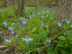
Naturalists and birders will accompany Gene Binder through the woods of Mertensia Park and perhaps up along the Auburn Trail, in pursuit of spring migratory birds. Bring your binoculars for the best bird viewing.
Tourists and Climbers will explore the roughly 1.3 mile trail through the park woods, and then head west along the Auburn Trail toward Victor, turning around to return at their discretion. The distance to the former freight depot at Maple Street is 2.6 miles; Tourists may wish to turn back earlier. A section of about .3 miles is a detour along East Victor Road and the Break of Day Road; all sections including the road walking are well marked and level, with a well drained walking and riding surface. Hikers also have the option of exploring the Auburn Trail going east toward Canandaigua – a new section of trail recently completed (almost) by the Town of Farmington.
If conditions permit, cyclists will also follow the Auburn Trail toward Victor, following the .3 mile detour at East Victor Road and then a 1 mile detour through the village on Avenue, School Street and Rawson Road before returning to the rail trail. The turning point will be in 7 miles at the Thruway underpass, with its railroad-themed mural, for a total ride of 14 miles. The 1841 Cobblestone Railroad Pumphouse at Fishers is an interesting stop along the way. There will be time to explore the bluebell trail in Mertensia Park at the end of the ride.
Social – Please join us for a dish-to-pass social at 6218 Silver Birch Drive, in the Collett Woods townhouse complex in Farmington – see below for directions from the park.
Directions to the site:
From Springwater: Follow Route 15A north to Honeoye Falls, turning right on West Main Street just west of the Village. At the center of Honeoye Falls, turn right at the traffic light on East Street, which becomes Boughton Hill Road. Follow Boughton Hill Road 11.6 miles, passing Ganondagan. After East Victor Road, make a left on Mertensia Road. Mertensia Park is on your left, just over the hill.
From Rochester: Take Route 490 and the NYS Thruway to Exit 44, Farmington. Go 1.4 mile south on Route 332 and turn right on Route 96. In another .4 miles turn left on Mertensia Road. Mertensia Park entrance will be in .6 miles on your right.
From Honeoye or points along Routes 5&20 east or west: Head toward Bloomfield and go north on Route 444 toward Victor. At Boughton Hill Road, go right for 2.3 miles and take a left on Mertensia Road. Park will be on your left in .1 mile.
DIRECTIONS TO THE SOCIAL: From the Mertensia Park entrance, go left (north) on Mertensia Road, and go 1.1 miles, passing through the intersection with Route 96, and enter the Collett Woods complex on the right. Follow the entry road until it comes to a T, with the office and pool ahead of you. Park by the pool and walk to the west and then around the corner to #6218 on the left.
Spring is here!, and it is time to get outside. The Finger Lakes Land Trust is sponsoring a volunteer opportunity at Wesley Hill. This is an opportunity for Springwater Trails to say thank you to one of our popular hike locations.
 Wesley Hill is one of FLLT’s most iconic nature preserves, and on Monday, May 20th, it will be turning 20 years old! If you have never visited our westernmost preserve, this is your chance! Wesley Hill is full of beautiful vistas, gorges, and old growth trees.
Please join me on Saturday the 18th to help refresh the hiking trails and clear a short reroute, as well as conduct habitat management. At the end of the day, we will raise a glass of something bubbly to a magnificent place that is protected forever. Tools, work gloves, and refreshments (including N/A options), will be provided. We will meet at 11:00am at the WESLEY RD. parking area. Directions can be found here.
Original email from:
Jason Gorman, Nature Preserve Manager
Finger Lakes Land Trust
202 E. Court Street
Ithaca, NY 14850
607.275.9487
www.fllt.org
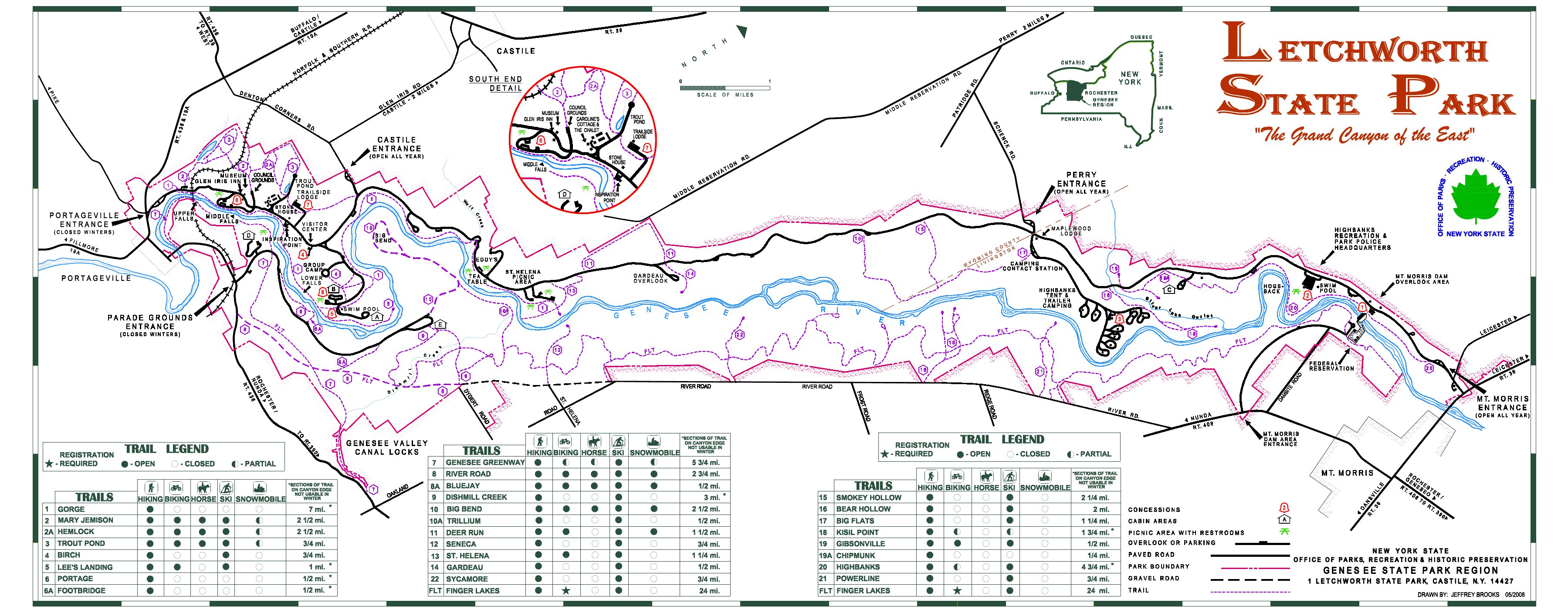 Last August, Springwater Trails started our Letchworth series. This series, which occurred once a month (usually the 3rd Sunday of the month), had to goal of hiking the entire Letchworth Branch in 2 hours segments. We have done the following hikes:
August – Mt Morris (Access A) to the Dam Visitor Center (Access B)
October – Access D to Hogsback overlook (Access C) – time constraints meant we missed continuing to the Dam Visitor Center (Access B).
November-Access D to Access E.
December – Access F to the river.
January and February – Canceled.
March – Dygert Rd (Access H) to Oakland Rd (Access G).
April – The parade grounds (Access K) to Dygert Rd (Access H).
So what is left.
Access B to Access C – This short section is left as a personal exercise, next time you are in the area.
 Access E to F. – This is a long hike which we are planning for this Sunday when a 2:00 start and an 8:30 sunset means we will have time to complete the hike.
Access F to G – Next month’s hike. (Remember, June hikes will start at 4:00)
Access K to L – This section from the Parade Grounds to where the trail returns to the road NY-436. north of Portageville, is currently a road walk. We will come back to this hike when the regular trail is reopened in the future.
Access L to the main FLT trail (Access N) – This 2.4 mile section follows the river bed along the old rail bed, and is mostly flat. We plan to complete this section in July.
All hikers will meet at 1:50 at Access Pt F on River Rd near the intersection of Picket Line Rd. We will then carpool back north to Access E in the Tourist and Naturalists cars. If you are running late, please meet us at Access E between Ridge Rd and Frost Rd. The hikes will take almost 3 hours, returning to the cars at about 5:00.
The Climbers will follow the blue access trail from the road (Access E) for 0.4 miles and turn left onto the main yellow trail. Continue on the main trail for 5.3 miles to a blue access trail going to the left. Access F and our cars are 0.3 miles up the access trail. This trail crosses many stream, some of which have steep sides. With all of the rain, we expect water is all streams, so be careful crossing each one. Total hike is 6 miles.
 The Tourists will do an out and back hike of 4.6 miles to an overlook of the river and gorge. You may want to carry binoculars and check out the birds and other wildlife in the gorge. Like the Climbers, the Tourists will follow the blue access trail from Access E. Turn left onto the main trail. In a mile and a half, turn right on a blue side trail leading to the overlook (0.4 miles). After taking your time with the view, follow the blue trail back. Turn left onto the main trail. Its 1.5 miles back to a right turn onto the access trail, then back to the cars.
The Naturalists will follow the Tourists to the overlook turnoff. At the turnoff, the Naturalists will turn around, and return to the cars. This hike will be 3.8 miles (since it is an out and back hike, the Naturalists hike leader has the option to turn around earlier).
 Following the hike, please join us for Pizza at the Nunda Pizza Corner on NY 408 and East St in Nunda.
Directions
From Springwater: From the light at the 4 corners, go west to follow NY 15 N for 1.5 miles to the top of the hill. Turn left onto Liberty Pole Rd (CR 38) and continue straight for 8.1 miles to Groveland. Turn left on NY-63 S and then a quick right (0.3 miles) onto NY-258 across the flats. In 1.9 miles, turn right onto NY-36 N. Pass the Correctional Facility and turn left (in 3.1 miles) on Dutch Street Rd (CR 30). Turn left to stay on Dutch Street Rd when Cleveland Rd enters from the right. Take the next right onto Ridge Rd for 3.5 miles. Turn left onto River Rd. In about half a mile, you will pass Access E on the right. Continue for 2.3 more miles past Frost Rd, Hoagland Rd, and Picket Rd. Parking for Access Point F will be on the shoulder.
From Wayland and Naples: Follow NY-21S to Wayland. Turn left (South) on NY-21 at the light in Wayland. In 1.8 miles, turn right onto I-390N through Dansville, Use exit 6 and turn left onto NY-36 N for 2.3 miles past the Correctional Facility. Turn left onto Dutch Street Rd and follow the Springwater directions above.
From Geneseo: Take South St west until it turns left and becomes Mt Morris Rd. In 2.0 miles, continue straight onto NY-63S. In 2.2 miles, the road curves to the right and becomes NY-48S. (63 turns left). Continue on NY-408S into Mt Morris. Turn left on Main St, then immediately right on Chapel st, to stay on NY-408, In 2.5 miles, turn a slight right onto River Rd. You will pass Access E on the right in 2.5 miles. Continue for anothe 2.3 miles to Access F and shoulder parking.
From Rochester: Take I390 south to exit 7. Turn left onto NY-408S and follow the Geneseo directions above.
Direction to the Nunda Pizza Corner: Head south on River Rd. Take the first left out to NY-408. Turn south on 408 into Nunda. The pizza will be on the left.
 The hike on Sunday 26th May2019 will follow a section of the Bristol Hills Branch of the Finger Lakes Trail in Naples. Springwater Trails has signed up to maintain this section of the Finger Lakes Trail. This section passes through the West Hill Preserve off Seman Rd and then across private land to Mt Pleasant St. in Naples.
We will walk this stretch of the BHB and cut away and brush and weeds that have overgrown the trail. The most useful tools for this are lopers and a small saw, and a weed whacker or two for the long grass; be sure to wear good work or gardening gloves. It’s a fairly long hike; if there’s a lot of grass to be cleared (this is usually at the two ends of the trail) then we’ll either leave teams there with weed whackers to concentrate on that or come back another day to finish the job.
We will meet at the entrance to the West Hill Preserve on Seman Road (42.66166, -77.396288). We will shuttle some cars down to the hike end in Naples (42.625950, -77.397304) before we start. The climbers will follow the trail down to the old cemetery in Naples. Naturalists follow the trail to the sign in box and then return to the cars on Seman Road.
Please note: Dogs are not allowed to hike on the Nature Conservancy property.
The Social
Following the hike, please join us for a social at the Neapolitan Pizzeria at 120 N. Main Street in Naples. If the weather is fine we can take a table on the porch.
Directions to the Hike Meeting Point:
From Springwater: Head south on NY 15 (for 5.2mi). At the light in Wayland turn left on NY 21N (for 6.7mi). In N Cohocton, turn left to stay on NY 21N (for 4.5mi). In Naples, turn left again to stay on NY 21N (for 1.8mi). On the north side of Naples, turn left on CR12 and head up the hill for 1.9 miles. Take the first left, Rhine St., to the 4 way intersection. Go left onto Seman Rd. Trailhead is about 1/2 mile, by a big sign on the left. Park along the road.
From Honeoye: Head south on CR 36 on the west side of Honeoye Lake (for 13.6 miles from NY 20A). Turn left onto Gulick Rd (for 2 mi), then right on Davis Rd (for 0.7mi). At the end of Davis, turn left on W Hollow Rd (CR 33) for 0.5mi, then right on Seman Rd. The Trailhead is about 1 mile, by a big sign on the right. Park along the road.
Looking for brochure.or mailing list so I can receive it in the mail.
Nothing opens up for mailing list.
There’s all kinds of very bizarre ads and post for viagra and other drugs above on calender page.
Please let me know if there’s a brochure available