
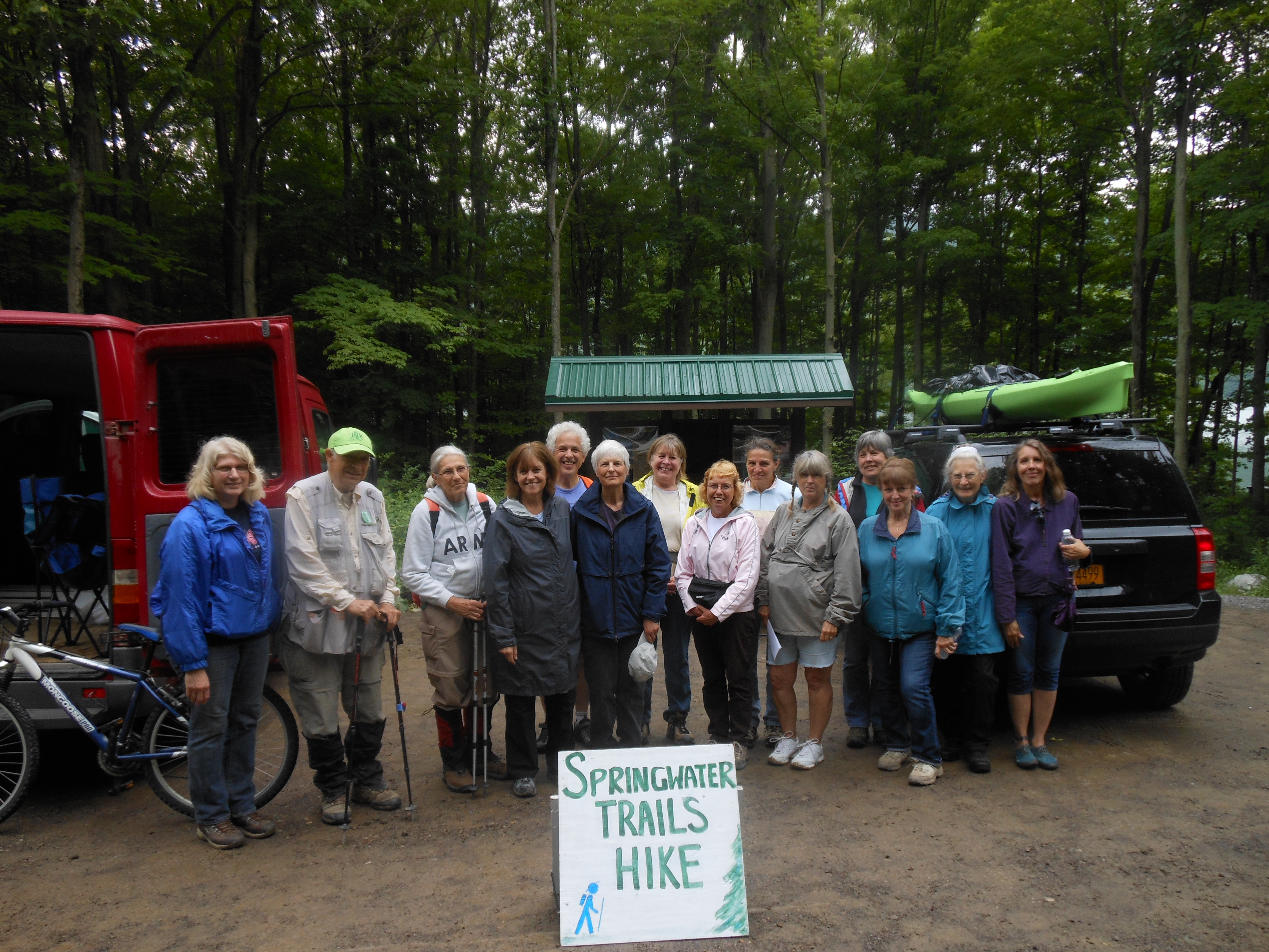
Hikes led by Springwater Trails are generally held on Sunday afternoons and appear in this calendar in green.
| Sun | Mon | Tue | Wed | Thu | Fri | Sat |
|---|---|---|---|---|---|---|
| Ontario Pathways – Seven hikes on seven Tuesdays 10:00 am Ontario Pathways – Seven hikes on seven Tuesdays Jun 2 @ 10:00 am – 12:00 pm Meet at the designated locations by 10:00am. May 12th. Meet at Gifford Rd. Hike to Wayne county line and back (3.6mi) May 19th. Meet at Rt 96 trail head. Hike Rt 96 to Wheat Rd (3.8mi) May 26th. Meet at … Continue reading | Ontario Pathways – Seven Saturday Hikes, one each month 9:30 am Ontario Pathways – Seven Saturday Hikes, one each month Jun 6 @ 9:30 am – 11:00 am Meet at the designated locations by 9:30. April 25th. Meet at the New Covenant Baptist Church Parking lot on County Road 46. Hike Main St to CR 46. (3mi) May 9th. Meet at the New Covenant Baptist Church Parking lot … Continue reading | |||||
| Springwater Trail Maintenance, Sugarbush Hollow 4:00 pm Springwater Trail Maintenance, Sugarbush Hollow @ Pardee Hollow Rd. Jun 7 @ 4:00 pm – 6:00 pm  Lets try again! But rain is predicted so check here on Sunday Every year, our organization devotes a few of our Sundays to keeping the trails we love to hike on, in good hiking condition. This Sunday, we’re going to … Continue reading | Ontario Pathways – Seven hikes on seven Tuesdays 10:00 am Ontario Pathways – Seven hikes on seven Tuesdays @ depot rd and Ontario Pathways Jun 9 @ 10:00 am – 12:00 pm Meet at the designated locations by 10:00am. June 9th. Meet at Depot Road. Hike Stanley Junction back to Depot Rd (3.8mi) You can download a PDF with more information. | ADK Outdoor Expo 2015 for outdoor enthusiasts 10:00 am ADK Outdoor Expo 2015 for outdoor enthusiasts @ Beach area of Hundred Acre Pond Jun 13 @ 10:00 am – 4:00 pm A quintessential experiencing, learning, and networking opportunity with all kinds of outdoor activity possibilities is the 18th Annual ADK Outdoor Expo to be held at Mendon Ponds Park at the beach area on Saturday, June 13, 2015 (for set-up 9:00AM) … Continue reading | ||||
| Canceled: Indian Fort Trails 4:00 pm Canceled: Indian Fort Trails @ Indian Fort Nature Preserve Jun 14 @ 4:00 pm – 6:00 pm 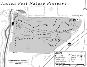 Canceled: At 2:20, the forecast has gotten more definite for thunderstorms. So we have canceled the hike for today. Please join us next Sunday. Notice: As of 1:30 Sunday, wunderground predicts 80% chance of thunderstorms in Geneseo. Although we aren’t … Continue reading | Ontario Pathways – Seven hikes on seven Tuesdays 10:00 am Ontario Pathways – Seven hikes on seven Tuesdays Jun 16 @ 10:00 am – 12:00 pm Meet at the designated locations by 10:00am. May 12th. Meet at Gifford Rd. Hike to Wayne county line and back (3.6mi) May 19th. Meet at Rt 96 trail head. Hike Rt 96 to Wheat Rd (3.8mi) May 26th. Meet at … Continue reading | Celebrate the Hemlock-Canadice State Forest Finalized UMP 5:30 pm Celebrate the Hemlock-Canadice State Forest Finalized UMP @ Hemlock Lake Park Pavilion Jun 18 @ 5:30 pm – 8:00 pm Pot-Luck Dinner Bring a dish to pass and your table service. Non-alcoholic beverages will be provided. The Little Lakes Sustainability Network (LLSN) and Frack Free Genesee invite you to join us in celebrating the citizen advocacy that has preserved this precious natural … Continue reading | ||||
| Third Annual Canadice Lake Tri-modal 4:00 pm Third Annual Canadice Lake Tri-modal @ Canoe Launch, Canadice Lake Jun 21 @ 4:00 pm – 6:00 pm  Note: Local flood conditions at the time of this post may have an effect on road and trail conditions. As of 6/18 Canadice Lake Road is open but the Canadice Lake Trail is questionable and will be confirmed on Friday. … Continue reading | Ontario Pathways – Seven hikes on seven Tuesdays 10:00 am Ontario Pathways – Seven hikes on seven Tuesdays Jun 23 @ 10:00 am – 12:00 pm Meet at the designated locations by 10:00am. May 12th. Meet at Gifford Rd. Hike to Wayne county line and back (3.6mi) May 19th. Meet at Rt 96 trail head. Hike Rt 96 to Wheat Rd (3.8mi) May 26th. Meet at … Continue reading | |||||
| Trail Maintenance 4:00 pm Trail Maintenance @ parking areas off Wheaton Hill Rd. Jun 28 @ 4:00 pm – 6:00 pm 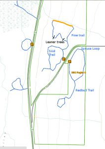 Update: At 1:00, it still isn’t raining, and light rain is still an hour away. Come join us for a hike in the rain on the Wheaton Hill trails. Put your tools in the car and wear water proof boots (almost … Continue reading |
Canceled: At 2:20, the forecast has gotten more definite for thunderstorms. So we have canceled the hike for today. Please join us next Sunday.
Notice: As of 1:30 Sunday, wunderground predicts 80% chance of thunderstorms in Geneseo. Although we aren’t cancelling the hike until we see the weather at 4:00, please know that we will cancel if there is lightning at 4:00 and we will abort if the lightning starts during the hike. Pati has also scoped out a couple of shelters for the social if it raining at the end of the hike. Hope to see you at four
A year ago last March our group enjoyed this hike despite the cold and muddy conditions. The weather predictions for this Sunday look sunny and warm. With the rain this week expect some mud, but for the most part a pleasant hike and great company. We will meet at 4:00 at the Preserve Kiosk on Jones Bridge Rd and Rt63.
History of the area
Indian Fort Nature Preserve (42.766,-77.8295) is managed and maintained by Genesee Valley Conservancy. It is known as “Indian Fort” because of the two palisades that once stood on the site. Two mounds are still visible where the wooden posts created a fenced enclosure between the two main gullies. These palisades date back to 1400 – 1500 A.D. The former Iroquois palisades prompted the area to be listed on the National Register of Historic Places in 1974. Because of the diverse botanical, cultural and geological features, the preserve has been designated a Research Reserve by the conservancy.
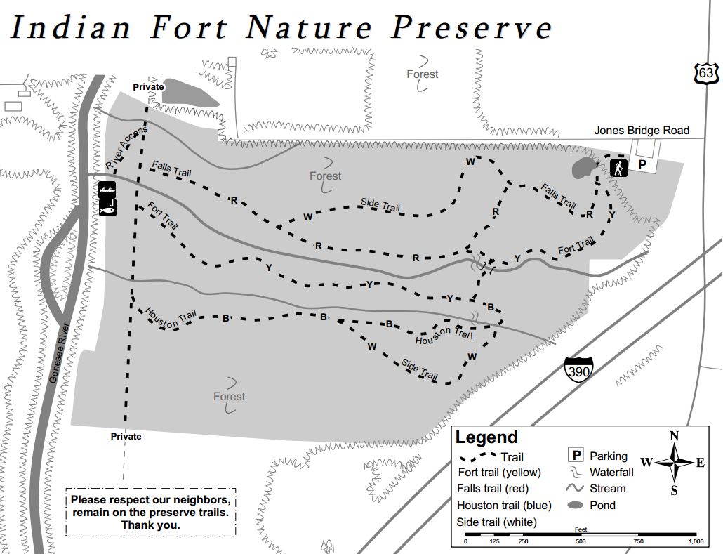
Upper falls
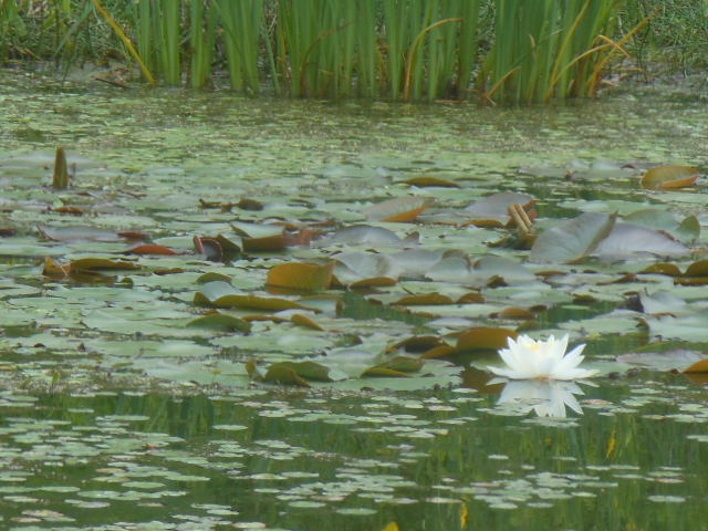
The property consists of sixty acres with gullies, creeks, a small field, a pond, and access to the Genesee River. Trails are well marked and go from the parking area on the northeast side of the preserve through the preserve to the Genesee River. Two waterfalls can be seen from the trails.
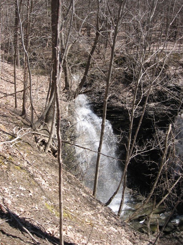
Snowfalls
Our Hikes
Climbers will not find the main trails a challenge, but they can travel up the gullies to the waterfalls and climb the steep sides of the gullies. Tourists can follow the climbers and scale the gully walls before they get too steep. naturalists will find easy hiking on trails that have slight hills and a lot of flat land.
The Social
The hike will be followed by a tailgate social in the parking lot. Bring a dish to pass and your own beverage or make a contribution to the social fund. Bring a chair is you choose to rest your bones.
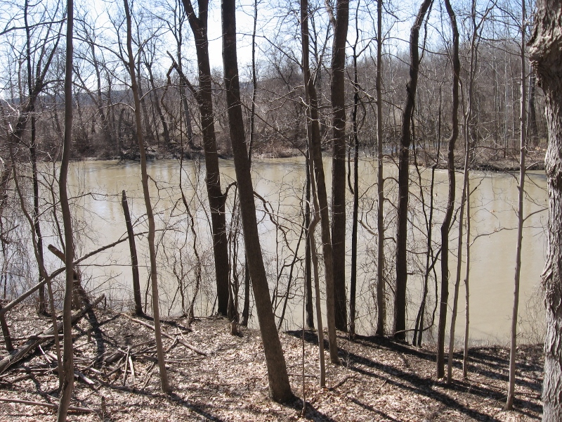
The Genesee River
Dogs are allowed on a leash or ‘controlled’ by verbal commands. Please note that some parts of the trails are in close proximity to busy route 63.
Directions
The preserve is located at 3432 Jones Bridge Road. There is no sign identifying this branch of Jones Bridge Road. Please note: Jones Bridge Road has three sections separated by the Genesee River and by I-390. The preserve is on the small section west of I-390 and east of the Genesee River.
From Springwater: There are many options from Springwater including taking I 390N from Wayland to Mt Morris (see below). The route with the fewest turns takes Rt 15 N out of Springwater for 1.5 miles. Turn left onto Liberty Pole Rd (CR 38) and follow that road for 8.1 miles (it will change names and CR numbers two times) to NY-63. Turn right and follow NY 63 for 8.3 miles (there is a right turn staying on NY 63 [Mt Morris-Geneseo Rd] after 6.4mi). The Preserve is on the left and the kiosk can be seen from the road.
From Mt. Morris exit of Rt 390: North on Rt. 408, which becomes Rt. 63. Stay on Rt. 63 for 2 miles. The Preserve is on the left and the kiosk can be seen from the road.
From Geneseo: Head south on Rt. 39/Rt. 20A. At the traffic light where Routes 20A and 39 turn to the right, continue south on Rt. 63 for 1.2 mile. The preserve is on the right and the kiosk can be seen from the road.
From Rochester: Head south on I 390 S to Exit 8. Turn right onto US 20A for 4.9 miles. Turn right onto Mt Morris Rd (20A and 39S). At the traffic light where Routes 20A and 39 turn to the right, continue south on Rt. 63 for 1.2 mile. The preserve is on the right and the kiosk can be seen from the road.
From Honeoye: Follow Rt 20A west to Geneseo. Turn right onto Mt Morris Rd (20A and 39S). At the traffic light where Routes 20A and 39 turn to the right, continue south on Rt. 63 for 1.2 mile. The preserve is on the right.
Meet at the designated locations by 10:00am.
May 12th. Meet at Gifford Rd. Hike to Wayne county line and back (3.6mi)
May 19th. Meet at Rt 96 trail head. Hike Rt 96 to Wheat Rd (3.8mi)
May 26th. Meet at the Orleans water tower. Hike Orleans to Boces (4.5mi)
June 2nd. Meet at BOCES parking lot. Hike Boces to Stanley Junction (3.5mi)
June 9th. Meet at Depot Road. Hike Stanley Junction back to Depot Rd (3.8mi)
June 16th. Meet at the New Covenant Baptist Church Parking lot on County Road 46. Hike Depot Road back to CR 46. (5mi)
June 23rd. Meet at the Ontario Street parking lot. Hike County Road 46 back to Main St. (3mi)
You can download a PDF with more information.
Pot-Luck Dinner
Bring a dish to pass and your table service. Non-alcoholic beverages will be provided.
The Little Lakes Sustainability Network (LLSN) and Frack Free Genesee invite you to join us in celebrating the citizen advocacy that has preserved this precious natural resource in our own backyard. Learn how each of us can move clean energy forward through Josh Fox’s Solutions Grassroots organization. Families are welcome and bring your friends!
This event will be in lieu of the monthly meeting of the LLSN !
Other events that LLSN has committed to attending are:
July 10 – 12: Geneseo Summer Festival (downtown during Air Show)
August 8: Avon Corn Festival
Note: Local flood conditions at the time of this post may have an effect on road and trail conditions. As of 6/18 Canadice Lake Road is open but the Canadice Lake Trail is questionable and will be confirmed on Friday.
Check your time: To keep everyone on schedule, Kayakers and Bikers are asked to arrive by 3:30 to ensure all equipment is ready by the 4:00 start time!
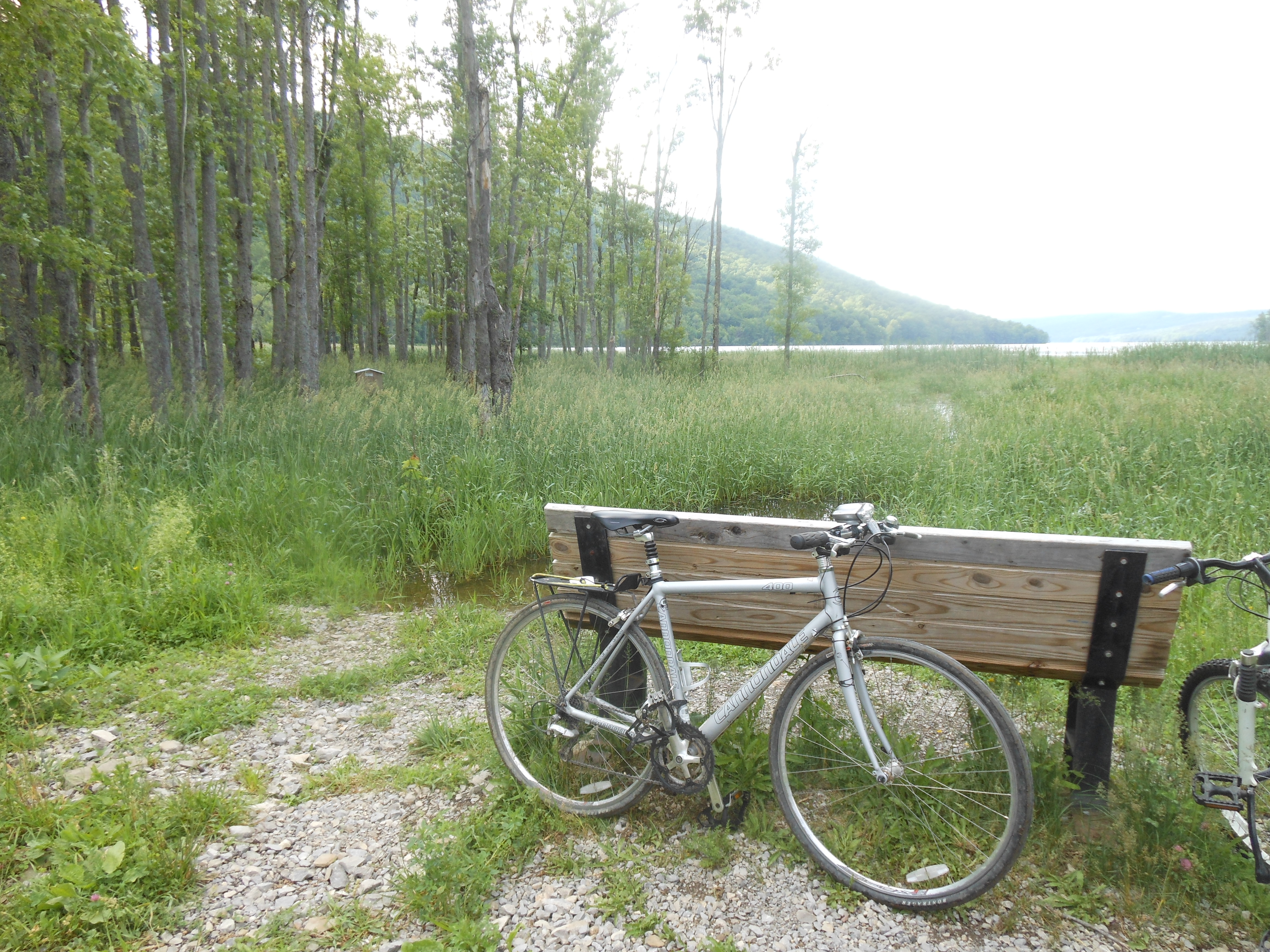
Biking
It’s that special time of year again – the Summer Solstice – Father’s Day – the Annual Canadice Lake Tri-modal! One unique “little finger lake”, Canadice Lake, offers at least 3 recreational opportunities for Springwater Trails to spend a day with their fathers, sons, grandsons, or anyone that has been special in their lives. We will bike, kayak/canoe, or hike around Canadice Lake, share memories with loved ones, and enjoy the Hemlock/Canadice State Forest and City of Rochester Water Reservoir.
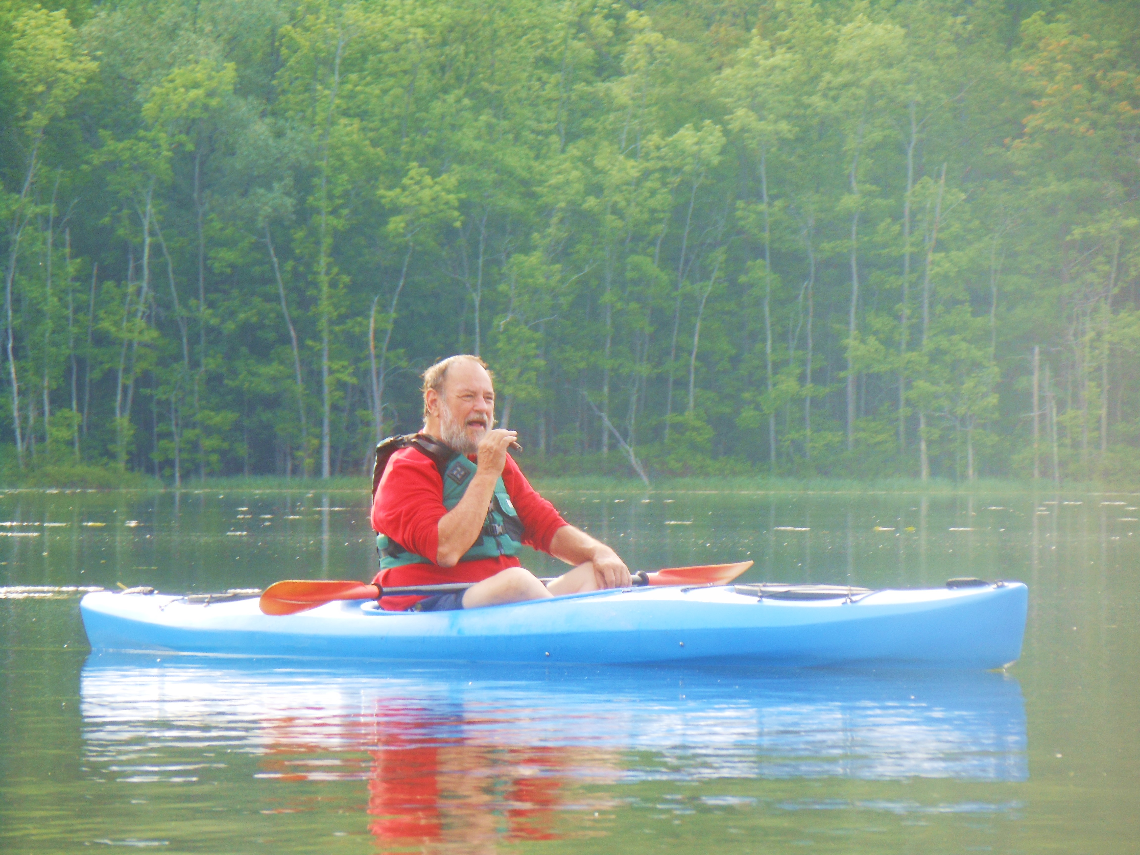
Kayak
We will meet at the kayak/canoe launch on Canadice Lake Road about a mile south past the state boat launch. Kayak/Canoe/Bikers please arrive at 3:30 as it takes some time to unload, outfit, and be ready for take off at 4:00. Hikers please arrive at 3:45. Times are important as not to congest the launch area.
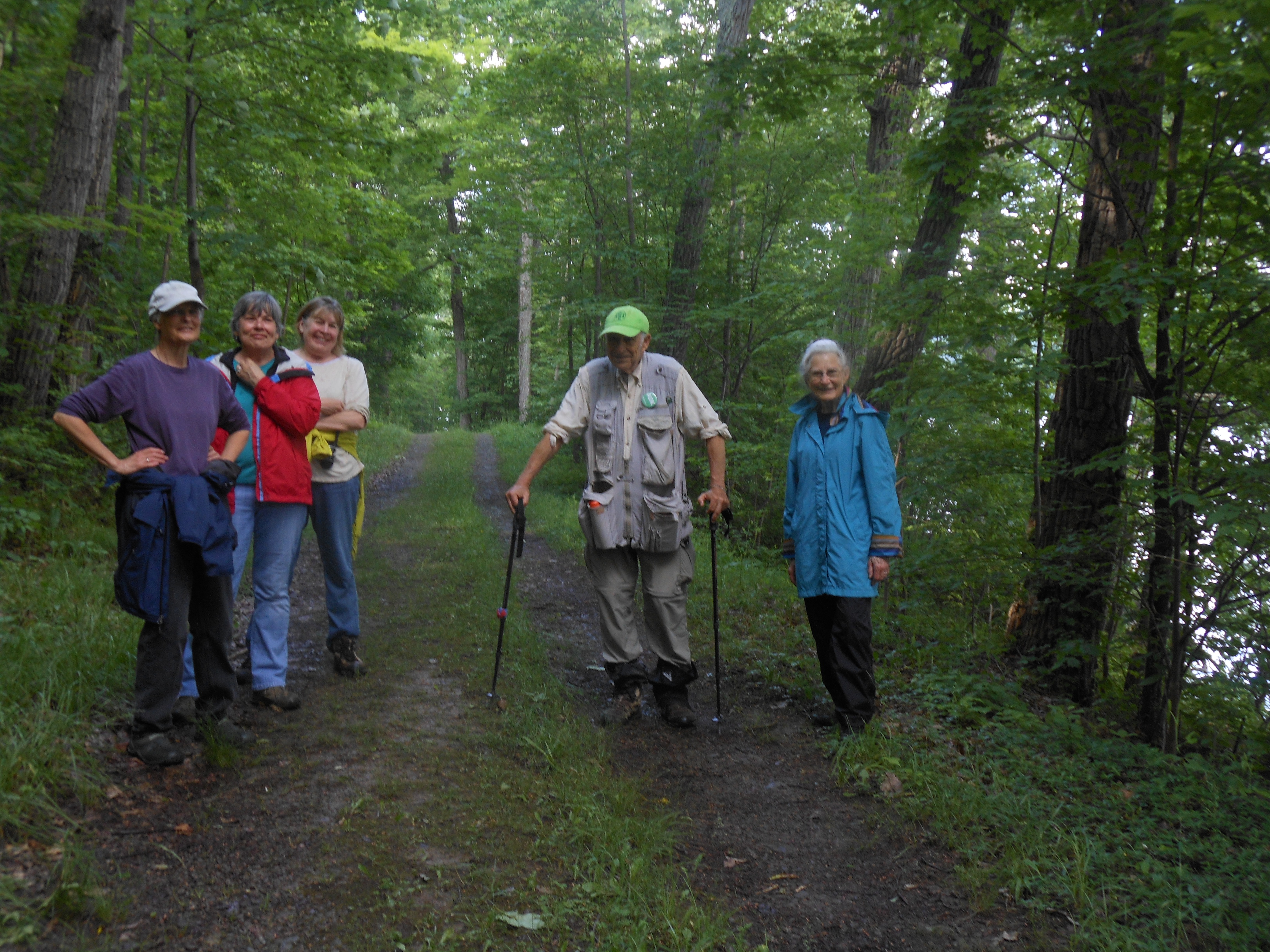
Hike
If you wish to do all three activities, which some have done in the past, you may note that the time span may extend past 2 hours. Biking first for 8 miles to the north on Canadice Lake Road, then Purcell Rd to the North Trail, ride the north trail 4 miles to the south entrance, then walk with your bike to the kayak launch, launch your kayak which has been waiting patiently. Those that complete all 3 events will be presented with a gift from Canadice Kitchens.
canadice lake.
If you wish to do one of the activities, this is the plan. Hikers will walk the road from the kayak launch to the south trail, walk a distance to their ability, and return. Bikers will ride around Canadice Lake, maybe taken a few side roads or stone hills to explore if they wish, or extend their trip down Canadice Lake Road to the north or south.
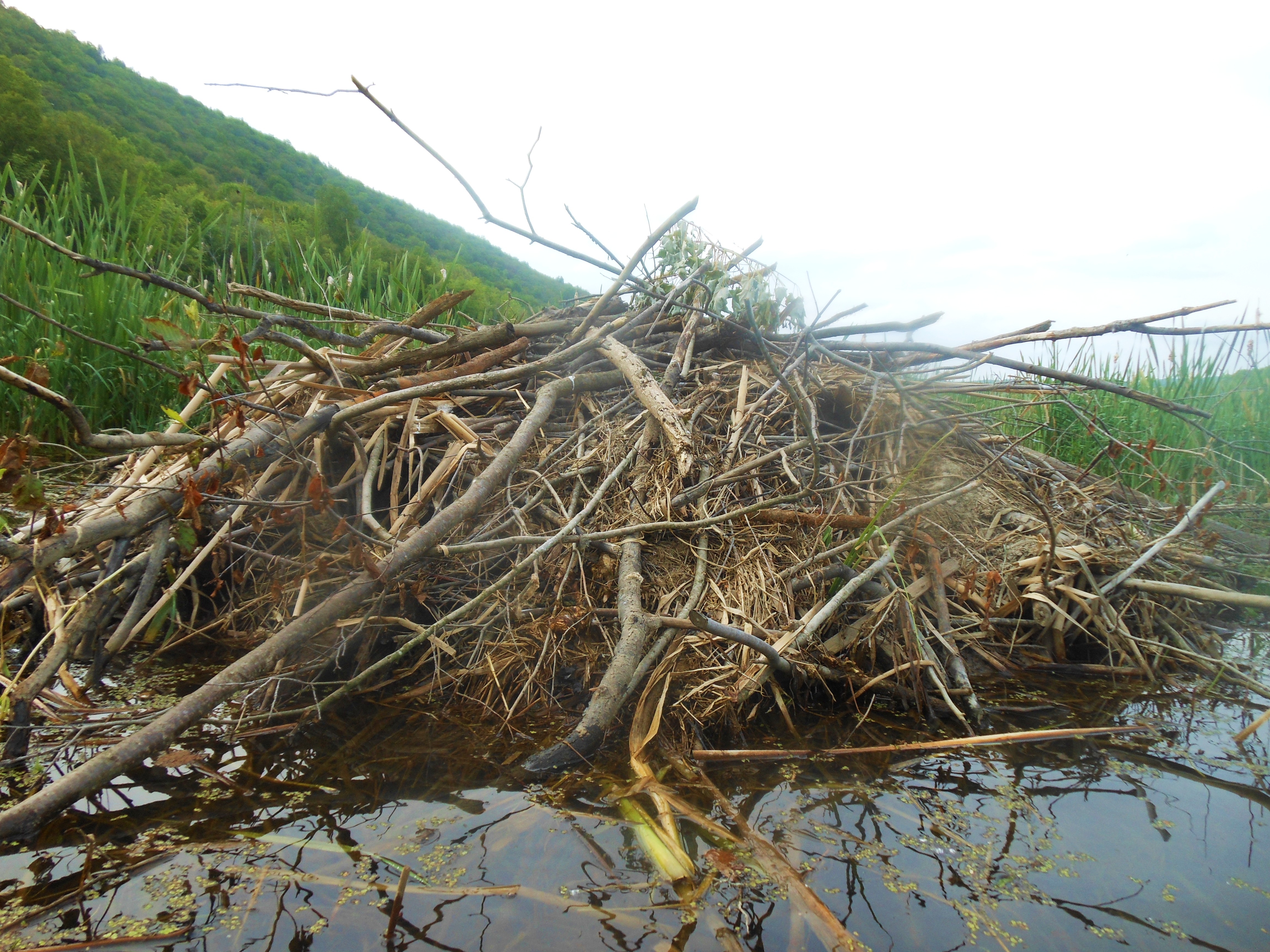
beaver lodge
Kayaks will venture from the launch south, exploring the wetland area, south west side of Canadice Lake, noting the birds and animals that live in the wetland area. Of course weather conditions will be watched at all times and changes may be made. If you want to rent a kayak or canoe you can contact Canadice Lake Outfitters 669-9512. They will deliver to the launch.
Join us again!
A tailgate will be held after the event at the kayak launch. Bring a dish to pass and your drink of choice. Possibly some Summer Solstice activities will be celebrated. Social will be moved to Pam’s if rain dampens our activities.
canadice lake
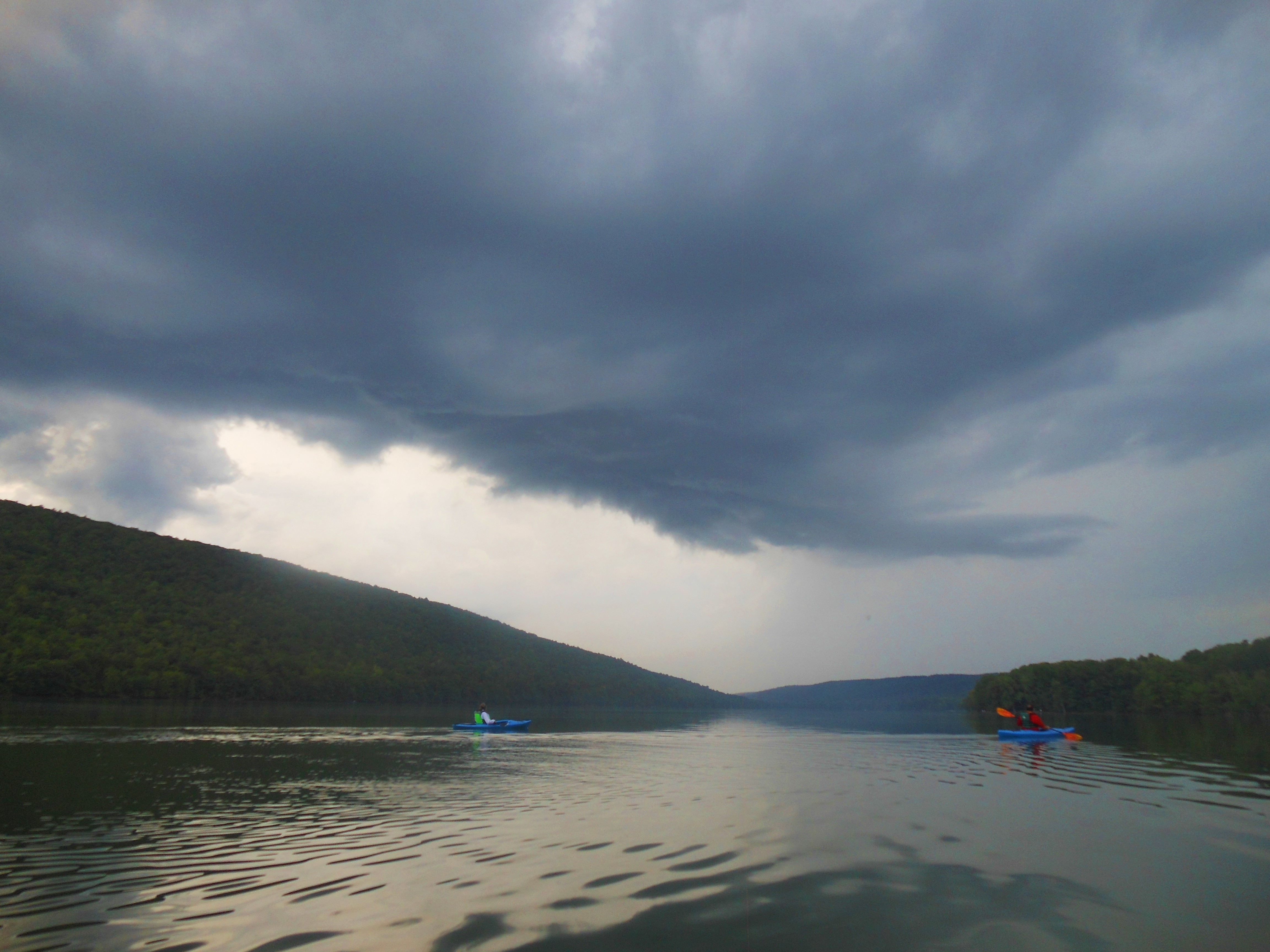
view of Canadice Lake looking north
Meet at the designated locations by 10:00am.
May 12th. Meet at Gifford Rd. Hike to Wayne county line and back (3.6mi)
May 19th. Meet at Rt 96 trail head. Hike Rt 96 to Wheat Rd (3.8mi)
May 26th. Meet at the Orleans water tower. Hike Orleans to Boces (4.5mi)
June 2nd. Meet at BOCES parking lot. Hike Boces to Stanley Junction (3.5mi)
June 9th. Meet at Depot Road. Hike Stanley Junction back to Depot Rd (3.8mi)
June 16th. Meet at the New Covenant Baptist Church Parking lot on County Road 46. Hike Depot Road back to CR 46. (5mi)
June 23rd. Meet at the Ontario Street parking lot. Hike County Road 46 back to Main St. (3mi)
You can download a PDF with more information.
 Update: At 1:00, it still isn’t raining, and light rain is still an hour away. Come join us for a hike in the rain on the Wheaton Hill trails. Put your tools in the car and wear water proof boots (almost an inch of rain yesterday is sure to be visible today) and a rain jacket. We will clip and hike the trails and look at some waterfalls. Linda and Melissa are bringing tacos and desert.
This Sunday, following the splendid job you did on the east portion of the trail at Sugarbush Hollow, earlier this month, we will go to the central portion of our trail on both sides of Wheaton Hill Rd. Please come and take a hike around the four Wheaton Hill loops and help make the trails sparkle for visitors to Springwater.
Following our hard work, stay for a picnic social at the trail head. The social is hosted by Springwater Trails, Inc. We will provide hot dogs and burgers grilled on a charcoal grill and salads. You may want to bring something to drink.
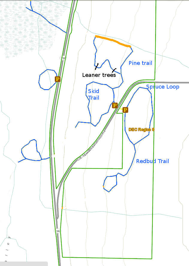
There is probably a need to mow the trails. Last time we were here, Rick brought a tractor mower and cleaned up the parking area and the Spruce Loop trail on the north east side of Wheaton Hill Rd. as well as the Redbud Trail (south west of the road). The Pine Trail on the north west side is not passable for the tractor. If anyone has a smaller mower with a high blade able to avoid small rocks on the trail, please contact Rick as soon as possible. The mower needs to be able to mow grass and small roses and other prickers. And you need to be able to get it across a small gully across the trail (walls about 2 feet high). Or, if you can, bring a string weedwacker to help mow. (If you plan to mow or weedwack, long pants and other protection from poison ivy is highly recommended).
There may be logs across the trails. A small bow saw might be helpful. Clippers for the roses will be useful on all of the trails. Although we did a great job on cutting them back last year, these invasive rascals keep growing back, requiring constant pruning to keep them from closing the trails. Clip as close to the ground as you can. You may find some that need trimming before the trail entrance. Clippers and gloves are very important for this work. If you always keep the bush away from your arms and legs, you can avoid scratches, and more important, poison ivy which seems to like the roses. Plan to wash your gloves and any other clothes that may have touched the poison ivy. Full length pants offer more protection from poison ivy and ticks, than shorts, and it’s easier to spot dark ticks on light colored pants.
There are a few raspberry bushes by the Spruce Trail entrance and some of them may be ripe. You’ll notice lots of blackberry bushes on this trail, which you can come back in a month and pick. Regretfully, I won’t be able to join you on this venture. We’ll be in Maine, checking on the lobsters.
Directions: Wheaton Hill is the first right turn north of the intersection of Rt 15 and Rt 15A in Springwater (0.9 mile north of the intersection). The trail head is 0.5 miles up Wheaton Hill just before the road turns straight east and heads up the main hill. More details are on the directions page.
What to bring:
- If you have a trail mower, contact our Trail Master before Sunday.
- Gloves and clippers – hand clippers or long handled loppers if you want to attack a large rose bush.
- Small bow saw.
- Plastic grocery bag in case you find any litter.
- Water to keep hydrated.
 We will hike the North tract and meet at the parking lot on SR64 1.4 miles North of the Bristol Mountain Ski area entrance, or 0.6 mile North of Lock Stock and Barrel. If coming from the North it’s a little over three miles south of the Bristol town center at the intersection of SR64 and CR32. It’s easy to see, look for the DEC sign on the East side of the road. The parking lot is adequate but not overly large so park with that in mind. There is a Stid Hill South parking lot near the intersection with CR34 which is not where we will be, so don’t go there.
Victor Hiking Trails (VHT) will be leading a hike at Robert H Treman Park, near the Ithaca area, on Saturday July 11th, 2015. This hike is part of the monthly guided hike series of VHT. (***** Please note!! – accept apologies for any inconvenience if you saw this hike initially listed as Fri 7/10/2015, there had been a planned campout for Friday with the hike on Saturday, but the campout had to be cancelled. The hike for Saturday is still ON.******)
Carpool will form behind Victor Town Hall, located at 60 East Main Street in Victor,NY (GPS = 42.9821448,-77.4087837 ), with intended leave time of 8:00AM on SATURDAY July 11th, 2015.
This hike locale of Robert H Treman Park is one that would be a bit far for Springwater Trails (S/T) to put on the S/T hiking schedule. So if you wanna enjoy this park in the summertime with a group of hikers similar minded to the S/T hiking group, this hike may be for you. Many waterfalls in Enfield Glen are a highlight of this park
Time guesstimates: Carpool at Victor 8:00AM ; At Robert H Treman Park ~ 10:00AM ; Hike ~3-4 hours ; Back in Victor at Town Hall ~4:30PM.
For further details/updates about this hike, check the VHT website. If you wish to meet the VHT group at Robert H Treman Park (rather than carpooling from Victor), you will need to coordinate a meet locale thru VHT hike leaders.
7/9/2015 update: Thoughts for your hiking comfort in shifting gears from our recent rainy grey skies to Saturdays predicted warmth and high sunshine angles. Checklist: Hat with a visor or brim that will stay on in windy conditions, and not end up in the glen. Sunglasses to cut reflection off the water and from overhead sunrays, again that will stay on. Light highly breathable clothing for sun reflection to prevent sunburn. Sunscreen on uncovered areas including you face.
 The following event is planned by the Genesee Valley Conservency.
Bring your own craft and enjoy the beautiful waters of the Genesee River.
Drop your craft in Mount Morris (behind Park Inn Liquor/Genesee Valley Resturant) (someone will keep an eye on your gear as you go to park), then proceed to the Indian Fort Nature Preserve to park your vehicle (this will be the ending point of the float). Transports will bring you back to Mt. Morris to start the float.
Meetup and parking will begin at 9am and we’ll get started on the water at 10am.
We’ll make a stop and provide some snacks, feel free to pack a lunch if you like!
*There is no cost, but you will be asked to sign-in and complete a waiver at the event.
*Event supported by Steuben Trust Company
update 7/9/2015: Thoughts for your paddling comfort in shifting gears from our recent rainy grey skies to Saturdays predicted warmth and high sunshine angles. Checklist: Hat with a visor or brim that will stay on in windy conditions, and not end up in the river. Sunglasses to cut reflection off the water and from overhead sunrays, again that will stay on, perhaps with a floating lanyard. Light highly breathable clothing for sun reflection to prevent sunburn. Sunscreen on uncovered areas including you face.
Looking for brochure.or mailing list so I can receive it in the mail.
Nothing opens up for mailing list.
There’s all kinds of very bizarre ads and post for viagra and other drugs above on calender page.
Please let me know if there’s a brochure available