
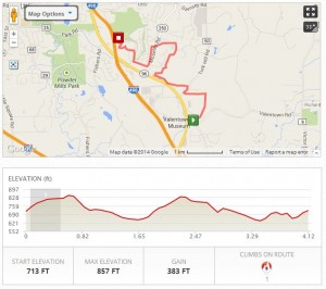
Click on the map for an interactive version of the hike route.
On Sunday, April 13, 2014, the Crescent Trail Association is celebrating the connection of the Victor Hiking Trails and the Crescent Trail. The trail connection on Lasalle Pkwy joins the 35 miles of pathways in the Crescent Trail system, to the 37 miles within the town of Victor.
This will be a one-way hike. Meet in the small parking area along the dead-end street on the north side of Victor’s large wooden-sided Valentown museum building (southeast of Eastview Mall). Hike on hilly trails, starting on a new section of Victor’s Seneca Trail, connecting with Perinton’s Crescent Trail at LaSalle Parkway. The hike continues on the Crescent Trail to the Woodcliff Hotel and Spa. Shuttle transportation will be provided to transport hikers from Woodcliff back to Valentown.

The view from Woodcliff at the end of the hike.
Hikers from Springwater should meet at the Springwater Town Hall at 11:50 to carpool to Victor. Please email Gene at [email protected] if you are planning to go to this hike. Gene will plan the staging of cars for this one-way hike.
Directions
From Springwater Town Hall: Head north on Rt 15 to 15A at the light. Bear right onto Wheaton Hill Rd (CR 16). Take the first left onto Canadice Rd. (CR 42). Bear right to stay on CR 42 which becomes CR 37 in Ontario County. Follow CR 37 to Canadice Hill Rd. Turn left to stay on CR 37 through West Bloomfield and Rt 65 North. Continue straight on CR 35, when Rt 65 curves to the left. Stay on this road (W Bloomfield Rd) for 5.8 miles. Turn right onto Rush Mendon Rd (NY 251 E). 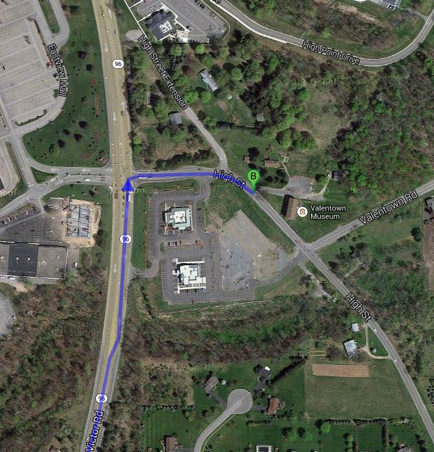 Follow NY 251 for 3.4 miles. Turn left onto Phillips Rd (NY 251 curves to the right at this intersection). Notice the Lehigh Valley Trail and the Auburn Trails which cross Phillips Rd. You may have already seen the Lehigh Valley Trail crossing NY251 and W Bloomfield Rd on its way to Rush, the Genesee River and the Greenway. At the light, turn right onto Main St Fishers (CR 42). Turn left onto Rt 96N to go under the thruway, then over 490. At 1.2 miles, turn right onto High St. The parking lot behind Valentown is the second left off of High St (0.1 miles).
[For those of you who read this post Tuesday morning, my sincere thanks to Don for pointing out that trails are measured in miles and that, if fact, there are no nukes in Victor! And if you are wondering, try typing miles with your right hand resting above the HJKL keys rather the the JKL; keys.]