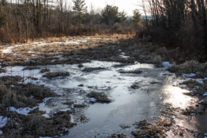
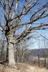
 The hike on Sunday 26th May2019 will follow a section of the Bristol Hills Branch of the Finger Lakes Trail in Naples. Springwater Trails has signed up to maintain this section of the Finger Lakes Trail. This section passes through the West Hill Preserve off Seman Rd and then across private land to Mt Pleasant St. in Naples.
We will walk this stretch of the BHB and cut away and brush and weeds that have overgrown the trail. The most useful tools for this are lopers and a small saw, and a weed whacker or two for the long grass; be sure to wear good work or gardening gloves. It’s a fairly long hike; if there’s a lot of grass to be cleared (this is usually at the two ends of the trail) then we’ll either leave teams there with weed whackers to concentrate on that or come back another day to finish the job.

We will meet at the entrance to the West Hill Preserve on Seman Road (42.66166, -77.396288). We will shuttle some cars down to the hike end in Naples (42.625950, -77.397304) before we start. The climbers will follow the trail down to the old cemetery in Naples. Naturalists follow the trail to the sign in box and then return to the cars on Seman Road.
Please note: Dogs are not allowed to hike on the Nature Conservancy property.
The Social
Following the hike, please join us for a social at the Neapolitan Pizzeria at 120 N. Main Street in Naples. If the weather is fine we can take a table on the porch.
Directions to the Hike Meeting Point:
From Springwater: Head south on NY 15 (for 5.2mi). At the light in Wayland turn left on NY 21N (for 6.7mi). In N Cohocton, turn left to stay on NY 21N (for 4.5mi). In Naples, turn left again to stay on NY 21N (for 1.8mi). On the north side of Naples, turn left on CR12 and head up the hill for 1.9 miles. Take the first left, Rhine St., to the 4 way intersection. Go left onto Seman Rd. Trailhead is about 1/2 mile, by a big sign on the left. Park along the road.
From Honeoye: Head south on CR 36 on the west side of Honeoye Lake (for 13.6 miles from NY 20A). Turn left onto Gulick Rd (for 2 mi), then right on Davis Rd (for 0.7mi). At the end of Davis, turn left on W Hollow Rd (CR 33) for 0.5mi, then right on Seman Rd. The Trailhead is about 1 mile, by a big sign on the right. Park along the road.
