Add to Calendar
When:
December 22, 2024 @ 2:00 pm – 4:00 pm
2024-12-22T14:00:00-05:00
2024-12-22T16:00:00-05:00
WEATHER UPDATE: Good cross country ski conditions, bundle up for cold temperatures!
The trail has about 3″ of snow in both directions, so bring your cross country skis if you’d like to try skiing the trail. On Saturday the snow was fluffy and skiable on top, though wet enough to stick to the underside of the skis in certain sections. With the overnight cold, the ground should be more frozen and snow conditions should be even better on Sunday. We suggest bringing a variety of equipment types to test out what works best for you. Conditions are also fine for walking in regular hiking boots.
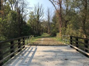
This Sunday, for a leisurely break from the holiday scene, we will hike sections of the Middlesex Valley Rail Trail, passing through the lowlands of the Hi Tor Wildlife Management Area between Route 245 and Route 21, just north of Naples. The Middlesex Valley Railroad began service in 1892 between Naples and Stanley, with connections to Geneva, Canandaigua and Wayne County. In 1895 it became part of the Lehigh Valley Railroad system, and continued in service until 1970. Now the 7-mile rail trail is a raised path with wetlands on either side – some shrubby and some forested. The section between Parrish Road and Naples has been closed to hikers in recent years, but DEC has now completed the necessary Naples Creek bridge repairs to reopen this section, so this will offer a new experience for most SWT hikers.

We will meet at 1:45 PM at the parking area on the north side of Parrish Road, which runs across the valley from Route 21 (near Monica’s Pies) to Route 245 (near the base of Conklin Gully). From there hikers will choose between the 2.25 round trip south toward Naples or the 4.25 round trip north toward the West River Boat Launch and Sunnyside, or go as far as you like at your own speed and turn around when ready. In both directions the trail is level, mowed and mostly well drained – an easy hike, no poles required unless you always use them. Expect some muddy conditions, so waterproof footwear is a must. Wear layers, and plan to walk as fast as you need to keep warm.

Social: Following the hike, please join us for an optional social at Brew and Brats at Arbor Hill, 6461 State Route 64, about 5 miles to the north of the hike start along Route 21 (bear left when Route 64 splits off from 21). Menu includes craft beer and other beverages, brats and other pub food: see https://brewandbrats.com/wp-content/uploads/2024/10/BNB-Winter-2425-MENU.pdf Note that Brew and Brats closes at 5 on Sundays.
Directions to the Hike Meeting Point:
From Springwater/Dansville/Wayland: Take Rt 21N into Naples. Turn left onto Main St for 1.5 miles. Turn right on Rt#245 (across from Bob and Ruth’s). Continue 1.5 miles, make a left on Parrish Rd. Parking area is on the right, in about .2 miles.
From Honeoye: Take Rt#36 south into Naples, left on Main St for approximately 1.25 miles. Right on Rt#245 (Across from Bob and Ruth’s). Continue 1.5 miles then left on Parrish Rd. Parking area is on the right, in about .2 miles.From Canandaigua: Take Rt#21S to Woodville. Keep straight toward Naples. Turn left on Parrish Road about 1.5 miles past Woodville, just after you pass Monica’s Pies. The parking area will be on your left, in about .5 miles.

Thanks for the update on skiing. Linda and I are bringing skis and will try it out. If they don’t work, we will come back to the car and switch to hiking.