
Hikes led by Springwater Trails are generally held on Sunday afternoons and appear in this calendar in green.
| Sun | Mon | Tue | Wed | Thu | Fri | Sat |
|---|---|---|---|---|---|---|
| Lehigh Valley Trail Hike or Bike in Rush, NY 2:00 pm Lehigh Valley Trail Hike or Bike in Rush, NY @ Stevens-Connor Lehigh Valley Lodge Apr 6 @ 2:00 pm – 4:00 pm Come join us for a leisurely hike or bike along the Lehigh Valley Trail on Sunday April 6th! With its flat even surface, the trail is a hidden gem for walking, hiking, jogging, biking. It is a vital link in … Continue reading | ||||||
| No Hike-Easter Break 2:00 pm No Hike-Easter Break Apr 20 @ 2:00 pm – 4:00 pm No hike has been scheduled for this date due to the Easter Holiday. Enjoy the break, spend time with loved ones and eat chocolate bunnies. This will give you something to burn off next week  | ||||||
| Mystery Hike- Richmond/Honeoye 2:00 pm Mystery Hike- Richmond/Honeoye Apr 27 @ 2:00 pm – 4:00 pm Mystery hike coming your way! Please check back for more details. |
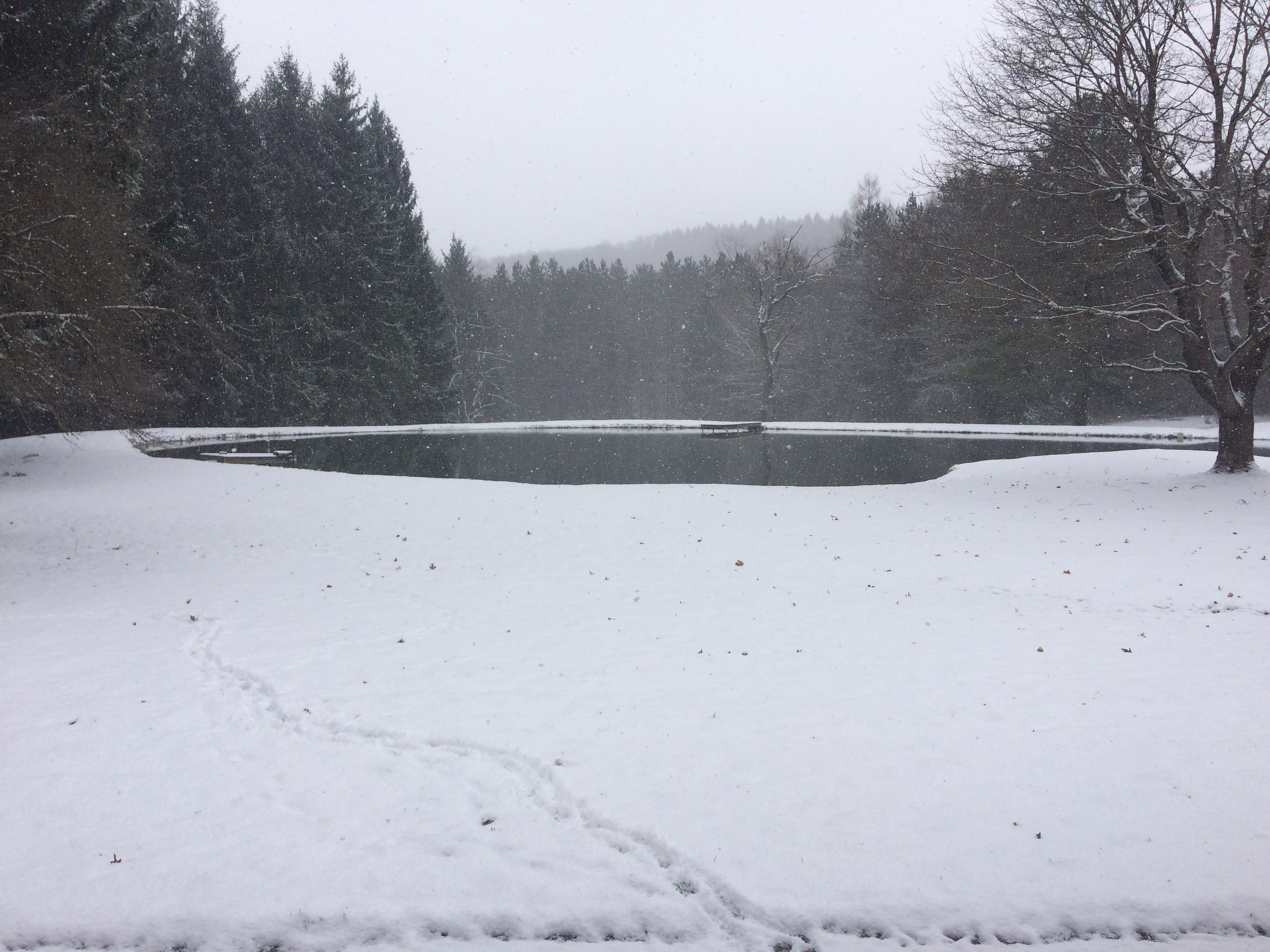
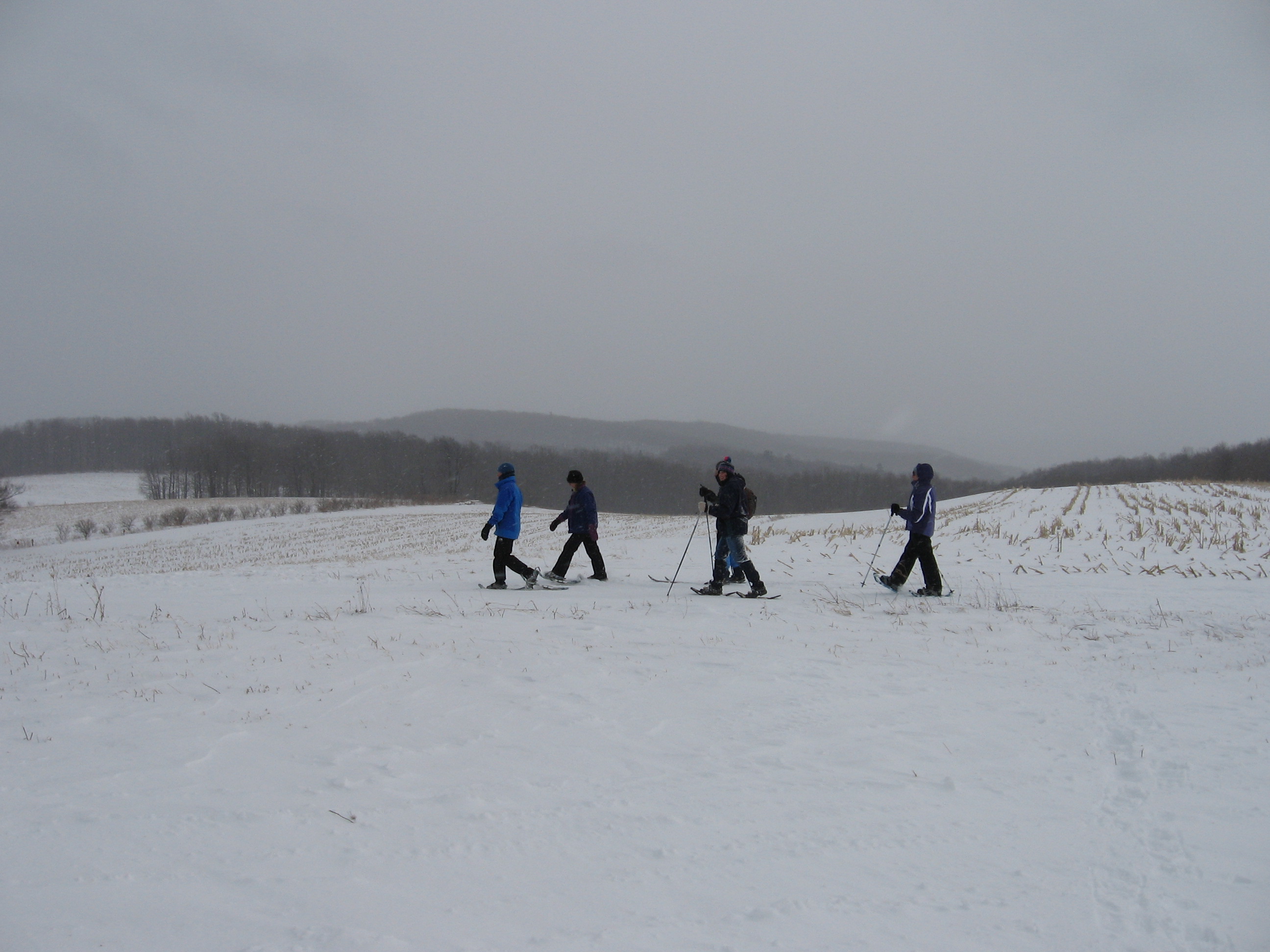
Note: Please arrive at 1:45, park along 5107 Old Bald Hill Road (near the curve), drop off a dish to pass for our social, dress for weather conditions, bring winter boots and, if desired, snowshoes.
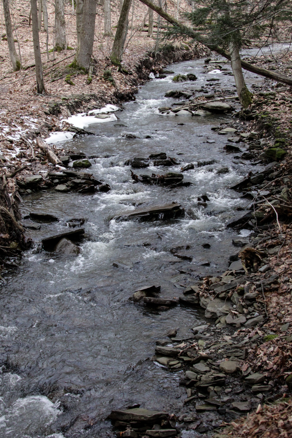
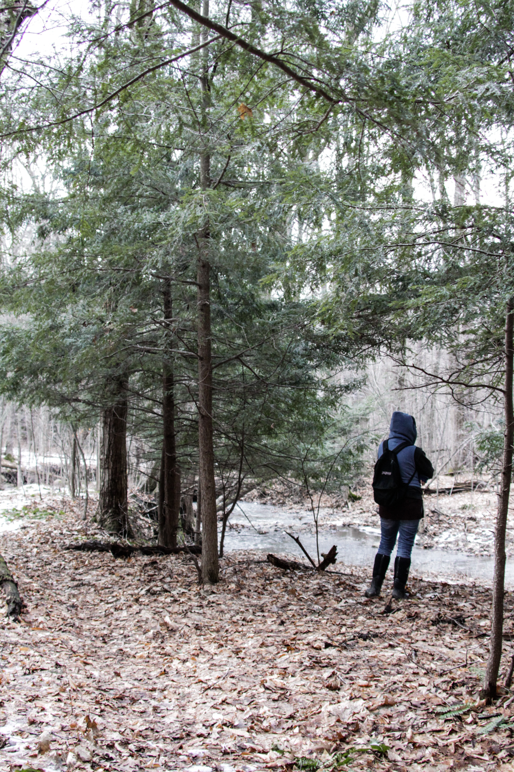
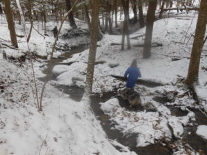 How did those footprints of a man (or woman with large feet) and a dog disappear? Where are the boundaries of the State Forest and private land? What happened in the early 1900s when all the mills disappeared from the Canadice Outlet area? All these questions will be explored as we hike from the abandoned Dixon Hollow Road through the Canadice Outlet area, ending at the Canadice Hollow Cemetery. Our adventure will take us through ravines, across creeks and tributaries, climbing and skirting ridges, bushwhacking through hardwoods and pines, and connecting with a DEC trail that will lead us to a cemetery. Only a mile-and-a-half as the crow flies will seem like four as we wind through the State Forest, taking time to enjoy the frozen creek and snow-covered trees while avoiding those nasty pricker bushes, and playing like children.
This can be a strenuous hike for many, especially if the snow is deep. Accordingly you may want to bring snowshoes, but they will have to be removed from time to time for traveling through dense areas that require bushwhacking. Once we reach the DEC trail, there will be a stretch that will accommodate snowshoes.
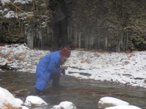
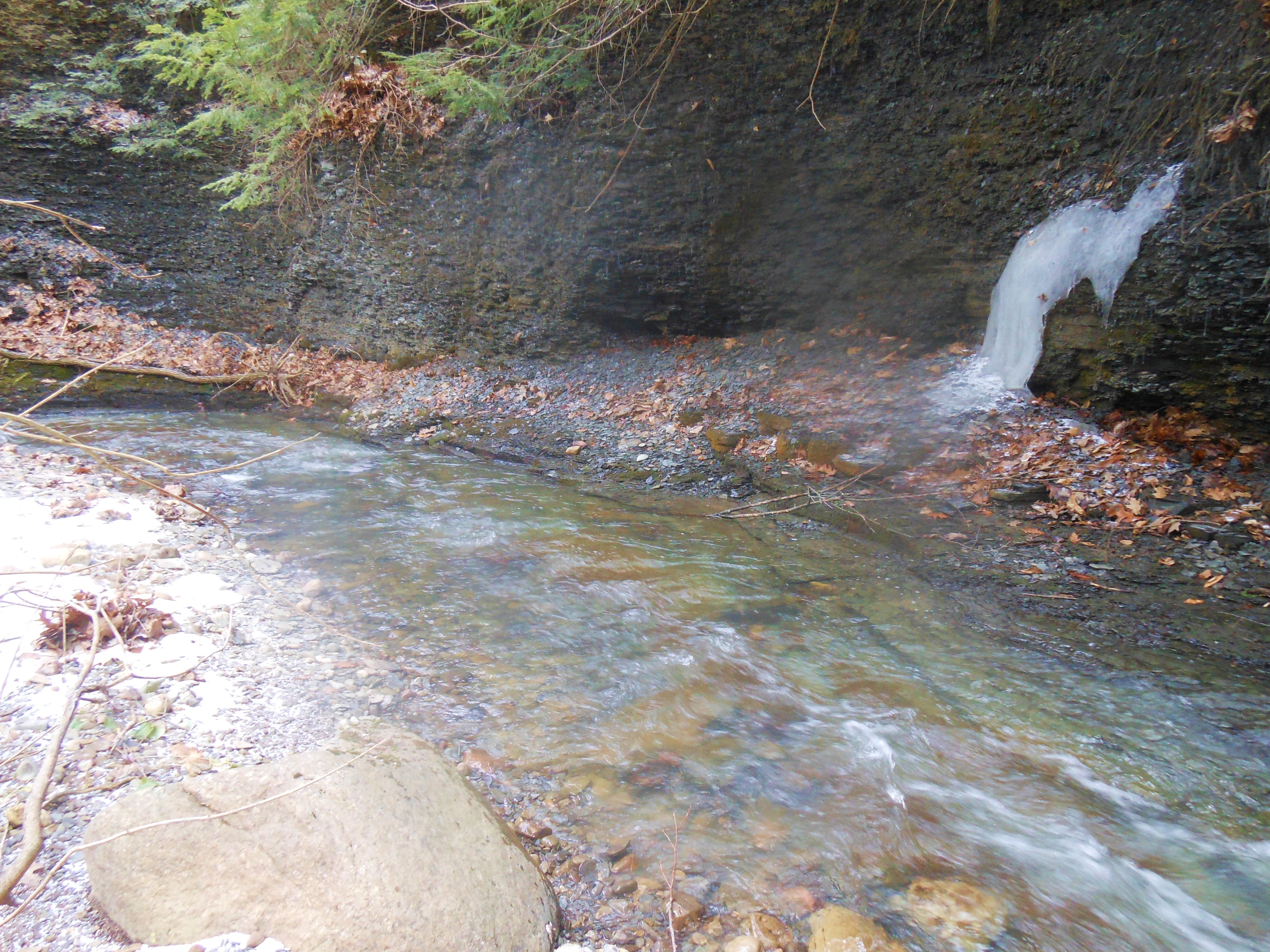
 Naturalists will follow the old abandoned Dixon Hollow Road down into the depths of the gully called the Canadice Outlet, exploring the area of the old Adam’s Mill and what I call “Superman’s Ice Castle.” Depending on the level of water in the creek, ice build-up, and sunshine, photographs can be outstanding in this area. Sometimes the creek is able to be crossed if you have waterproof boots. A small tributary dumps into the outlet adding beauty to this area. For those that would like to check out the Hemlock trees for the HWA, time will allow you to examine the health of the forest.
Tracking animal footprints is also possible since my grandson indicated he found an area where “something was living.” What animal would be eating a chunk of honeycomb right now?
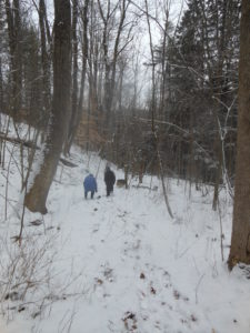
 Tourists and Climbers will follow the same beginning route, each at their own speed, crossing the tributary and climbing high above the creek. With special permission from local property owners, we will skirt the outlet area, bushwhack through hardwood forests, climb hills, and finally drop upon the DEC logging trail that leads to the cemetery. This can be an intermediate or advanced hike for many (especially one area where we will climb a very short but steep hill) and can be more difficult depending on snow depth. Cars will be located at the cemetery for the return trip.
 We will return to Old Bald Hill between 4 and 4:30 for a social, outdoor campfire, and the indoor warmth of the wood stove. Please bring a nice dish to pass, your drink of choice, and tales.
Directions: Follow these directions to the meeting place. Please arrive by 1:45 and park on the road but not directly on the curve.
current conditions at 10:00am
It looks like this Sunday will be much colder than last week at Pam’s. But come and enjoy anyway – and bring a friend.
The week we are returning to the Schribner Valley, for a hike that will show off the under-story of the forest before all the spring growth occurs. With high temperatures this week, we don’t expect much snow to be left.But the ferns were out last week and there should be more signs of life this week.
We will have two hikes this week. The Climbers will hike across the valley and the head south though mostly pine woods. After about a mile, we will head up to the top of the hill and enjoy some views across the fields. Expect some bush-whacking as we head back down and follow the stream back to the house and the social.
The Naturalists and Tourists will follow the same route for the first half of the hike, but will avoid the long climb to the high fields, instead spending a bit more time with the more accessible views.
Following the hikes, we will have a potluck social. Linda is making pulled pork. Bring a dish to pass and your own beverage or make a $5 donation to the social fund. Coffee or tea will also be available.
Directions Click here for Winter directions. Do not try to come in from Strutt St. since both Schribner and Giles are seasonal.
2:00 p.m. (Climbers: plan to arrive at 1:30 if wanting to help with a car pool to the parking lot at the north end boat launch. Please see below).
Parking Lot Sign
Join us for an early spring hike on the new section of Rob’s Trail, which meanders from Route 15A south of Hemlock, to the shores of Hemlock Lake. On the hike you will cross a new bridge across a ravine, installed since our last hike on Rob’s Trail a year ago. With all of the recent rain and snow melt the streams by the trail should be flowing like crazy! We will meet at the new parking lot for Rob’s Trail on the west side of 15A. (If there is insufficient space in this lot, use the parking lot a little way south across the road. Instead of walking on the road from there to the meeting place, you may take the connector trail which is about a quarter mile long, if desired). It is suggested that you wear sturdy hiking boots, and use a pole because of slippery leaves on steep inclines.
Climbers: you may choose to hike down to Hemlock Lake and connect to the trail leading to the north and terminus (4.8 miles) at the Hemlock Lake boat launch. This will necessitate leaving one or more cars at the parking lot before the hike. Tourists: you may hike down the trail to the shore line and return back up to the starting point (1.5 miles each way). The hike back up is fairly strenuous in some places. Naturalists: you may hike halfway down to the new bridge and back up from there.
The social following the hike will take place at Sammy’s Place, 8148 S Main Street in Springwater.
Directions: Click here for directions to the parking lot at the top of Bald Hill. To get to Sammy’s Place, head south on 15A through the Springwater Hamlet. Sammy’s is on the right across from the Fire Hall.

2:00 p.m. (Climbers: plan to arrive at 1:30 if wanting to help with a car pool to the parking lot at the bottom of Parrish Hill Road. Please see below).
Please note that the clocks go forward in the early hours of this day – don’t forget, or you’ll be there an hour late!
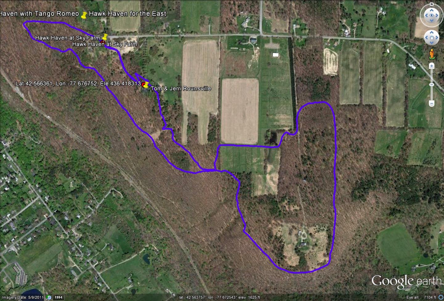
For the third year in a row, the Springwater Trails Annual Meeting will be held at the Springwater Center on Mill St Extension above the hamlet of Springwater. This scenic property overlooking the Springwater Valley, and half-way between Webster Crossing and the Hamlet is very appropriate for Springwater Trails. Our thanks to the entire staff of the center for their welcome.
Prior to the Annual Meeting. we will enjoy the many well marked trails that loop through open fields and forested areas. The trails through the fields are mowed and there are wonderful views of the surrounding hills and the valley below. 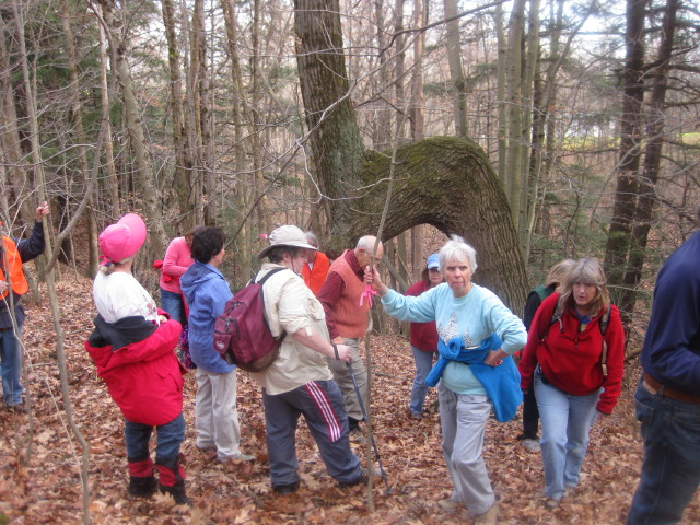 Two of the trails parallel a creek bed and gorge and one loops to another seasonal creek. Keep your eyes open for the Marker Tree near the creek.
With a foot of snow having fallen Tuesday and Wednesday, this will be a true winter hike with snowshoes or skis being appropriate.
It looks like it will be a good day for spring cross country skiing – set your wax for 40 degrees, and come enjoy the open fields. We will plan one hike for skiers and the others for snowshoes or boots.
Following the hikes, we will set up a pot-luck dinner in the kitchen. Everyone interested in Springwater Trails is welcome to the pot-luck and the Annual Meeting, and to the hike.
There will be three hikes. Wayne Coger and Susan McCallum, longtime Center members, will be available to answer questions and help with directions. Well-mannered dogs are welcome to hike with us. Dogs should stay in cars during the social.
If you are able to join us for the social after the hike, please bring a dish to pass and a non-alcoholic beverage or consider making a cash donation. There is a complete kitchen to store and reheat the dishes as needed. Please bring slippers as shoes and boots will need to be removed at the door.
Directions
From Springwater: Take Rt 15 to the West from the flashing light at the intersection with Rt 15A. Follow Rt 15 up the hill. Turn right at the top of the hill on Mill St Ext (just across the road from Harpers Ferry Rd) – you will see a Dead End sign. Springwater Center is the third driveway to the left (0.1 mile along Mill St. Ext., you will see the sign). Follow the driveway for 0.6 miles to reach the Center parking lot. The main building is just past the parking lot.
Additional directions to the Center are here.
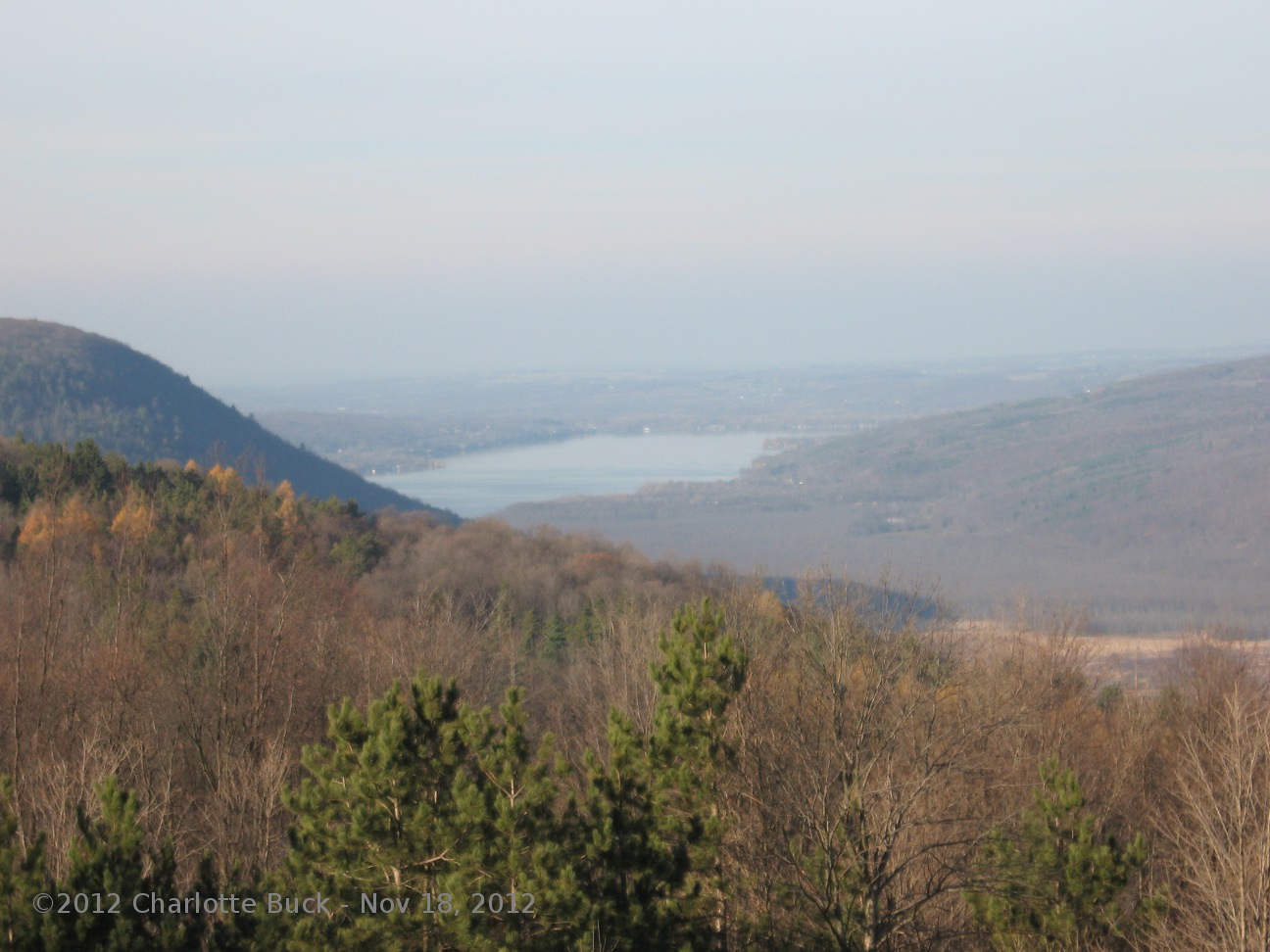
 This Sunday we will hike from the hills of East Springwater down into the Honeoye Valley. If the weather is good, we will enjoy some nice views of Honeoye Lake. Our thanks to the Buckley family and Hunt Hollow for permission for this hike.
Following the hike, join us for a social at Cheryl’s house on Rt 21. Bring a dish to pass and your own beverage, or contribute to the social fund. Cheryl will be making a warm stew to help us all warm up after what promises to be a damp hike.
We will have two hikes this Sunday, a through hike from Thorp Rd to the Hunt Hollow lodge, or from Thorp Rd to the top of the Ski Runs and then back to the start.
We will stage some cars at the Hunt Hollow parking lot before the hike, so it would be great to know how many hikers want to hike all the way down to the bottom of the ski runs. Please send an email (by Saturday night) to info at springwatertrails.org if you plan to hike to the lodge. Let us know how many are coming.
Also, please let us know if you can help with the carpooling by meeting us at the Hunt Hollow parking lot off of Ontario County Road 36 at 1:20 on Sunday.
We will all meet on Thorp Rd on the far east side of Springwater. We will hike up through the woods to the fields at the top. On the Thursday pre-hike, we could see the length of Honeoye Lake and all the way up to the towers in downtown Rochester. From the fields it will be a short walk through woods to the top of the chair lifts. The Climbers will head west along the easiest trail and follow it down the slope. The Tourists will follow the climbers to the overlook deck and then will retrace their steps back to the fields and will return to the cars on a different route around the woods.
The route starts at 1900 ft above sea level, and climbs to 2100. The Climbers will end at 1140ft,
We had about 4 inches of crusty snow for the pre-hike, but with rain and warmer temperatures predicted for Friday and Saturday, we are expecting much of the snow to be gone by Sunday. Wear waterproof boots in case it is muddy, and bring poles and cleats for stability.
 Directions
First a word of warning. Thorp Rd may not be on your map or GPS or may be labeled Monkey Run. Thorp Rd intersects Warner Rd to the north and Dutch Hollow to the south. Warner Rd may be labeled Garlinghouse Rd on your map or GPS. However, Monkey Run is a private road north of Warner Rd, and Garlinghouse is a seasonal road (not plowed in the winter) east of Thorp Rd. Set your GPS for the intersection of Tabors Corner Rd and Pardee Hollow Rd and follow the directions below. Avoid Monkey Run, Garlinghouse, Liddiard, and Coates, and Richards or Lanning Roads (especially in the winter).
From the corner of Tabors Corner Rd and Pardee Hollow Rd: Go east on Pardee Hollow Rd (There is a Maple Syrup sign pointing the way). At the stop sign turn left (north) onto Dutch Hollow Rd. Thorp Rd is on the right 1.3 miles up Dutch Hollow Rd. Park on the right side about a tenth of a mile down Thorp Rd.
From Springwater: From the center of Springwater, head north on Rt 15A. Bear right (east) onto Co Rd 16 (Wheaton Hill Rd) heading toward Tabors Corners. Continue up Wheaton Hill Rd to the end. Turn left (north) on Wetmore Rd, then the first right (east) on Co Rd 36/Tabors Corner Rd. After 0.4miles, bear Left (east) onto Dutch Hollow Rd. You will pass Peglow Rd on the right and Warner Rd on the left (both dirt roads). Take a sharp left turn onto Thorp Rd shortly after Warner Rd. Park on the right (east) side about a tenth of a mile down Thorp Rd.
From Wayland: Take NY-21 east from the light toward N Cohocton. Go 2.9 miles and turn left onto Steuben County Rd 37 (The sign reads Boles Corners). Stay on that road for 3.7 miles (In Livingston Co, it becomes Co Rd 36/Tabors Corners Rd). Turn Right (east) onto Pardee Hollow Rd (Note the Maple Syrup sign pointing the way). At the stop sign turn left (north) on Dutch Hollow Rd. Thorp Rd is on the right 1.3 miles up Dutch Hollow Rd. Park on the right side about a tenth of a mile down Thorp Rd.
From Honeoye: Contact us about helping with staging cars at Hunt Hollow.
More directions are available here.
Last week we hiked at Hunt Hollow on the last snow of the winter season. Spring has begun, and with it all the mud you can carry into the house. So come join us for a road walk out of Webster Crossing to Marrowback Rd above the south end of Hemlock Lake.
All hikers will meet at the Webster Crossing United Methodist Church. Parking is available behind the church. Following the hike, we will have a social at the church.
The Climbers will cross Rt 15 and walk up May Rd. At White Rd, May becomes a seasonal road. We will continue on May Rd up to Marrowback. As we walk, we should be able to see Tibbbls Rd across the valley. From Marrowback, we will head down hill to Kellog Rd where we will carpool back to the church..
The Naturalists will carpool up to White and Marrowback Roads to enjoy the views and walk back to the church for a walk just over 2 miles.
Finally, the Tourists will have the opportunity to start off with the Climbers, but will turn left on Marrowback for some nice views across the valley. At White Rd, they will hop into the Naturalists’ cars and bring them back to the church.
Following the hike, please join us for the optional dish to pass social at the church. Please bring a dish to share with the other hikers, and your own non-alcoholic beverage or make a small ($5) donation to the social fund.
Directions:
From Springwater: Follow NY-15N west from the flashing light for 3.6 miles. The church is on the left just before May Rd.
From Dansville: Take NY 36 toward Wayland. At the top of the hill, turn left on Reservoir Rd. At the end of Reservoir Rd, take a right on County Line Rd, then a quick left onto Carney Hollow Rd. At the end of Carney Hollow, turn left onto NY-15N. The church is on the left in 0.4 miles.
From Livonia: Take NY-15S from 20A for 11.5 miles. The church is on the right just past May Rd in Webster Crossing.
Note: We will meet at the large parking lot at the entrance to the South Boat Launch, Hemlock Lake off Rt. 15A at 1:45 and carpool to the top of Reynolds Gull Road. Social will be a tailgate at the DEC Reynolds Gull Parking lot on Rt. 15A (across from the entrance to the South Boat Launch, Hemlock Lake). BYOB and a dish to pass. Climbers, Tourists and Naturalists details will be organized on site.
It’s a little difficult to plan a Spring hike since I’ve been traveling in the Southwest for 6 weeks and coming back home to our special little slice of pie in the “Little Finger Lakes” of Western New York tomorrow. I was freezing last night at 28 degrees in a tent at Cumberland State Park, Tennessee, and had a thought of what I could organize for our hike this coming Sunday, April 9th. I sent out a message to my friends asking them what the conditions were in our area. They said it had rained for 3 days, the ground was saturated, creeks were running, walleyes and northern pike were spawning, and there was very little sighting of my favorite early spring wildflowers that I recently saw in Kentucky.
I thought about how Springwater Trails has been trying (going on 5 years now) to build a 32-mile trail throughout Springwater. To some, this trail project is considered an ambitious plan, and in the past has been considered or held back by local reluctant landowners or by lack of support from local, county, and state officials. Let me add that Springwater is an incredibly beautiful area with its hills (which I call the mountains of Livingston County) that affect 5 different watershed areas, lush valleys, many creeks, abandoned dirt roads, prime farmland, all of which touch upon the “Little Finger Lakes” of Hemlock, Canadice, Conesus and Honeoye Lakes.
This past year I have hiked portions of the Appalachian Trail (AT), Florida Trail, Arizona Trail, Continental Divide Trail (CDT) in New Mexico, National Scenic and National Recreation trails such as the Sheltowee in Kentucky. These and many other trails have been built across the United States of America for us hikers who appreciate and savor what nature has to offer. I came to the conclusion that not all trails have to be in the woods, fields, deserts or mountains. Sometimes, for short distances, a portion of a trail can be on a country road or a rural, lightly-used paved road, and can be a pleasurable hiking experience to reach our destination. In other words, we don’t have to be purists to reach our goal of building a 32-mile trail throughout Springwater.
The northeast portion of Springwater includes a winding dirt road along the Nature Conservancy area of Reynolds Gull, views down the paved road of Johnson Hill, the DEC Johnson Hill forest trail, with connecting creeks and cascading waterfalls which reach their climax at our beautiful pristine, undeveloped Hemlock Lake. What a treasure! This section of the overall 32 mile continuous trail is within our grasps.
Perhaps in the future, there will be landowners, businesses, or organizations that – assuming resolution of liability issues – will grant land access enabling the Springwater Trail to be sited entirely off-road. But in the meantime, let’s enjoy what we have: a recreational resource largely in a natural setting – something the majority of Americans don’t have at their doorsteps.
Come hike with us Sunday! Get directions here.
Springwater Trails is taking Easter Sunday off. If you are looking for a hike this weekend, the Genesee Valley Hiking Group is leading a hike at Stony Brook Park on Sunday Morning. Click on the word “leading” above and RSVP to the “Meet up” invitation. Or, if you wish to stay in Springwater, enjoy the Springwater Trail through Sugarbush Hollow. Follow the blue blazes on the trees to enjoy a wonderful hike. Please click on either link above for past hike descriptions.
Please be a part of our highway cleanup crew next Sunday, April 16. We will be getting Rt 15 through Springwater ready for the Spring and Summer seasons.
This week’s hike will be on the East Ridge in Dansville at Ann and Rick Lafford’s, 6270 McNeil Hill Road. The hike will include trails through Alexander’s Tree Farm, forest terrain, and the hang-glider launch site with great views of the town.
The after hike social will be at Ann and Rick’s home. Bring a dish to pass or make a donation (suggested $5) to the social fund to help defray expenses, and bring a beverage of your choice.
Climbers: This walk will cover approx. 4 miles of tree farm, forest terrain, and hang-glider launch-site, some of it following logging trails. The hike involves two climbs of approx. 400’ but these are separated and occur over a ¼ and ½ mile distance. There is one steep descent down a logging trail. There are a few wet areas so wear appropriate hiking shoes.
Tourists: This walk will cover approx. 3 miles of tree farm, forest terrain, and hang-glider launch-site, some of it through old vineyard. The hike involves one climb of approx. 300’ and another of 200’ but the slope is gentle and this is a relatively easy hike.
Naturalists: This walk includes the tree farm, forest terrain, and hang-glider launch-site, all on a well-groomed trail, with only moderate ups and downs.
Directions: From Main St. in Dansville, heading south on 63 leaving town, take Sahrle Hill Road, bare left until on top of the hill, then left on Sterner until it turns into McNeil Hill Rd. Follow McNeil Hill Rd until the dead end. Rick & Ann’s home is on the left. Parking is at the dead end turn-around or in the driveway. All hikers will start at Ann and Rick Lafford’s home.
Looking for brochure.or mailing list so I can receive it in the mail.
Nothing opens up for mailing list.
There’s all kinds of very bizarre ads and post for viagra and other drugs above on calender page.
Please let me know if there’s a brochure available