
Hikes led by Springwater Trails are generally held on Sunday afternoons and appear in this calendar in green.
| Sun | Mon | Tue | Wed | Thu | Fri | Sat |
|---|---|---|---|---|---|---|
| Hike at Fishers Park, Victor 2:00 pm Hike at Fishers Park, Victor Feb 2 @ 2:00 pm – 4:00 pm 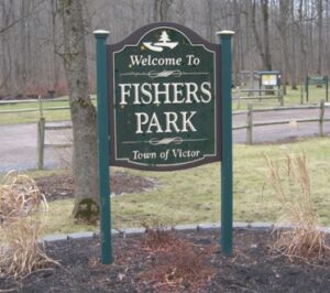 Join us on Sunday February 2nd for a hike around Fisher Park! Located in the hamlet of Fishers, this 93-acre park has a diversity of passive and active recreation opportunities. Visitors can see a multitude of wildlife from deer, squirrels, … Continue reading | ||||||
| Hike at Highland Park/Lamberton Conservatory, Rochester 2:00 pm Hike at Highland Park/Lamberton Conservatory, Rochester Feb 9 @ 2:00 pm – 4:00 pm This Sunday, we will have the pleasure of hiking in Highland Park and or Visiting Lamberton Conservatory in the southeast part of Rochester! George Ellwanger and Patrick Barry donated 20 acres of their nursery grounds, and, in 1888, Highland became … Continue reading | ||||||
| POSTPONED UNTIL MARCH 9: Winter Hike, Ski or Snowshoe-All Western Evergreen Farm, Springwater 2:00 pm POSTPONED UNTIL MARCH 9: Winter Hike, Ski or Snowshoe-All Western Evergreen Farm, Springwater @ Liberty Pole Road Feb 16 @ 2:00 pm – 4:00 pm 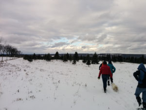 With the Winter Weather Advisory continuing through the day Sunday, Katherine and her advisors have postponed the Christmas Tree hike. Please be safe and drive carefully if you need to be out tomorrow. We will see you next Sunday (check … Continue reading | ||||||
| Hike at Gosnell Big Woods Preserve, Webster 2:00 pm Hike at Gosnell Big Woods Preserve, Webster Feb 23 @ 2:00 pm – 4:00 pm Note, weather dependent, this hike may be moved to Ellison Park, Penfield. Please check back closer to the scheduled hike date to confirm final details. |
This week we are returning to Harriet Hollister Spencer Park to enjoy the beautiful park high above Honeoye Lake. If you have never hiked at the Park, you will find many cross country ski trails that make for wonderful hiking trails through interesting forest. If you have hiked at the Park before, I am sure you will enjoy it again.
Join us at 2:00 at the Pavillion at the end of the Park road. We will have three levels of hikes, with the Naturalists doing a mile and a half loop around the shelter on the Pines, Little Whiteface and Racoon Run trails (See http://www.victormtbc.com/images/stories/MTB/HHSRAMap.pdf).
The Tourists will do Blue Spruce Way to Little White Face and back up the road to Racoon Run with bear trap and Upper Sidewinder for a bit less than 3 miles. The Climbers will take the challenge of about 4 miles, starting with Racoon Run, Bear Trap and Upper and Lower Sidewinder.
Please stay after the hike for a social at the park pavillion. Please bring a dish to pass and something to drink or make a small donation. The park has no running water, so be sure to bring some for the hike and afterwards.
This Sunday’s hike will follow the old Lehigh Valley railbed, now a trail, leaving from Naples and proceeding north through Hazlitt’s Vineyards (used to be Widmers), across Parish Flats Road and through the marshes and swamp along the West River that are now part of the Hi Tor Wildlife Management Area (NYSDEC).
We will leave from the VFW parking lot (behind the tank they have parked on their front lawn) off NYS Rte. 21 just north of the Village of Naples at 2 pm.
The hike is linear. We will stage a car at the 1.6 mile point ( Parish Rd) and at the 3.5mile point (Sunnyside Rd) allowing us some flexibility to adjust to the weather and the interests of the hikers. The climbers will plan to continuer northeast after passing Sunnyside Rd up the West River Valley for another mile and then return to the car at Sunnyside Rd. The Tourists will check their watches at Sunnyside Rd to see if they have time to explore upstream. The Naturalists will have time to investigate the creek, the vineyards and part of the swamp as they hike about 3/4 mile past Parish Rd and then return to the car on Parish.
Bug spray, sun shield and water are all recommended.
At Sunnyside Road, the hikers will observe Clark Gully to the west, the location where the Seneca people say they came out of the ground from another world into this one. A 65 acre parcel of vineyards near the gully was recently given to the Finger lakes Land Trust by Constellation Brands (acquired when they bought out Widmers).
This Naples Branch of the Lehigh Valley Railroad operated from 1892 hauling passengers and freight from Naples to Geneva and vice versa. The passenger service was dropped in 1938 and all service was discontinued in 1970. The 6.5 miles of railbed was acquired by the NYS DEC about 15 years ago, at the urging of an informal trails group in Naples.
You may want to tour Hazlitt’s Winery operations while you are in town.
After the hike, the Springwater Hikers will meet at the Middletown Tavern at the other end of Naples Village (on Rte. 21 just north of the juncture with NYS Rte. 53) at about 4:15-4:30 for socializing.
From Springwater, take 15 S to Wayland. Turn left on 21 and follow 21 for 12.8 miles through Naples. Just after the intersection with Rt 245, park on the right at the VFW parking lot. From Honeoye, you may take W Lake Rd or Co Rd 33 into Naples and then follow 21 North to the VFW.
Please send an email to Info@springwatertrails.org if you are willing to help with the staging of cars.
We will hike west to east as posted on the Amazing One Day Hike page. That is, we’ll begin hiking at Lain Road (Access 5 on FLT Map M10). The official end of Hike #24 will be at the intersection of Turnpike Road and Hughes Road (Access 9 on FLT Map M10).
We will meet at Access 9 and 9 a.m. on Saturday, June 2nd and car-pool/shuttle cars back to Access 5 to our starting point. We will have release forms for you to sign at our meet-up point before the hike starts.
Remember to bring water with you in case you have need of it before you reach a sag point for a refill.
All hikers are invited to a post-hike picnic at Kanakadea Park (it’s listed as the Almond Dam Rec. Area on the western end of the newer FLT M10 map) starting at about 2 p.m. Hot dogs & rolls, beverages, and paper plates, etc. will be provided. If you’re attending the picnic, please bring a dish-to-pass.
Our thanks to Mark Hopkins who has volunteered to help lead the hike since Bob’s recent stent placement may mean he will need to stop before the full 8.5 miles. I’ll have to say, however, that he is doing very well managing even to get up to our section and do some trail maintenance this past
We will be hiking on the Canadice Lake trail. This trail follows the west shore of Canadice Lake allowing hikers to enjoy both the forest and the views of the water.
THIS IS A CHANGE FROM THE ORIGINALLY SCHEDULED HIKE!
We will meet at the North End of Canadice at 2:00 and will walk up the west side of the lake. The Climbers group will go about 3 miles up the trail and then will return to the cars. The Tourists and Naturalists will set their own pace, and will turn around at 2 or 2.5 miles.
After the hike, the social will be at the Hemlock Grill in the center of Hemlock.
From Springwater, take 15A North. Turn right on Purcell Hill Rd. Parking is on the right off of Purcell Hill Rd on the west side of the lake.
From Honeoye, take 20A W toward Hemlock. Turn left on Canadice Lake Rd, then right on Purcell Hill Rd. Parking is on the left.
Please bring rain gear since we will hike unless severe wind or thunder force a cancellation.
This week the Springwater Trails hiking group moves to its summer hike times. Our hike on the Wheaton Hill Trails will start at 4:00PM (two hours later than the winter start time). This will give all hikes the opportunity to enjoy the music, the Duck Race and the Chicken Bar-B-Que at The Springwater 13th Annual Gala. Just remember we have a fascinating hike planned, so don’t eat too much.
We will meet at the large parking lot at the entrance of the Hemlock Lake South Boat Launch on Rt. 15A at 4:00 sharp. From there we will car pool to the trail entrance on Wheaton Hill Road about 2 miles away. Naturalists will be led by Ellen Folts, Certified Naturalist and owner of Amanda Gardens. Ellen will highlight the red bud trees which populate the trail as well as the late spring wildflowers and early summer wildflowers that are already appearing due to earlier than normal warm temperatures. Pam will lead the Tourists and Climbers around a loop at Wheaton Hill and then through the Hemlock/Canadice State Forest through 4 ravines to the Reynolds Gull and back to our cars at the South Boat Launch entrance.
Springwater Trails has begun the process of adopting the loop trails in the DEC Hemlock/Canadice State Forest at Wheaton Hill. This week’s hike will investigate this trail to understand the maintenance we will need to do once our adoption is complete. We will also hike the adjoining state forest land where we hope the DEC and Springwater Trails will create a connection from the Springwater Trail to Reynolds Gull, and continuing on to Hemlock Lake. Right now the grass is high on the trail so wear long pants and bug repellent. Pam’s group should be prepared or some steep descents as we will cross 4 ravines. Check out our map at http://springwatertrails/images/ReynoldsToWheatonHill.jpg. We will follow the blue line.
There will be no social after the hike this week. Please support the Springwater Gala in Canute Park in Springwater. Entertainment, food, and ice cream will be available up to 4:00.
Directions to the hike from Springwater: Go 2.2 miles north on 15A. The South Boat Launch parking lot is on the left side of the road. From Honeoye and Hemlock, come south on 15A for 8.6miles after the Hemlock-Honeoye Rd (20A). Wheaton Hill Rd is 1.3 miles south of our meeting place with the trail entrance a half mile up Wheaton Hill Rd.
This Sunday we will put a new perspective on Pam’s favorite hike from the Summer of 2011. We will be hiking down the hill from Rob’s Trail on Rt 15A to Hemlock Lake and then will continue north to the Park.
All hikers will meet at the Hemlock Park at the north end of Hemlock Lake. The Naturalists will carpool to the north-east public boat launch and walk the service road to the end. The Climbers and Tourists will carpool to the Rob’s Trail parking lot. Chris Williams will lead us across 15A to follow the Nature Conservancy / Hemlock State Forest boundary down toward the lake. About 15 minutes into the hike we will traverse north along the hillside with modest descents along the way. The final decent will go along the ridge of a large gully down to the lake where the group will proceed north on the old abandon road that once circled the lake.
The Climbers will meet the Naturalists at the bench not too far from the end of the service road and will return to the Hemlock park along the Service Road. If all works according to plan, the Tourists who will be a little behind, will catch up to the Naturalists at the Boat Launch and can carpool back to the park with the Naturalists. The Climbers will earn their reputation by walking out to the Park.
Following the hike we will have a picnic at the Hemlock Park. Please bring a dish to pass and something to drink or make a small cash contribution. Chris, who is a brewer for Rogues’ Harbor in Ithaca, promises to have some samples on hand. Joan and Pam will share preliminary plans for the summer hikes and you can help fill any gaps at that time.
From Springwater, take Rt 15A North over Bald Hill and turn left at the north end of Hemlock lake on Rix Hill Rd. From Hemlock, take 15A south and turn right On Rix Hill Rd. Park in the lot on the left of Rix Hill Rd about 0.3 miles off of 15A. At the park, we will be looking for a leader for the Naturalists who is familiar with the Boat Launch parking.
You can see a map of the hike at https://maps.google.com/maps/ms?msid=203559843629689924287.0004693e5fb77d99bda07&msa=0&ll=42.721795,-77.599354&spn=0.107069,0.110893 and a video from Rogues’ Harbor at http://www.youtube.com/watch?v=zM0SznSJXoI
See everyone Sunday!
Our goal this month is to complete work on the trail from Coates Rd to Pardee Hollow through the eastern half of Sugarbush Hollow. This work is needed to prepare for an official opening on July 1, and will involve placing signs at each end of the trail and blazing a section of the trail that has been changed.
We also have work to do on the western half of the property to start the next segment of the trail. This will involve cutting grass and clipping tree branches as needed.
If you are able to volunteer a few hours of your time, please join us at the Sugarbush Hollow sugar house porch, (8447 Pardee Hollow Road) for an organizational meeting at 3:30. We will provide a dinner for all volunteers at Chuck’s house at 6:30 after the work. Please bring water and suntan lotion. Also bring hand clippers and a string weedwacker if you wish.
From the North: RT. 15A south past Hemlock to just before hamlet of Springwater. Turn left onto Wheaton Hill Road (CR 16) (sign to Tabors Corners), go to end of road and turn right onto Wetmore Road, go to end of road and turn right onto Tabors Corners Road, turn left on Pardee Hollow road at Punky Hollow lighthouse sign (watch for maple bucket road sign on right), turn right at end of road and follow signs to Sugarbush Hollow 8447 Pardee Hollow Road
From West, South or Southeast: Rt. 21 North between Wayland and N. Cohocton, (watch for maple bucket road signs), turn left onto CR 38 which is also known as Rowe Road. Go .6 miles and turn left on to Pardy Hollow Road. Follow for 3 miles to Sugarbush Hollow 8447 Pardee Hollow Road.
This week we will hike through Conklin Gully in the High Tor Wildlife Management Area.
This is a change to the original spring hike schedule, but we think the views of the Gully and the waterfall will make up for the inconvenience.
The hike will follow a portion of the Bristol Branch of the Finger Lakes Trail. The Climbers will climb 700 feet up from Rt 245 on the Bristol Branch main Yellow trail, and will join the Blue trail for a traverse over to the Conklin Gully. The Tourists and Naturalists will start on Parish Rd and follow the Blue trail across the Gully, past the lean-to and will continue west on the blue trail. When the tourists and naturalists meet the climbers, they will all return back along the blue trail to Parish Rd.
Let’s meet at the parking area on Rt 245 about 0.3miles from Rt 21. The Tourists and Naturalists will carpool to Parish Hill Rd and a smaller parking lot at the head of the blue trail. After the hike we will gather at the Middletown Tavern at the other end of Naples Village (on Rte. 21 just north of the juncture with NYS Rte. 53) at about 6:15 to cool down and for socializing.
From Naples, proceed north on Rt 21. Turn right on Rt 245. The parking lot is on the right parallel to the road.
To get to Parish Hill Rd, go right out of the parking lot and follow 245 for 1.5 miles. Take the first right on Parish Hill Rd. Follow Parish Hill Rd for half a mile. The parking lot is about 0.1mile off the road on the right (at the 3rd left turn on Parish Hill) at the High Tor gate.
Grand Opening – Springwater Trail
The Springwater Trails Organization invites you to our opening of The Springwater Trail. The Springwater Trail is a public footpath around the town of Springwater. We are opening the first 2-mile portion through Sugarbush Hollow Maple Farm from Coates Rd to Pardee Hollow Rd.
Please join us at the top of the hill on Coates Rd at 4:00PM (EDT) for a celebration and a hike to follow. The social and campfire afterwards will be at the Hopkins’. Please bring a dish to pass – hot dogs, lemonade and coffee will be provided.
The official ceremony will start at 4:00 and the hike will start promptly at 4:30. We will have three levels of hike. The naturalists will hike the main trail from Coates Rd to Pardee Hollow. The tourists will follow the branch Trillium Path out and back and then will continue on the main trail to Pardee Hollow. The Climbers will take the main trail and will continue on the proposed route of the Springwater Trail past Pardee Hollow to Tabors Corners Rd.
Directions:
From Springwater, go North of 15A for .8mi from the light. Turn right on Wheaton Hill Rd. At the tee turn right onto Wetmore Rd. Bear right on Tabors Corner Rd. After 1.8 miles, turn left on Pardee Hollow Rd. Turn right at the tee to stay on Pardee Hollow Rd. Coates Rd is the first left. If you are going to hike, please carpool up Coates road: (park on the east side of Pardee Hollow Rd past Coates Rd just south of the Sugar House and form a carpool).
From Wayland, take Rt 21N for 5.6 miles. Turn left on Co Rd 38 (Garling House Rd AKA Rowe Rd). Take the first left onto Pardee Hollow Rd and continue for 3.2 miles. If you are going to hike, please carpool up Coates road: (park on the east side of Pardee Hollow Rd before Coates Rd just south of the Sugar House and form a carpool).
From Honeoye, take W Lake Rd south. Turn right onto French hill Rd. At the tee (at Dug Rd) turn right to stay on French Hill Rd. Take the first left on Garlinghouse/Atlanta Rd. Go Right on Pardee Hollow Rd and continue for 3.2 miles to Coates Rd. If you are going to hike, please carpool up Coates road: (park on the east side of Pardee Hollow Rd before Coates Rd just south of the Sugar House and form a carpool).
If you are planning to only attend the opening ceremony, proceed up Coates Rd to the highest point where the trail will start.
Suggestions:
1. Coates Rd is a half mile up on rough dirt road. Please plan to arrive at Pardee Hollow between 3:30 and 3:45 to give yourself time to carpool up Coates Rd.
2. The ceremony is .6 miles from the paved road on the east side of the hill (the Garlinghouse Rd side). This road is even rougher than the west end of Coates Rd and is not recommended.
This hike in the Canaseraga Forest will be a three mile hike over an easier road with some hilly terrain The road in to the forest is not too rough. We will meet at 9 am at the parking lot behind the police station, just down the street from Key bank at the third traffic light if you are coming south on Route 63.
Looking for brochure.or mailing list so I can receive it in the mail.
Nothing opens up for mailing list.
There’s all kinds of very bizarre ads and post for viagra and other drugs above on calender page.
Please let me know if there’s a brochure available