Hikes led by Springwater Trails are generally held on Sunday afternoons and appear in this calendar in green.
- Categories
- Tags Barry Childs and Kathy Cloonan barry@africabridge Bike Bill Cooke Bob and Cindy Wagner Bob Menz (bert6952@yahoo.com) Bristol Hills Branch CANCELED Clarks Gully CLWA Colorado Trail Dena Munsell Dog friendly Finger Lakes Trail FL FLT Gene & Georgia Binder (585) 236-5384 Gene and Georgia Binder (585) 236-5384 Greenway Gully Gypsy moth Hemlock Hike Jayne Affolter Jeanie Smith John L Katherine Humphrey? Kayak Kelly Rell Landowner Liability Leader: Mark Lehigh Valley Trail Mark and Laure Allen (585) 662-9305 Mark and Linda Mary Ann Devey (315) 573-0774 Mary Lou Wenthe (585) 208-4337 Melissa Mike and Jenny Johnson Mitchellsville mjkcloonan@frontiernet.net Mushroom Foray Naples Nunda POSTPONED Rick Henchen Rick Henchen and Sharon Boldt Saralinda Saralinda Hooker Schribner Sharon Boldt Sharon Boldt (boldtbs@yahoo.com) sugarbush hollow Summer Weekly Wendy Stevenson
| Sun | Mon | Tue | Wed | Thu | Fri | Sat |
|---|---|---|---|---|---|---|
| Lehigh Valley Trail Hike or Bike in Rush, NY 2:00 pm Lehigh Valley Trail Hike or Bike in Rush, NY @ Stevens-Connor Lehigh Valley Lodge Apr 6 @ 2:00 pm – 4:00 pm Come join us for a leisurely hike or bike along the Lehigh Valley Trail on Sunday April 6th! With its flat even surface, the trail is a hidden gem for walking, hiking, jogging, biking. It is a vital link in … Continue reading → | ||||||
| Ontario County Park at Gannett Hill Hike-Naples 2:00 pm Ontario County Park at Gannett Hill Hike-Naples Apr 13 @ 2:00 pm – 4:00 pm 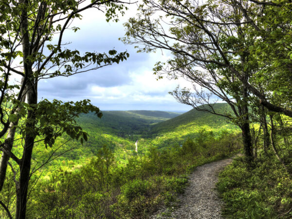 Save the date! This is one of our group favorite hikes. Ontario County Park at Gannett Hill is one of the highest points in Ontario County and located in the scenic Bristol Hills. At an elevation of 2,256 feet above … Continue reading → | ||||||
| No Hike-Easter Break 2:00 pm No Hike-Easter Break Apr 20 @ 2:00 pm – 4:00 pm No hike has been scheduled for this date due to the Easter Holiday. Enjoy the break, spend time with loved ones and eat chocolate bunnies. This will give you something to burn off next week  | ||||||
| Mystery Hike- Richmond/Honeoye 2:00 pm Mystery Hike- Richmond/Honeoye Apr 27 @ 2:00 pm – 4:00 pm Mystery hike coming your way! Please check back for more details. |
-
Categories
-
Tags
Barry Childs and Kathy Cloonan barry@africabridge Bike Bill Cooke Bob and Cindy Wagner Bob Menz (bert6952@yahoo.com) Bristol Hills Branch CANCELED Clarks Gully CLWA Colorado Trail Dena Munsell Dog friendly Finger Lakes Trail FL FLT Gene & Georgia Binder (585) 236-5384 Gene and Georgia Binder (585) 236-5384 Greenway Gully Gypsy moth Hemlock Hike Jayne Affolter Jeanie Smith John L Katherine Humphrey? Kayak Kelly Rell Landowner Liability Leader: Mark Lehigh Valley Trail Mark and Laure Allen (585) 662-9305 Mark and Linda Mary Ann Devey (315) 573-0774 Mary Lou Wenthe (585) 208-4337 Melissa Mike and Jenny Johnson Mitchellsville mjkcloonan@frontiernet.net Mushroom Foray Naples Nunda POSTPONED Rick Henchen Rick Henchen and Sharon Boldt Saralinda Saralinda Hooker Schribner Sharon Boldt Sharon Boldt (boldtbs@yahoo.com) sugarbush hollow Summer Weekly Wendy Stevenson
Weather Update, Sunday March 20: Looks like there will likely be steady rain this afternoon. We’ll be hiking if any hardy souls show up, but please bring rain gear, traction footwear, poles and gaiters, as it’s likely to be muddy and maybe slippery. Hike may be shortened if that’s the group consensus.
Our hike this Sunday will be at the Ganondagan State Historic Site, 7000 County Road 41 (Boughton Hill Road) in Victor. Ganondagan is the site of a large 17th century Seneca town, and offers hiking trails with interpretive markers illustrating the history and traditions of the Seneca people. The trails will take us through wooded rolling hills and meadows just south of the Village of Victor. Highlights will include the Granary Trail, where the Seneca protected and distributed their corn supplies on a palisaded mesa, and the Earth is Our Mother Trail, where interpretive markers describe local plants and their particular roles in Seneca life. See https://ganondagan.org/Visit/Hiking-Trails for more on Ganondagan and its interpretive trails.
We will meet at 1:45 at the Seneca Art and Culture Center parking lot, about .2 miles west of the intersection of Route 444 and Boughton Hill Road. All hikers will proceed past the Longhouse and around the Great Meadow to the Seneca Trail and then follow the Earth is Our Mother Trail along Great Brook. After about 2 miles, we will divide into two groups, with the Tourists and Naturalists returning to the Longhouse and parking area via the Great Oak Trail for a total hike of about 2.5 miles. The Climbers will cross School Street and proceed up the hill by the Eagle Trail to the Granary, where we can stop for a long view to the south over the Bristol Hills and Bare Hill, then return to School Street and the starting point via the rest of the Earth is Our Mother Trail. Total hike for the Climbers will be about 4.5 miles. Trails are well maintained and gently rolling hills, with switchbacks up steeper areas. In case of mud, poles and traction devices are advised.
Social – Will be at Cheap Charlie’s Restaurant, 8 Elm Street, Bloomfield (on Route 444, left side, as you enter Holcomb)
Directions: From Springwater/Honeoye area: Go north to Honeoye and then east on 20A to Route 64. Go north on 64 for 3.7 miles to the 5 and 20 intersection. Go west on 5 and 20 for 1.25 miles and make a right on Route 444 (Maple Ave.). Proceed 5.3 miles to Boughton Hill Road (County Rd. 41). Turn left at Boughton Hill Road (flashing light), proceed .2 mile down the hill. The Seneca Art and Culture Center is the white and glass contemporary building on your right, with a large parking lot in front.
From points east: Take 5 and 20 west toward Bloomfield. Go right at the Route 444 intersection, and proceed 5.3 miles north to Boughton Hill Road (County Rd. 41) (flashing light). Turn left at Boughton Hill Road, proceed .2 mile down the hill. The Seneca Art and Culture Center (a.k.a. Interpretive Center) is the white and glass contemporary building on your right, with a large parking lot in front.
From Thruway: Take Exit 45, and follow Route 96 east to the Village of Victor. In the village center, turn right on Route 444 (Maple Avenue). Go 1.5 miles to the top of Boughton Hill (flashing light). Turn right on Boughton Hill Road. Proceed .2 mile down the hill. The Seneca Art and Culture Center (a.k.a. Interpretive Center) is the white and glass contemporary building on your right, with a large parking lot in front.
To the Social: From the site, go east on Boughton Hill Road. Make a right at the flashing light and follow Route 444 to Holcomb, about 4 miles. Cheap Charlie’s is on the left at 8 Elm Street.
The Springwater Center, founded in 1981 by Toni Packer, is located in the northwest portion of Springwater. The property contains open fields, forests and waterfalls and provides many opportunities to enjoy the beauty of Springwater. The Center offers silent meditation retreats and year-round guest visits, currently to fully vaccinated guests. Springwater Trails has been regular guests at the center, always enjoying the center’s hikes.
There will be up to three hikes for the group to select from, each lead by a leader well versed in both the history and the landscape of the Center’s property. We can expect up-close views of Mill Creek waterfalls, and long views of Springwater Valley.
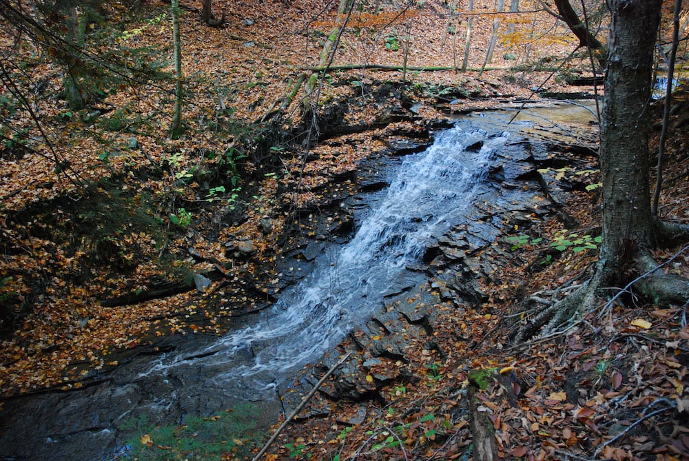 All hikers will meet at Wayne Coger and Susan McCallum’s house. Their house is adjacent to the east side of the Center property. Hikes will start at 2:00. Following the hike, you are invited to a dish to pass social at Wayne and Susan‘s house. Please bring a dish to share or your own snack and your own beverage. Oven and microwave will be available to keep food warm or reheat, if needed.
From Springwater: Heading south on Rte. 15A turn right onto Kellogg Road (1st right on the north edge of the village). Continue on Kellogg about ¾ mile to where Marrowback Road tees into Kellogg. Turn right onto Marrowback, continue about ¾ mile to the 1st driveway on the left. Turn left, continue a short distance to the top of the T and turn left again. One of us will meet you and direct you to parking areas. Similarly, if heading into Springwater on 15A from south of the village, turn left onto Kellogg at the north edge of town and then follow the directions above.
If coming south on 15, turn left onto Kellog (it loops between 15 & 15A and then left onto Marrowback. Then continue as written above.
Please click for detailed directions from Rochester, Livonia, and Naples.
This Sunday we will explore the woods and fields overlooking Honeoye Lake on the west side, followed by a dish-to-pass social at the Affolter farm. Meet at 5422 County Road 37, about 2 miles south of Route 20A and 2 miles north of Canadice Town Hall. Park in the drive or on the road shoulder. Our hikes will take us up the ridge, through wooded trails and along gully rims. Get a scenic vista of the whole expanse of Honeoye Lake, from a new and different perspective.
There will be a longer hike for the Climbers of 3.5 to 4 miles, and a shorter hike for the Tourists-Naturalists of 2 to 3 miles. Hiking conditions should be good, but layers are advised, and traction devices and poles are recommended in case of mud.
Bring your favorite goodies along for an indoor dish-to-pass social at the hike starting point.
Directions: From Springwater, take Route 15A north 2.7 miles to a right on Johnson Hill Road. In 1.1 miles, make a left on County Road 37. Continue northeast for 6.7 miles, including a turn to the left after Canadice Town Hall. #5422 will be on your left, just before you leave the town of Canadice and about a half mile after you pass Hayward Hill Road and Jersey Hill Road.
From Honeoye/Hemlock: Take Route 20A east from Hemlock or west from Honeoye to the intersection with County Road 37. Go south approximately 1.9 miles. #5422 will be on the right, just past the Entering Town of Canadice sign.
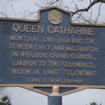
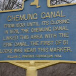
Catharine Valley Trail is a state park and recreation trail which is located in Schuyler and Chemung Counties. It runs for 12 miles between Watkins Glen State Park and Mark Twain State Park and uses the abandoned Chemung/Northern Central Railroad and the old Chemung Canal. The trail is named for Queen Catharine Montour, a prominent Seneca leader of Native American and French ancestry who lived in a village called She-O-Qua-Gah near present day Montour Falls. The village was one of the many destroyed by Sullivan’s Army in 1779. Catharine Creek, Seneca Lake’s inlet, is a popular Rainbow Trout fishing stream and runs parallel to the trail.
Meeting Place
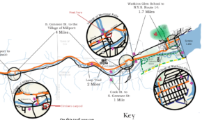
We will all meet at the S Genesee Street parking area south of the Village of Montour Falls to explore part of the trail. Bikers will go south for an out and back of about 8-10 miles (hybrid or mountain bikes recommended); climbers will carpool to Millport and walk north the 4 miles back to the S Genesee Street parking area; the tourists/naturalists will walk south from the parking area to complete a 2 mile loop along the old canal.
Social
The social will be at an area restaurant in Watkins Glen. Location TBD.
Directions
From Watkins Glen (or Rochester and Exit 42 on the Thruway and Geneva): Take NY 14 south from the thruway, through Geneva and Watkins Glen. South of Watkins Glen, stay on NY 14 until it curves to the left. In the middle of the curve, turn right onto S. Genesee St. The parking lot is on the left in 1.7 miles.
From Horseheads and I-86 Exit 52B: Turn left onto NY-14. In 10.8 miles, turn left onto S Genesee St. The parking area will be on the right, just past the bridge over Catherine Creek.
 From Springwater: take NY Route 15 south to Route 390. Take I-390/ south to I-86 east and get off at EXIT 40 – Savona. Turn left onto NY-226 and follow it 13.22 miles to where you will turn right onto County Road 23. Go 8.03 miles then take a slight right onto County Road 28. Go 1.16 miles and take a slight left onto NY-409. Go 0.54 miles and at the stop light in the Village of Watkins Glen turn right onto NY-14.
  Continue on NY-14 for 4.40 miles then turn right onto S Genesee Street. In a short distance go over the bridge for Catherine Creek and the parking area will be on the right. According to MapQuest this route is 61.8 miles and the estimated driving time is 1 hour 12 minutes.
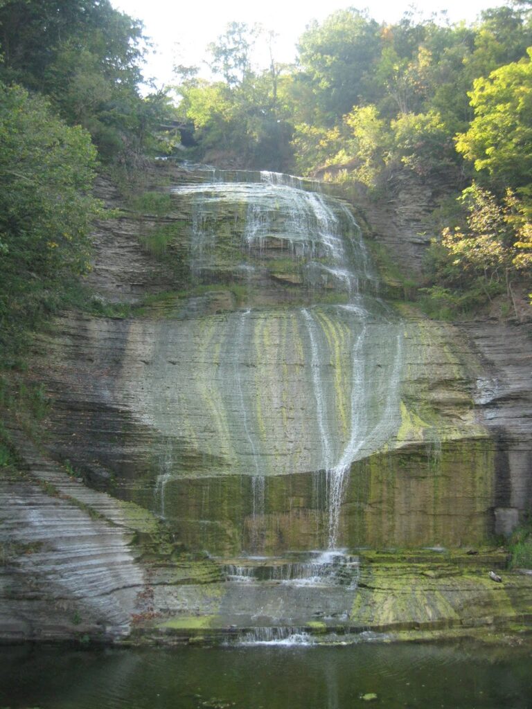
People may want to arrive early and budget extra time to stop at Shequaga Falls Park in Montour Falls, do some shopping at Famous Brands in Watkins Glen, or go birding along the Queen Catharine Marsh Trail.
More Information
The Sunday hike this week will be on Saturday 23rd April, and we will be participating in an Erie Canal Clean Sweep event in Macedon. This event is organized by someone other than Springwater Trails, so we will be joining them at the earlier time of 11:00am to walk a section of the Erie Canal in Macedon, pick up all the trash we can find and generally tidy up the towpath. We’ll limit our time at the event to something c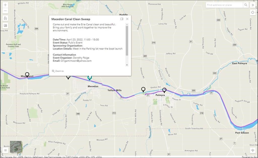 lose to our usual 2 hour hike.
We’ll meet at the parking lot near the boat launch in Macedon – See the map provided by the event organizer.
Please bring trash bags, secateurs and work gloves.
The Social: We’ll organize a social during the event.
Directions. NY 31 follows the canal east from Pittsford to Macedon. In Macedon turn north on 31F – Ontario Center Rd. In 0.2 miles, just before the canal, turn left into the park. Meet at the boat launch or in the parking lot.
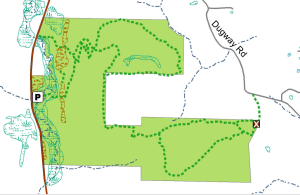
The Stid Hill Multiple Use Area is a 847 acre tract of land situated in the townships of Bristol and South Bristol in Ontario County. It is bounded by Route 64 on the west and Dugway Road on the north. Ganargua Creek, better known as Mud Creek, flows along Route 64. At one time, Stid Hill was productive sheep and cattle grazing land. Today the grazing has been eliminated. The mixture of steep hills, ravines, gullies, gorges, woods, and open areas create scenic vistas and also provide varied wildlife habitats.
We will meet at the Stid Hill MUA parking area on Rt. 64 at 1:45pm. Once we determine how many would like to hike the trail from top to bottom, we will leave some cars in this parking area. We will then carpool and proceed to drive up to the parking area on Dugway Rd. At this point the climbers will set out to hike back down to Rt. 64. The Tourists and Naturalists will follow the trails up at the top of the hill. The ground is uneven so you may want to bring poles. There are also very wet and muddy spots along the trail so waterproof hiking shoes or boots would be recommended. Rt. 64 runs north and south. If you are coming from the north starting at 5&20 head south, past Bristol Center and CR32, the parking area will be on your left. If you reach Bristol Mountain Ski Area, you have gone too far. From the south head up Rt. 64 past Bristol Mountain Ski Area, and the big wooden sign that says Stid Hill, you will see the parking area on your right.
Though the trails were well marked at one time, there hasn’t been much trail maintenance recently. The trail markers are difficult to follow and sometimes deceptive, and they disappear completely over the crown of the hill. The going will be very wet in places over the crown.
The Meeting Place
We will meet at the Stid Hill MUA parking area on Rt. 64 at 1:45pm.
Getting There
Route 64 runs north-south, so there are only two direction of approach.
From the north, (Honeoye and Bloomfield) starting at Route 5 & 20 in Bloomfield, come down Route 64. 3.0 miles south of Rt 20A and 1.4 miles past Bristol Center (and CR 32), turn left on Dugway Road. If you come to a Stid Hill MUA parking area, you’ve come too far south – turn around and try again.
From the south, starting at Bristol Springs for 6.4 miles, come up Route 64 past both Stid Hill parking areas, then turn right on Dugway Road. If you come to Bristol Center you’ve come too far north.
From Springwater, Google Maps recommends heading north to 20A through Honeoye, then south on 64.
From Wayland, the recommendation is to take Rt 21 through Naples to the east end of Dugway Rd (4.5 miles north of the intersection with NY 64). The trail head is 1.2 miles west on Dugway, (Dugway is paved to the Bristol/Canandaigua town line).
Dugway Road is a good dirt road. The trail head is exactly 2.0 miles from the Route 64 junction. It’s easy to miss – it’s just a widening of the road after a sharp left turn. The trail head is on the right of the road and marked with a discreet sign a little too far from the road. Please park carefully. There isn’t much parking space to be had.
The Social
We’ll go to Lock Stock and Barrel on Route 64 just north of Bristol Mountain for the social after the hike.
 NOTE: Please note the change of time to 3:00PM EDT. We plan to work until about 5:30.
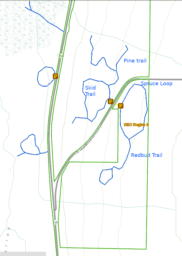
This Sunday’s hike will be a joint event with NYS Department of Environmental Conservation, Parks & Trails New York, and the NYS Parks and Recreation. It will be part of a state-wide network of events celebrating I Love My Park Day to honor New York’s state parks and state forests. Our effort will focus on making one of our closest patches of state land – Wheaton Hill in Springwater (42.657417, -77.564875) – cleaner and more hikable for visitors. The trails at Wheaton Hill are a small part of the Hemlock Canadice State Forest, a lovely patch of land in the hills of the Finger Lakes and is well worth a little TLC. We will split into several teams depending on how many people show up, with each team being assigned a route through the forest and tasks such as cutting grass, picking up trail debris, picking up trash, and general cleaning up the trails.
Please bring gloves to protect your hands, loppers or small clippers to cut branches and the ever present Multiflora roses. Other useful tools, if you have them, include a small saw for branches that are too large for the loppers, and a small shovel if you want to help direct some of the water on the path. If you want to do some serious damage, then bring a weed whacker and have at it. We will also have a sawyer at the event should there be fallen trees across a path. If you do plan to use power tools, PLEASE BRING EYE PROTECTION! These devices can kick up a lot of dust and small stones. Finally, a backpack may be useful to carry your water and saw while you use loppers to cut roses.
We will work on the Pine, Skid, Spruce and Redbud trails. Most of our work will be clearing fallen sticks off of the path and cutting back the roses and other growths. This organic debris will be moved off the trail, but left in the woods. Some garden duty trash bags will be available for carrying out any trash that has found its way into the forest..
The Social
We’ll have a picnic social if the weather if fine, otherwise we’ll just quit at the end of the day. All workers are invited to bring a sandwich or snack and beverage and a chair in case you wish to rest.
Directions: Wheaton Hill is the first right turn north of the intersection of Rt 15 and Rt 15A in Springwater (0.9 mile north of the intersection). The trail head is 0.5 miles up Wheaton Hill just before the road turns straight east and heads up the main hill. More details are on the directions page. Please park on the left side of the road as you come up the hill. There is a short entrance to the trails on the right side you can use to turn around.
What to bring:
- Gloves and clippers – hand clippers or long handled loppers for larger branches.
- Water to keep hydrated.
- A picnic dinner
- Solid boots to protect your feet
- Rain coat or poncho if the forecast changes
If you wish, bring one of the following
- A weed whacker if you want to cut grass, with gas mixture and extra string.
- Eye protection
- Small bow saw.
- Small shovel that is easy to carry
- Plastic grocery bags in case you find any litter.
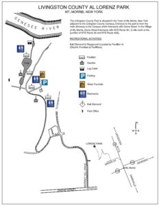
Since our last hike through the Al Lorenz County Park above Mt Morris, the county has made many improvements to the park, including new trails and beautiful bridges across the streams feeding the large pond. In honor of the opening of the summer season at the park, this Sunday’s hike will provide all hikers an opportunity to see more the park in person.
All hikers and bikers will meet at the parking lot behind Pavilions 4 and the playground (click on the map to the left for details). Following the hike and bike ride (around 4:30), we will meet at Pavilions 3 at the end of the Pond for a dish to pass social (at that time we can move cars to the pavilion parking area).
Our hikers will follow the Letchworth branch of the Finger Lakes Trail along the gorge to the Mt Morris Dam, and then will return to the Park. The Climbers will stay on the Letchworth Branch (Yellow blazes) past the FLTC Office, the Dam Visitors Center to the overlook of the dam. Given time, they will continue on to enjoy addition views of the Letchworth gorge until the trail jogs left away from the river. Turning around at that point will result in a round trip hike of about 3.4 miles.
The Naturalists hike will also follow the Branch trail up to a field before the Dam area. This field contains a Wildlife Loop. Based on the condition of the wildlife loop and the time, the Naturalists will choose whether to hike around the loop or continue on to the Dam overlook. Turning around at the Dam overlook will be a 2.8 mile hike.
Bikers will head west within the park and climb a steep hill to the Livingston County Campus, and then will descend a curving road to the Genesee Valley Greenway. From there, we will follow the Greenway north to NY-20A. We will turn around and ride the Greenway (or possibly River Rd) back to Mt Morris, to Grove St, where we will turn south, following Grove St and Parker Rd. After turning right on Al Lorenz Dr, we will re-enter the park. If time permits, we will ride some of the park trails back to the Pavilion 3.
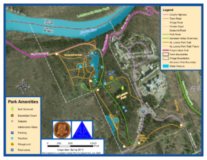 When hikers return to the Al Lorenz park, they should take some time to explore the trails around the pond. Between 4:30 and 5:00, gather at Pavilion 3 for a Dish to Pass social. Please bring a dish to share and your own beverage, or bring a sandwich if you are more comfortable not sharing. A contribution to support the social supplies of $5 is appropriate if you forget or can’t bring your food contribution.
All hikers and Bikers will meet at the parking lot behind Pavilions # 4 and the playground. Please be ready to start the hike or ride at 2:00.
Directions
From Springwater and Wayland: (Note that Liberty Pole Rd is under construction. These directions avoid Liberty Pole Rd). Head south on NY-15 through Wayland. Turn right onto I-390 past the Dansville exits to Exit 6 (16.3 mi) for NY 36, Mt. Morris. Turn left on NY-36N for 5.4 miles. At the third left following the lights at NY-408 turn onto Grove St. In 0.2 miles turn right onto Murray Hill Rd. At the top of the hill, turn left on Al Lorenz Dr. In about 0.1 mile, enter the Al Lorenz Park. Turn right in about 0.3 miles to get to the parking lot behind Pavilion #4.
From Rochester: Take I-390 S to Exit 7 for NY 408 Mt Morris. Turn left (south-west) on NY 408. At the Main St light, turn right. At the third left on Main St, turn onto Grove St. In 0.2 miles turn right onto Murray Hill Rd. At the top of the hill, turn left on Al Lorenz Dr. In about 0.1 mile, enter the Al Lorenz Park. Turn right in about 0.3 miles to get to the parking lot behind Pavilion #4.
This Sunday we will be hiking in Clark’s Gully just north of where Sunnyside Rd crosses the West River outside of Naples. We will plan on meeting at the DEC parking lot. Try to be there a little earlier, at 1:45pm.
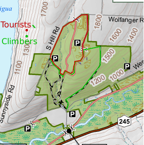 Climbers will start across the street from the parking lot. They will start up the main trail and then turn right where the trail splits. They will follow the logging road for about 1.5 miles until they reach the north end of the DEC border at which point the trail dead ends at the property line heavily marked with posted signs. They will turn left up the hill while staying on the DEC property. They will come out to a field on top and a DEC access road with a parking loop that comes in from north end of the DEC property off South Hill Road. There will be 2 choices to get over to the South Hill DEC parking area where the Tourist would have started their hike from. They can choose to either walk South Hill Road back to the South Hill parking area or take the ” yellow gated” access trail at the North end off South Hill back down to the waterfall and cross over the creek and up to the South Hill Parking area. They will be car pooled back to the DEC parking area off Sunnyside.
The tourists will drive up to the top of the park and start at the DEC parking area off of South Hill Road. They will follow the trail down to the creek and cross over following the trail up to access trail that comes in from the “yellow gate” at the north end of the park off South Hill Road. They can return back to the Dec parking lot off South Hill Road, where they started or continue to the DEC loop access road to the east of the yellow gate off South Hill Road and take the logging trail back down to the DEC parking area off of Sunnyside Drive.
The Naturalists can drive to the top of South Hill Parking lot and walk into the same trail as the tourists without crossing the creek. The woods is dotted with pines and is a pleasant walk or they may choose to walk South Hill road taking in the various wild flowers along the roadside.
Those that wish can meet back to the DEC parking area off Sunnyside Drive for a social. Bring a sandwich and a drink.
Note: It is tick and mosquito season so dress for prevention and bring bug spray and plenty of water.
Directions: From Route 21 north of the village of Naples, turn onto Route 245 north. Continue north for about 5 miles. You will pass the West River boat launch on the left. Just pass the launch about 1/2 mile, turn left onto Sunnyside Drive and the Clark’s Gully DEC parking lot will be on your right about 1/2 mile down.

Looking for brochure.or mailing list so I can receive it in the mail.
Nothing opens up for mailing list.
There’s all kinds of very bizarre ads and post for viagra and other drugs above on calender page.
Please let me know if there’s a brochure available