Hikes led by Springwater Trails are generally held on Sunday afternoons and appear in this calendar in green.
- Categories
- Tags Barry Childs and Kathy Cloonan barry@africabridge Bike Bill Cooke Bob and Cindy Wagner Bob Menz (bert6952@yahoo.com) Bristol Hills Branch CANCELED Clarks Gully CLWA Colorado Trail Dena Munsell Dog friendly Finger Lakes Trail FL FLT Gene & Georgia Binder (585) 236-5384 Gene and Georgia Binder (585) 236-5384 Greenway Gully Gypsy moth Hemlock Hike Jayne Affolter Jeanie Smith John L Katherine Humphrey? Kayak Kelly Rell Landowner Liability Leader: Mark Lehigh Valley Trail Mark and Laure Allen (585) 662-9305 Mark and Linda Mary Ann Devey (315) 573-0774 Mary Lou Wenthe (585) 208-4337 Melissa Mike and Jenny Johnson Mitchellsville mjkcloonan@frontiernet.net Mushroom Foray Naples Nunda POSTPONED Rick Henchen Rick Henchen and Sharon Boldt Saralinda Saralinda Hooker Schribner Sharon Boldt Sharon Boldt (boldtbs@yahoo.com) sugarbush hollow Summer Weekly Wendy Stevenson
| Sun | Mon | Tue | Wed | Thu | Fri | Sat |
|---|---|---|---|---|---|---|
| Lehigh Valley Trail Hike or Bike in Rush, NY 2:00 pm Lehigh Valley Trail Hike or Bike in Rush, NY @ Stevens-Connor Lehigh Valley Lodge Apr 6 @ 2:00 pm – 4:00 pm Come join us for a leisurely hike or bike along the Lehigh Valley Trail on Sunday April 6th! With its flat even surface, the trail is a hidden gem for walking, hiking, jogging, biking. It is a vital link in … Continue reading → | ||||||
| Ontario County Park at Gannett Hill Hike-Naples 2:00 pm Ontario County Park at Gannett Hill Hike-Naples Apr 13 @ 2:00 pm – 4:00 pm 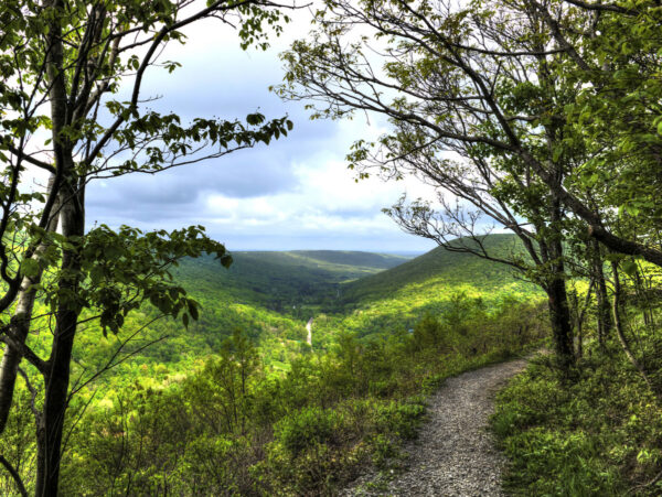 Save the date! This is one of our group favorite hikes. Ontario County Park at Gannett Hill is one of the highest points in Ontario County and located in the scenic Bristol Hills. At an elevation of 2,256 feet above … Continue reading → | ||||||
| No Hike-Easter Break 2:00 pm No Hike-Easter Break Apr 20 @ 2:00 pm – 4:00 pm No hike has been scheduled for this date due to the Easter Holiday. Enjoy the break, spend time with loved ones and eat chocolate bunnies. This will give you something to burn off next week  | ||||||
| Mystery Hike- Richmond/Honeoye 2:00 pm Mystery Hike- Richmond/Honeoye Apr 27 @ 2:00 pm – 4:00 pm Mystery hike coming your way! Please check back for more details. |
-
Categories
-
Tags
Barry Childs and Kathy Cloonan barry@africabridge Bike Bill Cooke Bob and Cindy Wagner Bob Menz (bert6952@yahoo.com) Bristol Hills Branch CANCELED Clarks Gully CLWA Colorado Trail Dena Munsell Dog friendly Finger Lakes Trail FL FLT Gene & Georgia Binder (585) 236-5384 Gene and Georgia Binder (585) 236-5384 Greenway Gully Gypsy moth Hemlock Hike Jayne Affolter Jeanie Smith John L Katherine Humphrey? Kayak Kelly Rell Landowner Liability Leader: Mark Lehigh Valley Trail Mark and Laure Allen (585) 662-9305 Mark and Linda Mary Ann Devey (315) 573-0774 Mary Lou Wenthe (585) 208-4337 Melissa Mike and Jenny Johnson Mitchellsville mjkcloonan@frontiernet.net Mushroom Foray Naples Nunda POSTPONED Rick Henchen Rick Henchen and Sharon Boldt Saralinda Saralinda Hooker Schribner Sharon Boldt Sharon Boldt (boldtbs@yahoo.com) sugarbush hollow Summer Weekly Wendy Stevenson
Please note: there is a start time change from the earlier published calendar. This will be the last spring hike with a 2PM start time, and the first SWT event of the year to offer a dish-to-pass social option.
Gene and Georgia Binder are inviting all hikers to join us this Sunday, June 6, at Durand-Eastman Park and arboretum, located on the shore of Lake Ontario. Most of us find this facility, with its unique botanical collection, to be quite enjoyable. Carpooling is advisable if you feel comfortable with it.
Hike Plan: We will start at the circle at the south end of Log Cabin Road, a dead end road on the south side of Lakeshore Boulevard, west of Zoo Road. The full group will begin with a leisurely walk to the arboretum, and into it, enjoying the botanical specimens we encounter. A special feature, at this time, will hopefully be the attractive pink flowers of the mountain laurel, which goes into bloom in June. These flowers have a unique way of getting bees to transfer pollen and, if there are any open flowers, we will try to demonstrate their sneaky trick. For those who would prefer a longer and faster hike, the arboretum walk will be followed by a longer trail walk around Durand and Eastman Lakes.
Social: We will all convene back at the circle on Log Cabin Rd., at 4 PM, for our optional after-hike social. If you’ve been vaccinated, and feel comfortable with it, we will go back to enjoying each other’s kitchen creations, like we used to, so bring something yummy to share with your fellow hikers. As before the pandemic, place settings will be provided. If you’re not yet comfortable doing this, just bring your own meal, as you’ve been doing. If there’s an unoccupied pavilion, we will appropriate it. However, if they’re all occupied, we’ll just put our chairs out on the lawn so, be sure to pack a folding lawn chair. We will pack a folding table and, if you have one that you can fit in, we may be able to use it. We don’t have a portable grill but, if someone has one and wants to bring it, go for it. There will be a small charcoal grill if you want to cook burgers and such.
Directions: Going north on 390, entering Monroe County, at the first fork, bear right to get on 590. At the next fork, bear left to stay on 590. Continue north in the center lane. When approaching 104, follow signs for sea breeze, avoiding 104 exits. Approaching the fourth roundabout, note sign for Durand Blvd. Go ¾ way around to get on Durand Blvd. Continuing west, you will come to the park, on your left. Turn left on Log Cabin Rd., the3rd road on your left. Go to the circle at the end of Log Cabin Rd., and park. We will meet there.
This Sunday we have a choice of activities, both starting from the northeast corner of Honeoye Lake – a hike on Sandy Bottom Trail and its adjacent creek, or a bike ride along or around Honeoye Lake. Note the later start time of 4 PM for both activities. After the workouts we will adjourn to the Birdhouse Brewing Company at 8716 Main Street, Honeoye for our social/recuperation.
Everyone meets at the Sandy Bottom Trailhead on East Lake Road, about .3 mile from Route 20A/Main Street Honeoye. There are two parking lots side-by-side, each holding about 10 cars. Hikers will all start out together on the field portion of the trail and then there are options: head down the path to the long winding creek for a creek walk to explore some of the most interesting rocks in the area, and fossils here and there as well. Or, continue walking the field loop into the woods loop and back out to finish the field loop (about 3 miles), then head down to explore the creek. There are plentiful treasures to see! Recommended attire – sturdy shoes with decent treads, walking sticks for creek with slippery stones.
For the cyclists there are two options:
-10 mile ride down East Lake Road to the South Boat Launch (5 miles) and return the same way, or
-18 mile loop ride around the lake clockwise, heading down East Lake Road to the South Boat Launch, heading further south to join County Road 36 (West Lake Road), and riding north back to Main Street/NYS Route 20A. Heading a mile east on Main Street and then .3 miles down East Lake Road will bring you back to the start.
Cyclists please bring plenty of water, and helmets are required.
Social: Please join us afterwards at the BirdHouse Brewing Company, 8716 Main Street, Honeoye, for restorative food and beverages. See their Sunday Grill specialties at https://birdhousebrewing.beer/index.php/from-the-kitchen/sunday-grill
Directions:
From the south (Naples, Springwater, etc): Take Rte 21 North to CR 36, make left onto CR 36, make right onto East Lake Road – parking lot is on left just past the County Road 33 intersection.
From the north (Bloomfield, Victor, Rochester, etc): Take CR 40 south to Rte 20A, cross 20A onto East Lake Road, parking lot is on right, 3/10 of a mile from intersection.
From the east (Bristol, Canandaigua, etc): Take Rte 64 south to Rte 20A, make right onto 20A, left onto East Lake Rd
From the west (Hemlock, Livonia, etc): Take Rte 15A to Route 20A, make left onto 20A, right onto East Lake Road
This Sunday’s hike will complete Springwater Trails tour of the Finger Lakes Trail between the Bristol Hills Branch and the Letchworth Branch. This hike should be an enjoyable end to the series, walking through some interesting landscape carved by the Genesee River, with views from high above the Genesee River. 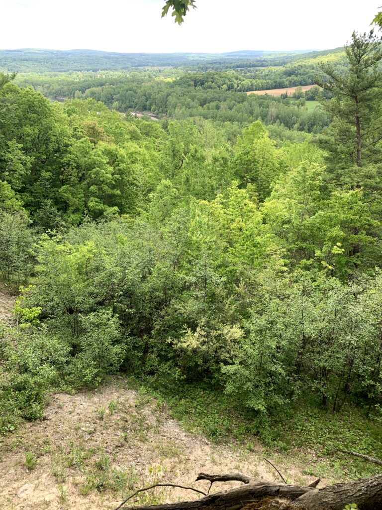
We will all meet at the Whiskey Bridge across the Genesee River. According to the Briidgehunter website, local legend gives two possible origins for “whiskey” bridge: the Irish immigrants who built the bridge drank so much whiskey it was called whiskey Bridge; OR Livingston county was “wet” and Wyoming county was “dry”, so whiskey was hidden under bridge and smuggled across.
At any rate, the bridge was lost in 1972 to the Agnes hurricane and was replaced by a “through truss” bridge we will see on Sunday.
After our group picture by the bridge, we will car pool to S. River Rd to start the hike. The hike starts in the woods, with interesting plants on either side, including – according to the FLT map description – some poison ivy. The trail continues along a sharp ridge with views to the south and west across the river valley. We will sign in at the register before beginning a gradual descent through some recent logging and past farmer’s fields. The blazing of the trail along the farmer’s road is occasionally difficult to follow, including at a left turn to follow the road down hill along the edge of a slope.
After passing farm equipment and buildings, we will emerge onto Bailey Rd. A left turn out of the gate will follow Bailey Rd up to Whiskey Bridge and our cars. We will walk across the bridge and check out the connections to the Genesee Valley Greenway, the FLT Letchworth Branch and the main Finger Lakes Trail in Wyoming County. The total hike is about 2.5 miles.
After a carpool back to pick up cars left on S River Rd, thirsty hikes can cross the bridge and head north to the Letchworth Pines in Portageville.
Directions:
From Springwater: Take NY-15 south to Wayland. Turn right on NY 63 to Dansville. Turn left onto Ossian St (NY 36 North). In half a mile, continue straight on Ossian St onto NY 436 W. In 19 miles, after passing through Nunda and continuing past an entrance to Letchworth State Park, to cross the Genesee River into Portageville, turn right to stay on NY 436. Rt 436 ends at NY 19A. Turn left on 19A for 0.7 miles. Turn left onto Bailey Rd and cross the Whiskey Bridge. Turn left onto Bolton Rd and park.
From Geneseo: Take NY 63 S toward Mt Morris. Curve left to continue on NY 408 under I-390 Continue on NY 408 for 13.3 miles through Mt Morris to Nunda (there is a left then right jog at Main St in Mt Morris to stay on 408). At Nunda, turn right on NY 436W for 6 miles through Portageville. Turn left on 19A for 0.7 miles. Turn left onto Bailey Rd and cross the Whiskey Bridge. Turn left onto Bolton Rd and park.
From Hornell: Head north on NY 36N for 10 miles. Turn left onto CR 70 for 10.2 miles. You will pass the intersection with NY 408. followed by Oakland Rd. Turn left onto CR 2 (Main St). In 1.3 miles, turn left on Short Track Rd, then right onto Stillson Rd. In 1.2 miles, turn right onto Pennycook Rd, then left onto Bailey Rd. In 1.7 miles, pass the bridge and park.
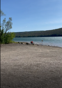 This Sunday we will be hiking and boating on Hemlock Lake. As always, please check back here before the hike in case of bad weather.
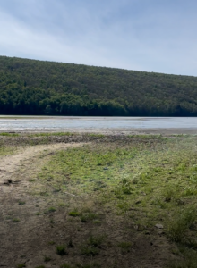
We will all meet at the North Boat Launch on Hemlock Lake. Boaters should arrive 15 minutes early to allow time to unload boats. The launch has been expanded since last summer, so unloading should be quite easy. Hikers will follow the trail south along the lake and can continue up Rob’s trail if time permits. Hikers should return to the cars by 6:00 PM, either along the trail or along the shore line (the lake is low enough to allow walking next to the water).
Boaters will explore the north end of the lake. We will make a loop, crossing the lake once each direction. If desired, some hikers will plan to meet a boat at the Rob’s Trail beach and trade transport with a boater.
 Following the hike, we will enjoy an optional pot-luck supper at the Hemlock Park pavilion. Bring your own beverage, a dish to pass, and, if you prefer, your own reusable plate and silverware.
Directions are available here.
One final note: With the low water on Hemlock, the south boat launch appears to be unusable. See the image to the left.
History: Genesee County Park is the oldest county forest in New York State. It has 431 acres of forested rolling hills, five ponds, and a 4-acre wetland, located in Black Creek Watershed. The park has 10 miles of trails for hiking, exploring and mountain biking.
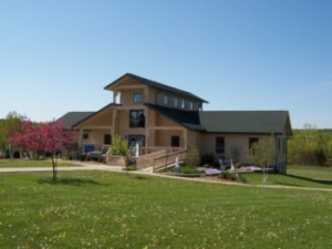
All hikers will start out in a single group from the Interpretive Nature Center to explore the center section of the park, including stands of hardwood and softwood trees and wetlands. When we reach the park perimeter, Climbers will follow the Boundary Trail around the park for a total hike of about 5 miles. Tourists and Naturalists will complete a shorter hike back to the start. Maps of entire park will be available at start of hike.
The Interpretive Nature Center is open Sunday 12-4 pm. Those wanting to visit the Center will need to arrive prior to 4 pm.
All hikers should meet at 3:45 in the large parking area in front of Interpretive Center, to get organized for a 4 pm. start.
Social – We will reconvene at the Interpretive Center at 5:45 for an optional social gathering on the grounds. Bring a lawn chair and your own beverage and meal or snacks, or bring a dish to share. Dessert will be provided.
Directions:
From the Thruway – Take exit 47 off Thruway (LeRoy/Route 19). Take Route 19 south through LeRoy to Route 20, make a right and go west for 5.6 miles. Turn right onto Old Telephone Road and then left onto Bethany Center Road (County Road 15). Turn left into the Park entrance onto Memory Lane and continue 1/4 mile to the Interpretive Center.
From the East: Go north to Route 20. Take Rt. 20 West past Avon, Route 19 and Route 63. Turn right onto Old Telephone Road and then left onto Bethany Center Road (County Road 15). Turn left into the Park entrance onto Memory Lane and continue 1/4 mile to the Interpretive Center.
From Springwater and points south – Get yourself to Geneseo area to pick up Rt. 63 North, either where it intersects with Rt. 36 North in village of Greigsville or in Geneseo. Follow 63 North to Route 20, go west 3.5 miles to Old Telephone Road/Bethany Center Road. Turn left into the Park entrance onto Memory Lane and continue 1/4 mile to the Interpretive Center.
I have received emails about possible substitute hikes for the Clark Gully hike that has been cancelled. According to Wunderground, there is a 20% chance of rain at both locations below, so make your own choice.
From Don:
Here is a very specific suggestion. A hike in Rochester in Charlotte area along the Riverway trail (River trail) in Charlotte that includes the board walk over part of the Genesee River in Charlotte and then 6-8pm free concert in the parking lot of Dairy Queen at 3644 Dewey in Greece where there will be a car show and the 1960s Girl Group band It’s My Party will be performing. Meet location for a 4pm start time would be at the bottom of Petten Street in Charlotte at the trailhead parking lot”, 1 1/2 – 2 hr hike, and then less then about a 5-ish minute drive to Dairy Queen. Opportunity to purchase some mostly unhealthy food options, or bring your own healthy (hopefully) food options (for self or sharing).
Directions from Springwater: Take NY 15A north to Lima. Turn left on 5&20. Turn right onto the entrance to I-390 north toward Rochester. At the intersection with I-590, stay on I-390 around the west side of Rochester. Take exit 27A onto the Lake Ontario State Parkway eastbound. In 3 miles, turn right onto Lake Avenue. In 0.3 miles, turn left onto Petten (the first street on the left). Park at the trailhead at the end of Petten St.
From John:
I’m up for a walk in Grimes Glen and a beer at the new Naples brewery. Since the brewery closes at 6, this would be a short walk, likely with raincoats, focused on watching the results of yesterday’s rain, followed by a visit to the newly opened brewery.
Directions from Springwater: Take NY-15 south to Wayland. Turn left on NY-21N continuing through N Cohocton to Naples. In Naples, at the Bristol Valley Theater, turn left onto Vine St. Grimes Glen is at the end of Vine St.
Note: These quick hike plans are completely Ad Hoc. Please click on the title of this event and leave a comment if you plan to come. Although right now I plan to come to Grimes Glen and Don plans to be at Petten St, if there are no commitments from other hikes on this website, there may be no one there if you go.
Reminder: Next week (July 27), Springwater Trails will host a paddle/hike at the Finger Lakes Museum in Branchport. We will kayak on the Sugar Creek and out onto Keuka Lake. The Museum has offered to arrange for kayak rentals if we have we know some of you want to rent a kayak. To help us get a count, please email info@springwatertrails.org by Monday, July 19th or talk with Linda or Mark at the Clark Gully hike. Thank you for helping us to plan ahead on this opportunity.
NOTICE: The expected mud on the steep trails has forced us to cancel our hike on Clark Gully.
On Sunday we will return to Clark Gully on the south east side of Canandaigua Lake. This gully is a part of the High Tor Wildlife Management Area which is less developed than the area south of 245, but it is popular none the less.
We will offer hikers two hikes, one on the east side of the gully, starting at the bottom. The other will be a bit easier, starting up high on the gully off of South Hill Road. Both hikes will be in and out.
The Climbers will head across the road from the DEC parking area. After a short walk along the creek that comes down the gully, we will head up a quite steep hill, enjoying the exercise and the views back across the West River. This is a steep climb and our speed will depend on each individual hiker. At the top we will continue on the trail down to the creek, for any hikers so inclined. After cooling off near the creek, the Climbers will follow the same trail back to the cars.
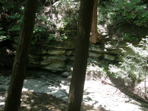
The Naturalists will drive on Sunnyside Rd toward the lake, staying to the right on South Hill Rd. Parking is available on the right side after the road enters the town of Middlesex and becomes seasonal. We will hike across the field into a forest on an outcropping between two gullies. After the first steep downhill the trail branches, with the left branch heading down to the creek and the right branch following the ridge down steeply to an overview of the valley. After the view, we will need to climb back up, so each hiker can decide how far they wish to go.
Following the hike, join us for a dish to pass social at the Naples Community Park on the left of rt 245 before you reach the village. In case all the picnic tables are taken, you may want to bring a chair along with a dish to share and your own beverage.
Directions: Drive to Naples. Off Rt 21 across from Bob & Ruth’s, turn onto Rt 245. Drive 3.9 miles toward Middlesex. You will pass a DEC boat launch (west river) on the left side about a mile before your left turn onto Sunnyside Road. Drive about a mile to a “T” in the road. There is a DEC parking lot off to the right. We will all meet there for the hike.
Please join us for kayaking on Sugar Creek and Keuka Lake or a hike through the marsh preserve to the lake. Our starting point will be the Finger Lakes Museum site, accessible from Guyanoga Road or from Route 54, both close to the flashing light at the center of Branchport. The Finger Lakes Museum is a former elementary school which is being gradually converted to a regional museum. They have an active boat launch site at the rear bordering Sugar Creek, the main tributary into the west branch of Keuka Lake.
Checking the weather, expect a very warm day with scattered showers.
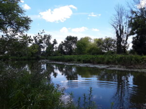
Kayakers should arrive by 3:40 to unload your boat and launch from their floating dock. Hikers, who will follow the trail along the river, and kayakers will leave at 4:00.
After launching, kayakers will head upstream in Sugar Creek through a woodland waterway. Based on time and conditions we then will turn around and head back past the dock to the lake. Once on the lake we will start heading west and enter the adjacent marshland owned by the Isaak Walton League. Cattails, water lilies and waterfowl are abundant in the marsh waterways. Back on the lake we will continue west to the marinas of Branchport. Another U-turn will take us toward Keuka Lake State Park. Finally, we will return to the river and up to the takeout at the Museum’s dock.
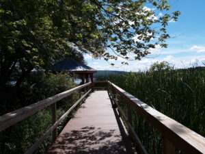
Hikers will hike to Keuka Lake along the museum paths, stopping at an observation platform overlooking the marsh and at the Museum’s lakefront pavilion.: After enjoying the lake views, we will return to the museum and explore the museum grounds.

Social: Bring your own snack or a dish to pass at the Museum’s pavilion. Or contribute $5 to the social fund and snack from the dishes available.
Directions:
From Springwater and Wayland – Take Route 15 south and then Route 21 north to Naples. Coming into Naples, go right on Route 53 toward Prattsburgh. In 1.2 miles make a left on Italy Valley Road. You will remain on Italy Valley Road for about 8.7 miles, although the county road number changes from 21 to 18 to 34 en route. At the end of Italy Valley Road, go left for .3 miles on Italy Hill Road (CR 35), then follow Itlaly Hill Road as it curves to the right and becomes CR32. In another 4.7 miles you will be at the flashing light in the center of Branchport. Go straight on Route 54A toward Penn Yan for .2 miles, and turn left into the Finger Lakes Museum across from the Library, and before the Fire Station. Look for the driveway toward the new barn on your right.
From Canandaigua and 5&20: Take East Lake Road south to County Road 1, or Route 247 from Reed’s Corners into Rushville. Continue South through Rushville toward Penn Yan. Route 247 will become Route 364 shortly before Potter. Continue for 4.5 miles past Potter and make a right on Guyanoga Road (CR 29). Go another 6.5 miles to Branchport. Turn left into the Finger Lakes Museum at 3369 Guyanoga Road, or if you miss it, go left at the flashing light and then left into the FLM drive. If you come in from Guyanoga Road, go to the right around the building and parking lot, and follow the signs to the Creekside Center (a new barn). Park on the grass near the boat rack. If you take the side entrance in from Route 54A heading east toward Penn Yan, turn in to the left, across from the library, and then right into the Creekside Center.

Looking for brochure.or mailing list so I can receive it in the mail.
Nothing opens up for mailing list.
There’s all kinds of very bizarre ads and post for viagra and other drugs above on calender page.
Please let me know if there’s a brochure available