
Hikes led by Springwater Trails are generally held on Sunday afternoons and appear in this calendar in green.
| Sun | Mon | Tue | Wed | Thu | Fri | Sat |
|---|---|---|---|---|---|---|
| Lehigh Valley Trail Hike or Bike in Rush, NY 2:00 pm Lehigh Valley Trail Hike or Bike in Rush, NY @ Stevens-Connor Lehigh Valley Lodge Apr 6 @ 2:00 pm – 4:00 pm Come join us for a leisurely hike or bike along the Lehigh Valley Trail on Sunday April 6th! With its flat even surface, the trail is a hidden gem for walking, hiking, jogging, biking. It is a vital link in … Continue reading | ||||||
| Ontario County Park at Gannett Hill Hike-Naples 2:00 pm Ontario County Park at Gannett Hill Hike-Naples @ Lookout Parking area Apr 13 @ 2:00 pm – 4:00 pm  This is one of our group’s favorite hikes! Ontario County Park at Gannett Hill is one of the highest points in Ontario County and located in the scenic Bristol Hills. At an elevation of 2,256 feet above sea level, you’ll … Continue reading | ||||||
| No Hike-Easter Break 2:00 pm No Hike-Easter Break Apr 20 @ 2:00 pm – 4:00 pm No hike has been scheduled for this date due to the Easter Holiday. Enjoy the break, spend time with loved ones and eat chocolate bunnies. This will give you something to burn off next week  | ||||||
| Hike Rob’s Trail – Hemlock Lake side 2:00 pm Hike Rob’s Trail – Hemlock Lake side Apr 27 @ 2:00 pm – 4:00 pm Join us on Sunday April 27th to hike the west side of Rob’s Trail, the DEC/Nature Conservancy property in the northeast corner of Hemlock Lake! Options are to hike out and back to the south along the trail from the … Continue reading |
Annually, one of two big shindigs that Victor Hiking Trails (VHT) sponsors, is National Trails Day (NTD) observed each year on the first Saturday of June. In 2018 the date is June 2nd. VHT is of course one of many hiking groups that plans some organized observance on NTD. Yep, that word “national” does in fact imply many groups across the USA observe or celebrate NTD in some manner. Now, before I describe more about NTD activities that VHT hosts, you were wondering what the other big shindig that VHT has annually. Weren’t You? Answer: the second big shindig VHT does is the VHT “challenge hike” usually held sometime around late September.
NTD in Victor with VHT is usually three serial hikes, with a break in between each of the three hikes for rest and refreshment. The first hike is a morning hike and the last hike finishes in the afternoon.
Details for 2018 are: On Saturday, June 2nd, Victor Hiking Trails will host the 26th annual National Trails Day in Victor. Come to Finger Lakes Community College, Victor Campus, located at 200 Victor Heights Parkway, Victor, NY 14564, at 8:30 a.m. for a free continental breakfast. There will be three easy hikes beginning at 9:00 A.M., bottled water and snacks, a free pizza lunch with drinks and raffle prizes. Everyone who completes all three hikes will receive a free one-year membership to Victor Hiking Trails.
You can also read about National Trails Day 2018 in the the VHT newsletter The Pathfinder Spring 2018 edition (volume 23, issue 1, pages 2 & 7). A direct hyperlink to a VHT webpage about NTD 2018 is here. And of course, you can check the VHT website for updated details about VHT’s NTD hike for June 2nd, 2018.
This is a joint trip with the Rochester Mycological Assn & NYFA. We will explore Keshequa Creek with its cliffs and see beautiful large trees. Bring
lunch. Leader: Ed Fuchs, 598-1307, edfuchs.nfbs@gmail.com Call or e-mail Ed for meeting place and time.
SPRINGWATER TRAILS HIKE FOR 4:00 pm, June 3, 2018
LOCATION: Harriet Hollister Spencer State Park
HIKE DESCRIPTION: HIKERS WILL SPLIT INTO 3 GROUPS. Each group will walk at their own
pace. We will start at the main parking lot at the entrance to the park.
Naturalists have a couple of choices; walk the roadway into the park and enjoy the
spectacular view of Honeoye lake and continue into the picnic area. There are a few shorter
loop trails around the picnic area that can be walked , i.e. Raccoon Run, Whiteface and Blue Spruce.
Tourists have several options they can walk the roadway into the park,take the bicycle trail
Take Ruthie’s trail or any of the other trails in the park.
Climbers may wish to head out to the south end of the park on C4 snowmobile trail and walk
the field back out to Townline road where the can be picked up and shuttled back to the parking lot.
RECOMMENDATIONS: Bring water,bug juice,hat and preferably,light weight pants.
After hike social: We will have our social at the picnic area at Harriet Hollister Spencer. Hot dogs and hamburgers will be provided. Bring a dish to pass or a five dollar donation would be appreciated.
DIRECTIONS : From Rochester: Take RT 15A south.Two miles before Springwater village, turn
left onto Wheaton Hill Road. Drive for about 3 miles. Turn Left onto Wetmore Rd. and
straight thru onto Canadice Hill road and drive another 2 miles to The Park.
From Honeoye: take Cty Road 37 for 4-5 miles.Continue straight onto Canadice Hill Rd. at Cty
Rd 37 turnoff in Canadice Hamlet.follow Canadice Hill Rd for 3.4 miles until you reach the Park entrance.

The Finger Lakes Trail Conference Spring Weekend is a time when we bring members and guests from across the state together for a 3-day weekend of hikes and programs. It is also the time of the Annual Meeting of the FLTC Membership and Annual Awards Presentation.
Additional information will be posted on the FLTC Website.
The 21st Annual ADK-GVC Outdoor Expo will be held on Saturday, June 9th 2018 at the Beach area of Hundred Acre Pond in Mendon Ponds County Park off Douglas Road. Outdoor activities, learning, experiences, educational & workshop sessions, etc abound at this free event, 9:30AM-3:30PM. And, YES, there are free trials of various kayaks and/or canoes, this aquatic activity is at the beach area of the Hundred Acre Pond.
Myriad presentations and interactive events are mostly centered around the area near the beach and contiguous areas of the adjacent parking lot. Many organizations, individuals, and businesses, all come together with the Genesee Valley Chapter of the Adirondack Mountain Club (ADK-GVC) to make this a premier event for outdoor enthusiasts.
Here is a hyperlink to ADK Outdoor Expo. http://www.gvc-adk.org/expo
And here is a hyperlink to an article about the 2015 Outdoor Expo, included for reference of the myriad type activities.
Our hike this Sunday will be a combination of field, creek and woods on the Sandy Bottom Trail in Honeoye. We will meet at the parking lot on East Lake Road, 3/10 of a mile south of Rte 20A/Main St., Honeoye. The lot is small – about 10 cars max, so some may have to park on the road shoulder. We will all start out together on the field portion and then there are options: head down the path to the long winding creek for a creek walk to explore some of the most interesting rocks I’ve seen in the area, and fossils here and there as well. Or, continue walking the field loop into the woods loop and back out to finish the field loop (about 3 miles), then head down to explore the creek. I spent well over an hour exploring the creek with a couple of friends last Spring – there’s plentiful treasures to see! Recommended attire – sturdy shoes with decent treads, walking sticks for creek with slippery stones.
Directions:
From the south (Naples, Springwater, etc): Take Rte 21 North to CR 36,make left onto CR 36, make right onto East Lake Road – parking lot is on left.
From the north (Bloomfield, Victor, Rochester, etc): Take CR 40 south to Rte 20A, cross 20A onto East Lake Road, parking lot is on right, 3/10 of a mile from intersection.
From the east (Bristol, Canandaigua, etc): Take Rte 64 south to Rte 20A, make right onto 20A, left onto East Lake Rd
From the west (Hemlock, Livonia, etc): Take Rte 15A to Route 20A, make left onto 20A, right onto East Lake Road
Social: Gather at the Honeoye Boat House a mile south of the SBPL for food & drink & chat
Last Summer and Fall, the Bristol Hills hike series was systematically moving north up the Bristol Hills Branch of the Finger Lakes Trail, one section each month. Then hunting season interfered and we needed to skip a section that was closed for the season. Now we are finally returning to the section north of Prattsburg to a section of the trail entirely in the woods.We will walk through a wide variety of forest including an active sugarbush, a beach forest, and a nature white pine forest.
This hike is a one-way hike so please expect some car shuffling. We are planning three routes. The Naturalists will hike the northern 1.6 miles, the Tourists will hike the southern 3.1 miles, while the Climbers to hike the entire 4.7 miles. There are no major climbs on this section, although the southern section has several down-slopes of 100 feet, followed by a matching climb back up.
Following the hike please join us for a potluck dinner social at the park in Prattsburg Town Square. Please bring a dish to pass and your own beverage. In case of rain, there is a small shelter at the park.
Logistics: Amy, Saralinda and Linda and I will position cars at the north end of the hike, where the Naturalists and Climbers will need rides back to their cars. We will meet at 3:20 on Pulteney Rd, drop off two cars and then drive to the Prattsburg Town Square. All other hikers should meet at the Prattsburg Town Square at 3:45. From the town square, we will car pool to the start of the hikes. We will only have shoulder parking at the hike, so minimizing the number of cars will be helpful. I am also hoping that a couple of Tourists can bring two sets of car keys, so that the Naturalist hikers can drive tourist cars to the mid-point of the hike where they will be positioned for the tourist’s return ride.
All hikers should meet on Rt 53 in Prattsburg at 3:45. The Naturalists will carpool to the Tuttle Rd crossing (about 7 minute drive), while all other hikers will carpool to Browns Corners Rd.
Directions:
From Springwater: Take NY 15 south to Wayland. At the light, turn left onto NY 21 for 8 miles through N. Cohocton to Naples. At the stop sign in Naples, turn right onto NY 53. It is 10.5 miles on NY 53 to Prattsburg. Park on the left side near the park before you get to Mechanic St.
From Naples: Take N Main St south toward Wayside Market. Continue straight onto NY 53. It is 10.5 miles on NY 53 to Prattsburg. Park on the left side near the park before you get to Mechanic St.
From Geneseo and Dansville (via 390): Take I 390 South toward Corning. Merge onto I 86 East for 1 mile. Take exit 37 for NY-53. Turn left onto NY 53 North. Follow 53N for 11.4 miles to Prattsburgh. Park on the right side by the park just after Mechanic St.
Tourist and Climbers directions to Access 12: Head south on NY 53, and take the first left on Mechanic St. Turn left to follow the main road onto Fairgrounds Rd. Take the first left onto Browns Corners Rd (CR 75). In 0.2 miles, the road curves left. In about 0.7 miles, there is a sign for the Finger Lakes Trail and a gravel parking area on the right side.
Naturalists directions to Tuttle Rd: Head north on NY 53.Take the first right onto Chapel St, At the tee, turn left onto N Main St. In 2.9 miles turn right onto Tuttle Rd. In about a mile, there are signs for the Finger Lakes Trail. If you get to a left turn on Pizura Rd, you have gone too far. Park on the right side near the trail.
 The hike on Sunday 24th June 2018 will follow a section of the Bristol Hills Branch of the Finger Lakes Trail in Naples. Springwater Trails has signed up to maintain this section of the Finger Lakes Trail. This section passes through the West Hill Preserve off Seman Rd and then across private land to Mt Pleasant St. in Naples. This section of trail is also in our plan to walk the entire length of the BHB.
We will walk this stretch of the BHB and cut away and brush and weeds that have overgrown the trail. The most useful tools for this are lopers and a small saw, and a weed whacker or two for the long grass; be sure to wear good work or gardening gloves. It’s a fairly long hike; if there’s a lot of grass to be cleared (this is usually at the two ends of the trail) then we’ll either leave teams there with weed whackers to concentrate on that or come back another day to finish the job.
We will meet at the entrance to the West Hill Preserve on Seman Road (42.66166, -77.396288). We will shuttle some cars down to the hike end in Naples (42.625950, -77.397304) before we start. The climbers will follow the trail down to the old cemetery in Naples. Naturalists follow the trail to the sign in box and then return to the cars on Seman Road.
Please note: Dogs are not allowed to hike on the Nature Conservancy property.
The Social
Following the hike, please join us for a social at the Neapolitan Pizzeria at 120 N. Main Street in Naples. If the weather is fine we can take a table on the porch.
Directions to the Hike Meeting Point:
From Springwater: Head south on NY 15 (for 5.2mi). At the light in Wayland turn left on NY 21N (for 6.7mi). In N Cohocton, turn left to stay on NY 21N (for 4.5mi). In Naples, turn left again to stay on NY 21N (for 1.8mi). On the north side of Naples, turn left on CR12 and head up the hill for 1.9 miles. Take the first left, Rhine St., to the 4 way intersection. Go left onto Seman Rd. Trailhead is about 1/2 mile, by a big sign on the left. Park along the road.
From Honeoye: Head south on CR 36 on the west side of Honeoye Lake (for 13.6 miles from NY 20A). Turn left onto Gulick Rd (for 2 mi), then right on Davis Rd (for 0.7mi). At the end of Davis, turn left on W Hollow Rd (CR 33) for 0.5mi, then right on Seman Rd. The Trailhead is about 1 mile, by a big sign on the right. Park along the road.
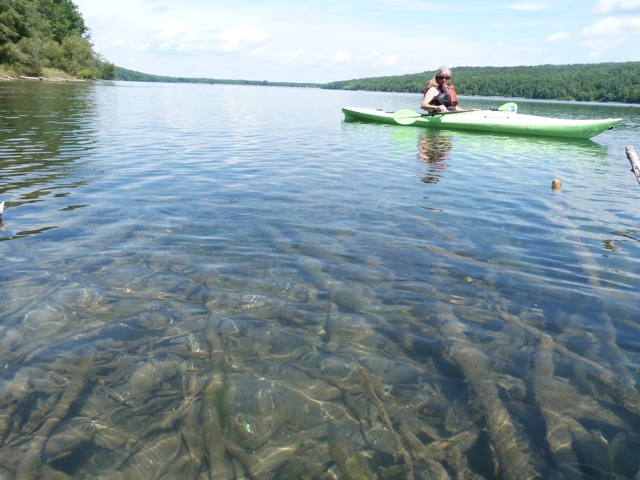 What better way to enjoy the hot weather than by taking a kayak or a walk along the gem of Hemlock Lake? This week we will meet at the South Boat Launch on Hemlock Lake just miles north of the light in Springwater, and kayak up the inlet. The water is high and the red winged black birds and baby ducks are absolutely delightful. The eagles may even turn out to soar above us. We will kayak into the inlet until we hit a “tree block”, turn around and come back. If time we may head north for a bit on the shore of Hemlock Lake.
![]() Attention: It is highly recommended that you bring sun glasses, suntan lotion, bug spray and water. It is going to be hot and sunny and there is no shade on the lake!
Attention: It is highly recommended that you bring sun glasses, suntan lotion, bug spray and water. It is going to be hot and sunny and there is no shade on the lake!
If kayaking isn’t for you, there is a lovely walk a,,long the lake with several opportunities to get down to the lake and enjoy the view of the water and the opposite tree filled shore. The walk goes along an abandoned road, which eventually turns into a bit of a path. It is approximately a total of 3 miles.
Social: Pot luck social after the hike near the parking lot. Please bring a dish to pass. The grill will be cooking hot dogs.
Kayak: Hemlock Boat Launch: South end, please arrive around 3:40 to get kayaks in the water
Hike: Hemlock trail from south end boat launch.
From Springwater: Follow 15A North from Springwater for 2.3 miles. Turn left into the parking area, then an immediate right to head down the access road. In about half a mile, the launch is on the left, and the parking area is on the right.
From Hemlock or Honeoye: Follow 15A South for 8.4 miles from the 15A / 20A intersection south of Hemlock. Turn right into the parking area, then an immediate right to head down the access road. In about half a mile, the launch is on the left, and the parking area is on the right.
Looking for brochure.or mailing list so I can receive it in the mail.
Nothing opens up for mailing list.
There’s all kinds of very bizarre ads and post for viagra and other drugs above on calender page.
Please let me know if there’s a brochure available