
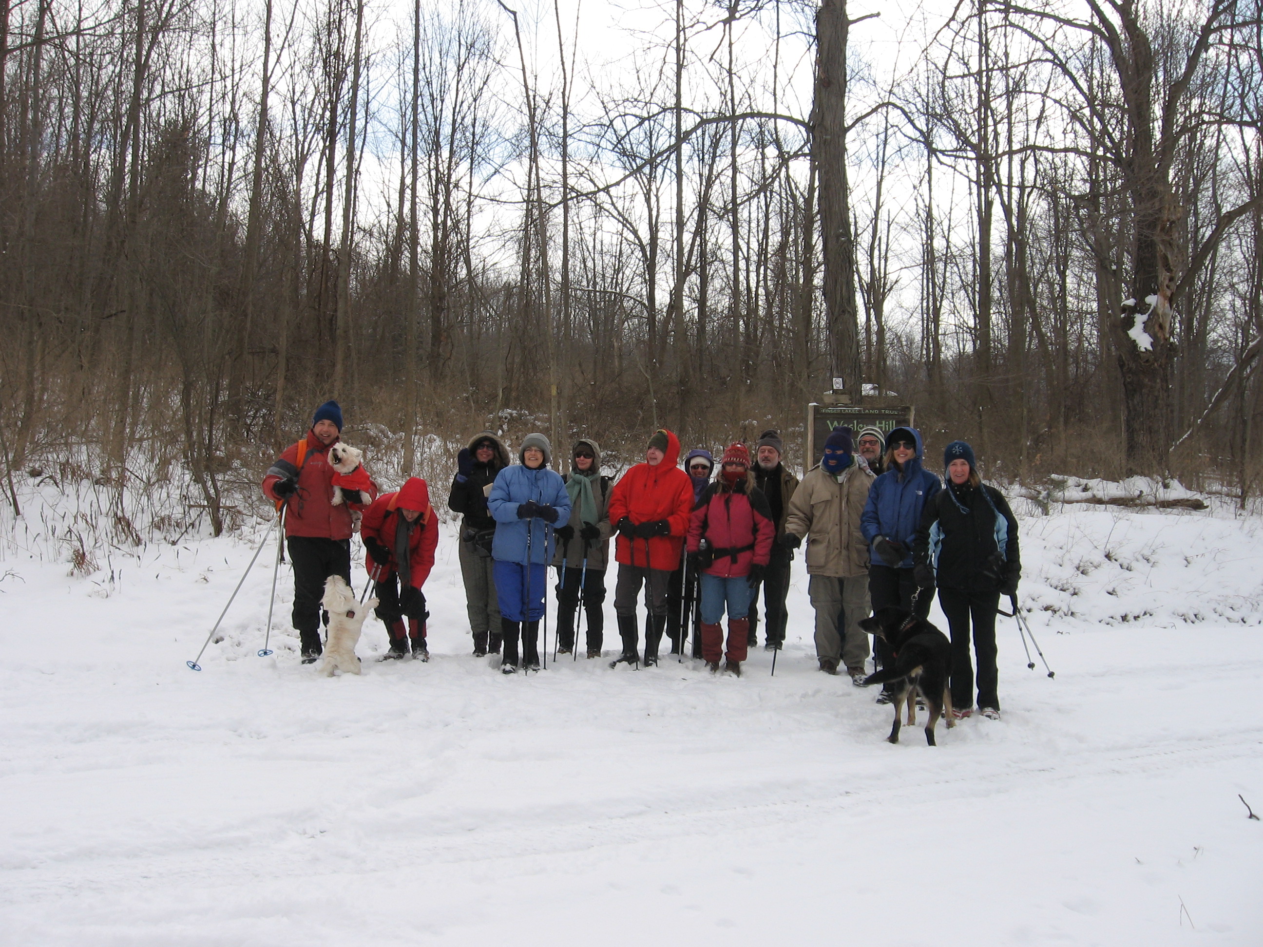
Hikes led by Springwater Trails are generally held on Sunday afternoons and appear in this calendar in green.
| Sun | Mon | Tue | Wed | Thu | Fri | Sat |
|---|---|---|---|---|---|---|
| Lehigh Valley Trail Hike or Bike in Rush, NY 2:00 pm Lehigh Valley Trail Hike or Bike in Rush, NY @ Stevens-Connor Lehigh Valley Lodge Apr 6 @ 2:00 pm – 4:00 pm Come join us for a leisurely hike or bike along the Lehigh Valley Trail on Sunday April 6th! With its flat even surface, the trail is a hidden gem for walking, hiking, jogging, biking. It is a vital link in … Continue reading | ||||||
| Ontario County Park at Gannett Hill Hike-Naples 2:00 pm Ontario County Park at Gannett Hill Hike-Naples @ Lookout Parking area Apr 13 @ 2:00 pm – 4:00 pm  This is one of our group’s favorite hikes! Ontario County Park at Gannett Hill is one of the highest points in Ontario County and located in the scenic Bristol Hills. At an elevation of 2,256 feet above sea level, you’ll … Continue reading | ||||||
| No Hike-Easter Break 2:00 pm No Hike-Easter Break Apr 20 @ 2:00 pm – 4:00 pm No hike has been scheduled for this date due to the Easter Holiday. Enjoy the break, spend time with loved ones and eat chocolate bunnies. This will give you something to burn off next week  | ||||||
| Rob’s Trail – Hemlock Lake side 2:00 pm Rob’s Trail – Hemlock Lake side Apr 27 @ 2:00 pm – 4:00 pm Join us on Sunday April 27 to hike the west side of Rob’s Trail, the DEC/Nature Conservancy property in the northeast corner of Hemlock Lake. Options are to hike out and back to the south along the trail from the … Continue reading |
UPDATE – TUESDAY MAY 2ND, TRAIL CONDITIONS: It will be muddy and wet, no chance of staying dry this year at the Bluebell hike. Perhaps Traction Devices &/or gaiters may be desirable for use, &/or waterproof boots.
Please feel free to join our friends of Genesee Valley Conservancy aka “GVC” (which has offices in Geneseo, NY) for its annual Bluebell hike(s). Each hike, one at 10:00AM and another at 2:00PM will be ~ 1.5-2 hours in duration and cover ~3.5 miles. Trail conditions may be muddy, so dress accordingly, TDs (Traction Devices) may be helpful.
This hike is a rather unique opportunity! And … you’re invited! You’ll marvel in the wonders of the blooms on Bluebells at this time of year, and as well traverse an area where normally hikers can not, as this hike on private property has been arranged exclusively for this GVC annual Bluebell hike (walk) event.
Hike location is at 3432 Nations Rd, Geneseo, NY.
Approx GPS Coords = 42.829918, -77.803816
Please note: hike times which start respectively at 10:00AM & 2:00PM are scheduled for just one day, Saturday , May 6th, 2017. Miss the date and you’ll need to wait a year for the hike opportunity to roll around again. Please realize that Mother Nature does not always cooperate with preplanned dates with design to showcase Natural Splendors. Advance predicted timing of Bluebell flowers blooming can be a tenuous undertaking, especially so in some years where weather patterns are substantially outliers from the norm.
Hike Location: Nations Rd runs, in an overall ~ “L” shape, westerly off NY Rt 39 (aka Avon Rd, and aka Avon-Geneseo Rd) a bit north of the Village of Geneseo, and also runs southerly off Co Rd 22 (aka Fowlerville Rd) in the western reaches of the Town of Avon. (The shortest entry to the hike locale from a main road is from NY Rt 39.) The hike location at 3432 Nations Rd is on the approximately e-w traversing section of Nations Rd, not far from the angular corner with the n-s traversing section of Nations Rd. Parking is with judiciousness and courtesy along the side of Nations Rd.
Directly extracted from the GVC website, below is the hike description provided by GVC.
_____________________________________________________________________
Bluebell Hike

This 3.5 mile hike takes place on trails that will be muddy and includes hiking through fields and over uneven surfaces. The hike features working agricultural fields and a forest along the Genesee River that is host to a spectacular sea of Common Bluebell flowers. The hike will take between 1.5 and 2 hours.
The hike will depart rain or shine. There is no transportation available. Participants must be able to complete the round trip.
The hike takes place on private property. Please help us continue this event by only visiting with us during these scheduled times.
*Event supported by Steuben Trust Company
An educational Hike with Springwater Trails and Victor Hiking Trails with impetus and designed to identify and view BLUEBIRDS, … and more, held at MaryFrances Bluebird Haven (MFBBH).
Trail conditions update, gained from 5/6/2017 Saturday’s preview hike: very wet, rubber boots suggested. Bluebirds were observed. For this hike & potluck after-hike social event, perhaps we can agree on “cloudy with a chance of meatballs.” The hike is offered rain or shine.
Starting at 2:00 p.m. on Sunday, May 7th, 2017 will be a joint hike of Springwater Trails (ST) and Victor Hiking Trails (VHT). For ST this is our regular Sunday weekly hike. For VHT this is a special hike outside of the monthly guided hike held on the 2nd Saturday of each month.
This is a special educational hike event at MaryFrances Bluebird Haven (MFBBH), a Town of Victor park, located at 235 County Rd 9 in Victor, NY. – – MFBBH entrance driveway, leading to the parking lot, is located on the east side of County Rd 9 (aka Victor-Egypt Rd) just south of intersect with Valentown Rd (which intersects from the west).
HIKING GROUPS, TRAIL ROUTING, (and map hyperlinks):
The hike, will have two separate sub-groups. Routing will be be slow and easy on mostly flat terrain for the Naturalists/birdwatchers group covering ~1 mile (the whole of the perimeter trail) within the MFBBH park, Gene as Hike Leader. The second routing will be fast paced for the Climbers/Tourists group covering ~3 miles within MFBBH park & on adjacent Monkey Run Trails, Dave as Hike Leader. (Climbers/Tourists routing will include MFBBH perimeter trail (~1mile) & MR three loop trails ~2miles of woodland walk, all mostly flat terrain.) MFBBH map // Monkey Run Trails map
KNOWLEDGE & EQUIPMENT:
We will have multiple hike leaders who are knowledgeable about birds, so bring your binoculars and camera (and telephoto lens if you have one). Also, wear good hiking boots as there may be some muddy spots. Possiblity that TDs (Traction Devices) may be helpful, but certainly not required. Hats with a visor and sunglasses may also be useful.
– Some ST hikers seized the opportunity to attend a presentation program “All About Bluebirds” held at the Geneseo Riviera Theater on Friday March 10th, 2017, one impetus that spurred this 5/7/2017 hike. Tickets for “All About Bluebirds” presentation were essentially “sold out” well prior to show day. Those ST hikers who attended will be looking to put newfound knowledge to use on this 5/7/2017 Bluebird hike. (Some other ST hikers were tending to matters as result of the 80+MPH windstorm of Wednesday 3/8/3017 on that Friday.) –
Hikers will have opportunity to learn about the impetus and history of MaryFrances Bluebird Haven.
Please note: Dogs are NOT allowed on this hike. Alcohol, smoking, and weapons are not allowed per park regulations. Oh, … and leave your saddle and mount at home, because horses are not allowed in this park, thus you’ll need to choose another mode of transportation to this hike.
AFTER-HIKE SOCIAL:
There will be an optional after-hike social dinner at the Butler Cottage located in MFBBH park beginning at 4:00 pm ; bring a dish to pass or make a donation (suggested $5) to the social fund to help defray expenses, and bring your beverage of choice (no alcohol please), if you would like to meet your fellow hikers. You may bring your own tableware if you’d like, albeit, disposable plates, plastic utensils, etc will be on hand as at most ST potluck socials.
Butler Cottage is a totally enclosed edifice with electricity / lighting / indoor plumbing / full facilities: restroom, full kitchen (counters & cabinets, stove/oven, refrigerator, microwave, and yes the “kitchen sink” too complete with running water), etc. The main area with tables and chairs accommodates 45 people. So, there is availability for heating up dishes best served warm, refrigeration, etc. Some hikers may wish to avail themselves prior to the start of the hike.
PARKING:
MFBBH parking lot will accommodate ~ 20 cars. Additional parking can be had along the entrance driveway, with judiciousness & thoughtfulness in mind.
DIRECTIONS:
From Springwater (and select other points south of Victor):
~45+ minutes drive from Springwater hamlet’s 4 corners, travel NY Rt 15A northbound (to just s of hamlet of Hemlock) ; turn right/eastbound onto NY Rt 20A (eventually passing through the hamlet of Honeoye, and continuing on NY Rt 20A northeasterly to just south of the hamlet of Bristol) ; turn left/northbound onto Co Rd 2 aka Oakmount Rd, pass through the hamlet of Bristol and continue straight on what will eventually become Oakmount Ave, crossing NY Rt 20 <USE FOREMOST CAUTION at this crossing!> to jct with Main St in Village of Bloomfield ; turn right/eastbound on Main St ; turn left/northbound onto NY Rt 444 (aka Elm St which becomes Victor Holcomb Rd which becomes Maple Ave) to jct with NY RT 96 aka East Main St in the Village of Victor ; turn right/eastbound onto NY Rt 96 aka East Main St ; turn left/northbound onto Church St ; Church St becomes Victor-Egypt Rd aka Co Rd 9 ; travel to 235 Victor-Egypt Rd where Mary Frances Bluebird Haven driveway is located ; turn right onto the entrance driveway to the MFBBH parking lot.
From Rochester area: (center city, areas directly contiguous east, as well as north and west Monroe County areas) ~ a bit under 30 minutes drive from Rochester get on I-490 eastbound expressway and travel to exit 28 (for NY Rt 96 southbound, in Perinton) ; from the exit 28 ramp turn left/southbound onto NY Rt 96 south ; from NY Rt 96 south turn left/eastbound onto High St (which is opposite Eastview Mall’s southern-most entrance drive) ; from High St turn left/northeastbound onto Valentown Rd ; <take note of the Valentown Museum as you pass it on the left side of the roadway> drive Valentown Rd (to road’s end) the jct with Victor-Egypt Rd aka Co Rd 9 ; turn right/southbound onto Victor-Egypt Rd, and then a quick left/eastbound into the driveway for MFBBH.
[Alternatively, I-490 expressway to exit 26 for NY Rt 31 eastbound, to Victor Rd aka Co Rd 52 (which becomes Victor-Egypt Rd aka Co Rd 9) ; turn right onto Victor Rd and travel to 235 Victor-Egypt Rd driveway for MFBBH ; turn left/eastbound into the driveway.]
CARPOOLING:
Carpooling in name of efficiency is encouraged due to distance from Springwater and also in light that this is a joint hike with VHT.
Named sequential carpool points (unsupervised), corresponding with directions to the hike (as written above) are: (1) <gather 12:40PM, leave at 12:50PM> Springwater Town Hall at 8022 S. Main St (aka NY Rt 15), in Springwater ; (2) <gather 1:00PM, leave at 1:10PM> Hemlock Lake Park parking lot, located at the northern end of Hemlock Lake and accessed via Rix Hill Rd immediately off NY Rt 15A (and a bit south of the jct with NY Rt 20A) ; (3) <gather at 1:15PM, leave at 1:25PM> in the hamlet of Honeoye on south side of Main St (aka Rt 20A) in the Honeoye Commons Plaza (~ 8567 Main St) parking lot of CVS/Subway/etc, optimally you wanna park closest to Main St. The entrance drive for Honeoye Commons Plaza is the next entrance drive past the entrance drive for Shurfine/Dollar General stores. (additional reference point: Honeoye Commons Plaza is ~ opposite Honeoye Central Schools).
Please note this sequential carpooling arrangement is set up so that those from further south will make a stop at each further north sequential carpool point, and potentially take on added passengers or reconfigure. There is an allowance of ~ 5 minutes from arrival to departure at each, to allow for loading, and not much fudge factor beyond that. Assuming all goes well, arrival at MFBBH for the hike is calculated to be ~ 1:55PM.
Additional information: can be gained from checking the VHT website, Facebook, Meetup or the VHT voice message line [phone: (585)- 234-8226], as well as checking the ST website for updates.
SPRINGTIME BIRDING:
An additional Article on “Birding” on the ST website, in anticipation of this Bluebird hike, for those who wish to learn a bit more about “Birding” in Springtime.
Subnote: (reference to a future hike)
Hikers may wish to take note of Valentown Rd (nearly opposite MFBBH entrance driveway), as a future ST hike will in part refer to historic “Valentown” which is situated at the western end of Valentown Rd & High St (in the Town of Victor), about two blocks away from present day Eastview Mall.
Hints: * Valentown was built in anticipation of a chartered railroad that was never built, the CNY&N RR (Central New York & Northern). This railroad was a one-time planned northern extension of the CNY&W RR (Central New York & Western), and was akin to the CNY&W. Come August 1, 1899, the CNY&N was consolidated with its parent company the CNY&W.
** (spoiler alert!) The CNY&W was a predecessor in lineage of the PS&N RR (Pittsburg, Shawmut & Northern), and August 2, 1899 the CNY&W was merged with a number of shortline railroads in Pennsylvania into the newly formed PS&N RR. Both the CNY&W and the PS&N in successive lineage routed high above Stony Brook Glen through what is present day Stony Brook State Park. Both respective sets of railroad high bridge abutments that remain in Stony Brook Glen were in this railroad lineage.
(credit to the book by Paul Pietrak “The Pittsburg, Shawmut and Northern Railroad Company” for some information cited herein.)
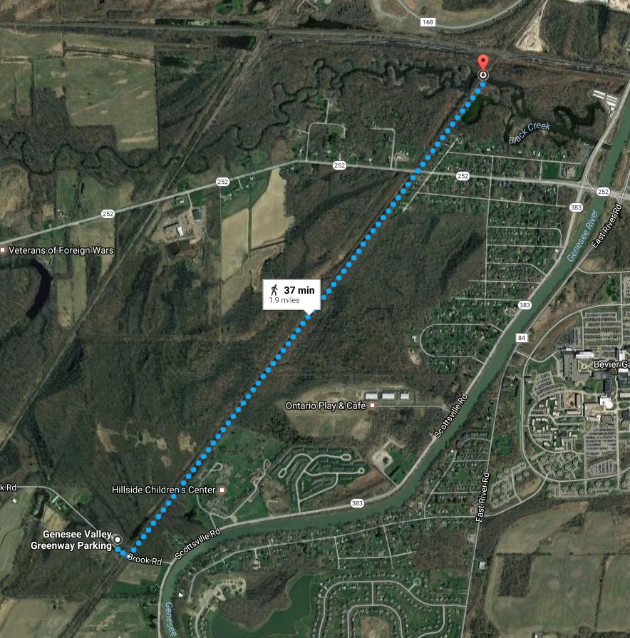 Today’s hike is an easy, flat trail with cinder surface, crossing an historic double-arched Genesee Valley Canal (GVC) culvert.
Meet at the Brook Rd Genesee Valley Greenway (GVG) Parking area. Total distance out and back is 3.7 miles.
For more information, check the Friends of the Genesee Valley Greenway (FOGVG) website, their Passport page, and the complete 2017 GVG Passport Series.
– – – Additionally, the Genesee Valley Greenway State Park (GVGSP) Facebook page usually lists the upcoming GVGSP events, and the FOGVG Facebook page also lists numerous GVG events in our area albeit a greater proportion of events listed on this page may at times be in the “Southern Tier” portion of the GVG as planned by a group of hikers known as the Southern Tier Greenway Hiking Group (STGH or STGHG) who welcomes all to hike with them.
– – – We also have a short history of the Greenway.
(subnote: The historic double-arched Genesee Valley Canal culvert (aqueduct) is best viewed for picturesque value from points other than on the GVG itself. As attested to by on-site GVG signage, the culvert/aqueduct, later turned viaduct for the railroad and subsequently the GVG, conducted the GVC over Black Creek. A great photographic vantage point is offered while on Black Creek in a kayak/canoe/boat. At low water levels you may be able to paddle Black Creek under the GVG to view both sides of the historic culvert , but at high water levels … well, not so.)
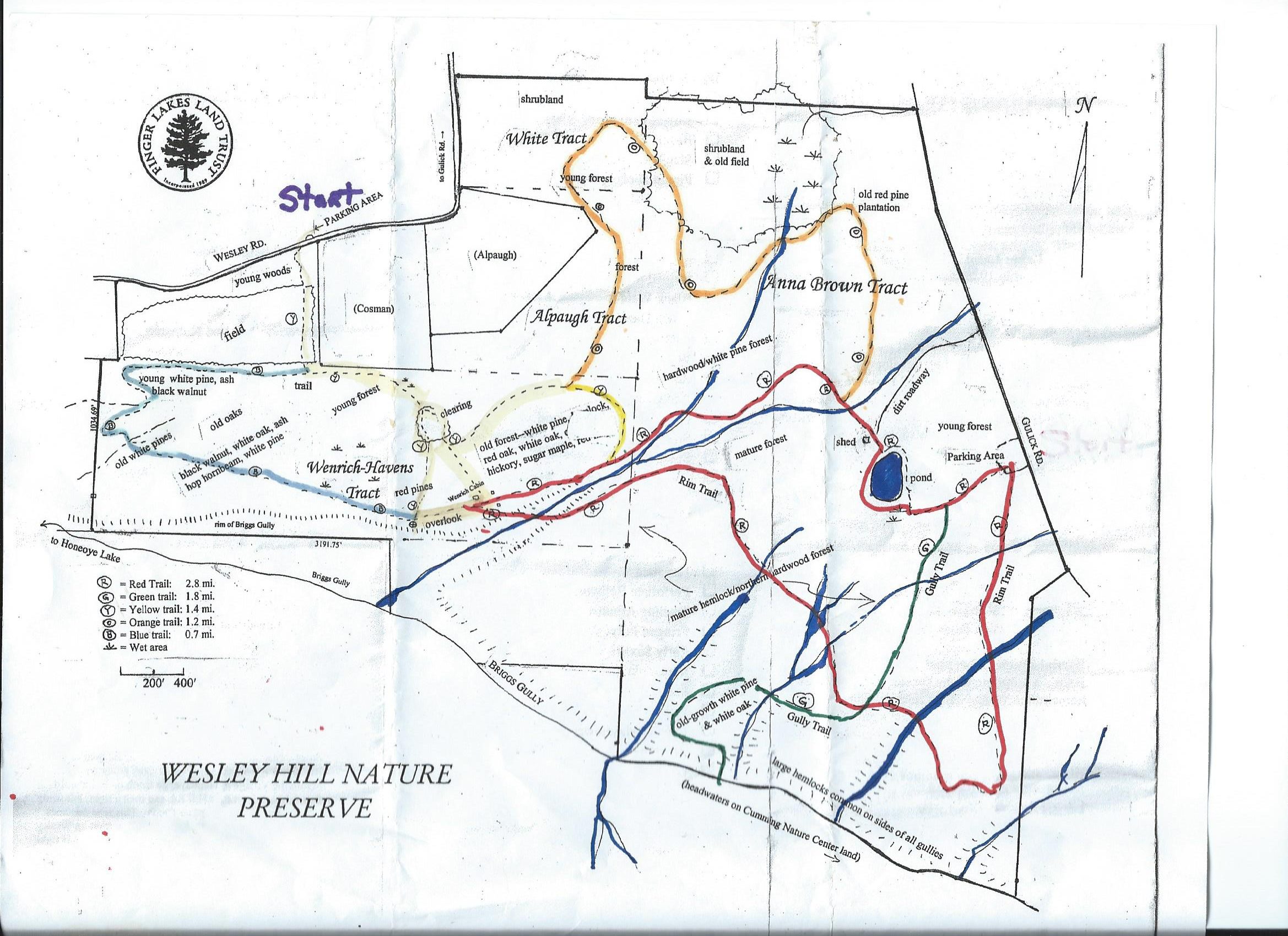 Wesley Hill Nature Preserve was founded in 1999 by the generous donation of 90 acres by the children of three artists – John Weinrich, James Havens and Colburn Dugan – to the Finger Lakes Land Trust. Since that time, the preserve has grown to over 390 acres by way of the purchase, by the land trust, of three parcels and a gift of the fourth.
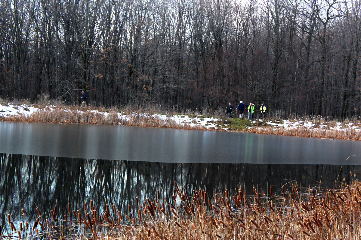 Highlights of our hikes will include views of Briggs Gully, the original Weinrich cabin, a bird watching area, breathtaking views of the surrounding hills, and a pond.. Click on the map above for a larger view.
We will meet at the parking lot on Wesley Road. The seasonal part of Wesley Road coming up from East Lake Rd (CR 33) was freshly graveled this spring.
The Climbers will be hiking the perimeter of the Preserve (4.5 miles). The Tourists will stay on the north side of the gully for a shorter 3.0 mile hike. The Naturalists will hike to the cabin and then on to the Wenrich-Havens Tract (2.0 miles).
Following the hike, please join us for an optional social at the Honeoye Boat House at the Trident Marina at 5226 East Lake Rd, Honeoye, NY.
February – Wesley Hill
Directions:
From Honeoye: take route 20A east through Honeoye to East Lake Road (CR 33). Turn right onto East Lake Road. (If coming from Bristol or points east, its a left onto East Lake Road). Take the first left, staying on CR 33, then the first right onto Pinewood Hill which becomes Gulick Road. Travel 3.4 miles, then turn right onto Wesley Road. Parking area is on the right side and can fit about 8 vehicles; the rest of us can park on the side of the road (it’s paved).
From Springwater: Head north on Rt 15A toward Hemlock. Just before Hemlock, turn right on Rt 20A. Follow Rt 20A to Honeoye and then follow the directions above.
From Naples: From the southern end of Naples, head west on Co Rd 36. Follow Co Rd 36 for 1.2 to the first right turn on Gulick Rd. Follow Gulick for 8.4 miles and turn left onto Wesley Rd. The parking area is on the right one mile down Wesley Rd.
Directions to the Social from the trailhead:
Via the seasonal part of Wesley Rd: Turn right out of the parking area and head down hill on Wesley Rd. At the bottom, turn right on East Lake Rd. The marina is on the left in 3.1 miles. The Boat House Grill is on the back of the building with a view of the lake.
Via Gulick Rd: Turn left out of the parking area and head up Wesley Hill Rd. At the top, turn left on Gulick Rd for 3.3 miles. The road bears left and becomes Pinewood Hill Rd. At the stop sign, turn left to stay on Pinewood Hill Rd (CR 33). In 0.4 mi, turn left onto E Lake Rd. In 0.8 miles, turn right at the sign for Trident Marine. The Honeoye Boat House Grill is about 150 feet down on the back of the building with a view of the lake.
So, you’ve been itching to get on your bike this Spring with impetus of a group bike outing of some kind. Well, here is an opportunity to do just that … on the Genesee Valley Greenway (GVG) from Avon to York Landing (round trip) on Saturday May 20th, 2017 at 10:00AM. Approximately a 17 mile round trip easy paced bike ride, and all trail mileage covered is in the nw corner of Livingston County. Meet location is at the Erie-Attica Trail (EAT) trailhead in Avon, accessed by Farmers Road off Rts 5&20 just east of the Genesee River.
– – – A digression – – Speaking of itching, this Hike Planner has had impetus to utilize the section of the GVG shortly north of Fowlerville Rd (and south of US Rt 20), said section has a short duration of trail topped with thick stone dust (mostly fine stone sans dust), for a ST hike since early Spring 2016 just following reconstruction of said section of trail which had been necessitated as result of a huge washout area. The thick stone dust topper (as determined during a potential preview hike in April 2016), provided wonderful cushioning upon a hikers joints, albeit bike/stroller/wheelchair wheels found much friction/consternation due to sinking in the freshly laid thick topper surface.
Due to complaints of wheeled trail users, later in 2016 the topper surface was rolled by a heavy duty roller to make for some compaction factor, and the surface is said now to be kinder to the aforementioned narrow wheeled vehicles (and probably offers less of an exuberant opportunity for a hiker’s joints). If there is a lesson here, perhaps it is that not all opportunities are lasting, some have but a small window of opportunity. Still, a future ST hike planned to utilize this section of the GVG may offer multiple unique opportunities including this now somewhat tamed section of thick stone dust topper.
Anyway, you’ll get to see this short section and so much more of the GVG via your bike on this traverse much more quickly than while on a hike. – – –
(A further digression, …for the curious, … utilization of the aforementioned section of trail south of US Rt 20 was in consideration for the 4/24/2016 ST hike, but ultimately was scrapped from the fledgling Hike Plan due to what would have been a controverted driving route to reach the GVG trailhead parking lot on US Rt 20, all thanks to road reconstruction on US Rt 20 just east of the GVG trailhead. -Now you know – substantially trials and tribulations that weighed in nixing this unique section of trail south of US Rt 20 for the 4/24 ST hike, … instead all hiking groups headed north from Avon.) – – – End of digressions. – – –
GETTING THERE:
From just inside Avon’s western town limits, to reach the Erie-Attica Trail parking lot & trailhead follow Farmers Rd to the end where you’ll find both the parking lot & the trailhead. – – – Seem familiar? Well, ST has in the past (10/18/2015 hike) held a hike utilizing exactly this trailhead and parking lot, as well as parts of the connecting GVG, so yes, it may seem familiar. And an April 24th 2016 ST hike also utilized the GVG in this area.
Detailed Directions From Springwater: Take Rt 15A North. In Lima, turn left on US Rt 20 (concurrent NY Rt 5, thus known as Rts 5&20). Follow Rts 5&20 for 7.6 miles (you will cross over I-390, pass through the hamlet of East Avon and the Village of Avon. After the traffic circle in the village, continue on Rts 5&20 for 0.8mi and turn right on Farmers Rd. The parking area is on the right, just after you pass under the flyover for the former RR truss bridge (now the Erie-Attica Trail truss bridge).
Further Event Details for this May 20th biking event are listed on the FOGVG Facebook page.
GVG Passport Booklet: This bike ride will cover a stretch of trail where you’ll be able to avail yourself of making a rubbing in the Wegman’s Passport to Family Wellness – GVG passport booklet. For those unfamiliar – – – Wegmans – “Passport to Family Wellness Program” series booklet for the Genesee Valley Greenway is a passport compilation of 14 separate hikes on the GVG, each hike route having a “rubbing post” for trail users to produce a “rubbing” in their passport booklet with purpose of documenting that a trail user has completed the respective hike. Passport booklets filled-in with rubbings can be turned in at a Wegmans retail store for redemption of coupons for Wegmans brand products and entry for a prize drawing. So, remember to bring your GVG passport booklet on this bike ride.
(Event post initially published on 5/7/2017, updated 5/17/2017.)
The plan for this hike has changed!
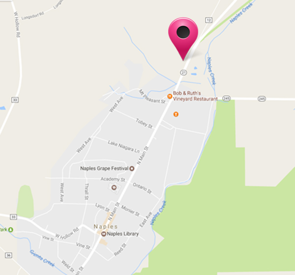
Now we will meet at 1:30 p.m. at the house of Gideon Hanggi at 7976 Route 21 in Naples. The house is black with red shutters; it is at the north end of Naples, opposite the Hanggi Christmas Tree Farm.
There is a meadow to the south side of the house – that’s the left as you look at the house. At the southern end of the meadow there is a dirt driveway – drive up as far as the tree line and park.
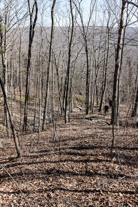
In order to get all the work done, we plan to get everyone to the work site with as much time as possible given to trail making. We’ll get there via Mr. Hanggi land rather than the one-hour hike to the site from either direction on the BHB. For those who can’t manage the steep climb to the top of the hill, Mr. Hanggi has offered to ferry people there in his 4-wheel drive vehicle – and back again of course for those who would like a ride! The site itself is on a slope, but it is manageable for all our hikers. The new route will follow the stream on both banks, which is also worth a good many photographs.
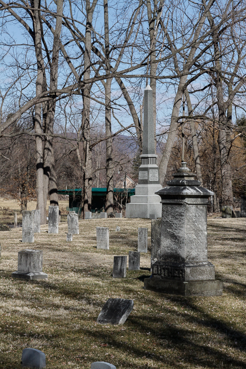
Please bring some tools with you to help trim back any brush that has grown into the pathway – loppers to trim brambles and roses are usually the most useful. Work gloves are also very necessary – roses can be sharp and mean! We’ll also clear away any fallen branches that we can manage. If heavier work is needed, such as mowing and tree removal then we’ll note what needs to be done and get it organized separately. It’s still early in the year, so we are not expecting any heavy encroachment of the undergrowth as yet. If anyone can bring a weed whacker, we’d like to get a crew of 2 people to walk up the trail from the cemetery in Naples and whack down some undergrowth about half way to the work site. This crew doesn’t have to walk all the way to the top of the hill if they don’t want to – the trail is clear for most of the way.
This hike is usually a dry hike, with good views at the higher elevations near Seman Road. The trail down to Naples follows a beautiful shale stream, with plenty of deep gullies and waterfalls – and there’s lots of water in the stream at the moment.
This event has been postponed again. We are still trying to line up the equipment listed below. Please stay tuned.
During our April 2 hike down Marrowback Rd, the many tires in the gullies below the road became a topic of conversation and concern. In addition to being an eye-sore, discarded tires are a convenient breeding site for mosquitos and can be a fire hazard.
Since that hike, we have talked with two major landowners and to the Town of Springwater about working to remove these tires and move them to a more appropriate place.
Our first day to work on this project will be May 23 at 10:00. Please come as we develop methods for pulling the tires up to the road and transporting them to the Town highway barn for disposal.
What to bring:
- Good work gloves.
- Good hiking boots. If desired, traction devices to help climbing up to the road.
- Rope to loop around tires.
- Clothes that can get dirty while working around heavy, wet tires.
In addition to helping with your energy and your muscles, you may want to lend your farm equipment. We need the following equipment:
- Power winches to pull the tires up the bank. If you have a vehicle with a power winch, we think that would be a great help in this project.
- Trailers to transport the tires.
- Trucks to pull the trailers. We will try to move the tires to the town Highway barn so the town Highway department can schedule disposal.
- Ropes to help handling the tires and the winches.
If you can volunteer any of this equipment, please leave a comment in the Tire Forum or contact John at vp@springwatertrails.org.
One final comment. A $2.50 fee has been collected since 2003 on every tire sold in New York State. In addition, any Tire Service company is required to accept, on a one-for-one basis old tires for recycling when new tires are sold. As a result, you have already paid for the disposal of your old tires and you should be returning them when you purchase new tires. Please remember, you do not need to dump your old tires into our forests.
The scenic Robinson Loops Trail awaits us this week. This area is a privately owned wildlife sanctuary and is connected to the Finger Lakes Trail. Prepare to be dazzled by ravines, streams, young forests, old growth trees, and panoramic views from open fields. Our meeting place will be at the parking area at the end of Mill St. in Swain NY. Please follow this link for information and a map of the area http://cnyhikig.com/FLT-RobinsonLoopTrails.htm .
For those of you who would like to carpool, please meet at the Springwater Town Hall at 1:00 PM on Sunday.
As usual, We will divide into three groups. Volunteers are needed to lead the Tourist and Naturalist groups.
Naturalists will enjoy a leisurely stroll along Caneseraga Creek on the Main Trail and the Yellow Loop. There should be some wildldflowers and various trees to identify. The rock ledges are quite extraordinary. It is a pleasant jaunt of 2.3 miles.
Tourists will be taking the “high road”, climbing gradually up the Blue Loop to the open fields that offer lovely views of the area. The elevation gain on this hike is 504 feet. Total mileage is 3.4.
Climbers will head for the woods on the Orange Loop, exploring a stream and ravine, looking for some old growth trees. If time permits they can take in some of the views from the Blue Loop. The trail is steep in places, with an elevation gain of 539 ft. Total miles about 4.5.
Directions: From Springwater, follow Rte 15 South to Wayland, then Rte 63 South to Dansville. Pick up Rte. 36 South in Dansville and follow to Junction of Rte 70. Turn right on 70, travel through Canaseraga, until left turn into Swain.
After Hike Social will be at the Sierra Inn in Swain.
Annually, one of two big shindigs (of a hiking variety) that Victor Hiking Trails (VHT) sponsors, is National Trails Day (NTD) observed the first Saturday of June. In 2017, the 25th year for this event in Victor, the date is June 3rd and the starting location is at Ganondagan State Historic Site Visitor’s Center located at 7000 Boughton Hill Road (County Road 41) .
VHT is of course one of many hiking groups that plans some organized observance on NTD. Yep, that word “national” does in fact imply many groups across the USA observe or celebrate NTD in some manner. Now, before I describe more about NTD activities, you were wondering what the other big shindig that VHT has annually. Weren’t You? Answer: the second big shindig VHT does is the VHT “Challenge Hike” usually held in late September.
NTD in Victor with VHT is usually three serial hikes, with a break in between each of the three hikes for rest and refreshment. The first hike is a morning hike and the last hike finishes in the afternoon.
You can read about National Trails Day from 2017 in the the VHT newsletter The Pathfinder Spring 2017 edition (volume 22, issue 1, page 1). And of course, you can check the VHT website for updated details about the NTD hike for June 3rd, 2017.
If you’re Interested in past years NTD in Victor, …two most recent years are cited: National Trails Day from 2016 in the VHT newsletter The Pathfinder 2016 Spring edition , and from 2015 The Pathfinder Spring 2015 edition (volume 20, issue 1, page 6).
Today’s hike is canceled.
Thunderstorms are predicted from 11 to 8 this afternoon. The Springwater Community Day is postponed and hiking during a thunderstorm is not recommended. Enjoy your indoor activities and join us next Sunday at Pat and Tony’s for a Conesus Lake Inlet hike.
Looking for brochure.or mailing list so I can receive it in the mail.
Nothing opens up for mailing list.
There’s all kinds of very bizarre ads and post for viagra and other drugs above on calender page.
Please let me know if there’s a brochure available