
Hikes led by Springwater Trails are generally held on Sunday afternoons and appear in this calendar in green.
| Sun | Mon | Tue | Wed | Thu | Fri | Sat |
|---|---|---|---|---|---|---|
| Lehigh Valley Trail Hike or Bike in Rush, NY 2:00 pm Lehigh Valley Trail Hike or Bike in Rush, NY @ Stevens-Connor Lehigh Valley Lodge Apr 6 @ 2:00 pm – 4:00 pm Come join us for a leisurely hike or bike along the Lehigh Valley Trail on Sunday April 6th! With its flat even surface, the trail is a hidden gem for walking, hiking, jogging, biking. It is a vital link in … Continue reading | ||||||
| Ontario County Park at Gannett Hill Hike-Naples 2:00 pm Ontario County Park at Gannett Hill Hike-Naples @ Lookout Parking area Apr 13 @ 2:00 pm – 4:00 pm  This is one of our group’s favorite hikes! Ontario County Park at Gannett Hill is one of the highest points in Ontario County and located in the scenic Bristol Hills. At an elevation of 2,256 feet above sea level, you’ll … Continue reading | ||||||
| No Hike-Easter Break 2:00 pm No Hike-Easter Break Apr 20 @ 2:00 pm – 4:00 pm No hike has been scheduled for this date due to the Easter Holiday. Enjoy the break, spend time with loved ones and eat chocolate bunnies. This will give you something to burn off next week  | ||||||
| Hike Rob’s Trail – Hemlock Lake Side 2:00 pm Hike Rob’s Trail – Hemlock Lake Side Apr 27 @ 2:00 pm – 4:00 pm Join us on Sunday April 27th to hike the west side of Rob’s Trail, the DEC/Nature Conservancy property in the northeast corner of Hemlock Lake! Options are to hike out and back to the south along the trail from the … Continue reading |
An educational Hike with Springwater Trails and Victor Hiking Trails with impetus and designed to identify and view BLUEBIRDS, … and more, held at MaryFrances Bluebird Haven (MFBBH).
Trail conditions update, gained from 5/6/2017 Saturday’s preview hike: very wet, rubber boots suggested. Bluebirds were observed. For this hike & potluck after-hike social event, perhaps we can agree on “cloudy with a chance of meatballs.” The hike is offered rain or shine.
Starting at 2:00 p.m. on Sunday, May 7th, 2017 will be a joint hike of Springwater Trails (ST) and Victor Hiking Trails (VHT). For ST this is our regular Sunday weekly hike. For VHT this is a special hike outside of the monthly guided hike held on the 2nd Saturday of each month.
This is a special educational hike event at MaryFrances Bluebird Haven (MFBBH), a Town of Victor park, located at 235 County Rd 9 in Victor, NY. – – MFBBH entrance driveway, leading to the parking lot, is located on the east side of County Rd 9 (aka Victor-Egypt Rd) just south of intersect with Valentown Rd (which intersects from the west).
HIKING GROUPS, TRAIL ROUTING, (and map hyperlinks):
The hike, will have two separate sub-groups. Routing will be be slow and easy on mostly flat terrain for the Naturalists/birdwatchers group covering ~1 mile (the whole of the perimeter trail) within the MFBBH park, Gene as Hike Leader. The second routing will be fast paced for the Climbers/Tourists group covering ~3 miles within MFBBH park & on adjacent Monkey Run Trails, Dave as Hike Leader. (Climbers/Tourists routing will include MFBBH perimeter trail (~1mile) & MR three loop trails ~2miles of woodland walk, all mostly flat terrain.) MFBBH map // Monkey Run Trails map
KNOWLEDGE & EQUIPMENT:
We will have multiple hike leaders who are knowledgeable about birds, so bring your binoculars and camera (and telephoto lens if you have one). Also, wear good hiking boots as there may be some muddy spots. Possiblity that TDs (Traction Devices) may be helpful, but certainly not required. Hats with a visor and sunglasses may also be useful.
– Some ST hikers seized the opportunity to attend a presentation program “All About Bluebirds” held at the Geneseo Riviera Theater on Friday March 10th, 2017, one impetus that spurred this 5/7/2017 hike. Tickets for “All About Bluebirds” presentation were essentially “sold out” well prior to show day. Those ST hikers who attended will be looking to put newfound knowledge to use on this 5/7/2017 Bluebird hike. (Some other ST hikers were tending to matters as result of the 80+MPH windstorm of Wednesday 3/8/3017 on that Friday.) –
Hikers will have opportunity to learn about the impetus and history of MaryFrances Bluebird Haven.
Please note: Dogs are NOT allowed on this hike. Alcohol, smoking, and weapons are not allowed per park regulations. Oh, … and leave your saddle and mount at home, because horses are not allowed in this park, thus you’ll need to choose another mode of transportation to this hike.
AFTER-HIKE SOCIAL:
There will be an optional after-hike social dinner at the Butler Cottage located in MFBBH park beginning at 4:00 pm ; bring a dish to pass or make a donation (suggested $5) to the social fund to help defray expenses, and bring your beverage of choice (no alcohol please), if you would like to meet your fellow hikers. You may bring your own tableware if you’d like, albeit, disposable plates, plastic utensils, etc will be on hand as at most ST potluck socials.
Butler Cottage is a totally enclosed edifice with electricity / lighting / indoor plumbing / full facilities: restroom, full kitchen (counters & cabinets, stove/oven, refrigerator, microwave, and yes the “kitchen sink” too complete with running water), etc. The main area with tables and chairs accommodates 45 people. So, there is availability for heating up dishes best served warm, refrigeration, etc. Some hikers may wish to avail themselves prior to the start of the hike.
PARKING:
MFBBH parking lot will accommodate ~ 20 cars. Additional parking can be had along the entrance driveway, with judiciousness & thoughtfulness in mind.
DIRECTIONS:
From Springwater (and select other points south of Victor):
~45+ minutes drive from Springwater hamlet’s 4 corners, travel NY Rt 15A northbound (to just s of hamlet of Hemlock) ; turn right/eastbound onto NY Rt 20A (eventually passing through the hamlet of Honeoye, and continuing on NY Rt 20A northeasterly to just south of the hamlet of Bristol) ; turn left/northbound onto Co Rd 2 aka Oakmount Rd, pass through the hamlet of Bristol and continue straight on what will eventually become Oakmount Ave, crossing NY Rt 20 <USE FOREMOST CAUTION at this crossing!> to jct with Main St in Village of Bloomfield ; turn right/eastbound on Main St ; turn left/northbound onto NY Rt 444 (aka Elm St which becomes Victor Holcomb Rd which becomes Maple Ave) to jct with NY RT 96 aka East Main St in the Village of Victor ; turn right/eastbound onto NY Rt 96 aka East Main St ; turn left/northbound onto Church St ; Church St becomes Victor-Egypt Rd aka Co Rd 9 ; travel to 235 Victor-Egypt Rd where Mary Frances Bluebird Haven driveway is located ; turn right onto the entrance driveway to the MFBBH parking lot.
From Rochester area: (center city, areas directly contiguous east, as well as north and west Monroe County areas) ~ a bit under 30 minutes drive from Rochester get on I-490 eastbound expressway and travel to exit 28 (for NY Rt 96 southbound, in Perinton) ; from the exit 28 ramp turn left/southbound onto NY Rt 96 south ; from NY Rt 96 south turn left/eastbound onto High St (which is opposite Eastview Mall’s southern-most entrance drive) ; from High St turn left/northeastbound onto Valentown Rd ; <take note of the Valentown Museum as you pass it on the left side of the roadway> drive Valentown Rd (to road’s end) the jct with Victor-Egypt Rd aka Co Rd 9 ; turn right/southbound onto Victor-Egypt Rd, and then a quick left/eastbound into the driveway for MFBBH.
[Alternatively, I-490 expressway to exit 26 for NY Rt 31 eastbound, to Victor Rd aka Co Rd 52 (which becomes Victor-Egypt Rd aka Co Rd 9) ; turn right onto Victor Rd and travel to 235 Victor-Egypt Rd driveway for MFBBH ; turn left/eastbound into the driveway.]
CARPOOLING:
Carpooling in name of efficiency is encouraged due to distance from Springwater and also in light that this is a joint hike with VHT.
Named sequential carpool points (unsupervised), corresponding with directions to the hike (as written above) are: (1) <gather 12:40PM, leave at 12:50PM> Springwater Town Hall at 8022 S. Main St (aka NY Rt 15), in Springwater ; (2) <gather 1:00PM, leave at 1:10PM> Hemlock Lake Park parking lot, located at the northern end of Hemlock Lake and accessed via Rix Hill Rd immediately off NY Rt 15A (and a bit south of the jct with NY Rt 20A) ; (3) <gather at 1:15PM, leave at 1:25PM> in the hamlet of Honeoye on south side of Main St (aka Rt 20A) in the Honeoye Commons Plaza (~ 8567 Main St) parking lot of CVS/Subway/etc, optimally you wanna park closest to Main St. The entrance drive for Honeoye Commons Plaza is the next entrance drive past the entrance drive for Shurfine/Dollar General stores. (additional reference point: Honeoye Commons Plaza is ~ opposite Honeoye Central Schools).
Please note this sequential carpooling arrangement is set up so that those from further south will make a stop at each further north sequential carpool point, and potentially take on added passengers or reconfigure. There is an allowance of ~ 5 minutes from arrival to departure at each, to allow for loading, and not much fudge factor beyond that. Assuming all goes well, arrival at MFBBH for the hike is calculated to be ~ 1:55PM.
Additional information: can be gained from checking the VHT website, Facebook, Meetup or the VHT voice message line [phone: (585)- 234-8226], as well as checking the ST website for updates.
SPRINGTIME BIRDING:
An additional Article on “Birding” on the ST website, in anticipation of this Bluebird hike, for those who wish to learn a bit more about “Birding” in Springtime.
Subnote: (reference to a future hike)
Hikers may wish to take note of Valentown Rd (nearly opposite MFBBH entrance driveway), as a future ST hike will in part refer to historic “Valentown” which is situated at the western end of Valentown Rd & High St (in the Town of Victor), about two blocks away from present day Eastview Mall.
Hints: * Valentown was built in anticipation of a chartered railroad that was never built, the CNY&N RR (Central New York & Northern). This railroad was a one-time planned northern extension of the CNY&W RR (Central New York & Western), and was akin to the CNY&W. Come August 1, 1899, the CNY&N was consolidated with its parent company the CNY&W.
** (spoiler alert!) The CNY&W was a predecessor in lineage of the PS&N RR (Pittsburg, Shawmut & Northern), and August 2, 1899 the CNY&W was merged with a number of shortline railroads in Pennsylvania into the newly formed PS&N RR. Both the CNY&W and the PS&N in successive lineage routed high above Stony Brook Glen through what is present day Stony Brook State Park. Both respective sets of railroad high bridge abutments that remain in Stony Brook Glen were in this railroad lineage.
(credit to the book by Paul Pietrak “The Pittsburg, Shawmut and Northern Railroad Company” for some information cited herein.)
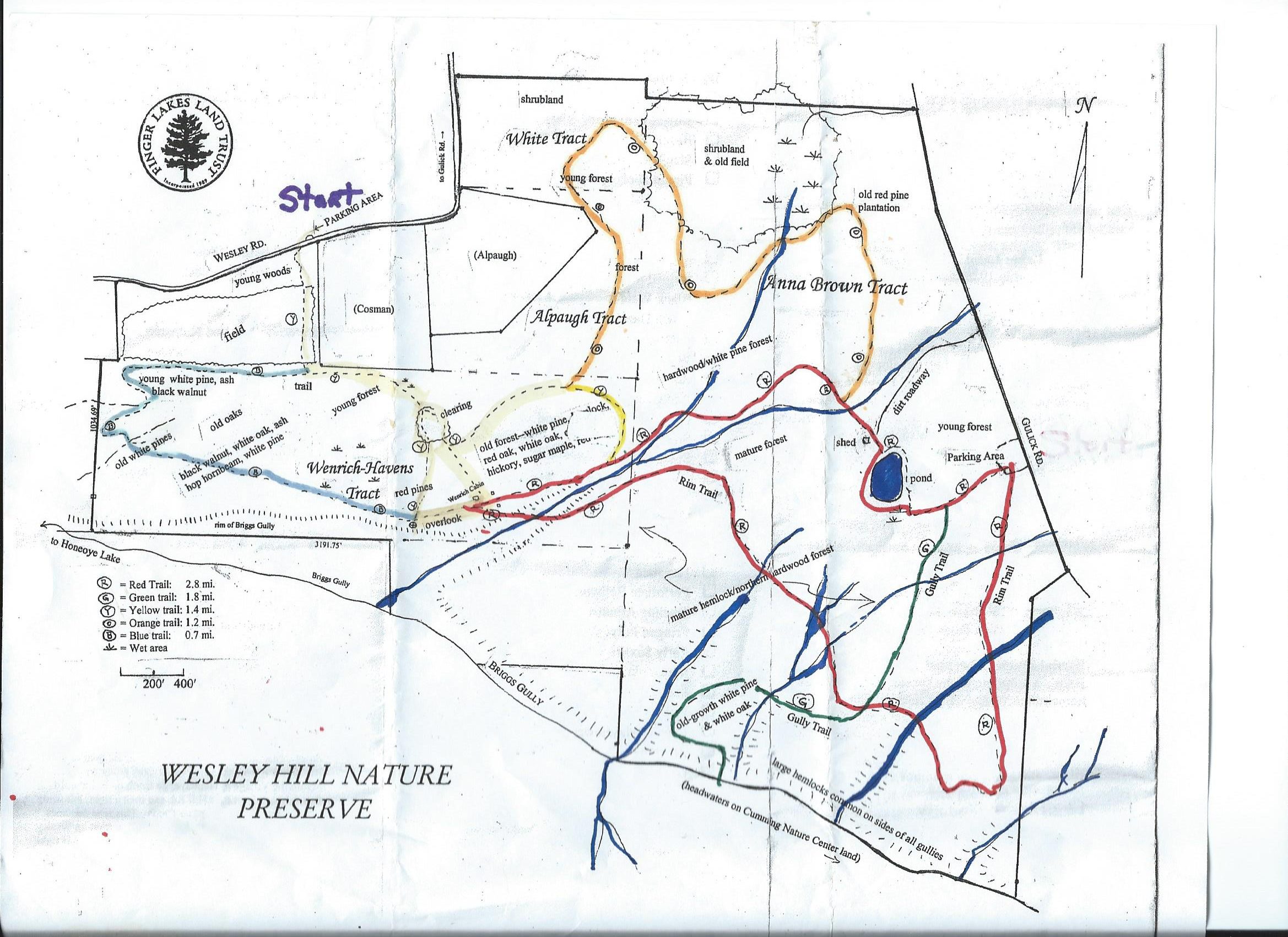 Wesley Hill Nature Preserve was founded in 1999 by the generous donation of 90 acres by the children of three artists – John Weinrich, James Havens and Colburn Dugan – to the Finger Lakes Land Trust. Since that time, the preserve has grown to over 390 acres by way of the purchase, by the land trust, of three parcels and a gift of the fourth.
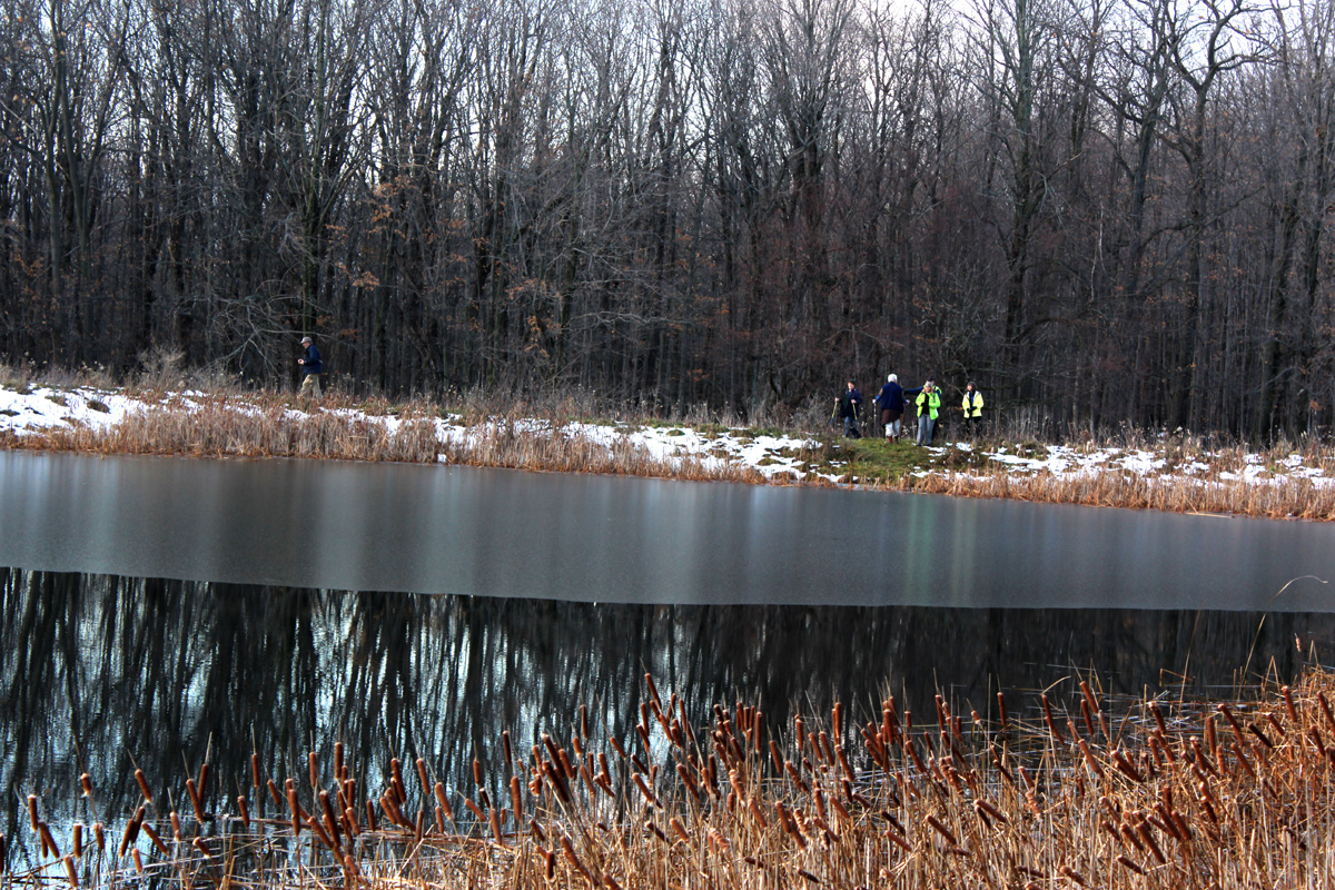 Highlights of our hikes will include views of Briggs Gully, the original Weinrich cabin, a bird watching area, breathtaking views of the surrounding hills, and a pond.. Click on the map above for a larger view.
We will meet at the parking lot on Wesley Road. The seasonal part of Wesley Road coming up from East Lake Rd (CR 33) was freshly graveled this spring.
The Climbers will be hiking the perimeter of the Preserve (4.5 miles). The Tourists will stay on the north side of the gully for a shorter 3.0 mile hike. The Naturalists will hike to the cabin and then on to the Wenrich-Havens Tract (2.0 miles).
Following the hike, please join us for an optional social at the Honeoye Boat House at the Trident Marina at 5226 East Lake Rd, Honeoye, NY.
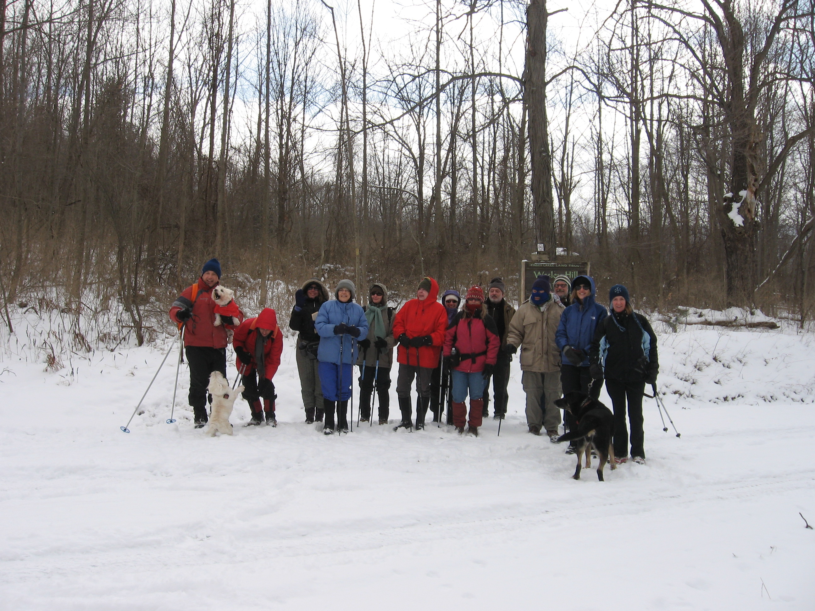
February – Wesley Hill
Directions:
From Honeoye: take route 20A east through Honeoye to East Lake Road (CR 33). Turn right onto East Lake Road. (If coming from Bristol or points east, its a left onto East Lake Road). Take the first left, staying on CR 33, then the first right onto Pinewood Hill which becomes Gulick Road. Travel 3.4 miles, then turn right onto Wesley Road. Parking area is on the right side and can fit about 8 vehicles; the rest of us can park on the side of the road (it’s paved).
From Springwater: Head north on Rt 15A toward Hemlock. Just before Hemlock, turn right on Rt 20A. Follow Rt 20A to Honeoye and then follow the directions above.
From Naples: From the southern end of Naples, head west on Co Rd 36. Follow Co Rd 36 for 1.2 to the first right turn on Gulick Rd. Follow Gulick for 8.4 miles and turn left onto Wesley Rd. The parking area is on the right one mile down Wesley Rd.
Directions to the Social from the trailhead:
Via the seasonal part of Wesley Rd: Turn right out of the parking area and head down hill on Wesley Rd. At the bottom, turn right on East Lake Rd. The marina is on the left in 3.1 miles. The Boat House Grill is on the back of the building with a view of the lake.
Via Gulick Rd: Turn left out of the parking area and head up Wesley Hill Rd. At the top, turn left on Gulick Rd for 3.3 miles. The road bears left and becomes Pinewood Hill Rd. At the stop sign, turn left to stay on Pinewood Hill Rd (CR 33). In 0.4 mi, turn left onto E Lake Rd. In 0.8 miles, turn right at the sign for Trident Marine. The Honeoye Boat House Grill is about 150 feet down on the back of the building with a view of the lake.
The plan for this hike has changed!
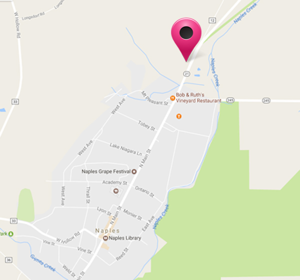
Now we will meet at 1:30 p.m. at the house of Gideon Hanggi at 7976 Route 21 in Naples. The house is black with red shutters; it is at the north end of Naples, opposite the Hanggi Christmas Tree Farm.
There is a meadow to the south side of the house – that’s the left as you look at the house. At the southern end of the meadow there is a dirt driveway – drive up as far as the tree line and park.
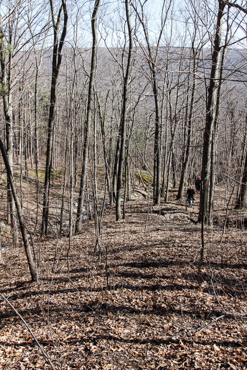
In order to get all the work done, we plan to get everyone to the work site with as much time as possible given to trail making. We’ll get there via Mr. Hanggi land rather than the one-hour hike to the site from either direction on the BHB. For those who can’t manage the steep climb to the top of the hill, Mr. Hanggi has offered to ferry people there in his 4-wheel drive vehicle – and back again of course for those who would like a ride! The site itself is on a slope, but it is manageable for all our hikers. The new route will follow the stream on both banks, which is also worth a good many photographs.
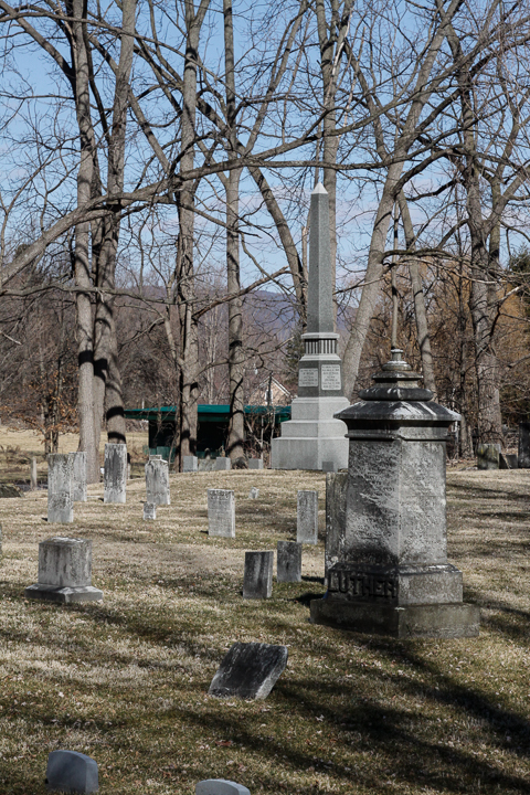
Please bring some tools with you to help trim back any brush that has grown into the pathway – loppers to trim brambles and roses are usually the most useful. Work gloves are also very necessary – roses can be sharp and mean! We’ll also clear away any fallen branches that we can manage. If heavier work is needed, such as mowing and tree removal then we’ll note what needs to be done and get it organized separately. It’s still early in the year, so we are not expecting any heavy encroachment of the undergrowth as yet. If anyone can bring a weed whacker, we’d like to get a crew of 2 people to walk up the trail from the cemetery in Naples and whack down some undergrowth about half way to the work site. This crew doesn’t have to walk all the way to the top of the hill if they don’t want to – the trail is clear for most of the way.
This hike is usually a dry hike, with good views at the higher elevations near Seman Road. The trail down to Naples follows a beautiful shale stream, with plenty of deep gullies and waterfalls – and there’s lots of water in the stream at the moment.
The scenic Robinson Loops Trail awaits us this week. This area is a privately owned wildlife sanctuary and is connected to the Finger Lakes Trail. Prepare to be dazzled by ravines, streams, young forests, old growth trees, and panoramic views from open fields. Our meeting place will be at the parking area at the end of Mill St. in Swain NY. Please follow this link for information and a map of the area http://cnyhikig.com/FLT-RobinsonLoopTrails.htm .
For those of you who would like to carpool, please meet at the Springwater Town Hall at 1:00 PM on Sunday.
As usual, We will divide into three groups. Volunteers are needed to lead the Tourist and Naturalist groups.
Naturalists will enjoy a leisurely stroll along Caneseraga Creek on the Main Trail and the Yellow Loop. There should be some wildldflowers and various trees to identify. The rock ledges are quite extraordinary. It is a pleasant jaunt of 2.3 miles.
Tourists will be taking the “high road”, climbing gradually up the Blue Loop to the open fields that offer lovely views of the area. The elevation gain on this hike is 504 feet. Total mileage is 3.4.
Climbers will head for the woods on the Orange Loop, exploring a stream and ravine, looking for some old growth trees. If time permits they can take in some of the views from the Blue Loop. The trail is steep in places, with an elevation gain of 539 ft. Total miles about 4.5.
Directions: From Springwater, follow Rte 15 South to Wayland, then Rte 63 South to Dansville. Pick up Rte. 36 South in Dansville and follow to Junction of Rte 70. Turn right on 70, travel through Canaseraga, until left turn into Swain.
After Hike Social will be at the Sierra Inn in Swain.
Today’s hike is canceled.
Thunderstorms are predicted from 11 to 8 this afternoon. The Springwater Community Day is postponed and hiking during a thunderstorm is not recommended. Enjoy your indoor activities and join us next Sunday at Pat and Tony’s for a Conesus Lake Inlet hike.
NOTE: This hike will start at 2:00PM (Please meet at 1:45 to allow for car-pooling).
The Conesus Lake Inlet is an 1100 acre Wildlife Management Area (WMA).
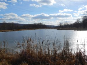
On June 11th we will walk 2 or 3 areas in this WMA.
We will meet, prior to the hike, at 7980 State Route 256, Dansville NY (approx. half-way between Dansville and Scottsburg)
The trails are not maintained on a regular basis so some bush-whacking may be necessary. Because of the rainy weather the ground may be soggy. Recommend long pants and stout footwear. This is a good opportunity to see some nice ponds and possibly some wild life
Meet a Pat and Tony’s at 1:45 to get organized. Some of the parking areas are small so maybe we can cram into 4 or 5 vehicles.
After the hike all are welcome to meet at Pat & Tony’s for a social. Bring a dish to pass. Tony will attempt to cook some Zweiglers.
Directions
From Springwater: Turn (left 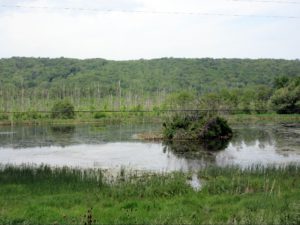 or Right) at light onto Springwater Hill (Rt 15), In 1.5 miles turn left onto Liberty Pole Road (CR 38) In 3.6 miles turn left onto Stage Coach Road (Rt 255) in 1.8 miles turn right onto Rt 256 (W Swamp Rd) in .3 miles you will arrive at Pat & Tony’s at 7980 State Route 256. (The last intersection prior to this location is Powell Road, on the left, we are in the blue house (sits back) on the left side after Powell Road. If you reach Springwater Road (CR1) you’ve gone too far
From Wayland: Start point Mobil/7-eleven on corner. Head west on Rt 63, (past the High School), go down Wayland Hill to Main St, Dansville, turn right on Perine Street and Perine street will turn into Route 256, proceed approx. 4.8 miles to 7980 State Rt 256 on left.
Will put a flag near diveway
 This Sunday is our first 4:00 hike of the summer season. Please plan to arrive shortly before 4:00 PM on Sunday, June 18.
Our hike this Sunday will explore the fields and woods along the Cohocton River in Atlanta, NY (not GA, but NY). The hike will be through rolling hills and along farm roads and through forests. We will walk along the Cohocton River, so bring your fishing gear if you would like to catch some trout. Hikes for Climbers and Naturalists will be available.
 We will meet on a field road off of Rt 21. Watch for the Springwater Trails sign on Rt 21 and follow the road back to a parking area near the pond. Following the hike, join us for a “dish to pass” social with hamburgers and hotdogs on Cheryl’s grill. Bring a dish to pass and your own beverage, or make a small ($5) contribution to the social fund.
Directions:
From Wayland, Springwater and Dansville: From the traffic light in Wayland on Rt 15, follow NY 21N east toward N. Cohocton and Naples. In 3 miles you will pass over the Cohocton Creek at Bowles Corners. Continue for another half mile. The driveway will be on the right just before you pass the “School Bus Stop Ahead” sign. Look for the Springwater Trails sign. Continue for about 400 ft (0.1mi) down the farm road to park near the pond.
From Naples, Honeoye and N Cohocton: Take NY 21S from Naples. Turn right to stay on NY 21S through N. Cohocton. In 3.3 miles, the driveway will be on your left, just before the guardrails. Look for the Springwater Trails sign. Continue for about 400 ft (0.1mi) down the farm road to park near the pond.
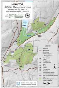
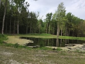
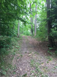
This Sunday we will hike the maintenance trails in High Tor WMA off Bassett and Brink Hill Rds. Naples.
The footing is easy, along dirt tracks with grass that has recently been rough mown. There are a few slow rise hills. We will pass 4 ponds along the way where ducks and turtles have been spotted.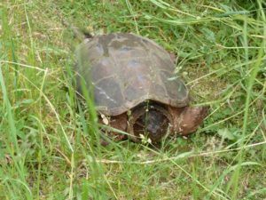
Let’s all meet at the Bassett Rd parking area at 3:45pm to leave a few cars. The remaining cars will then proceed to Brink Hill Rd maintenance trail parking lot.
Please remember to spray for ticks.
CLIMBERS will leave from Brink Hill Rd, staying right at the V, turning left at the intersection of the main trail then take the sharp left maintenance road to return to Brink Hill. Maps will be available. This route will probably exceed the 2 hours unless Char is setting the pace:~).
TOURISTS will also leave Brink Hill, stay right at the V, past the ponds to the main intersection. Time permitting, we will visit the Canandaigua Lake overlook, backtrack, then finish the hike along the maintenance road to Bassett parking.
NATURALISTS, should we have at least 2, will walk in from Brink parking, visit the ponds and retrace their steps back to the parking area.
The SOCIAL will be at Amy’s. Directions given at hike. Please bring a dish to pass or plan to make a donation. Meat will be provided. BYO drink. If you would like to drop your dish off prior to the hike, please let Amy know via the website’s contact address or directly, if you have her info.
DIRECTIONS: From Naples, take Main St south up Route# 53. Turn left on Italy Valley. Turn left on Bassett Rd at the curve. The parking area will be just after the first Bassett curve.
On Sunday 9th July, Springwater Trails will be cleaning up the Wheaton Hill Trails.There are two loops on each side of the road. We will split into four groups, with each group taking one of the loops. We will hike the loop, clearing any branches on the trail, clipping anything that is interfering with with hiking the trail, and we will take notes concerning larger items that need to be done on the trail in the future.
NOTE: If you plan to use a weed whacker, PLEASE BRING EYE PROTECTION! These devices can kick up a lot of dust and small stones.
Bring gloves to protect your hands, loppers to cut branches and if you have one, a small saw for branches that are too large for the loppers. This trail tends to grow a LOT of grass, so we’ll need as many weed whackers as people can bring..
If the weather is good we’ll have a picnic social after the hike; bring a dish to pass and something to drink with you. If it’s cool or threatening to rain then we’ll skip the social this time.
Directions: Wheaton Hill is the first right turn north of the intersection of Rt 15 and Rt 15A in Springwater (0.9 mile north of the intersection). The trail head is 0.5 miles up Wheaton Hill just before the road turns straight east and heads up the main hill. More details are on the directions page.
What to bring:
- Gloves and clippers – hand clippers or long handled loppers for larger branches.
- A weed whacker if you have one, with gas mixture and extra string.
- Small bow saw.
- Plastic grocery bags in case you find any litter.
- Water to keep hydrated.
This Sunday hike is the first in a series. Over the next year we are planning to hike the entire Bristol Hills Branch I(BHB) of the Finger Lakes Trail (FLT). On the third Sunday of each month, we will hike a different section of the trail. The Climbers will do the longest hikes, completing the entire trail including all road walks. The Tourists will generally skip the road walks, making their hikes a bit shorter. And finally, the Naturalists will hike a selected portion of the trail, based on length and terrain. These hikes will be one way hikes, so expect some shuttling of cars.
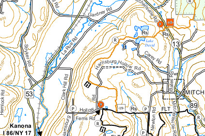 Our first BHB hike is on the Finger Lakes Trail map B3 (see the images). We will meet on Clark Hill Rd at the corner with LaRue Rd in Bath, NY. From there, some cars will drive to the north end of the hike on Mitchellsville Rd, the rest will drive to the south end of the hike at the corner of Ferris Rd and Harrisburg Hollow Rd.
The Climbers will car pool to the north end of the hike at Access Pt 18 on Mitchellsville Rd and will hike south. The hike will start with a long steep uphill, along a ravine. Once Lake David is reached, the trail flattens out, to a shallow, but steady climb to Harrisburg Hollow Rd. Crossing Harrisburg Hollow Rd, the hike will continue to the point where the BHB ends at the Finger Lakes Trail. Turning right, the climbers will follow the FLT west along the abandoned portion of Ferris Rd. When the FLT turns into the woods, we will continue on Ferris Rd back to the Tourists and Naturalists cars.
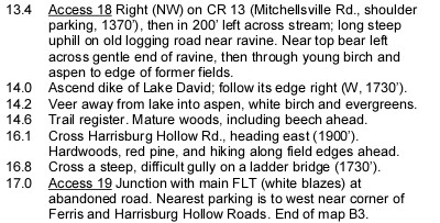 The Tourists and Naturalists will car pool to the south end of the hike. They will turn onto Harrisburg Hollow Rd and park the cars. The Naturalists and tourists will hike along Harrisburg Hollow Rd continuing north. In about half a mile, the Bristol Hills Branch will cross the road. The Tourists will turn left and follow the trail north (downhill) to Access 18 on Mitchellsville Rd where we hope to find the climbers cars and return by car to the southern start point. The Naturalists will turn right and follow the trail to the abandoned Ferris Rd. Turning right, they will follow the FLT and Ferris Rd to the top of the hill, and continue to the cars at Harrisburg Hollow. This trail passes through both forest and open fields. On the last leg of the BHB, you will cross a gully on a ladder bridge – a clever solution to a difficult crossing. If the Naturalists reach the FLT before 5:15, they may want to explore the FLT to the east, before returning to the cars.
We will do a picnic social after the hike on Harrisburg Hollow Rd and enjoy a beautiful view to the west. Bring a dish to pass and your own beverage (or contribute to the social fund). If it is raining, we will make other arrangements.
Directions:
From Springwater (and Wayland): Head south on NY-15 through Wayland. Turn left to get on I390. [If the entrance to I390 is still closed for construction, turn left on NY-415 just before going under I390. In 6.2 miles, turn righ onto Cohocton Look Lake Rd and in a half mile, turn left onto I-390S]. Continue onto I-86 (NY-17) east. Take Exit 37 and turn left only NY-53 north. In 2.8 miles, turn right onto Larue Rd, Take the first right onto Clark Hill Rd. We will meet here.
From Rochester and Dansville: Head south on I390 and join I-86 East. Take Exit 37 and follow the directions from Springwater.
From Bath and south: Head west on I-86. Take Exit 37 and follow the directions from Springwater.
From Naples and north: From NY-21 on the south edge of Naples, follow NY-53 South for 19 miles. Turn left onto Larue Rd. Take the first right onto Clark Hill Rd. We will meet here.
To get from the meeting location to Mitchellsville Rd: Turn right (North) onto Larue Rd for 2.2 miles. (Larue becomes Garner Rd in 1.3 miles) At the T, turn right onto CR 13 (Mitchellsville Rd. In 1.1 miles, the trail will be on the right. Best parking is on the right.
To get from the meeting location to Harrisburg Hollow Rd at Ferris Rd: Continue on Clark Hill Rd for 1.3 miles. Continue straight through the 4-way intersection. At the next intersection, turn left onto Harrisburg Hollow Rd. Park right there. (If you had continued straight, that would be Ferris Rd which becomes the FLT.) Warning: most of this route is dirt road.
To get from the North end back to the South end: As you come out of the trail to the cars, you will want to drive to the left on Mitchellsville Rd. Head north on Mitchellsville for 1.1 miles. Turn left onto Garner Rd. When Garner Rd turns right, continue straight onto LaRue Rd for 1.3 miles. Turn left onto Clark Hill Rd for 1.3 miles. Continue straight through the 4-way intersection. At the next intersection, turn left onto Harrisburg Hollow Rd. The Tourist cars should be there.
[ngg_images source=”galleries” container_ids=”15″ display_type=”photocrati-nextgen_basic_imagebrowser” ajax_pagination=”0″ order_by=”sortorder” order_direction=”ASC” returns=”included” maximum_entity_count=”500″]
If you have pictures of this section of the Bristol Hills Branch, please add them to our gallery. [ngg_uploader id=15]
Looking for brochure.or mailing list so I can receive it in the mail.
Nothing opens up for mailing list.
There’s all kinds of very bizarre ads and post for viagra and other drugs above on calender page.
Please let me know if there’s a brochure available