
Hikes led by Springwater Trails are generally held on Sunday afternoons and appear in this calendar in green.
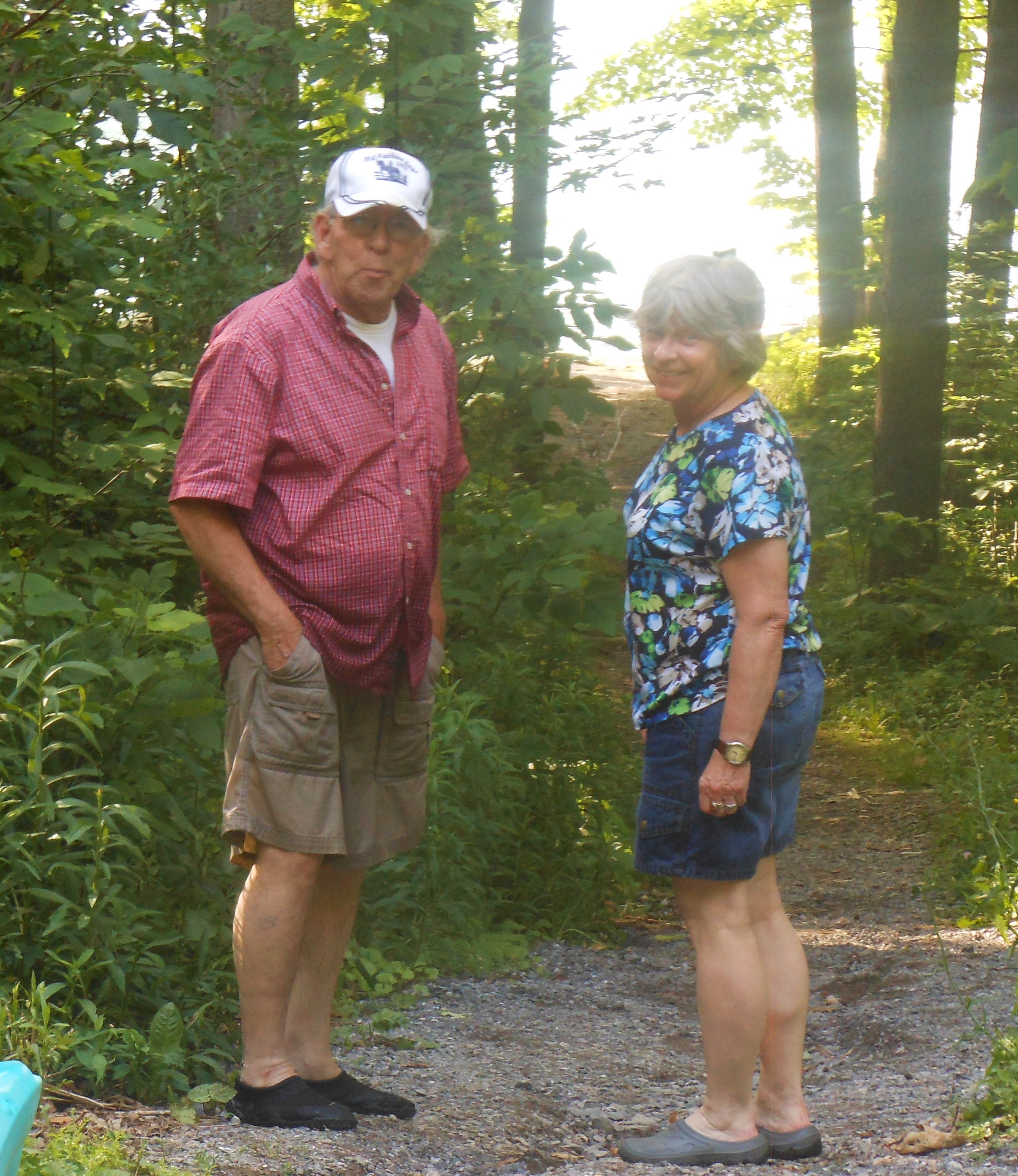
It’s spring time and a good time to help clean up our hiking trails before the summer season. This Sunday, Springwater Trails will be cleaning up the Wheaton Hill Trails.There are two loops on each side of the road. We will split into four groups, with each group taking one of the loops. We will hike the loop, clearing any branches on the trail, clipping anything that is interfering with with hiking the trail, and we will take notes concerning larger items that need to be done on the trail in the future.
Bring gloves to protect your hands, loppers to cut branches and if you have one, a small saw for branches that are too large for the loppers. It’s still early in the spring, so the grass doesn’t need cutting yet, so we are going to skip the weed wackers this time.
Since we expect most of you to want to get back home for additional spring cleaning, we aren’t planning a social to follow trail maintenance. Lunch at Sammy’s may be organized by attendees.
Directions: Wheaton Hill is the first right turn north of the intersection of Rt 15 and Rt 15A in Springwater (0.9 mile north of the intersection). The trail head is 0.5 miles up Wheaton Hill just before the road turns straight east and heads up the main hill. More details are on the directions page.
What to bring:
- Gloves and clippers – hand clippers or long handled loppers for larger branches.
- Small bow saw.
- Plastic grocery bags in case you find any litter.
- Water to keep hydrated.
ILMPD 2016 – – – I Love My Park Day, is an initiative of New York State Parks celebrated annually on the first Saturday of May which in 2016 falls on the 7th of May. It is an effort to improve NYS Parks from a grassroots perspective. Many NYS Parks hold an ILMPD event and activities may vary greatly from one state park to another. – – – Checking the NYS Parks website is one way to ascertain where and what some activities will be for this May 7th 2016 event. two web addresses are: parks.ny.gov -and- www.nysparks.com Parks and Trails New York ( ptny.org ) also is a website to check for info.
This “event post” speaks specifically to – 2016 ILMPD on the GVGSP with Friends of the Genesee Valley Greenway (FOGVG) who will be working on clearing debris at one specific extant former Genesee Valley Canal (GVC) lock situate on the GVG. This locale is situate in the southeastern reaches of Letchworth State Park, essentially at the hamlet of Oakland. Any hikers interested in joining in to clear the extant lock of the former GVC which has now become the GVG should feel free to join in this effort. (Of note: lock 60 is a very short walk in from Oakland Rd, so this is mostly a maintenance event and not much of a hike event.)
Plans are to start the day at 9:30am, working and providing for snacks and breaks as apropos, and work until Noon, with lunch provided to volunteers at 12:30pm in nearby Nunda. All volunteers are welcome, and if you need to leave early you are welcome to do so, easily accomplished since the ILMPD – Oakland Locks site is very near the car parking area.
ILMPD is coincidentally the same day that one of Springwater Trails’ own, Katherine (Secretary of Springwater Trails, and hiker/hostess extraordinaire), will be honored with an award at Livingston County’s 30th Annual Seniorama 2016, in recognition of the many community volunteer activities she has been involved in throughout many years. So, … if you wish to attend both the ILMPD event at Oakland locks and the Seniorama event honoring Katherine, you’ll need to make the ILMPD lunch at Nunda Historical Society pavilion at 12:30pm a quick lunch stop and be on your way by ~12:40PM to make it to Seniorama for the 1:30PM start time.
Below (between the triple arrowheads) is the info copied from the FOGVG website relevant to ILMPD – GVGSP at Oakland Locks.
>>>
2016 I Love My Park Day – Saturday, May 7, 2016
I Love My Park Day (ILMPD) is an exciting statewide event to celebrate and enhance New York’s state parks and historic sites and bring visibility to the entire state park system and its needs. Volunteers from across the state will participate in cleanup, improvement, and beautification events at New York State parks and historic sites.
This year the Friends of the Genesee Valley Greenway (FOGVG) have selected one work site rather than three for the Genesee Valley Greenway State Park. Volunteers will clear the last lock (#60) in the flight of Genesee Valley Canal locks that begin at Oakland Road in Oakland. We will gather at the work site at 9:30 am. Parking is available at the parking lot on Oakland Road and along Rt. 436 or Oakland Road.
Volunteers should bring water, gloves, pruning shears or brush cutters, insect repellant, and wear heavy shoes and protective clothing to guard against heavy brush, poison ivy, and ticks. Snacks will be available and lunch will be provided at about 12:30 pm at the nearby Nunda Historical Society pavilion. Volunteers will receive ILMPD T-shirts. If questions: email fogvg@frontiernet.net or call 585-476-2354.
Volunteers are encouraged to register at the PTNY website at http://www.ptny.org/ilovemypark/ or by calling 585-476-2354. Registering in advance on the website is strongly recommended since it avoids the need to complete Volunteer Service and Photo Release Forms on May 7th.
<<<
hyperlink – http://nysparks.com/parks/189/details.aspx
The flight of Oakland Locks where lock # 60 is situate is accessed via Oakland Road just north off NYS Rt 436, in the hamlet of Oakland in the Town of Portageville (just a bit west of the Village of Nunda, NY).
Of note: On the 4/24/2016 Springwater Trails hike on the GVG, hikers learned about the former Genesee Valley Canal (GVC) and also learned some about the GVG too, at the AP&HS program presented by Tom S Cook on the GVC at the Avon Opera Block on April 24th, 2016 and then following the presentation we furthered some knowledge on the S/T hike in the Town of Caledonia on the GVG . In fact in traveling to start points all hikers paused at and one group of hikers started their hike on the GVG at NYS Rt 5 trailhead, which was the same locale used for the 1840 party celebrating the opening of the first section of the Genesee Valley Canal.
Additionally, the following paragraph is copied from The Genesee Naturalist, a quarterly periodical about Letchworth State Park, the Genesee Region and surrounding area. This ILMPD info is about the broader Letchworth State Park effort for ILMPD, as delineated from the Oakland locks of the GVGSP at the southeastern reaches of Letchworth SP.
“Saturday, May 7th, 2016 at 8:00am I LOVE MY PARK DAY. A variety of volunteer projects are offered throughout the day: tree planting, invasive species removal, landscaping, leaf raking an canal locks beautification. Lunch and programming with Friends of Letchworth. Trailside Lodge. Volunteers may preregister at www.ptny.org (4-6 hours) (led by park staff and others)”
Below (between the triple arrowheads) is the info copied for Letchworth SP – ILMPD (copied from the NYS Parks website).
>>>
Saturday, May 7, 2016 09:00 AM – 02:00 PM
Letchworth State Park
Come join us at Letchworth State Park in celebrating the fifth annual I Love My Park Day! I Love My Park Day is an exciting statewide event to improve and enhance New York’s parks and historic sites and bring visibility to the entire park system and its needs.
Project 1: Raking Leaves, Litter clean up, staining benches at Wolf Creek, Great Bend overlook.
Project 2: Maintaining fall material of playgrounds on the south end of Letchworth park.
Project 3: Invasive plant removal
Project 4: We will have a group participating in stream bank erosion control by planting live stem dogwood branches. Please bring work gloves,knee high rubber boots/hip waders, and 5 gallon pails.
All ages are welcome. Volunteers should meet at the Tea Table/Eddy’s parking lot and to wear long sleeves, long pants, and enclosed shoes.
Contact event coordinator Douglas Kelly for more information: doug.kelly@parks.ny.gov
<<<
hyperlink – http://nysparks.com/events/event-results.aspx?pk=79
If perhaps you are interested in ILMPD efforts for another park location – you can start at www.nysparks.com and select the park and then select upcoming events.
Also of note, here are three upcoming hikes on the GVG. All three are led by NYS Park staff.
* on Saturday April 30th, 2016
Nature Hike from Fowlerville Road to York Landing
Saturday, April 30, 2016 10:00 AM
Genesee Valley Greenway State Park
Explore the GVG as it travels south, on the west side of the Genesee River. Meet at the York Landing Parking Area off River Road north of Piffard. Car-pooling is required. Bring a lunch. (3 hours, 2.6 miles).
** on Saturday May 14th, 2016:
Quaker Road to Lehigh Valley Trail (Wegmans Hike Number 4)
Saturday, May 14, 2016 10:00 AM
Genesee Valley Greenway State Park
This hike is located in Monroe County just south of the Village of Scottsville. Take River Road South from the Village, or north from Route 20. Turn east onto Quaker Road (Rt. 251). The trailhead is approximately ¼ mile ahead. Meet at the trailhead. (3.1 miles)
*** on Saturday June 11th, 2016:
Saturday, June 11, 2016 10:00 AM
Genesee Valley Greenway State Park
This hike is located in Livingston County in the Town of York. Park on the south side of Fowlerville Road. Meet at the parking area. (2.5 miles)
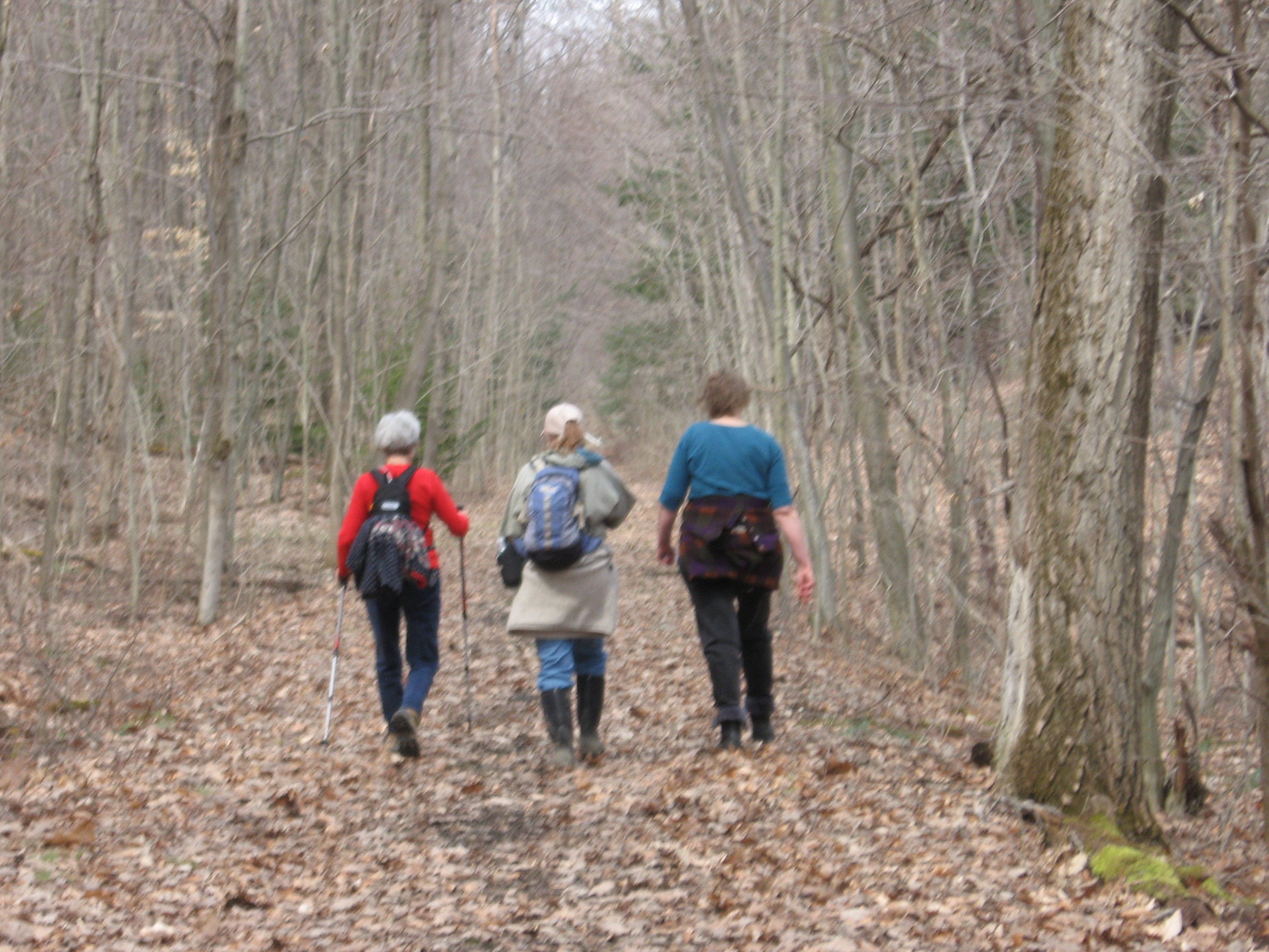
On Sunday, we are hiking between three cemeteries in Springwater, including the Green Gull Cemetery and the Pleasant Valley East Cemetery. In between, we will visit a surprise cemetery tucked into the hills of Springwater. All three cemeteries are noted on the 1872 Atlas of Livingston County. Click on the detailed map below to see the complete map of Springwater. The complete Atlas of Livingston County, New York, published by F. W. Beers & Co in 1872, is available on-line.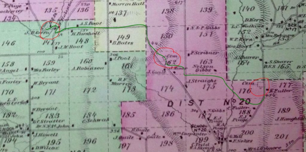
We will meet at 8664 Schribner Rd and carpool to the first cemetery.
Following the hike, join us for a pot luck social on Schribner Rd. Bring a dish to pass and your own beverage, or make a small $5 donation to the social fund.
Three hikes are planned. The Naturalists will carpool about 2 miles west to Green Gull Cemetery on Canadice Rd near Strutt St. This is a small cemetery above the road with graves of two veterans of the Revolutionary War. After exploring the cemetery, the Naturalists will follow Canadice Rd to Strutt St and climb Fox Rd to the top (about a 400 foot climb. From there we will follow the old Gilles Rd as laid out on the 1872 map to the second cemetery. From there we will follow trails through the woods and back to the starting point. This will be a 2 mile hike with both a climb up and down.
The Climbers and Tourists will carpool east to the Pleasant Valley Cemetery (East) on Tabors Corners Rd. This cemetery is also known as the East Springwater or The Fair View Cemetery and it contains graves of one War of 1812 veteran and 19 Civil War veterans. After exploring the cemetery, we will follow a farmer’s road across the Cohocton Creek, and up a steep climb to the fields above the Schribner Valley. The trail crosses Schribner and continues up along Giles Rd to our second cemetery. From there the Climbers will continue down Fox Rd to the Green Gull Cemetery. As they pass the Naturalists going the other direction, they will collect keys to the Naturalists cars to return to the start point. The Tourists will turn around at the second cemetery and follow the same route as the Naturalists back to the start point and the Social. A driver will be available to take drivers back to the Tabors Corners cemetery to pick up cars.
A note about the weather: The forecast calls for temperatures in the 40s and showers between 2 and 6 on Sunday. So dress warmly and bring a raincoat or poncho. Lets hope the forecast is off by a few hours.
Directions to the meeting place are available here. Directions for the hikes and the carpools will be available the day of the hike.
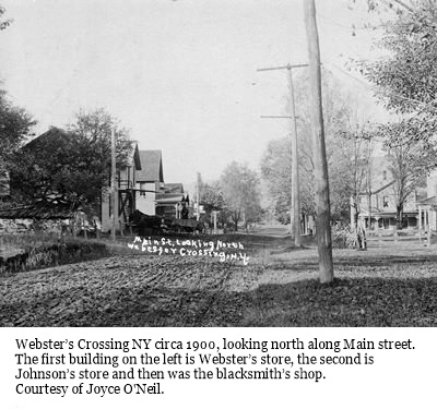 Our first Bicentennial Hike explored the Hamlet of Springwater back in April. This month we are going to explore Webster Crossing, the other hamlet in the Town of Springwater.
We will be meeting at Webster Crossing United Methodist Church, (Route 15, Webster Crossing Road, Springwater, NY 14560) at 4 p.m, The hike will start with a walking tour of Webster Crossing then break up into groups, depending on the distance comfortable for those who are attending. Suggested map routes for the Climbers, Tourists, and Naturalists will be provided.
We will be walking the Morris Road, Story Road, and the All Western Evergreen Tree Farms and other farm and homeowner’s properties depending on permission obtained. More details day of the hike.
The dish-to- pass social will be at the Webster Crossing Church where Gladys Weed, hamlet historian and retired postmaster, will have the history of the hamlet in photos and will be on hand to answer any questions.
Directions:
From Springwater and Wayland: Follow NY 15 north from Wayland to the flashing light in Springwater. Turn left to stay on NY 15. In 3.6 miles, the church is on the left.
From Rochester: Take I-390 South to Exit 9 – Lakeville. Turn left onto NY 15 south. Stay on NY 15 for 16.1 miles to Webster Crossing. The church is on the right.
Please note: For this hike, other routes recommended by your favorite routing tool are also available, and will get you to the church (42.669608, -77.635264) on time. Just enter the GPS coordinates and drive with confidence.
 This Sunday, Springwater Trails will be working with the Nature Conservancy to haul supplies for a footbridge across the gully and to help construct the remaining sections of Rob’s Trail extension. Please note the time change as we try to work with the Nature Conservancy schedule. Since we are planning this workday in real time, please check back here for updates. Please send John an email (vp@springwatertrails.org) if you are planning to come.
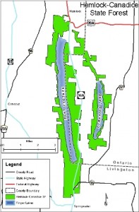
Rob’s Trail is one of the favorite hikes for Springwater Trails. The Central & Western New York Chapter of the Nature Conservancy built this trail in memory of Rob van der Stricht, their Board Chair who died in 2006. The trail from Rt 15A to Canadice Lake was opened in 2008.
In 2014, the Nature Conservancy announced plans to extend Rob’s Trail down to Hemlock Lake and the along the old road to the North Boat Launch. Based on the map published in the announcement, and on scouting done by Rick Osiecki, Springwater Trails led a hike from the west side of Hemlock Lake to the east side of Canadice last year, and this spring we hiked the partially completed extension from Rt 15A to the Hemlock North boat launch.
The work season for Rob’s Trail is just starting. There is a bridge to be built This Sunday, Springwater Trails will join the Nature Conservancy as they start the planned completion of this trail. Last Friday, we got a message requesting assistance with the work this spring, and decided to devote our trail maintenance Sunday to this trail. John took responsibility for planning and things have fallen into place. So please join us, and bring family members and friends, to help get this work off to a great start.
Details:
We will meet at the new trailhead/parking lot on the west side of 15A. This parking area is slightly north of the end of Old Bald Hill South and the original Rob’s Trail parking area. It connects directly to the Extension trail without crossing 15A. We will meet at 11:00AM. If you can’t make it at 11:00, please come as soon as possible and hike down the trail (west toward Hemlock Lake) to meet us. The upper part of the trail should be easy to follow. Bring work gloves and loppers. Be prepared for some digging in the dirt.
John will cater a social afterwards right at the parking area. Please contact him if you can help with the social – Springwater Trails will pay for the food.
Directions:
From Springwater: Go north on 15A for 6.0 miles. The parking area is on the left just after the north end of Old Bald Hill South.
From Hemlock: Go south on 15A for 5.1 miles. The parking area is on the right just before the north end of Old Bald Hill South.
A combination of the expectation of another hot, sunny Sunday and relaxing last week on Hemlock lake, plus the frustration of trying to find a pleasant hike from Reynolds Gull to Wheaton Hill Trails, has caused a change in our Sunday Bicentennial Hike.
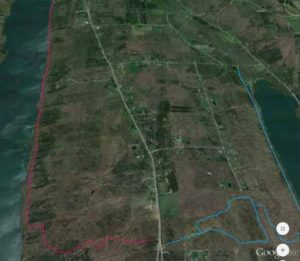
 This Sunday, we will take advantage of Canadice Lake, the smaller of the two undeveloped Finger Lakes north of the town of Springwater. Prior to the purchase of the land around these lakes by the City of Rochester, Canadice was known as the lake with cottages for the “locals”, while Hemlock catered more to the city folk. In celebration of the Springwater Bicentennial, the Hikers will take some extra time to explore some cottage foundations remaining on the west side of Canadice Lake.
We will all meet at the Canoe Launch near the south end of Canadice Lake. Boaters should arrive by 3:30 to allow time to unload boats and transport them to the lake. Following the hike and boating, we will have a Dish to Pass social at the Canoe Launch. Bring a dish to pass or make a donation to the Social Fund. Also bring your own beverage.
 Naturalists and Tourists will car pool to the south trail entrance and will follow the trail to the west side of the lake and up the west side. Checking the time, they will turn around to return to the cars and the canoe launch at 6:00. Climbers preferring a longer one way trip, will car pool to the north end of Canadice and arrange for a ride back with the Naturalists at the end of the hike. This trail is wide and fairly flat, allowing all hikers to enjoy the lake.
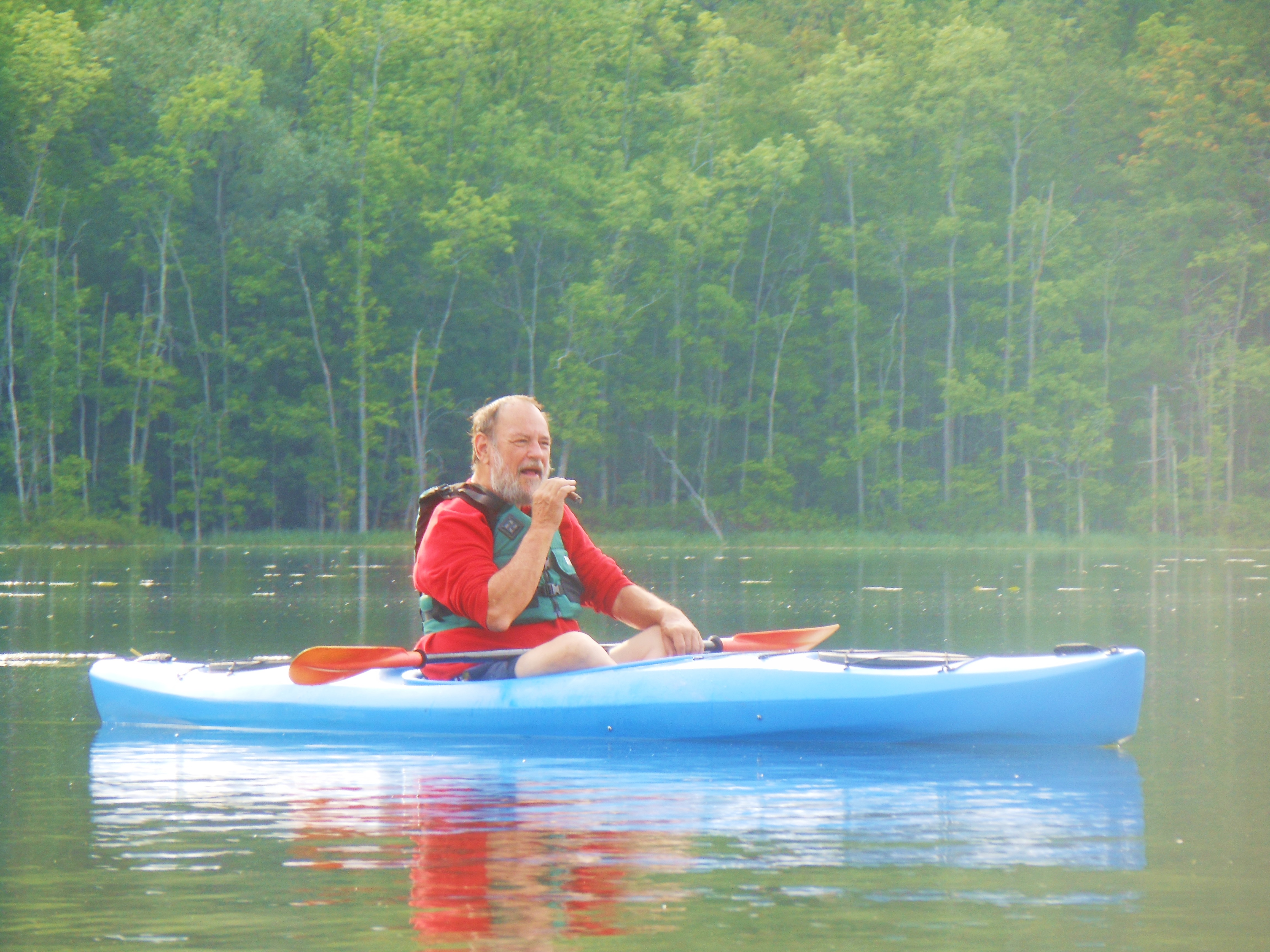
Boaters will launch from the Canoe Launch and will head North along the shoreline to the boat launch, about a mile and a half. From there, we will head across the lake to return south to the canoe launch for a 4 or 5 mile trip.
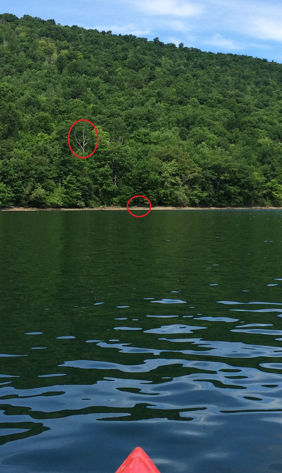
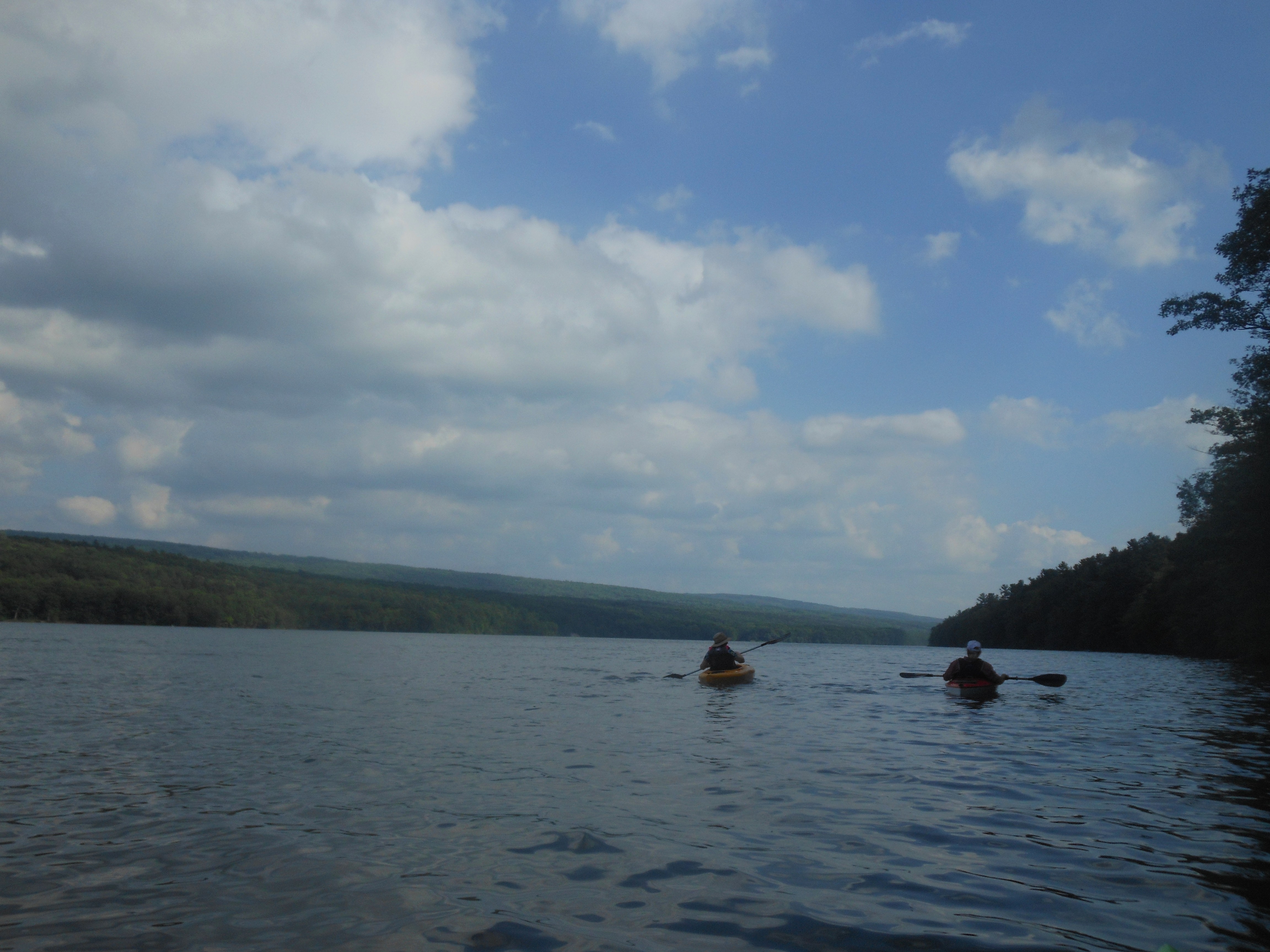
Suggested landing area for trading kayak paddlers.
A special suggestion: Boaters and Hikers may want to pair up, with one starting with the hikers and meeting the kayaker on the west side, where they can switch roles. With the low water level this weekend, landing is quite easy – the suggested location in the picture to the right is slightly north of the canoe launch. You can see the white tree above the landing area from the launch. The path from the hike route to the water is marked by yellow tape. More information will be available at the start of the hike.
Directions: Click on Directions for detailed directions, or on the starting points below for Google directions.
 From Springwater: Go North on 15A for 2.7 miles. Bear right on Old Bald Hill Rd S and then an immediate right on Johnson Hill Rd. Take the first left onto Canadice Lake Rd. The Canadice Canoe Launch is 1.8 miles north of Johnson Hill Rd.
From Honeoye: Take Co Rd 37 South from 20A, Turn right after 3.7mi to stay on Co Rd 37. Stay straight onto Burch Hill Rd. At the lake, turn left onto Canadice Lake Rd. The Canadice Canoe Launch is 2.1 miles south of Burch Hill Rd.
From Hemlock and Rochester: Take NY Rt 15A south from Rochester through Lima and Hemlock. Just past Hemlock, Rt 20A goes left. Continue straight on 15A for 3,2 miles after 20A. Turn left on Purcell Hill. At the end of Purcell Hill Rd, turn right onto Canadice Lake Rd on the east side of the lake. The Canoe Launch is 2.9 miles south.
Springwater Trails has been responsible for maintaining a section of the Bristol Hills Branch of the Finger Lakes Trail for over a year. We have two major projects for this summer:
- Repainting the orange blazes.
- A new bridge across the creek at the corner of the wildlife enclosure.
This week we will focus on the blazes. Many of the blazes are old and faded. And different sections have blazes that appear to be different colors. So, lets get out there and freshen up the blazes and make the trail look all spiffy.
We have paint, buckets and brushes, but we need some willing volunteers. Come join us at the park next to Bob & Ruth’s in Naples at 8:00. We will split into teams and will work from both ends of the trail.
Bring good hiking shoes and insect repellent, plus water to drink. If you have a weedwacker, bring that along and if we have enough volunteers, we will set up a team to mow the trail.
See you at 8:00 on Tuesday.
This Sunday, our Bicentennial Hike will follow a section of the old Erie Railroad. This section has been very well maintained by the many private landowners and runs along the west hillside overlooking Lawrence Gull and the Springwater valley. Springwater Trails Hiking Group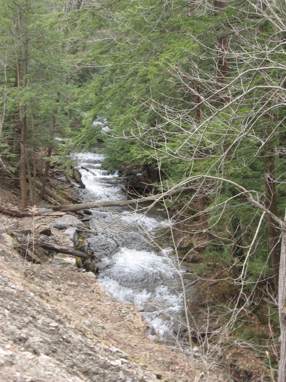 would like to thank the many private landowners that allow us to hike on their properties.
We will start the hike off Becker Road where the Erie Railroad once crossed and walk the railroad bed for about two miles to the north. There are some side trails heading up the hill toward Harpers Ferry Rd. The Climbers will venture off on some of the side trails where permitted returning back down to the railroad bed to continue on north.
At about 3:15, all groups will turn around and follow the railroad bed back to Becker Rd. The Naturalists will have the option to exit the railroad via a private trail down into Lawrence gull where a vehicle will be parked to shuttle them back to the start of the hike.
 The after hike holiday social will be held at Sammy’s Place on Rt 15 about half a mile south of the light in Springwater.
DIRECTIONS :
From The village of Springwater, head South on Route 15 toward Wayland. At the top of Springwater hill turn right onto Becker Road. Drive about 2 miles (past Lawrence Gull Rd). We will meet at Pokey Moonshine Rd to start the hike.
From Dansville, head east on Route 63 toward Wayland. About 1 mile from Wayland, turn left onto Buffalo Street. Drive for about 2 miles, to a spot just past Pokey Moonshine Rd where the hike will start.
From Naples: take Route 21 to Wayland and continue West on Route 63 for 1.5 miles. Turn right onto Buffalo Street. Drive 2 miles, to a spot just past Pokey Moonshine Rd where the hike will start.
It is time for some trail maintenance on the Springwater Trail at Punky Hollow and Sugarbush Hollow in preparation for the Music Fair on September 17th and 18th.

The Crawdiddies Band will be at the 2016 Bicentennial Edition of the Springwater Music Fair and American Crafts Show
We will meet on Pardee Hollow Rd near the intersection with Tabors Corners. Our task today will be to clean up the Springwater Trail between the Punky Hollow entrance east of the school house, to Sugarbush Hollow and Tabors Corners. Bring loppers or clippers for cleanup and a weed whacker if you can. Other tools will be available as needed.
We will split into up to four groups depending on attendance. Each group will car pool to a different entrance to the trail, allowing us to cover the entire trail.
The Naturalists will drive to the entrance on the other side of the school house and will hike through Punky Hollow and Sugarbush Hollow and exit at Tabors Corners. This is primarily a cleanup task, trying to remove sticks and stones from the trail. At the midpoint there are some rose bushes to push back from the edge of the trail while they are small. We hope to have a car at the exit for this group to use to get back to the start point. In addition, a few branches encroaching across the trail will need trimming. No weed wacker is needed with this group.
The Tourists will drive to the top of Coates Road and will hike down to Pardee Hollow. Weed whacking and trimming as needed. Blazing signs at some corners are probably needed.
One Climbers Group will drive to the trail intersection with Pardee Hollow Rd below Sugarbush Hollow. They will head west up the hill across from the Sugar House. The will refresh the blazes and will weed whack. At least one weed whacker should get to the tree plantation near the top of the hill and focus on the large task of mowing a trail across that mostly open field. This group may either return to the cars below the Sugar House, or continue hiking out to the trail head near the School House.
Our second Climbers Group will drive to the trail head on Tabors Corners. They will walk from there to the Sugarbush and do a clean up on the west side of the hill. Blaze signs will be used to refresh the blazes heading up the hill. In addition, weed whacking up the orange trail will be done as time permits. If time remains, week whackers should continue across the field at the top and join the first group cleaning the trail through the tree plantation.
Please join us following the work for a dish-to-pass social at the Punky Hollow Barn. Please bring a dish to pass or make a small contribution to the social fund. Bring your own beverage.
From Springwater: go North on 15A for 0.8mi from the light. Turn right on Wheaton Hill Rd. At the tee, at the top of the hill, turn right onto Wetmore Rd. Bear right on Tabors Corner Rd. After 1.8 miles, turn left on Pardee Hollow Rd. Park on the right at the end of the barn farthest from Tabors Corners.
From Wayland: take Rt 21N for 3 miles. Turn left on Steuben Co Rd 37 (Tabors Corners Rd) at the Bowles Corners sign. Take the second right (3.6 miles) onto Pardee Hollow Rd. Park on the right.
From Honeoye: take W Lake Rd south. Turn right onto French Hill Rd. At the tee (at Dug Rd) turn right to stay on French Hill Rd. Take the first left on Garlinghouse/Atlanta Rd. Go Right on Pardee Hollow Rd and continue for 3.8 miles. Turn right to stay on Pardee Hollow Rd for 0.3 miles. Park on the left.
Looking for brochure.or mailing list so I can receive it in the mail.
Nothing opens up for mailing list.
There’s all kinds of very bizarre ads and post for viagra and other drugs above on calender page.
Please let me know if there’s a brochure available