
Hikes led by Springwater Trails are generally held on Sunday afternoons and appear in this calendar in green.
Springwater Trails hikers and others may be interested in a number of program presentations (lectures) in the Mount Morris Winter Discovery Series 2017. In March, of particular salience in present day current events, as pertain to the Erie Railroad high bridge (Portage viaduct) spanning the Genesee River and constructon of a replacement bridge for this 140+ year old current trestle bridge, are the March 18th & 25th programs, among other programs of potential interest.
The annually recurrent Mount Morris Winter Discovery Series is offered January through March, on varying theme and topics. Each year holds about one dozen new program presentations.
The Mount Morris Winter Discovery Series 2017, is titled: “Life in America: Winter Discovery Series 2017”. Facilities provided by The U.S. Army Corps of Engineers Mount Morris Dam and Recreation Area, located at the northern end (east side of the Genesee River) of Letchworth State Park. All lectures are free of charge and will be held in the Visitor Center on Saturdays at 1pm. The Visitor Center, aka the William B. Hoyt II Visitor Center, which opened in 1999, is an enclosed heated venue with indoor restrooms and is located adjacent the east side of the Army Corps of Engineers’ Mount Morris Flood Control Dam (which was constructed 1948-1952). Often light refreshments are served at programs of the Winter Discovery Series. [Please note, do not confuse this A.C.E. Visitor Center with the Letchworth State Park – Humphrey Nature Center which is located in Letchworth State Park on the west side of the Genesee River and further south of the A.C.E. Mt Morris flood control dam.]
Mount Morris Dam and Recreation Area Visitor Center is located at 6103 Visitor Center Road in Mount Morris, NY 14510. For more information call (585) 658-4790.
There are numerous exhibits and educational experiences in the Visitor Center, a brief opportunity may exist to view and experience some immediately prior to or after the Winter Discovery Series program. Albeit, the Visitor Center is generally not otherwise open in the winter season.
March 11th NON-TRADITIONAL 19th CENTURY NUNDA WOMEN
As the women’s rights movement gathered strength in the late 1800’s, Nunda women were leaders in business, politics, medicine, art, education, and more. Hear their stories. Presenter – JOAN SCHUMAKER, Local Historian
– – – 2017 Saturday Dates (all program MMWDS dates listed) – – –
Author Arch Merrill described Letchworth Park as the place where Nature touches the Genesee with a magic wand and like Cinderella, the river leaves behind its ordinary garb and dons robes of dazzling splendor. Discover this geological Cinderella — how it came to be and explore the many interactions between man, river, and land. Presenter – JIM POMEROY, Biologist
January14th THE IMPACT OF WWI ON LIVINGSTON COUNTY: Life on the Homefront
In commemoration of the World War One Centennial, this program will provide an overview of the prelude to U.S. involvement and local civilian efforts and sacrifice during the Great War. Presenter – AMIE ALDEN, Livingston County Historian
January 21st SUFFRAGISTS IN EVERY TOWN AND COUNTY: How NY Women Won the Vote
November 2017 marks 100 years since New York State signed woman’s suffrage into law, three years before the U.S. passed the 19th Amendment. This was a milestone for the state and a transformative moment in American democracy. Equal opportunity is as important today as it was when Susan B. Anthony was arrested in Rochester for attempting to vote. Presenter – CHRISTINE RIDARSKY, Rochester Historian
January 28th EARLY WOMEN PHYSICIANS OF THE GENESEE COUNTRY
Did you know that two of the female students and one professor at the first truly co-educational medical school in the country came from the Genesee Valley? Uncover a fascinating story which shows how our region contributed to women’s ability to study medicine alongside men -a radical theory at the time. Presenter – JANE OAKES, Local Historian
February 4th OUR NATIONAL PARKS
Our National Parks have been called “the greatest idea America ever had.” This program covers the background of our National Park Service from its official creation in 1916, but really starts with the formation of the world’s first National Park -Yellowstone. Presenter – CRAIG BRAACK, Allegany County Historian
February 11th THE BURNED OVER DISTRICT
In the 19th century, New Yorkers were gripped by waves of religious revivalism. New groups established churches and utopian experiments all vied for converts. Examine the Shakers, Millerites, Mormons, Spiritualist and Evangelists and the impact that they had on social change. Presenter – PETER WISEBY, Genesee Country Village and Museum
February 18th WATER-POWERED MILLING
Follow the development of water-powered milling from strong beginnings in a new nation to its appearance in the Genesee Valley. We’ll journey through the pioneering discovery of the natural resources of the mighty Genesee River that excited the early American settler to pursue mechanization and industrial innovation. Presenter – ALEX PIERCE, Local Historian
February 25th THE GIANT CARDIFF – America’s Greatest Hoax
A ten-foot tall petrified giant is unearthed on a farm near the small rural town of Cardiff, New York in 1869. The word of the discovery soon ‘echoed’ across the countryside and it was quickly sheltered from the weather by a canvas tent to protect paying gawkers from the whims of New York’s weather. Presenter – RICH HAMELL, Geologist
March 4th LEGACY OF MILITARY SERVICE
Join Steve on a journey of his family’s military connections to conflicts during King Henry IV’s usurpation of the English throne in 1399 to King Philip’s War (1675), the Revolution, War of 1812, Civil War and on to the modern era. Presenter – STEVE CLARKE, Genealogist
March 11th NON-TRADITIONAL 19th CENTURY NUNDA WOMEN
As the women’s rights movement gathered strength in the late 1800’s, Nunda women were leaders in business, politics, medicine, art, education, and more. Hear their stories. Presenter – JOAN SCHUMAKER, Local Historian
March 18th LIFE IN THE LAND OF LETCHWORTH FROM NATIVE TIMES TO MODERN DAY
People have lived along the Genesee River for thousands of years. Join Tom as he explores life in the Valley through local stories, maps, photographs, diaries, and more. Highlights include the experiences of the Jemison family, early pioneers, the Letchworths, and some 20th century park families. Presenter – TOM COOK, Local Historian
March 25th The ROLE OF CAMP PORTAGE AND THE ERIE RAILROAD IN THE AMERICAN CIVIL WAR
Learn about the creation of Camp Portage (a Civil War Training Camp in Letchworth State Park) and the use of the Erie Railroad to transport Union Soldiers to the front lines! Presenter – MAX SZEMPLENSKI, Railroad Historian
Have you ever pondered about the “Parade Grounds” area in Letchworth State Park? What’s with the name and what is the history of the area? Perhaps you’ve hiked & spent time there. Well, read on for some answers.
The last program in the weekly Mount Morris Winter Discovery Series 2017 (MMWDS) serial of programs will be presented as follows:
“March 25th The ROLE OF CAMP PORTAGE AND THE ERIE RAILROAD IN THE AMERICAN CIVIL WAR
Learn about the creation of Camp Portage (a Civil War Training Camp in Letchworth State Park) and the use of the Erie Railroad to transport Union Soldiers to the front lines! Presenter – MAX SZEMPLENSKI, Railroad Historian”
Of note, Camp Portage and the nearby Erie RR (both of yesteryear) are in today what we know as Letchworth State Park, in the area and surrounds known today as the “Parade Grounds”. – – Some salience specifically of current events is: Sprinwater Trails hikers have on a number of occasions hiked in this area on some weekly scheduled Sunday hikes, and the 140+ year old Erie RR bridge which spans high above the Genesee River within Letchworth State Park currently has a replacement being built which will decommission the aging bridge.
The bridge, aka viaduct, has been subject of much attention as of late both in media postings and in program presentations put on for benefit of those in the community who have interest in the bridge and history. One such program was sponsored by Penfield Trails Committee (PTC) on Saturday, February 11th, 2017 as part of PTCs annual Hikers Jamboree program. Following the PTC sponsored program which was presented at Penfield Town Hall Auditorium, there where hikes in Penfield. Both Springwater Trails and Genesee Valley Hiking Club participated in leading such hikes.
– Excerpts of a Springwater Trails website previously posted article on topic of the MMWDS 2017 are:
Springwater Trails hikers and others may be interested in a number of program presentations (lectures) in the Mount Morris Winter Discovery Series 2017. In March, of particular salience in present day current events, as pertain to the Erie Railroad high bridge (Portage viaduct) spanning the Genesee River and constructon of a replacement bridge for this 140+ year old current trestle bridge, are the March 18th & 25th programs, among other programs of potential interest.
The annually recurrent Mount Morris Winter Discovery Series is offered January through March, on varying theme and topics. Each year holds about one dozen new program presentations.
The Mount Morris Winter Discovery Series 2017, is titled: “Life in America: Winter Discovery Series 2017”. Facilities provided by The U.S. Army Corps of Engineers Mount Morris Dam and Recreation Area, located at the northern end (east side of the Genesee River) of Letchworth State Park. All lectures are free of charge and will be held in the Visitor Center on Saturdays at 1pm. The Visitor Center, aka the William B. Hoyt II Visitor Center, which opened in 1999, is an enclosed heated venue with indoor restrooms and is located adjacent the east side of the Army Corps of Engineers’ Mount Morris Flood Control Dam (which was constructed 1948-1952). Often light refreshments are served at programs of the Winter Discovery Series. [Please note, do not confuse this A.C.E. Visitor Center with the Letchworth State Park – Humphrey Nature Center which is located in Letchworth State Park on the west side of the Genesee River and further south of the A.C.E. Mt Morris flood control dam.]
Mount Morris Dam and Recreation Area Visitor Center is located at 6103 Visitor Center Road in Mount Morris, NY 14510. For more information call (585) 658-4790.
There are numerous exhibits and educational experiences in the Visitor Center, a brief opportunity may exist to view and experience some immediately prior to or after the Winter Discovery Series program. Albeit, the Visitor Center is generally not otherwise open in the winter season.
UPDATE – TUESDAY MAY 2ND, TRAIL CONDITIONS: It will be muddy and wet, no chance of staying dry this year at the Bluebell hike. Perhaps Traction Devices &/or gaiters may be desirable for use, &/or waterproof boots.
Please feel free to join our friends of Genesee Valley Conservancy aka “GVC” (which has offices in Geneseo, NY) for its annual Bluebell hike(s). Each hike, one at 10:00AM and another at 2:00PM will be ~ 1.5-2 hours in duration and cover ~3.5 miles. Trail conditions may be muddy, so dress accordingly, TDs (Traction Devices) may be helpful.
This hike is a rather unique opportunity! And … you’re invited! You’ll marvel in the wonders of the blooms on Bluebells at this time of year, and as well traverse an area where normally hikers can not, as this hike on private property has been arranged exclusively for this GVC annual Bluebell hike (walk) event.
Hike location is at 3432 Nations Rd, Geneseo, NY.
Approx GPS Coords = 42.829918, -77.803816
Please note: hike times which start respectively at 10:00AM & 2:00PM are scheduled for just one day, Saturday , May 6th, 2017. Miss the date and you’ll need to wait a year for the hike opportunity to roll around again. Please realize that Mother Nature does not always cooperate with preplanned dates with design to showcase Natural Splendors. Advance predicted timing of Bluebell flowers blooming can be a tenuous undertaking, especially so in some years where weather patterns are substantially outliers from the norm.
Hike Location: Nations Rd runs, in an overall ~ “L” shape, westerly off NY Rt 39 (aka Avon Rd, and aka Avon-Geneseo Rd) a bit north of the Village of Geneseo, and also runs southerly off Co Rd 22 (aka Fowlerville Rd) in the western reaches of the Town of Avon. (The shortest entry to the hike locale from a main road is from NY Rt 39.) The hike location at 3432 Nations Rd is on the approximately e-w traversing section of Nations Rd, not far from the angular corner with the n-s traversing section of Nations Rd. Parking is with judiciousness and courtesy along the side of Nations Rd.
Directly extracted from the GVC website, below is the hike description provided by GVC.
_____________________________________________________________________
Bluebell Hike

This 3.5 mile hike takes place on trails that will be muddy and includes hiking through fields and over uneven surfaces. The hike features working agricultural fields and a forest along the Genesee River that is host to a spectacular sea of Common Bluebell flowers. The hike will take between 1.5 and 2 hours.
The hike will depart rain or shine. There is no transportation available. Participants must be able to complete the round trip.
The hike takes place on private property. Please help us continue this event by only visiting with us during these scheduled times.
*Event supported by Steuben Trust Company
UPDATE – TUESDAY MAY 2ND, TRAIL CONDITIONS: It will be muddy and wet, no chance of staying dry this year at the Bluebell hike. Perhaps Traction Devices &/or gaiters may be desirable for use, &/or waterproof boots.
Please feel free to join our friends of Genesee Valley Conservancy aka “GVC” (which has offices in Geneseo, NY) for its annual Bluebell hike(s). Each hike, one at 10:00AM and another at 2:00PM will be ~ 1.5-2 hours in duration and cover ~3.5 miles. Trail conditions may be muddy, so dress accordingly, TDs (Traction Devices) may be helpful.
This hike is a rather unique opportunity! And … you’re invited! You’ll marvel in the wonders of the blooms on Bluebells at this time of year, and as well traverse an area where normally hikers can not, as this hike on private property has been arranged exclusively for this GVC annual Bluebell hike (walk) event.
Hike location is at 3432 Nations Rd, Geneseo, NY.
Approx GPS Coords = 42.829918, -77.803816
Please note: hike times which start respectively at 10:00AM & 2:00PM are scheduled for just one day, Saturday , May 6th, 2017. Miss the date and you’ll need to wait a year for the hike opportunity to roll around again. Please realize that Mother Nature does not always cooperate with preplanned dates with design to showcase Natural Splendors. Advance predicted timing of Bluebell flowers blooming can be a tenuous undertaking, especially so in some years where weather patterns are substantially outliers from the norm.
Hike Location: Nations Rd runs, in an overall ~ “L” shape, westerly off NY Rt 39 (aka Avon Rd, and aka Avon-Geneseo Rd) a bit north of the Village of Geneseo, and also runs southerly off Co Rd 22 (aka Fowlerville Rd) in the western reaches of the Town of Avon. (The shortest entry to the hike locale from a main road is from NY Rt 39.) The hike location at 3432 Nations Rd is on the approximately e-w traversing section of Nations Rd, not far from the angular corner with the n-s traversing section of Nations Rd. Parking is with judiciousness and courtesy along the side of Nations Rd.
Directly extracted from the GVC website, below is the hike description provided by GVC.
_____________________________________________________________________
Bluebell Hike
This 3.5 mile hike takes place on trails that will be muddy and includes hiking through fields and over uneven surfaces. The hike features working agricultural fields and a forest along the Genesee River that is host to a spectacular sea of Common Bluebell flowers. The hike will take between 1.5 and 2 hours.
The hike will depart rain or shine. There is no transportation available. Participants must be able to complete the round trip.
The hike takes place on private property. Please help us continue this event by only visiting with us during these scheduled times.
*Event supported by Steuben Trust Company
Introductory info: – – Perhaps “motivation” to attend. – – “Trolleys at Twilight” is an annual event at NYMT. This event happens to be scheduled for Saturday, July 22 in 2017. Some ST hikers may recall that we in ST have synced at least two hikes at the Genesee River Reserve (a sprawling town park situated in the northwest corner of the town of Rush) with opportunities of NYMT whose main museum building is located near the northeastern corner of the Reserve. Impetus was expressed to do more ST hikes at the Reserve.
To date, ST has not synced a hike with “Trolleys at Twilight”. Perhaps that may be a distinct possibility for a future year. In the mean time here is an opportunity for ST hikers to avail themselves a unique opportunity, and perhaps “get the wheels turning” in consideration of planning a ST hike in sync with a scheduled NYMT “Trolleys at Twilight” future event. Any ST Hike Planner could meld a ST hike and NYMT “Trolleys at Twilight” event as a combo event opportunity, and likely a jump-starter to doing so would be to first experience “Trolleys at Twilight” first-hand.
A link to NYMT calendar of events, for edification and perhaps an impetus or prompt to a ST Hike Planner with an eye toward future hike combo event possibilities. (Note that Sept & Oct Sundays bring Fall Foliage trolley rides and Saturday 10/21 the Halloween Trolley Express, while December Sundays bring Holly Trolley rides. Merely some opportunity to plan a hike combo event for the ST Autumn hiking quarter, Oct-Dec.)
Topical Info: (provided by NYMT) Enjoy a unique evening at an old-time trolley park at the New York Museum of Transportation, Saturday, July 22, 2017 from 4:00 until dusk. Trolley rides will operate throughout the event and calliope music will waft through the air as the sun goes down over the scenic Genesee countryside. Complimentary ice cream treats will be provided for all attendees!
Trolley rides will operate continuously from 4 p.m. til dusk, and the museum model railroad will be alive with miniature trains. As the sun sets, there will be unique opportunities for night photography. No reservations are needed, and unlimited trolley rides are included in the admission price of $8 adults, $7 seniors age 65 +, and $6 youths age 3 – 12. Under age 3 are free.
The New York Museum of Transportation is located at 6393 East River Road, just 20 minutes from downtown Rochester and easily reached from Exit 11 off I-390. Phone: (585) 533-1113. The museum is regularly open only one day per week – Sundays from 11AM- 5PM, except for special events such as this Saturday special event “Trolleys at Twilight”. www.nymtmuseum.org
All are welcome to view and play the Aeolian home organ recently restored for a private residence. Originally installed in 1928, this organ is equipped with a player mechanism that enables the instrument to play from a repertoire of over 800 musical compositions.
Unfortunately, this open house coincides with the Stid Hill hike, but interested hikers might be able to work in a half hour or so with careful planning. Their facility is about a mile north of the Stid Hill parking lot.
Even if you can’t make the open house, take a moment to view pictures of the restoration.

The fourth hike in our Bristol Hills Branch series will be called the up and down hike.The longest climb on this section will be 300 feet in elevation over half a mile, but there are two of those plus a third climb of about 150 feet. So this hike is a challenge to select a sections that are less steep, so you will find that the hikes are a little shorter than usual, allowing some time for catching our breath.
All hikers will meet at Access Pt 15 on CR 77. This is the same spot that we meet last month.
The Naturalists and Tourists will carpool to Williams Rd to the north. This hike starts with a short step descent from the road, followed by a half mile of uphill. A downhill section through woods and down shared driveway will cross CR 74 and follow Presler Rd into the Bud Valley Campground. This is the targeted end of the Naturalist hike and cars will be pre-staged here. Based on the interest of the hikers, and the time, the Naturalists can explore the campground or continue on with the trail as it climbs to an abandoned road and another high point. The Tourists should check their watches at this high point and turn around to return to the campground.
Meanwhile, the Climbers will leave CR 77 and head north on the BHB. The trail immediately starts a climb to about 1600′ and to open views to the north. After crossing a creek, the trail turns west to follow an abandoned road between fields and descends to the campground. Continue to follow the campground driveway north to CR 74. After crossing the road, we continue north along an old shared road. Follow the blazes and don’t miss the sharp left off the road. This hike ends at Williams Rd at the Naturalists cars. Hikers intent on completing all of the BHB trail should turn right and follow the road to the next driveway where the trail enters the woods to the left. We will continue the trail at this point after hunting season.
Following the hikes we will need to find all of the cars and then return to Naples for a social.
Directions:
From Springwater (and Wayland, N Cohocton and Naples): Take Rt 15 South to Wayland. At the stop light, turn left and follow Rt 21 through North Cohocton (take a left at the stop sign) to the south end of Naples. At the stop sign, turn right onto NY 53S for 12.1 miles. Turn left onto Waldo Rd. Continue straight onto CR 77 (Shuart Rd). In 2.3 miles, parking is on the right hand shoulder just past the “Pulteney” sign.
From Bath: Take Exit 37 from I86 (NY 17) for NY 53. Head north on NY 53 for 8.8 miles. Turn right onto Bean Station Rd and take the first left (in 0.4 miles) on Muck Rd. At the end of Muck Rd, turn right on Shuart Rd. Parking is on the right in 1.6 miles.
Directions to Williams Rd: Head west on CR 77. Stay on Cr 77 (turns to right) at Waldo Rd, and continue past Flynn Rd. The next right is Trant Rd which continues straight onto Williams Rd. The trail head is 0.3 miles up on Williams Rd.
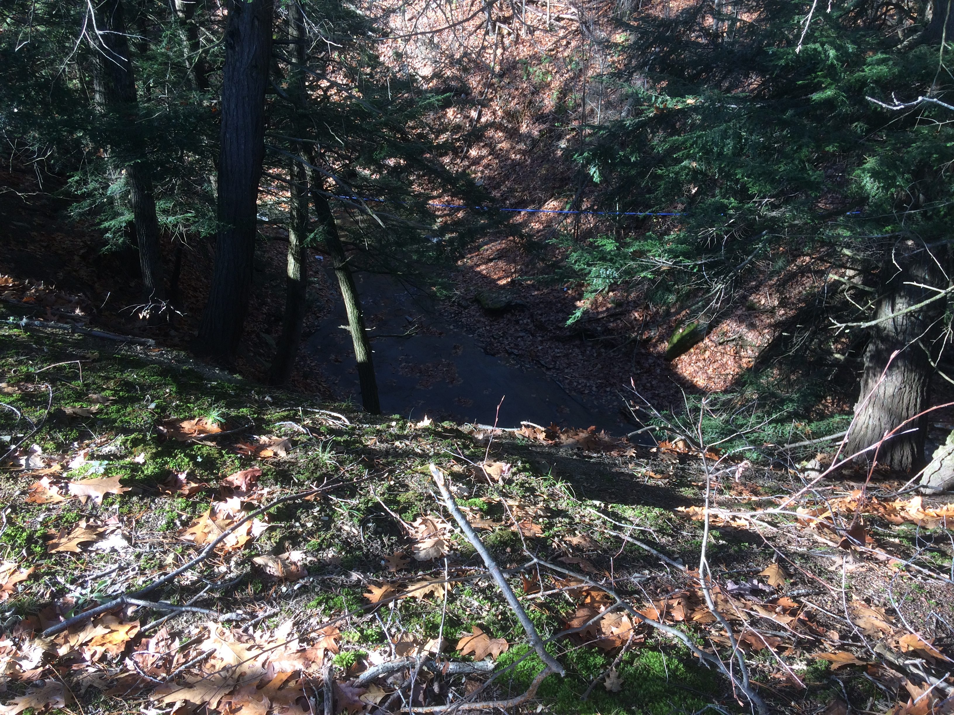
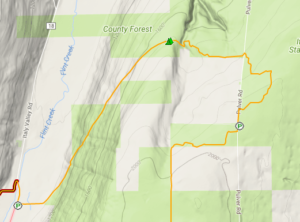
This Sunday, Springwater Trails will continue our monthly hike series on the Bristol Hills Branch of the Finger Lakes Trail.on the hills east of Italy Valley. Next month we will hike down from these hills to Italy valley but for this hike we will stay between 1400ft and 2100ft. As of Friday, Snow and temperatures at 32 are predicted. Expect some slippery slopes where walking sticks will be helpful.
NOTE: Due to hunting season closures, we will be skipping the section of the Bristol Hills Branch between Williams Rd and Pulteney Rd. But don’t worry, we will return to this section in January.
The trail from Pulteney Rd to Dunn Rd begins and ends with road walks. The 2.1 mile off road portion will form the heart of our hikes, of which we will have three levels.
All hikers will meet at the parking area at the end of Dunn Rd. This will be the end point for the Climbers and Tourist hikes. From the parking area, we will all carpool to the two starting points, while dropping off cars to pick up the Naturalists on CR 34 (Italy Turnpike).
IMPORTANT: If you are a Naturalist (wanting to hike 2.1 miles) and are willing to arrive at 1:45 to leave your car to transport Naturalists back to our meeting place, please RSVP by email to info at springwatertrails.org.
 The Climbers‘ hike (4.8 miles) will include all road walks for hikers who want to complete the entire BHB. We will start at Access 11 with a road walk along Pulteney Rd. The road has a gradual downslope to Fivemile Creek. This is followed by a steep climb up about 120 ft, where the orange trail leaves the road to the left.The trail is fairly level for 2.1 miles. We will travel along a corn field before entering a Sugarbush around a beautiful stream with small waterfalls. The first road we cross is Italy Hill Rd. Turn left and walk a hundred feet to the next hedge row. It is the same at Wetmore Rd – turn left on the road to the first hedgerow. At Emerson Rd the trail continues just a bit to the right.We will come out on onto CR 34 at mile 3. From this point, turn right on CR 34, and then left on Dunn Rd, to finish at the original gathering spot. Cars that were left at the end of Dunn Rd, can be used to retrieve the climber’s cars on Pulteney Rd.
 The Tourists and Naturalists will start at the point where the trail leaves Pulteney Rd north of Access 11. Since the Tourists are hiking farther (3.9 miles) than the Naturalists (2.1 miles), they should take the lead. The trail will cross three roads (Italy Hill Rd (go left), Wetmore Rd (go left) and Emerson Rd (slight right)) before coming out onto CR 34 after 2.1 miles. We will have a car waiting on CR 34 for the Naturalists, who can drive east on CR 34 to Dunn Rd and then back to the parking lot, Meanwhile the Tourists will continue to hike to the right on CR 34, and then left on Dunn Rd.
Following the hike, we will return to Naples for an optional dinner at the Redwood Inn.
Carpool instructions at the Hike: These instructions may be modified based on the number of hikers on the day of the hike.
One naturalist will be needed to drive the naturalists back to their cars. This person will drive their car from the Dunn Rd parking lot to CR 34. Another car will pick this driver up to go to the start of the hike.
The Climbers will drive all hikers to the start. They will head south on Dunn Rd back to CR 34, Turn left on CR 34. At the intersection with Italy Hill Rd, we will cross the road and turn right onto Pulteney Rd. Just before heading down the hill to Filemile Creek, we will stop to drop off the Naturalists and Tourists. The Climbers will then continue south east until the road turns east. This is Access where the trail comes in from the west. Climbers should turn around and park to the east of the access point on the north side of the road.
Directions: From the southern end of Naples, follow NY 53 toward Prattsburg. In 1.1 miles, turn left onto Italy Valley Rd (CR 21). In 5.5 miles, take a slight right onto Italy Hill Turnpike (CR 34). In 2.6 miles, turn left onto Dunn Rd. A large parking lot is at the end of the drivable portion of Dunn Rd. If the parking area is full, or too muddy, park along the road facing toward CR 34.
Are you looking for a great winter hike. This Sunday may be perfect. There was about 4 inches of snow on the ground Thursday, enough so you know it is winter but not so much as to interfere with hiking. Traction devices and even snow shoes will give you a stable base as you hike, and even XC Skis would provide an enjoyable trip for anyone willing to carry their skis across a few gullies.
Bring you traction devices or snowshoes and dress for winter, but in layers because you will warm up. And poles for stability. And plan to arrive at 1:45 to carpool to the top. If you miss us at the bottom parking area, please go directly to the end of Pulver Rd
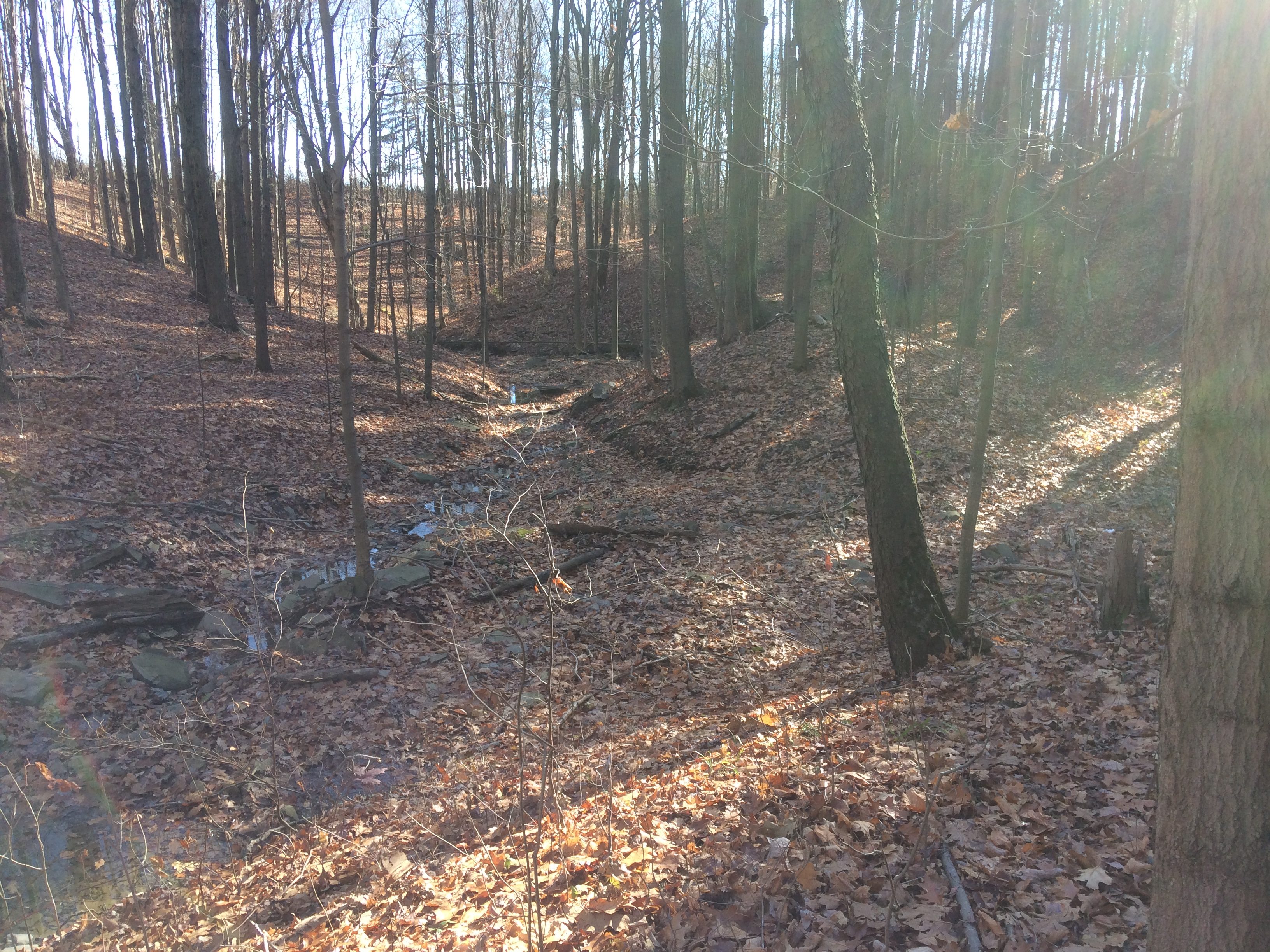
This Sunday, the sunset will officially start to get later. We will take advantage of the extra minute of daylight for a hike from Dunn Rd up on Italy Hill for 5 miles down to Italy Valley. We will pass through Italy Hill State Forest, and follow an old logging road on a gradual descent of nearly 1000 feet. At the bottom, a short (0.2mi) road walk on Italy Valley Rd will return us to our cars. This is one of the best downhills you will find – a very shallow steady incline broken up occasionally by various sized gullies. The trail is very even and well cared for.
In addition to the forest all around us, highlights include a small waterfall, the “Outback Inn Shelter”, and an absolutely beautiful Hemlock lined small gully on the trail down..
 As usual on our Bristol Hills Branch hikes, this hike is a one way hike for Climbers and Tourists, so we will have some car driving to do at the beginning of the hike.
All hikers will meet at the parking area on Italy Valley Rd (42.626312, -77.281368) just north of the Flint Creek crossing at 1:45. All hikers will then carpool up to the top of Italy Hill.
The Climbers will drive South on Italy Valley Rd to Italy Turnpike, then up the hill to Dunn Rd where they will turn left and park at the end of the road. We will hike straight ahead on an abandoned section of the road for 0.7 mi, and then turn right to continue on the trail over to Pulver Rd where we will pass the Tourist cars and continue on the same route they are taking.
The Tourists will also drive South on Italy Valley Rd, up Italy Turnpike, past Dunn Rd and turn left on Italy Hill, and immediately left again on Pulver Rd. About 2.5 miles up Pulver, there is a parking area. The Tourists then hike north on the abandoned part of Pulver Rd for 0.2 miles and then will turn right into the woods. At 1.5 miles we hike down to the stream and waterfall, then scramble up the other side. At 1.7 miles we will reach the Outback Inn. After a brief rest at the Inn (bring an energy bar since this “Inn” is a carry in/carry out self serve establishment), we will start a long descent to the valley floor.
The Naturalists will carpool with the tourists to Pulver Rd, and will follow them to the waterfall. Turning around at the waterfall will mean a 3.0 mile out and back hike, primarily on flat terrain.
 Upon reaching Italy Valley Rd, the Tourists and Climbers will turn right to follow the road back to the cars. We expect there will be enough cars left at the bottom to get everyone back up to the Tourists and Climbers cars at the top in one trip.
Total mileage, according to the FLT map, will be 5 miles for the Climbers, 3.7 miles for the Tourists and less than 3.0 miles for the Naturalists.
Following the hike, an optional social will be at the Neapolitan Pizzeria at 120 North Main Street in Naples, NY.
Directions
From Springwater, Wayland and Dansville: Take NY-15 south to Wayland. Turn left at the light onto NY 21 N. In 6.7 miles turn left to stay on NY-21. At the stop sign in Naples, turn right on NY 53S. In 1.3 miles, turn left onto Italy Valley Rd. In 7.7 miles, just over the bridge, there if parking for the Bristol Hills Branch. Please arrive at 1:45 to give us time to carpool to the top of the hike.
From Honeoye: Take CR 36 (West Lake Rd) into Naples. Turn right on NY 21S and continue straight onto NY 53S. In 1.3 miles, turn left onto Italy Valley Rd. In 7.7 miles, just over the bridge, there if parking for the Bristol Hills Branch. Please arrive at 1:45 to give us time to carpool to the top of the hike.
NOTE: Just a reminder that we will not be hiking next Sunday on Christmas Eve. Join us on New Years Eve for a 2:00pm hike at Harriett Hollister Spencer Park.
Looking for brochure.or mailing list so I can receive it in the mail.
Nothing opens up for mailing list.
There’s all kinds of very bizarre ads and post for viagra and other drugs above on calender page.
Please let me know if there’s a brochure available