
Hikes led by Springwater Trails are generally held on Sunday afternoons and appear in this calendar in green.
| Sun | Mon | Tue | Wed | Thu | Fri | Sat |
|---|---|---|---|---|---|---|
| Lehigh Valley Trail Hike or Bike in Rush, NY 2:00 pm Lehigh Valley Trail Hike or Bike in Rush, NY @ Stevens-Connor Lehigh Valley Lodge Apr 6 @ 2:00 pm – 4:00 pm Come join us for a leisurely hike or bike along the Lehigh Valley Trail on Sunday April 6th! With its flat even surface, the trail is a hidden gem for walking, hiking, jogging, biking. It is a vital link in … Continue reading | ||||||
| Ontario County Park at Gannett Hill Hike-Naples 2:00 pm Ontario County Park at Gannett Hill Hike-Naples @ Lookout Parking area Apr 13 @ 2:00 pm – 4:00 pm  This is one of our group’s favorite hikes! Ontario County Park at Gannett Hill is one of the highest points in Ontario County and located in the scenic Bristol Hills. At an elevation of 2,256 feet above sea level, you’ll … Continue reading | ||||||
| No Hike-Easter Break 2:00 pm No Hike-Easter Break Apr 20 @ 2:00 pm – 4:00 pm No hike has been scheduled for this date due to the Easter Holiday. Enjoy the break, spend time with loved ones and eat chocolate bunnies. This will give you something to burn off next week  | ||||||
| Rob’s Trail – Hemlock Lake side 2:00 pm Rob’s Trail – Hemlock Lake side Apr 27 @ 2:00 pm – 4:00 pm Join us on Sunday April 27 to hike the west side of Rob’s Trail, the DEC/Nature Conservancy property in the northeast corner of Hemlock Lake. Options are to hike out and back to the south along the trail from the … Continue reading |
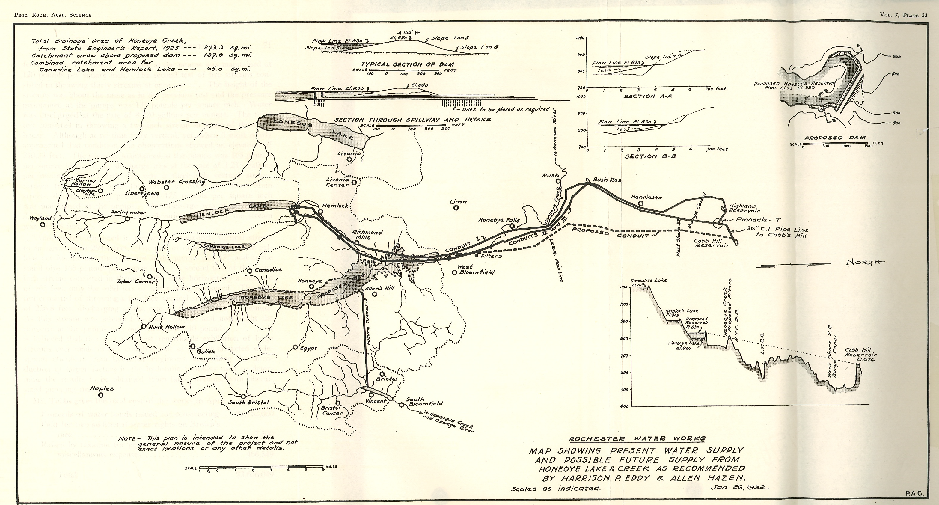
A map showing the 1932 city water supply system and a proposed addition of Honeoye Lake as an additional reservoir.
The City of Rochester started construction in 1873 of a gravity water system connecting Hemlock Lake to a reservoir in the city. The current Reservoir in Highland Park was completed in 1876. In 1887, George Ellwanger and Patrick Barry donated 20 acres of land adjoining the reservoir for the beginning of the public park system in Rochester. Over the years the original donation has grown to the 150 acre Highland Park, and to the 12,000 acre Monroe County Parks system consisting of 22 separate parks. The Ellwanger/Barry gift specified that the city would hire a landscape engineer to establish a first class arboretum with numerous trees donated from the Ellwanger/Barry Mt. Hope Nurseries. The city hired Frederick Law Olmsted Sr and Sons to design the park. Olmsted took advantage of the glacial topography of the park and in 1890 built the Children’s Pavilion on the high point of the park just east of the reservoir.
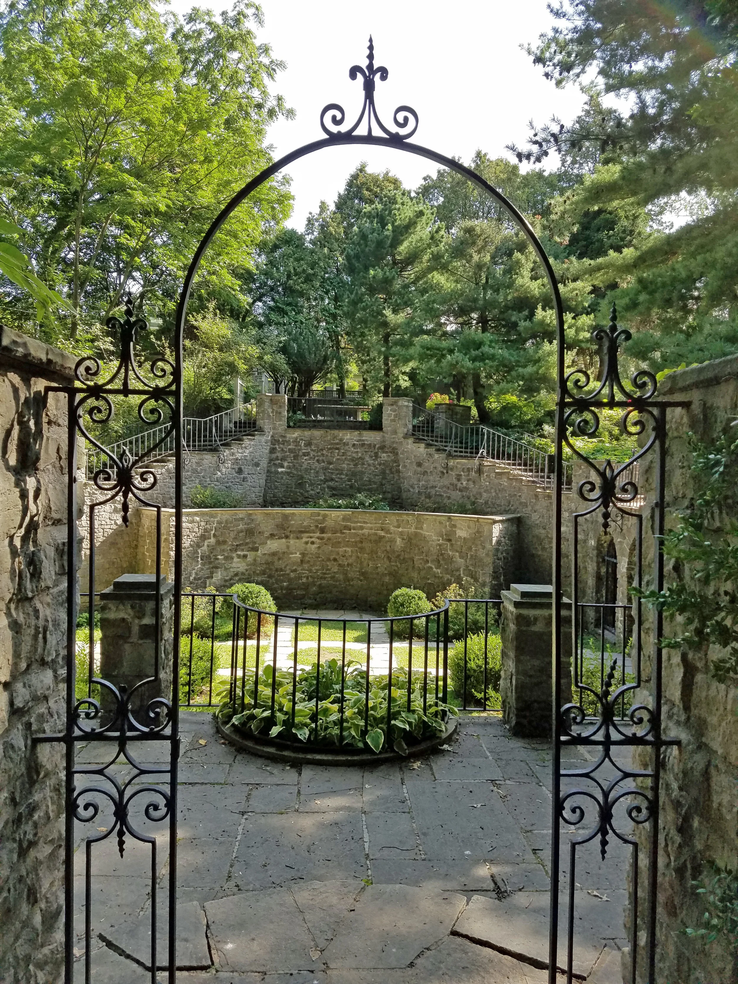 This Sunday’s hike will explore Highland Park with an emphasis on seven rare trees identified by the park department and the Sunken Gardens behind the Warner Castle.
All hikers will meet at the front of the Lamberton Conservatory on Reservoir Ave just east of South Ave. Following the hike, join us for a social at the Distillery Restaurant south of the park on Mt Hope Ave.
Directions:
From Springwater: Take NY 15A north from Springwater through Lima and Rush. (At last check, I390 was being repaved from Avon to NY 251 and is a single lane). Stay on NY 15A into the city. Cross Westfall Rd and stay to the right onto South Ave. In 1.1 miles, turn right onto Reservoir Ave. The Conservatory is on the left and parking is available on Reservoir Ave.
From Honeoye: Take US 20A west to Hemlock. Turn right onto NY 15A and follow the directions above.
From Dansville and Geneseo: Take I-390N to Rochester. Use exit 16B for NY 15A. Cross Westfall Rd and stay to the right onto South Ave. In 1.1 miles, turn right onto Reservoir Ave. The Conservatory is on the left and parking is available on Reservoir Ave.
From Naples: Take NY 21N out of Naples. Bear left onto CR 12. In 5.6 miles, turn left onto NY 64N. In 13 miles, turn left on 5 & 20. Turn right on NY 444N toward Victor. In 7 miles, turn left onto NY 96N. In 2.8 miles, use the right lane to merge onto I-490W to Rochester. Stay on I-490 into the city. Take the right exit 17 to Goodman St. Turn left onto Goodman St for 0.8 miles. Turn right onto Pinetum Dr. Stay to the left onto Reservoir Ave then right to stay on Reservoir Ave. The Conservatory is on the right and parking is available along Reservoir Ave.
From Canandaigua: To NY-332 N to the Thruway. Keep to the left at the entrance for I-90 West toward Rochester and Buffalo. Take the first exit 45 for I-490 W to Rochester. Take Exit 17 to Goodman St. Turn left onto Goodman St for 0.8 miles. Turn right onto Pinetum Dr. Stay to the left onto Reservoir Ave then right to stay on Reservoir Ave. The Conservatory is on the right and parking is available along Reservoir Ave.
Directions to the Social: Head west of Reservoir Ave across South Ave to Mt Hope Ave. Turn left onto Mt Hope Ave. In 0.3 miles, turn left onto Stewart St. The Distillery is on the right.
Welcome to the eighth Annual Mushroom Foray [thanks to both Springwater Trails and the Rochester Area Mycological Association] at the All Western Evergreen Farm. Three hiking groups are planned, all starting and ending at the parking area at the farm. The three groups will explore much of the farm, with many opportunities to find mycological specimens.
Please plan to arrive early (1:45 PM) to sign in and to sign the RAMA liability forms.
Maps of the farm, paper bags and paper plates for collecting and displaying mushrooms will be provided. Those who want to learn how to collect mushrooms will be instructed by Gene and Georgia, and any other Rochester Area Mycological Association members who will be our guests.
The Climbers will follow the driveway up to the fields, turning to the left at the top. We will circle the pond on the southern portion of the farm and the spruce forest along the edge of the Christmas tree plantations. Heading west through the Cathedral Pines will take us to wet spots in the woods. We will return along the edge of several more Christmas tree plantations (Douglas-fir, Nordmann fir, Grand fir, Concolor fir, Canaan fir, Alaska yellow cedar, Norway Spruce, Meyer Spruce).
The Tourists will follow the driveway up through the woods, stopping occasionally to explore for mushrooms. When reaching saleable size Christmas trees (Lot Z), head to the right around or through the Christmas tree plantation. At the corner where the small Southwestern White Pine tree row ends and the tall Concolor fir are, follow the trail into the woods and back to the field and head west along the north field road to a hidden corner of the field with some spectacular 35 foot green and blue Concolor fir Christmas trees live, the size seen during Christmas season in a large mall. If there is still time, follow the north field road next to the hedge row up to Story Road. We will return through the tillable fields, visiting smaller collections of trees and back down through the woods.
The Naturalists will start exploring under and behind the Western red cedars (thuja plicata or giant arborvitae) by the parking area and south to the Alaska yellow cedar, large Concolor fir and spruce, then back up through the woods to the right of the trail up to the main fields. These are likely full of mushrooms, but you will find some swampy areas, so don’t get lost behind people’s homes along Liberty Pole.
All hikers should check their watches and return to the parking area by 4:00 PM to have their collections identified. A portapotty with a sink is nearby.
Mushroom Identification
Once again we are fortunate to have several RAMA members (Randy Weidner, Don Tuminelli, Eugene & Georgia Binder) with us who have volunteered to identify the mushrooms collected between 4 and 5 PM. After the mushrooms are identified please join us for a social (5:00 – 6:30 PM) hosted by Katherine outside the house next to the Furnace Building. Please bring a lawn chair and your own bag lunch and beverage.
We will begin all the hikes at 6840 Liberty Pole Road where there is ample parking at the Christmas tree loading area between the tall Western redcedar and Morton Building and Nursery beds. Follow the parking signs. When we return from our foray, the mushrooms will be displayed for identification on paper plates on the tables outdoors. Please dress for the weather, rain gear as needed. Social distancing and masks are recommended when close together.
From Springwater: Go west from the Springwater light on NY-15 North. Just past the top of the hill and after rounding the tight curve, turn left on CR 38 (Liberty Pole Road). The farm is on the left (the high side) 1.1 miles from NY-15 at 6840 Liberty Pole Road after you cross Carney Hollow Rd. There is a sign for the All Western Evergreen Nursery & Christmas Tree Farm. Follow the orange cones to the parking area and park facing the house.
From Geneseo: Go south on NY-63. About 6.4 miles after passing NY-408, turn left on CR-1 (Groveland Scottsburg Rd) at Groveland Station. This road becomes CR 1A (Springwater Scottsburg Rd) at Scottsburg (Route 256) and then Liberty Pole Road after you cross Stagecoach Road (CR 71), and finally CR-38 (still Liberty Pole Rd) after crossing Reeds Corners Rd (CR-29). It is 7.1 miles from Groveland Station to All Western Evergreen Farm. The farm is on the right (the high side). Follow the orange cones to the parking area and park facing the house.
From Honeoye: Take 20A west to Hemlock and 15A south to Springwater. Then follow the Springwater directions above.
From Rochester: Take I-390S from Rochester. Use Exit 9 for NY-15 Lakeville. Turn left onto NY-15. Stay on NY-15 for 16.5 miles, through Lakeville, Livonia, Conesus and Webster Crossing. When NY-15 curves to the left at the south end of Webster Crossing, continue straight onto CR-60 (Carney Hollow Rd) and take the first right onto Liberty Pole Rd. The farm is on the left (the high side) at 6840 Liberty Pole Rd. Follow the orange cones to the parking area and park facing the house.
If using GPS, use the map directions on the www.allwesterntrees.com website and make sure you are on Liberty Pole Road and not being directed to the center of the farm from Swartz Road or Story Road. Follow the orange cones to the parking area and park facing the house.
Please note: The schedule paddle in Irondequoit Creek has been canceled due to possible poor weather conditions. If you were hoping to paddle, please come to the hike and social instead. While there may be some showers, temperatures will be good and the hike will proceed as planned. Be prepared for muddy trails.
Come to the south end of Irondequoit Bay for a hike in one of Monroe County’s most interesting but least well known parks. Lucien Morin Park abuts the wetlands surrounding Irondequoit Creek, and contains some low but rugged hills and valleys, similar to nearby Abe Lincoln and Durand Eastman Parks. In addition the property was used for target practice by the National Guard back in the mid 20th century, and has some interesting surviving site structures left over from the military use.
Lucien Morin Rifle Range Trail Map
Hikers will meet at 1:45 at the Lucien Morin Park trailhead and parking area at1135Empire Blvd., just east of the former McGregor’s pub. We will all start out together on the white trail and dirt road along the wetland (west) side of the park, heading for the gazebo where the officer used to oversee the shooting operations. From there we will continue on the white trail to the southwest corner of the park, passing several wetland overlook spots. We will split up after hiking about 1 mile (it will seem longer), with the Tourists/Naturalists returning north through the center of the park and the Climbers taking a longer route along the more rugged eastern edge. Hikes will range from 2.25 to 3 miles. There are some short but moderately steep climbs; bring good boots, water and hiking poles if you use them. See route maps below:
Lucien Morin Park – 2.2 mile hike along wetland
Lucien Morin Park – 2.8 mile hike through rifle range
Social: Please join us afterward for a dish-to-pass social at Gene and Georgia’s home at 1855 Westfall Road, Brighton, at the southeast corner of Westfall and Fairhill Drive. See directions below. Bring your own beverage and a folding chair along with assorted goodies, or donate $5 and help yourself. Bring a card table too if you have one. We will assemble in the garage if it’s too cool or damp outside.
Directions to Lucien Morin Park:
Take your favorite route toward Rochester, via route 15, 15A, 390, or 490. When you reach the Outer Loop (390/590), go north on Route 590 toward Irondequoit. About 2 miles after passing through the 490 intersection, take the Empire Boulevard/404 exit. Make a right on Empire Blvd, and go down the hill toward the bay. Lucian Morin Park trailhead and parking lot will be on your right at #1135, just past the former McGregor’s.
Directions to the Social 185 Westfall:
Head back to the west on Empire Blvd. You may take 590 south back to the Monroe Avenue (Route 31) exit, then make a left on Monroe and an immediate right on Westfall, proceeding to Fairhill Drive, the sixth left off Westfall. Make a U turn on Fairhill and park on the west side shoulder, next to 1855 Westfall, the house on the corner.
Simpler and more direct route: Head back to the west on Empire Blvd. Before you come to the 590 ramps, turn left on Winton Road. Take Winton Road all the way to Brighton – 4.6 miles. Cross Westfall Road, then take the next left on Fairhill Drive (it’s L shaped). Follow Fairhill around to the left, and park on the right hand shoulder at the last house on the right, 1855 Westfall.
Join the Vincent House of Wayland, and cycle for a good cause with a 30 mile route along scenic Canadice Lake – enjoy beautiful views as you cycle for a cause! Route options available for both road and trail riding.
This 2nd Annual cycling event is dedicated to the memory of Connie Curry
Fees: $45 early registration by September 22, 2020
$50 registration September 22 through day of the event
* T shirt included
Starting Location: Victory Park- Wayland, NY
SCHEDULE
Registration: 9:00 a.m.-10:00 a.m.
30 mile route departs: 10:00 a.m.
Post ride box lunch: 12:00 p.m. – 2:30p.m.
Questions? Call: Christy Mattice (585)728-2427 or Email: VHvolunteer@frontier.com
*Mail Registration and signed Waiver Form with check made out to:
The Vincent House
310 Second Ave. P.O. Box 566
Wayland, NY 14572
Click the links for the Registration and Waiver form as a MS-Word document or a PDF.
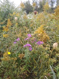
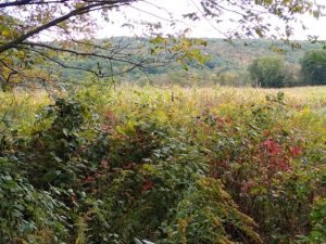
The Sunday hike on October 10th 2021 will most cover the FLT on Hatch Hill in Naples; the Fall colors should be at the finest for this hike. The hike will start at the Bob North bridge at the bottom of Ontario Street in Naples. There is a kiosk and a small parking lot there, and all groups will start at the same place. The Naturalists will walk along Matt’s Meander to the Naples Community Park and back, while the Tourist will walk south along Hatch Hill above the town to the south end of Naples. The Climbers will walk north on Hatch Hill to Conklin Gully. Both Tourists and Naturalists will walk back to the parking lot, while climbers will end up at the DEC parking area at the bottom of Conklin Gully and be shuttled back to Naples. Note: the last half mile of this hike is a very steep downhill, but it’s worth it; there are huge drops into the gully to the right of the trail, and wonderful view across the gully and down into it.
There is a DEC display board at the parking lot with a map of all the trails that meet there; all the day’s hiking trails are shown.
The social will take place at Brews and Brats in Cold Springs, Bristol. It’s on Rt. 64 at the junction of rt 64 with county road 12.
Naturalists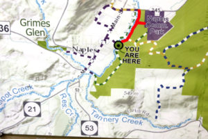

The Naturalists will cross Naples Creek on the Bob North bridge and bear to the left. It is a broad path through woods with the Naples Creek flowing to the left of the path. This trail is called “Matt’s Meander”, and it follows Naples Creek to the Community Park on Route 245. It is about a mile to the end of the trail and back.
Tourists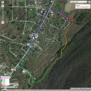

The tourists will cross the bridge and bear to the right. The trail runs south along Hatch Hill above Naples Creek, and goes parallel to both Naples Creek and Naples Main Street, though a lot higher up the hill. This path is not blazed or marked at all but it is well trodden for most of the way; it becomes a little harder to see at the southern end, but once the Turkey Federation parking lot is in sight then it’s not hard to find a way down to it. The trail passes through land that was once grazed and then terraced for vines, but is now returning to woodland. Traces of the shallow terracing for the vineyards can be seen all along the trail, and occasionally an abandoned farm building. The creek can be seen in the valley below the trail all the way along. This trail ends at the south end of Naples, on Mark Circle, where several streams come together to form the Naples Creek. There is water supply facility there, a swimming hole, and an antiques shop. The group will return to the Ontario Street parking lot via Naples Main Street. This walk is 2.1 miles. with just one short modestly steep section.
Climbers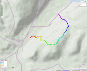
The Climbers will take the Finger Lakes Trail to Conklin Gully through the High Tor Game Management Area. They will cross the bridge and bear left along with the naturalists, and then about half way down Matt’s Meander the FLT branches off to the right. The group will follow the ORANGE blazes on a long uphill section; it’s steep in places with some switchbacks – the trail seems to be going the wrong way at times. There are some ponds at the top of the hill (it’s a mystery – where does that water come from?) with the Howard Beye memorial bench on one of them. It’s important to stay with the orange blazes here – there are several logging roads that make it easy to take the wrong path. Where the trail meets the top of Conklin Gully there is a lookout with a fine view of the Naples Valley and a well organized scout camp, complete with fire pit. The path down the hill from the camp is broad and easy walking. The group will leave the FLT where it branches off to the right over a bridge to the memory of Tom Noteware and follow the BLUE blazes down the hill to the DEC parking lot at the bottom of Parrish Hill.
The Meeting Place
We will meet at the trail head parking lot on Ontario Street, Naples, at 2:00pm on October 10th 2021. The climbers will shuttle some cars to Parrish Hill before starting off.
Getting There
From Springwater and Wayland, come south on Rt. 15 to the traffic light at Rt 21. Turn left on 21 and keep going all the way to Naples. Go through the downtown business area and turn right on Ontario Street, opposite the school. Go to the bottom of the hill and the parking lot is on the left.
From Dansville, follow Rt. 63 to Wayland where the road turns into Rt 21; continue on 21 all the way to Naples. Go through the downtown business area and turn right on Ontario Street, opposite the school. Go to the bottom of the hill and the parking lot is on the left.
From Naples, go to the school on Main Street (Rt. 21). Turn down Ontario Street opposite the school, go to the bottom of the hill and the parking lot is on the left.
The Social
The social will take place at Brews and Brats in Cold Springs, Bristol. It’s on Rt. 64 at the junction of rt 64 with county road 12.
.
About the Auburn Rail Trail: This crushed-stone trail follows the corridor of a New York Central line from Farmington to Pittsford. There remains one gap in Victor, but work is under way to close it. The trail is currently maintained by the Victor Hiking Trails organization in close cooperation with the town of Victor.
Our hike and bike ride for Sunday, 10/17/21 will begin at 2:00 pm from Mertensia Park in the town of Farmington, where all hikers and bikers will meet (and there is plenty of parking at the park).
People will have the option to hike or bike along the Auburn Rail Trail going westbound from the park. We will likely see peak fall colors. The trail surface is crushed, granular stone and mostly dry. There are many fallen apples, chestnuts, sticks, and leaves on the trail, so poles are recommended. Otherwise, this is an easy, mostly flat trail.
Hikers: All hikers will start together from the parking lot at the park, walking westbound. Naturalists and Tourists (or those wanting a shorter hike) will walk out and back, turning around where they wish, back to the park – joining at least one fellow hiker.
“Climbers” (or those wanting a longer hike) will hike out for about 60 minutes, then turn around and return to the park.
Bikers: Bikers will also ride westbound out and back. NOTE – AT APPROX. ¾ MI. INTO THE RIDE, BIKERS WILL TURN RIGHT AT EAST VICTOR RD. FOR ABOUT 0.2 MILE, TURN LEFT ONTO BREAK OF DAY ROAD FOR 0.1 MILE, THEN RE-ENTER THE AUBURN RAIL TRAIL ON THE SOUTH SIDE OF THE ROAD AND CONTINUE ON THE RAIL TRAIL. (HIKERS WILL NOT TURN RIGHT ONTO EAST VICTOR RD. THEY WILL CONTINUE STRAIGHT THROUGH THE CROSSWALK ON EAST VICTOR RD. AND ENTER A LOCAL TRAIL, WHICH ENTERS VICTOR HILLS EAST CLUB PROPERTY AND JOINS UP AGAIN WITH THE AUBURN RAIL TRAIL.)
In Victor the Auburn trail goes past the site of a circa 1840 railroad depot of the Auburn and Rochester Railroad, which lends its name to the trail. The depot is privately owned, as is an adjacent boxcar. NOTE – AT THIS LOCATION, BIKERS WILL CONTINUE ACROSS THE ROAD ON A TRAIL WHICH WILL JOIN BACK UP WITH THE AUBURN TRAIL. HIKERS ALSO, WILL CROSS THE ROAD IF THEY GET THAT FAR (WHICH IS UNLIKELY). Bikers will ride from Mertensia Pk. to RR marker 90 (near turn off to Powder Mills Park), take a short break and then head back to Mertensia Pk. (approx. 16 miles total).
Social Gathering: After the hike/bike ride we will gather at the Irish Mafia Brewing Company, located at the intersection of Routes 20 & 64 (Toomey’s Corners), 2971 Whalen Rd., Bloomfield, NY 14469. For more information about the restaurant and brewery visit irishmafiabrewing.com
Directions and Parking at Mertensia Park: Mertensia Park is located at 1390 Mertensia Rd., Farmington, NY 14425
From Springwater: Head north on NY 15A. Take a slight right onto Old Bald Hill Rd S, then a quick second right onto Johnson Hill Rd. At the end of Johnson Hill Rd, turn left onto CR 37 and continue on CR 37 through Canadice. Turn right onto US 20A. In 7.9 miles, turn left to stay on US 20A and NY 64. At the intersection with Rt 5&20, continue straight onto Whalen Rd, then turn right on North Bloomfield Rd. Continue to New Michigan Rd. (turn left). Drive 3.5 mi. to CR 41, turn left and drive 0.1 mi. to Mertensia Rd. The park entrance will be about 0.2 mi. on your left.
From Naples: Head northeast on State Rte. 21N. Continue to follow State Rte. 21N to NY-64N in South Bristol to Toomey’s Corners (Rte. 20/64). Continue straight onto Whalen Rd. then turn right on North Bloomfield Rd. Continue to New Michigan Rd. (turn left). Drive 3.5 mi. to CR 41, turn left and drive 0.1 mi. to Mertensia Rd. The park entrance will be about 0.2 mi. on your left.
From Honeoye: Drive on Rte. 20A east to 20A East/64N and then follow directions above (from Naples).
LOCATION: Enter the park through the North Entrance off of NY-36 and drive past the admission gate (this is considered “off-season” so no fees will be charged) to the parking area. We will start our hikes from the Clara Barton Shelter which is to the left of the parking area. Bathrooms near the shelter will be open.
HIKE DESCRIPTION: Stony Brook is one of the Finger Lakes State Parks which was the site of a Civil Conservation Corps camp during the 1930’s. Many of the trails and facilities at the park are thanks to the work that they did. We will hike on three trails that cover the length of the park – the Gorge Trail, West Rim Trail and East Rim Trail. The Gorge Trail runs along Stony Brook at creek level while the other two trails wind along the top of the gorge. Hikers will appreciate the work done this past summer to replace stone steps and wooden stairs where needed. We will split into three groups with each group walking at their own pace. All three trails have many steps and are most likely going to be wet and slippery so poles and traction devices or good treaded hiking boots are recommended.
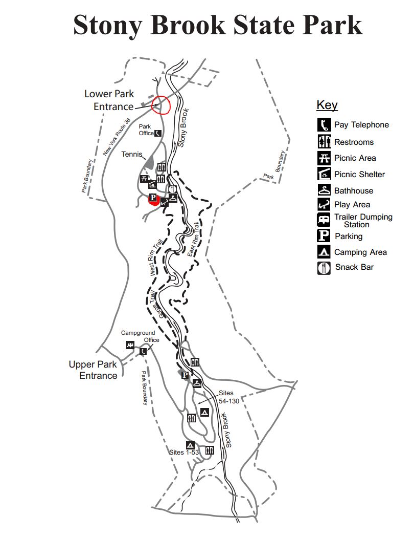 Climbers will hike the West Rim Trail and the East Rim Trail. They will cross over the playground area to the West Rim Trail trailhead and begin climbing about 400′ in elevation to the top of the gorge. The trail then goes along the rim to the upper park where hikers will go over the stone bridge and return back to the lower park along the East Rim Trail.
Tourists will hike the Gorge Trail and the East Rim Trail. They will go past the swimming area to the Gorge Trail trailhead and continue up past three waterfalls to the upper park where they will cross over the stone bridge and return back to the lower park on the East Rim Trail.
Naturalists will hike the Gorge Trail out and back. They will go past the swimming area to the Gorge Trail trailhead and continue as far as they want then return by the same route.
RECOMMENDATIONS: The weatherman is calling for cooler weather and a possibility of showers on Sunday so be prepared.
SOCIAL: An after hike social will be at the Clara Barton Shelter. Cider and donuts will be provided. If there is enough interest we could go in on a pizza and have it delivered to the park – people will be asked about this prior to beginning the hikes
DIRECTIONS: From the Village of Dansville take NY-36 South. The North Entrance to Stony Brook State Park is several miles south of the village on the left.
Leave a Reply
This Sunday we will bicycle and hike along the west side of Canadice Lake. We will meet at the north end of Canadice off of Purcell Hill Rd. Both hikers will head south on a pleasant and easy maintenance road that seems to be a favorite route for many local walkers and skiers (when there is snow). Climbers, Tourists and Naturalists will all hike the same route, each group going at its own speed and distance.
Please arrive a few minutes early so we can organize and start hiking at 2:00PM.
Since it’s Halloween, everyone is invited to cycle and hike in costume. Curses on politicians of any stripe are forbidden on state land, but well behaved dogs are welcome.
The Hikers
This hike will be a slow walk up and down the Canadice shoreline. We’ll walk south for an hour and then return to the starting place. Based on our hiking speed, some hikers will have time to head up Rob’s Trail for a view of the lake from above. If the lake level is low we will investigate a route down to the water for a walk back on the rocks of the shoreline.
The Bicyclists
The bicyclists will cycle south down the west side of Canadice lake to the end of the lake, and then return the same way. Since this is a short distance for a bike ride, we’ll explore the roads and trails at the south end of the lake before returning to the starting place.
The Social
The social will be at the Birdhouse Brewery in Honoeye.
Directions (click here for a more detailed guide):
We will meet at the northwest parking area for Canadice Lake on Purcell Hill Road west of Canadice Lake Road. Please note that this is not a boat launch.
From Rochester and the I390 Exit 11 Park and Ride: From Rochester, take I390 south to Exit 11. Turn left (south) on Rt 15. The park and ride is on the right side. From the park and ride, turn right onto Rt 15 and then an immediate left onto Rt 251 toward Rush. After 1.3 miles, bear right onto 15A. Follow 15A through Rush, Lima and Hemlock for 18.5 miles. Turn left on Purcell Hill Road for 1.2 miles. At the bottom of the hill, the parking area is on the right before you cross the Canadice outlet.
From Springwater: Take 15A north from the Rt15 intersection for 7.6 miles. Turn right on Purcell Hill Road for 1.2 miles. At the bottom of the hill, the parking area is on the right before you cross the Canadice outlet.
From Honeoye: From Rt 20A, turn south on CR 37. After 3.7 miles turn right at the white church in Canadice. Stay straight onto Burch Hill Rd when CR37 bears to the left. Follow Burch Hill Rd down to Canadice Lake Rd. Turn right (north) on Canadice Rd for 0.7 miles, then left on Purcell Hill. The parking area is on the left in 0.2 miles.
The Genesee Valley Greenway State Park is a 90-mile open space corridor that follows the route of the Genesee Valley Canal (1840-1878) and the Pennsylvania Railroad Rochester Branch (1882-1963) from the Erie Canalway Trail in Rochester’s Genesee Valley Park to the Village of Cuba in Allegany County. The Greenway will eventually extend to Hinsdale in Cattaraugus County. This Sunday’s hike will start at Fowlersville Rd parking area in the town of Caledonia and will follow the Greenway north to US-20 and then to NY-5 and finally will follow the Erie-Attica Trail out to a parking area. on Farmers Rd in Avon.
There are three options for this hike.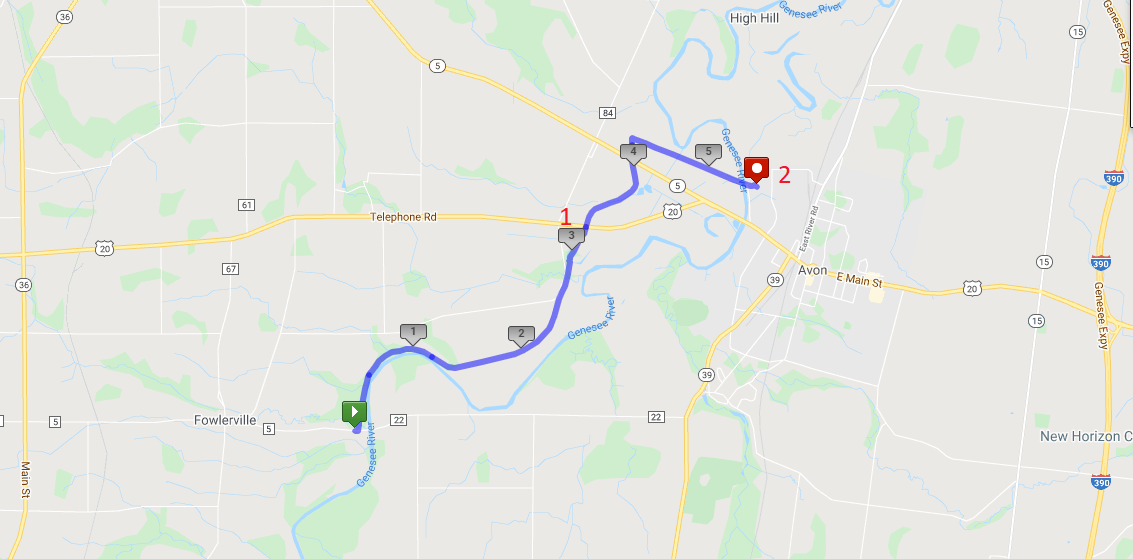
- The Tourists will do an out-and-back two hour hike. This is a good option for any hikers who would prefer to avoid car-pooling during the pandemic. The Greenway starts by following the Genesee River, crossing a couple of streams that cross under the trail through a deep culvert to get to the river. At about the 1.2 mile point, the river wonders through loops to the east, we nice big fields visible between the trail and the river. , The Tourist group should watch the time and turn around at 3:00 for a two hour out-and-back hike of less than 5 miles. Don’t go past Rt 20 – at that point the out and back will be over 6 miles. For safety sake, slower hikers should always stay in a group of at least 2 hikers and turn around at the same time.
- The Naturalists will do a through hike to US Route 20 (Pickup point #1 on the map). There will be a car available at Route 20, to return hikers to their cars. This option is 3.2 miles and will be limited by the size of the pickup car.
- The Climbers will continue on the Greenway past Route 20, and across NY 5. About a tenth of a mile past NY 5, the Climbers will turn right just past two bridge abutments onto the Erie Attica Trail. These abutments carried the Erie-Attica Railroad over the Pennsylvania Railroad. Interested hikers may find the planning study report for the Erie-Attica Trail of interest. This hike is 5.4 miles ending at pickup point 2 and will take slightly more than 2 hours if hikers maintain a 25 minute mile pace. If necessary, hikers can stop at the Route 20 crossing or return to that crossing prior to reaching the Erie Attica turnoff. Hikers who complete the hike to cross the Genesee River at Farmers Rd will have a couple of cars to carry them back to Fowlersville Rd. These cars should plan to stop at Rt 20 to pick up any stragglers.
Following the hike, join us for a social hour at either Tom Wahls in Avon or at the Rising Storm Brewery in South Lima.
NOTE: Carpool drivers should plan to arrive at 1:30 at their pickup point. It is about 10 minutes back to the Fowlerville Rd meetup point.
Directions: To the Fowlerville Rd parking area (the Green start point on the map).
From Springwater: Head west on NY-15 from the light in Springwater. Continue on route 15 through Livonia and Lakeville. At 1.5 miles north of Lakeville, turn left onto Triphammer Rd. In 3 miles at the end of Triphammer Rd, turn right onto NY-39. In 2.5 miles, turn left onto Fowlerville Rd. In 2.9 miles, cross over the Genesee River and the parking area is on the left. After parking, you will cross the road to hike north on the Greenway.
From Naples: Head west from Naples on CR 36 to Honeoye. Turn left on 20A for 1.5 miles. Turn right onto Big Tree Rd, across 15A and 15 for 7 miles. At the end of Big Tree Rd, turn left on US 20A into Lakeville. Take a slight right to stay on NY-15. At 1.5 miles north of Lakeville, turn left onto Triphammer Rd. In 3 miles at the end of Triphammer Rd, turn right onto NY-39. In 2.5 miles, turn left onto Fowlerville Rd. In 2.9 miles, cross over the Genesee River and the parking area is on the left. After parking, you will cross the road to hike north on the Greenway.
From Canandaigua: Head west on US 20 through Lima to Avon. At the traffic circle, take the 2nd exit to stay on Route 20. In 0.3 miles, turn left onto NY-39 (Wadsworth Ave). In 1.7 miles, turn right onto Fowlerville Rd. In 2.9 miles, cross over the Genesee River and the parking area is on the left. After parking, you will cross the road to hike north on the Greenway.
From Geneseo: Head north on NY-39 toward Avon. In 7 miles, turn left onto Fowlerville Rd. In 2.9 miles, cross over the Genesee River and the parking area is on the left. After parking, you will cross the road to hike north on the Greenway.
Directions to the Route 20/Greenway pickup point 1 (Drivers wanting to hike the 3 miles and willing to leave their cars at the parking area on Rt 20).
From Springwater: Follow NY 15 north through Livonia and Lakeville to Route 5 & 20. Turn left and follow 5&20 around the traffic circle in Avon. In 1.2 miles past the traffic circle, turn left to stay on US-20 as NY-5 continues straight. The Greenway is 1.1 miles ahead with parking on the right.
Directions to the Farmers Rd pickup point 2 (Drivers wanting to hike the full 5.4 miles and willing to leave their cars at the end.)
From Lima: (I assume you can find Lima!) Follow 5 & 20 west for 8 miles, around the traffic circle in Avon. Just before the Genesee River, turn right into Farmers Rd. Follow the road for half a mile, passing through the underpass under the trail. The underpass may have a pool of water under it. The parking area is on the north side of the underpass.
Directions From Farmers Rd to Fowlerville Rd: Turn right on 5&20. In 0.4 miles, turn left to stay on US-20. (Stop at the Greenway to pick up any drivers who have parked at the Rt 20 parking area.) In 3.5 miles, turn left onto Casey Rd. At the end of Casey Rd, turn left onto Fowlerville Rd. The parking lot is on the right in 1 mile.
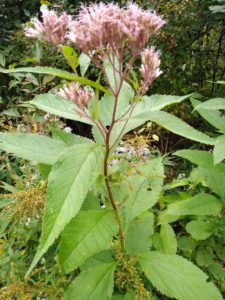
We will visit and hike a little-known gem nestled in the town of Bristol – Patriot Park – this Sunday. Patriot Park was acquired as a donation from Ontario County by the town of Bristol. The park spans 12.6 acres and is located on the south side of CR 32, just west of Mud Creek. Due to generous donations of a picnic table, many benches along the way, and much time and labor the park’s trail system is well-equipped and easy to navigate.
There are four small trails winding into each other for a total of just over 2 miles. This is an easy walk – most of it is flat with the exception of the Uplands Trail, which is a gentle slope of about 5 minutes in length.
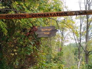
We will all do the same hike, meeting in the parking lot in adjacent Levi Corser Park and walking from there to the 3rd trail entrance to Patriot Park, west of Mud Creek. We will head to the Uplands Trail Loop for a lovely view of an open field on CR 32, then head north, then east, to a small pond. Walking north along the creek we will cross the creek right before the road and enter the Codding Conservation Area on our return. This is a pristine woodlands with no new plantings in the last 50 years. There are many wildflowers, trees, the creek and numerous wildlife including a wide array of songbirds, butterflies and deer.
We will also see some interesting ‘found objects’ art displays and natural benches, in the form of trees, along the way and will exit at the first trailhead for Codding Conservation Area, then head back to the cars.
Anyone wishing to extend the hike can walk the track around Levi Corser Park and then walk on to an old cemetery nearby on the east side of Route 64 and explore that. Depending on the weather we will either have a picnic social at Levi Corser Park or travel to Lock, Stock and Barrel, a few minutes drive down Rte 64. There is a pavilion at Levi Corser Park, with several picnic tables, attached to a building so it is open on three sides. There is one grill for use. There are bathrooms with running water on site. 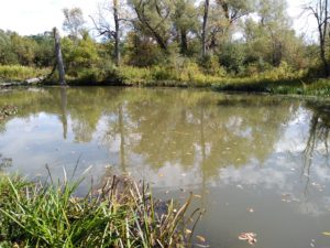
DIRECTIONS TO HIKE: FROM THE WEST: TAKE RTE 20A EAST TO CR32 (WIZARD OF CLAY ON CORNER). RIGHT ONTO CR32, LEVI CORSER PARK IS ON THE RIGHT SIDE. FROM THE EAST: TAKE CR32/BRISTOL ROAD WEST, CROSS RTE64, LEVI CORSER PARK IS ON THE LEFT. FROM THE NORTH: TAKE RTE 444 SOUTH TO BLOOMFIELD, TURN LEFT ONTO RTS 5&20, TURN LEFT ONTO RTE 64, LEFT ONTO CR32. FROM THE SOUTH: TAKE RTE 21 TO CR 12, LEFT ONTO RTE64N, LEFT ONTO CR32.
Looking for brochure.or mailing list so I can receive it in the mail.
Nothing opens up for mailing list.
There’s all kinds of very bizarre ads and post for viagra and other drugs above on calender page.
Please let me know if there’s a brochure available