
Hikes led by Springwater Trails are generally held on Sunday afternoons and appear in this calendar in green.
| Sun | Mon | Tue | Wed | Thu | Fri | Sat |
|---|---|---|---|---|---|---|
| Lehigh Valley Trail Hike or Bike in Rush, NY 2:00 pm Lehigh Valley Trail Hike or Bike in Rush, NY @ Stevens-Connor Lehigh Valley Lodge Apr 6 @ 2:00 pm – 4:00 pm Come join us for a leisurely hike or bike along the Lehigh Valley Trail on Sunday April 6th! With its flat even surface, the trail is a hidden gem for walking, hiking, jogging, biking. It is a vital link in … Continue reading | ||||||
| Ontario County Park at Gannett Hill Hike-Naples 2:00 pm Ontario County Park at Gannett Hill Hike-Naples @ Lookout Parking area Apr 13 @ 2:00 pm – 4:00 pm  This is one of our group’s favorite hikes! Ontario County Park at Gannett Hill is one of the highest points in Ontario County and located in the scenic Bristol Hills. At an elevation of 2,256 feet above sea level, you’ll … Continue reading | ||||||
| No Hike-Easter Break 2:00 pm No Hike-Easter Break Apr 20 @ 2:00 pm – 4:00 pm No hike has been scheduled for this date due to the Easter Holiday. Enjoy the break, spend time with loved ones and eat chocolate bunnies. This will give you something to burn off next week  | ||||||
| Hike Rob’s Trail – Hemlock Lake Side 2:00 pm Hike Rob’s Trail – Hemlock Lake Side Apr 27 @ 2:00 pm – 4:00 pm Join us on Sunday April 27th to hike the west side of Rob’s Trail, the DEC/Nature Conservancy property in the northeast corner of Hemlock Lake! Options are to hike out and back to the south along the trail from the … Continue reading |
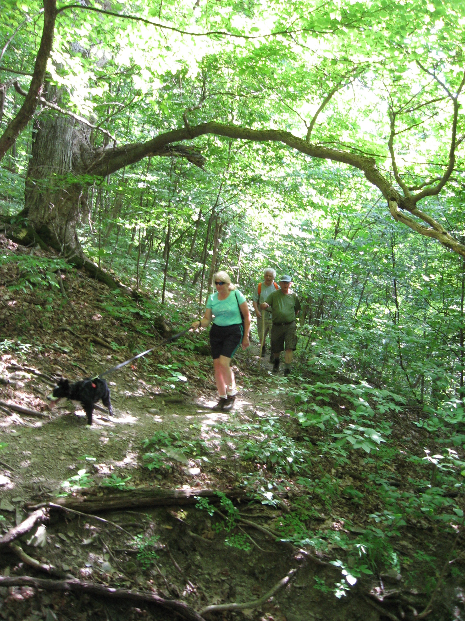 Hike and explore, beginning and ending at Dugway Road, a yellow loop trail that traverses a variety of forest types including shaggy hickory, thorn trees, pines, apple trees and field vegetation. Stid Hill was formerly a grazing area for sheep and other livestock and is now a multi-use area owned by New York State. There are a number of remains of old stone fences from those days of yesteryear. Multi-uses include hiking, horseback riding, mountain biking and hunting. Bow season is currently going on and while there are “designated” hunting areas, which we will not be in, it is recommended that hikers wear bright colors (blaze orange if you’ve got it, otherwise any other bright color will do) and do not wander from their respective group.
 The trails we will be hiking are actually older trails, dating back at least to the 1980’s, which were “hidden” due to the absence of sufficient markers or maintenance. Less than two years ago, there suddenly appeared new markers and paint and a lot of brush and weed elimination. This trail was an unexpected surprise for me – it is lovely with its expansive variety of trees and differs from the more commonly uphill treks in its much more gentle inclines.
We will offer two levels of hiking – Climbers and Tourists/Naturalists. We will all start out together, up the old road, through the stop sign and along a ravine. At the third DEC yellow marker we will make a right into the woods and onto the yellow trail. At the fork in the trail Climbers will bear left; Tourists/Naturalists will continue straight along.
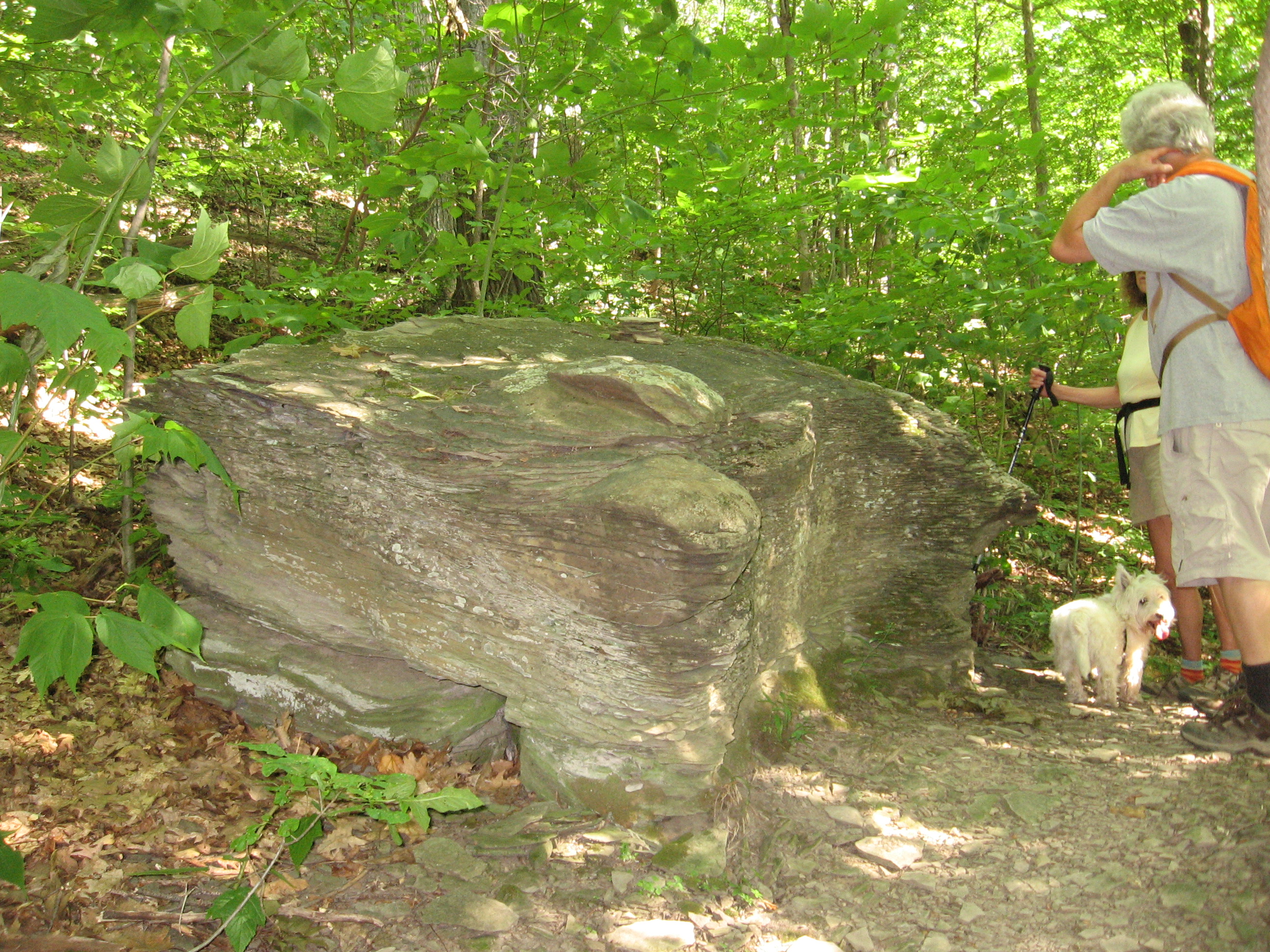
CLIMBERS will cover a little more trail at a faster pace…they will continue up the incline (not a real serious one, as this area typically offers otherwise) then make a right into the denser woods. Arriving at several large shaggy hickory trees that have many yellow paint marks on them (probably used a bucket of paint here) we will turn left, continuing on the portion of the yellow trail that heads south, through a grove of thorn trees, and ends up by a large stream. If time permits, we will explore the stream or rest on the scenic large rock wall bordering the creek. After a bit we will continue on, through a serene pine forest, and turn right onto a short trail that passes by an old pickup truck. Heading downhill, we will turn right onto the return loop through the pine & shaggy hickory forest.
TOURISTS/NATURALISTS, after traveling along the mostly straight trail, with just a few winds and bends, will turn left into the Shaggy Hickory & Pine Forest (yellow DEC marker on tree with obvious trail clearing), then at the end of it will turn left and follow trail back to ravine, stop sign and old road. There will be some soggy spots, in the area shortly before the turn off, due to remnants of an old, now overgrown, pond – but nothing vaguely approaching what we walked through back in April.
AFTER-HIKE SOCIAL will be at Lock, Stock and Barrel – approximately 3.5 miles south of Dugway Road, on Rte 64.
DIRECTIONS:
From the north, (Honeoye and Bloomfield) starting at Route 5 & 20 in Bloomfield, come down Route 64. 3.0 miles south of Rt 20A and 1.4 miles past Bristol Center (and CR 32), turn left on Dugway Road. If you come to a Stid Hill MUA parking area, you’ve come too far south – turn around and try again.
From the south, starting at Bristol Springs for 6.4 miles, come up Route 64 past both Stid Hill parking areas, then turn right on Dugway Road. If you come to Bristol Center you’ve come too far north.
From Springwater, Google Maps recommends heading north to 20A through Honeoye, then south on 64.
From Wayland, the recommendation is to take Rt 21 through Naples to the east end of Dugway Rd (4.5 miles north of the intersection with NY 64). The trail head is 1.2 miles west on Dugway, (Dugway is paved to the Bristol/Canandaigua town line).
Dugway Road, in Bristol, is a dirt road. The trail head is exactly 2.0 miles from the Route 64 junction. It’s easy to miss – it’s just a widening of the road after a sharp left turn. The trail head is on the right of the road and marked with a discreet yellow DEC sign a little too far from the road. Please park carefully. There isn’t much parking space to be had.
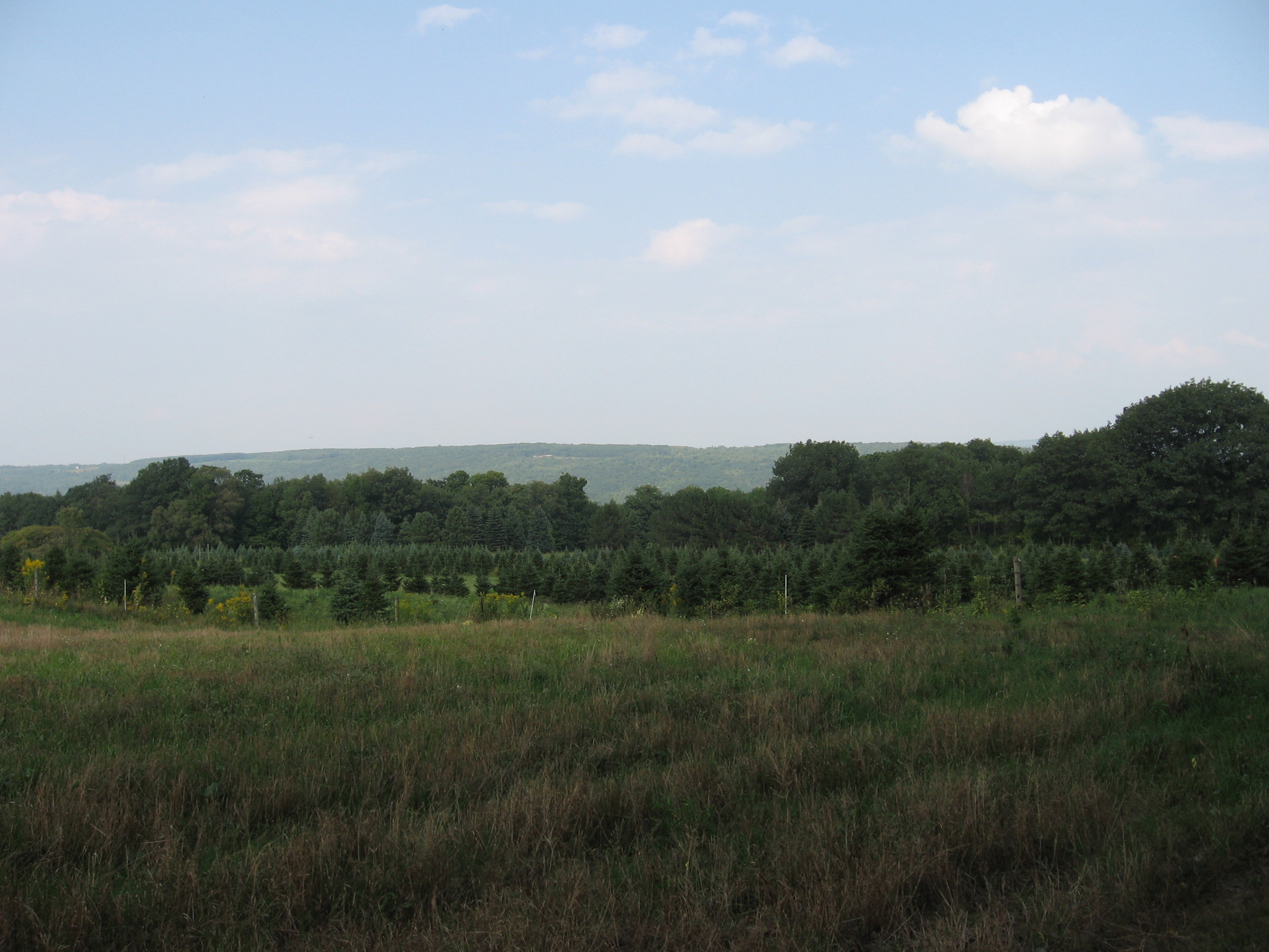 This Sunday we will be hiking on three farms on the west hill of Springwater. On the following Saturday, two of these farms are holding an open house to celebrate the Springwater Bicentennial, so our hike will provide a hiker’s perspective of the farm and the open house will provide a farmer’s perspective.
On Sunday we will hike on
- the All Western Evergreen Nursery and Christmas Tree Farm
- the Petraitis Dairy and Beef Farm
- Amanda’s Garden Native Perennial Nursery

Following the hike, weather permitting, we will have an outdoor social at Amanda’s Garden with a campfire in the fire pit. (If the weather doesn’t cooperate, the social will be inside at the All Western Tree Farm). Bring a dish to pass (or make a contribution to the social fund) and your own beverage.
Meet at the All Western Tree Farm, 6840 Liberty Pole Road, where there is ample parking at the Christmas tree loading area between the tall Western red cedar and the barn.
The Naturalists will hike the lower portions of the tree farm, including the Western Red Cedars in the nursery and in the wind break. They will then drive to Amanda’s Garden for a hike around the Garden with commentary from Ellen Folts. and on a trail that has been built through the woods.
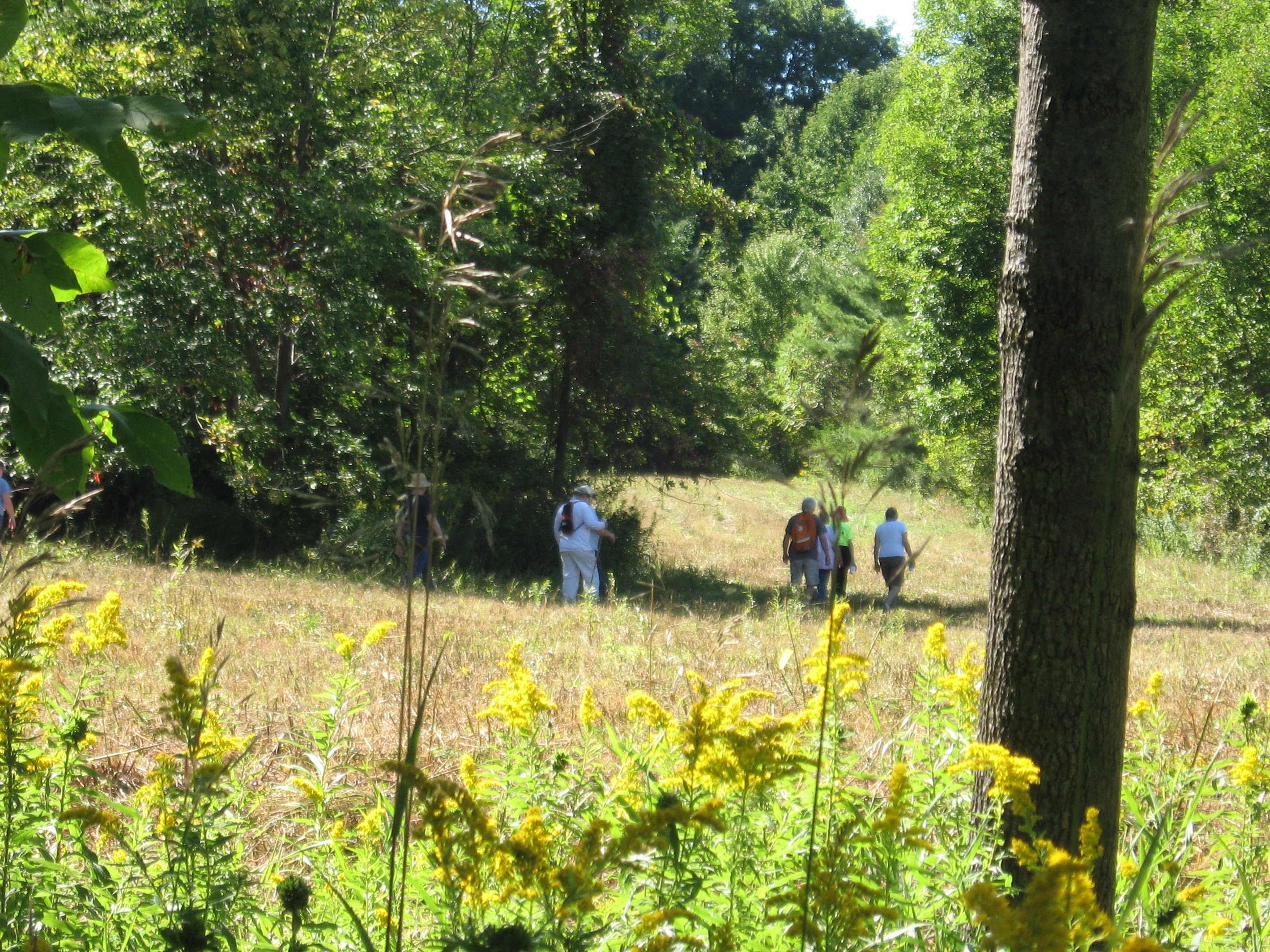 The Tourists and Climbers will hike up to the Christmas Tree plantations, through a recently planted field and a field that is available for cutting. We will follow a trail back down to Liberty Pole Rd, cross the road and proceed to the back fields of the Petraitis Farm. After a loop around these fields, we will return to the cars and drive to Amanda’s Garden for a hike through the woods surrounding the garden.
Following the hikes, we will have an outdoor social at the Garden with a campfire as the evening cools down. Please bring a dish to pass (or contribute ($5) to the Social Fund), your own beverage and a folding chair if you would like to relax.
In case of rain, we will adjust the hike to end at the tree farm house, for an indoor social.
Directions: Click here for directions to the All Western Christmas Tree Farm.
From AWTF to Amanda’s Garden (for the second half of the hike): Turn left out of the driveway onto Liberty Pole Rd. The first cross road is Story Rd, marking the Town line between Springwater and Sparta. The Patricia Willsea Beef Farm (also part of Saturday’s open house) is on the north-east corner. Turn left onto Story Rd. Amanda’s Garden is on the left in 2 miles (just before Mead Hill Rd.
Colorful Foliage and Tasty Fresh Cider on NY’s Signature Trail
Please note: Bow hunting season is in effect for next Sunday’s hike. Please wear blaze orange or something colorful.
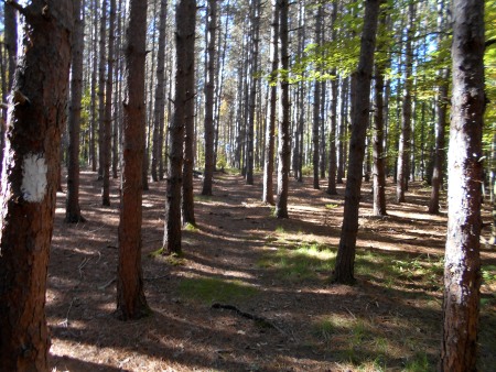
On Sunday, October 23, Springwater Trails will partake of two venerable central New York institutions: the Finger Lakes Trail and apple cider. Set in Steuben County a few miles south of Hornell, our hike on a section of the main FLT will take us through forests of colorful hardwoods as well as groves of pines and fields affording views of open country and rolling hills with nary a paved road in sight. Colors should have reached their peak by the time of our hike.
Finger Lakes Trail emerges from Burt Hill State Forest heading west
We have laid out three options for hikes, varying by length and difficulty. Regardless of the level that you choose, all of them are scenic and rewarding. Each hike ends at our gathering point – the Cider Creek Hard Cider cidery on Cunningham Creek Road.
Naturalists will enjoy a leisurely 1 mile hike eastward along the FLT. A shuttle will take you to the starting point on Laine Rd. The first half-mile follows Laine Road, a country dirt road where traffic should be minimal-to-non-existent. You then turn left into the woods from a well-marked sign to hike the remaining half-mile on a gradual descent to Cunningham Creek Road where the cidery awaits you on the right.
From the opposite direction, Tourists are hiking 2.4 miles in a westerly direction starting at Windfall Rd. Most of this hike is a gradual descent with one short upgrade in the last third. The steepness of the final descent to Cunningham Creek Rd. is ameliorated by the prospect of delicious fresh cider awaiting you at the cidery! Enjoy your libations while you await the Climbers whose 4-mile hike starts atop Spencer Hill, one of the highest points in Steuben County. Enjoying sweeping views for the first half-mile, we then walk along the edge of a field and enter Burt Hill State Forest. After descending to a small creek, a subsequent ascent takes you up to the ridgeline, passing a short side trail to the Burt Hill Lean-to en-route. This stretch through the state forest includes a beautiful pine grove as well as mixed hardwoods before we emerge in the open and reach Windfall Rd. From this point, our hike follows the Tourists route to the cider barn.
Please note that all three hikes described above include some rugged footing, primarily lots of protruding tree roots. The stretch from Windfall Rd. also contains mucky footing in some places.
Our social following the hike will be held at the cidery where, weather permitting, we’ll set up on picnic tables under a roof just outside the building. Please bring a dish to pass. There are no kitchen facilities available i.e. no oven, microwave, or refrigerator. However, there are outlets for crockpots and we’ll also have a Coleman stove set up for anyone who needs soup, stew, chili etc. heated up. You may bring a beverage but we encourage patronizing the cidery as they are very generous hosts in providing this facility for us. In addition to a variety of ciders – alcoholic and sweet – the cidery offers beer and wine. Ciders may be purchased to drink on premises (samplers of 4 kinds or glasses of your favorite) or take home in bottles or growlers.
Red pines line the Finger Lakes Trail in Burt Hill State Forest
Logistics: We encourage car pooling and have designated the Shurfine Supermarket parking lot in Wayland as the location to meet at 1:00 PM. Plan to arrive at the cidery no later than 1:45 PM. This slightly-early meeting time will maximize enjoyment of our time on the trail. We will organize car shuttles at the cider barn and head to our starting points no later than 2:00 PM.
Directions: Take Rt. 21 south towards Hornell. After Rt. 36 joins 21, stay on 36, looking for signs to Main St. Turn left on Main St., following it (becomes East Main St.) out of town where it becomes County Rt. 109, also known as Turnpike Rd. In the country out of Hornell, you’ll pass Laine Rd. The next road is Cunningham Creek Rd. Turn right and reach the cidery in about 1.3 miles. The cidery’s barn is on the right but please park across the road (just after crossing the creek).
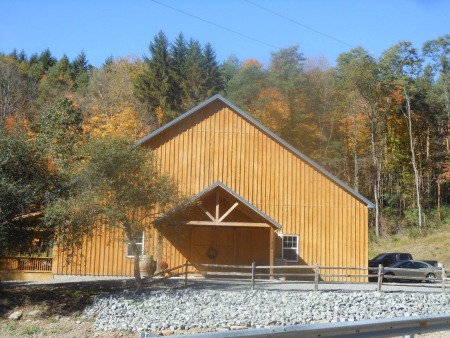
Cider Creek Cidery on Cunningham Creek Road

Cidery flavor board – some flavors may change

This Sunday, come back to a familiar hike for Springwater Trails, and see the changes that have taken place. The first thing that regular Springwater Trails hikers will notice is that the town has paved Schribner Rd. For those of you nostalgic for the old road, check out the summer directions and come in the back way.
The Climbers will be following logging roads up to the top of the hill. We then will cross the fields to explore various views across the valleys. The Tourists will take a bit more time climbing the hill. The new logging trails go across the hill, giving hikers some respite from the climb and a change to view more of the forest. And the Naturalists will follow a more level trail through the White Pines, then up to the Red Pines and then will cross the valley to see the Oaks, Maples and Beach forest.
Following the hikes, join us for a Dish to Pass social at the house. Depending on the weather, we will have the option of being outside for the last social before the end of Daylight Savings.
Directions:
From Springwater: Head north on Rt 15A from the light in Springwater. Take the first right on Wheaton Hill Rd (Co Rd 16). Turn right on Wetmore Rd at the stop sign at the top of the hill. At the end of Wetmore, bear right on Tabors Corners Rd. After 3.5 miles turn right on Scribner Rd. (There is no road sign at Schribner, but this is the first right off of Tabors Corners Rd.) The driveway is the 2nd driveway on the left one mile up Schribner Rd and about 10 feet before the intersection with Giles Rd. Turn around at the intersection and park on the west side of Giles Rd.
From Wayland: From Rt 15, head east on Rt 21 toward North Cohocton for 3 miles. Turn left on Tabors Corners Rd (Steuben Co Rd 37). (Note the road sign says Bowles Corners, although maps all say Tabors Corners) After exactly 2 miles, turn left on Schribner Rd (the second left – again, no street sign). The driveway is the 2nd driveway on the left one mile up Schribner Rd and about 10 feet before the intersection with Giles Rd. Turn around at the intersection and park on the west side of Giles Rd, or come in the driveway and park on the grass near the barn.
From Honeoye: From Rt 20A, head south on Ontario Co Rd 37. At Canadice, continue straight ahead on Canadice Hill Rd as Co Rd 37 turns right. Bear to the right onto Ross Rd. Take the first left turn onto Tibbles Rd (formerly Springwater Town Line Rd). At the end, turn right on Wetmore Rd. Stay on Wetmore up over the hill to the end. Bear right on Tabors Corners Rd. Take the first right in 3.5 miles on Scribner Rd (sorry, no street sign). The driveway is the 2nd driveway on the left one mile up Schribner Rd and about 10 feet before the intersection with Giles Rd. Turn around at the intersection and park on the west side of Giles Rd, or come in the driveway and park on the grass near the barn.
From the East Lake Rd in Honeoye or From Naples: Rather than traveling north to reach 20A or Co Rd 37, hikers from east of Honeoye Lake may go south to Ontario Co Rd 36 and follow Co Rd 36 to Naples. Turn right on Rt 21 south. Turn right to stay on Rt 21 for 4.5 miles to N Cohocton. Turn right to stay on Rt 21 towards Wayland. After 3.8 miles turn right on Tabors Corners Rd (Steuben Co Rd 37). (Note the road sign says Bowles Corners, although maps all say Tabors Corners) After 2 miles, turn left on Schribner Rd (the second left) (Again, no street sign). The driveway is the 2nd driveway on the left one mile up Schribner Rd and about 10 feet before the intersection with Giles Rd. Turn around at the intersection and park on the west side of Giles Rd, or come in the driveway and park on the grass near the barn.
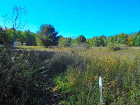
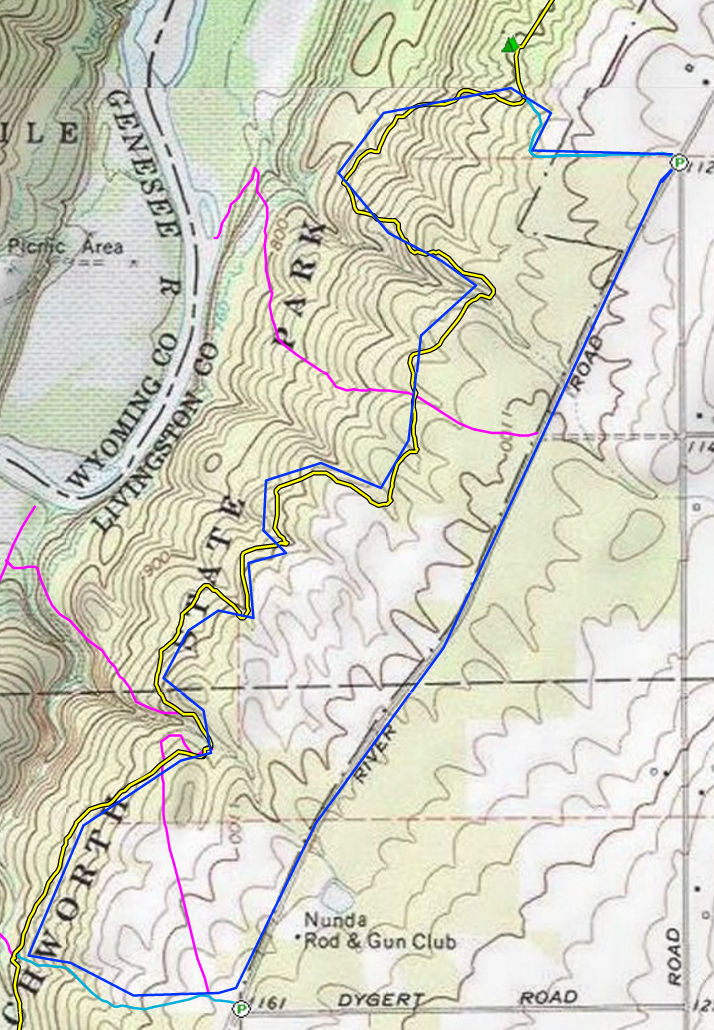
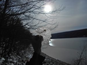
This Sunday hikers will venture into the east side of Letchworth Sate Park on a branch of the Finger Lakes Trail which travels a length of 25 miles through the park. A serene forest of mixed hardwoods and hemlock awaits us. Some gorgeous gullies will add excitement to our trek. Along the way there is a nice overlook of the Genesee River gorge with a view across the river of the former hamlet of St. Helena, now buried in mud from flood waters. The trail is changing but rewarding.
 Note earlier start time at 1:00 due to length of hike and change to EST.
Hiking Groups
All groups will meet at the junction of River and Oakland roads in the town of Mt. Morris, (AKA Access G on the Letchworth Map 2). There is shoulder parking and some additional off-road space. Please consider car pooling with a friend or two. The trail is rugged and may be slippery. Hiking boots and poles are needed.
Naturalists will depart heading west on a .4 mile access trail. Turning north at the junction with the Finger Lakes Trail, they will encounter a rustic shelter, used by through hikers. From there they can continue north as far as time and energy permit, before returning along the same route to the parking area. A hike leader is needed for this group. Map will be provided and the trail is blazed.
Tourists will head west on the park access trail then turn south on the Finger Lakes Trail. There will be some moderate climbs around the ravines. After taking in the view at the St. Helena overlook, they will take a side trail up to River Rd for a short road walk back to the parking area. Total hike 4 miles. A hike leader is also needed for this group
Climbers will follow the same route as the Tourists up to the overlook. This group will travel an additional mile before reaching the road. A road walk of 1.5 miles will return them to the parking area. Total hike 5.5miles.
Post Hike Social
We will be reviving our weary bones at Scovill’s Grill, 60 Red Jacket St., Dansville. The menu is good and it is on the way home to Springwater.
See what they have to offer at www.scovillsgrill.com.
Directions:
From Springwater: At the flashing light, turn west on Rt 15 North for 1.5 miles. Turn left onto Liberty Pole Rd (CR38), past the All Western Tree Farm. This road becomes CR1A, and then CR1 (don’t ask me why, since it is all the same county) so follow the road for 8.1 miles until it ends. Turn left onto NY-63 S for a quarter mile and turn right only NY 258W. In 1.9 miles, turn right ony NY-36 N. Continue for 3.1 miles on 36N past the Croveland Correctional Facility. Take the second left past the Correctional Facility on Dutch St Rd (CR 30) for 1.3mi. Turn left onto Ridge Rd, At the end of Ridge Rd, turn left on River Rd. The parking lot is on the left in 4.2 miles, just past Oakland Rd.
From Naples, Wayland and Dansville: Follow NY-21 from Naples. Turn right at North Cohocton to stay on 21 to the light in Wayland. Continue straight on NY-63N to Dansville. Turn left on NY-36N (Ossian St). In 0.8 miles, NY-36 turns right, but continue straight on Ossian St as it become NY436 W. There are some twists, but continue straight ahead for 18.2 miles on NY-436 through Nunda. Turn right onto Oakland Rd,the first cross street (1.5 miles) after Nunda. At the end of Oakland Rd, turn left onto River Rd and park on the left or on the shoulder.
From Rochester and Mt Morris: Take I-390 S to Exit 7, NY 408S to Mt Morris. Turn left onto NY-408S. Jog to the left at Main St, then right to stay on NY 408S. In 2.6 miles, turn a slight right onto River Rd. In 6.3 miles, the parking lot is on the left in 4.2 miles, just past Oakland Rd.
Hike Description
We will hike the FLT Bristol Hills Branch Trail (Map B3) to Huckleberry Bog and the Bog Nature Trail Loop. This upland bog is located on a plateau west of Keuka Lake in Urbana State Forest, Steuben County.
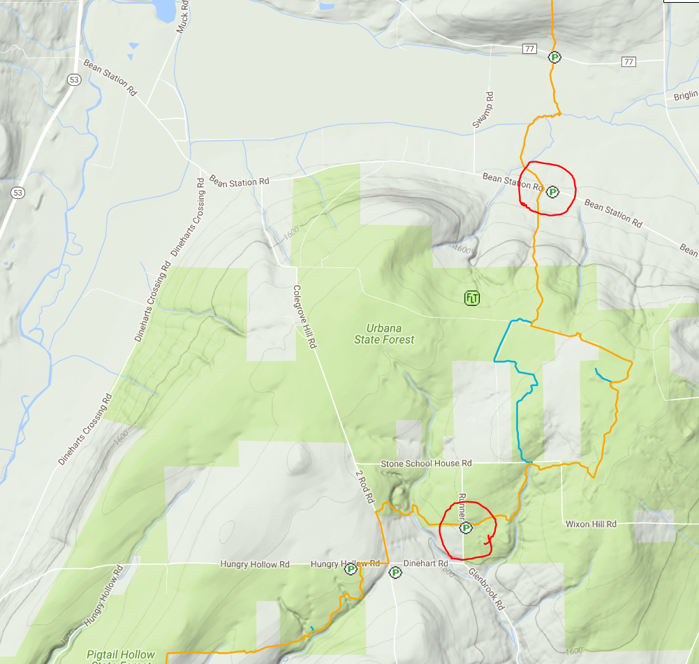 Climbers will start from the trailhead at Bean Station Rd and take the trail past an old cemetery and climb steadily uphill through a hemlock and oak woods to the state forest and onto the top of the plateau. Climbers will then follow the Bog Nature Trail Loop clockwise and return to Bean Station Rd by way of the main trail (4.5 miles).
Tourists and naturalists will start at a higher elevation from the access at Glen Brook Rd and take the trail northeast to the southern register of the Bog Nature Trail Loop. Tourists will go around the Bog Nature Trail Loop and return to Glen Brook Rd (~3.5 miles). Naturalists will retrace their steps back to Glen Brook Rd (~ 1mile).
Directions to Meeting Location for All Groups
From Springwater: Head south on NY 15 to Wayland. Turn left onto NY 21, Turn left in N Cohocton to stay on 21 into Naples. Turn right onto NY 53. Stay on 53 for 13 miles. At 10.4 miles on your trip odometer, you should pass through Prattsburgh. Follow the directions below.
From Prattsburgh, take NY 53 South for 2.6 miles to Bean Station Road. Turn east on Bean Station Road at the site of a large white warehouse for onions. Go 2.6 miles to the yellow trailhead sign on the right (south) side of the road at a little footbridge over the roadside ditch. Park on the opposite shoulder but not on the lawn or pull inot a small mowed spot marked “FLT Parking” about 200 feet further east, on the left (north side of the road). After breaking into groups, tourists and naturalists will caravan to the Glen Brook trailhead.
From Geneseo and Dansville: Take I-390 South to I-86East. In 1 mile,take exit 37 for NY-53. Turn left onto NY-53 and head north for 8.9 miles. Turn right onto Bean Station Road. Continue with the directions From Prattsburgh.
Car Pool
Car pooling is recommended. You can set up your car pool ahead of time or meet at the parking lot for the Mountain View Inn at 12:30.
After Hike Social
The after hike social will be at the Mountain View Inn, 34 Main Street, Atlanta.
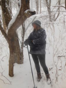
Hey, the weather predictions were correct – there is snow on the ground and the temperature at 9:00 is only 29° with a predicted high of 33, so we are cancelling the bike ride. BUT, we are hiking, so put on your orange vest and your hiking boots and come enjoy East Springwater by foot!
This Sunday we are offering something different – a bike or hike. (Well, maybe not so special since we are only hiking.) Come enjoy East Springwater either at a walking or a riding pace, according to your preferences.
This hike/bike is a part of the Bicentennial Celebration of Springwater.
Before we start, three cautions:
- This hike will start at our regular winter time of 2:00PM
- If you are hiking please wear orange or another bright color. This will be the second day of regular deer hunting season.
- If the temperature is below 40° then we do not plan to ride. .If you are unsure, please check the website Sunday at noon.
All hikers and bikers will meet at the barn at Punky Hollow near the corner of Pardee Hollow Rd and Tabors Corners Rd in Springwater. As always, please park carefully, as this is private property. Following the hike/bike, please join us for a social at John Larysz’s house. Bring a dish to pass and your beverage, or make a contribution ($5) to the social fund. Thanks John and Sue for volunteering your home.
Hiking above East Springwater
Hikers will hike on Punky Hollow trails. Based on the number of hikers, we will have one or two groups, both of which will follow trails through the woods to the top of the hill to look down on the Cohocton Creek and on Dutch Hollow. As time permits, we will explore the hill top and then return to the cars over a different trail.
Biking Dutch Hollow and Tabors Corners This hike is canceled due to the weather!
Dust those cobwebs off your bike and pump up those tires. Prepare to enjoy the hills of Tabors Corners on two wheels. Yes there will be a few elevation challenges on this ride. We will travel at a leisurely pace, but be prepared for some lovely scenery and a good workout.
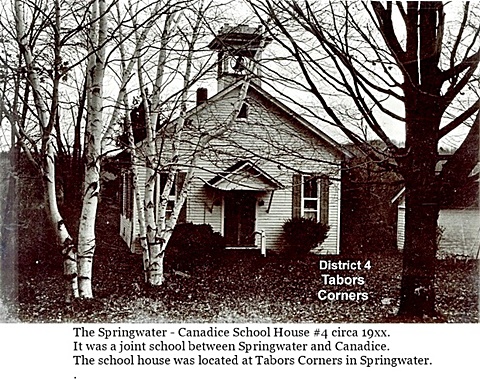
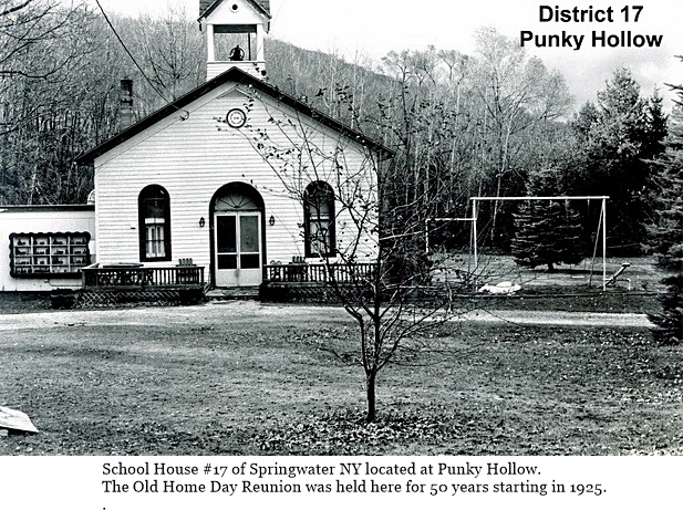
This ride will pass two former school houses in Springwater. Keep your eyes open to School #4 at Tabors Corners and Wetmore, and School # 17 on Pardee Hollow just before the end of the ride.
 Bikers will meet at the Punky Hollow event building (site of the Fiddlers’ Fair), on Pardee Hollow Rd., ready to ride at 2:00 PM. Riders will head west on Pardee Hollow then north on Tabors Corners Rd. At the junction of Wetmore Rd. we will head north for another mile to reach the town line of Springwater at Tibbals Rd. From there we will head back south on Wetmore turning south on Tabors Corners Rd. The ride continues to Dutch Hollow Rd., which we will follow for about 4 miles back to Pardee Hollow, Turning right we will have a nice downhill cruise back to the parking area. Total distance is 11 miles.
If it the road is snow covered or the temperature is below 40 degrees the ride will be cancelled and we will walk with the hiking group.
From Springwater: Head north on NY 15A from the light in Springwater. Take the first right onto Wheaton Hill Rd. At the Tee at the top of the hill (3.4 mi), turn right onto Wetmore Rd. In 1.2 mi, at the stop sign, turn right onto Tabors Corners Rd. Take the first right in 1.8mi onto Pardee Hollow Rd. The Barn is on the right. Park in the driveway at the far end of the barn, or along the side of Pardee Hollow Rd.
From Wayland: Head east on NY 21 from the intersection with NY 15. in 3 miles, turn left onto CR 37. The road sign says Bowles Corners, although the road name is Tabors Corners. In 3.6 miles, turn right onlo Pardee Hollow Rd The Barn is on the right. Park in the driveway at the far end of the barn, or along the side of Pardee Hollow Rd.
From Honeoye: Head west on NY 20A. Turn left (south) on CR 37 at the Valley Inn. Continue staight onto Canadice Hill Rd in the hamlet of Canadice. In 2.4 miles, Ross Rd goes off to the right, but stay straight to stay on Canadice Hill Rd. .In 2.4 miles of dirt road, the road enters Springwater and the name changes to Wetmore Hill. Continue straight on Wetmore Rd. At the stop sign after going over the hill, turn right onto Tabors Corners Rd. Take the first right in 1.8mi onto Pardee Hollow Rd. The Barn is on the right. Park in the driveway at the far end of the barn, or along the side of Pardee Hollow Rd.
The after hike social at John’s, is just a few turns away on French Hill Rd. Directions will be available at the hike.
An update as of 3:00 Saturday
Waterproof Boots are highly recommended.
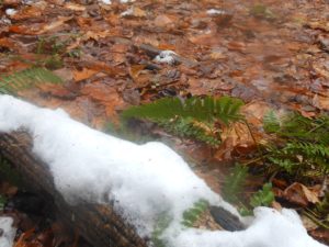
There are a number of streams we will need to cross on Sunday. You will be in about 2 to 3 inches of water.
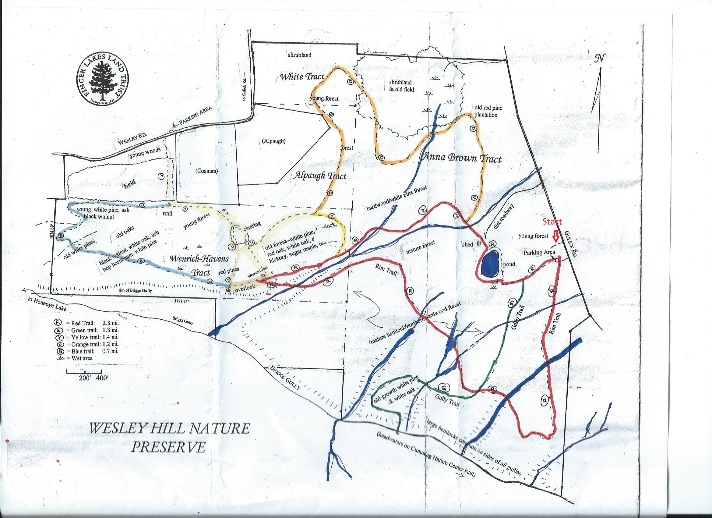
This week we will hike the Wesley Hill Nature Preserve which was founded in 1999 by the generous donation of 90 acres by the children of three artists- John Weinrich, James Havens and Colburn Dugan to the Finger Lakes Land Trust. Since that time the preserve has grown to over 390 acres by the way of the purchase, by the land trust, of three parcels and a gift of the fourth. Click on the trail map to the right if you want a larger trail map.
We will all meet at the preserve parking lot, on the west side of Gulick Road at 1:45 pm.
In case of snow or muddy trails, please wear correct footwear. Crampons and poles will be helpful.
Climbers led by Charlotte will follow the Red trail on the right of parking lot to Green Trail down to the Gully and back on the Green trail to the Red trail to the left to the cabin and past the pond and back to parking lot. 4+ miles
Tourists led by Nanette will follow Red trail on the right of parking lot to the cabin, past the pond and to parking lot. 3 miles
Naturalist led by hiker will follow the Red trail to cabin and back to parking lot. 2 miles
Our social will be at Honeoye’s Boat House (Trident Marina) on 5226 East Lake Road, Honeoye 14471. Was voted as one of the best in five Happy Hour Bars in the Rochester area.
A word of caution – do not try to access Wesley Road from down on East Lake Road, in spite of what your gps might tell you. The road is closed from East Lake Rd up to the Wesley Road Trail Head. If you try it you will readily see why.
From Honeoye: take route 20A east through Honeoye to East Lake Road (CR 33). Turn right onto East Lake Road. (If coming from Bristol or points east, its a left onto East Lake Road). Take the first left, staying on CR 33, then the first right onto Pinewood Hill which becomes Gulick Road. Wesley parking lot is 4.3 miles down Gulick, on the right side.
From Springwater: Head north on Rt 15A toward Hemlock. Just before Hemlock, turn right on Rt 20A. Follow Rt 20A east through Honeoye to East Lake Road (CR 33). Turn right onto East Lake Road. (If coming from Bristol or points east, its a left onto East Lake Road). Take the first left, staying on CR 33, then the first right onto Pinewood Hill which becomes Gulick Road. Wesley parking lot is 4.3 miles down Gulick, on the right side.
From Naples: From the southern end of Naples, head west on Co Rd 36. Follow Co Rd 36 for 1.2 to the first right turn on Gulick Rd. Follow Gulick for 7.5 miles. Wesley parking lot is on the left side.
Directions to the social: Turn left out of the parking area and head north on Gulick Rd for 3.3 miles. The road bears left and becomes Pinewood Hill Rd. At the stop sign, turn left to stay on Pinewood Hill Rd (CR 33). In 0.4 mi, turn left onto E Lake Rd. In 0.8 miles, turn right onto Deyo Dr at the sign for Trident Marine. The Honeoye Boat House Grill is about 150 feet down toward the lake.
[envira-gallery slug=”wesley-hill-preserve-winter”]
Note: This hike is weather permitting. We will gather at 1:45 at 5107 Old Bald Hill Road, Hemlock. Please park on the road and walk up the driveway. Bring a water bottle/or thermo with warm beverage, snack, warm boots and one more layer of warmth than you think you will need, as we will be moving more slowly than usual. There will be campfires at some locations along the walk, so please bring something simple to sit on in the forest. A donation of $5-$10 is greatly appreciated to Deb Denome. Social will follow at 4:30. Hot dogs/rolls will be provided. Please bring a warm dish to pass and your own drink.
 What will it be like to experience the forest we walk through every Sunday in a different kind of way? Most of our Springwater Trails’ hikes follow a similar routine: We arrive at our hike site with many cars, put on our boots and equipment, gather to get directions, select our skill group, take off with excitement, talk, talk, talk (while looking carefully down at our footing or ahead a blazes), move quickly to the expected finish time to keep up with the leader, and sometimes stop for breathing breaks or to photograph something in nature that catches our eye (scenic vistas, pretty plants, or unusually shaped trees). This week’s hike will be somewhat different for many of us….treat yourself to Forest Therapy, guided by our special guest, Deb Denome, Director of Shimmering Light Farm and Renewal Center, South Bristol. Your experience can help you through the stressful holiday season and will hopefully give you a new insight to what the forest has to offer us personally.
A forest therapy walk is a very slow, easy walk that consists of a series of guided invitations that help us enter more deeply into the present moment and the exquisite energy of the forest. The invitations are about 20 minutes each, mostly experienced individually, and then we come back together between each invitation and share what we are noticing/receiving from the forest. We will conclude with a tea ceremony that will help us incorporate the forest into our beings to take back with us. Time will feel spacious, and will fly by, simultaneously. Naturalists, Tourists, Climbers will all participate at the same level on this hike as we travel into the Hemlock/Canadice State Forest – Canadice Outlet area through private property.
The Finger Lakes Trail from Naples to Conklin Gully
The Sunday hike on December 11th 2016 will cover several trails on Hatch Hill in Naples. The hike will start at the Bob North bridge at the bottom of Ontario Street in Naples. There is a small parking lot there, and all groups will start at the same place. The naturalists will walk along Matt’s Meander to the Naples Community Park and back, while the Tourist will walk south along Hatch Hill above the town to the south end of Naples. The Climbers will walk north on Hatch Hill to Conklin Gully. Both Tourists and Naturalists will walk back to the parking lot, while climbers will end up at the DEC parking area at the bottom of Conklin Gully and be shuttled back to Naples.
There is a DEC display board at the parking lot with a map of all the trails that meet there; all the day’s hiking trails are shown.
The social will take place at the Neapolitan Pizzeria in downtown Naples.
Naturalists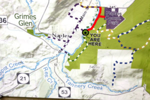

The Naturalists will cross Naples Creek on the Bob North bridge and bear to the left. It is a broad path through woods with the Naples Creek flowing to the left of the path. This trail is called “Matt’s Meander”, and it follows Naples Creek to the Community Park on Route 245. It is about a mile to the end of the trail and back.
Tourists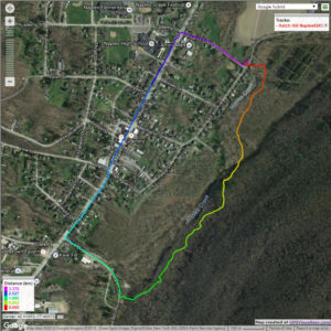

The tourists will cross the bridge and bear to the right. The trail runs south along Hatch Hill above Naples Creek, and goes parallel to both Naples Creek and Naples Main Street, though a lot higher up the hill. This path is not blazed or marked at all but it is well trodden for most of the way; it becomes a little harder to see at the southern end, but once the Turkey Federation parking lot is in sight then it’s not hard to find a way down to it. The trail passes through land that was once grazed and then terraced for vines, but is now returning to woodland. Traces of the shallow terracing for the vineyards can be seen all along the trail, and occasionally an abandoned farm building. The creek can be seen in the valley below the trail all the way along. This trail ends at the south end of Naples, on Mark Circle, where several streams come together to form the Naples Creek. There is water supply facility there, a swimming hole, and an antiques shop. The group will return to the Ontario Street parking lot via Naples Main Street. This walk is 2.1 miles. with just one short modestly steep section.
Climbers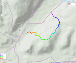
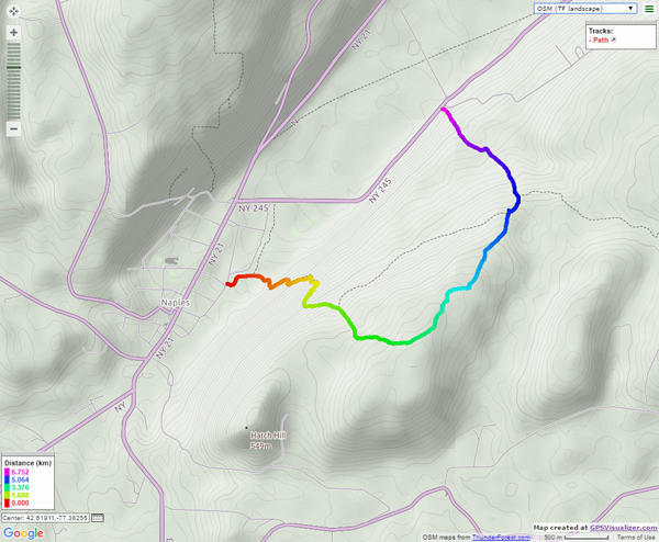
The Climbers will take the Finger Lakes Trail to Conklin Gully through the High Tor Game Management Area. They will cross the bridge and bear left along with the naturalists, and then about half way down Matt’s Meander the FLT branches off to the right. The group will follow the ORANGE blazes on a long uphill section; it’s steep in places with some switchbacks – the trail seems to be going the wrong way at times. There are some ponds at the top of the hill (it’s a mystery – where does that water come from?) with the Howard Beye memorial bench on one of them. It’s important to stay with the orange blazes here – there are several logging roads that make it easy to take the wrong path. Where the trail meets the top of Conklin Gully there is a lookout with a fine view of the Naples Valley and a well organized scout camp, complete with fire pit. The path down the hill from the camp is broad and easy walking. The group will leave the FLT where it branches off to the right over a bridge to the memory of Tom Noteware and follow the BLUE blazes down the hill to the DEC parking lot at the bottom of Parrish Hill.
Please note; IT’S STILL HUNTING SEASON! Please wear bright clothing, preferable hunter’s orange!
The Meeting Place
We will meet at the trail head parking lot on Ontario Street, Naples, at 1:00pm on December 11th 2016. The climbers will shuttle some cars to Parrish Hill before starting off.
Getting There
From Springwater and Wayland, come south on Rt. 15 to the traffic light at Rt 21. Turn left on 21 and keep going all the way to Naples. Go through the downtown business area and turn right on Ontario Street, opposite the school. Go to the bottom of the hill and the parking lot is on the left.
From Dansville, follow Rt. 63 to Wayland where the road turns into Rt 21; continue on 21 all the way to Naples. Go through the downtown business area and turn right on Ontario Street, opposite the school. Go to the bottom of the hill and the parking lot is on the left.
From Naples, go to the school on Main Street (Rt. 21). Turn down Ontario Street opposite the school, go to the bottom of the hill and the parking lot is on the left.
The Social
The social will take place at the Neapolitan Pizzeria in downtown Naples.
Looking for brochure.or mailing list so I can receive it in the mail.
Nothing opens up for mailing list.
There’s all kinds of very bizarre ads and post for viagra and other drugs above on calender page.
Please let me know if there’s a brochure available