
Hikes led by Springwater Trails are generally held on Sunday afternoons and appear in this calendar in green.
| Sun | Mon | Tue | Wed | Thu | Fri | Sat |
|---|---|---|---|---|---|---|
| Hike at Mt. Morris Dam, Mt Morris 2:00 pm Hike at Mt. Morris Dam, Mt Morris @ Mt Morris Dam hike Mar 2 @ 2:00 pm – 4:00 pm 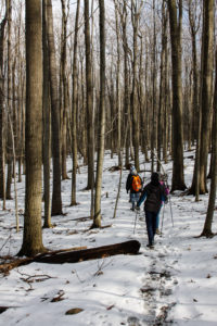 This Sunday, we will hike the Finger Lakes Trail (FLT) starting at the Mt. Morris Dam and Visitors Center Parking Lot. We expect to enjoy the height of winter as we follow the east rim of the Letch worth … Continue reading | ||||||
| Winter Hike, Ski or Snowshoe – All Western Evergreen Farm, Springwater 2:00 pm Winter Hike, Ski or Snowshoe – All Western Evergreen Farm, Springwater @ Liberty Pole Road Mar 9 @ 2:00 pm – 4:00 pm 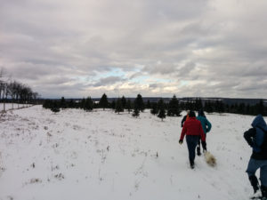 You are invited to hike, ski or snowshoe on a very special private property near the Northwestern corner of Springwater on the 248 acre All Western Evergreen Nursery & Christmas Tree Farm! Note, this hike was rescheduled from 2/16/25 date which … Continue reading | ||||||
| Hike at Sandy Bottom Park, Honeoye 2:00 pm Hike at Sandy Bottom Park, Honeoye Mar 16 @ 2:00 pm – 4:00 pm  Our hike this Sunday, March 16th will be at Sandy Bottom Nature Trail starting from Main Street across the street from Birdhouse Brewery (8716 Main Street Honeoye, NY 14471). This is where we will park and gather. The hike will … Continue reading | ||||||
| Canadice Westside Trail Hike, Canadice 2:00 pm Canadice Westside Trail Hike, Canadice Mar 23 @ 2:00 pm – 4:00 pm 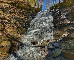 This week’s hike will be on Canadice Lake Trail! This is an easy, 1.8-mile each way hike along the shore of the lake; the trail is level and well-maintained and the lake views are lovely. For most hikers it will … Continue reading | ||||||
| Hike at Affolter’s Farm, Hemlock 2:00 pm Hike at Affolter’s Farm, Hemlock Mar 30 @ 2:00 pm – 4:00 pm More details about this very special hike coming soon! Please check back. |
 Hi everyone, This Sunday is our first maintenance hike of the year. As many of you know, as a group, we have been responsible for maintaining a section of the Bristol Hills Branch of the Finger Lakes Trail. Unfortunately, the section of the trail from Seman Rd to Mt Pleasant St in Naples has been closed and converted to a road walk, so now we are going to maintain the blue trail. On our first time, we are going to do some minimal maintenance while we explore the northern section of the blue trail. So, please bring a pair of clippers to trim back small branches and weed that are encroaching on the trail, and a walking stick that you can use to flick branches off the trail. Cloves may also be useful when the weed has thorns. And of course, bring water. Please arrive at 1:45 to allow time to plan a car pool. We expect the Tourists and Climbers will return to the cars by 4:30 after 3.5 miles of hiking.
We will not be cutting trees that cross the trail, although we may discuss future plans.
We also will not be pulling out roses and other invasives. And we will not be mowing the paths. These items will wait until spring.
There are three options for this Sunday hike. We will select based on attendance. All hikers will meet at the Ontario St parking lot in the Village of Naples.
The Climbers and Tourists will car pool to the Parish Hill parking lot, which is also known as the Blue Trail parking lot, because the Blue Trail starts there. From there, we will follow the Blue Trail down to where it joins the yellow trail (click on the map to see a larger copy where you can follow the trails [or CTRL-click for a new tab]). We will follow the yellow trail (also blazed with blue) over a ridge and down to the Tom Noteware bridge across the top of Conklin Gully. There is a steep climb after the bridge, which will require care from all hikers. Unfortunately, this route is not recommended for hikers who prefer level ground. There is an backup route if needed. From the top of the climb, we will find enjoy views of Conklin Gully from the top. The Tourists will turn around at the lean-to/overlook and return to the cars at Parrish Hill Rd, again being careful with the steep areas. The Climbers will continue on the blue trail which follows a fire lane to join the orange trail. We will turn right and follow the orange trail down to the cars on Ontario St.
The Naturalists will start out on the orange trail across the Naples Creek. But at the register, they will turn left onto the Burgandy Trail along the creek. About half a mile down the trail, they will turn left onto a smaller trail and follow it back to the orange trail and turn left towards the cars. But before the bridge the will turn left and follow a trail south along the creek. This trail exits onto E Hill road. At that point, hikers can choose to turn around an walk back to the cars on the trail by the creek, or continue on the road up to S Main Street and walk on the sidewalk back to Ontario St and the the cars.
Following the hike, we will gather at a Bob and Ruth’s on the north end of Main St.
Directions:
From Springwater and Wayland, come south on Rt. 15 to the traffic light at Rt 21. Turn left on 21 and keep going all the way to Naples. Go through the downtown business area and turn right on Ontario Street, opposite the school. Go to the bottom of the hill and the parking lot is on the left.
From Dansville, follow Rt. 63 to Wayland where the road turns into Rt 21; continue on 21 all the way to Naples. Go through the downtown business area and turn right on Ontario Street, opposite the school. Go to the bottom of the hill and the parking lot is on the left.
From Naples, go to the school on Main Street (Rt. 21). Turn down Ontario Street opposite the school, go to the bottom of the hill and the parking lot is on the left.
From Canandaigua, head south on Rt 21 through Chesire and Woodville to Naples. Turn left on Ontario Street, opposite the school. Go to the bottom of the hill and the parking lot is on the left.
From Honeoye, head south on CR 36 (West Lake Rd) from 20A for 15 miles to Naples. Turn left onto Main St (Rt. 21). Turn down Ontario Street opposite the school, go to the bottom of the hill and the parking lot is on the left.
From Penn Yan, head west on North St and continue onto Rt 364W for 12 miles. In Middlesex, join NY 245 and continue for 9 miles. Turn left on NY 21 South (N Main St) into Naples. Turn left on Ontario Street, opposite the school. Go to the bottom of the hill and the parking lot is on the left.
We will visit the picturesque and historic Village of Hammondsport on Sunday September 29th, with two options. Those in favor of a vigorous woods walk will hike a combination of hillside trails southeast of the village including the June Bug Trail, while those interested in a more leisurely but scenic walk around the village will stay at lake level and enjoy a tour of the historic village and waterfront. We will meet at 1:45 and start together in separate directions at 2 PM from the Glenn Curtiss Museum, at 8415 Route 54, just southeast of the village. The two groups will reconvene at about 4PM for a dish-to-pass social at Champlin Beach, a mile to the north on Route 54, just north of the fire station. Come early if you’d like to explore the Museum, which features exhibits on Hammondsport and Keuka Lake history as well as on the career and exploits of Hammondsport’s own Glen Curtiss, early 20th century pioneer in the fields of bicycling, motorcycling and aviation. See https://glennhcurtissmuseum.org/ for more on the museum, which is open until 5. Watch for the airplane in the front yard.
Climbers and Tourists will cross Route 54 and head up the June Bug Trail to the hilltop ridge along the east side of Pleasant Valley – a significant climb, but well worth it. At the hilltop, we will join the a beautiful section of the Finger Lakes Trail going south along the ridge, returning the same way for a hike of about 3.5 miles. Poles will be helpful on the climb and descent.
Naturalists and History Buffs will drive from the meeting place to public parking next to the Post Office at 76 Pulteney Street in Hammondsport and begin the walking tour at the Pulteney Square Gazebo. The tour, led by local historian Terry Bretherton, will highlight the history of the village, its public square, and the very intact Victorian cottage neighborhoods over about an hour and a half. The walking tour group will then return to Champlin Beach to enjoy the social, along with swimming or wading opportunities.
Social – Please bring your favorite goodies for our dish-to-pass social at Champlin Beach, just north of the Route 54A intersection and the fire station on Route 94. Bring your own beverage and chairs/folding table in case the pavillons are reserved. A $5 contribution to our social fund is fine in lieu of the edibles.
Directions – From Springwater area, head south to Wayland and pick up 390 South to Bath. Take Exit 38E from 390 to Bath, and follow Route 54 north 8 .5 miles to the Glenn Curtiss Museum at #8415, on your left.
From Canandaigua and points north – take the most direct route to Penn Yan, then head south on Route 54 toward Hammondsport. Pass the intersection with Route 54A, and continue another .75 miles to the Glenn Curtiss Museum at #8415, on the right.
From Honeoye/Naples area – go the Naples and head south on Route 53 through Prattsburgh. Continue on Route 53 for 18 miles and make a left on Gardner Road, then right on County Road 13/Mitchellsville Road. At the end of Mitchellsville Road in Urbana, turn left onto Route 54. Go 1.8 miles to the Museum, on your left.
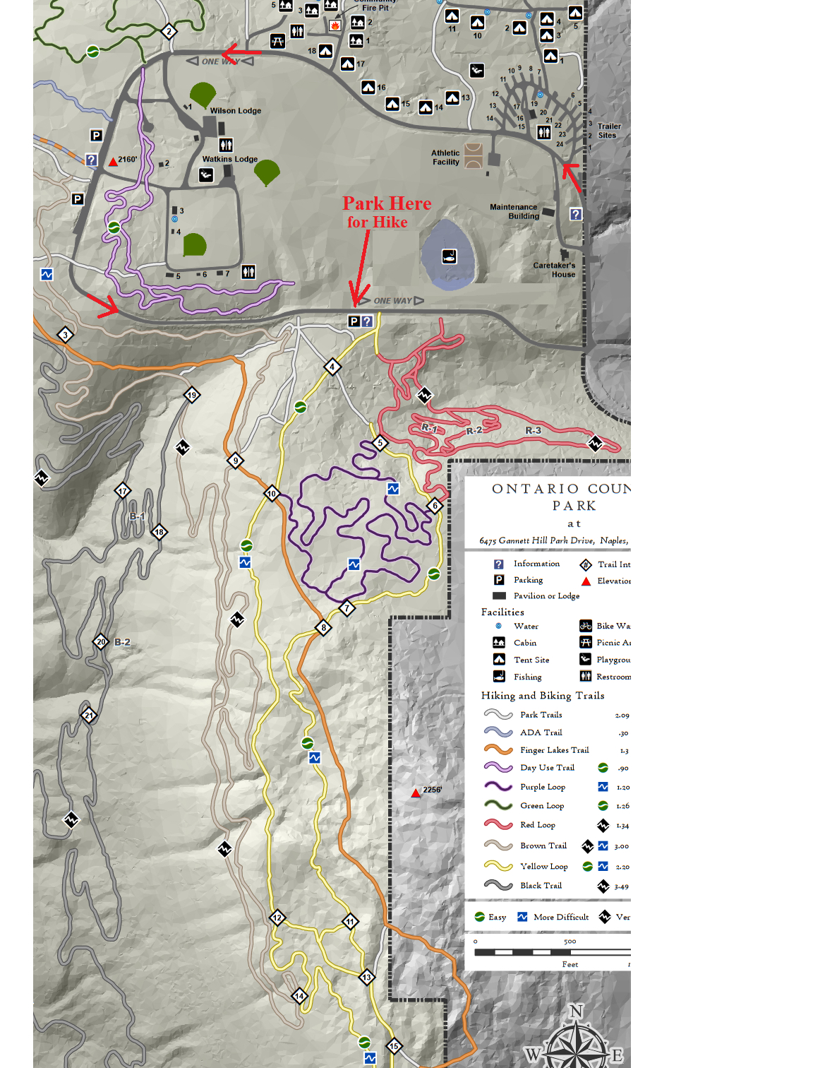
Social: Following our hike, we will drive back around the park loop to the Wilson Lodge parking area and gather for the social at an open pavilion near the Wilson Lodge rest rooms. Please bring a dish to pass or contribute $5. Bring your drink and maybe a chair.
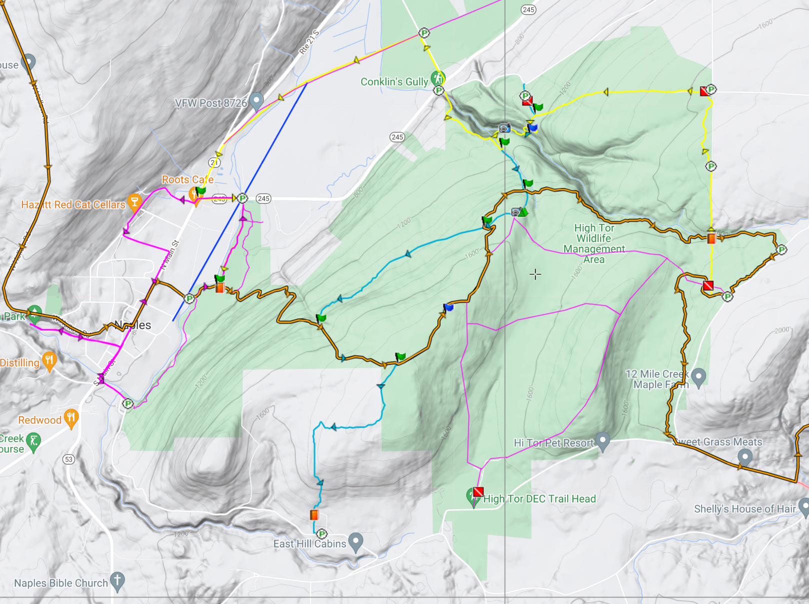
This Sunday’s hike at High Tor Wildlife Management Area in Naples will take us back to many of our previous hikes including:
- a hike by Springwater Parks and Trails at least one and a half decades ago
- a winter hike just before Covid hit
- and a follow-up to our maintenance hike on the Blue trail three weeks ago.
We will all meet at the DEC parking area on Basset Rd near the west end of the road (See the map to the right). Please arrive in time to start the hike at 2:00 PM. We will have two hikes based on distance. Hike leaders may adjust the hikes to accommodate our hikers and the weather. Please note: in the following hike descriptions, the term road refers to the maintenance road, which is more accurately called a wide trail.
All hikers will start on the same trail out of the parking area. The Naturalists will take the left route and follow the maintenance road up to the BHB orange trail. Turning left onto the BHB (orange blazes) they will quickly come to the pond and will explore the shore of that. Returning on the BHB to the maintenance road, the Naturalists will follow their own footsteps back to the cars.
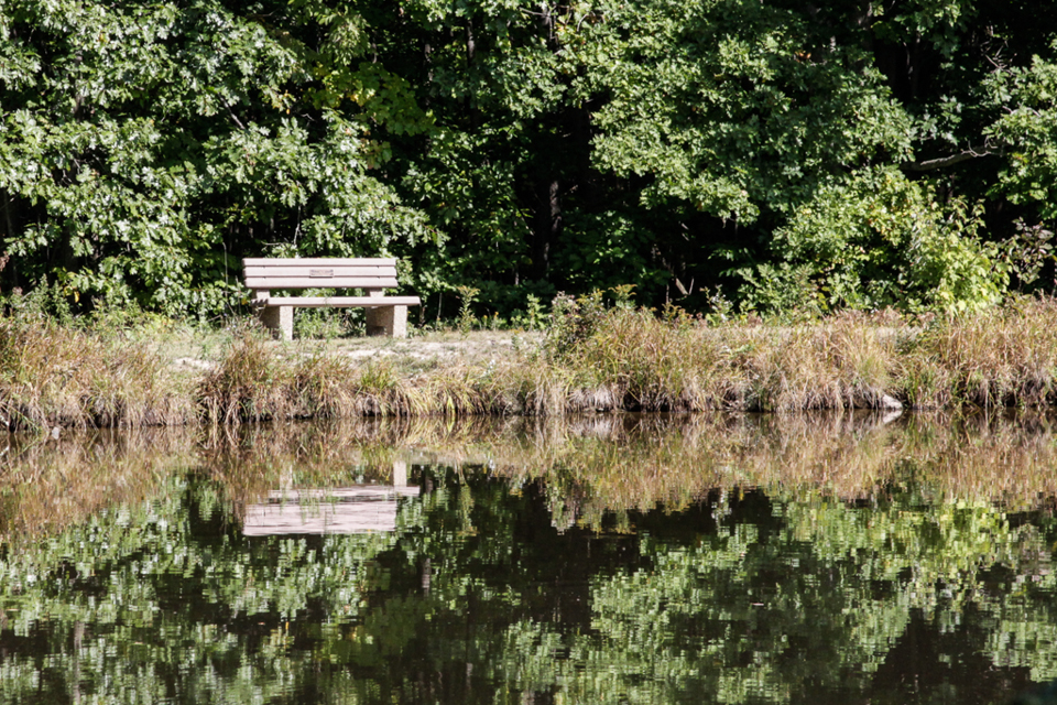
The Finger Lakes Trail from Naples to Parrish Gully. The Howard Beye memorial bench.
The Tourists will join the Naturalists up to the BHB orange intersection. The Tourists will continue straight on the maintenance road to the lean-to and overlook of Canandaigua Lake. Returning on the road, they will retrace their steps to the point where the BHB turns right. The tourists will continue straight (not on the BHB) south to the cars. They will likely meet up with the Naturalist on the final leg and will then return together to the cars.
The Climbers will also take the same route as the Naturalists. When they reach the BHB orange trail, the will turn left and continue around the pond. The Blue trail will break off to the right and the Climbers will follow that down to the Finger Lakes Community College property on East Hill Rd. Climbers are welcome to bring small clippers to do minor maintenance on the trail as we go. We will station a couple of cars at the final parking lot to ride back to the start point.
Following the hike, please join us for a social at Kelley’s home in Atlanta (NY). See directions below.
From Naples: Take NY 53 south from Naples for 1.1 miles. Turn left onto Italy Valley Rd (CR 21) for 2.1 miles. Turn left onto Basset Rd, when the main road takes a sharp right turn. Parking is on the left in 0.2 miles.
Additional directions are available here.
Directions To Kelly’s in Atlanta: Return to Naples by going right out of the parking area, then right onto Italy Valley Rd, then right onto NY-53 N. In 1.3 miles, turn left onto NY-21 S. In 4.5 miles, in N. Cohocton, turn right to stay on NY – 21. Take the next left onto University Ave. In 0.4 miles, Kelly’s home is the second house after the farmer’s field on the right.
LOCATION: Enter the park through the North Entrance off of NY-36 and drive past the admission gate (this is considered “off-season” so no fees will be charged) to the parking area. We will start our hikes from the Clara Barton Shelter which is to the left of the parking area. Bathrooms near the shelter will be open.
HIKE DESCRIPTION: Stony Brook is one of the Finger Lakes State Parks which was the site of a Civil Conservation Corps camp during the 1930’s. Many of the trails and facilities at the park are thanks to the work that they did. We will hike on three trails that cover the length of the park – the Gorge Trail, West Rim Trail and East Rim Trail. The Gorge Trail runs along Stony Brook at creek level while the other two trails wind along the top of the gorge. Hikers will appreciate the work done this past summer to replace stone steps and wooden stairs where needed. We will split into three groups with each group walking at their own pace. All three trails have many steps and are most likely going to be wet and slippery so poles and traction devices or good treaded hiking boots are recommended.
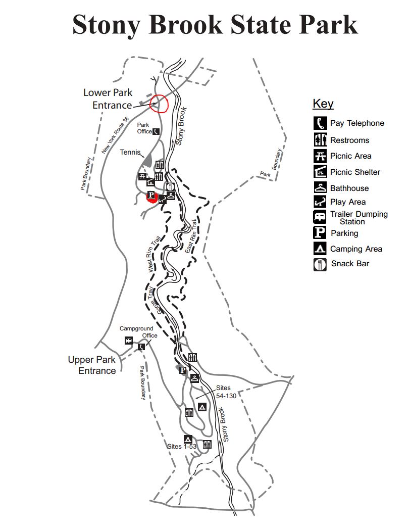 Climbers Will hike the Gorge Trail and return on the East Rim Trail. They will cross over the stone bridge located about 500ft from the Gorge Trail Exit returning on the East Rim Trailhead and continue following the trail back down to the Clara Barton Shelter.
Tourists They will go past the swimming area to the Gorge Trail trailhead and continue up past three waterfalls to the upper park and return back to the lower park on the East Rim Trail.
Naturalists will hike the Gorge Trail out and back. They will go past the swimming area to the Gorge Trail trailhead and continue as far as they want then return by the same route.
RECOMMENDATIONS: Hiking poles would be recommended.
SOCIAL: An after hike social will be at the Clara Barton Shelter. Hot dogs will be provided. Bring a dish to pass or a 5 dollar donation would be appreciated.
DIRECTIONS: From the Village of Dansville take NY-36 South. The North Entrance to Stony Brook State Park is several miles south of the village on the left.
Leave a Reply
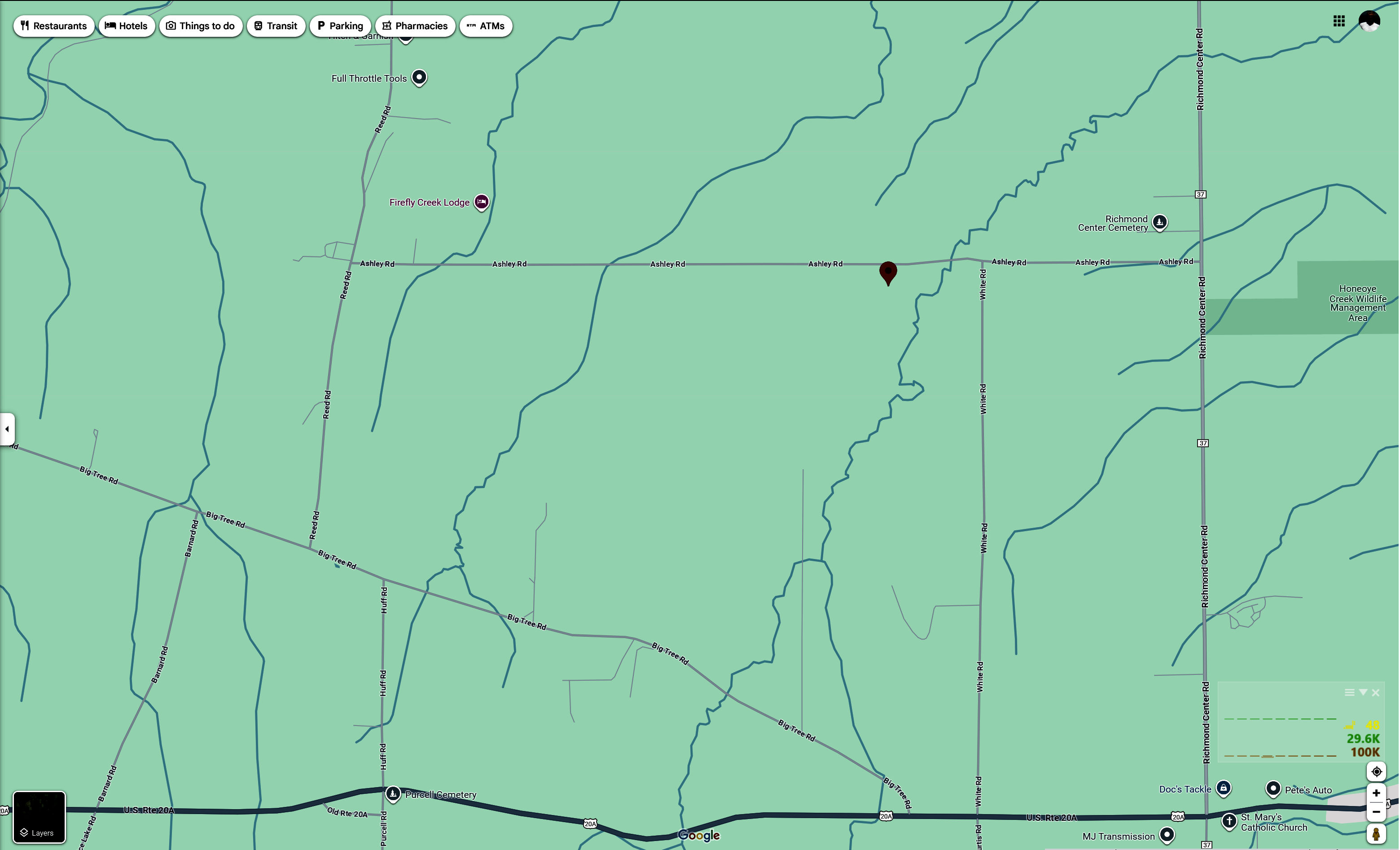
We are looking forward to hosting a hike on October 27th. The meeting point will be 9181 Ashley Rd, Livonia, NY at 1:45. We will gather and then proceed on the hike which will start out flat, going through a wooded area and then we will climb a hill for a beautiful view before heading back. The trail through the woods can be muddy at times. The social is a dish to pass at our home after the hike.
Directions- Ashley road runs between County road 37 and Reed road. Ashley road is also the only road off of county road 37 between 20A (Valley Inn is in the corner) and Richmond Mills Road. If heading south from Rochester it will be a right, if heading north from the Valley Inn it will be a left. We will be the first house past White Road in the left.
The water in Hemlock Lake is very low at the moment and a wide swath of beach is exposed. We will take advantage of the unusual conditions to walk a few miles to the south and back on this Sunday hike. The beach is generally 12-15 feet wide and varies between stony and rough stone chips. It will be a slow and careful walk but there’s plenty to see along the way and the lake and the late autumn woods on the opposite shore are very scenic. For those who prefer the easier dirt road parallel to the shoreline, there are several points to switch back and forth between the beach and the road. As a bow hunting season precaution, please wear some red or orange outerwear.
Meet at the north boat launch, at the end of the old east lake road, a sharp left after you first enter Rix Hill Road from Route 15A. This will be an out and back hike; we will all start out with a group on the beach and a group on the shore. All hikers may return at any time they are ready, or switch between groups at about the one mile point or about the two mile point. Ambitious hikers may want to head partway up Rob’s Trail after about 3 miles, where it veers to the east and up the hill.
Optional Social: Please join us at the Birdhouse Brewing Company in Honeoye – 8716 Main Street, just east of the traffic light, for craft beer and pub food.
Directions: From Springwater: proceed north on Route 15A 19 miles, then make a left on Rix Hill Road and an immediate left on Old East Lake Road, a.k.a Boat Launch Road.
From Honeoye and points east: Take Route 20A west from the Bristol Valley and Honeoye. When 20A meets Route 15A, make a left and go about .6 miles to Rix Hill Road. Make a right and then an immediate left on the dead end road to the boat launch parking area in one mile.
From Rochester and points west: Take Route 15 south from Henrietta or Route 15A south from Honeoye Falls, or Route 390 south to the Lakeville-Livonia exit, then go south on Route 15 and then east on Route 20A through Hemlock. When Route 20A turns east toward Honeoye, go straight another .6 miles and make a right on Rix Hill Road. Then make an immediate left onto the boat launch road and go to the end, 1 mile.
From Penn Yan: Take 54A across the north end of Keuka Lake to Branchport. Continue straight onto Italy Hill Rd (CR32). In 4.9 miles, turn left to stay on Italy Hill Rd and take the 2nd right onto Italy Hill Turnpike (CR34). At the bottom of the hill (3 miles) stay to the left onto Italy Valley Rd (CR18). On entering Ontario County, Italy Valley Rd becomes CR21. Continue to the T and turn right onto NY 53 into Naples. Continue straight onto NY 21 North past the Wayside Market and turn left onto Clark St (CR 36). Continue for about 15 miles along Honeoye Lake. Turn left at the light onto US 20A. In 4.8 miles, turn At 0.7miles past the intersection with 20A, take the first right onto Rix Hill Rd into the Hemlock Lake Park. Take the first left and follow the boat launch road to the end.
To the Social: From the Boat Launch parking area, return to Rix Hill Road, make a right and then a left on Route 15A. Go .6 miles and make a right on Route 20A. In about 4.75 miles you will reach the traffic light in Honeoye. A few buildings beyond the light is Birdhouse Brewing on the left at #8716.
PLEASE NOTE – CHANGE OF HIKE MEETING PLACE, BIKE RIDE CANCELLED
Come join us for a hike in Sandy Bottom Park, starting from the East Lake Road Trailhead. The bridge and boardwalk linking the two sides of Sandy Bottom Park are out of commission for a few weeks, so we will meet at 1:45 at the 4932 East Lake Road parking area and limit our hike to the 1.5 mile loop around the field and down to the stream to observe the improvements. Those seeking a longer hike are invited to go around again. The planned bike ride is cancelled due to rain.
Hikers will explore the nature trails and wetlands of Sandy Bottom Park. Our hike (about 1.5 or 3 miles) will be a combination of field and woods on a relatively flat terrain. Recommended attire – rain gear, umbrella, and sturdy waterproof shoes with good treads.
Social: Please join us to dry out after the workout at the Bird House Brewery, 8716 Main St, Honeoye, NY 14471. For menu see: https://commerce.arryved.com/location/BeNKYUPu/modality/pickup
Directions:
From Springwater: Head north to Route 20A in Hemlock. Turn east on 20A. Go through the Village of Honeoye to the East Lake Road intersection, just past the School, make a right and go about .3 miles to the Sandy Bottom Trailhead on your right.
From Naples: Go north on County Road 36, and right on Route 20A at the Honeoye traffic light. Go through the Village of Honeoye to the East Lake Road intersection, just past the School, make a right and go about .3 miles to the Sandy Bottom Trailhead on your right.
From the east (Bristol, Canandaigua, etc): Take Rte 64 south to Rte 20A, make right onto 20A, left onto East Lake Road as you come down the hill into Honeoye. Go about .3 miles to the Sandy Bottom Trailhead on your right.
From the west (Hemlock, Livonia, etc): Take Rte 15A to Route 20A, go through the Village of Honeoye to the East Lake Road intersection, just past the School, make a right and go about .3 miles to the Sandy Bottom Trailhead on your right.
Springwater Trails started as the Springwater Parks and Trails Committee around 2010 with initial funding from the Fiddler’s Fair. This committee was modeled after the Crescent Trail Association, a non-profit, incorporated organization active since 1980 with the full support of the town of Perinton. They have created over 23 miles of foot trails in the town. In the early 90’s, residents of the Town of Victor created a similar organization to develop and maintain trails in Victor. They adopted Bylaws and created a not-for-profit corporation in 1992 and continue to develop and expand their trail system. According to their strategic plan published in 2016, 55 miles of trails have been developed in Victor with 28 miles maintained by Victor Hiking Trails (VHT), 15 miles by Genesee Region of Cyclists (GROC) and the rest by the town of Victor.
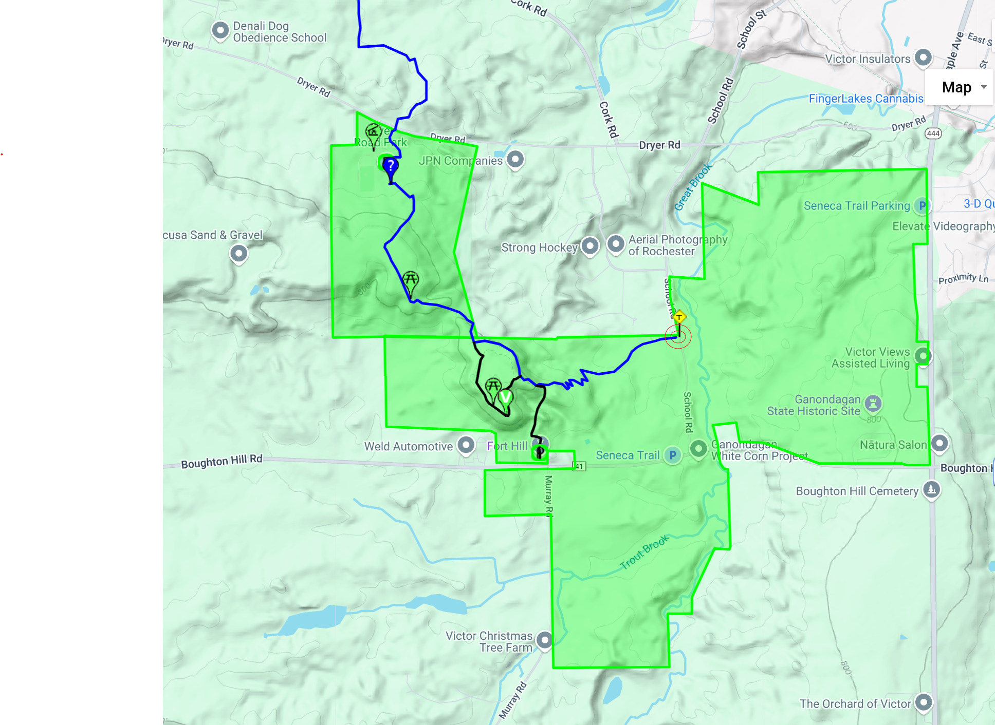 This Sunday, we will explore the Dryer trail located in Ganondagan State Historic Site and in Dryer Rd Park. Dryer Road Park is the home of 15 miles of bike trails (Click that link for an amazing map).
We will lead two hikes. Both hikes will be out and back, starting from the parking area on School St. This lot has only 7 parking spots, so carpooling would be good. We can also double park within the group. And there is a large parking area on Boughton Hill Rd where overflow can park and then carpool to School St.
Linda will lead the Naturalists and Tourists along the Blue Dryer Trail up Fort Hill to the Granary Trail that loops around the top of the hill where a Seneca granary store a significant amount of corn prior to July, 1687, when the Denonville campaign from Montreal destroyed Ganondagan and burned the granary. Hikers can read entries from the Denonville journals and enjoy views to the south of the hills around Canandaigua Lake. The trail up Fort Hill has several switchbacks making it a much easier route than the other trails to the granary.
The Climbers will stay on the Dryer Trail to Dryer Road Park. On the return hike, we will stop at the Granary as time permits.
Following the hike, join us for a social at a local restaurant.
Directions
Can be easily found using GPS
From Springwater and South – Take Route 15A north Just past the green dollar store in Hemlock make a right onto 20A. Make a left onto County Rd. 37 just before the Valley Inn on the corner. Take County Rd. 37. Continuing straight it will become Rt. 65, then W. Bloomfield Rd. (CR-35). You will turn right onto Boughton Hill Rd. (CR-53 which becomes 41) Make a left onto School St and the parking lot will be on the left.
From Rochester, take I-490 to the Victor exit, then Route 96 to Victor. At the second traffic light in Victor, use the right turn lane onto School St. Continue on School St (it switches to School Rd outside the village) for 1.5 miles. The parking are is on the right.
Alternate parking is available at the Visitor Center. Go south from the School Rd lot to Boughton Hill Rd. Turn left, and the parking lot in on the left.
Powder Mills Park, off Route 96 in the Town of Perinton (just west of Eastview Mall), is one of Monroe County’s outstanding hunting-free hiking parks, with a nice group of wooded glacial ridges and lowlands on a 380-acre property with a fish hatchery and a ski hill. It has been a county park since 1930, after an interesting history as a gunpowder factory.
As you enter the park via Park Road, off of Rt. 96, on the left hand side you will see the infamous Mushroom House. This eclectic private house, built in 1970, resembles giant mushrooms. The architect, James H. Johnson, designed its five concrete stems and pods to suggest Queen Anne’s Lace (wild carrots). Even though it is a private home, there is a lane leading up to other homes, which you can drive up for a closer look prior to the hike. Please be respectful and stay near the end of the driveway for viewing and taking pictures.
Also, prior to the hike, just past the Mushroom House on the left, you can check out the Fish Hatchery at Powder Mills Park, which was established in 1933. The hatchery is open all year long. Throughout the year, up to 20,000+ brown and rainbow trout in various stages of development are raised there.
The Meeting Place:
Meet at the Rand Lodge Parking Lot on Park Road at 1:45 PM for group photo and 2 PM start. Water bottle, warm layers, hiking poles and good boots are strongly advised. Due to prior and same day rain forecasts, anticipating some slick, wet leaves, & muddy conditions.
On the day of the hike, two restroom options will be available: restrooms at Rand Lodge & a handicapped port-potty next to the Oak Tree Lodge.
The Hike:
The Climbers and Tourist/Naturalist groups will start off together, briefly stopping by a marker which tells the story of Powder Mills. From there, the groups will hike along the easy Trillium Trail (yellow trail markers), a .5 mile (one way) of wetlands and unique plant life. The groups will then cross over Woolston Road and enter the Pine Forest Trail (black trail markers), staying to the left; woods filled with pine, maple, oak, and many other types of trees. There will be a short uphill climb at the start, but the Tourist/Naturalist group should be able to manage it. When the groups reach a newly-built wooden trailhead, the groups will veer off to the right, picking up the Creek Trail (white/pale yellow markers). The groups will hike along this trail till reaching an impassible point (too wet and muddy); at this point, the groups will turn around and head back to the Pine Forest Trail (black markers).
The Tourist/Naturalist group* will then go right, heading back down the Pine Forest Trail, and then turn to the right to pick up the Creek Trail (white markers); once crossing over a small muddy patch of the trail, the group will go left, continuing on the Creek Trail, returning to Woolston Road; the group will crossover the road and return to the Rand Lodge via the Trillium Trail (yellow markers), exiting via the trail along the chain-linked fence and over the bridge (~2+ miles total). If enough time, the Tourist/Naturalist group are welcome to drive over and check out the Fish Hatchery before the optional Social.
The Climbers group* will then go left, completing the Pine Forest Trail loop, and then turn to the right to pick up the Creek Trail (white markers); once crossing over a small muddy patch of the trail, the group will go left, continuing on the Creek Trail, returning to Woolston Road; the group will crossover the road, continuing on the Trillium Trail (yellow markers). At the second Ridge Trail (green markers) path, turn right to hike up trail to the top, hike most of the Ridge Trail (has an overlook point that allows you to see west for miles & the remains of the old Rand household), before returning down the same path to the Trillium Trail, exiting via the trail along the chain-linked fence and over the bridge (~3.5 miles total).
The Social:
Please join us afterwards for our optional post-hike Social at Champps Kitchen & Bar on Route 96, located at 819 Eastview Mall, next to the main central entrance facing Route 96. Menu at: https://www.champpsfead.com/victor-menu
Directions:
From Springwater: Head north on 15A and make a right on Kellogg Road to County Road 37. Continue on CR37 to West Bloomfield, then continue straight on County Road 35, (a.k.a. West Bloomfield Road). Continue past Route 251, and make a right on Smith Road. Continue past Route 64 and make a left on Mile Square Road, which becomes East Street. In 2.6 miles make a right on Park Road. The Rand Lodge parking area will be on your right.
Via 490: From Interstate 490 – take the Bushnell’s Basin exit. Go left on Route 96, pass the Garnsey Road light, and take a right on Park Road. Go past the Fish Hatchery and Corduroy Road, then take the first left into the Rand Lodge parking lot.
Looking for brochure.or mailing list so I can receive it in the mail.
Nothing opens up for mailing list.
There’s all kinds of very bizarre ads and post for viagra and other drugs above on calender page.
Please let me know if there’s a brochure available