
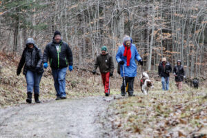
Hikes led by Springwater Trails are generally held on Sunday afternoons and appear in this calendar in green.
| Sun | Mon | Tue | Wed | Thu | Fri | Sat |
|---|---|---|---|---|---|---|
| Lehigh Valley Trail Hike or Bike in Rush, NY 2:00 pm Lehigh Valley Trail Hike or Bike in Rush, NY @ Stevens-Connor Lehigh Valley Lodge Apr 6 @ 2:00 pm – 4:00 pm Come join us for a leisurely hike or bike along the Lehigh Valley Trail on Sunday April 6th! With its flat even surface, the trail is a hidden gem for walking, hiking, jogging, biking. It is a vital link in … Continue reading | ||||||
| Ontario County Park at Gannett Hill Hike-Naples 2:00 pm Ontario County Park at Gannett Hill Hike-Naples Apr 13 @ 2:00 pm – 4:00 pm  Save the date! This is one of our group favorite hikes. Ontario County Park at Gannett Hill is one of the highest points in Ontario County and located in the scenic Bristol Hills. At an elevation of 2,256 feet above … Continue reading | ||||||
| No Hike-Easter Break 2:00 pm No Hike-Easter Break Apr 20 @ 2:00 pm – 4:00 pm No hike has been scheduled for this date due to the Easter Holiday. Enjoy the break, spend time with loved ones and eat chocolate bunnies. This will give you something to burn off next week  | ||||||
| Mystery Hike-Details Coming Soon 2:00 pm Mystery Hike-Details Coming Soon Apr 27 @ 2:00 pm – 4:00 pm Mystery Hike coming your way….details under construction. Please check back. |
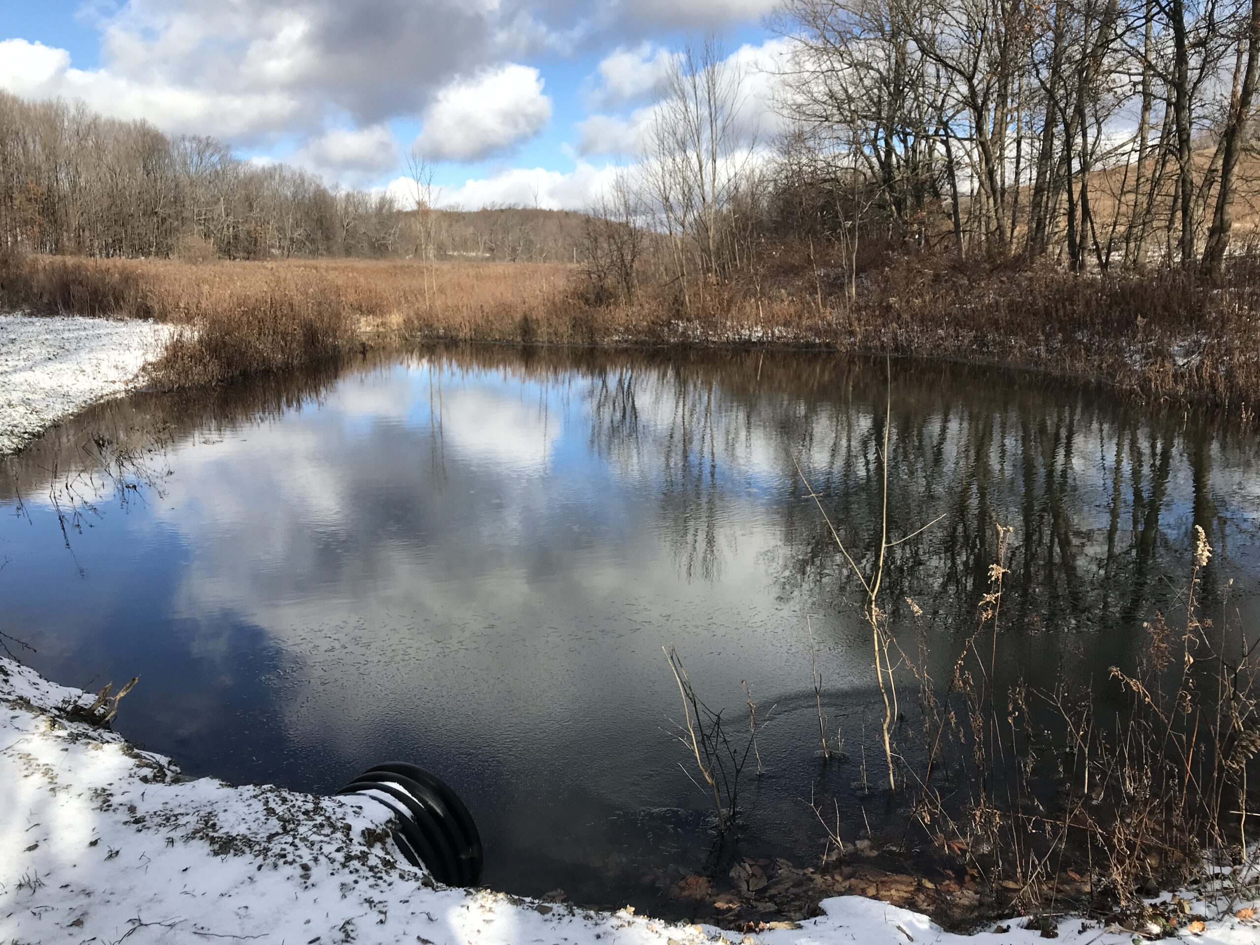
This Sunday we will enjoy the beautiful downtown Fairport NY, with some history of the Erie Canal and a walk along the banks of the Canal.
Our hike will start with a tour of the Fairport Historical Museum. Vicki Profitt, the Museum Director & Pres. of the Historical Society will be our tour guide. It is a very small museum & it will be open @ 2:00, so people are welcome to come in anytime after that but probably around 2:15-2:30 is ideal. The tour will be approximately 1/2 hr. Parking is available in the municipal lot across the street from the museum.
After the tour, we will have two hikes. The longer hike will cross the canal on the Lift Bridge and follow the canal path east. In about a mile, we will cross the canal and continue east on a wooded path. At the next bridge (Lyndon Rd), we will cross back over the canal and continue back to the village. Hikers wishing some refreshment will leave the canal, crossing a parking lot to Mulconry’s Irish Pub. The rest of the group will cross the Lift Bridge, taking the stair up beside the library to the parking lot and our cars. This hike is approximately 5 miles.
For a shorter hike we will stay on the canal path for about 1 and a half miles, returning the way we came.
Following the hikes, everyone is invited to Mulconry’s Pub at 17 Liftbridge Ln E, Fairport, NY 14450. You can find a description of Bangers and Mash plus other food on their menu. This pub is a very short walk from the Village Landing, so cars can stay parked there at the Landing. We will be making a reservation for 10 people & we can increase it if need be.
Directions: The Museum is in on Perrin St, one street west of Main St in Fairport. Parking is across the street – plenty of parking by the Dollar Store in Fairport Village Landing.
From Springwater: Head north on NY 15A. In 2.7 miles from the flashing light, take a slight right onto Old Bald Hill Rd South, then an immediate right onto Johnson Hill Rd. At the top end of Johnson Hill Rd, turn left onto CR 37. In Canadice, turn left to stay on CR 37 for 11 miles. At the light in W Bloomfield, continue straight onto NY 65. Continue straight onto CR 35 when NY-65 curves to the left. In Monroe County, the road changes name to W Bloomfield Rd but continue straight. After crossing the Thruway, Thornell Rd is 1.4 miles. Turn right on Thornell Rd. At the end of Thornell Rd, turn right onto NY 96. At the second light, turn left onto Kreag Rd. At the end of Kreag Rd, turn right onto Ayrault Rd. At the first light, turn left onto Moseley Rd (NY 250). In 0.9 miles, turn left into the Fairport Village Landing parking lot. Park on the far side of the parking lot, across the street from the Museum.
From Canandaigua: Tak3 NY 332 north to the Thruway. Head west on the Thruway to exit 45. Take the first exit off I-490 onto NY 96. Pass Eastview Mall and turn right onto Moseley Rd (NY 250). In 0.9 miles, turn left into the Fairport Village Landing parking lot. Park on the far side of the parking lot, across the street from the Museum.
From Rochester: Take I-490 east to Exit 25 – NY31F Fairport. In 3.6 miles you will be in the village of Fairport. Turn left onto Perrin St (the last street before the light). Go past the Museum on the left and turn into the parking lot on the right. Park across the street from the Museum.
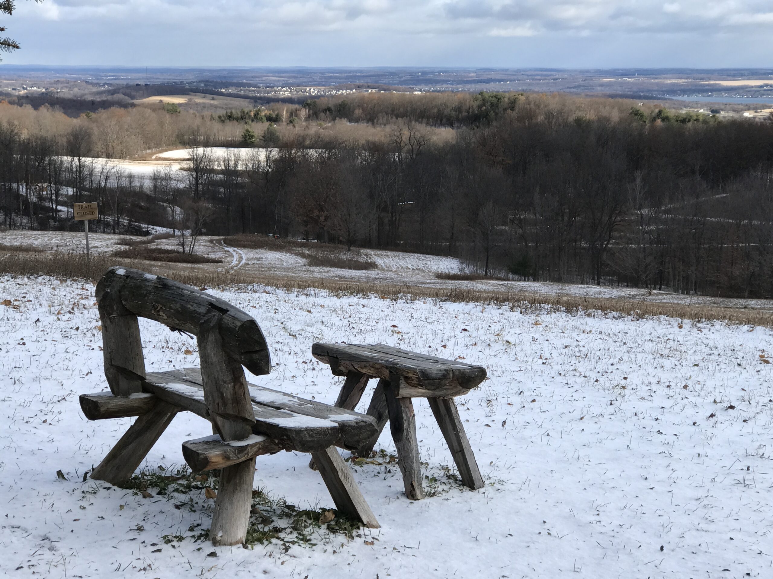
 Join us Sunday afternoon to explore the latest Nature Preserve of the Finger Lakes Land Trust – Canandaigua Vista, overlooking the Canandaigua Valley and points east. This preserve, on a 90-acre parcel that was once a dairy farm, includes a combination of meadow and woodlands, with trails circling the property and abutting parts of Barnes Gully and a farm pond. This is a shorter hike than our usual, but there’s a lot to see. If folks finish early and there is interest, we can visit another nearby Canandaigua overlook afterwards – Quiet Meadows on Barnes Road.
 Hiking is on mostly dry rolling hills, with some moderate climbs. The Land Trust permits fall hiking while also issuing a limited number of private bow hunting permits on the property in the interest of deer control; all permitted hunters have been advised of our event. WEAR SOME BLAZE ORANGE OUTERWEAR AS A PRECAUTION. Poles and mud-suitable boots also advised. Binoculars are also recommended if you have them – great for identifying landmarks way off across the lake.
Meet at 1:45 at the new trailhead parking lot near the top of Jones Road, a dead end off Route 21, about 2 miles south of Cheshire. Park in the generous off-road lot, not on the road. The whole group will take the White Trail around the perimeter of the preserve, stopping at various overlook points to take in the sights. At the end of the loop after about 1.25 miles, Naturalists and Tourists will return to their cars to adjourn to 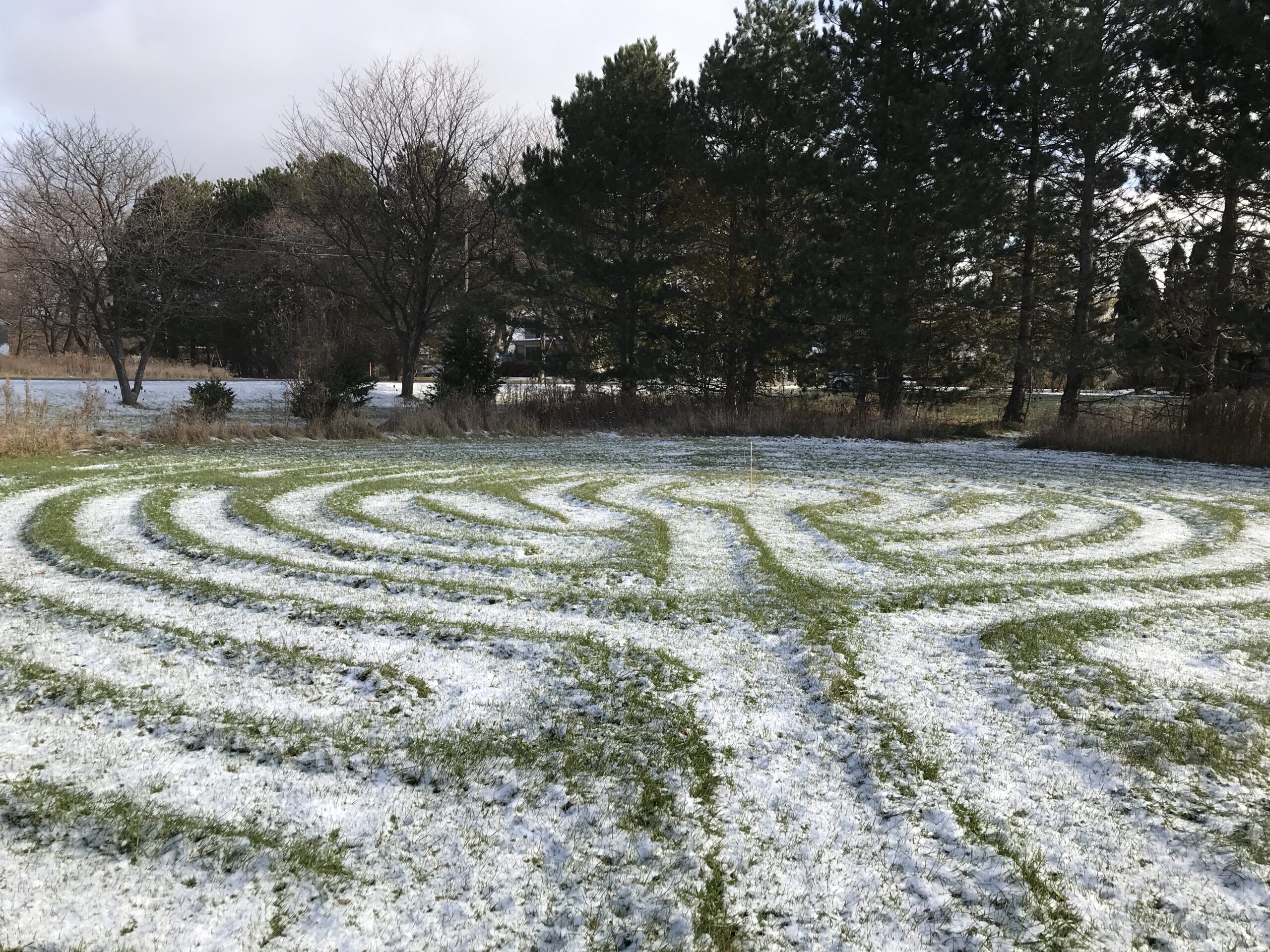 Quiet Meadows (see directions below), and Climbers may retrace the full loop back to the start, seeing the sights from the other direction for a total of about 2.5 miles, or adjourn to Quiet Meadows or nearby Onanda Park, where we can hike another 3 miles in a woods with its own Canandaigua Vistas.
Optional Social: Join us afterwards for refreshments at Brews and Brats, 6461 Route 64. Check out the menu here.:
 DIRECTIONS:
From Springwater, Wayland, Naples: Go east to North Cohocton and Naples and Route 21, then continue north through Woodville to the intersection of Route 21 and Route 64. Bear right at the fork and follow Route 21 north for 6.8 miles, to just past the Scenic Overlook. Make a left on Jones Road, and go up the hill about a half mile. The Trailhead parking area will be on the left. There is a big sign.
From Honeoye: Take Route 20A east to County Road 32 (Wizard of Clay), then make a right and proceed to the Bristol Valley. At the Route 64 intersection, go straight and up the hill, making a right on Montanye Road (later Goodale Road) This road ends in Cheshire . Make a right on Route 21, and go about 2 miles south. Make a right on Jones Road, just after the Seneca point Road intersection. Go 12 mile p the hill to the trailhead parking on the left.
From 5&20 and Canandaigua: Take Route 21 south to Cheshire and continue south another 2 miles to Jones Road, just after the Seneca point Road intersection. Go 12 mile p the hill to the trailhead parking on the left.
Directions to Quiet Meadows and Onanda Park: Return to Route 21 and make a left, then an immediate right on Seneca Point Road. In about .9 miles, turn left on Barnes Road. The first building on the right is a red barn. Park in front of the barn and go through the hedge row opening to the grassy labyrinth. Walk the labyrinth paths for a meditative experience, or navigate the mowed paths to the left around the 5 acres of hills and lake vistas. For Onanda Park, Barnes Road entrance, proceed another quarter mile down Barnes Road. After the road curves to the right, look for a dirt road entering the woods on your left (no sign) There is a trailhead and parking for about 8 cars in there.
Brews and Brats: From Canandaigua Vista, go down Jones Road and right on Route 21. In 6.8 miles, turn right on Route 64 and go a sort distance around the curve to the right. Brews and Brats is behind Arbor Hill at 6461 Route 64.
This Sunday’s hike will take us back to an old favorite, Mendon Ponds Park, with well-marked trails and much to see in every season. We will meet outside the Nature Center/Wild Wings at 1:45PM. Wild Wings is open 10AM-2PM if you want to arrive early and walk through before our hike. There are also restrooms at the center.
The weather on Sunday is expected to be a nice 40 degrees but the rain on Saturday could make our hike a bit muddy. Please be prepared and bring your pole(s) if you use them.
We’ll split into just two groups for this hike. The Naturalists and Tourists will hike the area of the Grasslands and West Esker trails with an overlook of the Devil’s Bathtub, for about 2+ miles. The Climbers will do a combination hike of the Nature Trail/Birdsong and the Quaker Pond loop for a longer (and quicker paced) hike of about 5 miles, with an enjoyable view of Quaker Pond. See attached map with trail descriptions.
Park Map: https://www.monroecounty.gov/files/parks/jan%2015%20mpp%20map.pdf
For the social afterwards, interested members can head to Flaherty’s in Honeoye Falls at 60 W Main St..
Directions:
From Springwater: Head north on 15A for 21.6 miles through Hemlock and Lima. Take a right at the exit to Honeoye Falls. Stay on W Main St into the village where you will pass the Flaherty’s on the right. Continue straight onto NY 65 for 4.4 mi. (At 2 miles, you will go around a traffic circle. Stay on NY 65.) Turn right onto Pond Rd at the park entrance. The Nature Center parking area is immediately on the right.
From Honeoye, take US 20A west and head north on CR 37 for 8.2 miles to W Bloomfield. Continue straight on NY 65 for about 3 miles, and make a right on Quaker Meeting House Road just before you come into Honeoye Falls. When Quaker Meeting House Road ends at Route 251 (Rush-Mendon Road), go left and then right on Route 65/Clover Street. The Pond Road entrance to the park is about 2 miles to the north, on the right. The Nature Center parking area is immediately on the right.
From Rochester: Exit I 590 at Monroe Ave toward Pittsford. Turn right (south) onto NY 65 (Clover St). In about 6.7 you will come to the Canfield Road entrance to the park – this is not the one you want. Continue another 1.5 miles, then turn left onto Pond Rd, the second entrance into the park. The Nature Center parking area is immediately on the right.
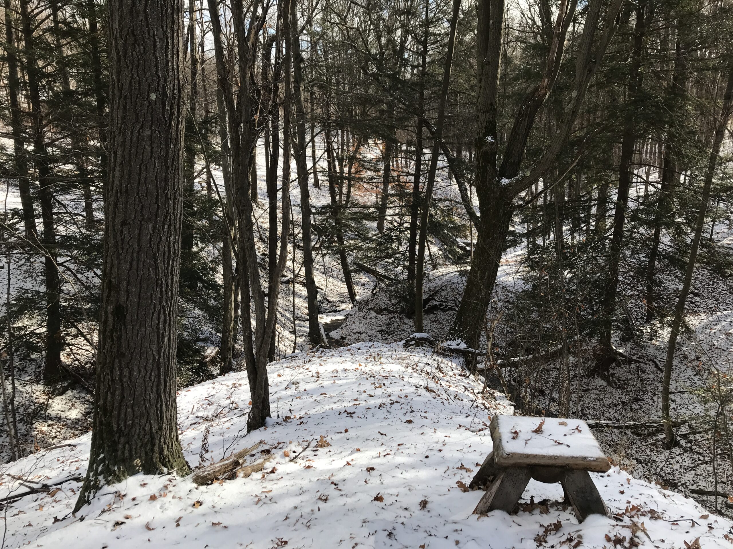
Please join us this Sunday to explore a hiking site not far from Springwater. A few years ago New York State acquired several new parcels of land to the south of Harriet Hollister Spencer Park, linked to the main park by an established snowmobile trail called C4.In the past, we’ve hiked the section of the C4 trail closest to the main park, and this Sunday The Climbers will start from the main parking lot and hike out following Ruthies trail to C4 off Deremus trail going as far as the intersection of Canadice Hill Road and Tibbals Road, a.k.a Townline Road (that’s the town line between Canadice and Springwater – also the Ontario-Livingston County Line). Climbers can return to the main parking area by returning back on C4 or following the Canadice Hill Road back. Total distance for Climbers is about 4 miles round trip. Tourists and Naturalists will follow the same route until the C4 turnoff but stay in the main park, for a total hike of 1.5 hours and about 2.5 miles.
Wear proper clothing according to prevailing weather conditions . As always, bring water, good hiking footwear and poles if you typically use them. The trail is gently rolling – no especially steep sections.
Social: After the hike we will repair to Birdhouse Brewing Company at 8716 Main Street, Honeoye, for their menu of craft beers and food.
Directions:
From Springwater and Wayland – take Route 15A North from Springwater, turning right on Wheaton Hill Road. Take a left on Canadice Road (County Road 42), forking to the right when County Road 42 divides off from Canadice Lake Road. Make the next right, on Tibbals Road (formerly Town Line Road). The trail head is where Tibbals Road ends at Canadice Hill Road/Wetmore Road.
From Rochester or Canandaigua – go to Honeoye, and follow Route 21A (Main St. Honeoye) west toward Hemlock. About a mile out of Honeoye turn left on County Road 37. Follow County Road 37 until it makes a 90 degrees turn to the right across from the Canadice Methodist Church; at this point go straight onto Canadice Hill Road instead of County Road 37. Continue straight on Canadice Hill Road, taking the left fork at Ross Road, and passing the main entrance to HH Spencer Park. The trail head is 1.7 miles south of the main park entrance, and 8.5 miles from Route 21A. Beyond the trailhead Canadice Hill Road turns into Wetmore Road.
Directions from Hike to Social at Birdhouse Brewing Co.
-
Take Canadice Hill Rd. going toward Harriet Hollister Parking Lot. Keep going straight, it will become County Rd. 37.
-
When you come to Route 20A you will make a right. (at the intersection, St. Mary’s Catholic Church will be on the Right corner). Take 20A into Honeoye.
-
Birdhouse Brewing will be a brown building on your left, four buildings past the traffic light.
On Sundays they serve Hot Dogs and Hamburgers and are open until 7:00pm.
Come fight off of your Christmas day hangover with a hash walk at Another World Bed and Breakfast on Sunday December 26th at 2 pm. We will wander around the property with three goals in mind:
- Don’t get lost
- Have food and drink afterward
- Pick on John L at every opportunity.
For those who may not be familiar with hashing, a hash follows a marked route that contains checkpoints and false trails to keep you thinking and get you frustrated. You will be driven on by the fact that a cold beer awaits when you finish. The original idea of the hash was to promote physical fitness, get rid of weekend hangovers, acquire a thirst that will be slated, and persuade all-comers that they are not as old as they feel.
Directions
From Naples: Take Main Street to Clark Street (Middletown Tavern is on the corner) and take Clark out of the town. After about 2 miles turn left on French Hill Road. After about 1 mile, Another World will be on the right at 8404 French Hill Road. Park in the driveway
From everywhere else in the universe: Take your favorite route to Naples and follow the direction above!!!!!!!
The Social
Soup, Dessert, and refreshments will be served to all survivors.
The Hike:
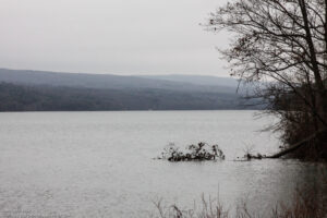
A First Day hike along Canadice Lake.
Start the New Year the way you mean to go on – come for an inspiring hike along Canadice Lake! This is an easy, 1.8-mile each way hike along the shore of the lake; the trail is level and well-maintained and the lake views are lovely. For most hikers it will be a walk along the lake for an hour or so, and then back the same way; more enthusiastic hikers can veer off on Rob’s Trail that leads over the ridge and down to Hemlock Lake – this is a moderate to hard trail with several steep uphill and downhill sections. We’ll take a roll call the day of the hike if anyone wants to walk Rob’s Trail. We’ll arrange for transport back for those who only want to walk one way. Dress appropriately for the weather, carry water and some energy food, and carry a walking pole if it helps. Leashed pets are welcome.
A First Day hike along Canadice Lake.
This is not a “routine” Sunday hike – for a start, it’s happening on a Saturday! The hike is promoted by the NYS DEC, and is part of a larger program of First Day Hikes to encourage people to get out and experience the magnificent Sate of New York that they live in.
The Meet-Up Location
All First Day hikers should meet at the parking area off Purcell Hill Road, Town of Canadice, Ontario County. Google Maps (leaves this website)
The Social
There won’t be an organized social on this hike.
Our hike this Sunday will be on the southern portion of the Crescent Trail in Perinton, NY. The Crescent Trail is a system of footpaths within the Town of Perinton suitable for uses such as hiking, cross-country running, snowshoeing, nature study, and photography. Approximately thirty-five miles of footpaths provide public access to wooded hills, Town parklands, scenic overlooks, the margins of wetlands, and other preserved open spaces. Our hike will start on the Seneca Trail, one of the trails in the Victor Hiking System. We will hike north on the Seneca Trail to connect the trails systems of the two towns, and then along the main Crescent Trail,
From the parking lot, we will head NW on the Seneca trail to Lasalle Parkway that runs parallel to Highway 96. After a quarter mile on Lasalle we join the Crescent Trail system on a gray trail to join the orange trail that links Route 250 to Turk Hill Road. From the 50 Square Drive to the Orange trail is a 35 minutes walk. Then:
- Naturalists will go west on the orange trail for as long as they want and return on the same route to 50 Square Drive and to the Distillery if they wish.
- Hikers will go east on the orange trail for as long as they want and return on the same route to 50 Square Drive and to the Distillery if they wish.
The trails are steep in parts, run along creek beds and are very pretty. Lots of ups and downs. Poles are recommended.
Following the hike, the Distillery across the parking lot is available for a social. Please bring a mask for entering the restaurant.
Directions:
From Springwater, Wayland and Honeoye: Head north on NY 15A. Take the first right outside town onto Wheaton Hill Rd. Turn left onto Canadice Rd CR42 (the first left). Stay on CR42 as it turns right up the hill toward Canadice. The road becomes CR 37 in Ontario County. Stay on CR37 with a left at Canadice and all the way to West Bloomfield. Continue straight onto NY 65, and then outside of W Bloomfield, stay straight onto CR 35 as NY 65 curves left. This road becomes CR 66 in Monroe County. Turn right onto NY 251, Rush Mendon Rd. Stay on NY 251 for 3.4 miles. Turn left onto Phillips Rd, as 251 curves to the right. At the light turn right onto Main St Fishers, then left onto NY-96. In 1.7 miles (probably the 4th light) turn right onto Turk Hill Rd and then turn left into the plaza at the first light. We will meet in the parking lot on the right in front of the office building.
From Naples: Head north on NY 21. Continue straight onto NY 64 in South Bristol when 21 turns to the right. In 13 miles, turn left at the light onto Rt 5 & 20. In 1.2 miles, turn right onto NY 444 toward Victor. In Victor, turn left onto NY 96 for 4.2 miles. Turn right onto Turk Hill Rd, and then turn left into the plaza at the first light. We will meet in the parking lot on the right in front of the office building.
From the Thruway: Use Exit 45 for I-490 W. Take the first exit (Exit 29). At the light turn right onto NY 96. Turn right onto Turk Hill Rd, and then turn left into the plaza at the first light. We will meet in the parking lot on the right in front of the office building.
From Rochester: Use I-490 E to Exit 28. Turn left onto NY-96. In 1.3 miles, turn left onto Turk Hill Rd, and then turn left into the plaza at the first light. We will meet in the parking lot on the right in front of the office building.
From Fairport and Penfield: Take NY 250 south. Turn left onto NY 96. In 0.6 miles, turn left onto Turk Hill Rd, and then turn left into the plaza at the first light. We will meet in the parking lot on the right in front of the office building.
Looking for brochure.or mailing list so I can receive it in the mail.
Nothing opens up for mailing list.
There’s all kinds of very bizarre ads and post for viagra and other drugs above on calender page.
Please let me know if there’s a brochure available