
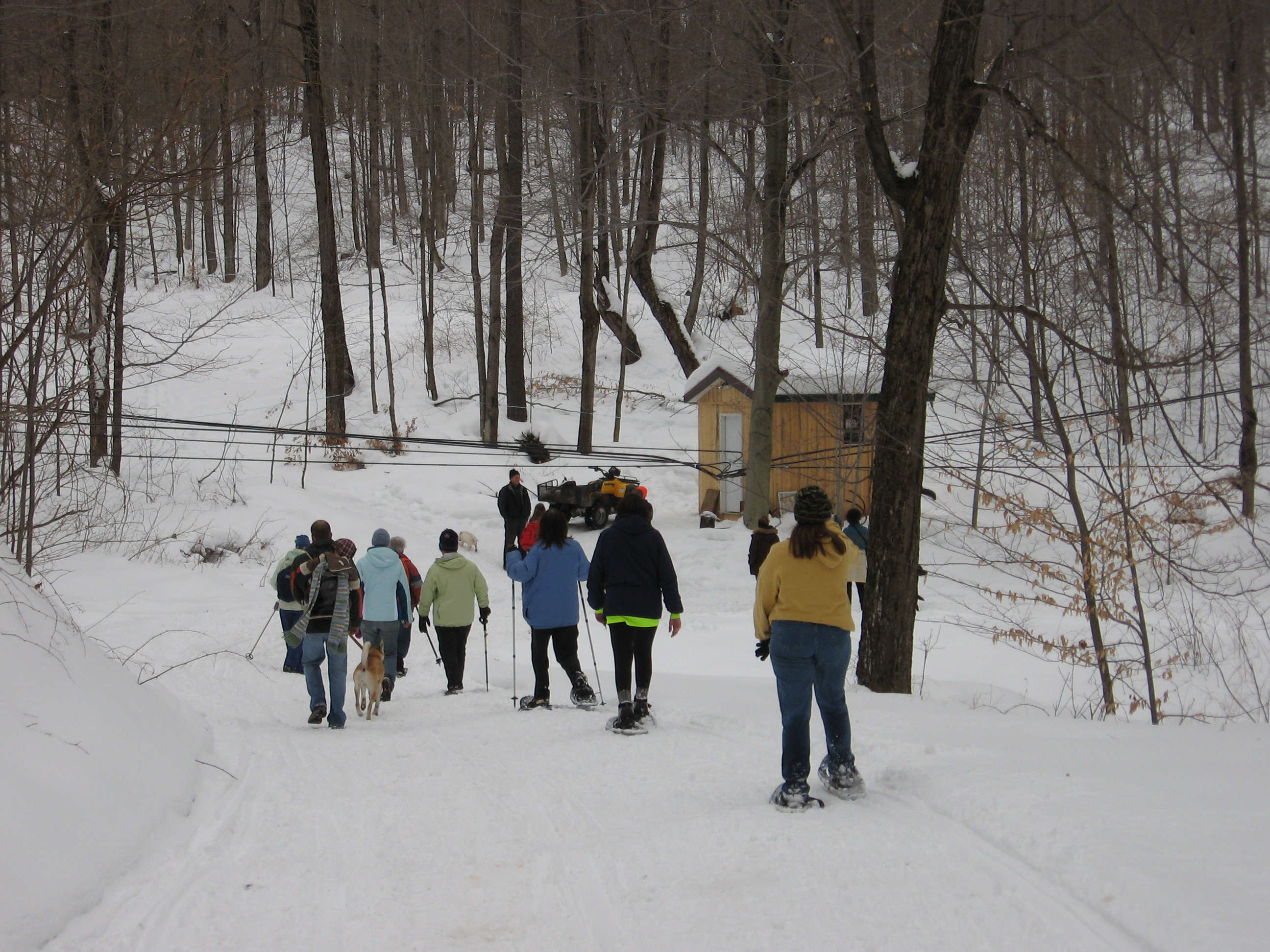
Hikes led by Springwater Trails are generally held on Sunday afternoons and appear in this calendar in green.
| Sun | Mon | Tue | Wed | Thu | Fri | Sat |
|---|---|---|---|---|---|---|
| Lehigh Valley Trail Hike or Bike in Rush, NY 2:00 pm Lehigh Valley Trail Hike or Bike in Rush, NY @ Stevens-Connor Lehigh Valley Lodge Apr 6 @ 2:00 pm – 4:00 pm Come join us for a leisurely hike or bike along the Lehigh Valley Trail on Sunday April 6th! With its flat even surface, the trail is a hidden gem for walking, hiking, jogging, biking. It is a vital link in … Continue reading | ||||||
| Ontario County Park at Gannett Hill Hike-Naples 2:00 pm Ontario County Park at Gannett Hill Hike-Naples @ Lookout Parking area Apr 13 @ 2:00 pm – 4:00 pm  This is one of our group’s favorite hikes! Ontario County Park at Gannett Hill is one of the highest points in Ontario County and located in the scenic Bristol Hills. At an elevation of 2,256 feet above sea level, you’ll … Continue reading | ||||||
| No Hike-Easter Break 2:00 pm No Hike-Easter Break Apr 20 @ 2:00 pm – 4:00 pm No hike has been scheduled for this date due to the Easter Holiday. Enjoy the break, spend time with loved ones and eat chocolate bunnies. This will give you something to burn off next week  | ||||||
| Rob’s Trail – Hemlock Lake side 2:00 pm Rob’s Trail – Hemlock Lake side Apr 27 @ 2:00 pm – 4:00 pm Join us on Sunday April 27 to hike the west side of Rob’s Trail, the DEC/Nature Conservancy property in the northeast corner of Hemlock Lake. Options are to hike out and back to the south along the trail from the … Continue reading |
GOLF ANYONE!!!!
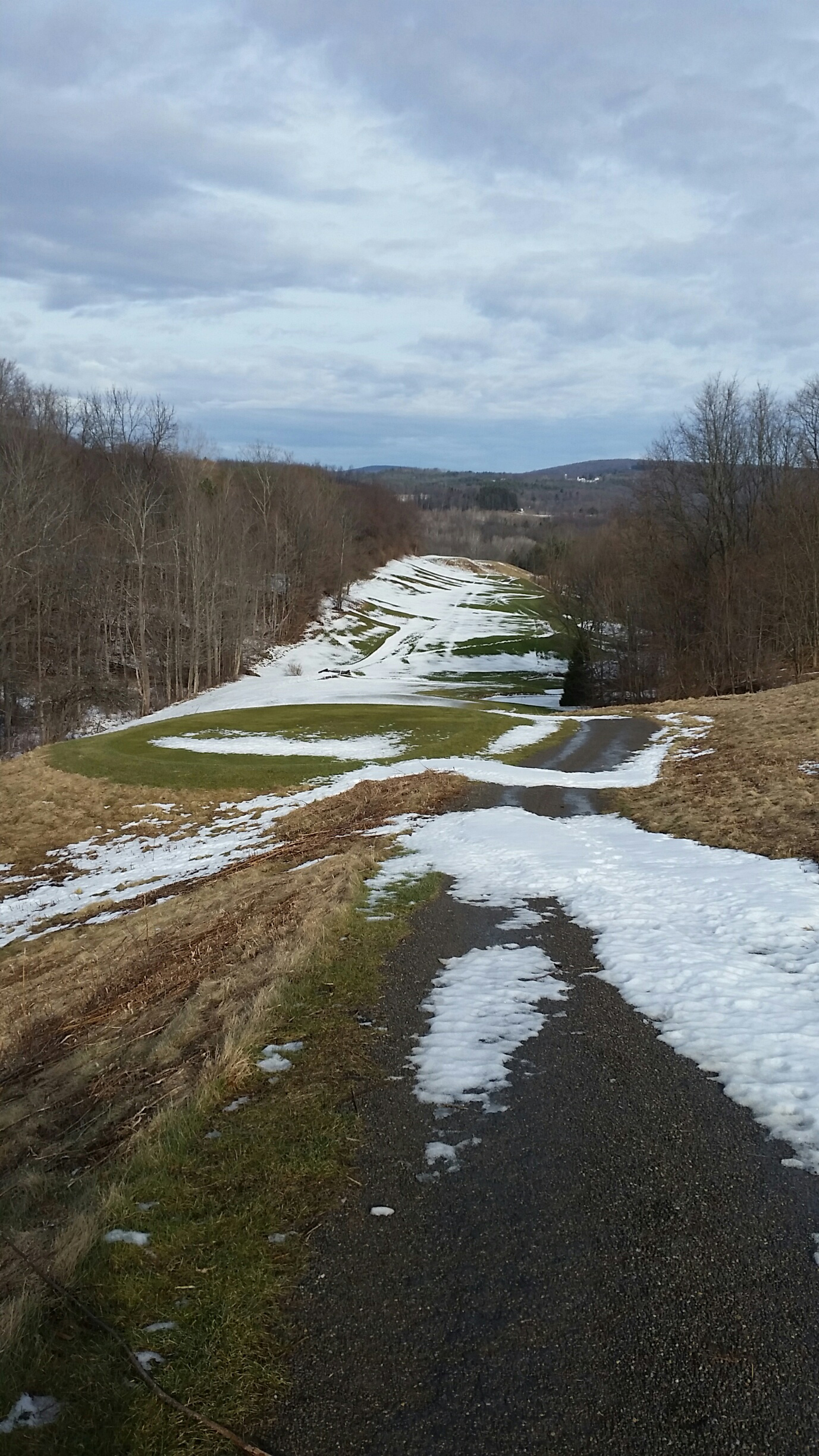
If there is enough snow you might want to try your hand at snowshoeing or cross country skiing. More than likely you will want your poles and footwear with good traction if there is snow on the ground. The lay of the land is up and down but the inclines are short but the views are beautiful!
We will meet in the parking lot of Reservoir Creek Golf Course at 2:00pm.
After hike Social will be at Neapolitan Pizzeria 120 N Main street Naples.
Or
Take 390 South to the Wayland Exit. Turn right on Rte. 21 North at the light in Wayland. At the intersection of Rte. 21 and Rte. 371 in the Town of North Cohocton turn left staying on Rte. 21 North. Reservoir Creek Golf Course is on your right about 4 .1 miles.
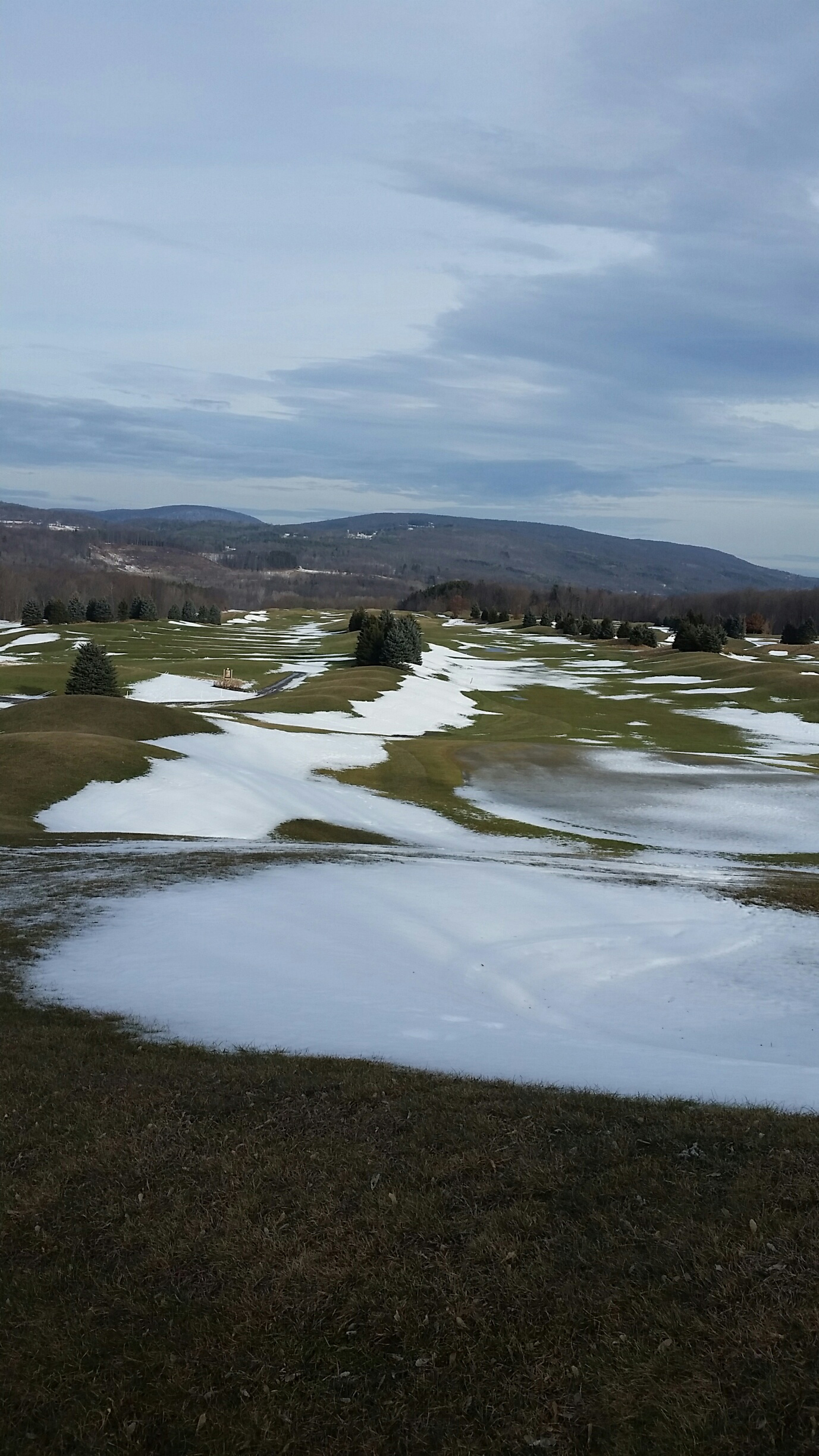
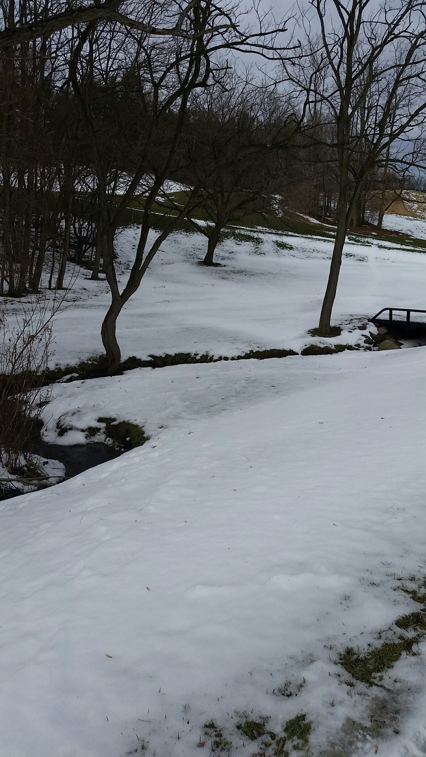
This Sunday Hike will continue the Bristol Hills Branch of the Finger Lakes Trail to the north. In January, we hiked south from Seman Rd to Naples, so this month we will do the section north from Seman Rd.
NOTE: Dogs are not allowed on this hike, except with Naturalists.
Before we start, a word about the Springwater Trails BHB Series of hikes. In July, 2017, we started this series at the southern end of the Bristol Hills Branch in the town of Bath. Each month, we continued north until we came to hunting season and skipped the section between Access Point 12 and 11 near Prattsburgh. Instead, in November and December, we continued north into Italy Valley. Next, we skipped over High Tor and hiked the Naples to Seman Rd section that Springwater Trails helps to maintain with spring and late summer trail cleanup days.In February and March, we will continue north from Seman Rd until we reach the end of the Bristol Hills Branch. But please do not worry, this spring we will return to Prattsburgh (April) and (in May and June) hike through High Tor.
Starting in July, we are planning a hike series through the Letchworth Branch. The town of Springwater sits half-way between the Letchworth and the Bristol Hills Branches. Plan to join the Springwater Trails on the third Sunday of each month through the summer and fall to complete a hike of the entire Letchworth Branch.
Now, back to our regularly scheduled program.
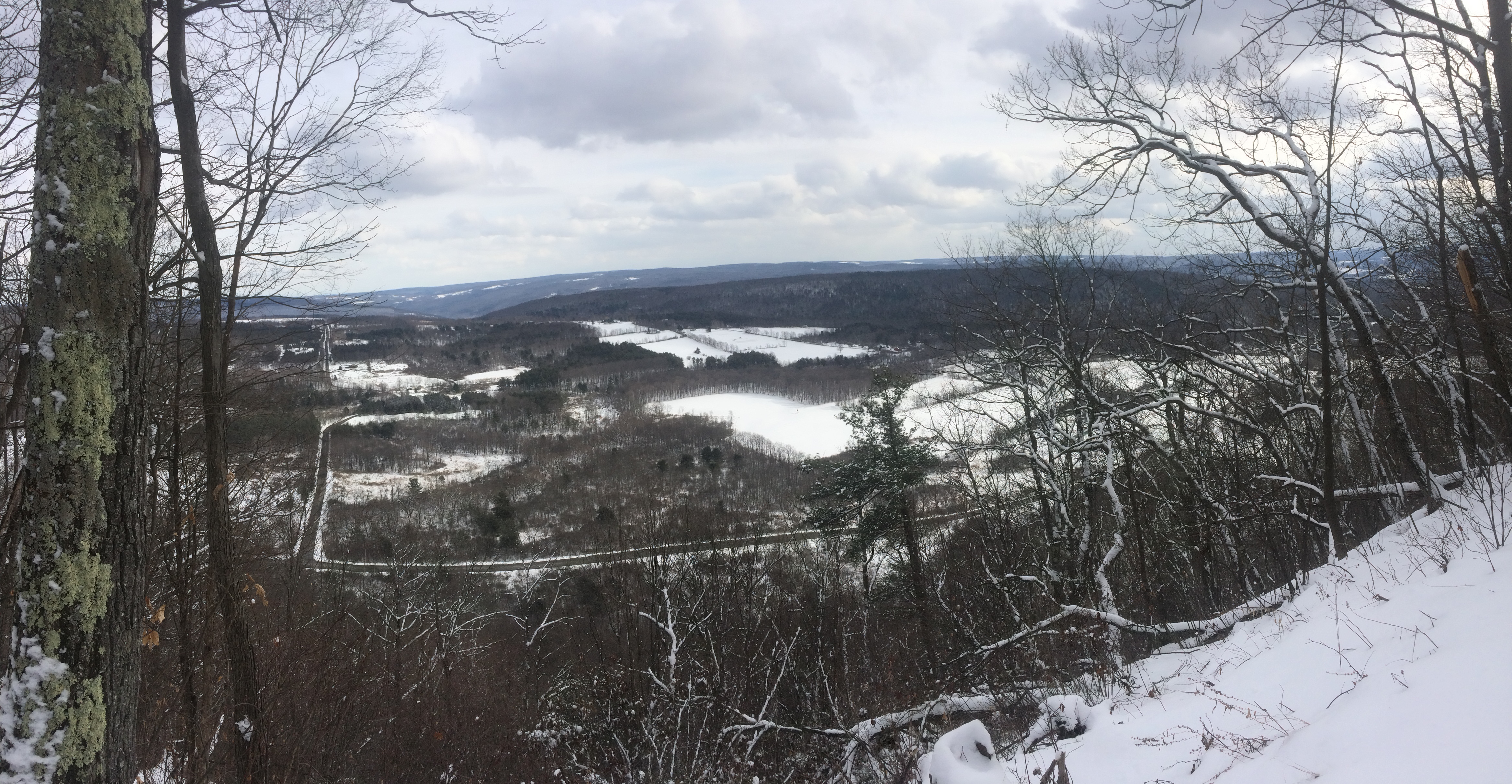
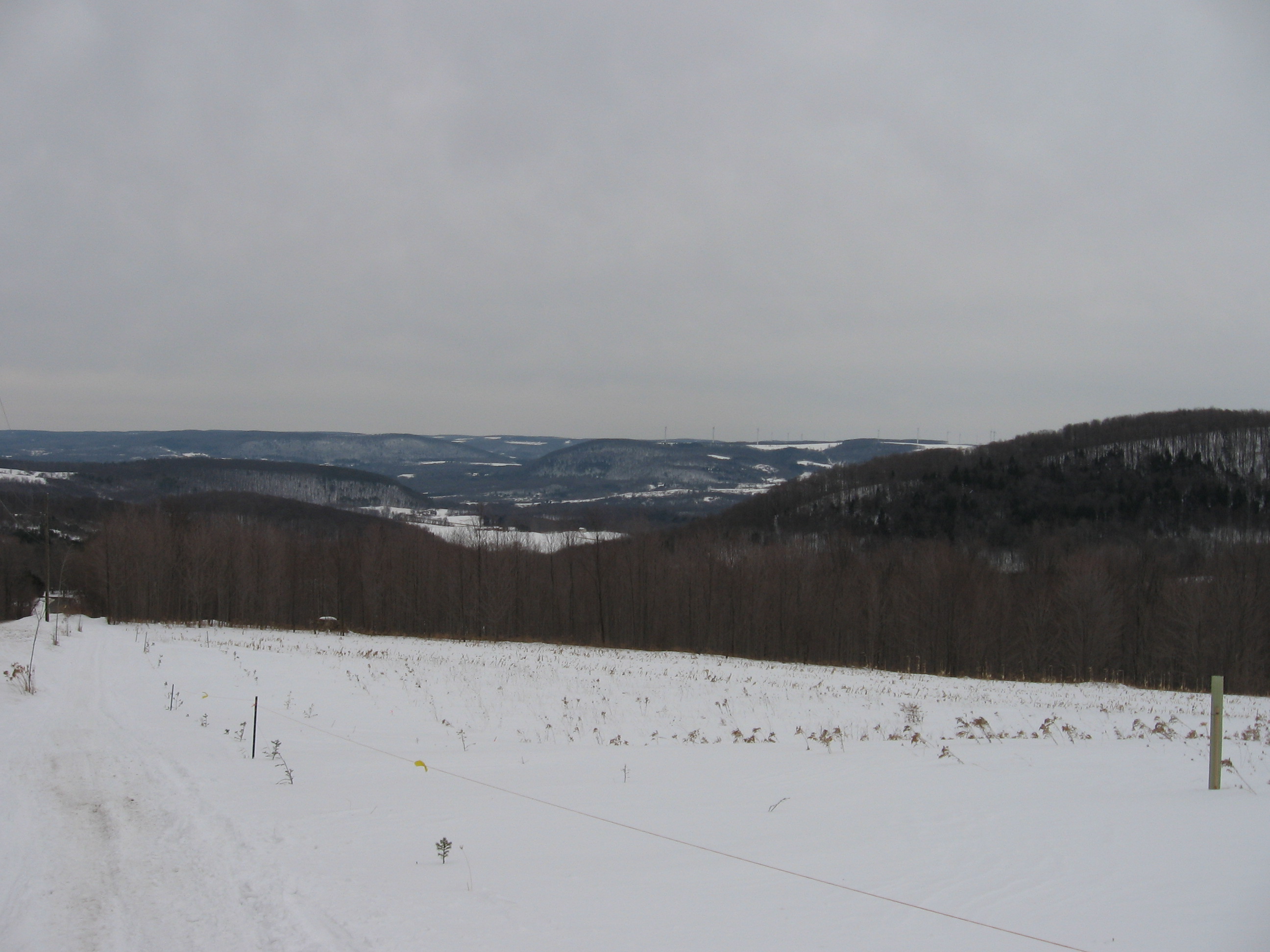
Click on picture for a high resolution panorama view.
This section of the BHB consists of two sections: a road walk from Seman Rd to Clement Rd; and a woods walk up Cleveland Hill through the Camp Warren Cutler boy scout camp and back down to West Hollow Rd (CR 33). The Climbers will hike the entire 4.8 miles from Seman Rd to CR 33. The Tourists will hike 3.1 miles from Clement Rd to CR 33. Meanwhile, the Naturalists will avoid the hill completely, and instead will cross CR 33 and hike a mile into the Beaver Pond before returning to the cars.
All hikers will meet at the Camp Cutler parking area on West Hollow Rd (CR 33), to leave most cars at the end of the hike. The parking lot (42.6862, -77.417) is on the west side of CR 33 about 1.8 miles north of Clement Rd, or 2.3 miles south of CR 34. From the parking lot, the Climbers will carpool to the Seman Rd West Hill Preserve (1.2 miles east of CR 33). The Tourists will carpool to the Clement Rd parking area (0.2 miles west of CR 33). The Naturalists will leave their cars in the parking lot, walk across the road and turn right for 200 feet to and follow the BHB trail to the east.
As you will see when you arrive at this hike, Cleveland Hill is quite high and steep. The climb is 400 vertical feet at each end. Fortunately, the trail has nice long switchbacks, so the slope is reasonable, but continues for nearly a mile. Plan on a steady climb with stops to catch your breath.
From the West Hill Preserve, the Climbers will follow Seman Rd back toward CR 33, then turn right for 0.3 miles, then left on Clement Rd for 0.3 miles. The trail turns off the road a tenth of a mile past the parking area.From here, the Climbers should be able to follow the Tourists footprints.
The Tourists will turn right coming out of the parking lot and walk on the road for a tenth of a mile. Turning right off the road and following the orange blazes, hikers will first pass a boy scout shelter, and then will turn right at the intersection with the white and blue trails. At several points on this hike, different boy scout trails will connect to the BHB trail, but we will stay on the orange trail for the entire route.The trail follows the east side of the hill, with at least one photo opportunity overlooking the West Hollow. A steep hike down will lead to the original parking away on CR 33.
The Naturalists will exit the parking lot and turn right to follow the road for 200 feet, where they will turn left to leave the road and cross the open field. They will follow a relatively flat trail for about an hour to the beaver pond. If time permits, there is a branch trail around the pond that can be explored. After the pond, the Naturalists will retrace their steps to the car.
As always, check the weather and dress appropriately. You will appreciate layers that can come off during the initial climb, and worn again at the top. Snowshoes or other traction devices, and hiking poles, are also recommended. The snow on Thursday was about 6 inches deep, so gaiters or high boots will keep the snow out of your hiking boots.
Following the hikes, please join us at Brew and Brats in South Bristol for food and socializing.
Directions:
From Springwater, (Wayland and Dansville): Take NY 15 South from Springwater to the light in Wayland. Turn left on NY 21 for 11.7 miles through N Cohocton (left turn) and into Naples (left turn at NY 53). Follow Main St for a half mile and turn left onto Vine St (the fourth left). Take an immediate right onto Race St following the sign “To CR 33”. Take the next left onto Cross Rd and then bear to the left onto West Hollow Rd. The parking lot is 4.7 miles ahead on the left.
From Honeoye: Head east on US 20A and turn right onto E. Lake Rd. In 0.6mi turn left onto Egype Valley Rd (CR 33). In 6.9 miles, turn right onto West Hollow Rd (stay on CR 33). The parking area is on the right in 2.3 miles.
From West Lake Rd south of Honeoye Lake: Follow West Lake Rd (CR 36) south, past Hunt Hollow ski area and past French Hill Rd. Turn left onto Gulick Rd. In 2.9 mi, turn right on Clement Rd. In a half mile, you will see the entrance to the BHB trail on the left, followed in a tenth mile, the parking lot also on the left. But keep going to the tee and turn left onto West Hollow Rd. The parking lot is on the left in 1.8 miles.
From Canandaigua: Take NY-21 south to the intersection with NY-64. Turn right onto NY 64 North for 2.3 miles. Turn left onto CR 34, then left onto CR 33 (West Hollow Rd). The parking area is on the right in 2.3 miles.
Directions to social at Brew and Brats:
From end of the hike on CR 33: Head north on CR 33. Turn right onto CR 34, then right onto NY 64. Brew & Brats is on the left behind Arbor Hill.
From W Hill Preserve on Seman Rd: Head east on Seman Rd, through the 4-way stop. Turn left on CR 12 (Naples Rd). In 2.8 mi, turn left on NY 64. Brew & Brats is on the right behind Arbor Hill.
The Feb 18 Hike will take place at Cumming Nature Center in the Bristol Hills. The nature center is an extension of the Rochester Museum and Science Center. This weekend Cumming celebrates Winter with their Nordic Fest on Saturday and Sunday.
There is a fee to access the Nature Center. Fees have been paid so just identify yourself, at the desk, as part of Springwater Trails Hiking Group.
You may want to arrive early to see the exhibits. Varieties of Chili and some baked goods will be available to purchase until 2:30 PM, proceeds benefit the Genesee Valley Ski Patrol.
On Saturday, 17 Feb, there will be a talk by Megan McGrath, adventurer and high-altitude mountaineer. For information about events during the Cumming Nordic Fest go to www.rmsc.org.
Depending on weather conditions cross country skiing and snow-shoeing will be available. (Rentals are available , but best to bring your own equipment). Maps of the various trails will be available. There are trails designated for walking or snow-shoeing only. Many trails are off-limits for hiking as they are groomed for skiing.
We will decide what participants want to do when we get there. The weather will be a big factor.
DIRECTIONS;
From Rochester and points North: Take 390 South to Routes 5 & 20. Proceed east to Rt 15A in Lima. Head South on Rt 15A to Route 20A in Hemlock. Head East on 20A to East Lake Road in Honeoye. Proceed South on East Lake Road to County Road 33 (there are signs pointing the way from the junction of East Lake Road and County Road 33) Turn East on County Road 33 then Southwest on Pinewood Hill Road. This becomes Gulick Road. After 4.7 miles Coming Nature Center entrance will be on the Right.
From Springwater: Go North on Rout 15A to Route 20A in Hemlock. Head East on Route 20A to East Lake Road in Honeoye. Proceed South on East Lake Road to County Road 33 (Signs point the way from the junction of East Lake Road and County Road 33) Turn East on County Road 33, then South East on Pinewood Hill Road. This becomes Gulick Road. After 4.7 miles the Cumming Nature Center entrance will be on the right.
From Wayland, Naples, and points South: Follow NY21 East from Wayland thru N.Cohocton to Naples (11.4 miles) Turn Left onto Clark Street (County Hwy36) heading North (Next to Middletown Tavern)) Take Right on Gulick Road. Follow Gulick Road for 6.6 miles. The Nature Center entrance will be on the Left.
The After Hike Social will be at the Middletown Tavern (1835 Main St, Naples), the intersection of Hwy36 and Rt 21.
Turn Right out of the Nature Center onto Gulick Road. After 7 miles turn Left onto Hwy 36. Follow Hwy 66 until immediately before the intersection of Rt 21. The Tavern is on the Right.
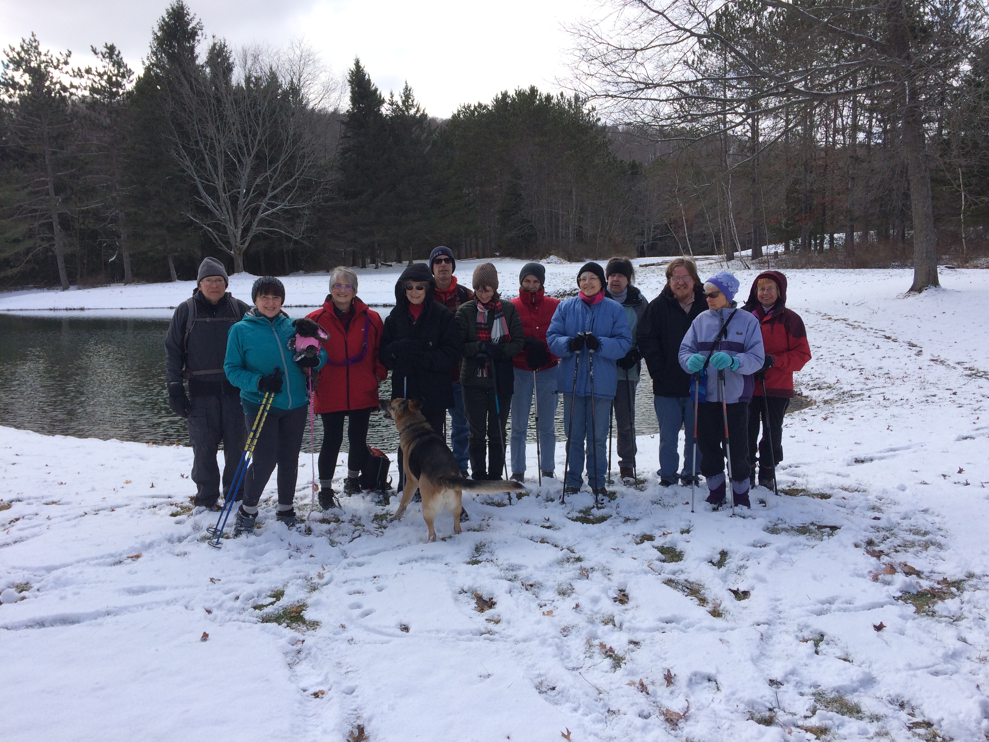
 Come join Springwater Trails hikers on Saturday, February 25 starting at 2 PM. Please plan to arrive at 6840 Liberty Pole Road by a quarter to 2 and park on the loading pad out behind the farm house across from the metal Morton Building. We will convene at the well head. Naturalists will be ferried up to the Swartz Road entrance to the farm to walk on level fields into the Cathedral Pines. Tourists and Climbers will trek up through the woods and split at the top of Tree Lot Z. The Tourists will go to the left (south) and the Climbers will go to the right (north). From there the hike leaders will be leading the two groups on their separate ways.
Hiking the perimeter of the 250 acre farm is 4-5 miles, as it is approximately 1 mile from east to west and 1 mile north to south. The evergreen tree species include Japanese Vietch fir, Grand fir, Douglas-fir, Fraser fir, Concolor fir, Nordmann fir, Korean fir, Turkish fir, Canaan fir, Dawn redwood, Sequoia, Eastern White pine, Southwestern Border pine, Austrian pine, Red pine, Colorado Blue Spruce, Englemann spruce, Norway spruce, White spruce, Western redcedar, Alaska Yellow cedar, and holly.
The social will be at the farm house after the hikes and all are invited to bring a dish-to-pass or to put a $5 bill in the kitty to help offset the cost of the place settings.
Directions: You can find directions here.
SPRINGWATER TRAILS HIKE FOR 2:00 pm (try to arrive at 1:45 PM), March 4th , 2018
LOCATION: Stony Brook State Park Temperature is suppose to be ~ +40 degrees.
HIKE DESCRIPTION: Hikers will split into three groups. Each group will walk at their own pace.
Climbers will start from the southwest (SW trail on map) snowmobile trail off the main parking lot and climb along the western trail working their way up to the upper park and then down to the group camp area continuing along Acomb Drive where they will pick up the SW snowmobile trail (SW trail on map) taking them back down to the lower parking lot to their cars.
The Tourists will car pool to the upper park and walk southward alone the south border of the park for 1/2 mile and then down through the camping area (sites 1-135),cross over to the group camp area continuing along Acomb Drive where they will pick up the SW snowmobile trail (SW trail on map) taking them back down to the lower parking lot. Hikers with cars at the upper park will be shuttled back up to get their cars.
Naturalists: Can walk the the athletic fields and take in a walk along the creek in the lower park.
RECOMMENDATIONS: Dress accordingly, multiple thin layers(synthetic under layer, fleece 2nd layer. light shell 3rd layer; avoid heavy parka’s.
Trails are most likely going to be wet and slippery so poles and traction devices or hiking boots with good tread recommended.
After hike social: Will be the Sunrise Restaurant on the North end of Main St., downtown Dansville.
DIRECTIONS : From Downtown Dansville take RT.36 South for about 4 miles. Turn left into Stony Brook State Park. Drive to the main parking lot where we will divide into our three groups.
NOTICE: Daylight Savings Time starts on Sunday.
This week’s hike was originally scheduled for the Bristol Hills Branch through Hi Tor. This section is 5.6 miles according to the FLT map, which is a bit longer than a standard climbers hike (4 to 4.5 miles), did not seem out of line with other hikes in this series. However, the snow makes a difference. On Wednesday, Linda and I did a pre-hike which took over 5 hours – way too long, even if we started an hour early. So, quick change of plans.
Sunday’s hike will be at 8664 Schribner Rd. There will be three hikes of 1, 2 or 3 miles long. Today (Thursday), the snow is 8 to 10 inches deep with a crust on the top. Snow shoes or cross country skis are highly recommended, although boots will be acceptable once a couple of snowshoes lead the way. Each hike will be adjustable by the hike leader to accommodate conditions. So plan on a two hour winter hike through fields and woods.
The Climbers and Skiers will head across the valley and then go south along the side of the valley. This hike will climb one short but steep climb up from the creek. On the way back, skiers may want to take off their skis since the snow is crusty and heavy and the trail is narrow. We will go down and back up the valley on either side of the old farmer’s fields. The fields are now filled with pines and other trees planted in the 1950’s.
 The Tourists will also cross the valley, but will turn right for a slightly shorter hike. This hike will follow the edge of the hardwood forest that was harvested three years ago. Hikers on the Cleveland Hill section of the BHB last month, may want to compare logging to encourage regeneration of Oak trees on Cleveland Hill, to logging to allow the small Maple trees to thrive.
The Naturalists will stay on the road side of the valley. The hike will only climb about 50 feet across a large field. At the top, be sure to turn around for the best view on the property. On the way back, we will take a quick peak inside the Red Pine woods planted in the 1930’s. You will see a few trees marked for telephone poles, but not worth the effort needed to remove them.
After the hike, please join us for a social at our house. Bring a dish to pass and your own beverage, or contribute $5 to the social fund.
Directions are available here. If you use a GPS, enter “Schribner and Tabors Corners Rd, Wayland NY” and the come up Schribner Rd for 1 mile. Park along the road just past the driveway, or park in the driveway if there is room.
For the fourth year in a row, the staff at Springwater Center has invited Springwater Trails to enjoy a hike on their scenic property overlooking the Springwater Valley. Our thanks to Wayne Coger and Susan McCallum and the entire staff of the center for their welcome.
If the weather forecast holds, expect some wonderful sun and plenty of snow on the ground to enjoy skiing, snowshoeing and hiking. Last year, the upper portion of the trails were perfect for skiing with a couple of short downhills for excitement for everyone.
The many well marked trails that loop through open fields and forested areas are mowed across the fields and were clear last fall through the woods and give opportunities for wonderful views of the surrounding hills and the valley below.  Two of the trails parallel a creek bed and gorge and one loops to another seasonal creek. Keep your eyes open for the Marker Tree near the creek.
Following our hikes, we will set up a pot-luck dinner in the kitchen. Everyone interested in Springwater Trails is welcome to the pot-luck and the Annual Meeting, and to the hike.
Well-mannered dogs are welcome to hike with us. Dogs should stay in cars during the social.
If you are able to join us for the social after the hike, please bring a dish to pass and a non-alcoholic beverage or consider making a cash donation. There is a complete kitchen to store and reheat the dishes as needed. Please bring slippers as shoes will need to be removed at the door.
Directions
From Springwater: Take Rt 15 to the West from the flashing light at the intersection with Rt 15A. Follow Rt 15 up the hill. Turn right at the top of the hill on Mill St Ext (just across the road from Harpers Ferry Rd) – you will see a Dead End sign. Springwater Center is the third driveway to the left (0.1 mile along Mill St. Ext., you will see the sign). Follow the driveway for 0.6 miles to reach the Center parking lot. The main building is just past the parking lot.
Additional directions to the Center are here.
NOTE CHANGE IN HIKE STARTING TIME
 Have you been enjoying the aroma of boiling maple sap in the air? We’re going to enjoy this year’s Palm Sunday with a lunch of pancakes with this year’s maple syrup, followed by a revisit to a hike which our group did back in 2016. The pancake lunch will be today’s social.
We will meet at Wohlschlegel’s Maple Farm, near the east end of Coates Rd., west of Naples. For $7.00, you can get all the pancakes you can eat, 2 sausages and beverage. Their pancake kitchen opens at 8 AM but closes at 1 PM so, you will need to get there by 12:30 to enjoy your meal. If there’s time after your meal, you can enjoy tours of their farm as well as samples of some of their maple products. For more information on Wohlschlegel’s Naples Maple Farm you can check out their website at: http://www.fingerlakesbulkmaplesyrup.com/
 Because you have to get there by 12:30 for your pancake lunch, we’re going to start our hike today at 1:30. We will have our usual 3 hiking groups, starting on the snowmobile trail on their farm. Mark will lead the climbers, possibly to the late Chuck Winship’s Sugarbush Hollow. John has agreed to lead the tourists, Wendy will lead the naturalists.
There will be no hike next week so, enjoy your Easter. See you in 2 weeks.
Directions:
Wohlschlegel’s Maple Farm, 8064 Coates Rd. Naples. From Wayland. Go east on SR 21. Left on to CR 38. At the end, go left at the T. Left on Coates Rd. Farm is on the left, about 1/2 mile. Look for the bright purple roof. There are also signs on the road to help you. Don’t attempt to enter Coates Rd. from Pardee Hollow, as it may not be plowed and is a rough seasonal road at that end.
Looking for brochure.or mailing list so I can receive it in the mail.
Nothing opens up for mailing list.
There’s all kinds of very bizarre ads and post for viagra and other drugs above on calender page.
Please let me know if there’s a brochure available