
Hikes led by Springwater Trails are generally held on Sunday afternoons and appear in this calendar in green.
| Sun | Mon | Tue | Wed | Thu | Fri | Sat |
|---|---|---|---|---|---|---|
| Lehigh Valley Trail Hike or Bike in Rush, NY 2:00 pm Lehigh Valley Trail Hike or Bike in Rush, NY @ Stevens-Connor Lehigh Valley Lodge Apr 6 @ 2:00 pm – 4:00 pm Come join us for a leisurely hike or bike along the Lehigh Valley Trail on Sunday April 6th! With its flat even surface, the trail is a hidden gem for walking, hiking, jogging, biking. It is a vital link in … Continue reading | ||||||
| Ontario County Park at Gannett Hill Hike-Naples 2:00 pm Ontario County Park at Gannett Hill Hike-Naples Apr 13 @ 2:00 pm – 4:00 pm  Save the date! This is one of our group favorite hikes. Ontario County Park at Gannett Hill is one of the highest points in Ontario County and located in the scenic Bristol Hills. At an elevation of 2,256 feet above … Continue reading | ||||||
| No Hike-Easter Break 2:00 pm No Hike-Easter Break Apr 20 @ 2:00 pm – 4:00 pm No hike has been scheduled for this date due to the Easter Holiday. Enjoy the break, spend time with loved ones and eat chocolate bunnies. This will give you something to burn off next week  | ||||||
| Mystery Hike- Richmond/Honeoye 2:00 pm Mystery Hike- Richmond/Honeoye Apr 27 @ 2:00 pm – 4:00 pm Mystery hike coming your way! Please check back for more details. |
This event has been postponed again. We are still trying to line up the equipment listed below. Please stay tuned.
During our April 2 hike down Marrowback Rd, the many tires in the gullies below the road became a topic of conversation and concern. In addition to being an eye-sore, discarded tires are a convenient breeding site for mosquitos and can be a fire hazard.
Since that hike, we have talked with two major landowners and to the Town of Springwater about working to remove these tires and move them to a more appropriate place.
Our first day to work on this project will be May 23 at 10:00. Please come as we develop methods for pulling the tires up to the road and transporting them to the Town highway barn for disposal.
What to bring:
- Good work gloves.
- Good hiking boots. If desired, traction devices to help climbing up to the road.
- Rope to loop around tires.
- Clothes that can get dirty while working around heavy, wet tires.
In addition to helping with your energy and your muscles, you may want to lend your farm equipment. We need the following equipment:
- Power winches to pull the tires up the bank. If you have a vehicle with a power winch, we think that would be a great help in this project.
- Trailers to transport the tires.
- Trucks to pull the trailers. We will try to move the tires to the town Highway barn so the town Highway department can schedule disposal.
- Ropes to help handling the tires and the winches.
If you can volunteer any of this equipment, please leave a comment in the Tire Forum or contact John at vp@springwatertrails.org.
One final comment. A $2.50 fee has been collected since 2003 on every tire sold in New York State. In addition, any Tire Service company is required to accept, on a one-for-one basis old tires for recycling when new tires are sold. As a result, you have already paid for the disposal of your old tires and you should be returning them when you purchase new tires. Please remember, you do not need to dump your old tires into our forests.
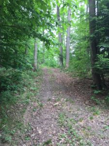
The scenic Robinson Loops Trail awaits us this week. This area is a privately owned wildlife sanctuary and is connected to the Finger Lakes Trail. Prepare to be dazzled by ravines, streams, young forests, old growth trees, and panoramic views from open fields. Our meeting place will be at the parking area at the end of Mill St. in Swain NY. Please follow this link for information and a map of the area http://cnyhikig.com/FLT-RobinsonLoopTrails.htm .
For those of you who would like to carpool, please meet at the Springwater Town Hall at 1:00 PM on Sunday.
As usual, We will divide into three groups. Volunteers are needed to lead the Tourist and Naturalist groups.
Naturalists will enjoy a leisurely stroll along Caneseraga Creek on the Main Trail and the Yellow Loop. There should be some wildldflowers and various trees to identify. The rock ledges are quite extraordinary. It is a pleasant jaunt of 2.3 miles.
Tourists will be taking the “high road”, climbing gradually up the Blue Loop to the open fields that offer lovely views of the area. The elevation gain on this hike is 504 feet. Total mileage is 3.4.
Climbers will head for the woods on the Orange Loop, exploring a stream and ravine, looking for some old growth trees. If time permits they can take in some of the views from the Blue Loop. The trail is steep in places, with an elevation gain of 539 ft. Total miles about 4.5.
Directions: From Springwater, follow Rte 15 South to Wayland, then Rte 63 South to Dansville. Pick up Rte. 36 South in Dansville and follow to Junction of Rte 70. Turn right on 70, travel through Canaseraga, until left turn into Swain.
After Hike Social will be at the Sierra Inn in Swain.
Annually, one of two big shindigs (of a hiking variety) that Victor Hiking Trails (VHT) sponsors, is National Trails Day (NTD) observed the first Saturday of June. In 2017, the 25th year for this event in Victor, the date is June 3rd and the starting location is at Ganondagan State Historic Site Visitor’s Center located at 7000 Boughton Hill Road (County Road 41) .
VHT is of course one of many hiking groups that plans some organized observance on NTD. Yep, that word “national” does in fact imply many groups across the USA observe or celebrate NTD in some manner. Now, before I describe more about NTD activities, you were wondering what the other big shindig that VHT has annually. Weren’t You? Answer: the second big shindig VHT does is the VHT “Challenge Hike” usually held in late September.
NTD in Victor with VHT is usually three serial hikes, with a break in between each of the three hikes for rest and refreshment. The first hike is a morning hike and the last hike finishes in the afternoon.
You can read about National Trails Day from 2017 in the the VHT newsletter The Pathfinder Spring 2017 edition (volume 22, issue 1, page 1). And of course, you can check the VHT website for updated details about the NTD hike for June 3rd, 2017.
If you’re Interested in past years NTD in Victor, …two most recent years are cited: National Trails Day from 2016 in the VHT newsletter The Pathfinder 2016 Spring edition , and from 2015 The Pathfinder Spring 2015 edition (volume 20, issue 1, page 6).
Today’s hike is canceled.
Thunderstorms are predicted from 11 to 8 this afternoon. The Springwater Community Day is postponed and hiking during a thunderstorm is not recommended. Enjoy your indoor activities and join us next Sunday at Pat and Tony’s for a Conesus Lake Inlet hike.
The 20th Annual ADK-GVC Outdoor Expo will be held on Saturday, June 10th 2017 at the Beach area of Hundred Acre Pond in Mendon Ponds County Park off Douglas Road. Outdoor activities and learning abound at this free event, 9:30AM-3:30PM.
Presentations and interactive events are mostly centered around the beach area and contiguous areas of the adjacent parking lot.
Here is a hyperlink to ADK Outdoor Expo. http://www.gvc-adk.org/expo
And here is a hyperlink to an article about the 2015 Outdoor Expo, included for reference of the myriad type activities.
Genesee Valley Greenway State Park (GVGSP) Passport Hike Series–Brook Road to Morgan Road–Wegmans Hike #3
Saturday, June 10, 2017 at 10:00 AM
Brookdale Preserve, on Brook Road, Scottsville, NY
The GPS Coordinates: N43 04.577 W77 42.550
Meet at the Brook Rd Genesee Valley Greenway (GVG) Parking area.
The hike will be going southward from the Brook Road parking lot along the eastern edge of Brookdale Preserve. We will see remnants of the Genesee Valley Canal and the well preserved Lock #2.
The hike leader is Elijah Kruger from the educational staff of Letchworth State Park. The hike distance is 4.3 miles round trip. The Genesee Valley Greenway State Park is hosting this hike. There is no charge to attend this hike. Therefore, please consider joining us.
For more information, check the Friends of the Genesee Valley Greenway (FOGVG) website, their Passport page, and the complete 2017 GVG Passport Series.
– – – Additionally, the Genesee Valley Greenway State Park (GVGSP) Facebook page usually lists the upcoming GVGSP events, and the FOGVG Facebook page also lists numerous GVG events in our area albeit a greater proportion of events listed on this page may at times be in the “Southern Tier” portion of the GVG as planned by a group of hikers known as the Southern Tier Greenway Hiking Group (STGH or STGHG) who welcomes all to hike with them.
– – – We also have a short history of the Greenway.
NOTE: This hike will start at 2:00PM (Please meet at 1:45 to allow for car-pooling).
The Conesus Lake Inlet is an 1100 acre Wildlife Management Area (WMA).
On June 11th we will walk 2 or 3 areas in this WMA.
We will meet, prior to the hike, at 7980 State Route 256, Dansville NY (approx. half-way between Dansville and Scottsburg)
The trails are not maintained on a regular basis so some bush-whacking may be necessary. Because of the rainy weather the ground may be soggy. Recommend long pants and stout footwear. This is a good opportunity to see some nice ponds and possibly some wild life
Meet a Pat and Tony’s at 1:45 to get organized. Some of the parking areas are small so maybe we can cram into 4 or 5 vehicles.
After the hike all are welcome to meet at Pat & Tony’s for a social. Bring a dish to pass. Tony will attempt to cook some Zweiglers.
Directions
From Springwater: Turn (left 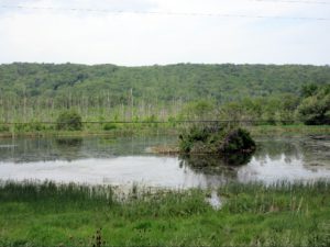 or Right) at light onto Springwater Hill (Rt 15), In 1.5 miles turn left onto Liberty Pole Road (CR 38) In 3.6 miles turn left onto Stage Coach Road (Rt 255) in 1.8 miles turn right onto Rt 256 (W Swamp Rd) in .3 miles you will arrive at Pat & Tony’s at 7980 State Route 256. (The last intersection prior to this location is Powell Road, on the left, we are in the blue house (sits back) on the left side after Powell Road. If you reach Springwater Road (CR1) you’ve gone too far
From Wayland: Start point Mobil/7-eleven on corner. Head west on Rt 63, (past the High School), go down Wayland Hill to Main St, Dansville, turn right on Perine Street and Perine street will turn into Route 256, proceed approx. 4.8 miles to 7980 State Rt 256 on left.
Will put a flag near diveway
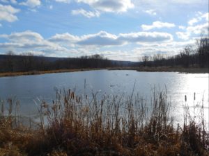
 This Sunday is our first 4:00 hike of the summer season. Please plan to arrive shortly before 4:00 PM on Sunday, June 18.
Our hike this Sunday will explore the fields and woods along the Cohocton River in Atlanta, NY (not GA, but NY). The hike will be through rolling hills and along farm roads and through forests. We will walk along the Cohocton River, so bring your fishing gear if you would like to catch some trout. Hikes for Climbers and Naturalists will be available.
 We will meet on a field road off of Rt 21. Watch for the Springwater Trails sign on Rt 21 and follow the road back to a parking area near the pond. Following the hike, join us for a “dish to pass” social with hamburgers and hotdogs on Cheryl’s grill. Bring a dish to pass and your own beverage, or make a small ($5) contribution to the social fund.
Directions:
From Wayland, Springwater and Dansville: From the traffic light in Wayland on Rt 15, follow NY 21N east toward N. Cohocton and Naples. In 3 miles you will pass over the Cohocton Creek at Bowles Corners. Continue for another half mile. The driveway will be on the right just before you pass the “School Bus Stop Ahead” sign. Look for the Springwater Trails sign. Continue for about 400 ft (0.1mi) down the farm road to park near the pond.
From Naples, Honeoye and N Cohocton: Take NY 21S from Naples. Turn right to stay on NY 21S through N. Cohocton. In 3.3 miles, the driveway will be on your left, just before the guardrails. Look for the Springwater Trails sign. Continue for about 400 ft (0.1mi) down the farm road to park near the pond.
This public hearing has been rescheduled for June 19.
The Spirngwater Town Board will hold a Public Hearing for the adoption of its first Comprehensive Plan.
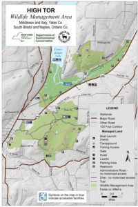
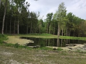
This Sunday we will hike the maintenance trails in High Tor WMA off Bassett and Brink Hill Rds. Naples.
The footing is easy, along dirt tracks with grass that has recently been rough mown. There are a few slow rise hills. We will pass 4 ponds along the way where ducks and turtles have been spotted.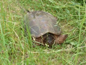
Let’s all meet at the Bassett Rd parking area at 3:45pm to leave a few cars. The remaining cars will then proceed to Brink Hill Rd maintenance trail parking lot.
Please remember to spray for ticks.
CLIMBERS will leave from Brink Hill Rd, staying right at the V, turning left at the intersection of the main trail then take the sharp left maintenance road to return to Brink Hill. Maps will be available. This route will probably exceed the 2 hours unless Char is setting the pace:~).
TOURISTS will also leave Brink Hill, stay right at the V, past the ponds to the main intersection. Time permitting, we will visit the Canandaigua Lake overlook, backtrack, then finish the hike along the maintenance road to Bassett parking.
NATURALISTS, should we have at least 2, will walk in from Brink parking, visit the ponds and retrace their steps back to the parking area.
The SOCIAL will be at Amy’s. Directions given at hike. Please bring a dish to pass or plan to make a donation. Meat will be provided. BYO drink. If you would like to drop your dish off prior to the hike, please let Amy know via the website’s contact address or directly, if you have her info.
DIRECTIONS: From Naples, take Main St south up Route# 53. Turn left on Italy Valley. Turn left on Bassett Rd at the curve. The parking area will be just after the first Bassett curve.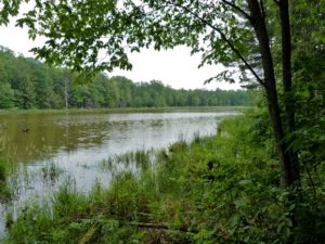
Looking for brochure.or mailing list so I can receive it in the mail.
Nothing opens up for mailing list.
There’s all kinds of very bizarre ads and post for viagra and other drugs above on calender page.
Please let me know if there’s a brochure available