
Hikes led by Springwater Trails are generally held on Sunday afternoons and appear in this calendar in green.
| Sun | Mon | Tue | Wed | Thu | Fri | Sat |
|---|---|---|---|---|---|---|
| Lehigh Valley Trail Hike or Bike in Rush, NY 2:00 pm Lehigh Valley Trail Hike or Bike in Rush, NY @ Stevens-Connor Lehigh Valley Lodge Apr 6 @ 2:00 pm – 4:00 pm Come join us for a leisurely hike or bike along the Lehigh Valley Trail on Sunday April 6th! With its flat even surface, the trail is a hidden gem for walking, hiking, jogging, biking. It is a vital link in … Continue reading | ||||||
| Ontario County Park at Gannett Hill Hike-Naples 2:00 pm Ontario County Park at Gannett Hill Hike-Naples @ Lookout Parking area Apr 13 @ 2:00 pm – 4:00 pm  This is one of our group’s favorite hikes! Ontario County Park at Gannett Hill is one of the highest points in Ontario County and located in the scenic Bristol Hills. At an elevation of 2,256 feet above sea level, you’ll … Continue reading | ||||||
| No Hike-Easter Break 2:00 pm No Hike-Easter Break Apr 20 @ 2:00 pm – 4:00 pm No hike has been scheduled for this date due to the Easter Holiday. Enjoy the break, spend time with loved ones and eat chocolate bunnies. This will give you something to burn off next week  | ||||||
| Hike Rob’s Trail – Hemlock Lake side 2:00 pm Hike Rob’s Trail – Hemlock Lake side Apr 27 @ 2:00 pm – 4:00 pm Join us on Sunday April 27th to hike the west side of Rob’s Trail, the DEC/Nature Conservancy property in the northeast corner of Hemlock Lake! Options are to hike out and back to the south along the trail from the … Continue reading |
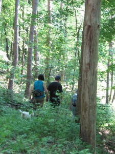 On Sunday, Springwater Trails will be back to Wheaton Hill trails. This week we will focus on mowing the trails and do some work on the roses again.
Following our hard work, come for a picnic social at Schribner Rd. The social is hosted by Springwater Trails, Inc. We will provide hot dogs and burgers grilled on a charcoal grill and salads. You may want to bring something to drink.
The primary need is to mow the trails. We will have a small mower for the parking/picnic area, but the trails will be best done with weed wackers. If you aren’t mowing. We will have a small saw for logs across the trail. There is also one large leaner across the trail which we will not try to remove.
And, clippers for the roses will be useful on all of the trails. You may find some that need trimming before they get out into the trail, or you may choose to attack a large bush at the side of the trail. Clippers and gloves are very important for this work – if you always keep the bush away from your arms and legs, you can avoid scratches, and more importantly, poison ivy which seems to like the roses. Plan to wash your cloves and any other clothes that may have touched the poison ivy.
Directions: Wheaton Hill is the first right turn north of the intersection of Rt 15 and Rt 15A in Springwater (0.9 mile north of the intersection). The trail head is 0.5 miles up Wheaton Hill just before the road turns straight east and heads up the main hill. More details are on the directions page.
What to bring:
- Bring a weed wacker if you can. We could have one on each of the four trails.
- Gloves and clippers – hand clippers or long handled loppers if you want to attack a large rose bush.
- Small bow saw.
- Plastic grocery bag in case you find any litter.
- Water to keep hydrated.
Many trolley companies across the country once created popular amusement parks and picnic grounds. The New York Museum of Transportation recreates an evening at an old-time “trolley park” with the happy sound of the calliope providing the background for authentic trolley rides through the rolling hills. SPECIAL HOURS 4:00 p.m. – dusk
The New York Museum of Transportation is open year ’round, Sundays only, from 11 a.m. to 5 p.m. Group visits on weekdays can be made by appointment. Train rides are offered on the only electric trolley operation in New York State. In the museum a variety of trolleys, a steam locomotive, and road vehicles on display provide a unique hands-on learning experience for all ages. A large model railroad, gallery, and gift shop are also featured. The museum is located at 6393 East River Road, W. Henrietta, NY. For details: (585) 533-1113 or info@nymtmuseum.org.
 UPDATE 8/14/16 11:00 AM Conditions have changed on the river since we did the pre-paddle last Tuesday – the water level is several feet higher and there is a stronger current. Therefore, this trip is now only for people with river paddling experince. Because the water level may continue to rise over the day, we will re-evaluate conditions at 3PM in Mount Morris. The Greenway hike is planned to go on as scheduled.
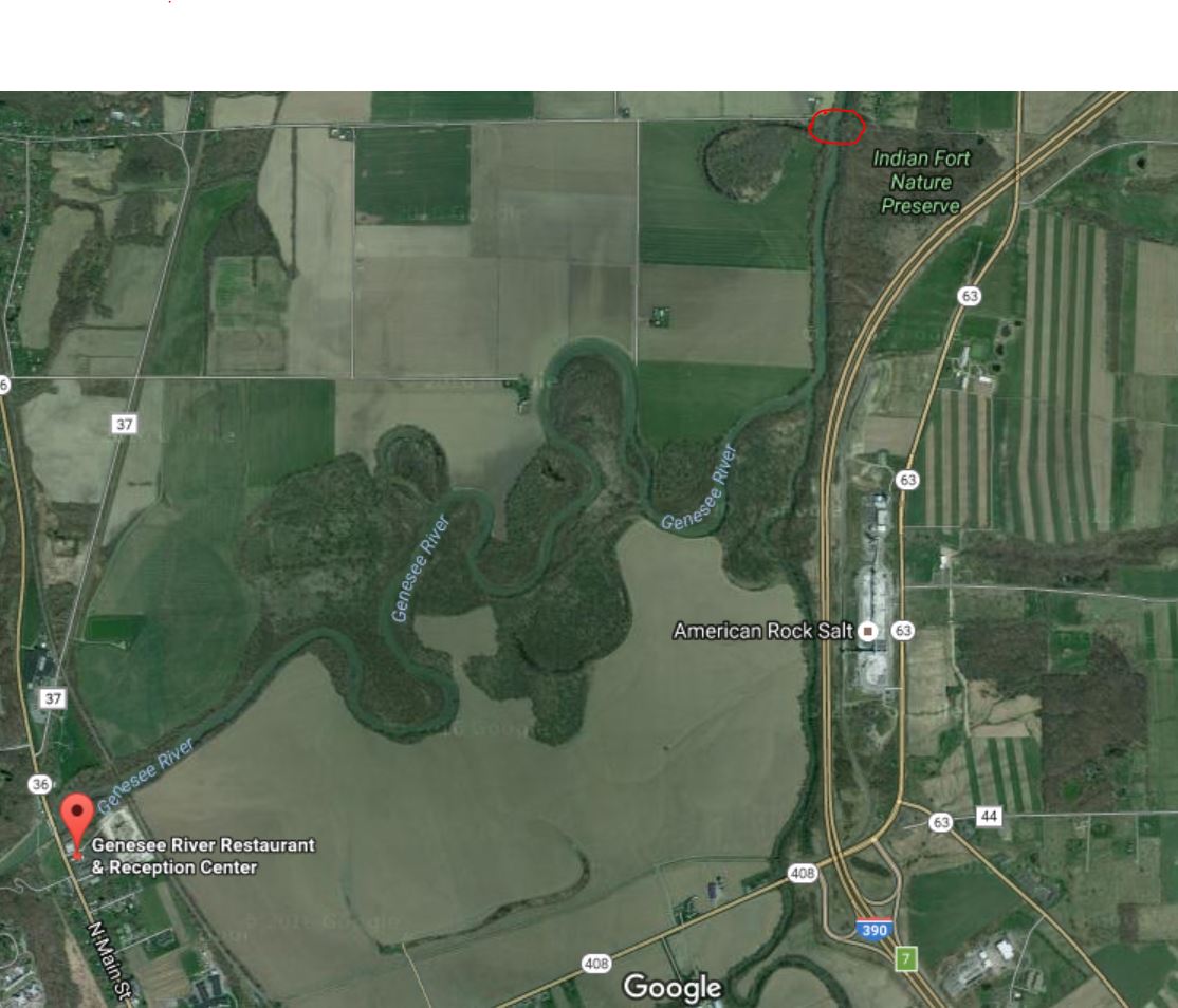
This Sunday people will have the choice of paddling north on the Genesee River from Mount Morris to the Genesee Valley Conservancy’s Indian Fort property or hiking a section of the Genesee Valley Greenway near Mount Morris. For those paddling, this is a pretty section of the river with mostly wooded riverbanks. For those hiking, it looks like the Greenway has been mowed and is in good shape.
Paddlers should bring their boats to the parking lot behind the Genesee Valley Restaurant and Reception Center (on the east side of Route 36 and just south of the river) at 3PM to unload and prepare to shuttle vehicles to the take out. The put in and take out both have fairly steep (but short) dirt paths with some poison ivy. The water level is low with a slow current which makes for relaxed paddling. However, in some areas boats will most likely be scraping bottom and people will need to get out to float them through shallow sections. Each person should have a PFD, water shoes, a whistle, drinking water and a snack.
Hikers should meet at 4PM at the Genesee Valley Greenway’s parking area on the west side of Route 36 and just north of the river. There is a map of the Greenway in the kiosk which will help people decide whether they would like to go north or south on the trail. People should plan on hiking for an hour or so and retracing their steps back to the parking area. Each person should have a hat, sturdy shoes, drinking water and a snack. (Greenway maps can also be Googled online).
For those who would like to get something to eat and drink before heading home, we will meet at Charred American Grill & Bar at 36 Main Street in Mount Morris.
Directions:
From Springwater: Head west on NY 15N for 1.5 miles. Turn left on Liberty Pole Rd and continue west for 8.1 mi. Turn right on NY 63N for 6.4 mi. Turn left on NY 408S for 2.2 mi into Mt Morris. Turn right on NY 36N/Main St for 1 mi. The parking area for Kayakers is on the right just before the Genesee River behind the Genesee Valley Restaurant and Reception Center. The parking area for Hikers is on the left just past the Genesee River.
From Wayland and east: Head west on Interstate 390N through Dansville. Take Exit 6, NY 36. Turn left onto NY 36 for 5.2 miles, through Mt Morris. The parking area for Kayakers is on the right just before the Genesee River behind the Genesee Valley Restaurant and Reception Center. The parking area for Hikers is on the left just past the Genesee River.
From Rochester: Take Interstate 390S to Exit 7, NY 408/ Mt Morris. Turn right onto NY 408S for 1.9 mi into Mt Morris. Turn right on NY 36N/Main St for 1 mi. The parking area for Kayakers is on the right just before the Genesee River behind the Genesee Valley Restaurant and Reception Center. The parking area for Hikers is on the left just past the Genesee River.
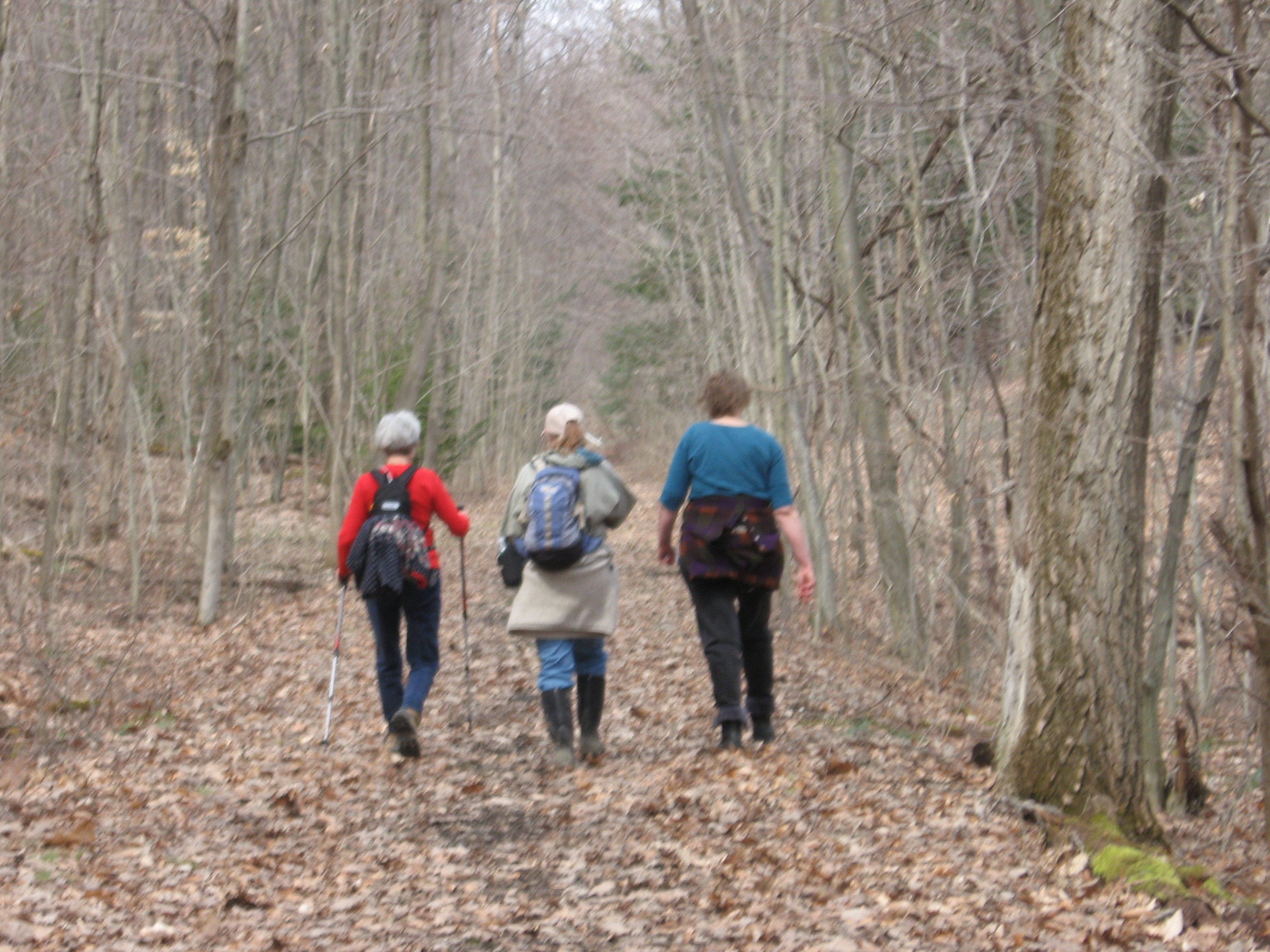
This Sunday, our Bicentennial Hike will follow a section of the old Erie Railroad. This section has been very well maintained by the many private landowners and runs along the west hillside overlooking Lawrence Gull and the Springwater valley. Springwater Trails Hiking Group would like to thank the many private landowners that allow us to hike on their properties.
We will start the hike off Becker Road where the Erie Railroad once crossed and walk the railroad bed for about two miles to the north. There are some side trails heading up the hill toward Harpers Ferry Rd. The Climbers will venture off on some of the side trails where permitted returning back down to the railroad bed to continue on north.
At about 3:15, all groups will turn around and follow the railroad bed back to Becker Rd. The Naturalists will have the option to exit the railroad via a private trail down into Lawrence gull where a vehicle will be parked to shuttle them back to the start of the hike.
 The after hike holiday social will be held at Sammy’s Place on Rt 15 about half a mile south of the light in Springwater.
DIRECTIONS :
From The village of Springwater, head South on Route 15 toward Wayland. At the top of Springwater hill turn right onto Becker Road. Drive about 2 miles (past Lawrence Gull Rd). We will meet at Pokey Moonshine Rd to start the hike.
From Dansville, head east on Route 63 toward Wayland. About 1 mile from Wayland, turn left onto Buffalo Street. Drive for about 2 miles, to a spot just past Pokey Moonshine Rd where the hike will start.
From Naples: take Route 21 to Wayland and continue West on Route 63 for 1.5 miles. Turn right onto Buffalo Street. Drive 2 miles, to a spot just past Pokey Moonshine Rd where the hike will start.
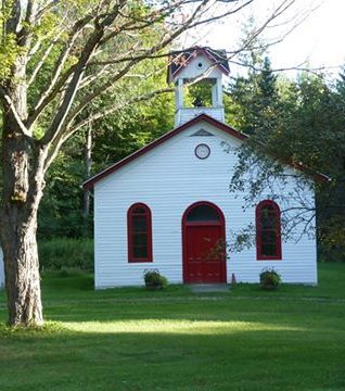
It is time for some trail maintenance on the Springwater Trail at Punky Hollow and Sugarbush Hollow in preparation for the Music Fair on September 17th and 18th.

The Crawdiddies Band will be at the 2016 Bicentennial Edition of the Springwater Music Fair and American Crafts Show
We will meet on Pardee Hollow Rd near the intersection with Tabors Corners. Our task today will be to clean up the Springwater Trail between the Punky Hollow entrance east of the school house, to Sugarbush Hollow and Tabors Corners. Bring loppers or clippers for cleanup and a weed whacker if you can. Other tools will be available as needed.
We will split into up to four groups depending on attendance. Each group will car pool to a different entrance to the trail, allowing us to cover the entire trail.
The Naturalists will drive to the entrance on the other side of the school house and will hike through Punky Hollow and Sugarbush Hollow and exit at Tabors Corners. This is primarily a cleanup task, trying to remove sticks and stones from the trail. At the midpoint there are some rose bushes to push back from the edge of the trail while they are small. We hope to have a car at the exit for this group to use to get back to the start point. In addition, a few branches encroaching across the trail will need trimming. No weed wacker is needed with this group.
The Tourists will drive to the top of Coates Road and will hike down to Pardee Hollow. Weed whacking and trimming as needed. Blazing signs at some corners are probably needed.
One Climbers Group will drive to the trail intersection with Pardee Hollow Rd below Sugarbush Hollow. They will head west up the hill across from the Sugar House. The will refresh the blazes and will weed whack. At least one weed whacker should get to the tree plantation near the top of the hill and focus on the large task of mowing a trail across that mostly open field. This group may either return to the cars below the Sugar House, or continue hiking out to the trail head near the School House.
Our second Climbers Group will drive to the trail head on Tabors Corners. They will walk from there to the Sugarbush and do a clean up on the west side of the hill. Blaze signs will be used to refresh the blazes heading up the hill. In addition, weed whacking up the orange trail will be done as time permits. If time remains, week whackers should continue across the field at the top and join the first group cleaning the trail through the tree plantation.
Please join us following the work for a dish-to-pass social at the Punky Hollow Barn. Please bring a dish to pass or make a small contribution to the social fund. Bring your own beverage.
From Springwater: go North on 15A for 0.8mi from the light. Turn right on Wheaton Hill Rd. At the tee, at the top of the hill, turn right onto Wetmore Rd. Bear right on Tabors Corner Rd. After 1.8 miles, turn left on Pardee Hollow Rd. Park on the right at the end of the barn farthest from Tabors Corners.
From Wayland: take Rt 21N for 3 miles. Turn left on Steuben Co Rd 37 (Tabors Corners Rd) at the Bowles Corners sign. Take the second right (3.6 miles) onto Pardee Hollow Rd. Park on the right.
From Honeoye: take W Lake Rd south. Turn right onto French Hill Rd. At the tee (at Dug Rd) turn right to stay on French Hill Rd. Take the first left on Garlinghouse/Atlanta Rd. Go Right on Pardee Hollow Rd and continue for 3.8 miles. Turn right to stay on Pardee Hollow Rd for 0.3 miles. Park on the left.
This Sunday people will have the choice of biking the Keuka Lake Outlet Trail or hiking a section of it. The trail follows Keuka Lake’s outlet to Seneca Lake, starts in Penn Yan and goes 7.5 miles to Dresden dropping 275′ along the way. Everyone should plan to meet at the Cherry Street Access in Penn Yan.
This trail is in a pretty wooded ravine, it was “formerly a canal towpath and later a rail road bed, it crosses the original Pre-Emption Line and passes near the area of the first permanent white settlement of ‘The Universal Friend Jemima Wilkinson’, along waterfalls and ruins of mills, factories and canal locks”. http://keukaoutlettrail.org/index.
Bikers will go out and back approximately 14 miles. Because the trail is a combination of dirt, gravel and asphalt and somewhat uneven, hybrid bikes or bikes with fatter tires are best suited for this trail. Please let the Hike Coordinator know ahead of time if you plan to bike.
After meeting at the Cherry Street Access, hikers will spot a few cars at the Visitor Center Access on Outlet Road, return to the Cherry Street Access and hike to the cars – (approximately 3.7 miles – mostly downhill).
For those who would like to get something to eat and drink before heading home, we will choose a local restaurant to stop at.
A car pool will leave from the Springwater Town Hall at 1:00PM.
Directions:
Directions to the Town Hall for car pooling are available here. Be sure to bring directions to the Access Point in case you need to drive.
Directions to Cherry Street Access:
From Springwater, Wayland and Naples: Head south from Springwater on NY-15S to Wayland, then turn left on NY-21. Follow NY-21 for 12.7 miles through N Cohocton and Naples. Turn right on NY 245N across from Bob & Ruth’s. Follow NY-245 for 8.9 miles to Middlesex and take a slight right turn onto NY 364E. In Penn Yan, turn right onto Liberty St for 0.7mi, then left on Elm St for 0.5 mi. Take a sharp right turn onto Seneca St (Seneca becomes Walnut St to the left of Elm St). Take the first left onto Cherry St. The parking area is on the right at the first Cherry St curve.
From Honeoye: Take W Lake Rd (CR 36) south to Main St in Naples. Turn left on NY 21 (Main St) for 1.2 miles. Turn right on NY 245N across from Bob & Ruth’s. Follow NY-245 for 8.9 miles to Middlesex and take a slight right turn onto NY 364E. In Penn Yan, turn right onto Liberty St for 0.7mi, then left on Elm St for 0.5 mi. Take a sharp right turn onto Seneca St (Seneca becomes Walnut St to the left of Elm St). Take the first left onto Cherry St. The parking area is on the right at the first Cherry St curve. (Note: your GPS may take you through Canandaigua or South Bristol. Both routes are fine.)
Come to a Celebration of Little Lakes History, providing a unique opportunity to explore the rich, local history of Hemlock, Canadice, Conesus and Honeoye Lakes and the communities of Hemlock, Canadice, Conesus, Richmond and Springwater. This event is free and open to the public.
At 2:00, visitors can explore each town’s history in the various “town rooms”. Local historians will be available to answer questions.
At 3:00, the keynote speaker – Lima Historian Doug Morgan – will present an entertaining and informative show highlighting the “glorious past of Hemlock and Canadice Lakes” in the Center’s gymnasium.
Starting at 12:30, prior to the event, a chicken BBQ with all the fixings will be available outside the Center, We hope you chicken fans have your tickets, because the BBQ is SOLD OUT!!
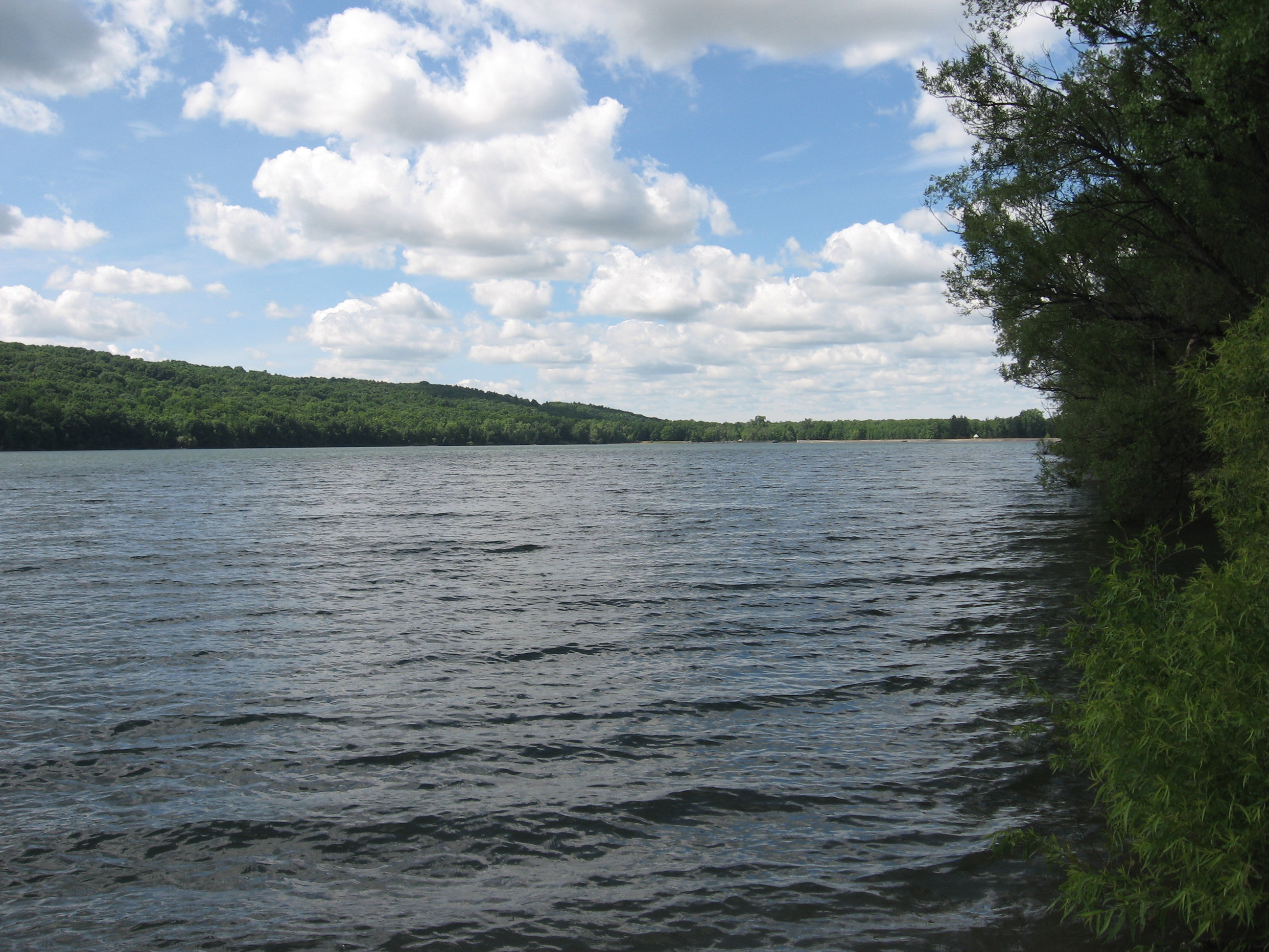
Viewing the west shore of Hemlock from the north boat launch.
After the history program at the Jack Evans Community Center, Springwater Trails will lead a shortened hike along the west side of Hemlock Lake. We will take some time to view the old cottage foundations along the trail.
This will be an abbreviated hike, lasting about one hour. The trail is intended to be level, but creeks that have washed out parts of the trail will require some careful climbing. We may also venture out on the shoreline, to take advantage of the lower water level of the lake.
A chicken BBQ will be available before the history program at 12:30. We will not have a social following the hike.
Directions:
From The Jack Evans Community Center: Head south on NY-15A for 0.9 miles. Take the first right turn onto Rix Hill Road. Park near the Kiosk on the left on the far side of Hemlock Lake.
From Springwater: Go north on NY-15A for 10.1 miles from the light in Springwater. Turn left at the north end of Bald Hill onto Rix Hill Road. Continue on Rix Hill Rd past the Hemlock Lake Park to the Kiosk on the west side of Hemlock Lake.
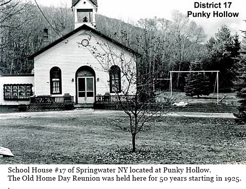 This month’s Bicentennial Hike is celebrating the one room school houses in Springwater. Our hike will start at the Punky Hollow School #17, located on Pardee Hollow, just down the hill from the Springwater Music Fair which is running both Saturday and Sunday. This hike will be approximately one hour and is open to everyone – admission to the fair is not required.
Hikers are invited to come to the Music Fair and enjoy the bands, check out the crafts and enjoy some good food. In addition, the East Springwater Historical Museum will be open Sunday afternoon, so you can view some of the history of School #17.
We will all meet at 2:00 in front of the school house. We will start the hike by exploring the property around the school itself, and then will travel on the Springwater Trail around the edge of the Punky Hollow Farm and return to the school house at about 3:00. For hikers attending the Fair, we will continue the hike up to the Fair grounds and explore the trails “up top” if time permits.
In 1872, there were 17 school houses in Springwater. There are two other school houses in East Springwater, one at Tabors Corners and Wetmore roads, and another on Schribner Rd. Both are now private residences.
 Directions:
Parking for the hike and for the fair is available at the Pardee Hollow and Dutch Hollow intersection. There will be a bus to the fair – ask the driver to let you off at the school house. Or if you don’t mind a short walk, it is less than a quarter mile from the parking entrance to the school house.
These directions avoid the Tabors Corners/Pardee Hollow corner where foot traffic from the fair may make driving difficult.
From Rochester: Follow Rt 15A south through Lima and Hemlock. From the intersection with Rt20A south of Hemlock, continue on Rt 15A for 9.9 miles and take a sharp left turn on Wheaton Hill Rd (CR 16). At the tee, at the top of the hill, turn left onto Wetmore Rd and take the first right onto Tabors Corner Rd. After 0.4 miles, take a slight left onto Dutch Hollow Rd. After 3.6 miles, the parking area is on the left at the intersection with Pardee Hollow Rd.
From Springwater: go North on 15A for .8mi from the light. Turn right on Wheaton Hill Rd. At the tee, at the top of the hill, turn left onto Wetmore Rd and take the first right onto Tabors Corner Rd. After 0.4 miles, take a slight left onto Dutch Hollow Rd. After 3.6 miles, the parking area is on the left at the intersection with Pardee Hollow Rd.
From Wayland: take Rt 21N for 5.6 miles. Turn left on Co Rd 38 (Garling House Rd AKA Rowe Rd). Take the first left onto Pardee Hollow Rd and continue for 3.8 miles. The parking area is on the right at the intersection with Dutch Hollow Rd.
From Honeoye: take W Lake Rd south. Turn right onto French Hill Rd. At the tee (at Dug Rd) turn right to stay on French Hill Rd. Take the first left on Garlinghouse/Atlanta Rd. Go Right on Pardee Hollow Rd and continue for 3.8 miles. The parking area is on the right at the intersection with Dutch Hollow Rd.
Looking for brochure.or mailing list so I can receive it in the mail.
Nothing opens up for mailing list.
There’s all kinds of very bizarre ads and post for viagra and other drugs above on calender page.
Please let me know if there’s a brochure available