
Hikes led by Springwater Trails are generally held on Sunday afternoons and appear in this calendar in green.
| Sun | Mon | Tue | Wed | Thu | Fri | Sat |
|---|---|---|---|---|---|---|
| Lehigh Valley Trail Hike or Bike in Rush, NY 2:00 pm Lehigh Valley Trail Hike or Bike in Rush, NY @ Stevens-Connor Lehigh Valley Lodge Apr 6 @ 2:00 pm – 4:00 pm Come join us for a leisurely hike or bike along the Lehigh Valley Trail on Sunday April 6th! With its flat even surface, the trail is a hidden gem for walking, hiking, jogging, biking. It is a vital link in … Continue reading | ||||||
| Ontario County Park at Gannett Hill Hike-Naples 2:00 pm Ontario County Park at Gannett Hill Hike-Naples @ Lookout Parking area Apr 13 @ 2:00 pm – 4:00 pm  This is one of our group’s favorite hikes! Ontario County Park at Gannett Hill is one of the highest points in Ontario County and located in the scenic Bristol Hills. At an elevation of 2,256 feet above sea level, you’ll … Continue reading | ||||||
| No Hike-Easter Break 2:00 pm No Hike-Easter Break Apr 20 @ 2:00 pm – 4:00 pm No hike has been scheduled for this date due to the Easter Holiday. Enjoy the break, spend time with loved ones and eat chocolate bunnies. This will give you something to burn off next week  | ||||||
| Hike Rob’s Trail – Hemlock Lake Side 2:00 pm Hike Rob’s Trail – Hemlock Lake Side Apr 27 @ 2:00 pm – 4:00 pm Join us on Sunday April 27th to hike the west side of Rob’s Trail, the DEC/Nature Conservancy property in the northeast corner of Hemlock Lake! Options are to hike out and back to the south along the trail from the … Continue reading |
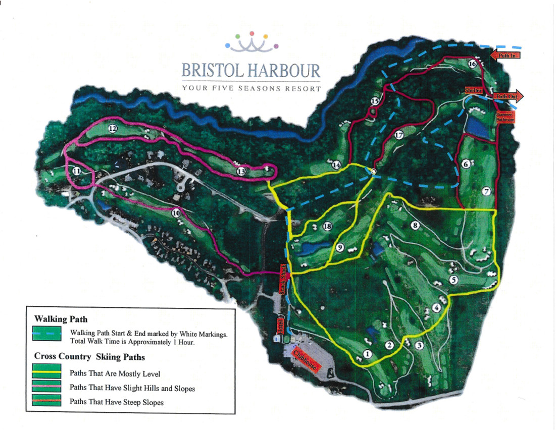
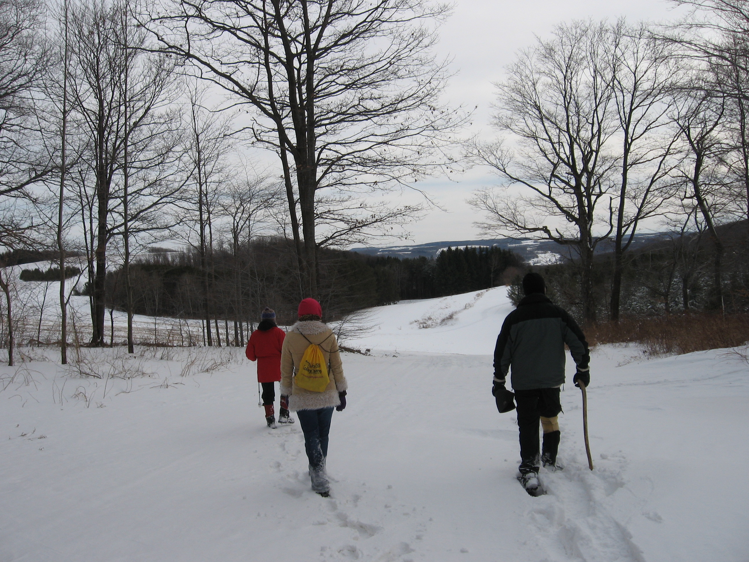
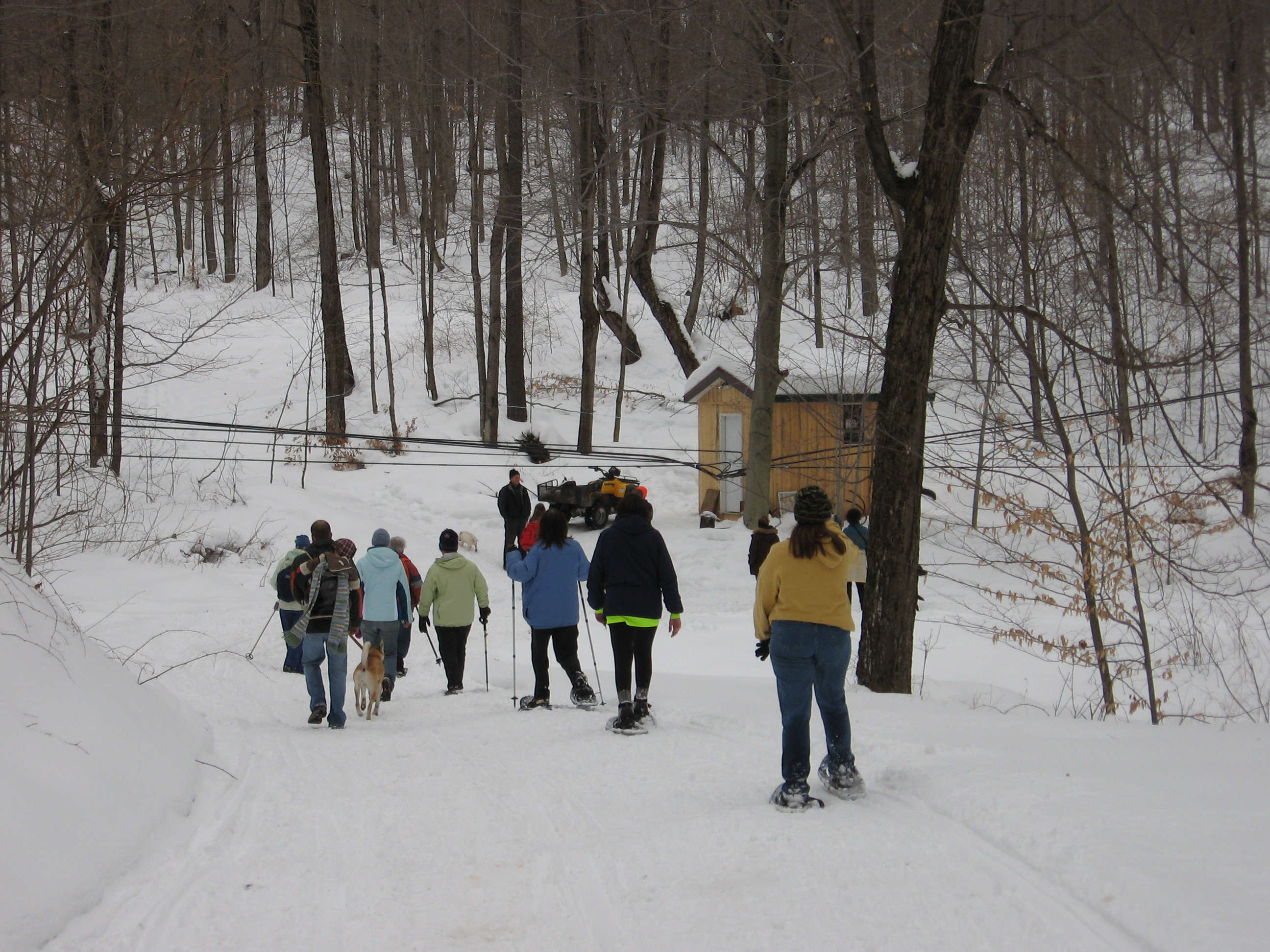
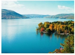 This Sunday’s outing will be at the Bristol Harbour Resort overlooking Canandaigua Lake. We will meet in the parking lot for the Lodge and Golf Course. The Robert Trent Jones golf course is an 18 hole course that has paths which can be used in winter for walking, cross country skiing and snow shoeing. This is a scenic course with hills, ponds, woodlots and views of the lake. It is open to the public at no charge for these winter activities.
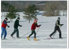 Once there, we will break into groups based on people’s interests. If there is enough snow and you would like to cross country ski or snow shoe, come prepared with your equipment as they do not have rentals. Cold temperatures are forecast for this weekend so everyone should dress accordingly.
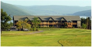
 Our after hike social will be in the tavern in the Lodge which was built and is furnished in a rustic Adirondack style.
Directions
From Springwater: It is about 30 miles and a 45 minute drive to Bristol Harbour from the 4 corners in Springwater. Starting from the 4 corners, head north on 15A, take a right onto Old Bald Hill S and then on Johnson Hill Road. At the top, turn left onto County Route 37. At Route 20A turn right and head east through Honeoye and then take a right onto East Lake Road. Turn left onto County Route 33. At Route 64 turn right and just past Bristol Springs take a left onto Route 21 north. Turn right onto Bopple Hill Road (0.8 mi) which becomes Seneca Point Road at the lake. Follow Seneca Point Road along the lake and up the hill (2.2 mi) to the driveway on the left for the Bristol Harbor Lodge and Golf Course.
 From Wayland (23 miles, 35 minutes): Head east on NY 21 through N Cohocton and Naples. Turn right in South Bristol to stay on NY 21N. In 0.8 mi, turn right onto Bopple Hill Road which becomes Seneca Point Road at the lake. Follow Seneca Point Road along the lake and up the hill (2.2 mi) to the driveway on the left for the Bristol Harbor Lodge and Golf Course.
 From Rochester and Canandaigua: Take NT 21S from Canandaigua for about 6 miles from Rts 5 & 20. Turn left onto Seneca Point Rd. (If you miss Seneca Point Rd, turn left on W. Lake Rd, then the first right on Seneca Point Rd) Follow Seneca Point Road for 2.9 miles to the driveway on the right for the Bristol Harbor Lodge and Golf Course.
Hemlock lake is considered by many to be the most beautiful of the Finger lakes.
Arch Merill’s 1943 Democrat and Chronicle article gives an apt descripti![]() on of this wondrous lake.
on of this wondrous lake.
“She is a wild and elfin child of the hills and forest. None of the slim blue lakes of the Genesee country has more physical allure.”
“Hemlock is a mountain lake although the conservativism of her people would never let them call Old Bald Hill, or her other guardians, anything but plain hills.”
Hemlock lake played an important part in the development of Springwater. The lake was a highway used by many of the earliest settlers of the town. In 1807 Seth Knowles traveled up the ice of Hemlock with his family and all his wordly possessions. He settled in the western part of Springwater.
On Sunday we will hike the Northern end of Hemlock lake.
We will meet at the Hemlock lake Park Parking area, North end of the lake.
Climbers, Tourists, and Naturalists will proceed in a Westerly direction along the dike and pass the outlet end of the lake. We will hike the short Walnut trail on the West side of the lake (several old foundations can be seen along this route). We can get some great lake views walking the West shore line. If time permits we can cross the road and walk part of the Bur Oak Trail.
Dress according to weather conditions. Boots will be an excellent idea if weather conditions remain warm as the trails are muddy. If we get freezing conditions traction devices might be helpful.
Social: After the hike we will meet at Sammy’s Family Restaurant in Springwater; on the right heading South, aprox 1/4 mile past the traffic light in Springwater village.

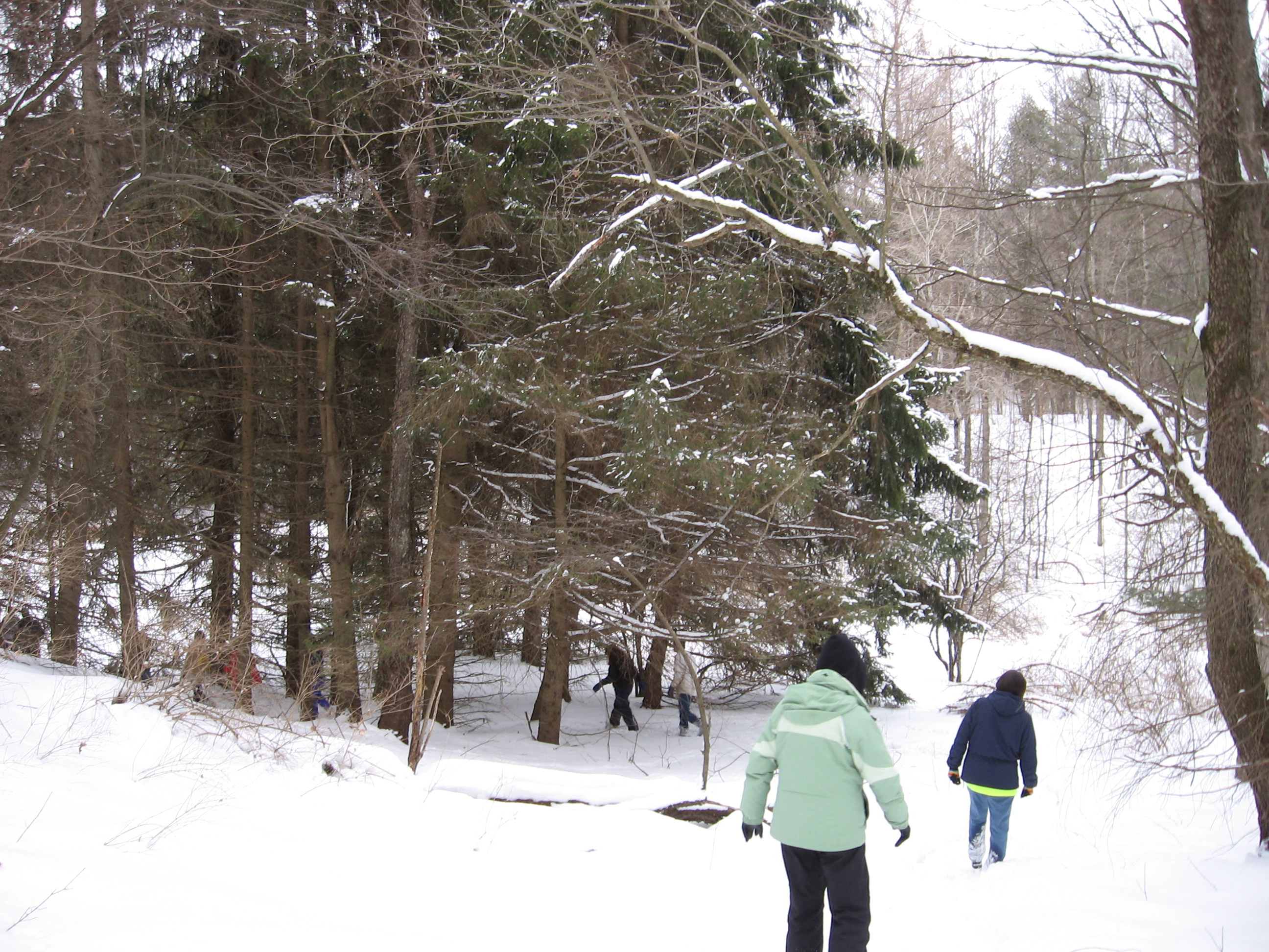
 As is usual this winter, our Sunday hike in the Schribner Valley will be flexible to adjust to the snow that is on the ground. We have three hikes planned if we can hike without snowshoes. If there is enough snow to wear snowshoes and skis, then we will adjust to those conditions.
NOTE: Today is Friday and the ground is covered with snow and the temperature is below freezing. But Sunday is expecting a high in the 50s, so I believe we will be hiking with waterproof boots. Go figure!
The Climbers will head west across the valley and up through the woods. We will select a safe route through the forest that is currently being logged, and the climbers will get a first hand view of the logging process. When we reach the top, we will take time to enjoy the views to the south, then will head down through pine woods and return along the stream to the house.
 The routes for the Tourists will travel through the fields, across the stream, and will climb to the lower side of the forest that is being logged. They will follow the edge of the forest to the far end of the valley, and then come back to the house. Keep your eyes open for animal tracks – lots of deer and fox, but probably not any bear.
The Naturalists will stay on the house side of the stream and will cross walk in an area of the valley that Springwater Trails has not explored. Expect one or two hills with about 25 ft rise. On the return, the naturalist will see the cut logs up close.
Following the hike, join us for a pot luck social at the Hopkins house. If it is cloudy, we will have a fire going and a big plate of pulled pork. Please bring a dish to pass and your own beverage, or make a small ($5) contribution to the social fund.
Directions: During the winter it is necessary to enter Schribner Rd from Tabors Corners road. Detailed directions are available here. Parking for five cars is available in the driveway, or park along Giles Rd just past the driveway.
From Wayland: From Rt 15, head east on Rt 21 toward North Cohocton for 3 miles. Turn left on Tabors Corners Rd (Steuben Co Rd 37). After 2 miles, turn left on Schribner Rd (the second left). The driveway is the 2nd driveway on the left one mile up Schribner Rd and about 10 feet before the intersection with Giles Rd. Turn around at the intersection and park on the west side of the road.
From the North: Take Canadice Hill Rd past Harriet Hollister Spencer Park to Springwater where it becomes Wetmore Rd. Or take Wheaton Hill Rd up from NY 15A to the top at Wetmore Rd. Continue south on Wetmore. At the end of Wetmore, bear right on Tabors Corners Rd. After 3.5 miles turn right on Scribner Rd. The driveway is the 2nd driveway on the left one mile up Schribner Rd and about 10 feet before the intersection with Giles Rd. Turn around at the intersection and park on the west side of the road. Additional detailed directions may be helpful.
Last year, Springwater Trails signed up to maintain a section of the Finger Lakes Trail, Bristol Branch. We are responsible for the section from W Hollow Rd and Seman Rd to Mt Pleasant St and N Main St in Naples. This section passes through the West Hill Preserve off Seman Rd and then across private land to Mt Pleasant St in Naples.
This Sunday, we will explore the Preserve and follow the trail, making notes about areas that need maintenance. Maintenance days will be planned in the spring and late summer, to help keep this trail in the conditions that hikers have grown to expect.
We will meet at the entrance to the West Hill Preserve. From there, the climbers will carpool to Naples and hike back to the cars. Naturalists follow the Bristol trail to the sign in box, where Gene will replace the knob. They then will explore the other trails on the Preserve, while the Tourists continue on the Bristol Branch for an hour before returning to the cars.
Please note: Dogs are not allowed to hike on the Nature Conservancy property.
Following the hike, please join us for a social at one of the fine restaurants in Naples.
Directions:
From Springwater: Head south on NY 15 (for 5.2mi). At the light in Wayland turn left on NY 21N (for 6.7mi). In N Cohocton, turn left to stay on NY 21N (for 4.5mi). In Naples, turn left again to stay on NY 21N (for 1.8mi). On the north side of Naples, turn left on CR12 and head up the hill for 1.9 miles. Take the first left, Rhine St., to the 4 way intersection. Go left onto Seman Rd. Trailhead is about 1/2 mile, by a big sign on the left. Park along the road.
From Honeoye: Head south on CR 36 on the west side of Honeoye Lake (for 13.6 miles from NY 20A). Turn left onto Gulick Rd (for 2 mi), then right on Davis Rd (for 0.7mi). At the end of Davis, turn left on W Hollow Rd (CR 33) for 0.5mi, then right on Seman Rd. The Trailhead is about 1 mile, by a big sign on the right. Park along the road.
Once agina, the Springwater Center has kindly offered to host our Annual Meeting. This scenic property overlooking the Springwater Valley, and half-way between Webster Crossing and the Hamlet is very appropriate for Springwater Trails. Our thanks to the entire staff of the center for their welcome.
Prior to the Annual Meeting. we will enjoy the many well marked trails that loop through open fields and forested areas. The trails through the fields are mowed and there are wonderful views of the surrounding hills and the valley below. 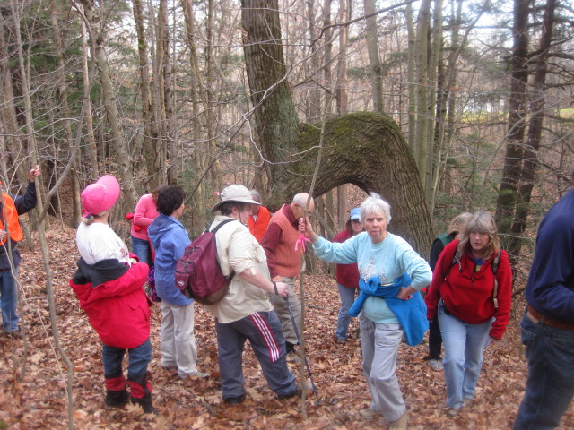 Two of the trails parallel a creek bed and gorge and one loops to another seasonal creek. Keep your eyes open for the Marker Tree near the creek. Following our hikes, we will set up a pot-luck dinner in the kitchen. Everyone interested in Springwater Trails is welcome to the pot-luck and the Annual Meeting, and to the hike.
There will be three hikes Wayne Coger and Susan McCallum, longtime Center members, will be available to answer questions and help with directions. Well-mannered dogs are welcome to hike with us. Dogs should stay in cars during the social.
If you are able to join us for the social after the hike, please bring a dish to pass and a non-alcoholic beverage or consider making a cash donation. There is a complete kitchen to store and reheat the dishes as needed. Please bring slippers as shoes will need to be removed at the door.
Directions
From Springwater: Take Rt 15 to the West from the flashing light at the intersection with Rt 15A. Follow Rt 15 up the hill. Turn right at the top of the hill on Mill St Ext (just across the road from Harpers Ferry Rd) – you will see a Dead End sign. Springwater Center is the third driveway to the left (0.1 mile along Mill St. Ext., you will see the sign). Follow the driveway for 0.6 miles to reach the Center parking lot. The main building is just past the parking lot.
Additional directions to the Center are here.
NOTE: This is the first day of Daylight Savings Time. The hike will start promptly at 2:00 Eastern Daylight Time. The hike will be followed by a social at the Springwater Center and by the Springwater Trails Annual Meeting.
NOTE CHANGE IN HIKE STARTING TIME
 Have you been enjoying the aroma of boiling maple sap in the air, since January? Today, we’re going to enjoy this year’s Palm Sunday with a lunch of pancakes with this year’s maple syrup, a hike in a new location for our group, and conclude this great day with a social at the home of one of our newest members.
We will meet today at Wohlschlegel’s Maple Farm, near the east end of Coates Rd., west of Naples. For $7.00, you can get all the pancakes you can eat, 2 sausages and beverage. Everyone I’ve ever talked to has given me great reports about the quality of their pancakes and syrup so, I’m looking forward to a treat. Their pancake kitchen closes at 1 PM so, you will need to get there by 12:30 to enjoy your meal. If there’s time after your meal, you can enjoy tours of their farm as well as samples of some of their maple products. If you’re still hungry, or come late, there will be hot dogs and other items available.
 Because you have to get there by 12:30 for your pancake lunch, we’re going to start our hike today at 1:30. We will have our usual 3 hiking groups, starting on the snowmobile trail on their farm. Mark, assisted by Duffy, will lead the climbers, possibly to the late Chuck Winship’s Sugarbush Hollow. John Larysz has agreed to lead the tourists I will attempt to lead the naturalists.
After our hiking workout, John has offered to break bread at his home so, bring your broken bread and come on over. You know the routine, same as last week, dish to pass or feed the kitty.
There will be no hike next week so, enjoy your Easter. See you in 2 weeks, bright eyed and bushy tailed, or the other way around.
Directions:
Wohlschlegel’s Maple Farm, 8064 Coates Rd. Naples. From Wayland. Go east on SR 21. Left on to CR 38. At the end, go left at the T. Left on Coates Rd. Farm is on the left, about 1/2 mile. Look for the bright purple roof. There are also signs on the road to help you. If your sweet Garmin lady tells you to enter Coates Rd. from Pardee Hollow, she doesn’t know that Coates is a rough seasonal road at that end, so you may want to make her recalculate. According to Garry W., she’s been known to send people to a potato field. Their phone number is 775-7770.
John Larysz. 8402 French Hill Rd., Naples. From Wohlschlegel’s, turn right on Coates. At the end, right at the T. Go straight, to French Hill Rd. and turn left on it, till you reach John’s house. It’s green, has a mailbox with the number on it, and there are not too many houses on that road. Ms. Garmin should help you with this one but, if not, and you’re lost, call him at 374-8366, and you will be found.
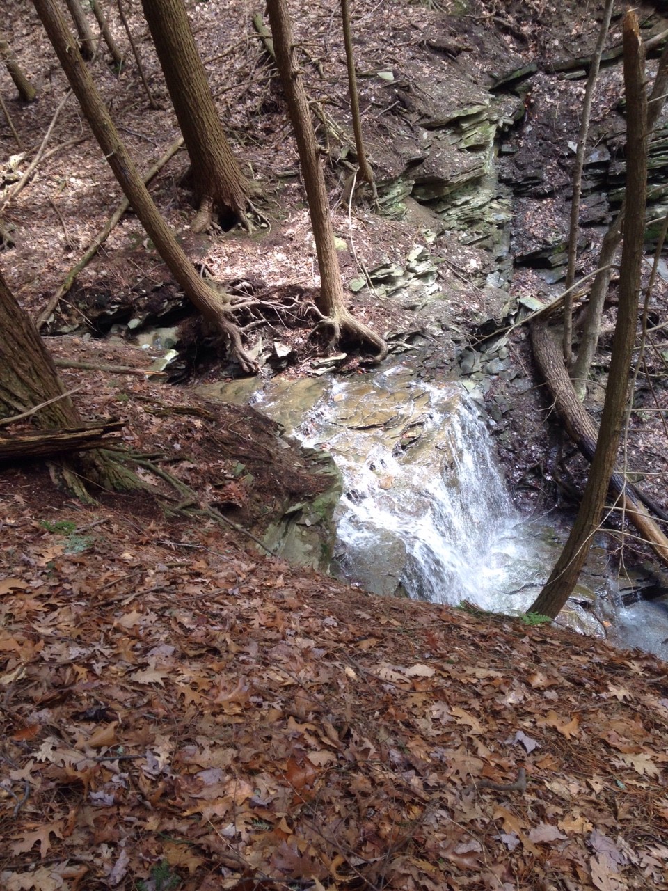
The Nature Conservancy of Central and Western New York has been planning to extend Rob’s trail down to Hemlock Lake for several years. Last summer several work days were held, building trail part way down from Rt 15A, and extended the lake side trail south from the north boat launch. A bridge is planned to cross a gorge and provide a wonderful and safe view of a waterfall on the way down to the lake. Currently there is a temporary route marked across the creek and the rest of the way to the lake.
 On Sunday, join us for a spring hike on this new trail and an optional social following at Peggy’s Rumpus Room in Honeoye. We will meet at the Rob’s Trail parking lot, and will split into three groups. The Climbers will hike down to the lake and connect to the new trail north to the North End (about 5 miles). The Tourists will hike down to the lake, and then will return back up the trail to the cars. This hike is about 3 miles, but makes up for the shorter distance with the steep climb back to the cars. Finally, the Naturalists will hike down the trail about half way to the lake where the bridge is planned. From there, they will return back to the cars, taking some time to explore a branch trail to the location of the proposed western parking area. This hike will be approximately 2.5 miles.
Following the hike, our optional social will be held at Peggy’s Rumpus Room at the Cornerstone Market. This is a small dinning area with soup, sandwiches and salads, plus bottled beer, and non-alcoholic beverages from the Cornerstone Market. To streamline the social, please RSVP to info@springwatertrails.org and to thecornerstonemarket@gmail.com. Please use the subject line “Springwater Trails Social April 3 at 4:30” with the number of people you are bringing and with your salad or sandwich order. You can find a menu at on their website. The restaurant is 10 miles from Rob’s Trail – go north on Rt 15A. Turn right on Rt 20A at Hemlock. The restaurant is at 8732 Main Street near the light at CR 36.
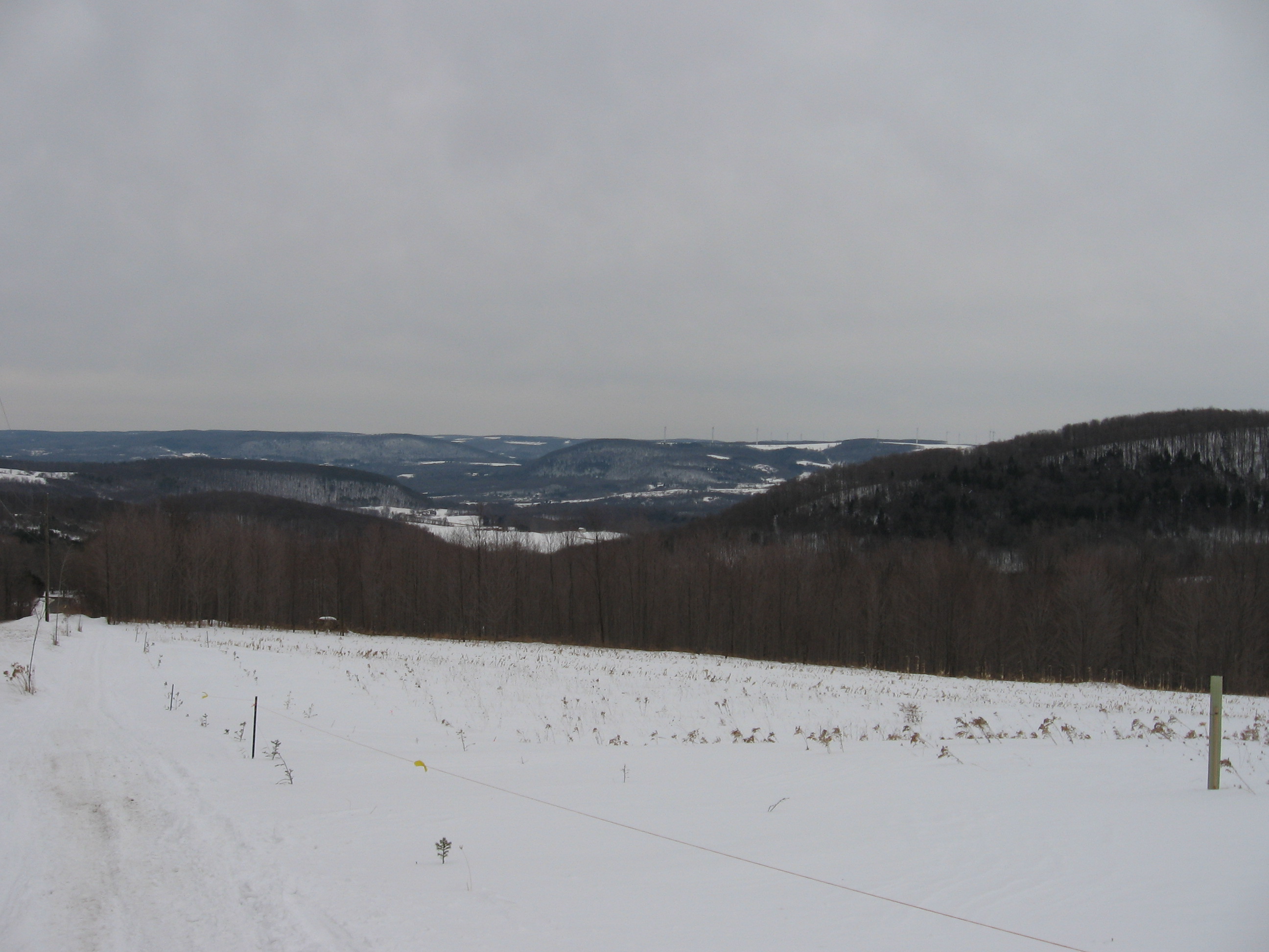
The Stid Hill Multiple Use Area is a 847 acre tract of land situated in the townships of Bristol and South Bristol in Ontario County. It is bounded by Route 64 on the west and Dugway Road on the north. Ganargua Creek, better known as Mud Creek, flows along Route 64. At one time, Stid Hill was productive sheep and cattle grazing land. Today the grazing has been eliminated. The mixture of steep hills, ravines, gullies, gorges, woods, and open areas create scenic vistas and also provide varied wildlife habitats.
The hike on Sunday 10th April 2016 will begin at the Dugway Road trail head. The initial quarter mile is a good path, but steep and uneven. This ends at a prominent “Stop” sign and a gate. This is a little misleading; a public trail continues past the Stop sign for a hundred yards or so and then swings to the right – follow the yellow Foot Trail buttons nailed to the trees and not the yellow paint dabs; the dabs lead away from public lands and will drop you on Stid Hill Road where it is still a dirt road.
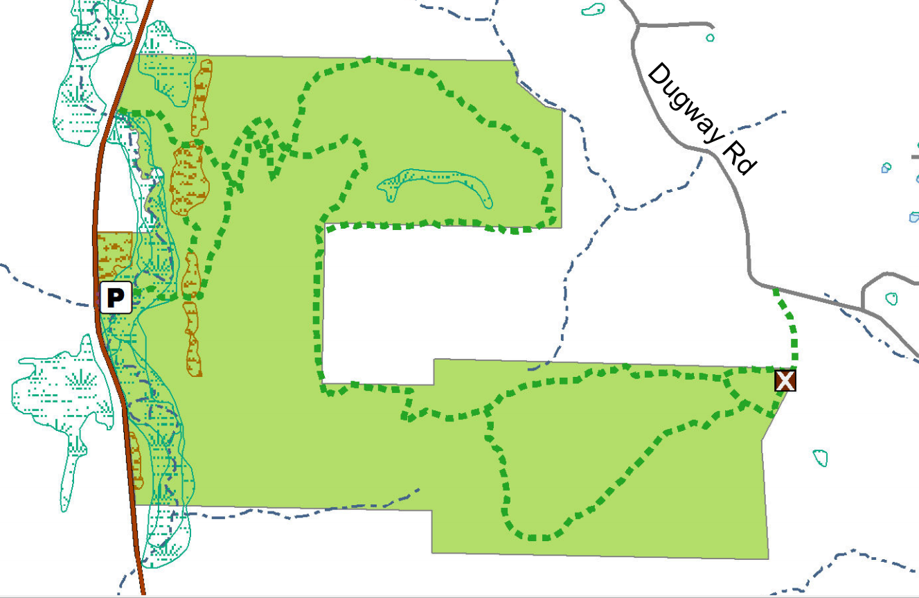 An alternative trail from the Stop sign goes to the right past a length of crash barrier across the path, and follows a broad trail up the hill (properly marked with paint dabs this time) deeper into the Stid Hill MUA. Both trails come together about a mile from the trail head.
Though the trails were well marked at one time, there hasn’t been much trail maintenance recently. The trail markers are difficult to follow and sometimes deceptive, and they disappear completely over the crown of the hill. The going will be very wet in places over the crown.
Tourists and Naturalists
For the tourists and Naturalists, there are loop trails starting at the Stop sign. The left and the right trails from the Stop sign are joined by linking trails through the woods. The paths are dry and in good shape here and marked with yellow or pink paint dabs.
Climbers
The climbers will hike all the way over Stid Hill and come down the steep escarpment to the more northerly Route 64 Stid Hill parking area. We’ll shuttle back to the Dugway Road trail head to collect the cars. The paint dabs start off yellow, but there a blue trail that parallels the yellow one and is easier to find. Here’s the route:
Once past the initial steep climb the trail is reasonably level until we come over the crown of the hill and start down the escarpment to Route 64. The trail markers run out pretty soon at the beginning of the walk, but the path is well trodden and easy to follow. It is however VERY WET! Wear good boots or get wet feet. It’s also very muddy in places. The section down the escarpment switchbacks a lot; it is steep, dry, and nicely wooded. The trail markers start up again as we start to come downhill again, but they get confusing and it’s easy to miss a sharp right turn to follow the borders of state land.
The Meeting Place
We will meet at the Dugway Road trail head at 1:45pm for a head count, and we’ll arrange to have some cars down at the Route 64 parking area for a ride back up the hill.
Getting There
Route 64 runs north-south, so there are only two direction of approach.
From the north, (Honeoye and Bloomfield) starting at Route 5 & 20 in Bloomfield, come down Route 64. 3.0 miles south of Rt 20A and 1.4 miles past Bristol Center (and CR 32), turn left on Dugway Road. If you come to a Stid Hill MUA parking area, you’ve come too far south – turn around and try again.
From the south, starting at Bristol Springs for 6.4 miles, come up Route 64 past both Stid Hill parking areas, then turn right on Dugway Road. If you come to Bristol Center you’ve come too far north.
From Springwater, Google Maps recommends heading north to 20A through Honeoye, then south on 64.
From Wayland, the recommendation is to take Rt 21 through Naples to the east end of Dugway Rd (4.5 miles north of the intersection with NY 64). The trail head is 1.2 miles west on Dugway, (Dugway is paved to the Bristol/Canandaigua town line).
Dugway Road is a good dirt road. The trail head is exactly 2.0 miles from the Route 64 junction. It’s easy to miss – it’s just a widening of the road after a sharp left turn. The trail head is on the right of the road and marked with a discreet sign a little too far from the road. Please park carefully. There isn’t much parking space to be had.
The Social
We’ll go to Lock Stock and Barrel on Route 64 just north of Bristol Mountain for the social after the hike. The climbers are likely to be about half an hour late so earlier arrivals should feel free to set up beers for them for when they finally get there.
![]() It’s going to be an exciting Sunday, celebrating the Springwater Bicentennial. Events start at 10:00AM at the Springwater Fire Hall with a communal church service. Following the Service, a chicken BBQ with $9.00 chicken dinners with all the trimmings. At 1:00PM, the Waylandaires will perform, there will be birthday cake for Springwater, and expect some speeches from local and state representatives in town to celebrate with Springwater.
It’s going to be an exciting Sunday, celebrating the Springwater Bicentennial. Events start at 10:00AM at the Springwater Fire Hall with a communal church service. Following the Service, a chicken BBQ with $9.00 chicken dinners with all the trimmings. At 1:00PM, the Waylandaires will perform, there will be birthday cake for Springwater, and expect some speeches from local and state representatives in town to celebrate with Springwater.
Following the cake, Springwater Trails will meet in the Fire Hall parking lot for a walk through the hamlet of Springwater. All friends of Springwater looking to celebrate the town with a two hour walk around the hamlet are invited to join us.
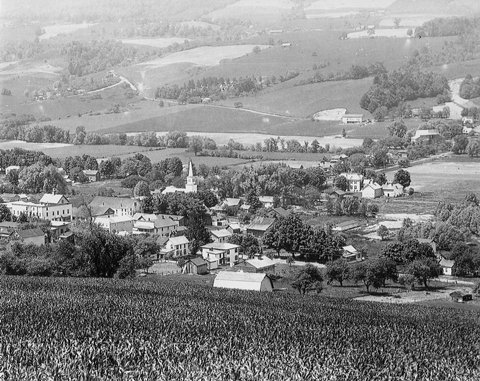
The Hamlet of Springwater from the north east hill. The intersection of Kellogg Rd and Depot Rd in the distance will be one of our hike goals. Photo courtesy of Joyce O’Neil via hemlockandcanadicelakes.com
We will visit Canute Park and the Springwater Creek, which drains the west hill of Springwater valley, and we will cross Limekiln Creek, which drains the east hill. A swing across Kellogg Rd marks the north edge of the hamlet. The hike will take two hours and we will return to the cars.
Bring old pictures of the hamlet, if you would like to share them as we hike. We are expecting a clear day with temperatures in the 60’s. Following the hike, we will gather at Canute Park for a pot luck social. Bring a dish to pass, and something to drink.
Looking for brochure.or mailing list so I can receive it in the mail.
Nothing opens up for mailing list.
There’s all kinds of very bizarre ads and post for viagra and other drugs above on calender page.
Please let me know if there’s a brochure available