
Hikes led by Springwater Trails are generally held on Sunday afternoons and appear in this calendar in green.
| Sun | Mon | Tue | Wed | Thu | Fri | Sat |
|---|---|---|---|---|---|---|
| Lehigh Valley Trail Hike or Bike in Rush, NY 2:00 pm Lehigh Valley Trail Hike or Bike in Rush, NY @ Stevens-Connor Lehigh Valley Lodge Apr 6 @ 2:00 pm – 4:00 pm Come join us for a leisurely hike or bike along the Lehigh Valley Trail on Sunday April 6th! With its flat even surface, the trail is a hidden gem for walking, hiking, jogging, biking. It is a vital link in … Continue reading | ||||||
| Ontario County Park at Gannett Hill Hike-Naples 2:00 pm Ontario County Park at Gannett Hill Hike-Naples @ Lookout Parking area Apr 13 @ 2:00 pm – 4:00 pm  This is one of our group’s favorite hikes! Ontario County Park at Gannett Hill is one of the highest points in Ontario County and located in the scenic Bristol Hills. At an elevation of 2,256 feet above sea level, you’ll … Continue reading | ||||||
| No Hike-Easter Break 2:00 pm No Hike-Easter Break Apr 20 @ 2:00 pm – 4:00 pm No hike has been scheduled for this date due to the Easter Holiday. Enjoy the break, spend time with loved ones and eat chocolate bunnies. This will give you something to burn off next week  | ||||||
| Hike Rob’s Trail – Hemlock Lake side 2:00 pm Hike Rob’s Trail – Hemlock Lake side Apr 27 @ 2:00 pm – 4:00 pm Join us on Sunday April 27th to hike the west side of Rob’s Trail, the DEC/Nature Conservancy property in the northeast corner of Hemlock Lake! Options are to hike out and back to the south along the trail from the … Continue reading |
Dates: March 21, 22 and March 28, 29
Time: 10:00AM to 4:00PM
Open House:
Tour the Maple Shed
Taste testing
Maple Syrup demonstrations
Children’s maple activities
Our Store:
Maple Syrup
Molded candy
Maple cream
BBQ sauce
Pancake Breakfast – 10:00 – 3:00
Pancakes, Sausage, Coffee, Juice
Suggested donation: $7, children under 12: $5.
We would love to have you and your family come tour our maple shed. Come meet us and see how we make Maple Syrup. We will have tastings and demonstrations and lots of conversation.
Visit our Maple Store while you are here.
Between 10:00 and 2:00 we will be serving a pancake breakfast for you and your family. All you can eat pancakes, with sausage, coffee, tea and orange juice, are available for a contribution of $7. Vegetarian: $6, Children under 12: $5.
We welcome you to stop by and tour the shed!
 This is definitely a challenging hike description to write. Looking outside on March 9, I can definitely believe that we will be snowshoeing and skiing in twenty days. But remembering how the snow disappeared before Christmas, it really is hard to say.
With this hike, we are experimenting with recycling a previous hike, even though we do not have a hike planner scheduled. Please email the winter hike coordinator if you are willing to complete the planning of this hike. You will want to do a brief pre-hike the week before the hike, checking for current trail conditions and then update this hike description as needed.
 We have been working to keep the Wheaton Hill trails open. Mostly this means cutting out Multiflora rose while avoiding the Poison Ivy. This hike will give us a first view of these trails to help planning our trail maintenance for 2015. If you can’t walk past a Multiflora rose without clipping it back, bring heavy cloves and a pair of clippers. But we will be hiking the entire system of trails.
Please dress according to the weather, and expect wet ground if it is above freezing. You may find a change of pants and shoes make the social afterward more enjoyable.
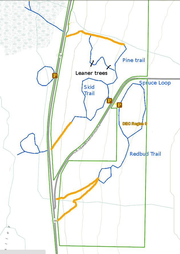
 Climbers will head up the Pine Trail, staying to the right to the edge of the gully. Being careful to stay out of the gully, this group will follow the gully downhill to the return trail Hardy souls may want to continue following the orange line on the map until they can see 15A and across to the Roots View Trail that heads out to the Hemlock inlet. After climbing back up the Pine Trail, this group will stay to the right and follow the Skid trail around and back to the cars. Again, at the half way point, an off trail hike along the middle orange trail will look for the route to 15A and the Green Ash Loop. Please skip the orange side routes if you think the steep climbs back to the main trail will be more than you are willing to do. This will depend on how much snow is still on the ground.
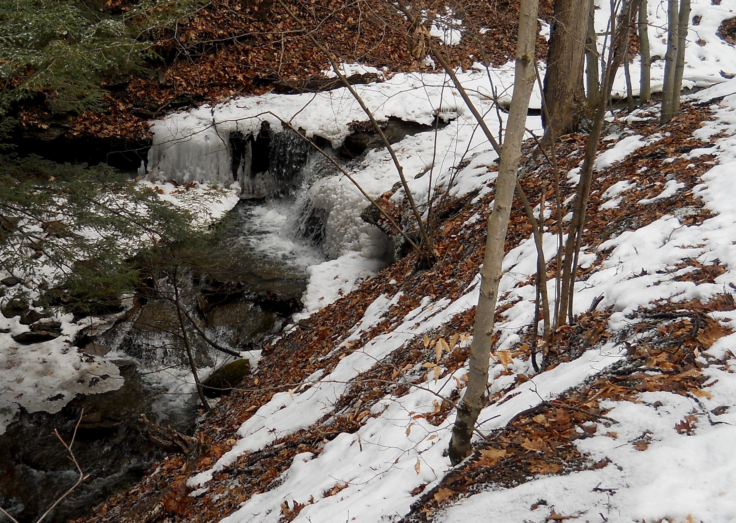
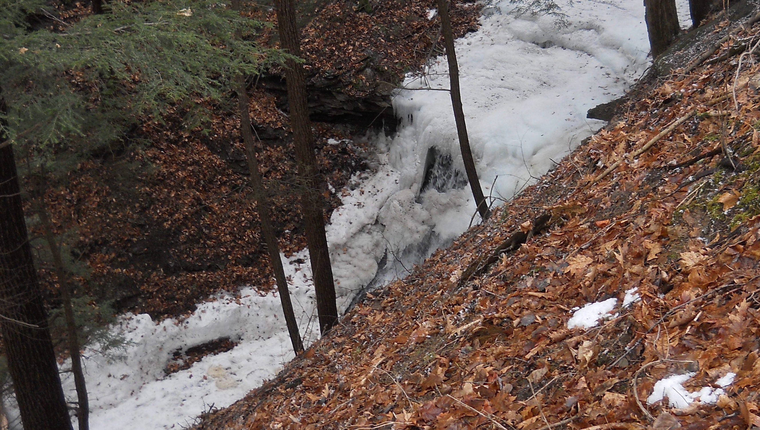
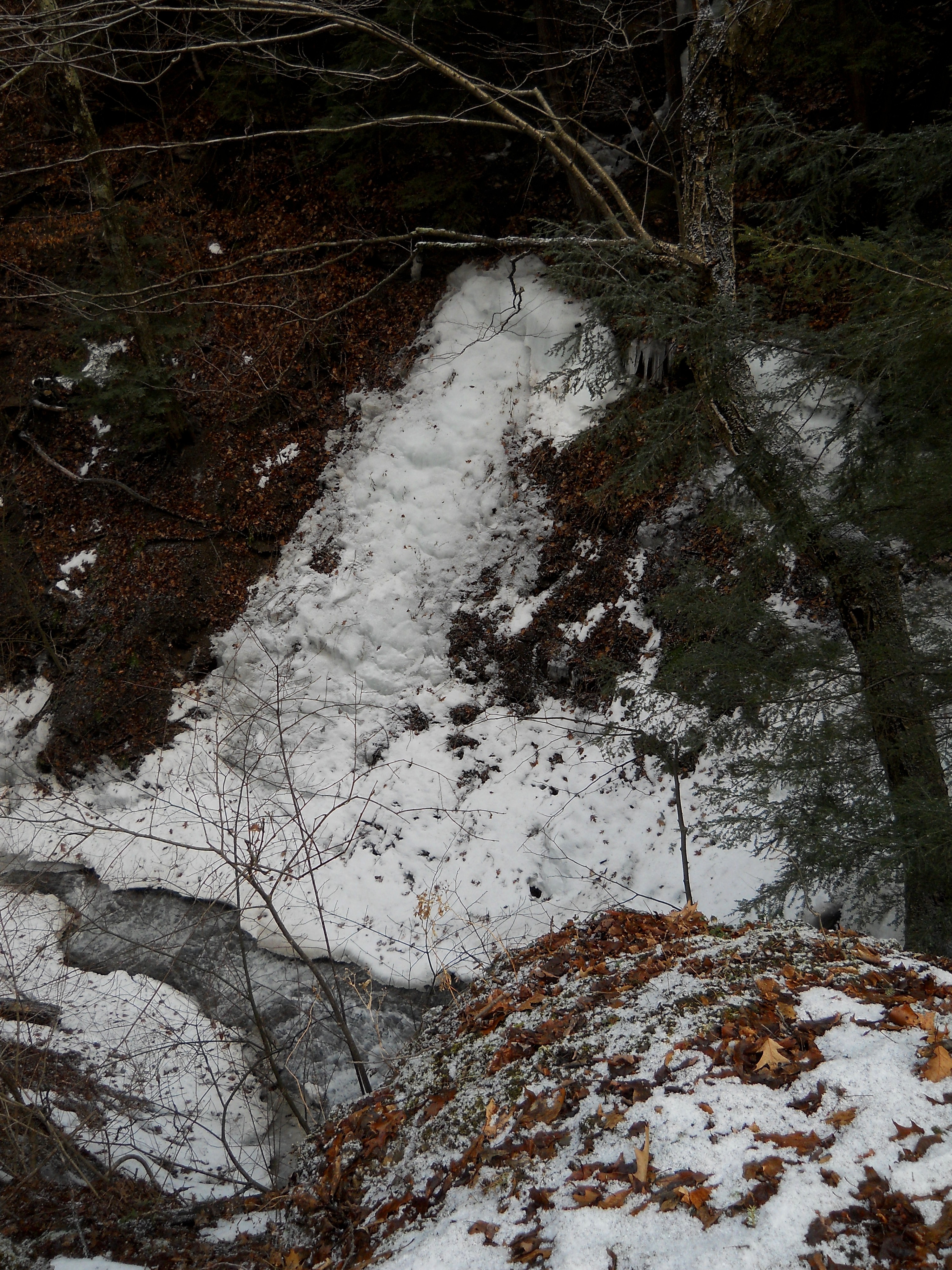
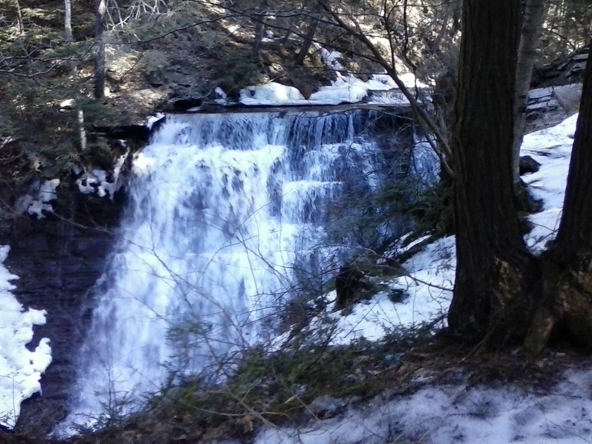
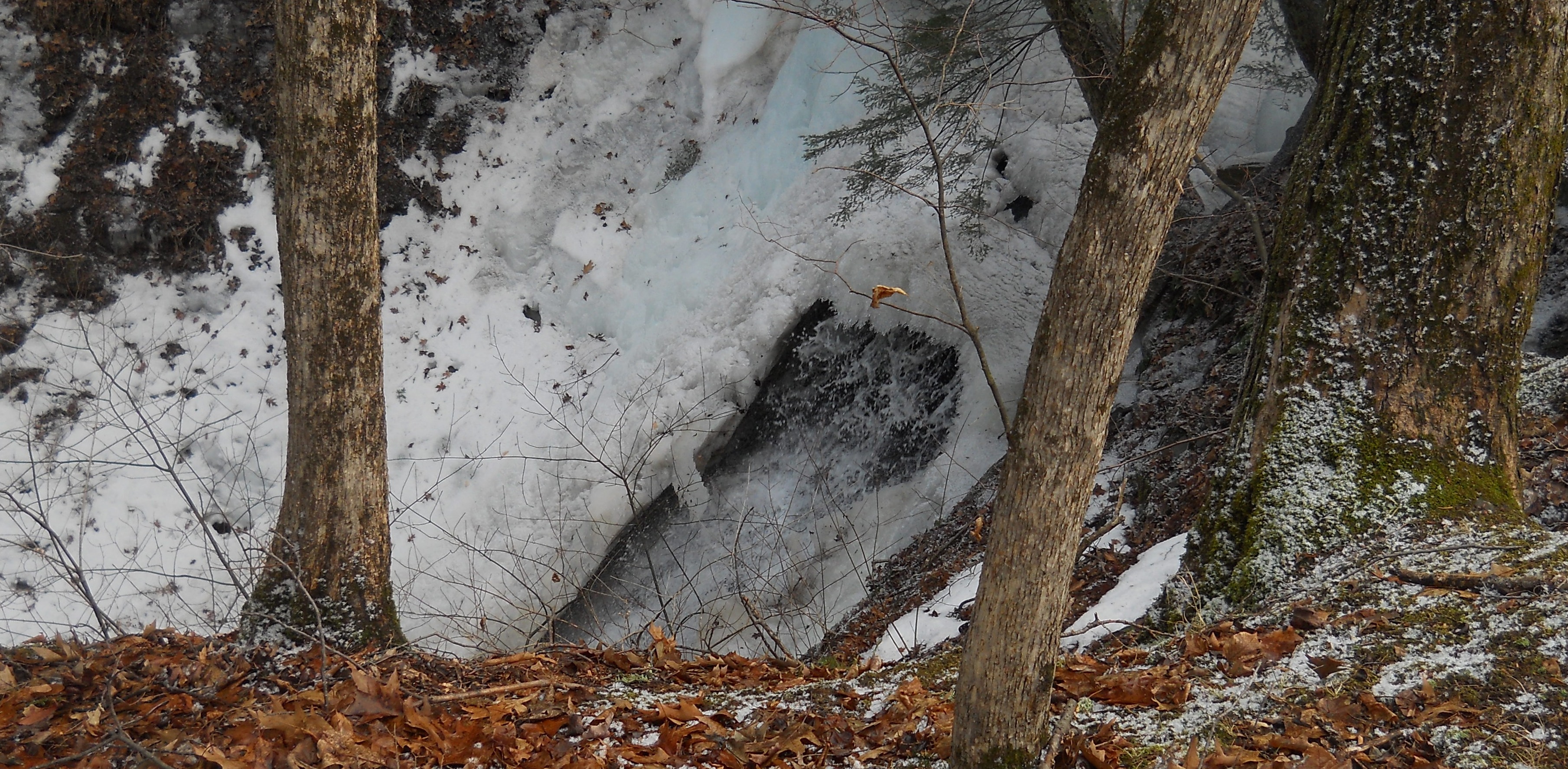 Tourists will follow the climbers up the Pine Trail to the gully and the waterfall. Pam reports that the waterfall is SPECTACULAR, with water running through the ice. Saftety is critical with ice and snow at the top of the gully. Tourists will turn around at the gully, returning on the high branch of the Pine trail to the start point. After crossing the road, they will turn right on the Spruce trail following it around, through the spruces and back to the start. Based on time, the tourists can then follow the Skid Trail, turning left out of the parking area and following the Skid Trail clockwise around.
Please park on Wheaton Hill facing down the hill – avoid parking on both sides of the road and be alert for cars while waiting for the start of the hike. Directions are available to the Wheaton Hill trailhead.
 After hike social will be at Pam’s house, about 10 minutes north of Wheaton Hill, just off RT 15A. (Details at the hike) Bring a dish to pass and your drink of preference. A “special maple glazed” meat will be provided as the main meal. We encourage our Sunday Maple Weekend pancake workers that are unable to attend the hike, to stop in for the social on their way home. Parking available on road or in driveway at this point, unless weather conditions change.
 As most of you know, Springwater Trails does not usually schedule a hike for Easter. You are all invited to enjoy the outdoors with friends and family this Sunday.
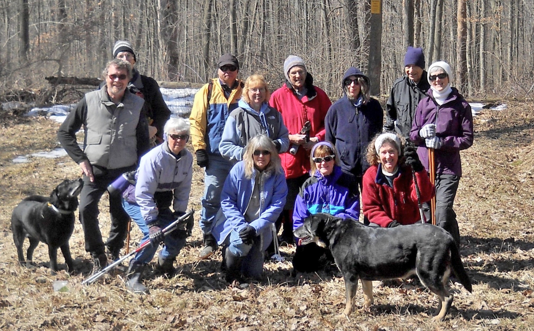
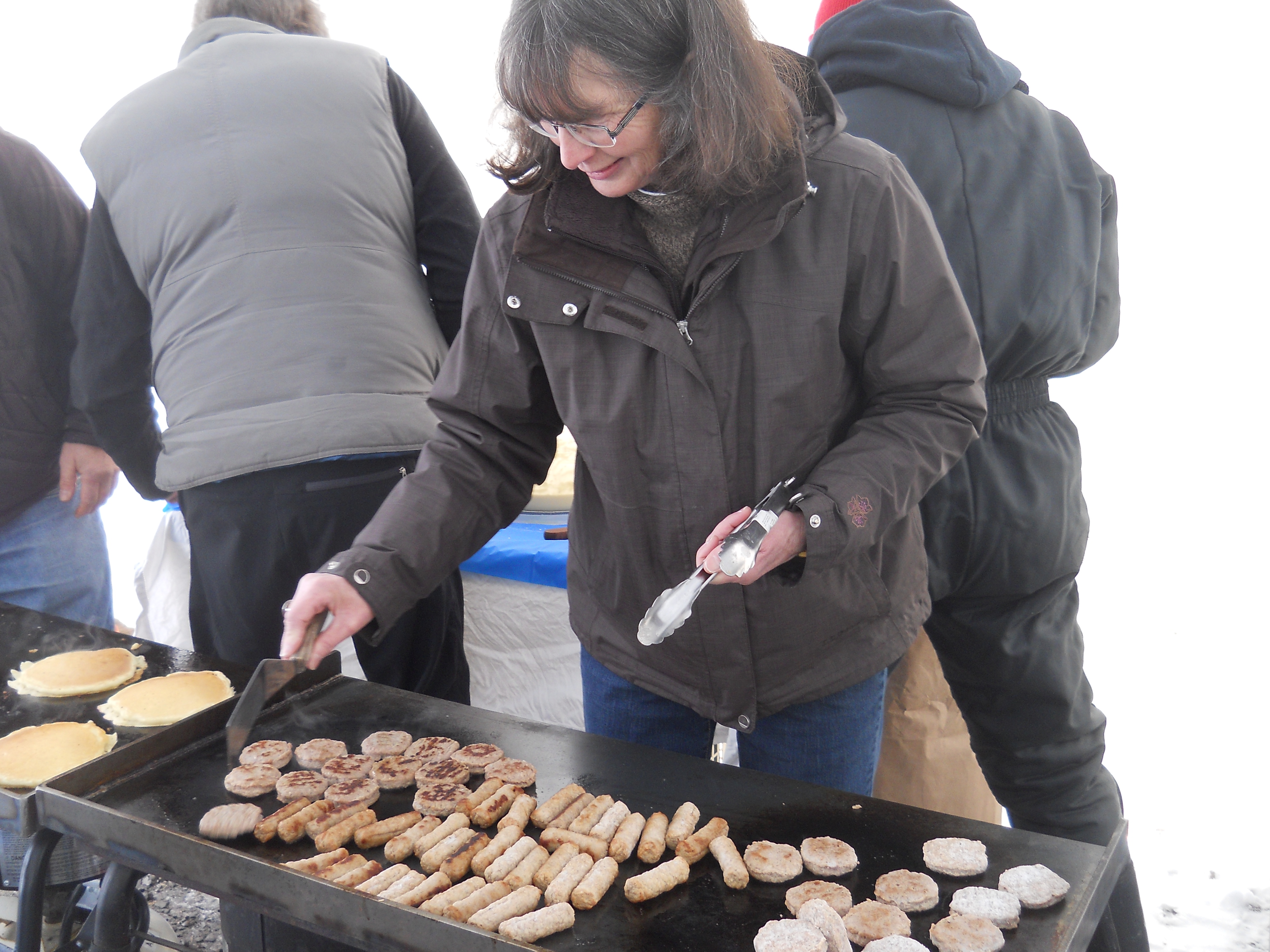
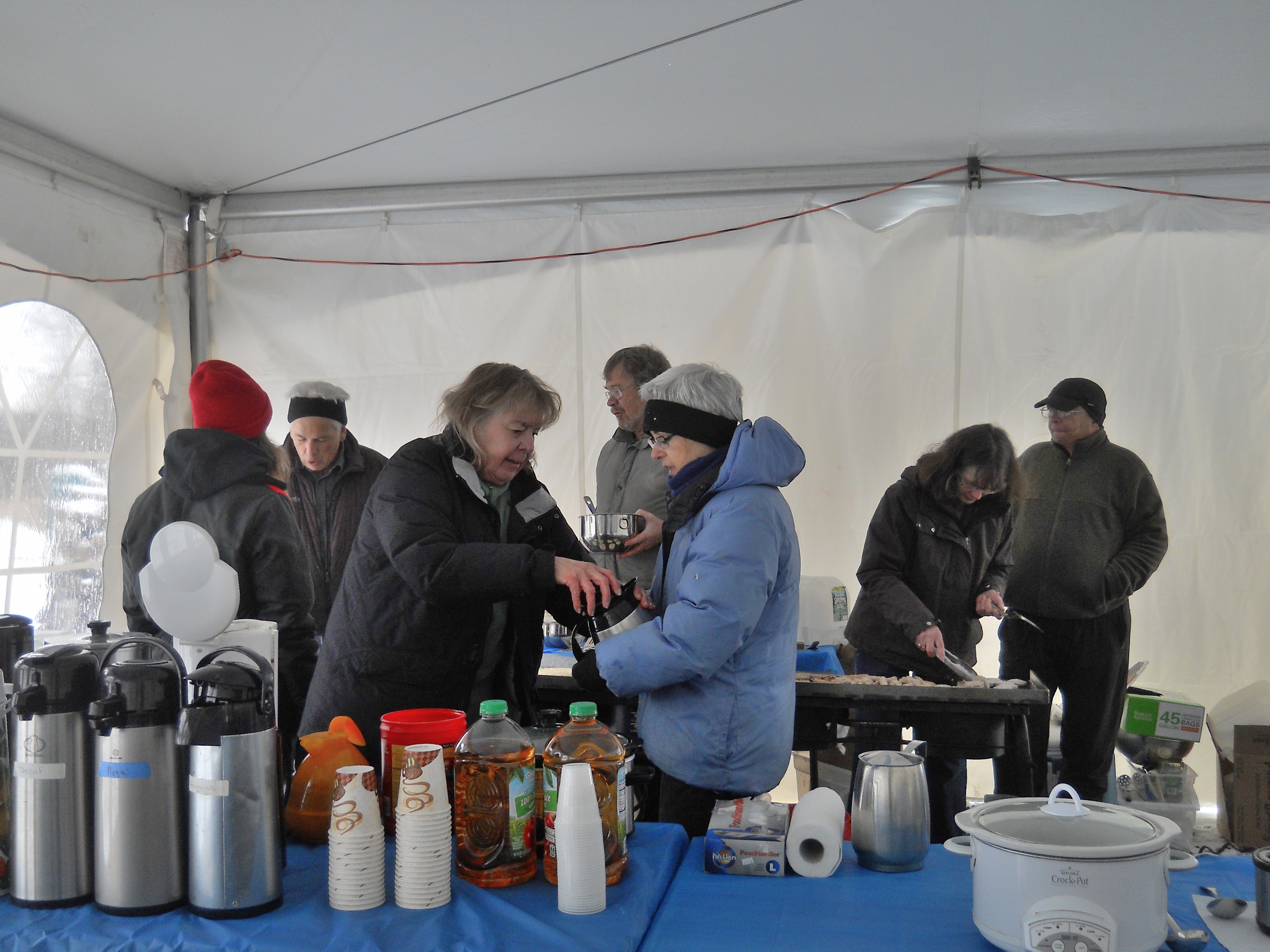
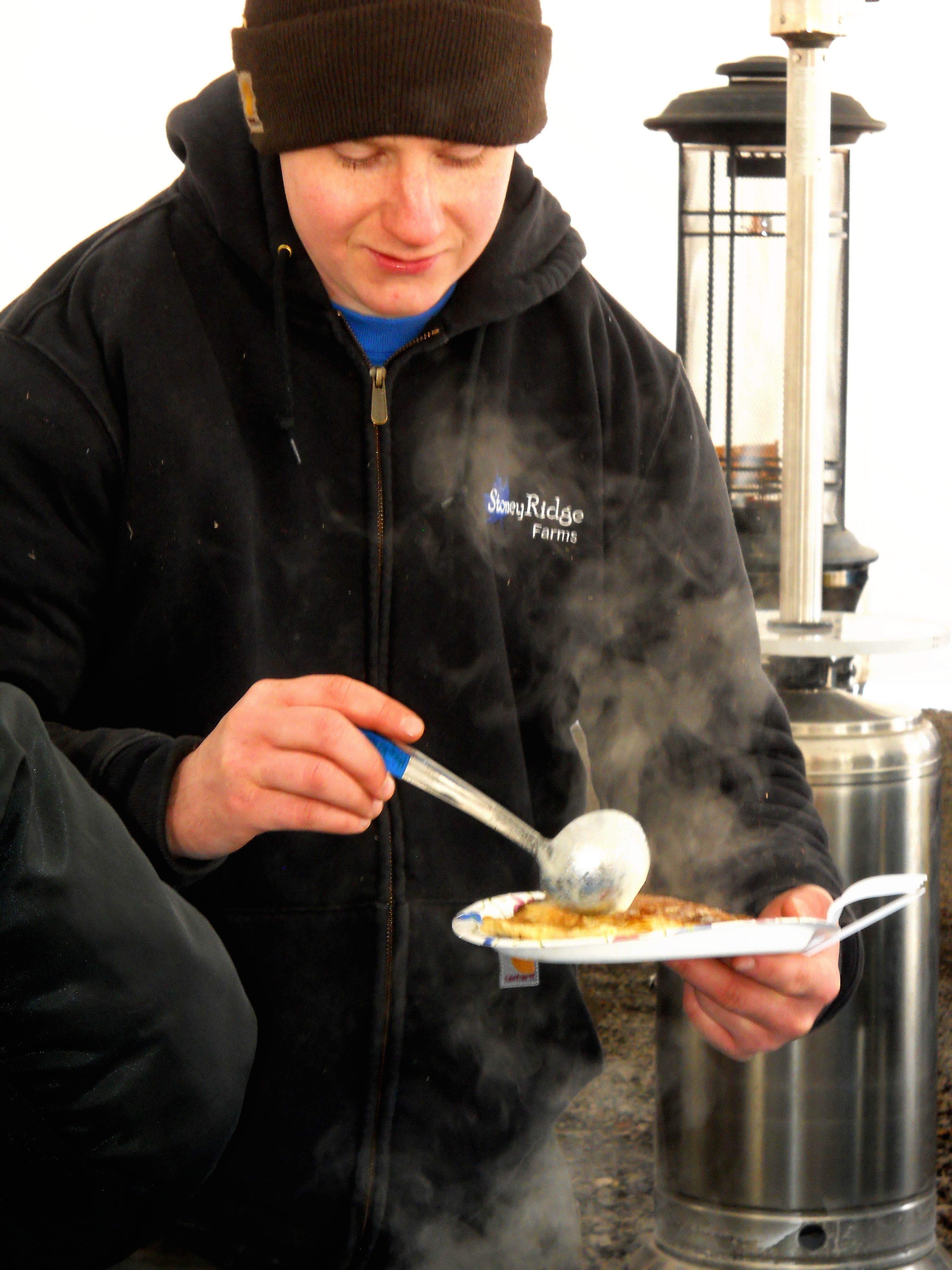
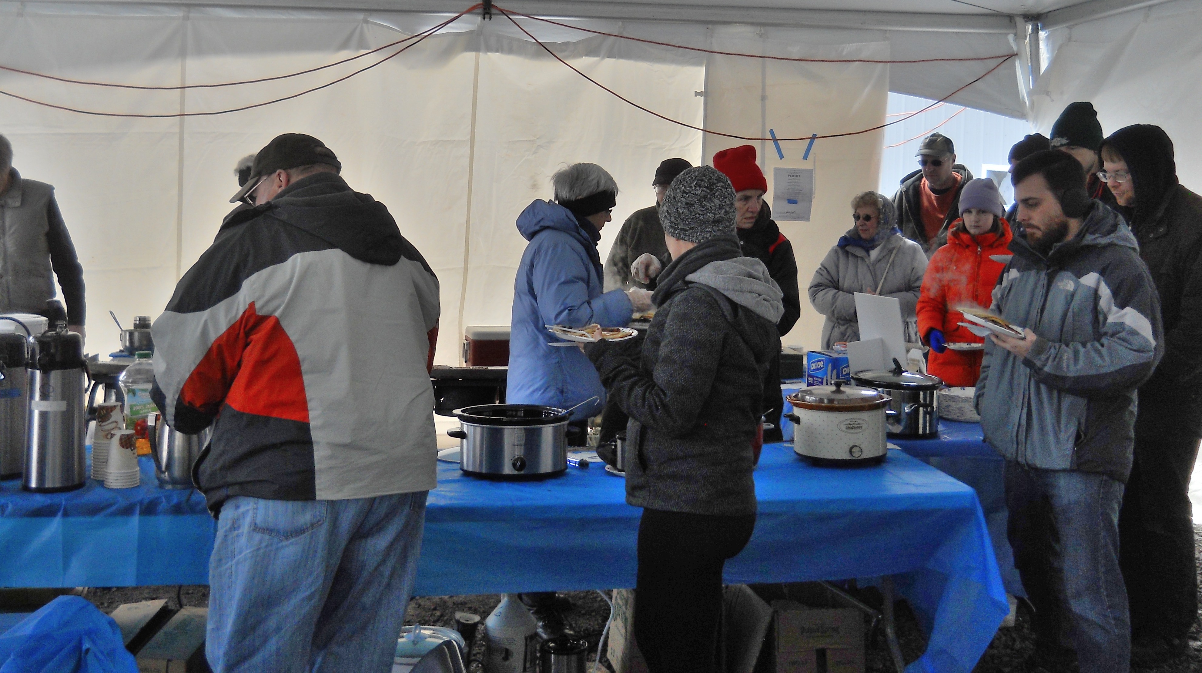 The picture above is from Sunday’s hike at Wheaton Hill. The others are from Saturday, March 28 at Stoney Ridge Farms. This was the coldest day of Maple Weekend pancake breakfast this year.
Here is a Spring (multiple entendre intended) opportunity to join Victor Hiking Trails (VHT) for a hike in Fishers Park. Many S/T hikers may recall an Autumn Springwater Trails hike at Fishers Park planned and led for S/T by Douglas. The date was November 16th, 2014 and S/T hikers were greeted at the start of the hike by Dave Wright, Chairman of VHT.
Well, about five months later, on Saturday April 11th, 2015, Dave Wright will again be greeting a group of hikers at the start of a hike in Fishers Park, albeit this time he will be leading the group of hikers on a VHT guided hike. All hikers are free to join in this hike, no membership or fees are required.
Perhaps you will find a different world in the trails of Spring vs Autumn. Traction Devices (TDs) are recommended for this hike and other hikes at this time of year. A possible alternative to TDs may be deep tread sole footwear. Since it may be muddy this early in Spring Season, consider waterproof footwear, and perhaps gaiters.
For more details on the hike you can check the VHT website , or telephone (585)-234-8226 (234 is a Rochester telephone exchange) for details.
For all those interested in trails advancement in our region- the next round of public input and meetings for the Genesee-Finger Lakes Regional Trails Initiative is here!
Since the fall of last year, folks have been working hard on the Regional Trails Initiative Plan Update, and Livingston County has participated actively with input coming from municipalities, trail groups or organizations, and trail users. The next opportunity for public input is this weekend and early next week. See the attached flyer for details. The main goals at this time are to obtain public comments, determine how to refine the recommended network, and set priorities for implementation. I anticipate being in attendance at the Public Open House in Batavia. I look forward to seeing you there!
Pubic Open Houses:
Saturday, April 11, 2015, 9 am- 1 pm. Rochester- City of Rochester Public Market.
Monday, April 13, 2015. 6 pm – 8 pm. Batavia – Genesee County Building No. 2
Tuesday, April 14, 2015. 5 pm – 7 pm. Geneva – The Ramada.
If you would like to review and comment on the network now – please do! Check the website and wiki map – and please pass the links along to your fellow citizens. I have also included a copy of the RTI map, in pdf format, zoomed into Livingston County. The full Region map can be viewed at the website link.
The Livingston County Planning Department is also participating on the Regional Trails Initiative Steering Committee. The next Steering Committee meeting is scheduled for Wednesday, April 15, 2015. If you have any questions or have input that you would like to provide, please feel free to contact me before this meeting so I can share your input. Please feel free to distribute this email and attached resources. We would like to hear from all who are interested.
This week’s hike will be on the East Ridge in Dansville and will include a hike through Whiteman Gully on Little Mill Creek. The highlight will be a beautiful waterfall on Little Mill Creek, which is quite spectacular with all the snow melt. Ann and Jerri did a hike preview on Thursday April 2nd and the current conditions are wet with some snow and ice patches. It is expected that more of the snow and icy patches will be gone by our hike but you may wish to bring some trackers for those areas just in case. Please plan to be there at 1:45pm so cars can be relocated for the Naturalists. More details below.
There will be a social event after the hike at the Jerri and Tom’s. Either bring a dish to pass or make a donation (suggested $5) to the social fund to help defray expenses, and bring a beverage of your choice.
Climbers/Tourists: The climbers and tourists will begin the hike at Jerri and Tom’s house. This hike will pass through Alexander’s tree farm and forest terrain with some of it following logging trails. The hike involves about a 300’- 400’ descent to reach Whiteman Gully. After viewing the waterfall the hike will continue on to the old Dansville railroad bed for a flat walk, finishing with a medium, but long climb back up to Ann’s house and finishing at the Jerri’s. Total elevation climb from the gully back to the top of the ridge is around 900’. Overall hike is 5.4 miles. If some do not wish to make the final climb there will be transportation back to the social.
Naturists: This hike will begin at Whiteman Gully. After viewing the waterfall and the seasonal wild life plants the hike will continue on to the old Dansville railroad bed for a flat walk, finishing at the north end of the trail. There will transportation to bring the Naturists back up the hill to the social. Overall hike is around 3 miles.
Directions: From Main St. in Dansville, heading south on 63 leaving town, take Sahrle Hill Road, bare left until on top of the hill, then left on Sterner Road until it turns into McNeil Hill Rd. Follow McNeil Hill Rd until you reach a fenced in pasture on your left. Turn in the first driveway at Maple Lane Farm. Follow the long driveway to Tom and Jerri’s home (6286 McNeil Hill Rd).
>>> update Sat 4/18/2015: If you were one of those kids who always wished that you could be the first kid on the block to do whatever, then here is a hike for you. Likely Springwater Trails will be the first organized hiking group to hike this newly acquired park land in the Town of Rush. The large parcel adjacent the NYMT is the former Monroe BOCES#1 Campus in Rush, and prior to that was part of the NYS Agricultural and Industrial School in Rush dubbed “Industry” and alternately known as Oatka Residential facility, a NYS juvenile reform school.
Being that Sunday is predicted to be low-mid 60s temperatures with some sun, and winds described as breezy, we will be holding our after-hike social outside at the picnic grove of the NYMT adjacent the NYMT parking lot. And being that weather has offered only one day of rain as of late, likely this hike will NOT be a muddy one. Reminder: consider BINOCULARS for use at the hill top vista. end of update. <<<
_______________________________________________________
NOTE: New York Museum of Transportation (NYMT) opens at 11:00AM. This is a Springwater Trails (S/T) “hike combo event”, a hike coupled with a visit opportunity to the NYMT in Rush NY and a special program presentation at 1PM in the NYMT on topic of “The Interurban Era”. (There is a $5 admission fee to the NYMT, see “Hike Event Details:” section below.) Hikers are encouraged to allow themselves ample time for touring the NYMT and to see the ~ 45 minute program (including time for questions) on “The Interurban Era” prior to 2:00PM hike time. History appreciators need longer time to see the NYMT exhibits, casual lookers need less time.
If you wish to hike only, and not visit the NYMT, you may do so. Admission fee is only required inside the NYMT, not for grounds admission.
If we have a substantial size group present prior to 12Noon in the NYMT, there may be opportunity to have a specially timed presentation of “The Interurban Era”. Please consider an RSVP so that we can determine in advance the possible arrangements for a S/T 12:00Noon presentation of “The Interurban Era”.
Arrival of hikers to the NYMT between 11:00AM and ~11:50AM, and identifying yourself as an S/T hiker upon gaining admission, will allow admission desk staff to maintain a tally of our hiker numbers, and suggest whether a 12:00Noon “specially timed for S/T” presentation of “The Interurban Era” will be presented. We need a minimum number present for a 12:00Noon presentation. Barring this happening, we all will hope to fit in the limited seating viewing gallery where “The Interurban Era” special program will be presented for the scheduled 1:00PM presentation. (Of course if this preferred time frame does not work for your personal circumstance, arrive when you can.)
HIKE EVENT DETAILS:
 PLEASE NOTE: Hike is slated to start at 2:00PM on Sunday 4/19/2015 at the two tall white silos adjacent a fence and historic Greyhound and RTS buses displayed at the NEW YORK MUSEUM OF TRANSPORTATION (NYMT) located at 6393 East River Rd. (On the provided map, NYMT is depicted at the upper right corner.) Majority of the hike (“Plan A”) is to hike the adjacent newly acquired Town of Rush park lands (approximately 350 acres) which generically utilize a park access road at 6565 East River Rd (6565 ERR Park). Please take note: Today’s hike is NOT slated to actually start at 6565 ERR Park “center campus”, nor via that access road.
Overall, this is a hike on flat to mildly sloped trails through open fields and woods. This will be a great outing for younger hikers. There will be more than one hike group. Hike group formation will offer hikes at various level of pace and distance, as well as subject interest of hikers. All hike groups are slated to finish in under two hours. Hikers will have opportunity to indicate their group of choice when assembling, at the hike meet point. Binoculars are suggested for use on the first portion of this hike, as a panoramic vista point will be hiked to. After the vista point, groups diverge upon their customized routings. (And, yes if you want to see the vista point a second time, your group can hike to it near hike end.)
>>A hike MICRO-challenge, is spelled out at the bottom of this hike announcement, should any hike group(s) or hiker(s) wish to accept the challenge.
If the 6565 Town of Rush park lands are too wet overall, though doubtful, for reasonable hiking on hike day, “Plan B” is to hike a rail trail closeby. The Lehigh Valley Trail (LVT) and the Genesee Valley Greenway (GVG) are both rail trails with access points within a few minutes drive from the NYMT. Curent thoughts are Plan A will work. Regardless, Plan A or Plan B, hike meet point is at the two white silos of NYMT (as was further described above).
Coupled with this hike is the opportunity to visit the NYMT, “off season” admission: $5 adult and $4 children under 12, is in effect on April 19th. The NYMT is open 11AM-5PM year round Sundays only. >> At 1PM in the NYMT there is a special program on “The Interurban Era”, early 20th century high speed trolley / rail lines that connected various cities in Western NY and the Finger Lakes Region of NY. This era was before the advent of popularization of automobiles which diminished popular use of Interurbans and ultimately led to their demise. The special program on “The Interurban Era” is included in admission fee to the NYMT. This program is the last of the varied special programs of the Jan-April 2015 winter program series at the NYMT.
Consider that trains, trolleys, trucks, construction equipment, and all kinds of other neat stuff, as well as an outdoor adventure equate to a great adventure and memories for kids and families, as well as for mature audiences. Minors accompanied by parent or guardian are welcome at all facets of this event.
No pets are allowed inside the NYMT buildings. Well-mannered, leashed, and cleaned-up after pets are welcome on the hike.
DIRECTIONS:
New York Museum of Transportation & the Springwater Trails hike meet and start points are at: 6393 East River Rd, located in the Town of Rush’s northwest section, in southern Monroe County, NY. Use lat/long coords of: 43.016616, -77.710161 (Note: if you use 6393 East River Rd in GPS unit, input may need to be West Henrietta rather than Rush.)
As a generic reference point, NYMT on East River Rd (ERR) is just south of the jct with Rush Henrietta Townline Rd, and is in plain view from that jct.
Via northbound or southbound on NYS Route I-390, exit at Exit 11: **(up-front a directions cautionary: Route I-390 exit 11 has multiple ramps, and the intertwining NYS Rt 15 & NYS Rt 251 all present with multiple junctions can be confusing. If utilizing I-390 as your approach, as you approach I-390 exit 11, carefully follow signs for NYS Rt 251 westbound.)** >>> From Exit 11, travel on NYS Rt 251 west (for ~1 1/2 miles) to the fourway intersect of East River Rd ; turn right (northbound) on East River Rd. (The NYMT is ~ 1 mile north of this intersection.) As you progress northbound on that one mile stretch of East River Road you will pass (on your left) the access road (driveway) for 6565 East River park and will see numerous red barns on the campus core of the park (this access road is not utilized to get to the meet or start point for this hike). The next access road (driveway) on the left is the NYMT access road and is labeled with museum signage nearby. Turn left onto this access road and follow the signs for visitor parking.
Via northbound or southbound on NYS Rt 15 or NYS Rt 15A: >>>At the jct with NYS Rt 251, turn onto NYS Rt 251 heading westbound. Travel NYS Rt 251 west to the fourway intersect of East River Rd ; turn right (northbound) on East River Rd. As you progress northbound you will pass (on your left) the access road (driveway) for 6565 East River park and will see numerous red barns on the campus core of the park (this access road is not utilized to get to the meet or start point for this hike). The next access road (driveway) on the left is the NYMT access road and is labeled with museum signage nearby. Turn left onto this access road and follow the signs for visitor parking.
A directions cautionary: As you are westbound on NYS Rt 251 be sure to carefully follow signs for NYS 251. Some possibility for confusion exists at some intersections.
AFTER-HIKE SOCIAL (optional):
Pot-luck after-hike social is slated for approximately 4PM to be held either at the outdoor picnic grove of the NYMT, or if factors such as weather suggest otherwise the pot-luck social will be held inside an historic trolley (the “party trolley”, formerly located inside the Spaghetti Warehouse Restaurant in downtown Rochester). This trolley now housed inside the display buildings of the NYMT, has been in the NYMT collection since 1996. If the social is held in the trolley inside the NYMT, all who attend would be responsible for having paid the NYMT $5 admission.
Please bring a “dish to pass”, or make a contribution to the S/T social fund (suggested $5) to help defray expenses. Also bring an appropriate beverage of choice. Note: there is a “no alcohol policy” in the party trolley inside the NYMT. If bringing a “dish to pass” in a crock pot is essential to keep warm during your NYMT visit and hike, likely we can plug in a crock pot or two.
SUGGESTIONS / finer points:
In this hike, subgroups will first climb a gradual slope to a hill top where there is a commanding view to the north and east, with no trees obscuring views. Binoculars are highly suggested, and possibly a map of Monroe County, to orient to reference points and landmarks, while on the hill top.
For historic cemetery appreciators, depicted here is a photo of the no longer utilized cemetery of the NYS Agricultural and Industrial School in Rush, NY (eventually dubbed “Industry”). The large white cross in the cemetery can be seen from near the museum rail tracks. Prior to the acquisition of the lands in Rush, “out in the country”, this school existed (sans the Agricultural moniker) at the location now known as Edgerton Park, in the City of Rochester, circumscribed by Backus St, Bloss St, Dewey Ave, and Emerson St. Most edifices, from “back in the day”, of this school have been razed at the present Edgerton Park, but a few remain. The for decades now known as Stardust Ballroom is one such edifice, and it houses the Edgerton Model Railroad Club aka Edgerton Model Train Room in the basement of this building.
 Being we are still early in Spring, had a deep snowpack that still was partially in place at some spots on April 2nd, and being that this park lands parcel is adjacent the Genesee River, … some trails or traverses are likely to be soft, perhaps occasionally muddy. Translated, if you have underfoot Traction Devices (TDs) that are apropos for soft terra and mud bring them. If you have an extra pair that you are willing to loan for the hike, likely another hiker will appreciate opportunity to borrow & trial them. As usual, some hikers may find trekking poles useful. One topic of hiker discussion at the after-hike social will hopefully be comparison of TDs. (Update Note : Based a a recent preview hike, TDs are optional for this hike, since there is no ice, nor steep soft/ muddy trails. So if you have no idea what TDs are, “No Worries, Mate”, and likely you can learn about these from some fellow hikers.)
Restroom inside the NYMT, with indoor plumbing / lavatory sinks. No kitchen facilities or other water faucets at the NYMT.
Check for possible updates at the head of this Hike Announcement, just prior to hike day.
note: generically for 6565 East River Rd park, lat/long coords are 43.013208, -77.707463 (entrance driveway), but this is neither the meet nor start point for today’s hike.
View an unofficial draft map of the 6565 East River Rd, Town of Rush park lands here. Rush_Reserve_Trailmap_DraftLR *You may wish to print a copy of this map and bring it on hike day for your personal use and edification.
Please note on the map, NYMT is in the upper right corner of the map, turquoise colored trail is at the corner of the NYMT parking lot. Hike start progresses nearly directly southward on the park campus road, and then either through or along the perimeter of pasture land up a hill. Hill top with a vista, binocular worthy, can be referenced on the map at the approximate point as described. >> On the map across the midsection, is the word DRAFT. Where the bottom of the lower of the two horizontals of the “F” in DRAFT intersects with the vertical of that “F” is the hill top with a view. Also described as ~ 43.010123, -77.713647 ~or~ 43°00’36.4″N 77°42’49.1″W [A no longer utilized flag pole (wooden utility pole with a pulley near the top but with no rope) is situate at that approximate location, and is a reference point when at the park.]
Meet at the designated locations by 9:30.
April 25th. Meet at the New Covenant Baptist Church Parking lot on County Road 46. Hike Main St to CR 46. (3mi)
May 9th. Meet at the New Covenant Baptist Church Parking lot on County Road 46. Hike CR 46. to Depot Road (5mi)
June 6th. Meet at Depot Road. Hike Depot Rd to Stanley Junction (3.8mi)
July 11th. Meet at BOCES parking lot. Hike Stanley Junction to Boces (3.5mi)
August 15th. Meet at the Orleans water tower. Hike Boces to Orleans (4.5mi)
September 12th. Meet at Rt 96 trail head. Hike Wheat Rd to Rt 96 (3.8mi)
October 10th. Meet at Gifford Rd. Hike to Wayne county line and back (3.6mi)
You can download a PDF with more information.
Rob’s Trail Oct 30, 2011
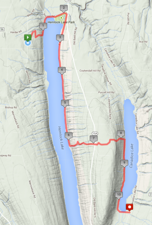
This Sunday’s hike is a special hike from the west side on Hemlock Lake to the east side of Canadice. How often can you hike around two Finger Lakes on a single one day hike?
Here is the schedule:
 10:00 am: Meet at Hemlock Lake Park. Carpool to the DEC parking area on Blank Rd, just north of Niver Rd. Start hike on left branch. Bushwhack down to the Walnut trail along the west side of the lake.
- 10:45 Break at Hemlock Lake Park. Replenish water. Continue walk to North Boat Launch on the east side of Hemlock Lake.
- 11:20 Continue on road after the boat launch to the end of the maintained road. Stay on the old road for about a mile. Bear to the right, following orange survey tape blazes to bushwhack up the hill to the corner of the Nature Conservancy land. From there, follow yellow blazes until in sight of the road. Finally cross 15A at Old Bald Hill South.
- 1:45 Break at Rob’s Trail parking area. Replenish water.
- 2:00 Continue onto Rob’s Trail, heading to the right around the top circle.
- 2:40 The Naturalists continue around the loop on top, and back to the parking area.
- 2:40 The climbers and tourists turn right to head onto DEC land and down to Canadice Lake. After crossing the bridge at the bottom, turn right and follow the lake side trail to the inlet and the southern entrance on Canadice Lake Rd.
- 3:20 The Naturalists return to the Rob’s Trail parking area and drive to the southern entrance on Canadice lake. If time permits, they may hike in on the lake-side trail to meet the climbers and tourists.
- 4:00 Car pool back to the Rob’s Trail entrance and then on to Hemlock Lake Park for a social.
Hikers are welcome to join the hike at 10:00, 11:30 or 2:00 depending on their schedule and interest.
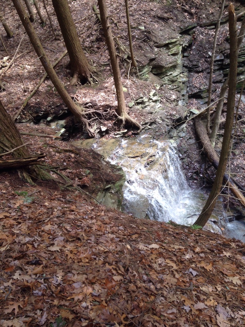 The hike from Blank Rd on the west side of Hemlock Lake to the east side of Canadice is about 11 miles and will require that we move right along to keep on schedule. The hike starts on an existing trail from the north-most parking area on Blank Rd. At the lowest point of this trail a previous hiker has marked a trail down the hill to the Walnut Trail along the edge of the lake. At this time of year, the trail down the hike is relatively easy with no underbrush, although it is steep and good hiking shoes are required. We will find there are a couple of missing culverts on the Walnut Trail but these are easy to cross. Then the route literally becomes a walk in the park to the boat launch road to the bench providing a nice view to the south. But no time to stop, we will continue to follow the overgrown old road. A few shallow gullies to cross and a few brambles to watch for. We will pass an old foundation about a mile south of the bench, and soon after that we will pick up a trail marked by the Nature Conservancy up Bald Hill to Rob’s Trail. Look for Orange tape heading up the hill. Just as you are about to give up and impeach the hike planner, a pretty waterfall will appear ahead. This is a good time to drink some water and enjoy the view. We are fortunate to be seeing the falls in the spring with water flowing over them. About half way up, we cross a small creek and the tapes switch to yellow.
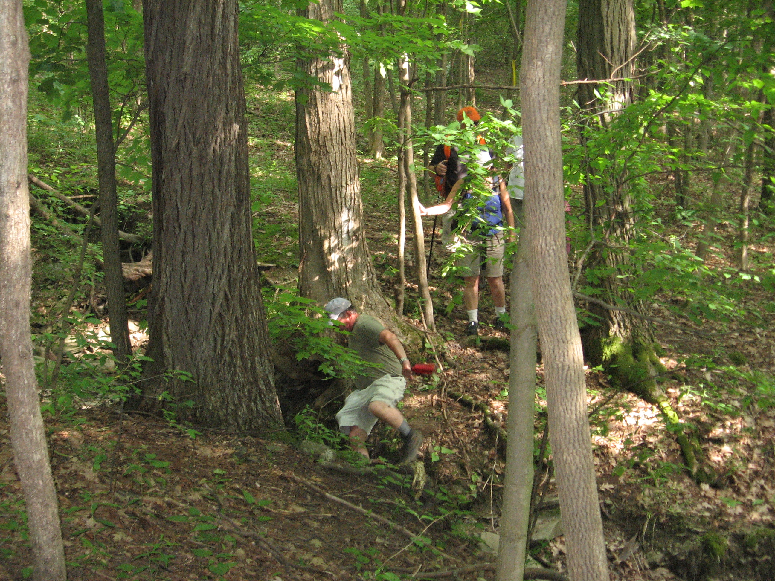
Heading down from Rob’s Trail to Hemlock Lake in June 2012. We will climb the hill on Sunday.
The Nature Conservancy is planning to make this a Rob’s Trail extension to eliminate some of the bushwhacking.
At about 1:45 we plan to be at the Rob’s Trail parking lot for a small snack and to meet up with the rest of our hikers to continue the hike around Rob’s Trail and down to Canadice and out the south end of the lake.
Now, please pay attention.
If you wish to hike all the way from Blank Rd to Canadice Lake Rd (about 11 miles), then meet us at the Hemlock Lake Park at 10 am. We will carpool to the start point on Blank Rd. Please pack a lunch and bring water. Additional water will be available at the park and at the Rob’s Trail entrance.
If you wish to just hike over Bald Hill via the Rob’s Trail extension (8 miles), meet us at the North Boat Launch on Hemlock at 11:15. We will be along shortly. Please feel free to hike down to the bench at the end of the maintained road (past the gate about a mile) if the first group is too far behind.If you wish to only hike Rob’s Trail (3.5 miles), then meet at the trail head on Old Bald Hill Rd South between 1:30 pm and 2:00 pm. The Tourists will hike Rob’s trail starting to the right, then to the steep trail down to Canadice Lake. At the bottom, we will turn south and hike to the inlet of the lake. Meanwhile, the Naturalists will continue around Rob’s Trail on the top of Bald Hill. When they return to the cars, the Naturalists will drive to the south end of Canadice and hike on the west trail to meet the Tourists. The Naturalists will help to carpool hikers back to their cars at the Rob’s Trail trailhead.
Following the hike, we will have a pot luck social at Hemlock Lake Park at the north end of Hemlock Lake. Please bring a “dish to pass”, or make a contribution to the S/T social fund (suggested $5) to help defray expenses. Also bring a beverage of choice.
Looking for brochure.or mailing list so I can receive it in the mail.
Nothing opens up for mailing list.
There’s all kinds of very bizarre ads and post for viagra and other drugs above on calender page.
Please let me know if there’s a brochure available