
Hikes led by Springwater Trails are generally held on Sunday afternoons and appear in this calendar in green.
| Sun | Mon | Tue | Wed | Thu | Fri | Sat |
|---|---|---|---|---|---|---|
| Honeoye Lakeview Hike 2:00 pm Honeoye Lakeview Hike @ 5422 County Road 37, Canadice Apr 3 @ 2:00 pm – 4:00 pm This Sunday we will explore the woods and fields overlooking Honeoye Lake on the west side, followed by a dish-to-pass social at the Affolter farm. Meet at 5422 County Road 37, about 2 miles south of Route 20A and 2 … Continue reading | ||||||
| Catharine Valley Trail Hike/Bike 2:00 pm Catharine Valley Trail Hike/Bike @ S Genesee Street Parking Area Apr 10 @ 2:00 pm – 4:00 pm  Catharine Valley Trail is a state park and recreation trail which is located in Schuyler and Chemung Counties. It runs for 12 miles between Watkins Glen State Park and Mark Twain State Park and uses the abandoned Chemung/Northern Central Railroad and … Continue reading | ||||||
| The Erie Canal at Macedon 11:00 am The Erie Canal at Macedon @ Canal Park Apr 23 @ 11:00 am – 12:00 pm 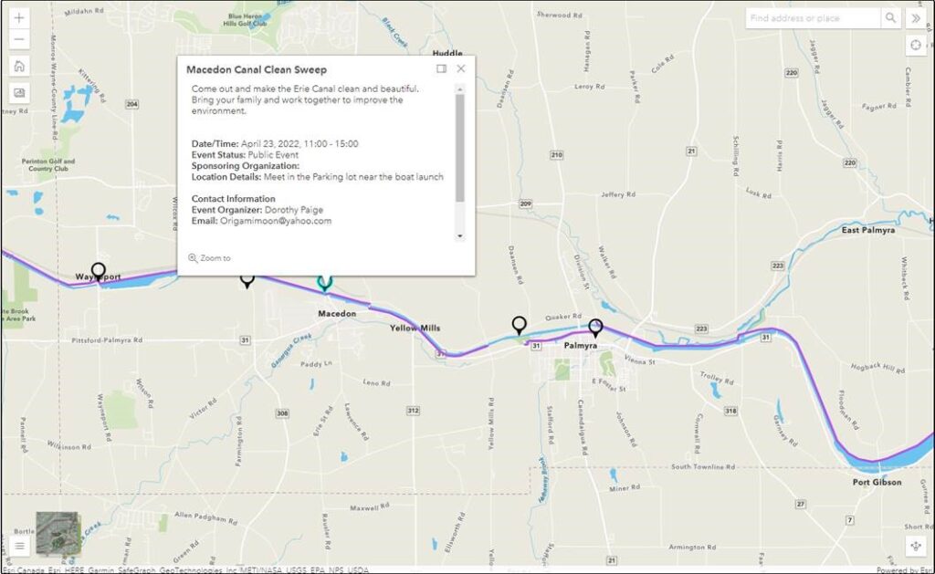 The Sunday hike this week will be on Saturday 23rd April, and we will be participating in an Erie Canal Clean Sweep event in Macedon. This event is organized by someone other than Springwater Trails, so we will be joining them at the … Continue reading | ||||||
The Sunday hike this week will be on Saturday 23rd April, and we will be participating in an Erie Canal Clean Sweep event in Macedon. This event is organized by someone other than Springwater Trails, so we will be joining them at the earlier time of 11:00am to walk a section of the Erie Canal in Macedon, pick up all the trash we can find and generally tidy up the towpath. We’ll limit our time at the event to something c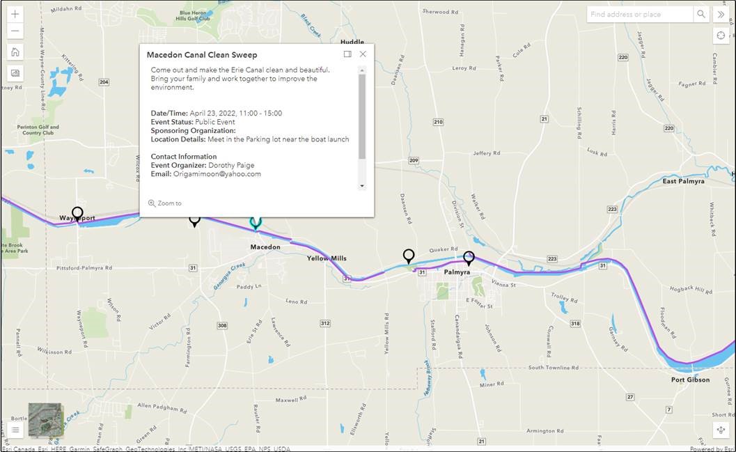 lose to our usual 2 hour hike.
We’ll meet at the parking lot near the boat launch in Macedon – See the map provided by the event organizer.
Please bring trash bags, secateurs and work gloves.
The Social: We’ll organize a social during the event.
Directions. NY 31 follows the canal east from Pittsford to Macedon. In Macedon turn north on 31F – Ontario Center Rd. In 0.2 miles, just before the canal, turn left into the park. Meet at the boat launch or in the parking lot.
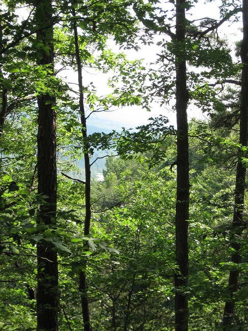
The Stid Hill Multiple Use Area is a 847 acre tract of land situated in the townships of Bristol and South Bristol in Ontario County. It is bounded by Route 64 on the west and Dugway Road on the north. Ganargua Creek, better known as Mud Creek, flows along Route 64. At one time, Stid Hill was productive sheep and cattle grazing land. Today the grazing has been eliminated. The mixture of steep hills, ravines, gullies, gorges, woods, and open areas create scenic vistas and also provide varied wildlife habitats.
We will meet at the Stid Hill MUA parking area on Rt. 64 at 1:45pm. Once we determine how many would like to hike the trail from top to bottom, we will leave some cars in this parking area. We will then carpool and proceed to drive up to the parking area on Dugway Rd. At this point the climbers will set out to hike back down to Rt. 64. The Tourists and Naturalists will follow the trails up at the top of the hill. The ground is uneven so you may want to bring poles. There are also very wet and muddy spots along the trail so waterproof hiking shoes or boots would be recommended. Rt. 64 runs north and south. If you are coming from the north starting at 5&20 head south, past Bristol Center and CR32, the parking area will be on your left. If you reach Bristol Mountain Ski Area, you have gone too far. From the south head up Rt. 64 past Bristol Mountain Ski Area, and the big wooden sign that says Stid Hill, you will see the parking area on your right.
Though the trails were well marked at one time, there hasn’t been much trail maintenance recently. The trail markers are difficult to follow and sometimes deceptive, and they disappear completely over the crown of the hill. The going will be very wet in places over the crown.
The Meeting Place
We will meet at the Stid Hill MUA parking area on Rt. 64 at 1:45pm.
Getting There
Route 64 runs north-south, so there are only two direction of approach.
From the north, (Honeoye and Bloomfield) starting at Route 5 & 20 in Bloomfield, come down Route 64. 3.0 miles south of Rt 20A and 1.4 miles past Bristol Center (and CR 32), turn left on Dugway Road. If you come to a Stid Hill MUA parking area, you’ve come too far south – turn around and try again.
From the south, starting at Bristol Springs for 6.4 miles, come up Route 64 past both Stid Hill parking areas, then turn right on Dugway Road. If you come to Bristol Center you’ve come too far north.
From Springwater, Google Maps recommends heading north to 20A through Honeoye, then south on 64.
From Wayland, the recommendation is to take Rt 21 through Naples to the east end of Dugway Rd (4.5 miles north of the intersection with NY 64). The trail head is 1.2 miles west on Dugway, (Dugway is paved to the Bristol/Canandaigua town line).
Dugway Road is a good dirt road. The trail head is exactly 2.0 miles from the Route 64 junction. It’s easy to miss – it’s just a widening of the road after a sharp left turn. The trail head is on the right of the road and marked with a discreet sign a little too far from the road. Please park carefully. There isn’t much parking space to be had.
The Social
We’ll go to Lock Stock and Barrel on Route 64 just north of Bristol Mountain for the social after the hike.
 NOTE: Please note the change of time to 3:00PM EDT. We plan to work until about 5:30.
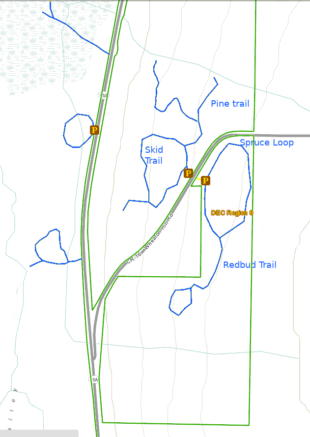
This Sunday’s hike will be a joint event with NYS Department of Environmental Conservation, Parks & Trails New York, and the NYS Parks and Recreation. It will be part of a state-wide network of events celebrating I Love My Park Day to honor New York’s state parks and state forests. Our effort will focus on making one of our closest patches of state land – Wheaton Hill in Springwater (42.657417, -77.564875) – cleaner and more hikable for visitors. The trails at Wheaton Hill are a small part of the Hemlock Canadice State Forest, a lovely patch of land in the hills of the Finger Lakes and is well worth a little TLC. We will split into several teams depending on how many people show up, with each team being assigned a route through the forest and tasks such as cutting grass, picking up trail debris, picking up trash, and general cleaning up the trails.
Please bring gloves to protect your hands, loppers or small clippers to cut branches and the ever present Multiflora roses. Other useful tools, if you have them, include a small saw for branches that are too large for the loppers, and a small shovel if you want to help direct some of the water on the path. If you want to do some serious damage, then bring a weed whacker and have at it. We will also have a sawyer at the event should there be fallen trees across a path. If you do plan to use power tools, PLEASE BRING EYE PROTECTION! These devices can kick up a lot of dust and small stones. Finally, a backpack may be useful to carry your water and saw while you use loppers to cut roses.
We will work on the Pine, Skid, Spruce and Redbud trails. Most of our work will be clearing fallen sticks off of the path and cutting back the roses and other growths. This organic debris will be moved off the trail, but left in the woods. Some garden duty trash bags will be available for carrying out any trash that has found its way into the forest..
The Social
We’ll have a picnic social if the weather if fine, otherwise we’ll just quit at the end of the day. All workers are invited to bring a sandwich or snack and beverage and a chair in case you wish to rest.
Directions: Wheaton Hill is the first right turn north of the intersection of Rt 15 and Rt 15A in Springwater (0.9 mile north of the intersection). The trail head is 0.5 miles up Wheaton Hill just before the road turns straight east and heads up the main hill. More details are on the directions page. Please park on the left side of the road as you come up the hill. There is a short entrance to the trails on the right side you can use to turn around.
What to bring:
- Gloves and clippers – hand clippers or long handled loppers for larger branches.
- Water to keep hydrated.
- A picnic dinner
- Solid boots to protect your feet
- Rain coat or poncho if the forecast changes
If you wish, bring one of the following
- A weed whacker if you want to cut grass, with gas mixture and extra string.
- Eye protection
- Small bow saw.
- Small shovel that is easy to carry
- Plastic grocery bags in case you find any litter.
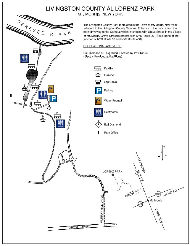
Since our last hike through the Al Lorenz County Park above Mt Morris, the county has made many improvements to the park, including new trails and beautiful bridges across the streams feeding the large pond. In honor of the opening of the summer season at the park, this Sunday’s hike will provide all hikers an opportunity to see more the park in person.
All hikers and bikers will meet at the parking lot behind Pavilions 4 and the playground (click on the map to the left for details). Following the hike and bike ride (around 4:30), we will meet at Pavilions 3 at the end of the Pond for a dish to pass social (at that time we can move cars to the pavilion parking area).
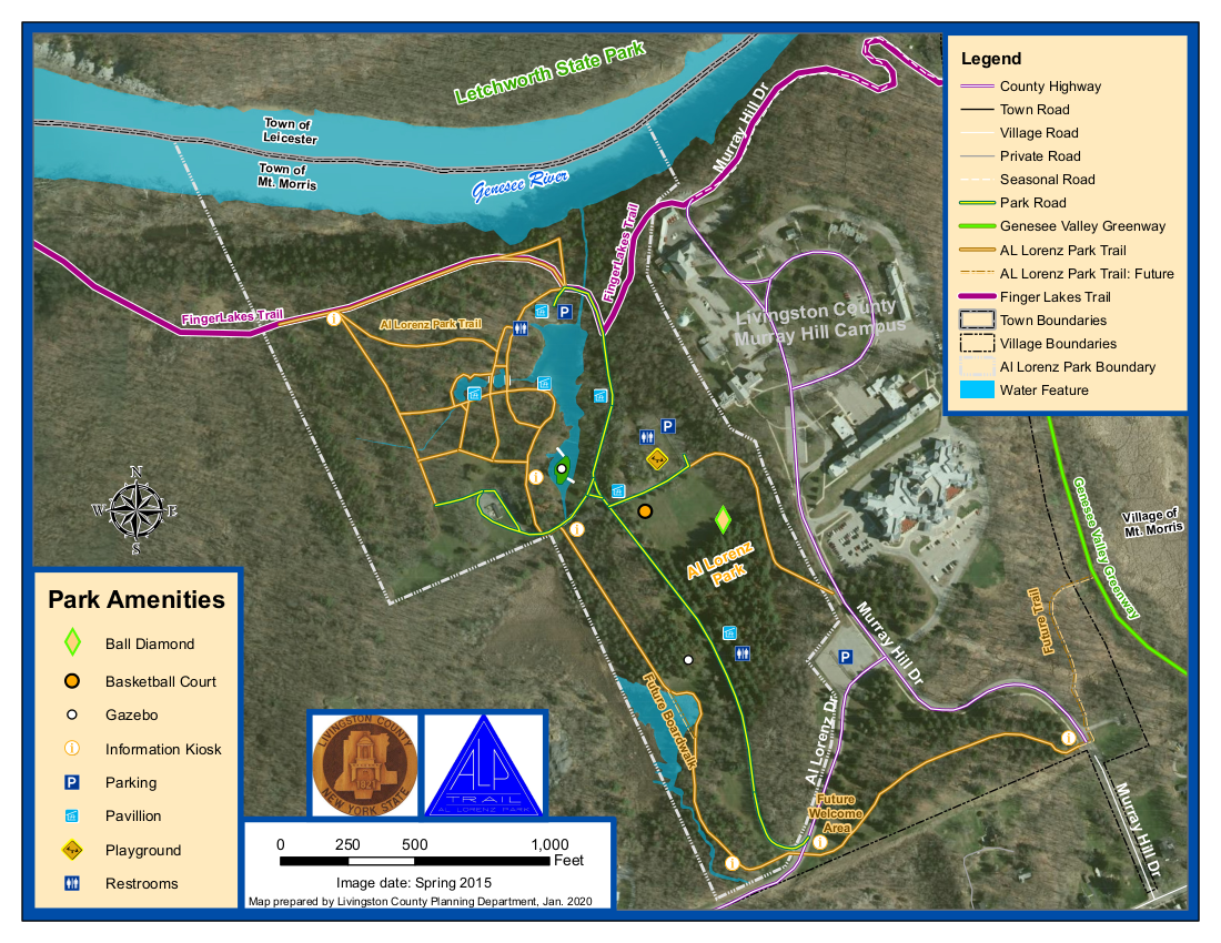
Our hikers will follow the Letchworth branch of the Finger Lakes Trail along the gorge to the Mt Morris Dam, and then will return to the Park. The Climbers will stay on the Letchworth Branch (Yellow blazes) past the FLTC Office, the Dam Visitors Center to the overlook of the dam. Given time, they will continue on to enjoy addition views of the Letchworth gorge until the trail jogs left away from the river. Turning around at that point will result in a round trip hike of about 3.4 miles.
The Naturalists hike will also follow the Branch trail up to a field before the Dam area. This field contains a Wildlife Loop. Based on the condition of the wildlife loop and the time, the Naturalists will choose whether to hike around the loop or continue on to the Dam overlook. Turning around at the Dam overlook will be a 2.8 mile hike.
Bikers will head west within the park and climb a steep hill to the Livingston County Campus, and then will descend a curving road to the Genesee Valley Greenway. From there, we will follow the Greenway north to NY-20A. We will turn around and ride the Greenway (or possibly River Rd) back to Mt Morris, to Grove St, where we will turn south, following Grove St and Parker Rd. After turning right on Al Lorenz Dr, we will re-enter the park. If time permits, we will ride some of the park trails back to the Pavilion 3.
 When hikers return to the Al Lorenz park, they should take some time to explore the trails around the pond. Between 4:30 and 5:00, gather at Pavilion 3 for a Dish to Pass social. Please bring a dish to share and your own beverage, or bring a sandwich if you are more comfortable not sharing. A contribution to support the social supplies of $5 is appropriate if you forget or can’t bring your food contribution.
All hikers and Bikers will meet at the parking lot behind Pavilions # 4 and the playground. Please be ready to start the hike or ride at 2:00.
Directions
From Springwater and Wayland: (Note that Liberty Pole Rd is under construction. These directions avoid Liberty Pole Rd). Head south on NY-15 through Wayland. Turn right onto I-390 past the Dansville exits to Exit 6 (16.3 mi) for NY 36, Mt. Morris. Turn left on NY-36N for 5.4 miles. At the third left following the lights at NY-408 turn onto Grove St. In 0.2 miles turn right onto Murray Hill Rd. At the top of the hill, turn left on Al Lorenz Dr. In about 0.1 mile, enter the Al Lorenz Park. Turn right in about 0.3 miles to get to the parking lot behind Pavilion #4.
From Rochester: Take I-390 S to Exit 7 for NY 408 Mt Morris. Turn left (south-west) on NY 408. At the Main St light, turn right. At the third left on Main St, turn onto Grove St. In 0.2 miles turn right onto Murray Hill Rd. At the top of the hill, turn left on Al Lorenz Dr. In about 0.1 mile, enter the Al Lorenz Park. Turn right in about 0.3 miles to get to the parking lot behind Pavilion #4.
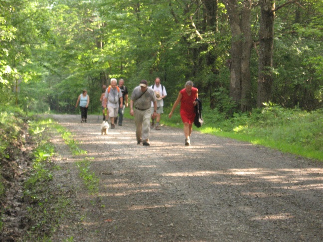
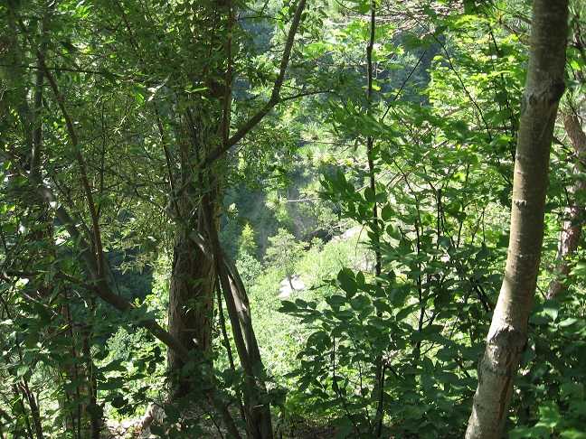
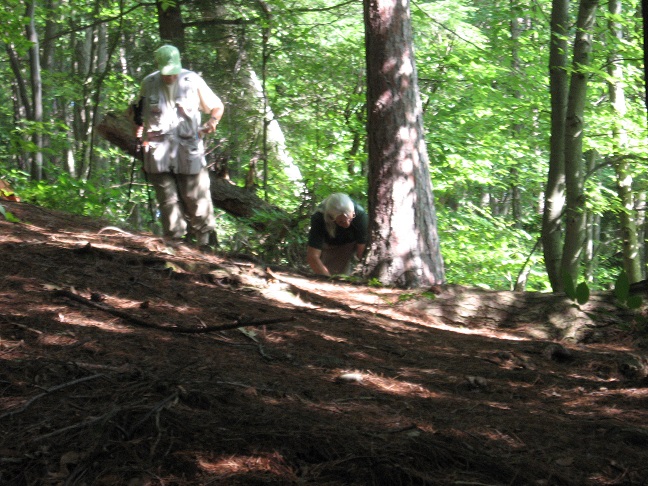
This Sunday we will be hiking in Clark’s Gully just north of where Sunnyside Rd crosses the West River outside of Naples. We will plan on meeting at the DEC parking lot. Try to be there a little earlier, at 1:45pm.
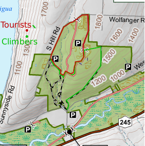 Climbers will start across the street from the parking lot. They will start up the main trail and then turn right where the trail splits. They will follow the logging road for about 1.5 miles until they reach the north end of the DEC border at which point the trail dead ends at the property line heavily marked with posted signs. They will turn left up the hill while staying on the DEC property. They will come out to a field on top and a DEC access road with a parking loop that comes in from north end of the DEC property off South Hill Road. There will be 2 choices to get over to the South Hill DEC parking area where the Tourist would have started their hike from. They can choose to either walk South Hill Road back to the South Hill parking area or take the ” yellow gated” access trail at the North end off South Hill back down to the waterfall and cross over the creek and up to the South Hill Parking area. They will be car pooled back to the DEC parking area off Sunnyside.
The tourists will drive up to the top of the park and start at the DEC parking area off of South Hill Road. They will follow the trail down to the creek and cross over following the trail up to access trail that comes in from the “yellow gate” at the north end of the park off South Hill Road. They can return back to the Dec parking lot off South Hill Road, where they started or continue to the DEC loop access road to the east of the yellow gate off South Hill Road and take the logging trail back down to the DEC parking area off of Sunnyside Drive.
The Naturalists can drive to the top of South Hill Parking lot and walk into the same trail as the tourists without crossing the creek. The woods is dotted with pines and is a pleasant walk or they may choose to walk South Hill road taking in the various wild flowers along the roadside.
Those that wish can meet back to the DEC parking area off Sunnyside Drive for a social. Bring a sandwich and a drink.
Note: It is tick and mosquito season so dress for prevention and bring bug spray and plenty of water.
Directions: From Route 21 north of the village of Naples, turn onto Route 245 north. Continue north for about 5 miles. You will pass the West River boat launch on the left. Just pass the launch about 1/2 mile, turn left onto Sunnyside Drive and the Clark’s Gully DEC parking lot will be on your right about 1/2 mile down.
.


There was time to explore the waterfall while the mushroom hunters caught up.
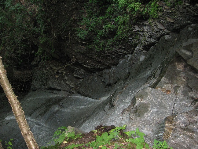
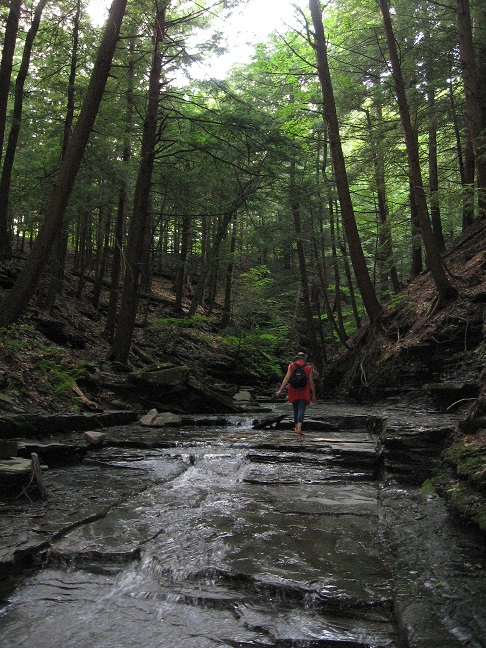
Next we had a creek walk up to the “campground”.

PLEASE NOTE – THIS IS THE FIRST SUNDAY EVENT WITH OUR SUMMER STARTING TIME OF 4:00 PM
This Sunday we will explore Ontario County Park at Gannett Hill, the highest point in Ontario County, and the surrounding terrain, using the travel method of your choice. Hikers and Cyclists will all start at the Jump Off Parking Area heading off in different directions, and will rendezvous at the Jump-Off for our optional post-exercise social. Please gather promptly at 3:45 pm to get organized and be ready to hike or ride by 4 PM. The later start time is intended to allow participants to also attend the Bristol Hills Historical Society’s 2 PM event at the Burning Springs on Case Road – see https://bristolhillshistory.org/events
Hikers will follow the Finger Lakes Trail’s orange blazed trail to the south and west. Climbers and Tourists will hike down the hill to the Beaver Pond and back, a total of about 4.25 miles and 500 feet of elevation change, while Naturalists will explore the more level trails near the top of the park. Bring water, poles, and good hiking footwear for the park’s rugged terrain. The Park and FLT are full of wildflowers this week – on the prehike we found wild geranium, violets, star flowers, fringe flower, lupines, wild azaleas, trillium, and a lady slipper.
Cyclists will follow the one-way Park Road out to Gannett Hill Road, then head south toward Naples, rounding the south end of Gannett Hill on Seman Road and returning to the north along County Road 33 for a total of about 8 miles of mostly downhill terrain ( a 500 foot drop overall, with some uphill sections) with great views of the hills across the Naples Valley, and of West Hollow. Upon reaching the County Road 33 trailhead and parking area, north of 6910 County Road 33 (look for wooded parking area on the left and orange trailhead marker on right), they will lock up their bikes, change their footwear, and hike back up the Finger Lakes Trail past the Beaver Pond to the starting point, returning to retrieve their locked bikes at the end of the social. Cyclists please bring a bike lock and appropriate garb and equipment for both activities. If you plan to ride, please contact Saralinda at sh73sh73@yahoo.com no later than Saturday, so that we can identify a ride leader. If you prefer an all-riding event, please advise Saralinda and make your own arrangements for the return to the park by bike or a placed vehicle, and feel free to join us for the post-ride social around 6-6:30 PM.
Social: Bring food, beverages, and a lawn chair for a dish-to-pass gathering at the Jump-Off shelter, or nearby if the lodge is reserved. If you run out of time to shop or cook, bring $5 for the can.
Directions: From Springwater: Go south to Naples via Wayland and Route 21. Continue north to Woodville and the start of Route 64. Turn left on Gannett Hill Road and enter the park at the top of the hill. Loop around the perimeter road until you reach the Jump Off parking area and trailhead.
From Honeoye and Hemlock: Take County Road 33 south from East Lake Road, Honeoye, turning left on County Road 34 to meet Route 64. Go right on 64 and proceed 1.8 miles to make a right on Gannett Hill Road. Enter the park at the top of the hill and loop around the perimeter road until you reach the Jump Off parking area and trailhead.
From Rochester or Routes 5&20: Take Route 5&20 to Toomey’s Corners, about 2 miles east of Bloomfield. Go south on Route 64, about 13 miles to make a right on Gannett HIll Road. Enter the park at the top of the hill and loop around the perimeter road until you reach the Jump Off parking area and trailhead.
It is June and sunny and warm. What better way to spend a Sunday afternoon than on Hemlock Lake? Bring you kayak or hiking shoes and meet Springwater Trails at the North End boat launch on Hemlock Lake. We will enjoy the water or Rob’s Trail and then will meet after the hike (and kayak) at Hemlock Lake Park for a pot luck social. Bring a dish to pass and your own beverages or donate to the social fund.
Kayak or Canoe Paddle
Boaters will meet at Hemlock Lake North Boat Launch and must arrive early enough to have their boat unloaded and car parked in preparation for a 4PM launch. Try to arrive at 3:30 because the launch will likely be crowded. They will cross the lake to the western shore, paddle south, cross the lake to the eastern shore and return north to the boat launch. Paddlers will need to determine how far south they can go and have enough time to get back to the launch by 6PM.
Hikers
All hikers will meet at the large parking area of Hemlock Lake Park off Rix Hill Road at 4PM. All hikers will walk south past the gate on the flat part of Rob’s trail.
The Tourists and Climbers will walk south through the woods until Rob’s Trail heads uphill. Before turning up the hill, we will step out onto the beach and check on the progress of the kayakers. Then this group will continue up the hill to the bridge (or as time permits) and then will return down hill and back to the cars.
The Naturalists will follow the climbers but likely will turn around at or before the beach and return along the same path to the cars.
All hikers and kayakers are welcome to join us for a social at the Hemlock Park pavilion. Head north out of the boat launch to Rix Hill Rd. Turn left and take the second left into the pavilion..
Directions to Hemlock Lake North Boat Launch
From Springwater: Head north on 15A for 10.1 miles. Turn left on Rix Hill Road. Take the first left and follow the road to the end at the boat launch. If the main boat launch is not crowded, we will launch kayaks from there. Otherwise, we can park in the parking lot or along the road and carry kayaks to the kayak launch site.
From Hemlock and Honeoye: From Hemlock head south on 15A. From Honeoye, head west on 20A and turn left onto 15A. From the intersection of 20A and 15A south of Hemlock, continue south for 0.7 miles and turn right onto Rix Hill Rd. Take the first left and follow the road to the end at the boat launch. Parking is available in the lot at the end, or along the road.
Warning: The weather report calls for rain this afternoon and possibly thunder storms. We will be at the trailhead by 4 and will ride if the weather permits. If it looks like thunder we likely will postpone to another day and just have a beer. Stay safe and keep hiking.
This Sunday we have a choice of activities, both starting from the northeast corner of Honeoye Lake – a hike in Sandy Bottom Park or a bike ride along or around Honeoye Lake. Note the start time of 4 PM for both activities. After the workouts we will adjourn to the Birdhouse Brewing Company at 8716 Main Street, Honeoye for our social/recuperation.
Everyone meets at the Sandy Bottom Park Trailhead on East Lake Road, about .3 mile from Route 20A/Main Street Honeoye. There are two parking lots side-by-side, each holding about 10 cars. Hikers will all start out together on the field portion of the trail and proceed as long as you want, with some hiking all the way down to the creek, lakefront and wetland boardwalk.
Based on last year’s experience, most cyclists will opt for the full 18 mile circuit of the lake, all going at our own speeds. We’ll decide as a group whether to go clockwise or counterclockwise. An alternative for those who want a shorter ride is the 5 mile dash down East Lake Road to the South Boat Launch, returning the same way for a 10 mile total.
Cyclists please bring plenty of water, and helmets are required.
Social: Please join us afterwards at the BirdHouse Brewing Company at 8713 Main Street, Honeoye, for restorative food and beverages and maybe some entertainment. For the menu see https://birdhousebrewing.beer/
Directions to Sandy Bottom Trailhead:
From the south (Naples, Springwater, etc): Take Rte 21 North to CR 36, make left onto CR 36, make right onto East Lake Road – parking lot is on left just past the County Road 33 intersection.
From the north (Bloomfield, Victor, Rochester, etc): Take CR 40 south to Rte 20A, cross 20A onto East Lake Road, parking lot is on right, 3/10 of a mile from intersection.
From the east (Bristol, Canandaigua, etc): Take Rte 64 south to Rte 20A, make right onto 20A, left onto East Lake Rd
From the west (Hemlock, Livonia, etc): Take Rte 15A to Route 20A, make left onto 20A, right onto East Lake Road
Directions to Birdhouse Brewing Company: From the trailhead, return to Route 20A, Main Street Honeoye. Make a left and proceed through the village. Birdhouse Brewing is at #8713, just past the bridge on the right, a few buildings before the red light.
This Sunday, we will have the opportunity to enjoy the unique arboretum at Durand-Eastman Park. Included in their rhododendron collection, are a few trees called mountain laurels, which are common in the Appalachian hills. The mountain laurel is in bloom at this time. It has a unique trick for getting bees to transfer their pollen, which we will attempt to demonstrate. When we tried last year, we were too early. This year, our timing looks better.
We will meet in the circle at the end of Log Cabin Rd. at 3:45 PM. We will then hike the trail, at the south end of the park, to the junction of Zoo and Pine Valley Rds., enter the arboretum at Pine Valley, and walk to the mountain laurels for the attempted demonstration. Afterwards, hikers seeking a more vigorous walk are welcome to enjoy some of the park’s nice hiking trails and return to the Log Cabin Rd. Circle at 6 for our after-hike social.
There are 4 shelters in this area so, in case one of them is unoccupied, perhaps we can appropriate it. If not, we’ll just use the lawn (and hope it isn’t raining). Bring a food item to share or make a $5.00 donation. Also bring lawn chairs. I have a folding table but, we might be able to use more, if you have and would like to bring one.
Mark will bring a small portable grill, in case anyone wants to grill something.
Directions:
From the Springwater area, go north to I-390. In Monroe Co., use the right lanes to get on I-590. At junction with 490, stay on 590. Get in middle lane, avoid 104 exits, and stay left to go toward Sea Breeze. At the fourth roundabout (you’ll see a bunch of flags), go ¾ of the way around and keep going straight west on Durand Blvd, which turns into Sweet Fern Road, and then Pine Valley Rd and then (at Zoo Rd) into Lakeshore Blvd. DO NOT turn on Zoo Rd, or you will have to walk from Zoo Rd to Log Cabin Rd because that section of Log Cabin Rd is closed to cars. Instead, take the next left on Log Cabin Rd. (past Zoo Road), go to the circle at the end and park in the circle.
Hikers wishing to carpool from Springwater should meet at 2:30 at the Springwater Town Hall and plan to leave promptly at 2:40. Be sure to ask the driver if they are staying for the social. This is a self organizing car pool, so be sure to be on time.
From Naples or Canandaigua, head north to the Thruway and I-490 west. Stay right to exit onto 590 north. Get in middle lane, avoid 104 exits, and stay left to go toward Sea Breeze. At the fourth roundabout (you’ll see a bunch of flags), go ¾ of the way around and keep going straight west on Durand Blvd, which turns into Sweet Fern Road, and then Pine Valley Rd and then (at Zoo Rd) into Lakeshore Blvd. DO NOT turn on Zoo Rd, or you will have to walk from Zoo Rd to Log Cabin Rd because that section of Log Cabin Rd is closed to cars. Instead, take the next left on Log Cabin Rd. (past Zoo Road), go to the circle at the end and park in the circle.
From Honeoye, there are several ways to get to 590 north. Google maps is suggesting Clover St to Monroe Ave and then get on I-590, but it depends on traffic. So I am going to leave it to each driver to find their way to I-590 or I-490 and then follow the directions above.
Finally, Happy Father’s Day to all my fellow dads.
Looking for brochure.or mailing list so I can receive it in the mail.
Nothing opens up for mailing list.
There’s all kinds of very bizarre ads and post for viagra and other drugs above on calender page.
Please let me know if there’s a brochure available