Hikes led by Springwater Trails are generally held on Sunday afternoons and appear in this calendar in green.
- Categories
- Tags Barry Childs and Kathy Cloonan barry@africabridge Bike Bill Cooke Bob Menz (bert6952@yahoo.com) Bristol Hills Branch CANCELED Clarks Gully CLWA Colorado Trail Dog friendly Finger Lakes Trail FL FLT Gene & Georgia Binder (585) 236-5384 Gene and Georgia Binder (585) 236-5384 Greenway Gully Gypsy moth Hemlock Hike John L Katherine Humphrey? Kayak Landowner Liability Leader: Mark Lehigh Valley Trail Mark and Laure Allen (585) 662-9305 Mark and Linda Mary Ann Devey (315) 573-0774 Mary Lou Wenthe (585) 208-4337 Melissa Mitchellsville mjkcloonan@frontiernet.net Mushroom Foray Naples Nunda POSTPONED Saralinda Saralinda Hooker Schribner Scott Sevensma (585) 413-8461 Sharon Boldt (boldtbs@yahoo.com) sugarbush hollow Summer Weekly Wendy Stevenson
| Sun | Mon | Tue | Wed | Thu | Fri | Sat |
|---|---|---|---|---|---|---|
| Saturday Morning Bluebell Hike in Geneseo, led by Genesee Valley Conservancy 10:00 am Saturday Morning Bluebell Hike in Geneseo, led by Genesee Valley Conservancy May 9 @ 10:00 am – 12:00 pm  Saturday Afternoon Bluebell Hike in Geneseo, led by Genesee Valley Conservancy 2:00 pm Saturday Afternoon Bluebell Hike in Geneseo, led by Genesee Valley Conservancy May 9 @ 2:00 pm – 4:00 pm  | ||||||
| Finger Lakes Trail Series – Klipnocky State Forest – Canceled 2:00 pm Finger Lakes Trail Series – Klipnocky State Forest – Canceled May 17 @ 2:00 pm – 4:00 pm  There will not be any Springwater Trails hike this Sunday. However, we are planning to start up again next weekend with boating and hiking at the north boat launch at Hemlock Lake. Please join us then. Meanwhile, everyone is … Continue reading → | ||||||
| Boating and Hiking at Hemlock Lake 4:00 pm Boating and Hiking at Hemlock Lake @ North Boat Launch May 24 @ 4:00 pm – 6:30 pm 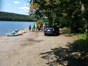 As the COVID-10 pandemic recedes and New York opens up Springwater Trails will resume hiking on May 24th – Memorial Day. We want to encourage prudent social separation until the governor recommends otherwise so we’ll be planning on plenty of … Continue reading → | ||||||
| Kayak and hike on the Marrow Beds 4:00 pm Kayak and hike on the Marrow Beds @ Rick's Back Yard May 31 @ 4:00 pm – 6:00 pm 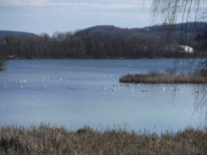 This Sundays hike will include a 3 mile easy hike and (or) kayak in the wetland pond known to locals as ” The Marrow Beds”. This pond was excavated during the late 1800”s and was reported to be as deep … Continue reading → |
-
Categories
-
Tags
Barry Childs and Kathy Cloonan barry@africabridge Bike Bill Cooke Bob Menz (bert6952@yahoo.com) Bristol Hills Branch CANCELED Clarks Gully CLWA Colorado Trail Dog friendly Finger Lakes Trail FL FLT Gene & Georgia Binder (585) 236-5384 Gene and Georgia Binder (585) 236-5384 Greenway Gully Gypsy moth Hemlock Hike John L Katherine Humphrey? Kayak Landowner Liability Leader: Mark Lehigh Valley Trail Mark and Laure Allen (585) 662-9305 Mark and Linda Mary Ann Devey (315) 573-0774 Mary Lou Wenthe (585) 208-4337 Melissa Mitchellsville mjkcloonan@frontiernet.net Mushroom Foray Naples Nunda POSTPONED Saralinda Saralinda Hooker Schribner Scott Sevensma (585) 413-8461 Sharon Boldt (boldtbs@yahoo.com) sugarbush hollow Summer Weekly Wendy Stevenson

There will not be any Springwater Trails hike this Sunday. However, we are planning to start up again next weekend with boating and hiking at the north boat launch at Hemlock Lake. Please join us then.
Meanwhile, everyone is encouraged to go outside and enjoy the spring weather. Opportunities are available from walking around your house to pick up from the winter, to hiking the Finger Lakes Trail. Check here for recommendations for use of the FLT and other hiking trails during the COVID epidemic.
As the COVID-10 pandemic recedes and New York opens up Springwater Trails will resume hiking on May 24th – Memorial Day. We want to encourage prudent social separation until the governor recommends otherwise so we’ll be planning on plenty of boating and bicycling over the next few months as a natural way of operating as a group and keeping well separated. We would like our hikers to carry masks for the times when we do gather to talk as a group, but doing anything strenuous while wearing a mask isn’t going to work. Our hikes during the pandemic will be “in-and-out” hikes, and we will avoid car sharing and the shuttling of cars to pick up at the far end of a one way hike.

Kayaking on Hemlock Lake
The Memorial Day hike will be at Hemlock Lake. We will meet at the parking area near the north boat launch at 4:00. For those who choose to walk there’s Rob’s Trail running south along the shore of the lake; paddlers are asked to arrive about 20 minutes early to have time to ready their boats for a 4:00 launch.Rob’s Trail isn’t suitable for normal bicycling, though dedicated mountain bikers are welcome to try it.
Boaters will head south along the eastern shore from the launch for 2-3 miles, depending on the conditions and the speed of the paddlers. After 1 hour they will turn back to the launch along the western or eastern shore.
Hikers will all walk south on Rob’s Trail as far as they as comfortable with, and then turn back.
The Social
We will have a social at the end of the hike. We won’t share food as we usually do, but we can gather at the picnic tables at the north end of the lake and each hiker can deal with his or her own lunch box.
This Sundays hike will include a 3 mile easy hike and (or) kayak in the wetland pond known to locals as ” The Marrow Beds”. This pond was excavated during the late 1800”s and was reported to be as deep as 45 feet. the pond has silted in over time and the deepest spot is about 4 feet. The morrow was loaded on a small set of railroad tracks and sent across town to the cement works.

There is an abundance of wild life (water birds of various kinds, turtles,beavers and occasional eagle sightings).
We will have a Social in the yard, practicing “social distancing”. Bring a snack with you also.
Directions
From Wayland: From the intersection of Rt 15 and 21, head west on NY-63 (Naples St) for 1.2 miles. Turn left onto Dieter Rd. Dieter Rd will make a 90° right turn, and then you should immediately turn left toward the Rod and Gun Club. Rick is the home on the left.
From Dansville: Head southeast on NY-63 S/Main St toward Wayland for 4.5 miles. Turn right onto Deiter Rd. Continue past the Transfer Station for 0.6 miles. Just before Dieter Rd will makes a 90° left turn, turn right toward the Rod and Gun Club. Rick is the home on the left.
We need a few volunteers to help re-route a section of the FLT between Seman Road and the Old Cemetery in Naples. Ideally we need 2 crews of at least 2 people each, one to paint out the old blazes and one to paint blazes on the new route. We estimate the job will take about 2 hours. Painting can be messy, so wear old clothes.
If you can offer some time, meet at 11:00am on Wednesday June 3rd at Bob and Ruth’s Parking Lot at the junction of Route 245 and Route 21 in Naples.
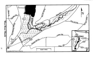 This event will combine a downstream paddle on the West River and a hike on the Middlesex Valley Rail Trail (aka the Lehigh Valley Trail). The best time to paddle this waterway is Spring. Let’s hope we have timed it right. According to Native American legend, this is the birthplace of the Seneca Indians. For images and additional information http://www.ilovethefingerlakes.com/rivers/west.htm
Paddlers The West River is a lazy stream, so we will be able to do an out- and -back with no problem. Launching at the Sunnyside Bridge, we will head downstream through a marshland full of waterfowl, turtles, and possibly eagles and osprey. Distance will depend on conditions, but likely 4 miles round trip (2 hours). PLEASE ARRIVE AT LEAST 15 MINUTES EARLY, READY TO LAUNCH AT 4:00.
Hikers The rail trail is a level path that parallels Rt 245 for 2.6 miles from Sunnyside to Parrish Hill Rd. There will likely be mud, so dress accordingly. The easy terrain lends itself to observing the surprises that nature has to offer. You might want to bring a camera. Distance will depend on hikers choice.
Directions From Route 21 in Naples head northeast on Route 245. Turn left on Sunnyside Rd and park on the left before the bridge at the brown and yellow DEC sign “West River Fishing Access Site”. Parking for 4-5 cars.
Social For those who wish to gather after the event, the Community Park on Route 245 just east of Naples has a large picnic area with tables and pavilions. Please bring your own food and drinks. Social distancing will be observed. Masks are also advisable.
We will explore Canadice Lake and its surrounding terrain with the travel method of your choice, starting at the Canoe Launch (the southernmost lake access point) on Canadice Lake Road (southeast corner of the lake). Meet at 3:45 and park on the road shoulder near the kiosk. If you are bringing a boat or a bike, allow extra time for unloading.
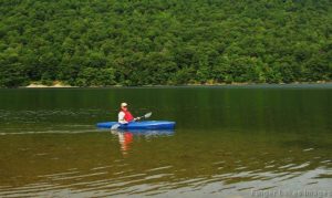
Hikers: Local resident Jim Kersting will lead the hiking group on a rambling loop up and down the hillside and gullies to the east of Canadice Lake. Bring poles and good boots, as there will be some climbs and shallow water crossings. Those interested in a gentler walk may head south along Canadice Lake Road to the southern end of the Canadice Lake Trail and follow it as long as you like, then return. The side trail through the ponds south of Canadice Lake is a nice addition to this route.
Paddlers: Put in at the south launch site and paddle the shores as far as you’d like, then return.
Cyclists: Starting at the southeast corner of Canadice Lake, head north along the Canadice Lake Road, west on Purcell Hill Road and back to the start on the Canadice Lake Trail for a total of about 7.8 miles. It that’s too short, do it twice, or extend the loop by going north to Canadice Hollow Road, adding another 2 miles to the loop. The Lake Trail is fairly level and a decent surface for road bikes with medium tires, better for hybrid or mountain bikes.
Optional Social: Bring your own food, drinks, masks and lawn chairs for a social-distance guided gathering at the south lake access area after the event. No sharing of food, but sharing of stories is fine.
DIRECTIONS: From Springwater: Head north on 15A and cut over to Canadice Lake Road. via Wheaton Hill or Johnson Hill Road. The south access area will be on the left.
From Canandaigua, Honeoye and Hemlock: Take Route 20A to the Canadice Lake Road intersection. Go south 6.5 miles to the southernmost lake access area, on your right.
From Rochester: Take Route 390 south to the 5&20 exit, go east to Lima, then south on Route 15A. After Hemlock, turn left on Route 20A and right on Canadice Lake Road. The southernmost access area is 6.5 miles down, on your right.
This Sunday we will celebrate Father’s Day with a return to Hemlock Lake to Kayak from the South End. We will explore the Springwater Creek Inlet and the west side of the lake.
Meanwhile, hikers will go to the Johnson Hill Trail and will enjoy a walk in the woods, above two waterfalls. This trail is appropriate for all skill levels, but if we have more then 10 hikers, we will split into two groups, with one group following the old lake road north along Hemlock Lake.
Fathers are welcome to bring children and grandchildren (and other family members!).
Following the hike everyone is invited to gather for a socially distanced picnic at the boat launch. Bring your own food and beverage and a chair if you wish.
Kayakers will meet at the South Boat Launch. Come early to unload your boat(s) so we are ready to push off at 4:00.
Hikers will meet at the parking area at the entrance to the South Boat launch. From there they will drive to the Johnson Hill Trail or drive or walk the road to the boat launch and then continue on the trail past the boat launch.
Directions to the Hiker’s meeting area are available here. The boaters should follow these directions.
PS. For those of you expecting a Conesus Inlet paddle and hike, the Inlet Trail has not been mowed this year. However, the trail south from the bridge on Sliker Rd is mowed and has two nice views of the inlet pond.
Looking south down Honeoye Lake from Sandy Bottom Park is one of the most beautiful views in the Finger Lakes. That is where we will meet on Sunday and split into two groups – one for paddling and one for hiking. Everyone should plan on meeting in front of the green pavilion by the swimming beach at 4:00 for a general welcome and to sign in.
Paddlers:
Plan to arrive early enought to have your canoe or kayak unloaded and ready to go prior to meeting at 4:00 at the pavilion. Unload your boat to the right of the swimming beach and outside of the buoys. After unloading, take your car back to the main parking area. You must wear a PFD and should have drinking water, a whistle, and a rope that could be used to tie to your boat. We will paddle on Honeoye Lake for about two hours – up and back along the west side of the lake.
Hikers:
Park in the main parking area and pick up a brochure/trail map at the small kiosk near the trail head on your way to meeting others at 4:00 at the pavilion. Hikers may want to split into different groups based on interests, but everyone will basically follow the same loop along the Sandy Bottom Nature Trail up to East Lake Road and back. The trail winds through a wetland along the Honeoye Lake outlet (Honeoye Creek) and skirts around an upland agricultural area next to Mill Creek. It is basically flat, maybe 2 to 3 miles long and has lots to check out along the way – turtles, fish, birds, wild flowers, etc.
Social:
For the social (optional) whoever gets back earliest should try and secure some picinic tables with good views of the lake. People should bring their own cooler and picnic supper – food, drink, table service, etc. and maybe a folding chair. No potluck for this social.
There is a nice sand volleyball court, so maybe we will want to try and get a couple of teams together for a game. As I write this, I don’t know if the swimming beach will be open on Sunday evening or not. It was closed earlier this week due to blue green algae but when I was there today (Thursday) the water looked good.
Directions:
Sandy Bottom Park is located at the north end of Honeoye Lake in Ontario County. At the stop light on Route 20A in the Village of Honeoye, go south on West Lake Road for one-half mile and then turn left onto the Sandy Bottom Park entrance. In front of you will be the main parking area.
COVID:
All participants will be expected to follow the COVID health and safety guidelines by using social distancing, masks (when needed), hand sanitizers, staying at home if you do not feel well, etc.
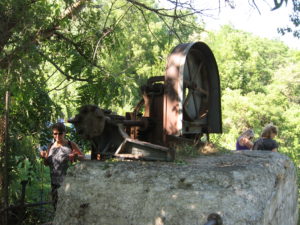
This Sunday people will have the choice of bike riding the Keuka Lake Outlet Trail or hiking a section of it. The trail follows Keuka Lake’s outlet to Seneca Lake, starts in Penn Yan and goes approximately 7 miles to Dresden dropping 275′ along the way.
This trail runs along the stream in a wooded ravine, it was “formerly a canal towpath and later a rail road bed, it crosses the original Pre-Emption Line and passes near the area of the first permanent white settlement of ‘The Universal Friend Jemima Wilkinson’, along waterfalls and ruins of mills, factories and canal locks”.
 Everyone will meet at the Seneca Mill Access parking area (Point 17 on the map) on Outlet Road at 4:00 PM. From there, bikers can go out and back both ways on the trail for a total of up to 14 miles. Well suited for hybrid or mountain bikes, the trail is a combination of dirt, gravel and asphalt and somewhat uneven. Hikers will divide into two or three groups depending on how far people choose to hike in the two hours that they have. All groups should plan to take in the Seneca Mills & Falls site (.2 miles west of the parking area) and the Cascade Mills & Falls site (1 mile east of the parking area).
We’ll have the usual COVID-style picnic at the Seneca Mill shelter if it’s available, and on the grass if not. Bring your own picnic, masks, and a folding chair.
Some maps of the outlet trail will be available at the beginning of the hike: you can print your own map from the The Friends of the Keuka Outlet Trail website.
Directions:
From Springwater, Wayland and Naples. Head south from Springwater on NY-15 south to Wayland, then turn left NY-21. Follow NY-21 for 12.7 miles through N Cohocton and Naples. Turn right on NY 245N across from Bob Ruth’s. Follow NY-245 for 8.9 miles to Middlesex and take a slight right turn onto NY 364E. In the Village of Penn Yan, turn right onto Liberty St., turn left onto Clinton St (State Route 54 North) and follow it 2 miles, turn right onto Bentley Rd (which becomes Bell Road) and go for 1 mile, turn left onto Outlet Road and go for .7 miles, parking area is on right.
This Sunday promises to be cooler, and we will return to the woods of Naples for hiking along the hills south of the village. Starting at the DEC buildings along Route 245, we will head southwest along Naples Creek, with the groups splitting up near the Ontario Street Bridge. All hikers meet at 3:45 for a 4 PM start.
Tourists and Naturalists will continue along Naples Creek, skirting the side of Hatch Hill to the parking area at Mark Circle and back, for a total hike of about 3 miles. This is a fairly flat and easy hike, close to the stream for cooling breezes.
Climbers will take the turn-off for the more challenging Bristol Hills Branch of the Finger Lakes Trail up the hill on the orange blazed trail, cutting off on the blue trail to make a loop past the overlook area and returning to the start by the orange trail. Total distance is about 5.75 miles with roughly 1,100 feet of elevation gain.
Social: Following the hike, we will retire to the community park next to Bob’s and Ruth’s for a picnic with social distance. There are a few picnic tables, but bring a lawn chair to be on the safe side.
DIRECTIONS:
From Springwater/Dansville/Wayland: Take Rt 21N into Naples, turning to the left at the intersection with Rt 53. Turn right after about 1.4 miles down Main St onto Route 245 (across from Bob’s and Ruth’s) and drive .4 miles to the parking area on the right, just over the Naples Creek bridge.
From Honeoye: Take Rt#36 south into Naples, turn left on Main St and drive 1.2 miles and turn right onto Route 245. Parking area is on right, just past Naples Creek bridge.
From Canandaigua: Take Rt#21S to Woodville. Turn left at the intersection with Rt 245, drive approximately .4 miles to the parking area on the right, just over the Naples Creek bridge.

Looking for brochure.or mailing list so I can receive it in the mail.
Nothing opens up for mailing list.
There’s all kinds of very bizarre ads and post for viagra and other drugs above on calender page.
Please let me know if there’s a brochure available