Hikes led by Springwater Trails are generally held on Sunday afternoons and appear in this calendar in green.
- Categories
- Tags Barry Childs and Kathy Cloonan barry@africabridge Bike Bill Cooke Bob and Cindy Wagner Bob Menz (bert6952@yahoo.com) Bristol Hills Branch CANCELED Clarks Gully CLWA Colorado Trail Dena Munsell Dog friendly Finger Lakes Trail FL FLT Gene & Georgia Binder (585) 236-5384 Gene and Georgia Binder (585) 236-5384 Greenway Gully Gypsy moth Hemlock Hike Jayne Affolter Jeanie Smith John L Katherine Humphrey? Kayak Kelly Rell Landowner Liability Leader: Mark Lehigh Valley Trail Mark and Laure Allen (585) 662-9305 Mark and Linda Mary Ann Devey (315) 573-0774 Mary Lou Wenthe (585) 208-4337 Melissa Mike and Jenny Johnson Mitchellsville mjkcloonan@frontiernet.net Mushroom Foray Naples Nunda POSTPONED Rick Henchen Rick Henchen and Sharon Boldt Saralinda Saralinda Hooker Schribner Sharon Boldt Sharon Boldt (boldtbs@yahoo.com) sugarbush hollow Summer Weekly Wendy Stevenson
| Sun | Mon | Tue | Wed | Thu | Fri | Sat |
|---|---|---|---|---|---|---|
| Cumming Nature Center 2:00 pm Cumming Nature Center @ Cummings Nature Center Feb 5 @ 2:00 pm – 4:00 pm 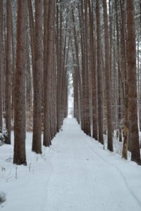 The Feb 5 Hike will take place at Cumming Nature Center in the hills above Naples NY. The Nature Center is an extension of the Rochester Museum and Science Center. Dress warm. If conditions are right snow-shoeing is available. There … Continue reading → | Penfield Indoor Hike 10:00 am Penfield Indoor Hike @ Penfield Town Hall Feb 11 @ 10:00 am – 12:00 pm  The Penfield Trails Committee will host its annual ‘Indoor Hike’ on Saturday, February 11, 10:00 am at Penfield Town Hall Auditorium, 3100 Atlantic Avenue. There will be a presentation entitled “Letchworth’s Portage Viaduct – New and Old”, information on trails … Continue reading → Naturalists hike on Saturday 1:00 pm Naturalists hike on Saturday @ Ellison Park Feb 11 @ 1:00 pm – 3:00 pm Ellison Park is a Monroe County Parks System park. Start point for this hike is in the parking lot on the north side of Blossom Rd at the intersection with Ellison Park Rd – the parking lot at the bottom … Continue reading → Penfield hike on Saturday in sync with Hikers’ Jamboree 2017 1:00 pm Penfield hike on Saturday in sync with Hikers’ Jamboree 2017 Feb 11 @ 1:00 pm – 3:30 pm This weekend, February 11th & 12th, 2017, you’ll have two Springwater Trails (ST) hike event opportunities. The Sunday hike is a “travel hike” to Steege Hill in Big Flats, NY. There is also a ST “Bonus Hike Event” on Saturday … Continue reading → | |||||
| February 12 Steege Hill Nature Preserve 2:00 pm February 12 Steege Hill Nature Preserve @ steege hill nature preserve Feb 12 @ 2:00 pm – 4:00 pm 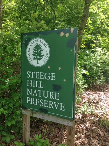 Located in Chemung County in the town of Big Flats, Steege Hil is a 794 acre preserve acquired in 2001 by the Finger Lakes Land Trust from an anonymous donor. In 1970, this area was nearly ruined by heavy logging. … Continue reading → | Annual Finger Lakes Trail Howard Beye Winter Hike 9:30 am Annual Finger Lakes Trail Howard Beye Winter Hike @ Heron Hill Winery, Upper Parking Lot Feb 18 @ 9:30 am  The Finger Lakes Trail across upstate NY was started in 1962, and for nearly 25 of those years, Howard Beye was THE major volunteer for the organization that tends it. He was a deeply involved trail chair, keeping track of map … Continue reading → | |||||
| The Disappearing Footprints- Winter in the Hemlock-Canadice State Forest – Canadice Outlet 2:00 pm The Disappearing Footprints- Winter in the Hemlock-Canadice State Forest – Canadice Outlet @ Pam's house Feb 19 @ 2:00 pm – 4:00 pm 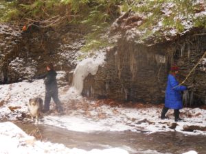 Note: Please arrive at 1:45, park along 5107 Old Bald Hill Road (near the curve), drop off a dish to pass for our social, dress for weather conditions, bring winter boots and, if desired, snowshoes. How did those footprints of … Continue reading → | ||||||
| Last Gasp of Winter 2:00 pm Last Gasp of Winter Feb 26 @ 2:00 pm – 4:00 pm 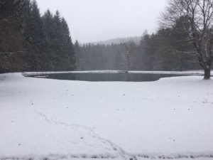 It looks like this Sunday will be much colder than last week at Pam’s. But come and enjoy anyway – and bring a friend. The week we are returning to the Schribner Valley, for a hike that will show off … Continue reading → |
-
Categories
-
Tags
Barry Childs and Kathy Cloonan barry@africabridge Bike Bill Cooke Bob and Cindy Wagner Bob Menz (bert6952@yahoo.com) Bristol Hills Branch CANCELED Clarks Gully CLWA Colorado Trail Dena Munsell Dog friendly Finger Lakes Trail FL FLT Gene & Georgia Binder (585) 236-5384 Gene and Georgia Binder (585) 236-5384 Greenway Gully Gypsy moth Hemlock Hike Jayne Affolter Jeanie Smith John L Katherine Humphrey? Kayak Kelly Rell Landowner Liability Leader: Mark Lehigh Valley Trail Mark and Laure Allen (585) 662-9305 Mark and Linda Mary Ann Devey (315) 573-0774 Mary Lou Wenthe (585) 208-4337 Melissa Mike and Jenny Johnson Mitchellsville mjkcloonan@frontiernet.net Mushroom Foray Naples Nunda POSTPONED Rick Henchen Rick Henchen and Sharon Boldt Saralinda Saralinda Hooker Schribner Sharon Boldt Sharon Boldt (boldtbs@yahoo.com) sugarbush hollow Summer Weekly Wendy Stevenson
 The Penfield Trails Committee will host its annual ‘Indoor Hike’ on Saturday, February 11, 10:00 am at Penfield Town Hall Auditorium, 3100 Atlantic Avenue. There will be a presentation entitled “Letchworth’s Portage Viaduct – New and Old”, information on trails groups from around the Rochester area, and light refreshments will be served. This event is free.
Please click on the poster to the right for a full size version.
Chris Costello, professional land surveyor, will speak about the 1875 Portage high bridge / railroad viaduct high above the Genesee River in Letchworth State Park. Costello will give an inside look at the construction of the new bridge in progress. Learn the history and the future of Letchworth rails and trails. Hikers, history buffs, and rail fans – lace up your boots and join us!
“This year’s speaker will give participants a rare behind-the-scenes glimpse of the much anticipated construction of the new railroad bridge,” says Nels Carman, Penfield Trails Committee chair. “This iconic structure has an interesting past and a promising future.”
While the “hike” is free, participants are asked to pre-register by calling Penfield Recreation at 340-8655, option 0. (requested, albeit not required)
Penfield Trails Committee is always seeking volunteers to serve on its planning committee, as well as to do manual labor for trails maintenance. For more information, please call Penfield Recreation at (585) 340-8655.
For general information – Penfield Trails Committee leads one guided hike per month March through January, and the twelfth hike of the year is the annual ‘indoor hike’ in February.
Springwater Trails Note: Following the “indoor hike”, there are two hikes that Springwater Trails hikers can take advantage of. A strenuous 5-6 mile hike at Lucien Morin Park, 1131 Empire Boulevard, Rochester, will be hosted by the Genesee Valley Hiking Club. And ST’s own, Gene will be leading a shorter hike at Ellison Park. Both hikes start at 1:00. So, come and enjoy the Monroe County Parks. An after-hike social will be held ~ 3:330PM at MacGregor’s loacted at 1129 Empire Blvd (next to Lucien Morin Park).
Ellison Park is a Monroe County Parks System park. Start point for this hike is in the parking lot on the north side of Blossom Rd at the intersection with Ellison Park Rd – the parking lot at the bottom of Blossom Rd hill that is not the “Dog Park” parking lot. Well behaved dogs accompanied by owners are allowed on this Ellison Park hike route, where Gene will be the ST Hike Leader.
This Ellison Park hike route is mostly a flat route for an easy hike, substantially paralleling two bifurcations of Irondequoit Creek, reaching a memorial marker of an Indian trading post and site of Fort Schuyler where a reproduction of the original fort structure is situated.
Directions:
From the Penfield Town Hall: From Penfield Town Hall utilize the Town Hall’s Atlantic Av drive. Turn right heading westbound on Atlantic Av, to the 4-way intersection with Creek St and Blossom Rd. Turn left onto Blossom Rd and proceed on Blossom Rd to the Ellison Park parking lot on the right immediately after crossing Ellison Park Rd.
This weekend, February 11th & 12th, 2017, you’ll have two Springwater Trails (ST) hike event opportunities. The Sunday hike is a “travel hike” to Steege Hill in Big Flats, NY. There is also a ST “Bonus Hike Event” on Saturday in form of a Hike Combo Event in Penfield, NY, … which is the subject of the ‘event post’ you are reading (here and now). This Hike Combo Event in Penfield is also a “travel hike”, albeit a closer travel than is Steege Hill.
The Saturday 2/11/2017 ST hike starts at 1:00PM in Penfield, NY. There are two separate start points for the ST hike event!!! In fact there are two different parks, both in Penfield NY, which are holding the hike routes and start points for this ST hike event. One hike is described as strenuous, hilly, 5-6 miles in length at Lucien Morin Park (aka Rifle Range Trail & more trails), a hike for ST Climbers. (Mildly stated, it is highly likely you’ll want TDs for this hilly hike at this time of year, be it snow/ice/mud for trail conditions. See the further description about TDs below.) The other hike is described as easy, ~ 2 miles on mostly flat trails, a hike for ST Tourists & Naturalists. After-hike social to be held at MacGregor’s Grill & Tap Room at 1129 Empire Blvd, Penfield.
This ST Bonus Hike Combo Event is scheduled in Penfield so as to conveniently sync with the 6th Annual Hikers’ Jamboree (HJ2017), which is badged as an “Indoor Hike” event, organized by Penfield Trails Committee (PTC), scheduled for 10:00AM-12:00Noon at Penfield Town Hall Auditorium situate at 3100 Atlantic Avenue, Penfield, NY. Following HJ2017, two outdoor hikes are subsequently provided at 1:00PM at two separate parks in Penfield, both with some included history components. This years program presentation for HJ2017 is on the famed railroad high bridge (viaduct) situate in Letchworth State Park. The viaduct high above the Genesee River is 140+ years old and will soon be replaced by a new viaduct. You’ll learn much more about these two viaducts at the HJ 2017 viaduct program presentation which runs ~10:30-11:40am. Penfield Town Hall is located at 3100 Atlantic Av, Penfield NY; ~ GPS coords 43.160959 , -77.446125
(Of note, many ST hikers will recall a ST hike on Oct 13, 2013 in Letchworth State Park where all three hiking subgroups by chance were on the trail near the base of this 1875 railroad high bridge, when we all had chance opportunity to view a train pass overhead! Thanks go to superb arrangement by that day’s Hike Planners Joan & Bob for the rare experience.)
During HJ2017 light refreshments will be served, so you’ll have sustenance/fuel opportunity before availing of choice of two outdoor hike locations with an 1:00PM start time. For easy reference and more info, here is an Event post about Hikers’ Jamboree 2017 as published on the ST website.
⇓ TWO HIKES ⇓ Start times for both at 1:00PM.
Those ST hikers desiring a Climbers level hike, (which will finish ~ 3:15PM), will hike in Lucien Morin Park, an “undeveloped” Monroe County Park, located at 1135 Empire Blvd. Climbers, as a ST subgroup, will actually be “joining-in” a GVHC hike that is led by Ryan B. (A number of ST hikers are previously acquanted with Ryan from previous hikes & socialization.) The hike start is at the entrance to Lucien Morin Park (a Monroe County Parks System park), the park entrance is off Empire Blvd near the foot of Irondequoit Bay, and situate immediately east of MacGregor’s Grill & Tap Room Restaurant (1129 Empire Blvd).
This hike will be hilly and will be adjacent Irondequoit Creek in some areas, and will traverse areas that were used in World War reserve troop training, including rifle training and more. Remnants of training areas still remain suggesting some of the training that took place. The “lost city of Tryon” lies on the the east side of Irondequoit Creek as does Tryon Park, an undeveloped Monroe County Park. Tryon Park can be seen accros the creek at various places on this hike.
Parking at Lucien Morin Park: There is a parking lot for this park at the end of the rather short park entrance road (entrance road runs off Empire Blvd). You can see the parking lot from Empire Blvd. Additional parking if needed can be had at MacGregor’s Grill & Tap Room Restaurant parking lot, said parking lot is immediately adjacent the park’s parking lot and entrance road. Please be respectful of this business who allows hikers to utilize the lot for overflow parking, if needed please park as far back in this business’s parking lot as is possible.
Being Climbers subgroup is joining-in a GVHC hike, GVHC hike rules apply (which are quite similar to ST hike rules). Perhaps the most glaring difference of hike rules … on GVHC hikes DOGS ARE NOT ALLOWED! So, if you want to hike with your dog on today’s ST provided for hike, you’ll need to do so with the Tourists/Naturalists which is wholly a ST hike (ie – not a join-in with GVHC).
Note: Climbers should expect many more hikers at this hike than ST hikers usually experience at a hike. Lucien Morin Park hike route is hilly and can be strenuous for some, but hey, that’s what Climbers are all about.
Naturalists & Tourists will hike in Ellison Park as accessed via Blossom Rd (at the bottom of Blossom Rd hill, ~1809 Blossom Rd). Ellison Park is a Monroe County Parks System park. Start point for this hike is in the parking lot on the north side of Blossom Rd, … the parking lot at the bottom of Blossom Rd hill that is not the “Dog Park” parking lot but is slightly east of the Dog Park parking lot. Well behaved dogs accompanied by owners are allowed on this Ellison Park hike route, where Gene will be the ST Hike Leader.
This Ellison Park hike route is mostly a flat route for an easy hike, substantially paralleling two bifurcations of Irondequoit Creek, reaching a memorial marker of an Indian trading post and site of Fort Schuyler where a reproduction of the original fort structure is situate.
⇓ TRACTION DEVICES, A HIKER’S FRIEND ⇓
Given that it is winter season, Traction Devices (TDs) may be in order (read … probably an excellent idea) for each of these two hikes routes. Lucien Morin Park trails are hilly and under certain conditions can be strenuous sans TDs. TDs help to tame the hills when they are slippery with ice &/or mud. Ellison Park trail route can also be slippery albeit the trail route is mostly flat. TDs such as Kahtoola MICROspikes, Hillsound Trail Crampons, Hillsound Trail Crampons Ultra, and similar, may be desirable on Lucien Morin Park hills, and same type or lesser aggressive TDs may be good for Ellison Park.
If your best guess is there is no snow and/or ice if hike day’s temps are higher than average, well… that could equate to mud on the hills which equates to a need for added traction. (A side note, I have under similar conditions seen hikers quickly return to the start point due to lack of having TDs and the trail being beyond their best adjudged capabilities without them.)
Hug The Trees, Please! When wearing TDs with spikes/cleats & similar … please be kind to trees … whenever possible anticipate your footing placement on the trail and step over tree roots, not directly on them which can puncture and damage roots & ultimately health of those trees and on larger scale the forest and ecosystem. Think about it … If you were lying on the trail gazing at the sky would you rather have a group of hikers wearing sharp piercing TDs step on you, or, step over you or around you. Safe to say if hikers were NOT stepping on you you’d be unscathed by those sharp cleats and spikes of said passing hikers, but not so if alternatively they stepped on you with those sharp metal cleats & spikes.
⇓ DIRECTIONS TO HJ2017 AND THEN TO TWO SUBSEQUENT SEPARATE HIKES ⇓
Directions to PENFIELD TOWN HALL AUDITORIUM, 3100 Atlantic Ave aka NYS Rt 286. For Penfield Trails Committee’s (PTC) “Indoor Hike” aka Hikers’ Jamboree 2017 scheduled 10:00AM-12:00Noon. From points south of Rochester take expressway I-390 northbound, to expressway Rt 590 northbound, to exit for Browncroft Blvd / NYS Rt 286, head east on NYS Rt 286 which is also Browncroft Blvd and which will change names to Atlantic Avenue at the intersect with Whalen Rd & Scribner Rd 4-way intersection, continue on NYS RT 286 / Atlantic Avenue to just past Jackson Rd and then turn let into the Penfield Town Hall driveway.
⇓ Directions: to the two separate hike start locations (1:00PM hike), from Penfield Town Hall. ⇓
To LUCIEN MORIN PARK (1135 Empire Blvd) – NO DOGS ALLOWED on this hike: From Penfield Town Hall utilize Town Hall’s entrance/exit drive aka Columbus Crossing (westbound) to Jackson Rd and turn right onto Jackson Rd, proceed northbound on Jackson Rd to Plank Rd & turn Left, proceed on Plank Rd to Empire Blvd, turn left onto Empire Blvd and near the bottom of the Empire Blvd hill on the left you will find the entrance drive to Lucien Morin Park. (It is immediately adjacent MacGregor’s Grill & Tap Room Restaurant.)
To ELLISON PARK (~1809 Blossom Rd) – DOGS ARE ALLOWED on this hike: From Penfield Town Hall utilize the Town Hall’s Atlantic Av aka NYS Rt 286 entrance/exit drive, turn right heading westbound onto NYS RT 286 aka Atlantic Av, continue on NYS RT 286 / Atlantic Av westbound (realizing Atlantic Av will change names to Browncroft Blvd at the intersect with Whalen Rd & Scribner Rd 4-way intersection), continue on NYS RT 286 / Browncroft Blvd to the 4-way intersect with Creek St and Blossom Rd, turn left onto Blossom Rd and proceed on Blossom Rd down a winding hill to the Ellison Park parking lot on the right which is is slightly east of the Dog Park parking lot. (hints: There is a porta-potty at the far west side of this hike meet parking lot, and also a winter ice skaing rink immediately contiguous to the west side of this parking lot. Hike Meet point is about in the middle of this designated parking lot. If as you travel on Blossom Rd, you reach the dog Park parking lot, you went to far and have passed the designated hike meet parking lot.)
⇓ Directions: to the two separate hike start locations (1:00PM hike), from points south of Rochester. ⇓
Directions to LUCIEN MORIN PARK: – take expressway I-390 northbound, to expressway Rt 590 northbound, to the exit for NYS Rt 404 / Empire Blvd exit, head east NYS Rt 404 / Empire Blvd to the bottom of the hill / foot of Irondequoit Bay, Lucien Morin Park (1135 Empire Blvd) entrance road and parking lot is immediately east of MacGregors Grill & Tap Room Restaurant at 1129 Empire Blvd.
Directions to ELLISON PARK: – take expressway I-390 northbound, to expressway Rt 590 northbound, to Blossom Rd exit, head east on Blossom Rd to the bottom of the hill, where Ellison Park will then be on both sides of Blossom Rd. Ellison Park parking lot for this hike is on the north side of Blossom Rd (a left turn into the lot), further described as the parking lot at the bottom of Blossom Rd hill that is not the “Dog Park” parking lot but is slightly east of the Dog Park parking lot. (If you reach “Gatherings Catering” Company – at “Daisy Flour Mill” Party House / Restaurant, situate in the circa 1840 Daisy Flour Mill building, on the right side of Blossom Rd, you’ve gone too far.)
AFTER-HIKE SOCIAL & ⇓ Directions thereto ⇓: After-hike social is at MacGregor’s Grill & Tap Room Restaurant [phone=288-8630] located at 1129 Empire Blvd next to Lucien Morin Park. So Climbers will merely walk nextdoor from the hike end portal to MacGregor’s.
Naturalists/Tourists will need to drive to the social. From Ellison Park on Blossom Rd head east up a long winding hill, at the 4-way intersection of Blossom Rd & Creek St (where Browncroft Blvd aka Rt 286 intersects) continue straight onto Creek St, at Plank Rd turn left, at Empire Blvd turn left, at the bottom of Empire Blvd hill & the foot of Irondequoit Bay will be MacGregor’s of the left.
Springwater Trails (ST) and Genesee Valley Hiking Club (GVHC aka GVHG) both provide their hikes as open to the general public, no need to be a respective member to hike with either group. Hike rules as set by respective groups and Hike Leaders apply.
Located in Chemung County in the town of Big Flats, Steege Hil is a 794 acre preserve acquired in 2001 by the Finger Lakes Land Trust from an anonymous donor. In 1970, this area was nearly ruined by heavy logging. The Town of Big Flats took action to stop the degradation on the hill by shutting down the operation and passing a law regulating future logging within town limits. Now the original forest is making an impressive recovery. Numerous species of hardwoods prevail, mixed with conifers on the steeper slopes. Wildlife include black bear, timber rattle snakes, and Allegheny Mound Ants. Their distinctive nests can be found trail side and in open areas. For additional information and maps go to http://fllt.org/preserves/steege-hill-preserve
Steward, Bob Corneau has maintained a network of more than 6 miles of trails, mostly over old logging roads. It is our good fortune to be able to enjoy the quiet beauty of these tails on a winter afternoon, Check the Springwater Trails website on February 11 for an update on trail conditions. If there is snow we could ski or snowshoe.
Parking in very limited at this preserve so car pooling is strongly encouraged.
Hike Description
All groups will depart from the parking area on Steege Hill Rd. After a short but steep ascent, our groups will branch out as follows:
Naturalists will follow the yellow loop in a clockwise direction, enjoying some gentler terrain as well as views of the Chemung River and ponds. The ant mounds are numerous on this trail. Out nature experts will no doubt enjoy identifying the many varieties of trees and birds. Hike length will be about 2.5 miles.
Tourists will head our on the yellow loop in a counter clockwise direction, past the ponds and then onto the blue trail to loop through the forest back to the yellow trail. Views of the valley as well as the lower slopes should be nice. Hiking distance about 3.5 miles.
Climbers An ambitious journey awaits you, a complete circuit of the trail system.. This group will veer off from the initial climb to follow the white trail, traversing some significant ups and downs. They will sample the blue and red trails (more hills) before returning home on the yellow loop for about 5 miles. It’s all down hill on the return.
After Hike Social will be at Tag’s Restaurant on Rte, 352 in Big Flats.
Getting There Parking is VERY LIMITED. Roadside parking is not advisable. Please carpool from the Springwater Town Hall, leaving at 12:30. Drive time is about 1 hour 15 minutes.
 Directions: Take 390 South to I 86 East. Take Exit # 48. Turn Right on NY 352. Go 1.5 miles. Turn right on S. Corning Rd. (Chemung CR 10). Go .7 miles. Just after bridge turn left on Steege Hill Rd. Go 1 mile. Slow down. Parking is on left. Preserve sign is difficult to spot.
Social There is a great little joint called Tags, recommended by local folks. To get there, retrace your steps back to Rte 352. Turn right and travel about 0.6 mile. Restaurant is on the right. Menu is full of salads, burgers, wraps and apps. See it at tagsrestaurant.com
Trail conditions Update 2/11/17. Looks like freezing rain tonight and rain tomorrow. Best bet is to wear waterproof clothing and bring traction control devices/ hiking poles in case conditions are slippery.
 The Finger Lakes Trail across upstate NY was started in 1962, and for nearly 25 of those years, Howard Beye was THE major volunteer for the organization that tends it. He was a deeply involved trail chair, keeping track of map updates, organizing and training those who adopt portions of our over 900-mile trail system, tracking volunteer hours for every one of them during an annual “census,” arranging Challenge Cost Share projects, and organizing every one of our three to four special work-week projects, the annual “Alley Cats,” and handling the majority of correspondence with the state agencies who host many miles of our trail.
2017 HOWARD BEYE WINTER HIKE
We will hike to Huckleberry Bog on the Bristol Hills Trail and follow the Bog Nature Trail Loop. This is an upland bog located on a plateau west of Keuka Lake in Urbana State Forest, Steuben County. Two routes will be offered, one approaching from the north and one from the south. Both hikes are loop hikes and both ~4.5 miles.
a) Northern Approach. The trail climbs steadily through a hemlock and oak woods to the top of the plateau, going by the Evangeline Shelter and entering Urbana State Forest before reaching the Bog Nature Trail Loop.
b) Southern Approach. The hike starts at a higher elevation and directly enters Urbana State Forest. It will be a somewhat slower hike. Hikers will follow the Bog Nature Trail Loop and along the way stop at the observation deck to see how the bog looks in mid-winter.
A Bog Nature Trail Guide can be downloaded from the FLTC website.
The Huckleberry Bog Nature Trail is Hike #6 in the FLT Passport book for the Central Portion. Bring your book and a pencil if you would like to take a rubbing.
Bring water and a lunch that can be eaten on the trail. Snowshoes may be needed if the snow is deep.
Meeting time9:30am. Car pools will leave for the hike at 9:45am. LocationMeet at Heron Hill Winery, 9301 County Route 76, Hammondsport, NY 14840 in the upper parking lot. The parking at the trailhead is very limited, so we will leave the majority of the cars at Heron Hill. The Heron Hill winery will be open from 10-5. There will not be restrooms at the winery available for us to use prior to the hike. Directions to Meeting LocationFrom Springwater: Head south of NY-15 through Wayland. Turn left onto I-390 S. In 15.9 miles, merge onto I-86 E. Take Exit 38 Bath. Turn left onto Washington St (NY 54). In 1.2 miles turn left onto Liberty St to stay on NY 54. Follow NY 54 for 6.7 miles into Hammondsport. From the Village of Hammondsport turn left on Main St/NY-54A. At the T, turn right onto Pulteney St to stay on NY-54A and go .33 miles. Turn slight left onto Pulteney St/ CR 76 and go 2.99 miles. Follow signs and turn left onto the Hill Winery driveway. Park in the upper parking lot. Enjoy the view of Keuka Lake. |
Directions:From Springwater: Head south on NY 15 to Wayland. Turn left onto NY 21, Turn left in N Cohocton to stay on 21 into Naples. Turn right onto NY 53. Stay on 53 for 13 miles. At 10.4 miles on your trip odometer, you should pass through Prattsburgh. Follow the directions below.
From Prattsburgh, take NY 53 South for 2.6 miles to Bean Station Road. Turn east on Bean Station Road at the site of a large white warehouse for onions. Go 2.6 miles to the yellow trailhead sign on the right (south) side of the road at a little footbridge over the roadside ditch. Park on the opposite shoulder but not on the lawn or pull inot a small mowed spot marked “FLT Parking” about 200 feet further east, on the left (north side of the road). After breaking into groups, tourists and naturalists will caravan to the Glen Brook trailhead.
From Geneseo and Dansville: Take I-390 South to I-86East. In 1 mile,take exit 37 for NY-53. Turn left onto NY-53 and head north for 8.9 miles. Turn right onto Bean Station Road. Continue with the directions From Prattsburgh.
Note: Please arrive at 1:45, park along 5107 Old Bald Hill Road (near the curve), drop off a dish to pass for our social, dress for weather conditions, bring winter boots and, if desired, snowshoes.
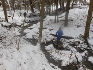 How did those footprints of a man (or woman with large feet) and a dog disappear? Where are the boundaries of the State Forest and private land? What happened in the early 1900s when all the mills disappeared from the Canadice Outlet area? All these questions will be explored as we hike from the abandoned Dixon Hollow Road through the Canadice Outlet area, ending at the Canadice Hollow Cemetery. Our adventure will take us through ravines, across creeks and tributaries, climbing and skirting ridges, bushwhacking through hardwoods and pines, and connecting with a DEC trail that will lead us to a cemetery. Only a mile-and-a-half as the crow flies will seem like four as we wind through the State Forest, taking time to enjoy the frozen creek and snow-covered trees while avoiding those nasty pricker bushes, and playing like children.
This can be a strenuous hike for many, especially if the snow is deep. Accordingly you may want to bring snowshoes, but they will have to be removed from time to time for traveling through dense areas that require bushwhacking. Once we reach the DEC trail, there will be a stretch that will accommodate snowshoes.
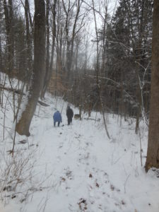 Naturalists will follow the old abandoned Dixon Hollow Road down into the depths of the gully called the Canadice Outlet, exploring the area of the old Adam’s Mill and what I call “Superman’s Ice Castle.” Depending on the level of water in the creek, ice build-up, and sunshine, photographs can be outstanding in this area. Sometimes the creek is able to be crossed if you have waterproof boots. A small tributary dumps into the outlet adding beauty to this area. For those that would like to check out the Hemlock trees for the HWA, time will allow you to examine the health of the forest.
Tracking animal footprints is also possible since my grandson indicated he found an area where “something was living.” What animal would be eating a chunk of honeycomb right now?
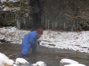 Tourists and Climbers will follow the same beginning route, each at their own speed, crossing the tributary and climbing high above the creek. With special permission from local property owners, we will skirt the outlet area, bushwhack through hardwood forests, climb hills, and finally drop upon the DEC logging trail that leads to the cemetery. This can be an intermediate or advanced hike for many (especially one area where we will climb a very short but steep hill) and can be more difficult depending on snow depth. Cars will be located at the cemetery for the return trip.
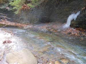 We will return to Old Bald Hill between 4 and 4:30 for a social, outdoor campfire, and the indoor warmth of the wood stove. Please bring a nice dish to pass, your drink of choice, and tales.
Directions: Follow these directions to the meeting place. Please arrive by 1:45 and park on the road but not directly on the curve.
It looks like this Sunday will be much colder than last week at Pam’s. But come and enjoy anyway – and bring a friend.
The week we are returning to the Schribner Valley, for a hike that will show off the under-story of the forest before all the spring growth occurs. With high temperatures this week, we don’t expect much snow to be left.But the ferns were out last week and there should be more signs of life this week.
We will have two hikes this week. The Climbers will hike across the valley and the head south though mostly pine woods. After about a mile, we will head up to the top of the hill and enjoy some views across the fields. Expect some bush-whacking as we head back down and follow the stream back to the house and the social.
The Naturalists and Tourists will follow the same route for the first half of the hike, but will avoid the long climb to the high fields, instead spending a bit more time with the more accessible views.
Following the hikes, we will have a potluck social. Linda is making pulled pork. Bring a dish to pass and your own beverage or make a $5 donation to the social fund. Coffee or tea will also be available.
Directions Click here for Winter directions. Do not try to come in from Strutt St. since both Schribner and Giles are seasonal.
Springwater Trails hikers and others may be interested in a number of program presentations (lectures) in the Mount Morris Winter Discovery Series 2017. In March, of particular salience in present day current events, as pertain to the Erie Railroad high bridge (Portage viaduct) spanning the Genesee River and constructon of a replacement bridge for this 140+ year old current trestle bridge, are the March 18th & 25th programs, among other programs of potential interest.
The annually recurrent Mount Morris Winter Discovery Series is offered January through March, on varying theme and topics. Each year holds about one dozen new program presentations.
The Mount Morris Winter Discovery Series 2017, is titled: “Life in America: Winter Discovery Series 2017”. Facilities provided by The U.S. Army Corps of Engineers Mount Morris Dam and Recreation Area, located at the northern end (east side of the Genesee River) of Letchworth State Park. All lectures are free of charge and will be held in the Visitor Center on Saturdays at 1pm. The Visitor Center, aka the William B. Hoyt II Visitor Center, which opened in 1999, is an enclosed heated venue with indoor restrooms and is located adjacent the east side of the Army Corps of Engineers’ Mount Morris Flood Control Dam (which was constructed 1948-1952). Often light refreshments are served at programs of the Winter Discovery Series. [Please note, do not confuse this A.C.E. Visitor Center with the Letchworth State Park – Humphrey Nature Center which is located in Letchworth State Park on the west side of the Genesee River and further south of the A.C.E. Mt Morris flood control dam.]
Mount Morris Dam and Recreation Area Visitor Center is located at 6103 Visitor Center Road in Mount Morris, NY 14510. For more information call (585) 658-4790.
There are numerous exhibits and educational experiences in the Visitor Center, a brief opportunity may exist to view and experience some immediately prior to or after the Winter Discovery Series program. Albeit, the Visitor Center is generally not otherwise open in the winter season.
March 4th program (lecture) LEGACY OF MILITARY SERVICE
Join Steve on a journey of his family’s military connections to conflicts during King Henry IV’s usurpation of the English throne in 1399 to King Philip’s War (1675), the Revolution, War of 1812, Civil War and on to the modern era. Presenter – STEVE CLARKE, Genealogist
2:00 p.m. (Climbers: plan to arrive at 1:30 if wanting to help with a car pool to the parking lot at the north end boat launch. Please see below).
Parking Lot Sign
Join us for an early spring hike on the new section of Rob’s Trail, which meanders from Route 15A south of Hemlock, to the shores of Hemlock Lake. On the hike you will cross a new bridge across a ravine, installed since our last hike on Rob’s Trail a year ago. With all of the recent rain and snow melt the streams by the trail should be flowing like crazy! We will meet at the new parking lot for Rob’s Trail on the west side of 15A. (If there is insufficient space in this lot, use the parking lot a little way south across the road. Instead of walking on the road from there to the meeting place, you may take the connector trail which is about a quarter mile long, if desired). It is suggested that you wear sturdy hiking boots, and use a pole because of slippery leaves on steep inclines.
Climbers: you may choose to hike down to Hemlock Lake and connect to the trail leading to the north and terminus (4.8 miles) at the Hemlock Lake boat launch. This will necessitate leaving one or more cars at the parking lot before the hike. Tourists: you may hike down the trail to the shore line and return back up to the starting point (1.5 miles each way). The hike back up is fairly strenuous in some places. Naturalists: you may hike halfway down to the new bridge and back up from there.
The social following the hike will take place at Sammy’s Place, 8148 S Main Street in Springwater.
Directions: Click here for directions to the parking lot at the top of Bald Hill. To get to Sammy’s Place, head south on 15A through the Springwater Hamlet. Sammy’s is on the right across from the Fire Hall.
On Friday evening 3/10/2017 at 7:00PM, this unique opportunity to learn about Bluebirds, habitat, and more is being presented by Genesee Valley Conservancy (GVC), open to the public. This event is taking place at the Geneseo Riviera Theater . (There will be a subsequent Springwater Trails hike about two months later in sync with Bluebirds as topic and when Bluebirds are out & about in our area of the Finger Lakes.)
Excerpt about this program from the GVC website:
All About Bluebirds, and More!

CLICK HERE TO RESERVE SEATS(Select the # of seats, click ‘add-to-cart’, enter your name and email click ‘complete order’)
Come learn about the life and history of Eastern Bluebirds from John Rogers, a nationally recognized expert on Bluebirds. John was the co-founder of the NYS Bluebird Society in 1982 and is a past recipient of the Norah Lane Bluebird Conservation Award from the North American Bluebird Society.
Seating in the newly restored Riviera Theater is limited, use the link above to reserve free tickets. General admission will be first-come first-serve. Be sure you can get a seat for this fantastic event by supporting the Conservancy today!
*Event supported by Steuben Trust Company
Not only will this be an opportunity for edification about Bluebirds, but it is also an opportunity to appreciate the recently restored Riviera Theater, located at 4 Center St in the village of Geneseo. The theater building, which for years sat vacant & unused, is now once again being utilized not only as a theater, but additionally serves as a multi-faceted community resource venue, a vibrant part of the Geneseo community. (This program on Bluebirds is but one of the community resource programs that are on the schedule of the Geneseo Riviera Theater.)
And speaking of opportunity and unique, … well, on a subsequent date – Sunday, May 7th, 2017 Springwater Trails as a joint hike with Victor Hiking Trails will lead a Hike at MaryFrances Bluebird Haven (MFBBH) located in Victor, NY (and on adjacent Monkey Run trails too). On the hike, there will be opportunities for observing Bluebirds, and as well will be field edification of hikers on Bluebirds and conservation efforts, … plus more.
More details on this ST/VHT hike as Sunday, May 7th approaches on the calendar.

Looking for brochure.or mailing list so I can receive it in the mail.
Nothing opens up for mailing list.
There’s all kinds of very bizarre ads and post for viagra and other drugs above on calender page.
Please let me know if there’s a brochure available