
Hikes led by Springwater Trails are generally held on Sunday afternoons and appear in this calendar in green.
| Sun | Mon | Tue | Wed | Thu | Fri | Sat |
|---|---|---|---|---|---|---|
| Springwater Trail 2:00 pm Springwater Trail @ Pardee Hollow and Coates Rd Dec 6 @ 2:00 pm – 4:00 pm  We took one week off from hiking, but it is time to get back on track before the December holidays. So come join us on the Springwater Trail in east Springwater, for some good views, good climbs, and good conversations. … Continue reading | Ontario County Park, north trails – a VHT hike 10:00 am Ontario County Park, north trails – a VHT hike Dec 12 @ 10:00 am – 12:00 pm December 12— Ontario County Park, north trails. The mountain bike club GROC has created several miles of new trails at the north end of the park. We will be hiking (or skiing if there is snow) these trails from 10:00 … Continue reading | |||||
| FLT Letchworth East Side 2:00 pm FLT Letchworth East Side Dec 13 @ 2:00 pm – 4:00 pm Hike the Finger Lakes Trail on the east side of the beautiful Letchworth gorge. With the foliage gone the view should be exquisite. We will park by the visitors’ center for the Mt. Morris dam. There is a trail head … Continue reading | ||||||
| Erie Railroad, Springwater 2:00 pm Erie Railroad, Springwater Dec 20 @ 2:00 pm – 4:00 pm 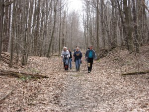 This Sunday we will hike a section of the old Erie Railroad has been very well maintained by the many private landowners and runs along the west hillside overlooking Lawrence Gull and the Springwater valley. Springwater Trails Hiking Group would like to … Continue reading | ||||||
| Harriet Hollister Spencer State Recreation Area 2:00 pm Harriet Hollister Spencer State Recreation Area @ HHS Parking Area off Canadice Hill Road Dec 27 @ 2:00 pm – 4:00 pm 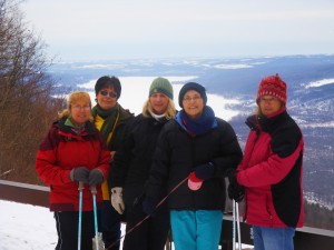 This Sunday December 27th Springwater Trails will hike at the Harriett Hollister Spencer State Recreation Area. The Recreation Area is 1550 acres with 16 miles of trails and is part of the New York State Parks System. Although this is … Continue reading |
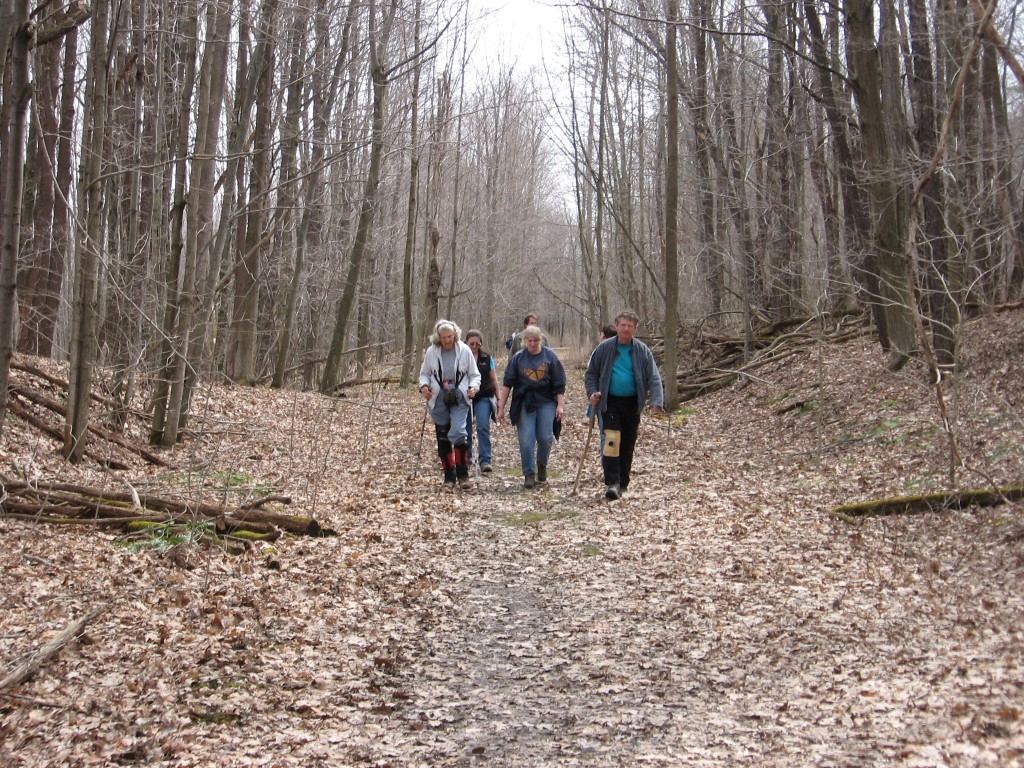
We took one week off from hiking, but it is time to get back on track before the December holidays. So come join us on the Springwater Trail in east Springwater, for some good views, good climbs, and good conversations.
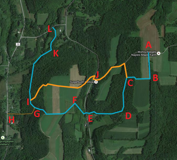 Please park along Pardee Hollow at Coates Rd (J).
All hikers will car pool to entrance (L) and hike the new section of the Springwater Trail through Punky Hollow.
The Naturalists will hike the main trail to point (I) and then switch to the alternate orange trail up over the hill and down to the cars (J) (about 2 miles LKIJ).
The Tourists will hike the main trail across Pardee Hollow (E) and up into the middle of the Sugarbush. At (C) we will switch to the orange trail to come out on Coates Rd, which we will follow down to the cars. ( and then take the orange trail out to Coates Rd and down to the cars. (LKIGFEDCJ) About 3 miles with two climbs.
The Climbers will follow the main blue trail the entire way to the top of Coates Rd (A), then will head down Coates Rd to the entrance back onto the trail to C, back down to Pardee Hollow and then up the road to the cars at J (about 3.5 miles LKIGFEDCBACDE).
After the hikes, you have the option of enjoying good food and fellowship of your fellow hikers, at the Mountain View Inn, in Atlanta.
Directions:
From Springwater, go north on 15A, right on Wheaton Hill Rd. (CR 16), right on Wetmore Rd, right on Tabors Corners Rd. Go left on Pardee Hollow Rd. On the corner, is the Punky Hollow Farm, where this year’s Fiddlers Fair was held. Continue on PHR, by going right at the T. Park across from Coates Rd. and look for our sign. Try to get there by 1:45.
For the Mountain View Inn, go down Pardee Hollow till it ends at Rowe Rd. (CR 38) and go right to SR 21. Go left on 21, and then, right, into Atlanta.
Additional directions available here.
December 12— Ontario County Park, north trails. The mountain bike club GROC has created several miles of new trails at the north end of the park. We will be hiking (or skiing if there is snow) these trails from 10:00 A.M. until noon. For those that want, we will stop for lunch at the Brown Hound Bistro in South Bristol for lunch.
Please check the message line at 585-234-8226 for details and last minutes updates.
Gleaned from the Victor Hiking Trails (VHT) Website & page 4 of the VHT Pathfinder- Fall 2015 newsletter, Vol 20 issue 3, pages 2&4, the December VHT hike is as listed above.
VHT guided hikes are scheduled the 2nd Saturday of most every month, as is the above hike. Hikes are open to all, no membership or fee required to participate. This hike locale has been a popular locale with S/T hikers, and is relatively close to some. So, the hike is posted in view of possible participation of some S/T hikers.
Page 5 of the same VHT Pathfinder lists info about the Nov 28&29 Santa Train in the Village of Victor, by www.friendsoftherailroad.org
Hike the Finger Lakes Trail on the east side of the beautiful Letchworth gorge. With the foliage gone the view should be exquisite. We will park by the visitors’ center for the Mt. Morris dam. There is a trail head at the end of the dam parking lot.
Climbers will car pool to what is referred to as Access D on River Road on the Letchworth Trail map. River Road is a right turn off of Route 408. Access D is just before the power line grid. Climbers will hike back to the parking lot. Tourists will start at the Hog’s Back Overlook and hike to the blue access trail to Access D and bring back the Climbers’ cars. Naturalists will start at the trail head by the parking lot and hike to the Hog’s Back Overlook and back to the parking lot.
Maps will be available at the hike.
After the hike, they are expecting us at Charred at 36 Main Street in Mt. Morris.
Directions: From the south, take NYS Route 36 to Mt. Morris, turn left on NYS Route 408, go past the cemetery, past Damsite Road on the right, and take the next right, which is the entrance to the Mt. Morris dam, to the visitors’ center parking lot. From the north, take NYS Route 36 to Mt. Morris, turn right on NYS Route 408, and proceed as above.
 This Sunday we will hike a section of the old Erie Railroad has been very well maintained by the many private landowners and runs along the west hillside overlooking Lawrence Gull and the Springwater valley. Springwater Trails Hiking Group would like to thank the many private landowners that allow us to hike on their properties.
Hikers will split into three groups but essentially walk the same trail. Each group will walk at their own pace. We will start the hike off Becker Road where the Erie Railroad once crossed and walk the railroad bed for about a mile to the north. At this point the Climbers will venture off on some of the side trails where permitted returning back down to the railroad bed to continue on north.
 The Tourist group will have the option to follow the Climbers or continue down the railroad bed.
The Naturalists will continue down the railroad bed. At about 3:15, all groups will turn around and follow the railroad bed back to Becker Rd. The Naturalists will have the option to exit the railroad via a private trail down into Lawrence gull where a vehicle will be parked to shuttle them back to the start of the hike.
Most of the trail is dry but the weather before this Sunday’s hike calls for rain.The side trails might be slippery. Sunday should be sunny and a high of 40 degrees.
 RECOMMENDATIONS: Dress according to the weather on Sunday. Poles for the side trails, traction devices or good treaded shoes will be useful on the slippery trails. Slippers for the optional holiday social will help keep your feet warm.
The after hike holiday social will be held at Katherine’s. There will be a hot ham, cranberry relish, and holiday beverages. Bring a dish to pass or a small five dollar donation would be helpful. (Directions to the social will be available at the hike).
DIRECTIONS :
From The village of Springwater, head South on Route 15 toward Wayland. At the top of Springwater hill turn right onto Becker Road. Drive about 2 miles til past Lawrence Gull where we will meet to start the hike.
From Dansville, head east on Route 63 toward Wayland. About 1 mile from Wayland, turn left onto Buffalo Street. Drive for about 2 miles, to a spot about a quarter mile after Pokey Moonshine Rd where the hike will start.
From Naples: take Rout 21 to Wayland and continue West on Route 63 for 1.5 miles. Turn right onto Buffalo Street. Drive 2 miles, to a spot about a quarter mile after Pokey Moonshine Rd where the hike will start. where the hike will start.
 This Sunday December 27th Springwater Trails will hike at the Harriett Hollister Spencer State Recreation Area. The Recreation Area is 1550 acres with 16 miles of trails and is part of the New York State Parks System. Although this is a popular destination for cross country skiing, snow is not currently in the forecast for this weekend. Hikers will split into 3 groups and head out on the Overlook Road. From there the Naturalists will hike the Pines and Bypass Trails (total of approximately 3 miles); the Tourists will hike Raccoon Run to Blue Spruce and the Chalet Trails (total of approximately 4 miles); and the Climbers will take Raccoon Run, Lower and Upper Sidewinder, and C4 to the Chalet Trail (total of approximately 5 miles), The after hike social will be at K&D’s Valley Inn restaurant at the corner of Route 20A and County Route 37 in Honeoye.
![hh-map-12-2012-rev-1-21[1]](/wp-content/uploads/2015/09/hh-map-12-2012-rev-1-211.jpg) Directions –
Directions –
FROM HONEOYE From Route 20A turn south onto County Route 37 and go about 4 miles to the County Route 37/Canadice Hill Road split. Continue south on Canadice Hill Road approximately 3 miles. Harriett Hollister Spencer Park will be on your left.
FROM SPRINGWATER Take Route 15A north out of Springwater for one mile and turn right onto Wheaton Hill Road. Drive about 2.5 miles and turn left on Wetmore Road. Drive about 3/4 of a mile to the intersection of Townline and Canadice Hill Roads, continue north on Canadice Hill Road 1.5 miles to Harriett Hollister Spencer Park.
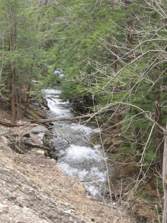
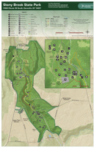
Stony Brook is a small stream that flows north into Dansville where it joins the Canasaraga Creek and then the Genesee River. In the years since the last ice age, the stream has eroded a gorge south of Dansville, This gorge was first developed as a tourist attraction after the Civil War when a local landowner started charging admission to walk the creek through the gorge. In 1883, a railroad came to Stony Brook, as evidenced by the large stone and concrete bridge footings in the upper park. In 1928, the Finger Lakes State Park Commission purchased the land around the gorge and created the Stony Brook State Park. During the Depression, public employment programs such as the Civilian Conservation Corp put unemployed laborers to work improving the park trails and facilities.
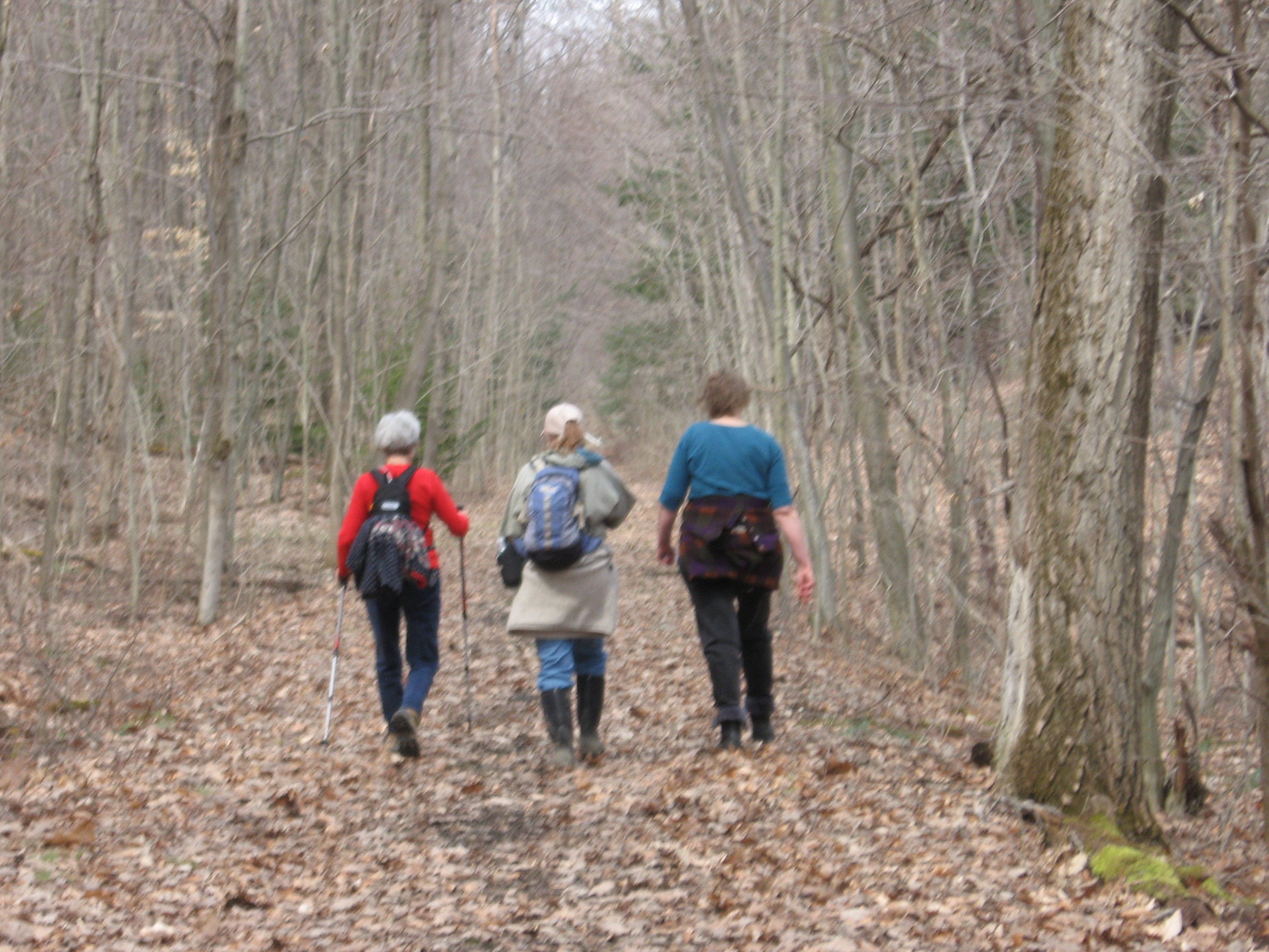
 Hikers will split into three groups but essentially walk the same trail. Each group will walk at their own pace. Climbers and Tourists will start from the snowmobile trail off RT 36 at the lower park entrance and climb along the eastern trail working their way up to the upper park and then crossing over Stony Brook Creek to the west side of the park and continue down to the lower park parking lot.
The Naturalists will car pool to the upper park and walk toward Stony Brook Creek and cross over to the east trail and work their way down the snowmobile trial that the climbers and tourists climbed up. Once at the bottom, they will walk to the lower parking lot.
Most of the trail is up and down hill at the beginning and end of the hike but, levels off in the upper park. Trails are most likely going to be wet and slippery so poles and traction devices or good treaded hiking boots are recommended.
RECOMMENDATIONS: Please check the weather and dress accordingly, multiple thin layers allow for adjustments during the hike (synthetic under layer, fleece 2nd layer. light shell 3rd layer; avoid heavy parka’s).
After hike social will be the Sunrise Restaurant on the North end of downtown Dansville.
DIRECTIONS :
From Downtown Dansville take RT.36 South for about 4 miles. Turn left into Stony Brook State Park. Drive to the main parking lot where we will divide into our three groups.

Hike Leader – Cate Concannon, catrina616@gmail.com
Hike Description – Map B3, Access 18 to Map 12, Access 2.
This hike will start with a steep uphill at Access 18 off Mitchellsville Road on the Bristol Hills Trail. We will follow the BHT through the forest, past Lake David and through gullies for a total of 3.6 miles, then cross over to the mail FLT with a short road walk on Harrisburg Hollow Road. We should have some nice views of the area and finish the hike on 2.1 miles of the main FLT trail. A hike encompassing two maps and two different trails – how fun! Perhaps someone will know if this is the first time this has been done on the Named Hike series.
Car Pooling: Springwater Trails will organize a car pool from the parking area behind the Wayland Fire House. Be at the parking are at 9:15 – we will leave promptly at 9:25!
Meeting time – 10 am, with a departure time of 10:10. We’ll need to place cars for the car shuttle.
Meeting place – We will meet at the Hickory Hill Campground (click for map and directions) . From there we will drop cars at our end point and proceed to our starting point, Access 18 on Route 13. From exit 38 off I-86 (Route 17), follow signs to Route 54. After following Rt 54 through town including a 90 degree left turn, Route 13/Mitchellsville Road will branch off to the left. Prominent signs for the campground, which will be on your left off Rt 13 just north of Bath.
Notes – Please dress for the weather, but as a general rule of thumb, dress in layers and bring extra clothes. Waterproof jacket & pants will most likely come in handy, plus hat and gloves. Pack a lunch that can be eaten quickly on the trail, plus lots of water.Be prepared for steep ascents and descents! E-mail hike leader with your interest in joining the hike – carpooling is encouraged and she will help to organize.
Updates: Check for updates at the FLT website.
Canadice Lake (from the Iroquois for “Long Lake”) is both the highest in elevation and the smallest in area of the Finger Lakes. In order to protect the quality of drinking water from Canadice Lake the city of Rochester obtained much of the property surrounding the lake. Over the years the land was planted or naturally reverted to forest. Today you get a good idea of how all the Finger lakes looked in their wilder days.
On Sunday we will hike the West side of Canadice Lake. If weather permits, snow shoes or skis may be appropriate.
The Climbers will start at the North end of the lake and hike to the South gate on Canadice Lake road. They may utilize some side trails.
The Tourists will start on the South end of the lake and hike to the North gate.
Naturalists will start at the North end of the lake journey South for an hour and return to start point.
Please arrive at the North end of Canadice Lake by 1:45 so we can get organized and get started by 2 P.M.. The tourists will carpool to the south end, and the climbers will use the tourist cars to return to the north end. Tourists willing to carpool may want to bring an extra set of keys for the climbers to use. (As this is my first go as a hike planner some changes may need to take place)
DIRECTIONS: The Northwest parking area for Canadice Lake is off Purcell Hill Road just west of Canadice Lake Road (42.7394625,- 77.5418878).
From Rochester: Get on Route 15A South. Follow 15A thru Rush, Lima, and Hemlock. Above the village of Hemlock turn left on Purcell Hill Road(1.2 miles). At the bottom of the hill (before Canadice Lake Road) turn right into parking area.
From Springwater: (At traffic light) Take 15A North for 7.6 miles. Turn right on Purcell Hill road (1.2 mles) Parking area on right.
From Honeoye: Take RT 20A west toward Hemlock. Turn left (South) on Lake Rd about 2.6 miles west of CR37. After 3.4 miles turn right onto Purcell Hill Rd. Parking area is on the left in .2 miles.
SOCIAL: The closest Eatery is Sammy’s Restaurant in Springwater. Directions: Upon leaving parking area on Purcell Hill Road turn left, When you reach the intersection of Rt 15A, turn left heading South. Sammy’s is located approx. 1/4 mile past the traffic light on the right side of the road.
For History Buffs: “History of Canadice” by Beverly Deats is an interesting read, and contains the story of the Indian maiden Onnalee.
Excerpt from W.H.C. Hosmer’s poem (takes place at the end of Onnalee’s Run)
Regadless of the Whizzing Storm
Of Missiles raining round her form
Imploring eye she then upcast
And, a low mournful death hymn sang
On hill and forest looked her last
One glance upon the water cast
and from the high rock sprang
(It is said her beautiful, spirit form can still be seen rising from her watery grave)
According to an internet source, Canadice Lake was considered the “local lake” (reasonably affordable, containing more of a “blue-collar” population). Hemlock was the “blue-blood” lake (summer houses for many wealthy Rochesterians).
Lastly: Beware of Candy, the Canadice Lake sea serpent. She frequently makes forays onto dry land to feast upon unsuspecting hikers. Strange ripples have been seen, on the lake’s surface, could be attributed to Candy’s movements.
On Sunday we are going to try to snowshoe in Mendon Ponds Park, if the weather permits. Mendon Ponds Park is the largest Monroe County Park with 2,500 acres of woodlands, ponds, wetlands and glacially created landforms. In 1969, it was named to the National Registry of Natural Landmarks due to its geologic history and presence of significant kames, eskers, and kettles.
Sunday, from 11 to 4, is the Mendon Winterfest. Come to Mendon early and learn about and try out other winter activities such as ice fishing, orienteering and ice boating. While Winterfest is geared towards families, it should be an enjoyable day for everyone no matter how cold or warm the weather. Springwater Trails will be at the Evergreen Shelter with a display of traction devices for winter hiking. Volunteers willing to help explain the various devices should meet at the Shelter at 10:45. After examining the various traction devices, you will want to take the opportunity to try snowshoes at the ADK display in the same shelter. Check the schedule for other events.
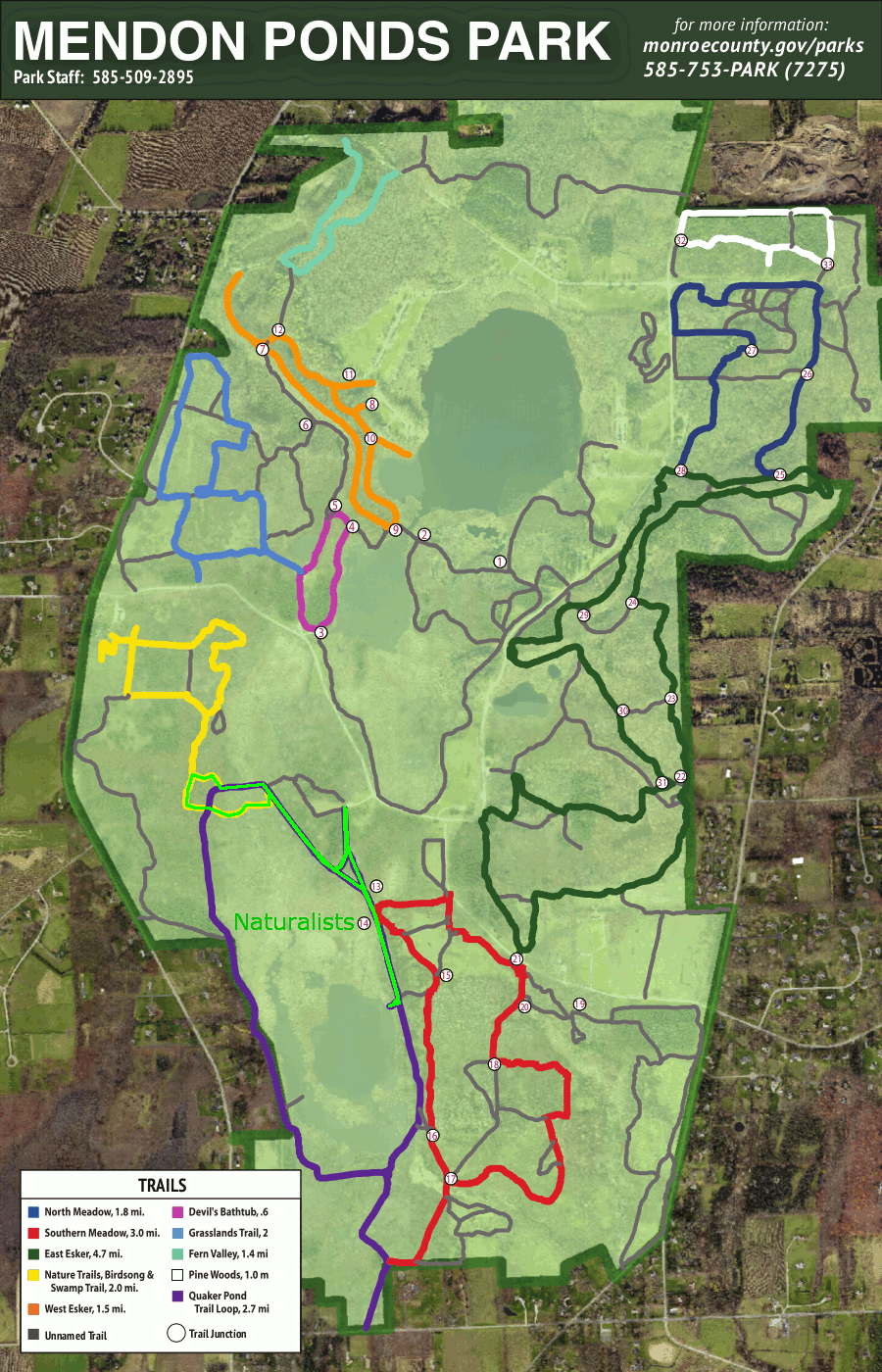 Springwater Trails will meet for our Sunday hike at 2:00 on Pond Road at the parking area behind Lookout Lodge. We will all start out together on the Quaker Pond Loop (Purple trail), heading to the right to loop around the pond in a counter-clockwise direction.
After a quarter mile, we will join the Birdsong Trail and cross a small bridge. Naturalists will stay on the Birdsong Trail for a short loop and an opportunity to feed the Chickadees. After completing the Birdsong loop across a second bridge and back to the original Quaker Pond Loop, the naturalists will follow Quaker Pond loop in the clockwise direction south to the lookout platform with a view of the pond. Heading back to the cars from this point will make a 2 mile hike.
The Tourists will join the Naturalists for the Birdsong loop, but will return to the Quaker Pond Loop in the counter-clockwise direction. There are two branches to the left to lookouts over the Quaker Pond. Continuing on around the loop and back to the cars makes a 3 mile hike.
The Climbers will stay on the Quaker Pond Loop trail, past the first lookout. As the trail loops around the pond and starts back north, the climbers will take a short side trail to connect to the Southern Meadow Trail. They will turn right on the Southern Meadow trail and then loop around back along Pond Rd and finally back to the Quaker Loop trail, where they will head north to the car for almost 4 miles total.
Following the hike, we will gather at the Brewery Pub and Grill at 8 W Main S in Honeoye Falls for refreshment and warm conversation.
Directions:
From Springwater: Head north on 15A for 21.6 miles through Hemlock and Lima. Take a slight right exit to Honeoye Falls. Stay on W Main St into the villiage where you will pass the Brewery Pub and Grill on the right at the intersection with NY 65 (1.9 mi). Continue straight onto NY 65 for 4.4 mi. (At 2 miles, you will go around a traffic circle. Stay on NY 65.) Turn right onto Pond Rd. The parking area is on the right in 1 mile. NOTE: to get to the Evergreen Shelter before the hike, stay on NY 65 for another 1.2 miles past Pond Rd. Turn right on Canfield Rd. The shelter is on the right 0.7 miles down Canfield.
From Honeoye: From US 20A, head north on CR 37 for 8.2 miles to W Bloomfield. Continue straight on NY 65 for 0.7 miles, then continue straight onto CR 35/W Bloomfield Rd for 6.6 miles. Turn left onto Pond Rd. Inside Mendon Ponds Park, the road will come to a T – turn left to stay on Pond Rd. The parking area is on the left in 0.2 miles. Note: to get to the Evergreen Shelter before the hike, stay on W Bloomfield Rd for another 1.7 miles past Pond Rd. Turn left on Canfield Rd. The shelter is on the left 2.1 miles down Canfield.
From Rochester: Exit I590 at Monroe Ave toward Pittsford. Turn right (south) onto NY 65 (Clover St). In 6.7 miles, turn left onto Pond Rd. The parking area is on the right in 1 mile. NOTE: to get to the Evergreen Shelter before the hike, turn left from NY 65 in 5.5 miles onto Canfield Rd. The shelter is on the right 0.7 miles down Canfield.
From the Evergreen Shelter: Head west on Canfield Rd for 0.7 miles. Turn left onto NY 65 for 1.2 miles. Turn left onto Pond Rd. The parking area is on the right in 1 mile.
 Cumming Nature Center (CNC) is a dynamic environmental education facility that celebrates the unique landscape and culture of the Finger Lakes region through hands-on learning opportunities and thoughtful exhibits. The 900-acre preserve is as beautiful as it is vast. You can meander through more than 6 miles of trails complete with wetlands, climbing forest roads and hiking through the past. The environmental education center located seven miles north of Naples and seven miles south of Honeoye, New York, in the Bristol Hills.
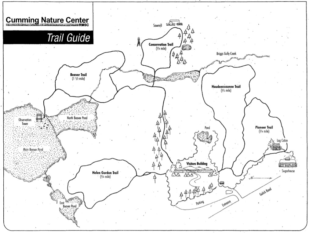 Maps of the trails will be available at the center upon our arrival. We will divide into our three groups and choose our routes and pace. Hikers may want to save some time to enjoy the nature exhibits in the Center.
There is a donation fee to access the Nature Preserve. This fee will be covered by Springwater Trails Organization; however additional donations are always welcome. Upon arrival please identify yourself as part of the Springwater Trails Group at the entrance desk.
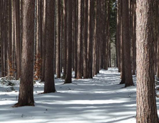
 Winter is a beautiful time of year at Cumming Nature Center. If conditions are right there are 15 miles of groomed ski trails and a 3-mile loop for snowshoeing. As of Wednesday, the 20th the Trail Conditions are open for winter hiking; Closed for skiing and snowshoeing until snow depth increases. The Snow Depth is 1″ with no additional snow in the forecast this week.
For those of us that may want to return when there is more snow keep in mind for your convenience Cummings rent ski equipment and snowshoes at the Visitor Center:
- Ski package (skis, poles and shoes): $15
- Snowshoes: $5
Directions from Rochester, NY and points north:
- Take Interstate 390 south to Routes 5 & 20.
- Proceed east to Route 15A in Lima.
- Go south on Route 15A to Route 20A in Hemlock.
- Head east on Route 20A to East Lake Road in Honeoye.
- Proceed south on East Lake Road to County Road 33. There are signs to point the way from the junction of East Lake Road and County Road 33.
- Turn east on County Road 33, and then southeast on Pinewood Hill Road. This becomes Gulick Road, and the CNC entrance will be on your right.
Directions from Springwater, NY:
- Go north on Route 15A to Route 20A in Hemlock.
- Head east on Route 20A to East Lake Road in Honeoye.
- Proceed south on East Lake Road to County Road 33. There are signs to point the way from the junction of East Lake Road and County Road 33.
- Turn east on County Road 33, and then southeast on Pinewood Hill Road. This becomes Gulick Road. After 4.7 miles, the CNC entrance will be on your right.
Directions from Wayland, Naples, NY and points south:
- Follow NY 21 east from Wayland, through N Cohocton to Naples (11.4 miles).
- Turn left onto Clark Street (County Hwy 36), heading north (next to Middletown Tavern)
- Take first right onto Gulick Road.
- Follow Gulick Road for 7 miles.
- CNC will be on your left.
The after hike social will be at the Valley Inn, 8970 Main Street, Honeoye. On the corner of Route 37 and 20a.
Directions to Valley Inn:
- Turn left out of the CNC. Take Gulick Rd north until it turns left to become Pinewood Hill Rd.
- Follow Pinewood Hill Rd to the T with CR 33.
- Turn left to stay on Pinewood Hill Rd (CR 33).
- Turn right on East Lake Rd.
- Turn left onto US 20A west.
- The restaurant is on your right in 1.6 miles at CR 37.
Looking for brochure.or mailing list so I can receive it in the mail.
Nothing opens up for mailing list.
There’s all kinds of very bizarre ads and post for viagra and other drugs above on calender page.
Please let me know if there’s a brochure available