
Are you ready for something new and different this Sunday? Dust off your bike and prepare to explore a section of the Ontario Pathways Trail. Hikers can enjoy the same path as riders at a slower pace.
Our journey will begin at he parking area on County Road 23 in the Hamlet of Orleans, approximately 4 miles north of Flint. Bikers and hikers will head south on the Pathway traversing fields and forests, following Flint Creek. The trail is flat with a surface of cinder, dirt, and grass. There are numerous “speed bumps” created by gnarly roots poking through the surface. Mountain bikes are recommended due to the rough surface, but hybrid bikes will do as well. For safety sake, please wear a helmet. Bikers will ride 7 miles to the Stanley terminus and return on the same route for a total of about 14 miles. Hikers will walk southward as far as time allows, then return to the parking area via the same trail. For more information and a map of the trail, visit their website www.ontariopathways.org.
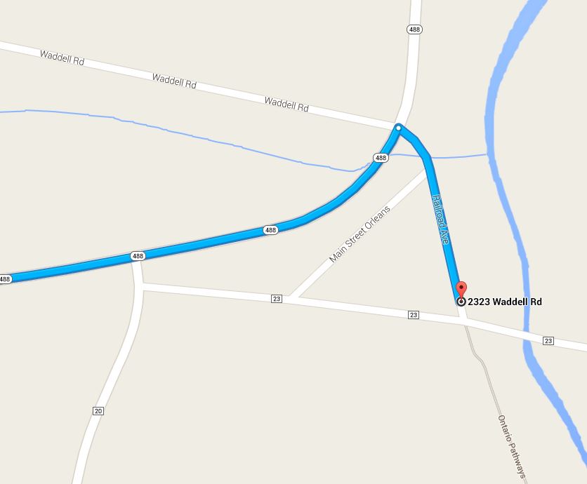 Directions: From Canandaigua head north on Route 21. North of the city bear right on Route 488, heading east. Follow this route for 6.3 miles to the point where Route 488 turns to the left to head north. Turn right at the cross roads (Waddell Rd and Railroad Rd). The gravel parking area is on the left before the intersection with CR 23. You will see an old wooden mill to the north of the parking area.
Social: After the bike/hike let’s gather at the Wegman’s Market Café on Route 5/20 in Canandaigua. So many yummy choices and tons of seating. From the trail head, head west on CR23. Turn left on CR 20. Take the first right on CR4. After 6.5 miles, turn left onto CR10. Then right on US-20. Wegmans is on the left after a half mile.