
Seman Rd
Naples, NY 14512
USA
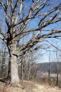
The hike on Sunday 21st January 2018 will follow a section of the Bristol Hills Branch of the Finger Lakes Trail in Naples. Springwater Trails has signed up to maintain this section of the Finger Lakes Trail. This section passes through the West Hill Preserve off Seman Rd and then across private land to Mt Pleasant St. in Naples. This section of trail is also in our plan to walk the entire length of the BHB.
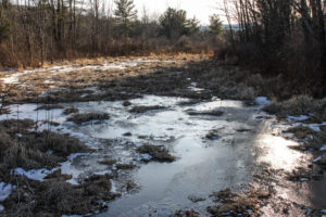
The trail is in good shape provided that there has been no serious winter damage. It rises steadily from the Seman Road access point to the ridge line, and then drops fairly steeply down to Naples. It has been a reliably dry trail in the past apart from a short section of bog near the beginning of the hike. We will be making notes about areas that need maintenance. Maintenance days will be planned in the spring and late summer, to help keep this trail in the conditions that hikers have grown to expect.
We will meet at the entrance to the West Hill Preserve on Seman Road (42.66166, -77.396288). We will shuttle some cars down to the hike end in Naples (42.625950, -77.397304) before we start. The climbers will follow the trail down to the old cemetery in Naples. Naturalists follow the trail to the sign in box and then return to the cars on Seman Road.
Please note: Dogs are not allowed to hike on the Nature Conservancy property.
The Social and the Christmas Party
Following the hike, please join us for a social and late Christmas party at John’s house (42.615870, -77.456155). The address is 8402 French Hill Road, Naples, NY 14512.
Directions to the Hike Meeting Point:
From Springwater: Head south on NY 15 (for 5.2mi). At the light in Wayland turn left on NY 21N (for 6.7mi). In N Cohocton, turn left to stay on NY 21N (for 4.5mi). In Naples, turn left again to stay on NY 21N (for 1.8mi). On the north side of Naples, turn left on CR12 and head up the hill for 1.9 miles. Take the first left, Rhine St., to the 4 way intersection. Go left onto Seman Rd. Trailhead is about 1/2 mile, by a big sign on the left. Park along the road.
From Honeoye: Head south on CR 36 on the west side of Honeoye Lake (for 13.6 miles from NY 20A). Turn left onto Gulick Rd (for 2 mi), then right on Davis Rd (for 0.7mi). At the end of Davis, turn left on W Hollow Rd (CR 33) for 0.5mi, then right on Seman Rd. The Trailhead is about 1 mile, by a big sign on the right. Park along the road.
Directions from the Hike Meeting Point to John’s House (42.615870, -77.456155).
From the meeting point on Seman Road, go west to the junction with West Hollow Road (that’s left, with your back to the trail head). Turn left on to West Hollow Road, and then first right onto Davis Road. At the junction with Gulick Road, turn left and go all the way to the end of the road where it meets County Road 36 (Hunts Hollow Road). Turn right, and half a mile later turn left onto French Hill Road.John’s house is 1 mile up French Hill Road, on the right. It has green siding.
Directions from the Old Cemetery in Naples to John’s House (42.615870, -77.456155).
From the hike end point at Bob and Ruth’s restaurant go south on Rt. 21 through downtown Naples (that’s right with you back to Bob and Ruth’s) and then turn right on county road 36, also known as Hunts Hollow Road; this turn is at the Middletown Tavern. Go north up County 36 for about 2 miles, and then turn left onto French Hill Road. It is the second left after turning onto the road from Rt. 21. John’s house is 1 mile up French Hill Road, on the right. It has green siding.
Post Hike Notes
This hike should be classed as a “hard” hike in winter, and possibly “very hard” if conditions are icy. The section is about 60% gentle uphill in the north, starting at Seman Road, but becomes very steep once the ridge line is crossed. Some parts on that southern section are very steep, and snow and ice make it especially difficult. This hike took 3 hours in moderate snow.