Posted on by

Letchworth Branch, Parade Grounds to Dygert Rd

This week’s hike continues our Letchworth Branch series. For those of you who have been following this series, you may be looking forward to lots of creek crossings and the associated scrambles up and down the creek banks. But this week will be a bit calmer, with much of the hike follows the old Genesee Valley Canal, and the seasonal portion of River Rd.

The hike will start at the Parade Grounds. All hikers should park at the Parade Grounds, just off the East Park Rd.  The branch trail is a short walk down hill on the road from the parking area.

Weather note:  Rain is expected Sunday morning, so trails will be wet, and poles and traction footwear are recommended, especially for Climbers. Naturalist and Tourist routes are fairly flat, but Climber route includes some hills and small stream crossings.  

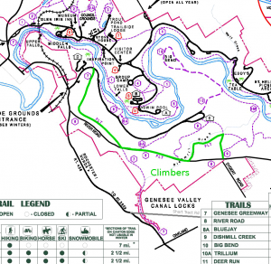
The Climbers and Tourists will turn right onto the FLT Branch trail (See the green line on the map [click the map to enlarge]) At this point the Genesee Valley Greenway and the FLT Branch are the same trail and are marked with yellow blazes. The trail follows the old canal for 1.8 miles to River Rd. Turn left onto River Rd (the Greenway continues straight across the road heading toward Nunda). River Rd is seasonal on this section – it is officially open for traffic but likely we won’t meet many cars.  Stay on River Rd for a mile – you may note two park trails (8A and 9) leaving the road to the left.  Look for yellow blazes where the Letchworth Branch enters into the woods on the left. At this point, the tourists should continue straight on River Rd to our staged cars at Dygert Rd. The tourist hike is about 3.5 miles.

Meanwhile, the Climbers will turn left to stay on the branch trail from River Rd. In a bit less than a mile, turn right onto the blue access trail to hike out to Dygert Rd (you can’t miss the turn, because the main trail heads up a step hill with only a narrow path (that we climbed last month).  The Climber hike is about 4.2 miles.

Back at the East Park Rd intersection with the Branch Trail, the Naturalists will turn left on the branch trail and walk to the middle falls.  There is a sign at the start of this trail announcing that it is closed in a half mile. The Naturalists will follow this trail to the Middle Falls. In half a mile when you come to a fence, turn around and return to the road. At this point there are three options:

  1. Continue straight along the branch trail for another half mile. Turn around at 3:30 and return to the cars.
  2. Turn left and walk down the road a half mile, to a point opposite the lower falls, then turn around and return to the road and climb back up to the cars.
  3. Turn right and return to the parade grounds. A brief walk around the parade grounds will complete the hike.

Following the hike, everyone is invited to join us for a pot luck picnic at the Parade Grounds shelter. Bring a dish to pass and your own beverage (or make a small donation to the social fund). Perhaps someone who just doesn’t have the time to make a dish to pass will stop at a grocery and bring hotdogs and buns. John will bring a grill.

Directions:

Since this hike is a one-way hike for Climbers and Tourists, we need to stage some cars at Dygert Rd.  If you would like to participate in this effort, please meet at Dygert Rd at 1:30PM. If you can’t make it to Dygert before 1:40, please go directly to the Parade Grounds.

To the Parade Grounds from Springwater, Wayland and Dansville: In Dansville, take Ossian St (NY-36N) west from Main St.  Continue straight onto NY-436W. Follow NY 436 for 18.3 miles through Nunda. About 4.3 miles past the light in Nunda, turn right into the Letchworth entrance – there are two roads at this intersection, take the sharp right through the gate. Parking is about half a mile down on the left.

To the Parade Grounds from Mt Morris, Geneseo and I390: Take exit 7 from I390 and head south-west on NY-408.  In Mt Morris, 408 jogs one street to the left at Main St.  Continue on NY-408 south from Mt Morris for 9.2 miles. Turn right onto Wildey Rd, then (in 1 mile) turn left onto Short Tract Rd. At the end, turn right onto NY-436. In 2.1 miles turn right into the Letchworth entrance – there are two roads at this intersection, take the sharp right through the gate. Parking is about half a mile down on the left.

To the Dygert from Springwater, Wayland and Dansville: Follow these directions if you can leave your car at Dygert Rd before 1:40. In Dansville, take Ossian St (NY-36N) west from Main St.  Continue straight onto NY-436W. Follow NY 436 for 15.2 miles through Nunda. About 1.5 miles past the light in Nunda, turn right onto Oakland Rd. Continue straight at the stop sign at Short Tract Rd and take the next left onto Dygert Rd.  Park on the south side of the road at the tee with River Rd.


Posted on by

Historic Geneseo Village Walking Tour

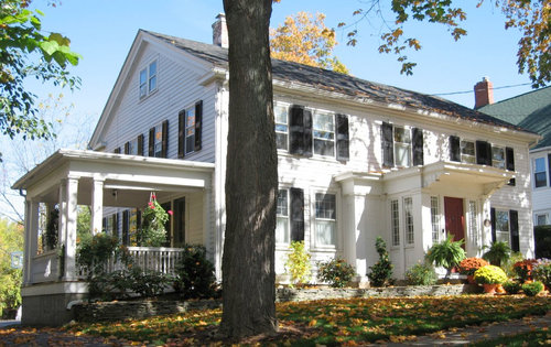
This Sunday we will take a somewhat leisurely tour of Geneseo Historic District landmarks and properties described in the Association for the Preservation of Geneseo’s brochure ” A Walking Tour of Geneseo, New York Village Center”.   At each of the approximately 40 stops on the tour, we will read the information in the brochure to learn about the age, architecture and early owners of the properties and landmarks.  First settled by William and James Wadsworth, the township of Geneseo was established in 1789.  Many of the buildings we will see date from the early to mid 1800’s.  In addition, the Wadsworths planted many oak trees, and the village now has a large number of mature oak trees 200 years or more in age.  The district was listed on the National Register of Historic Places in 1977 and an enlarged district was designated a National Historic Landmark in 1991.

Parking is available off Main St between Center and Chestnut streets or at the meters on Main St (no cost on Sunday). We will meet on the west side of Main St at the Memorial Fountain at the intersection of Main and Center streets.

Although there will be a few available to share, you may want to bring your own copy of the brochure with you.  Here is the link.

As time allows, some people may also want to visit the Roemer Arboretum on the SUNY Geneseo Campus and/or the Genesee Valley Conservancy’s Island Preserve across from Geneseo Central School.

An after hike social will be held at The Village Tavern, 137 Center Street, Geneseo (Menu).


Posted on by

Ontario County Park

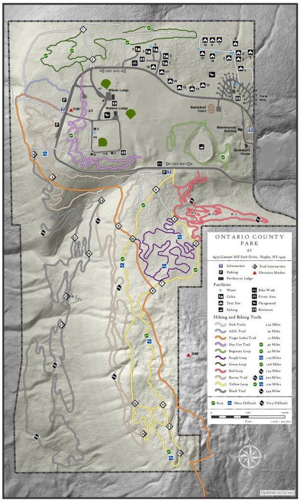
2017 Map

Ontario County Park is really a hidden gem in the area, providing hiking, biking, cross country skiing, fishing (no hunting), and camping or picnicking opportunities depending on the season. This Sunday we will explore some winter hiking trails we haven’t visited much over the years. You should expect some interesting views around the park..

The weather is very interesting right now. On Tuesday Mark and I did a prehike in a howling gale with blowing snow up on top of Gannett Hill. The temperature up on the hill was 29° when the village of Naples was us at 34° and no snow. On Thursday for a second prehike, we ran into snow drifts up to 2 feet deep and invisible trails covered with snow. And now weather forecasts are calling for rain on Saturday, and light rain with temperatures around 50 on Sunday. Right now is a good time to get our you rubber boots and your snow shoes and cross country skis, so you are ready for whatever comes.  

Here are our current plans for Sunday – these may change depending on the conditions on Sunday.

The Climbers will explore the black trail on the west side of the park. This trail weaves along near the steep west hill of the park. It’s not clear we were actually on the trail on Thursday, but the hiking was generally quite easy and we have marked a trail with yellow tape so we won’t get lost.

The Tourists and Naturalists will explore the green trail on the north side of the park.  Mark will lead this hike which means we may not always know where the trail is.

Following our hike, all interested hikers will gather at the Neapolitan in Naples for Pizza or hot sandwiches.The Neapolitan is located on the west side of Main St one block south of the high school.

Directions: The easiest route is to take NY 64 to Bristol Springs and turn west on Gannett Hill Rd.  There is a sign indicating Ontario County Park.  At the top of the hill turn right onto  South Gannett Hill Road.  The  park entrance is straight ahead.    Follow the park road for about .5 miles to our meeting place which is the parking area along the park road near the information kiosk at the Finger Lakes Trail trail-head. 

Posted on by

Thanksgiving hike

Hemlock Lake  Post-Thanksgiving Hike – Work off those extra holiday desserts!

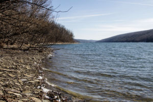
Join us on Sunday, Nov. 25th for a hike along the east shore of Hemlock Lake on the lakeshore section of Rob’s Trail. We will meet at 1:45 at the Boat Launch parking area at the end of Old East Lake Road, and hike south along the shoreline path. The path is fairly level, with some minor stream crossings.  Climbers will hike as far as the point where the trail turns away from the lake (about 3 miles) and then return to the cars.   Tourists and Naturalists may turn back sooner to keep their hikes to their desired length and time. 

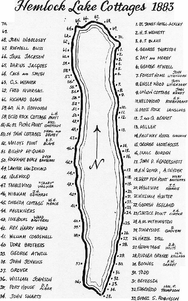
We’ll be hiking along what used to be Hemlock Lake’s East Lake Road, back in the days when there were cottages, hotels and steamboat service on the lake. That era came to an end when the City of Rochester took control of the Hemlock Lake watershed for its public water supply, around 1900. All structures from the cottage era were removed, and the waters of Hemlock Lake, along with the smaller Canadice Lake, continue to supplement the Monroe County water system, while the State of New York has assumed ownership and management of the surrounding land as the Canadice-Hemlock State Forest. The undeveloped shorelines of these lakes offer a soothing contrast to the homes, docks, boat hoists, seawalls, and high levels of activity and investment along the other Finger Lakes shorelines and slopes.

After the hike the social will be at the Cornerstone Market, 8732 Main Street, Honeoye.  The Cornerstone is open until 7, but their kitchen closes at 5, so menu orders should be made by phone before 4:30 (585-229-2411).  Between 5 and 7 they have soup, chili, beverages and pre-made sandwiches to purchase and eat on site in Peggy’s Rumpus Room.

Directions to the North Boat Launch

From Rochester and Hemlock: Head south on NY-15A. Before Hemlock, NY-20A will enter from the right. At 0.7miles past the intersection where NY-20A turns left, take the first right from NY-15A onto Rix Hill Rd into the Hemlock Lake Park. Take the first left and follow the east lake road to the boat launch, about a mile.

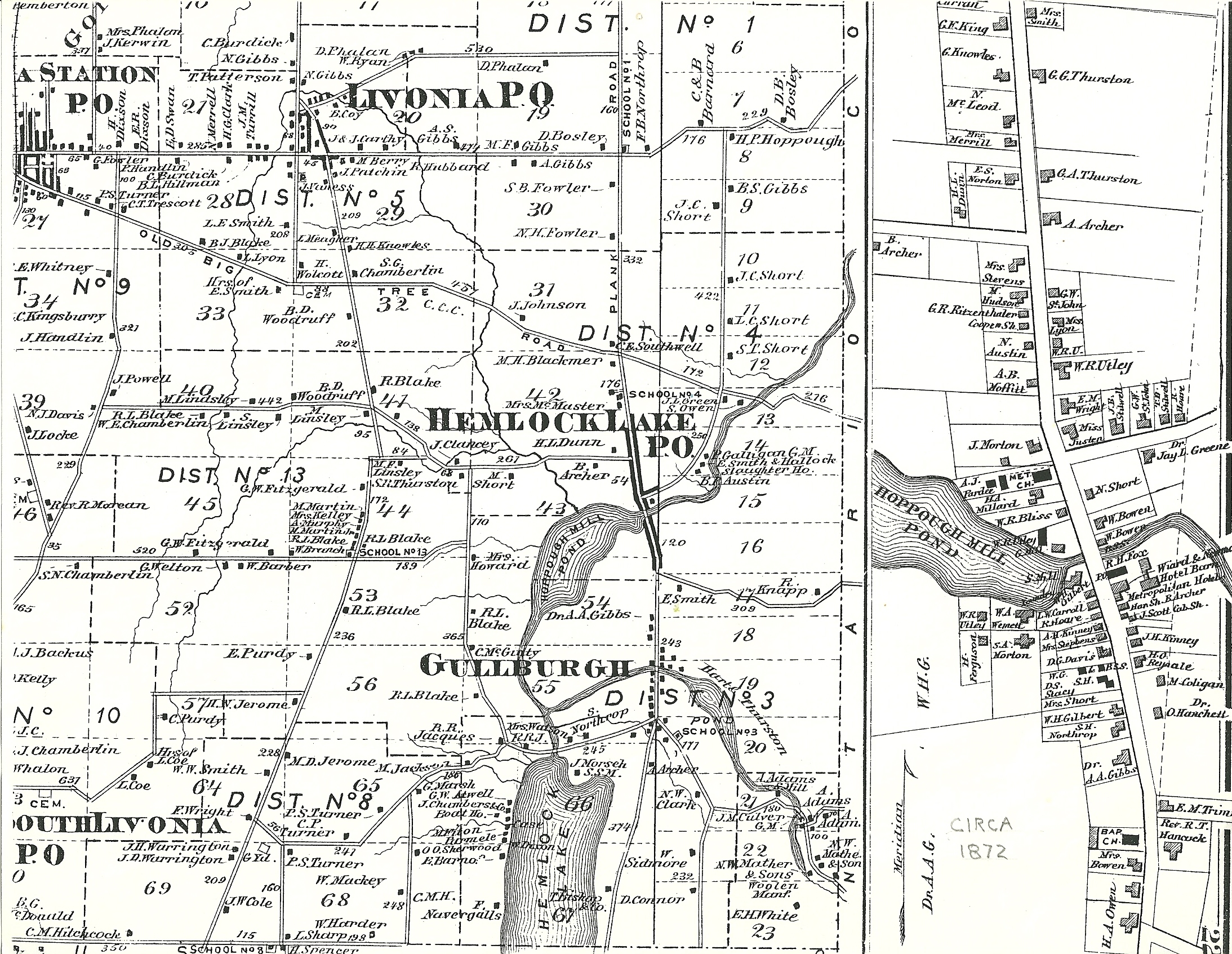
Hemlock 1872. Shows only one cottage along East Lake Rd. Also, check out the 1902 view also.

From Springwater: Head north on NY-15A for 10.1 miles. Turn left on Rix Hill Rd and an immediate left on East Lake Rd. Follow this road to the boat launch.

From Geneseo: Head east on NY-20A through Lakeville and Livonia. Take a slight right to stay on 20A as it joins NY-15A. Stay on 15A when 20A turns left. In 0.7 miles past that intersection, turn right onto Rix Hill Rd. take the first left and follow the east lake road to the boat launch.

Directions to the Social:

From the Boat Launch, go back to Rix Hill Road and turn left on Route 15A.  After .5 miles take a right on NY-20A just before Hemlock, and go 4.5 miles to Honeoye. The Cornerstone Market is at 8732 Main Street ,on your left at the intersection with County Road 36.