This Sunday’s hike is the 4th in our series on the Letchworth Branch. This hike will join the trail at Access Point F and will follow the trail to Access H for a 5 mile hike. The Tourists and Naturalists will exit early at Access G for a 2 or 3 mile hike. For hikers tracking our progress on this branch trail, you will note that we have skipped the section from E to F. This section is six miles with no early exits – so, we are postponing that hike until March and daylight savings time when less snow should allow us to finish the hike well before sunset.
Starting from shoulder parking at Access F, all hikers will follow the blue trail into the main yellow trail. The climbers will turn left onto the main trail. In a mile and a half, we will stop at a shelter for a sip of water from our individual supply of water which all hikers are expected to carry on all hikes. In another mile, we will cross the abandoned St. Helena Rd. This road carried traffic to a bridge across the Genesee to a hamlet of St. Helena on the west side of the river. At the time of the Civil War, St. Helena had 90 students in its school, but in 1884 and again in 1904, the bridge was washed away by ice jams. In 1920, there were just 6 families left, and the school was closed. The last resident left in 1948. The Mt Morris Dam was completed in 1952 and contained the hamlet within the lake that forms behind the dam during floods. About two miles after crossing the St Helena road, we will turn left onto the blue trail and hike out to an awaiting car to carry us back to our cars at the trail head.
The Tourists will follow the same access trail as the climbers to the main trail, but will continue straight across and continue of the park trail to the edge of the river flats or as far as the hikers wish to go. If they hike for 0.6 miles, they can reach a large old sycamore tree, the largest tree in Letchworth. The tourists will then return on the same park trail back to the yellow trail, and will turn right to follow the hikers (and naturalists). About 500 feet past the shelter, the tourists will leave the branch trail on a blue access trail and hike out to another waiting car on River Rd which will transport them back to cars at the trail head.
The Naturalists will also follow the blue trail into the yellow trail. Turning left they will follow the climbers to the shelter. A tenth of a mile past the shelter, the Naturalists will turn left onto another blue access trail to Access G on River Rd. The Naturalists should wait for the Tourists behind them and share the car ride back to the cars Access F.
Following the hike, please join us for a social at the Sunrise restaurant in Dansville. Prior to the hike, the tourists and naturalists should confirm that they plan to meet the climbers at the restaurant. They can let the restaurant know the number of climbers that should be expected about a half hour later than the tourists and naturalists.
Directions
From Springwater: Take NY 15-N west from the light in Springwater. At the top of the hill and around the curve, turn left onto Liberty Pole Rd (CR 38). Continue straight across Reed’s Corners Rd where it becomes CR 1A, and across Stagecoach Rd where it becomes Springwater-Scottsburg Rd and finally across NY 256 where it becomes Groveland-Scottsburg Rd (CR 1). Finally, in 8.1 miles from NY 15, in Groveland, turn left onto NY 63. Take the first right onto NY 258 (Flats Rd). At the end of that road, turn right onto NY 36. After the Correctional Institution. take the second left onto Dutch Street Rd. In 1.3 miles, turn right onto Ridge Rd. Turn left onto NY 408. Go past Frost Rd and turn left onto Hoagland Rd. At the tee, turn left onto River Rd. Parking is on the right just past the next street (Picket Line Rd).
From Wayland: Take I-390N through Dansville. Take Exit 6 for NY-36. Turn left onto NY-36. After the Correctional Institution. take the second left onto Dutch Street Rd. In 1.3 miles, turn right onto Ridge Rd. Turn left onto NY 408. Go past Frost Rd and turn left onto Hoagland Rd. At the tee, turn left onto River Rd. Parking is on the right just past the next street (Picket Line Rd).
From Mt Morris: Take NY-408 south from Main St. In 2.5 miles, bear right onto River Rd. Continue on River Rd for 5.5 miles, past Ridge Rd, Frost Rd and Hoagland Rd. Just past Picket Line Rd, parking is on the right shoulder of the road.
From Nunda: Take NY 436 west from route 408. In 3.1 miles, turn right onto Oakland Rd. At the end, bear right onto River Rd. Parking will be on the left shoulder in about 3/4 mile.
Directions to Sunrise Restaurant: Follow River Rd south. In 0.7 miles, take a slight right onto Oakland Rd. Turn left onto NY 436. In 15 miles, continue straight onto NY-36. At Main St, turn left. Park on the street in front of the restaurant, or take the driveway past the restaurant to the parking area behind the restaurant.
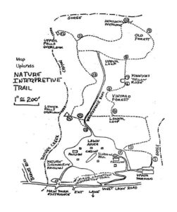
 Two of the trails parallel a creek bed and gorge and one loops to another seasonal creek. Keep your eyes open for the Marker Tree near the creek.
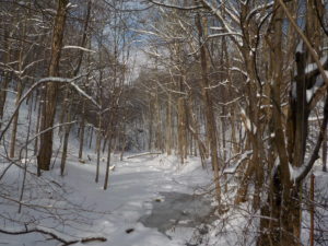
 Update on hiking conditions: There is about a 4 inch base of thick wet snow, with another inch or so of powdery snow on top. Conditions should be good for hiking in boots with traction devices and poles.
 Tourists and Naturalists will follow a similar plan, except making one loop rather than two and without the streamside trail, to limit the distance to 2-3 miles, depending on the route selected.