Posted on by

NordicFest at Cumming Nature Center

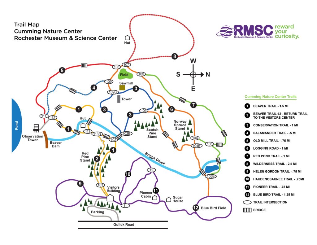
2-16-19 UPDATE ON TRAIL CONDITIONS:  As of Saturday, the trails are snow covered and suitable for regular snow hiking, cross-country skiing or snow shoeing. There are some grainy and icy patches. Trails are individually designated by condition for hikers/snowshoes or for skiers. Trails #9 through #12  are designated for hiking/snowshoes – these go both north (Pioneer, Blue Bird and Haudenosaunee Trails) and south (Helen Gordon Trail) from the Visitors Center, and total about 3 miles. Trails #1 through #8 are groomed for skiing only – these total about 8 miles and include the Beaver and Conservation Trails, the logging road, and Observation Towers and others.  Maps will be available.  We will split into groups and enjoy a nice trek with multiple options for length.  Ski Patrol members will be monitoring the trails throughout the afternoon, so no one will get lost.   The social will be before the hike, beginning at 12:30 – see below.


On Feb 17 we will visit Cumming Nature Center in the hills above Naples NY on Day 2 of their Annual NordicFest Weekend for hiking/skiing/snowshoeing, depending on conditions.  The festival is a fund raiser for the Genesee Valley Nordic Ski Patrol, and includes a host of activities with winter sports, winter wear, food, and Scandinavian culture – see:

https://rmsc.org/cumming-nature-center/nature-center-programs-and-events/item/250-genesee-valley-nordic-days

If conditions permit, skis and snowshoes will be available for rental ($15), or bring your own. If you have extras, bring them to share. Whatever your mode of travel, dress warmly with good traction footwear, poles, layers and water. 

Cumming is a branch of Rochester Museum and Science Center. If you are not a member of RMSC, there is a small fee for access to the Center.  Group fees have been paid by SWT, so just identify yourself, at the desk, as part of Springwater Trails Hiking Group.

Our treks will begin at 2 PM. You also may want to sign up for the Ski Orienteering program offered from 12:00 to 2:00 by Rochester Orienteering Club – see https://roc.us.orienteering.org/event-2782708    This costs $9 for a single person, or $5 per person for a group. The program will proceed on skis or on foot.

Social – Our social gathering will be in the Nature Center Building beginning at 12:30 in the lower level dining area (with fireplace). We encourage members to patronize the food services offered by the Ski Patrol, who will be selling locally-sourced chili (vegan/vegetarian options available), cornbread, cider and baked goods on site for $10 between 11:00 and 2:30, or you can bring your own food and beverages. Afterwards we will gather back at the fireplace between 4 and 5 for warm-up and an exchange of desserts (bring a dessert-to-pass).

Directions

From Rochester and points North: Take 390 South to Routes 5 & 20,   Proceed to Rt15A in Lima. Head South on Rt15A to Route 20A in Hemlock,   Head East on 20A to East lake Road in Honeoye. Proceed South on East Lake Road to County Road 33, (there are signs pointing the way from the junction of East Lake Road and County Road 33). Turn East on County Road 33, then Southwest on Pinewood Hill Road. This becomes Gulick Road.  After 4.7 miles the CNC entrance will be on the right

From Springwater: Go North on Rt 15A to Route 20A in Hemlock,   Head East on Rt 20A to East Lake Road in Honeoye. Proceed South on East Lake Road to County Road 33 (Signs point the way from the junction of East Lake Road and County Road 33). Turn East on County Road 33, then Southeast on Pinewood Hill Road.  This becomes Gulick Road.  After 4.7 miles the CNC entrance will be on the Right.

From Wayland, Naples, and points South: Follow NY 21 East from Wayland,thru N.Cohocton to Naples (11.4miles). Turn Left onto Clark Street (County Hwy36), heading North (Next to Middletown Tavern). Take first Right onto  Gulick Road. Follow Gulick Road for 6.6 miles.   CNC will be on the Left.


Posted on by

All Western Evergreen Tree Farms

Come join Springwater Trails hikers at 2 PM, Sunday, Feb 10, 2019. Please plan to arrive at 6840 Liberty Pole Road by a quarter to 2 and park on the loading pad out behind the farm house across from the metal Morton Building. We will convene at the well head.

No snow is expected before hike time, but if temperatures stay below freezing, we should be able to walk throughout the farm, enjoying views across the valley and close up within the forests. We will take some time to explore through the Christmas trees, walk around the pond and generally enjoy the outdoors.

Naturalists will be ferried up to the Swartz Road entrance to the farm to walk on level fields into the Cathedral Pines. Tourists and Climbers will trek up through the woods and split at the top of Tree Lot Z. The Tourists will go to the left (south) and the Climbers will go to the right (north). From there the hike leaders will be leading the two groups on their separate ways.

Hiking the perimeter of the 250 acre farm is 4-5 miles, as it is approximately 1 mile from east to west and 1 mile north to south. The evergreen tree species include Japanese Vietch fir, Grand fir, Douglas-fir, Fraser fir, Concolor fir, Nordmann fir, Korean fir, Turkish fir, Canaan fir, Dawn redwood, Sequoia, Eastern White pine, Southwestern Border pine, Austrian pine, Red pine, Colorado Blue Spruce, Englemann spruce, Norway spruce, White spruce, Western redcedar, Alaska Yellow cedar, and holly.

The social will be at the farm house after the hikes and all are invited to bring a dish-to-pass or to put a $5 bill in the kitty to help offset the cost of the place settings. You may also bring your own dish to pass.

Directions: You can find directions here.

Posted on by

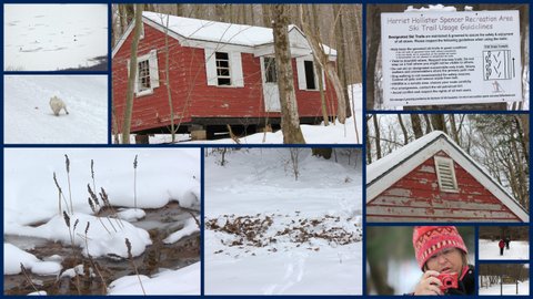
Harriett Hollister Spencer State Recreation Area

Hike, Ski and Snowshoe at Harriett Hollister Spencer State Recreation Area

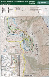
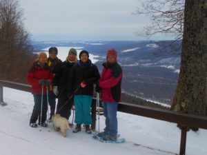
We will meet at the parking area at 2:00PM.  Although there is record breaking cold this week, temperatures are forecast to be in the 40’s on Sunday with the possibility of rain.  Bring gear to snowshoe, cross country ski or hike. Hikers may want to bring traction devices. We will break into groups based on the interests of the participants. If you bring an extra pair of snowshoes, you may find someone who would like to try them out. Bring water and snacks and dress appropriately for the weather with layers that are easy to add or subtract.  Having your own map is always a good idea – here is a link to a winter trail map.

Hikers on boots or snowshoes will need to avoid walking on the groomed ski trails (carefully groomed by the Rochester Cross Country Ski Foundation). Since the park is a popular winter sports location, some trails may be easy walking even with snow and we will adjust based on conditions and snow depth.

The after hike social will be at  The Boat House Grill, 5226 East Lake Road, Honeoye, NY

Directions:

FROM HONEOYE: From 20A turn south onto County Route 37 and go about 4 miles to the County Route 37/Canadice Hill Road split. Continue south on Canadice Hill Road about 3 miles. Harriett Hollister Spencer Park will be on your left.

FROM SPRINGWATER: Take Route 15A north out of Springwater for one mile and turn right on Wheaton Hill Road. Take the 1st left onto Canadice Rd. Turn right to stay on Canadice Rd. At the county line continue onto Co Rd 37 for 2.0 miles. Turn right onto Luckenbach Hill Rd. At the top, turn left onto Ross Rd. At the stop sign, take a sharp right onto Canadice Hill Rd. Harriett Hollister Spencer Park will be on your left.

FROM NAPLES: Please check your route before you leave. Google Maps will send you up Garlinghouse, which is a seasonal road and impassible in the winter. From Main St in Naples, turn north west on Clark St and continue onto CR 36 (Hunt Hollow Rd) for 11.9 miles. Turn left onto Jersey Hill Rd (Note Cratsley Rd is also seasonal). At the top, turn left onto CR 37. Continue straight through Canadice onto Canadice Hill Rd, and stay straight on Canadice Hill Rd when it turns to a dirt road. The Park will be on your left.


Posted on by

Canadice Lake Trail in the Snow, with options for level hiking, XC skiing (maybe), and hiking/snow shoeing Rob’s Trail East – Jan. 27th 2-4 PM

Join us for a winter outing on the Canadice Lake Trail and try out your favorite winter equipment. Starting at the north end, the trail skirts the west side of Canadice Lake, mostly a wide and level easy surface. We’re hoping the trail will remain snow-covered, and we offer an out-and-back option or the chance to hike, snowshoe or cross-country ski the full four-mile length, with a ride back to the start. At about the mid-point, the lake trail joins Rob’s Trail, which heads up the hill, and any energetic hikers craving an elevation challenge can take that route as an alternative.

Please dress appropriately for the weather. Bring traction devices, poles and snowshoes if you expect to try Rob’s Trail. Otherwise wear good boots and poles, cross country skis if desired, and carry water with you. We’ll provide an update on conditions a few days before the hike.

Trail condition update: With new snow on Sunday morning,  it’s mostly a rough surface of frozen hikers’ tracks with some fresh snow on top, so the potential ski conditions are hard to predict.  We suggest you bring boots, poles and spikes at a minimum, plus whatever other equipment you’d like to try out.  For Rob’s Trail, poles and snow shoes or boots and traction devices should work. 

Meet at 1:45 at the north end parking lot, Purcell Hill Road.  Car Pool Drivers needed: We’ll need three or four people to volunteer to meet at 1:30 at the south end trailhead on Canadice Lake Road and leave cars for the return trip. Please leave a comment below if you can take at least 3 in your car in addition to the driver and gear.

Naturalists will hike south as far as they wish, and return to their cars.  Tourists will hike the full length of the trail on the level (4 miles), and catch a ride back to the parking lot at the end. Climbers will hike as far as Rob’s Trial and then up to the top, returning the way they came – this is about 3.5 miles on the level and another 1.5 miles up and down.

The Social will be held at Honeoye Boat House Grill, 5226 East Lake Road, Honeoye

DIRECTIONS:

From Springwater: Head north on NY-15A. In 7.6 miles, turn right into Purcell Hill Rd. Go up and over the hill (1.2 miles). At the bottom but before the lake, the parking is on the right. 

From Rochester and Hemlock: head south on Ny-15A. Go through Hemlock NY. In 3.5 miles, turn left onto Purcell Hill Rd. Go up and over the hill (1.2 miles). At the bottom but before the lake, the parking is on the right. 

From Canandaigua and points east: Take Routes 5 & 20 to Toomey’s Corners and go south on Route 64. In 3.7 miles, make a right on Route 20A. This will take you to Honeoye in 6 miles. Continue west on 20A for another 4 miles, and make a left on Canadice Lake Road. After 3.4 miles, make a right on Purcell Hill Road. The parking area will be on your left in .2 miles, before you go up the hill.

Directions to the Social: Turn right out of the parking lot onto Purcell Hill Road, and at the end turn left on Canadice Lake Road.  After 3.4 miles take a right on NY-20A, and go 4.1 miles through Honeoye Village. After passing the school on your left, make a right on East Lake Road. The Boat House Grill is 1 mile down, on the right, on the same driveway as Trident Marina.