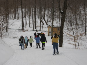
Posted on by

Earth Day Trail Maintenance

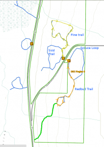
Click on the map to see a larger version. This map shows the paths we will work on, and the possible extension.

Springwater Trails is taking part in the Livingston County “Operation Community Cleanup” in honor of Earth Day 2018.

NOTE:Due to the popularity of the Earth Day “Operation Community Cleanup”, all equipment for highway cleanups are in use this weekend.  Therefore, we are making a last minute change in plans to do our cleanup at the Wheaton Hill Tr ails in Springwater.  Rather than a highway cleanup, this will be a trail and forest cleanup.

Join us at the State Forest trails on Wheaton Hill at 2:00 on Sunday. Springwater Trails has an agreement with the Department of Environmental Conservation to maintain four trails at this location. After a windy winter, we will break into groups to remove branches from the trails and litter from the woods.

We will form a one group on Spruce Loop, another on the Pine and Skid Trails and a third walking through the woods north of the trailhead checking for trash from the road. 

All members of the greater Springwater Community are welcome to join this effort. 

What do I need to bring?

The trails are mostly dry, but you should expect some mud as you cross the many drainage flows that tend to collect on the low spots. Bring hand held clippers to remove the multiflora roses that have sprung up on the trail. Look for thick gloves that will protect you from the thorns. Also there are lots of small branches on the trails, which only need light gloves. Finally, trash bags if you want to help pick up road litter in the woods. And, of course, bring your water bottle.

Social

Following the cleanup, join Springwater Trails for hotdogs at the trail-head.  We will provide the hot-dogs and salads.  Please bring your own water and other beverage. 

Directions to the trails are available here.


Posted on by

Hike/Bike Ride at Lehigh Valley Rail Trail, April 7, 2-4 PM, 42.990611, -77.679500

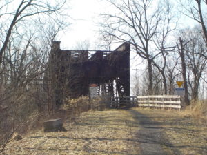
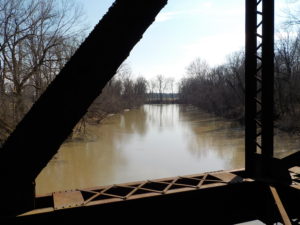
On April 7 we will hike or bike the western end of the Lehigh Valley Trail Linear Park, following the rail trail across the Genesee River on the original rail truss bridge to the Greenway intersection. Hikers have the option of a 5-mile hike or a 2.5 mile hike to the river and back.  Part of the Monroe County Parks System, the rail trail is wide, flat, fairly dry and nicely paved with stone dust along most of its length, and has some interesting railroad era structures and interpretive markers at the river crossing end.  We might see some early signs of spring too.  See trail flier at map.

Everyone will meet at 1:45 at the Honeoye Creek Fishing Access parking area on Fishell Road west of Route 15 in Rush, just past the 390 overpass.  Tourists and Climbers will hike to the west 2.5 miles to the Greenway crossing on the west side of the Genesee, and back for a total of 5 miles. Naturalists will drive to an alternative parking lot closer to the river, continuing west on Fishell Road to the East River Road intersection, making a left, and parking in the trailside parking lot on the west side of East River Road, walking from there to the end and back for a total of about 2.5 miles. If weather is conducive, Cyclists will begin at the Fishell Road parking area and ride to the Greenway and back, then continuing east along Honeoye Creek as far as Rochester Junction in Mendon before returning to the cars, for a total of about 15 miles. Expect a few damp sections of trail.

Social – Please join us for the social gathering at the Brewery Pub at 8 W. Main Street in the center of Honeoye Falls, overlooking the falls.

Directions:

From Springwater, Honeoye and points south: Follow Route 15A north through Hemlock and Lima. In Honeoye Falls, after the turn-off to West Main Street, make a left on Honeoye Falls-Five Points Road. Go through the Five Points intersection and past the Oak Openings on your left. At Route 15 (W. Henrietta Road) make a right. Go 1 mile and make a left on Fishell Road. The parking area will be on your left, just past the first 390 overpass.

Alternative Interstate Route: Take I-390 north to Exit 11 (Route 251 Rush). Go east on 251 for a short distance, then south on NY Route 15 for about 2 miles. Make a right on Fishell Road. The parking area will be on your left, just past the first 390 overpass.

From Rochester and points north: Take 390 South to Exit 11,  Go east on 251 for a short distance, then south on NY Route 15 for about 2 miles. Make a right on Fishell Road. The parking area will be on your left, just past the first 390 overpass.

Directions to Social:  Return east on Fishell Road to Route 15. Go south 2 miles to Honeoye Falls-Five Points Road and make a left. Go about 4 miles into the center of Honeoye Falls. At the light, the Brewery Pub will be straight ahead on your right, just before the bridge.

Posted on by

Wohlschlegel’s Maple Weekend

NOTE SPECIAL HIKE STARTING TIME

IMG_0233It has been an interesting Maple season this year, with temperatures having wide swings all winter.   Come learn about the experience of the Wohlschlegel Maple Farm just over the Coates Rd from Springwater. Springwater Trails will take advantage of Maple Weekend for a lunch of pancakes with this year’s maple syrup, followed by a revisit to a hike along the Snowmobile Trail and through the Wohlschlegel’s Sugar Bush.  The pancake lunch will be today’s social.

We will meet at Wohlschlegel’s Maple Farm, near the east end of Coates Rd., west of Naples.  For $7.00, you can get all the pancakes you can eat, 2 sausages and beverage.  Their pancake kitchen opens at 8 AM but closes at 1 PM so, you will need to get there by 12:30 to enjoy your meal.  If there’s time after your meal, you can enjoy tours of their farm as well as samples of some of their maple products.   For more information on Wohlschlegel’s Naples Maple Farm you can check out their website at: http://www.fingerlakesbulkmaplesyrup.com/

IMG_0232Because you have to get there by 12:30 for your pancake lunch, we’re going to start our hike today at 1:30.  We will have our usual 3 hiking groups, starting on the snowmobile trail on their farm.  The climbers will follow the Snowmobile trail south toward Richards Rd and then will return through the sugar-bushto the Sugar House. Naturalists and Tourists will walk through the sugar-bush, take a quick peek into the pump house followed by a hike up through the eastern half of the sugar-bush.

Directions to Wohlschlegel’s Maple Farm, 8064 Coates Rd. Naples.  

Although Wohlschlegel’s is just over the road from Springwater, you can’t get there directly from Springwater because of seasonal roads. Check your GPS and note that Warner Rd/Garlinghouse Rd, Liddiard Rd, Coates Rd and Richards Rd are all closed until April 1 as they cross over from Springwater to Naples.  (And you likely won’t want to drive them even when they are open). You must enter Coates Rd from Garlinghouse Rd on the Naples side of the hill.

From Wayland and the hamlets of Springwater and Webster Crossing.  Go south on NY-15 to Wayland. Turn east on NY 21(N) for 5.6 miles.  Left on to CR 38 (Rowe Rd).  At the tee (3 miles), go left onto Garlinghouse Rd.  Take the second left on Coates Rd (watch for Maple signs).  Farm is on the left, about 1/2 mile.  Look for the bright purple roof.  Don’t attempt to enter Coates Rd. from Pardee Hollow, as it is not be plowed and is a rough seasonal road at the top of the hill.

From Tabors Corners and East Springwater: Head south on Tabors Corners Rd. Turn left on Pardee Hollow Rd. At the tee, turn right to stay on Pardee Hollow Rd.  Continue past Coates Rd and Richards Rd, ignoring any directions from your GPS. At the tee, turn left on Atlanta-Garlinghouse Rd. At the next tee, go left onto Garlinghouse Rd.  Take the second left on Coates Rd (watch for Maple signs).  Farm is on the left, about 1/2 mile.  Look for the bright purple roof.  Don’t attempt to enter Coates Rd. from Pardee Hollow, as it is not be plowed and is a rough seasonal road at the top of the hill.

From Naples and Canandaigua. Head south on NY-21. On the southern side of Naples, turn right at the Middletown Tavern on Clark St (CR 36) which becomes Hunt Hollow Rd. In 2 miles, turn left on French Hill Rd. At the tee, turn right to stay on French Hill Rd, which becomes Garlinghouse Rd at the next intersection. In 1.4 miles, turn left onto Coates Rd. Farm is on the left, about 1/2 mile.  Look for the bright purple roof.

From Hemlock and Honeoye. From US-20A, turn south on CR-36 (West Lake Rd) for 13.9 miles. Turn right onto French Hill Rd. At the tee, turn right to stay on French Hill Rd, which becomes Garlinghouse Rd at the next intersection. In 1.4 miles, turn left onto Coates Rd. Farm is on the left, about 1/2 mile.  Look for the bright purple roof. NOTE: do not take CR 37 south from Honeoye into Springwater. This would put you on the wrong side of the hill and you will need to go through Springwater into Steuben County to get to the Sugar House.

Posted on by

Letchworth Branch, Access H to G

This hike WILL OCCUR as scheduled on Sunday, March 17th at 2:00

Sorry everyone. I copied this description from last month when we cancelled because of high wind.  Then I forgot to remove “Canceled” from the title. Please tell your friends and come join us.

Come celebrate St Patrick’s Day with a hike in our Letchworth Branch series followed by a social at the Letchworth Pines in Portageville. All weekend they will feature Corned Beef and cabbage along with Reuben’s and Shepard’s pie.

Pleasant weather is predicted for Sunday, with highs of 33° and mostly cloudy. I am hoping we can avoid the water and mud, but we will adjust our hike to match conditions.

All hikes will start at Access Pt H at the corner of Dygert Rd and River Rd on the east side of Letchworth State Park. We are planning three routes for this hike, depending on who comes and the conditions. The Climbers will follow the main trail from Access H to G for a 3.6 mile hike. The Tourists will use park trails (old roads) at the start and end of the hike to reduce the length to about 2.7 miles. Finally, the Naturalists will follow the Park trail, then explore the main trail as time and interest permit, or will do a road walk, returning to the cars they way they went in.  This hike would vary between 1 and 2 miles. 
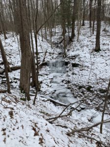
This is a one way hike for the Climbers and Tourists so we will need to stage cars at the end. We are looking for volunteers who can arrive 20 minutes early to position the cars. If you arrive by 1:40, please meet at the intersection of Oakland Rd and River Rd (Access G). We will carpool from there to the trailhead, leaving some Climber’s cars at the end of the hike to transport us back to the start. If you find you are later than 1:40, please go directly to Dygert and River Rd (Access H). See directions below.

Hike details

All hikers will start from Access H. The Climbers will follow the blue blazes for less than a half mile to the main yellow blazes. We will turn right and scramble up a steep, but short, hill. The blazes here are new and easily followed, even if there is still snow cover. In 0.4 miles, we will cross Park trail #9. We left an orange tape on a tree at this intersection for reference. You may notice some orange blazes and some older yellow blazes with the number 9 marking this part trail. We will stay with the newer and brighter yellow blazes. The trail turns slightly going up stream to find a crossing point, then loops down the other side of the stream. Watch for the double blaze indicating a right turn – if you go straight you will go downhill on the park trail #9. In another 1.2 miles, we will cross park trail #12. We also marked this trail with orange tape. The Climbers will continue on the main trail crossing two more streams that will require some bushwhacking to find a way down to a safe crossing. At the junction with the blue access trail, we will turn right and hike out to awaiting cars.

From Access H, about 100 feet down the blue trail, the Naturalists and Tourists will turn right at the orange arrow and follow park trail #9 down a slight grade to the main trail. At the main trail the Tourists will turn right and follow the main trail for 1.4 miles. After crossing the first stream, there is a sharp right turn that you don’t want to miss.  If you miss the turn, you will end up at the river on Park trail #9. The turn is easy to see – just watch for the double blazes on the left side of the trail. When you come to Park trail #12 (There is an orange tape on the main trail and a couple more on trail #12), turn right and follow the trail out to River Rd. Turn left on River Rd for a half mile walk to the awaiting cars.

The Naturalists who followed the Tourists from Access H and down park trail #9, should do some exploring when they reach the main trail. If they turn left and follow the main trail, it is fairly level until a steep downhill that connects to the blue access trail.  Turn around at the top of the steep downhill or at 3:00 and return the way you came. If there is deep snow, the Naturalists may prefer to hike River Rd.

Following the hike, all hikers are invited to meet at the Letchworth Pines for some food and conversation. If interested, bowling and video games are also available.

Directions:

From Springwater: Take NY-15 north from the light. In 1.5 miles, turn left onto Liberty Pole Rd (CR 38). Continue straight for 8.1 miles to Groveland. Turn left  onto NY-63 S and then right (in 1/4 mile) on NY-258. At the tee, turn right onto NY 36. Go past the Correctional Facility and take the second left onto Dutch Street Rd. In 1.3 miles, turn right onto Ridge Rd and follow it to the end. Turn left on River Rd and continue for 4.2 miles to Oakland Rd which branches off at a slight left. If you are earlier that 1:40, please wait here for the car pool. Otherwise, go left onto Oakland Rd, take the first right onto Dygert Rd to get to Access H.

From Wayland: Follow NY-63 to Dansville. In Dansville turn left on Ossian St (NY-36 N) (don’t turn on 36 south!). Stay straight on Ossian St which becomes NY-436. Continue on NY-436 for 15 miles through Nunda. Turn right on Oakland Rd. If you are earlier that 1:40, stay on Oakland Rd to the end at River Rd. Otherwise, take the first left after the stop sign at Short Track on Dygert Rd to get to Access H.

From Rochester, Geneseo and Mt Morris: From Rochester, take I-390 south to Exit 7 (Mt Morris, NY-408). Turn left onto NY-408S. From Geneseo, take NY-63S and turn right onto NY-408S. At Main St in Mt Morris, turn left and then right to stay on NY-408. Stay on NY-408 for 2.6 miles past the Visitor Center Rd. Bear right onto River Rd.  In 6.3 miles, Oakland Rd will bear to the left. If you are earlier than 1:40, please wait here for the car pool. Otherwise, go left onto Oakland Rd, take the first right onto Dygert Rd to get to Access H.

Directions to the Letchworth Pines: Take Oakland Rd south to the stop sign at  Short Tract. Turn right on Short Tract Rd, then right onto NY-436W. In Portageville, turn right onto Hamilton St, to stay on NY436. NY-436 ends at NY-19A. Turn left and go 0.2 miles. The Letchworth Pines is on the left with a good size parking lot in front.